
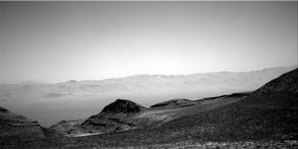
A low mid-latitude crater on Mars apparently filled to overflowing with ice
Click for original image.
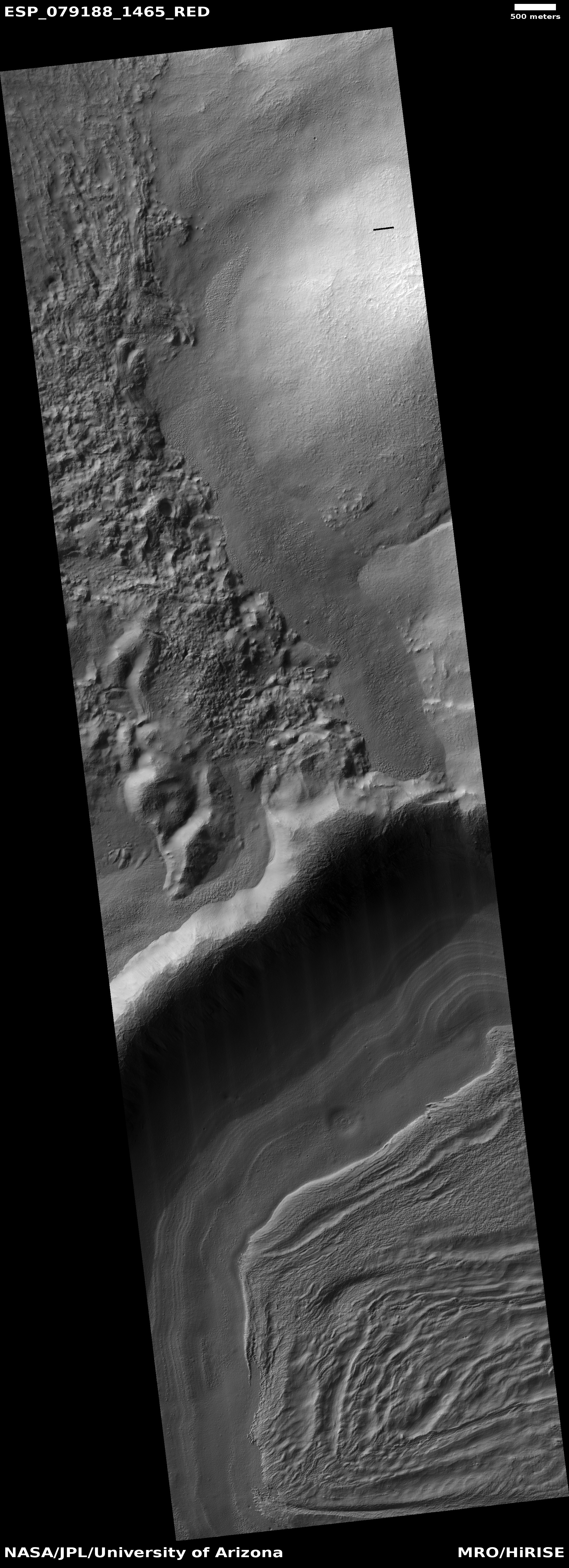
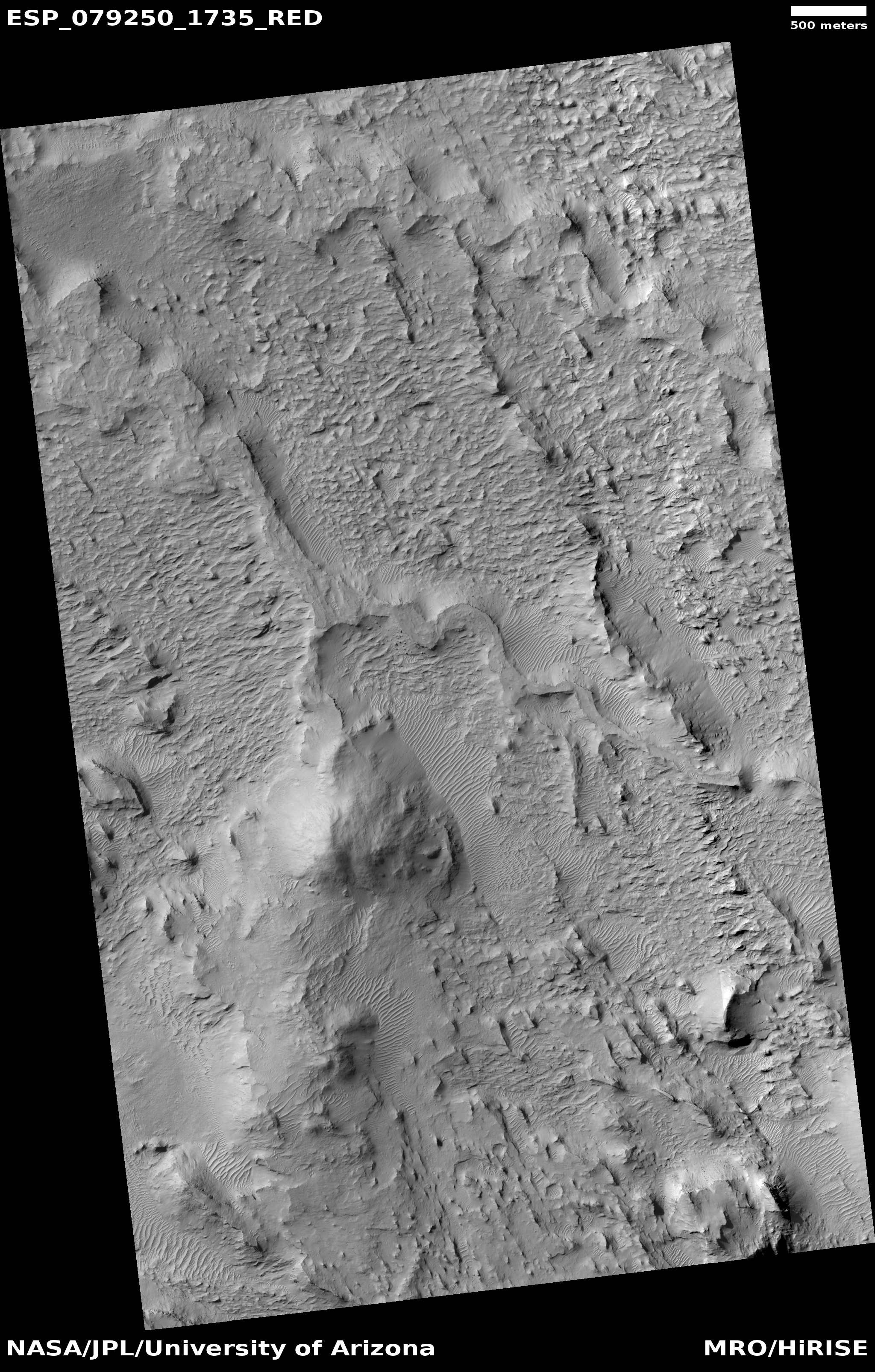
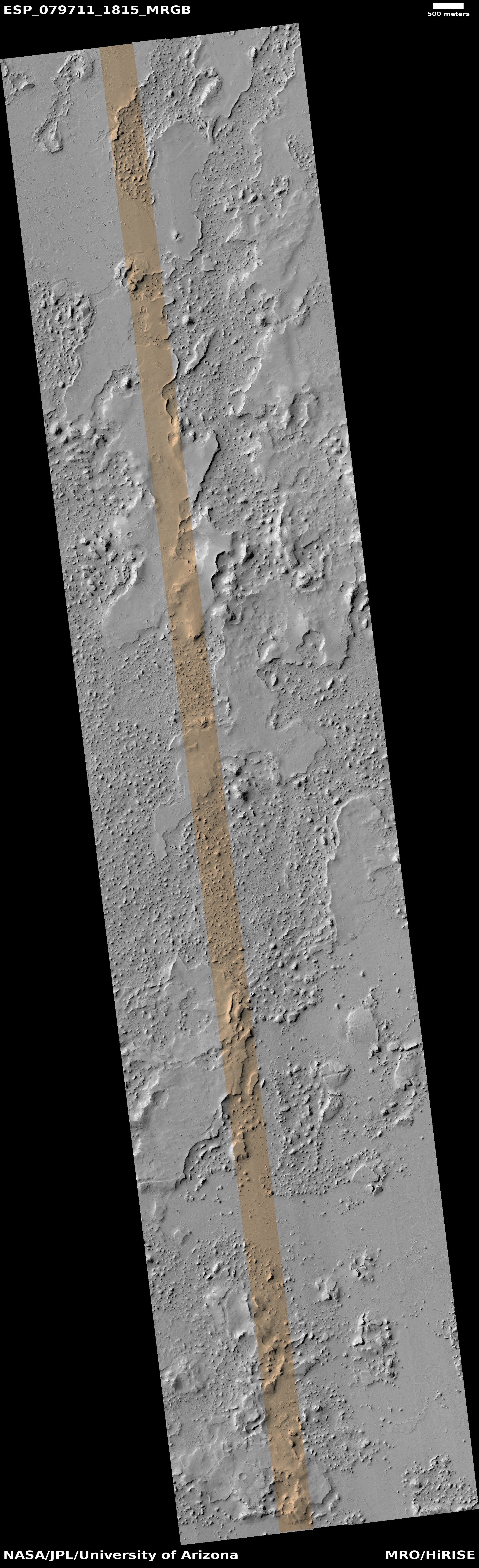
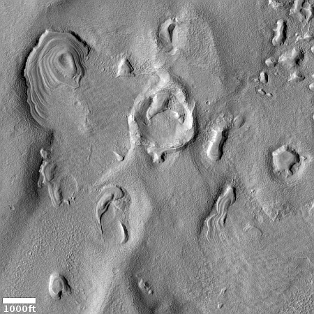
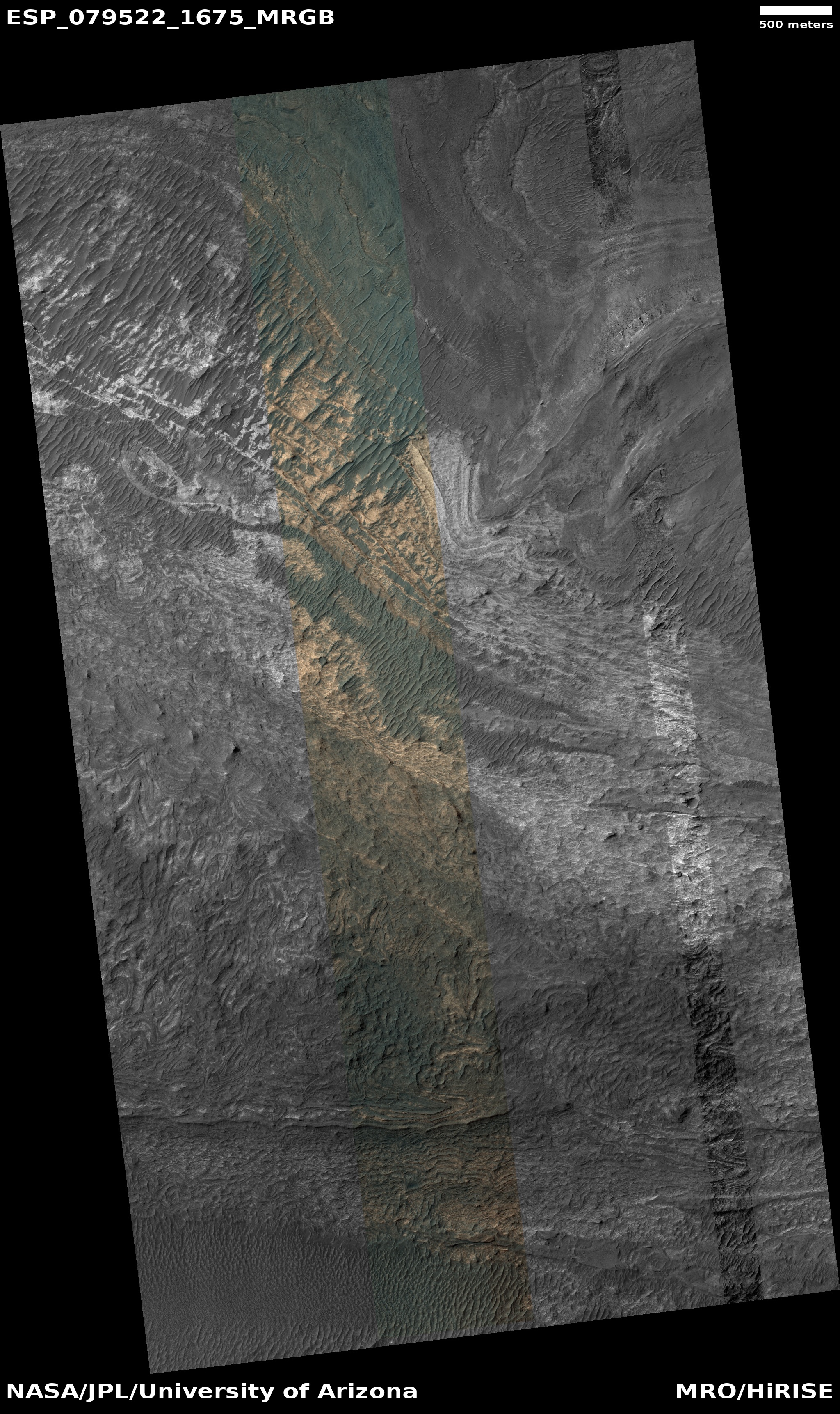
Cool image time! The picture to the right, rotated, cropped, reduced, and sharpened to post here, was taken on June 18, 2023 by the high resolution camera on Mars Reconnaissance Orbiter (MRO). It shows a steep 1,000-foot-high cliff with what appears to be extensive glacial material at its base.
The many layers all suggest past climate cycles, where snow was deposited and the glacier grew, followed by a period when no snow fell and the glacier either shrank or remained unchanged. The terraced nature of the layers near the base of the cliff suggest that with each active cycle less snow was deposited and the glacier grew less.
The latitude is 33 degrees south, which puts it just outside the dry equatorial regions of Mars and inside the mid-latitude region where many such glacial features are found. Its closeness to the tropics however is significant, because by this point we should be seeing a diminishment of such features. Instead, the wider view shows us that the near surface ice in this region is extensive and in fact appears to cover everything.
» Read more
