Ingenuity completes 58th flight on Mars
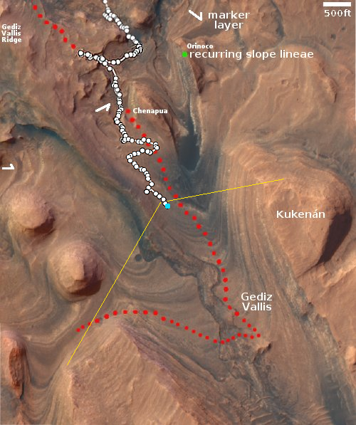
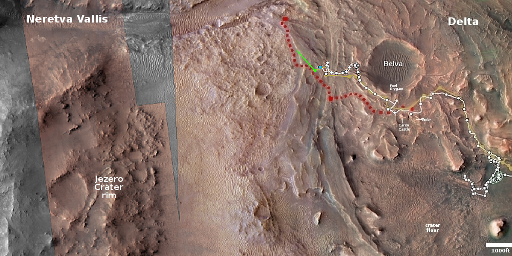
Click for interactive map.
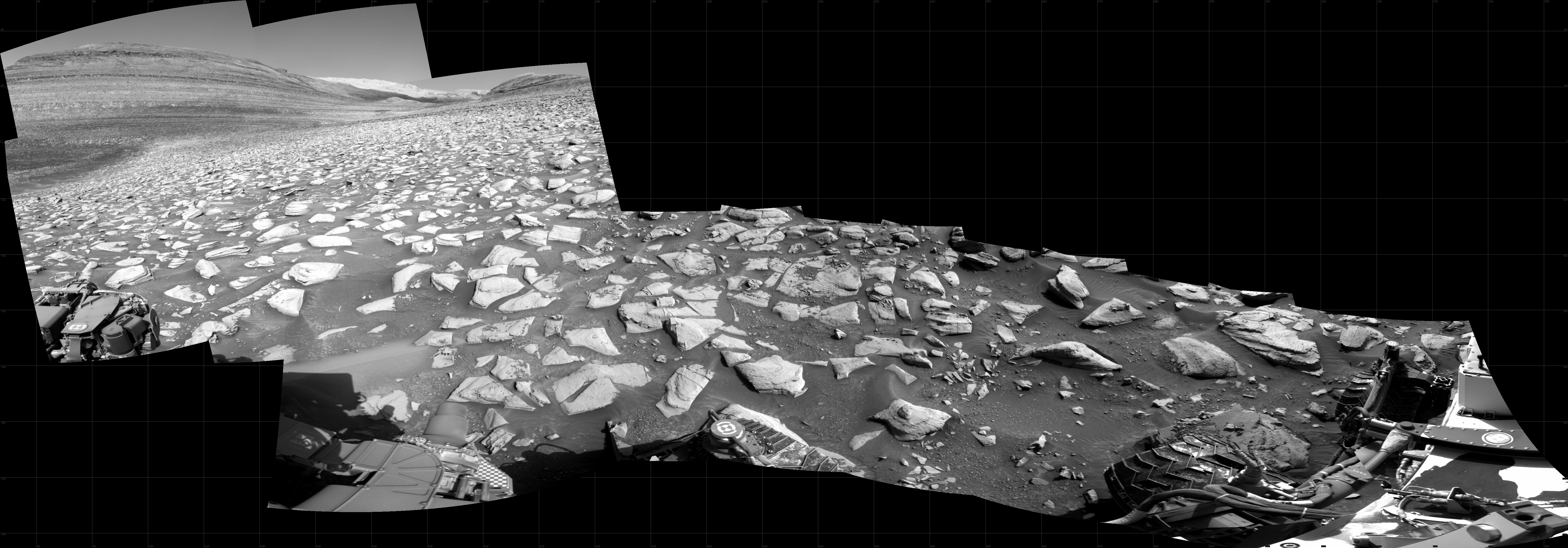
Ingenuity yesterday successfully completed its 58th flight on Mars, flying 571 feet to the northwest for 107 seconds at a height of 33 feet.
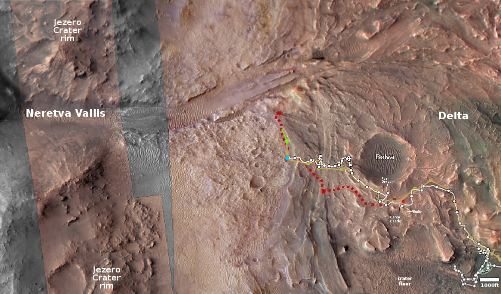
The overview map above shows with the green line the approximate route of the helicopter. Though the Ingenuity engineering team has updated the flight log (at the link above), the route has not yet been added to the Perseverance interactive map. I am guessing at that route based upon the flight plan posted on September 7, 2023, which stated the rover would head northwest as well as image science targets. That suggests it was flown above Perseverance’s planned route, as indicated by the red dotted line.
This particular flight was different than recent flights, which have generally lasted slightly longer and covered a slightly longer distance, probably so the helicopter could find a safe landing spot. This time Ingenuity landed about 23 seconds early, though the distance traveled was still slightly longer. The difference once again was almost certainly caused by the helicopter’s software picking a good landing spot. It just got above its planned landing spot sooner than expected, found a good pad, and then landed.
The blue dot marks Perseverance’s present location. It is presently moving west to reach what the scientists consider an important geological contact between two layers.