
Smooth on Mars is apparently not so smooth
Click for full resolution. For original images, go here and here.
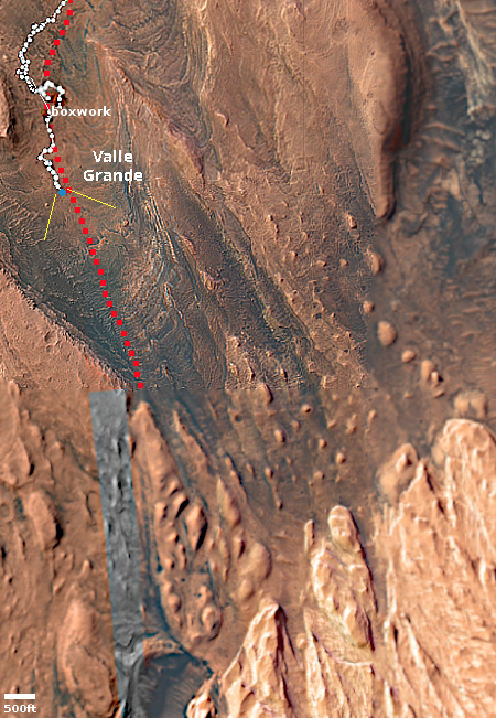
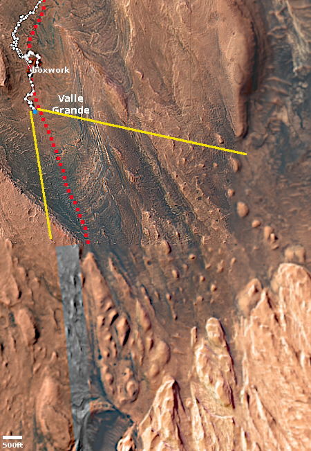
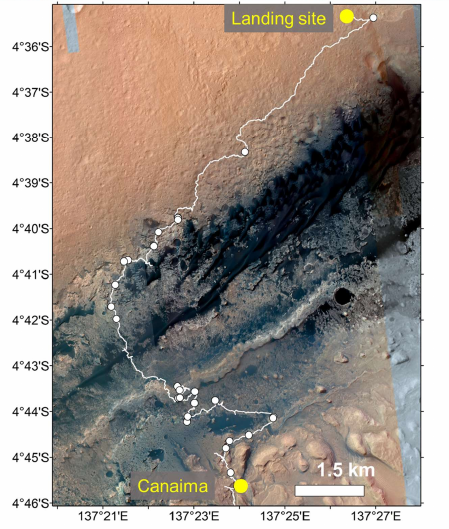
Click for interactive map.
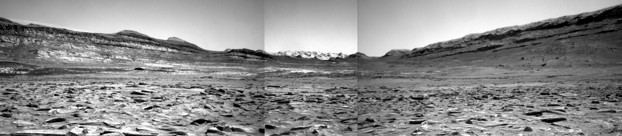
Last week I noted how the terrain that stood ahead of Curiosity in its travels on Mount Sharp on Mars appeared to be the smoothest the rover had seen in years.
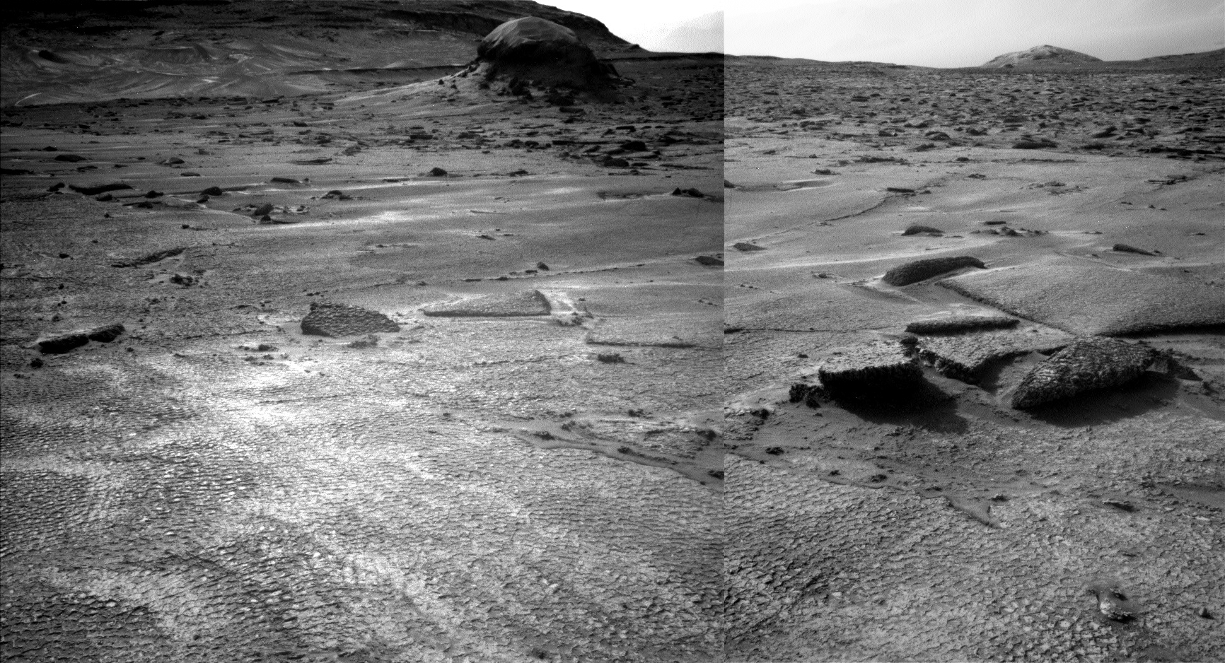
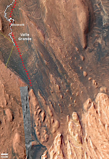
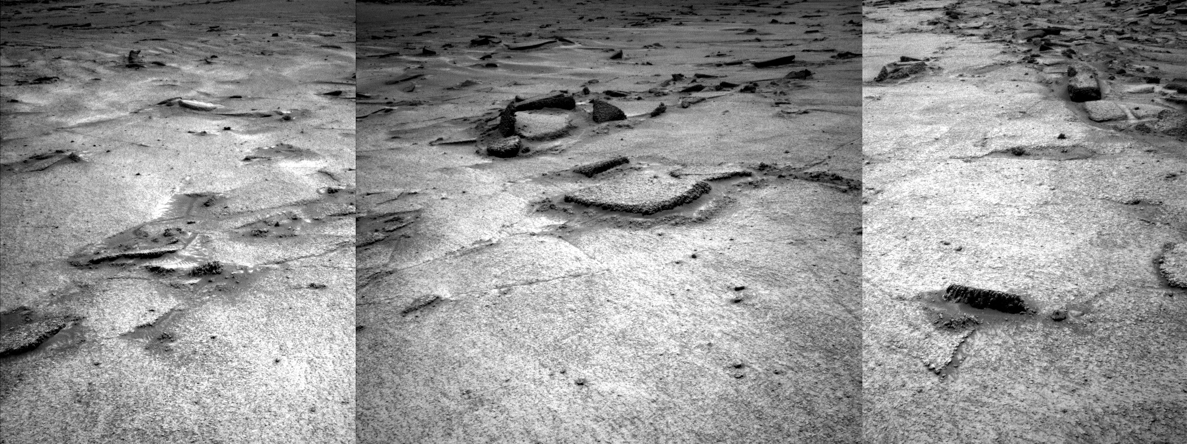
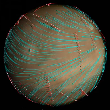
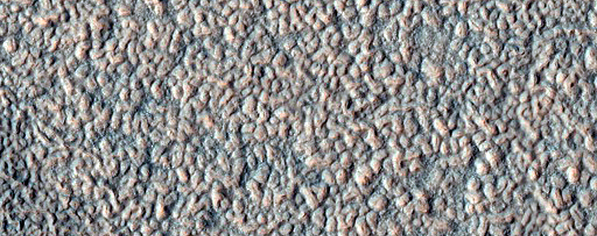
This week it turns out that upon closer inspection, smooth on Mars is not as smooth as it seems. The panorama above, created from two pictures taken by the rover’s left navigation camera on June 17, 2026 (here and here), provides a much closer view of that smooth ground, and revealed that it isn’t actually smooth at all, but covered with small polygons. The inset on the left shows the area in the white rectangle at full resolution, making the patterned nature of the ground very obvious. From today’s update by the science team:
From up close, the parking spot looks anything but smooth. … There are polygons, veins, lamination, and probably more, once we inspect the higher-resolution images taken today. “Higher-resolution” is the key for why we were in for such a surprise! The features are quite small, a few centimeters across, and therefore we could not see them in the orbital images or from a distance in our navigation and mast camera images. The camera resolution from a distance just isn’t enough to see them. But up close, the terrain revealed all its beauty!
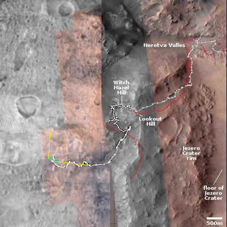
The blue dot on the overview map to the right marks Curiosity’s present position, the white dotted line its actual travels, the red dotted line its planned route. The yellow lines indicate roughly the area covered by the panorama above. The rim of Gale Crater can dimly be seen through the dusty atmosphere 20 to 30 miles away.
Explaining the geological process that caused this patterned surface is beyond my pay grade. My first guess would be it is related to the past presence of water, in the form of liquid or ice, but no one should take that guess very seriously.
As I have said many times, Mars is strange, Mars is wonderful, but above all, Mars is alien.


