
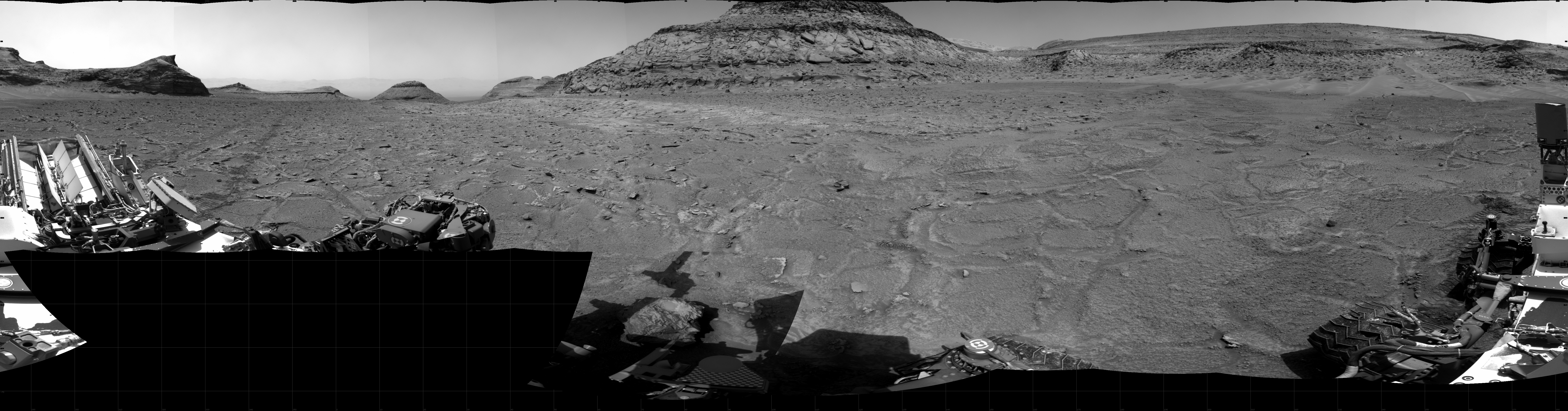
A glacial river on Mars
Click for full image.
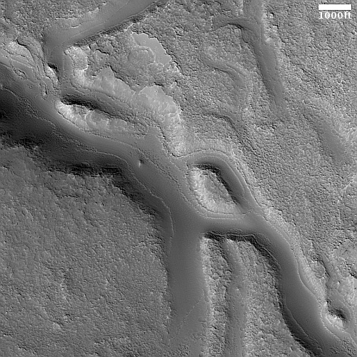
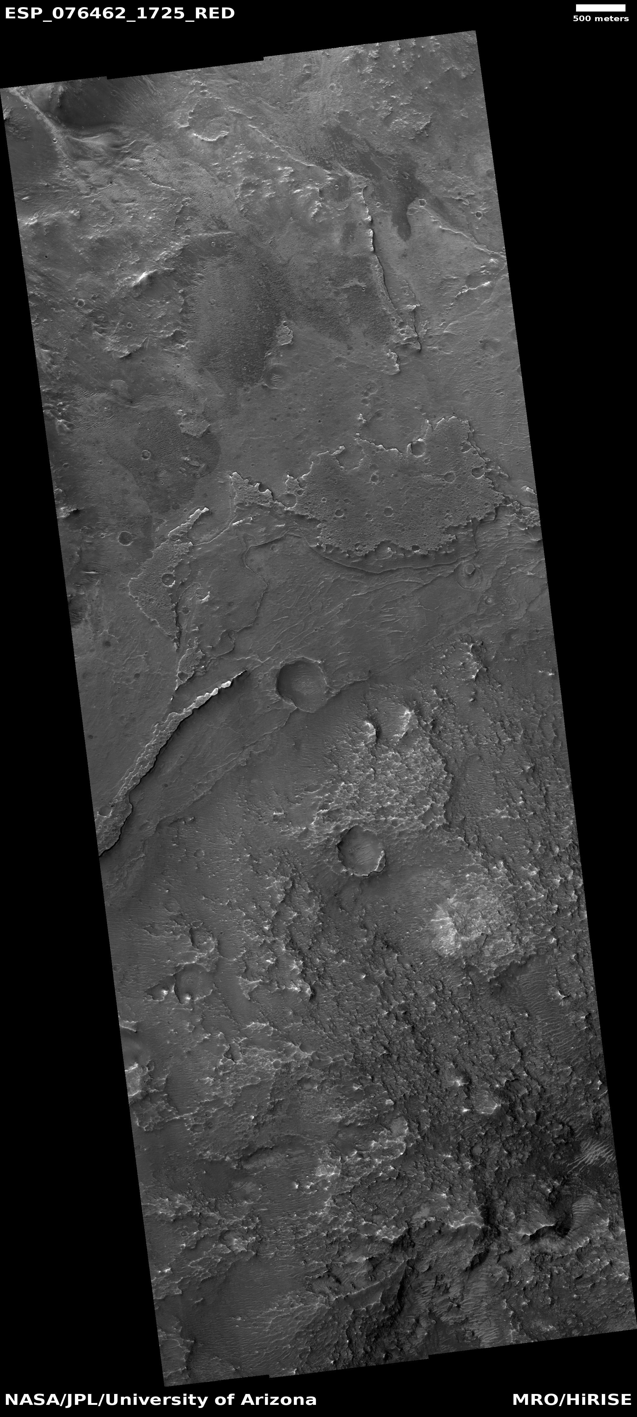
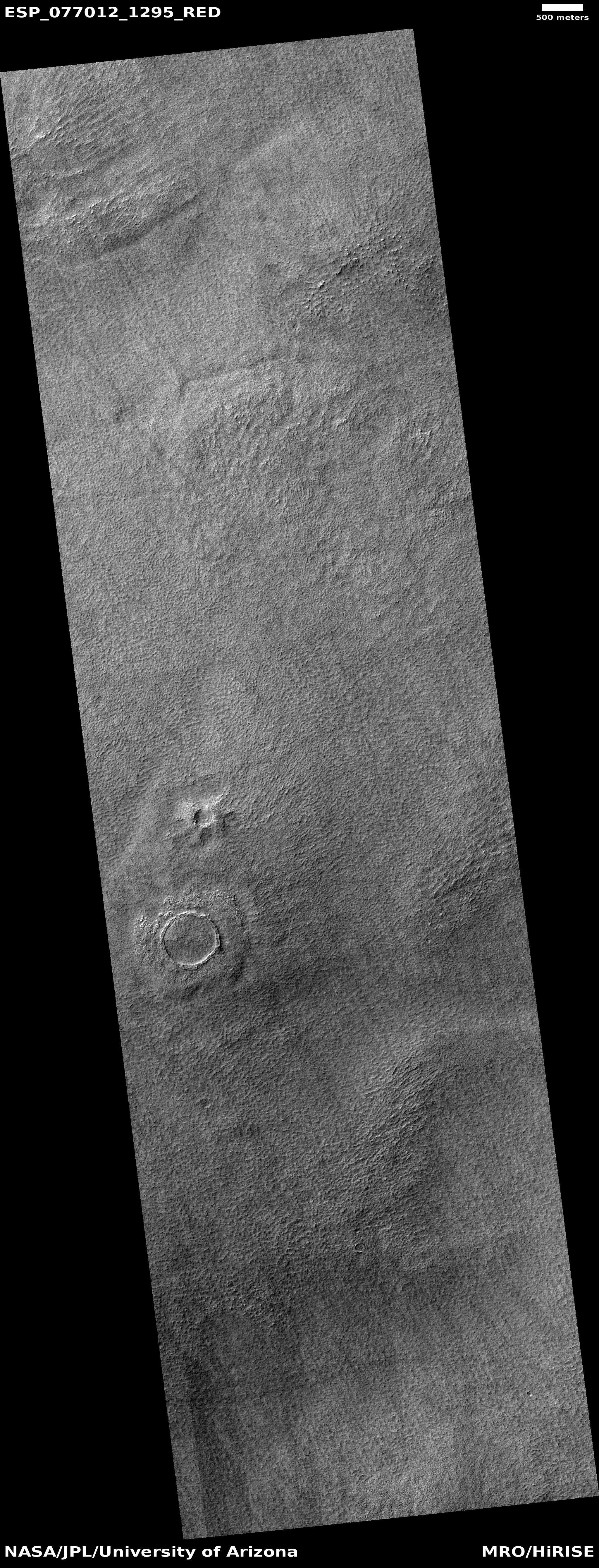
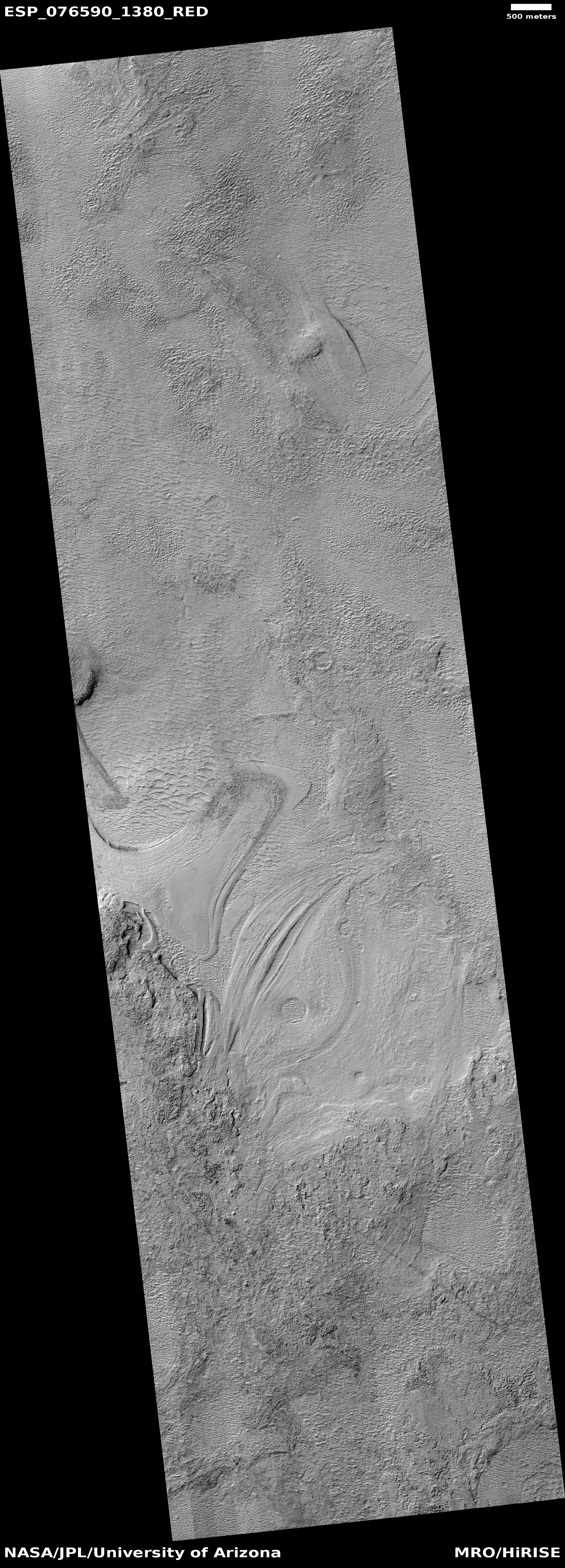
Cool image time! The picture to the right, cropped, reduced, and sharpened to post here, was taken on November 1, 2022 by the high resolution camera on Mars Reconnaissance Orbiter (MRO). It shows a wonderful example of a glacier-filled canyon on Mars, the ice apparently flowing both along and around mesas as it carves its way downhill.
I think the downhill grade here is to the north, but this could be wrong for the two side canyons on the main canyon’s north side.
Not only is the material in the canyon likely ice, covered with a protective layer of trapped dust and ash that makes the glacier surface look so smooth, the mesa tops are likely impregnated with ice as well. The mesas however have little dust, so the plateaus have a mottled stippled look likely caused by sublimation of that underground ice.
The location of these canyons explains the presence of ice.
» Read more
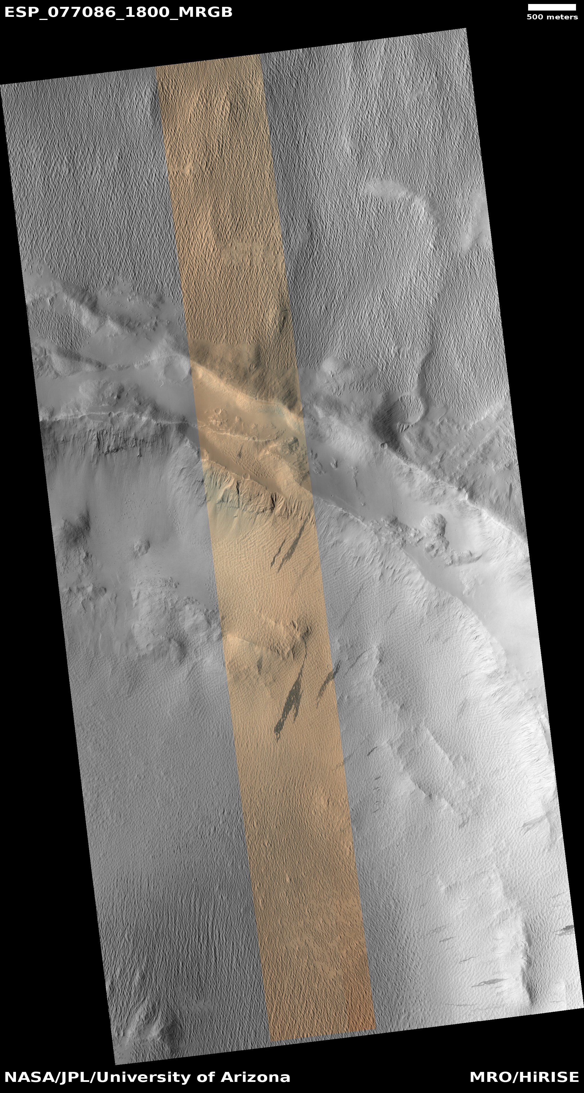
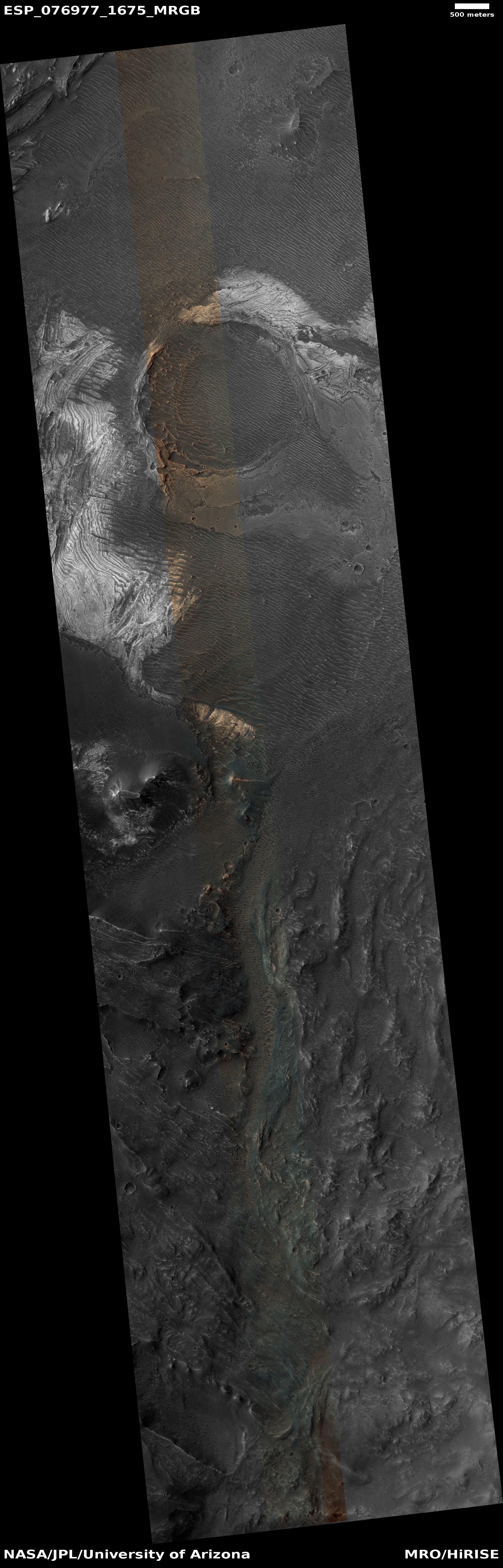
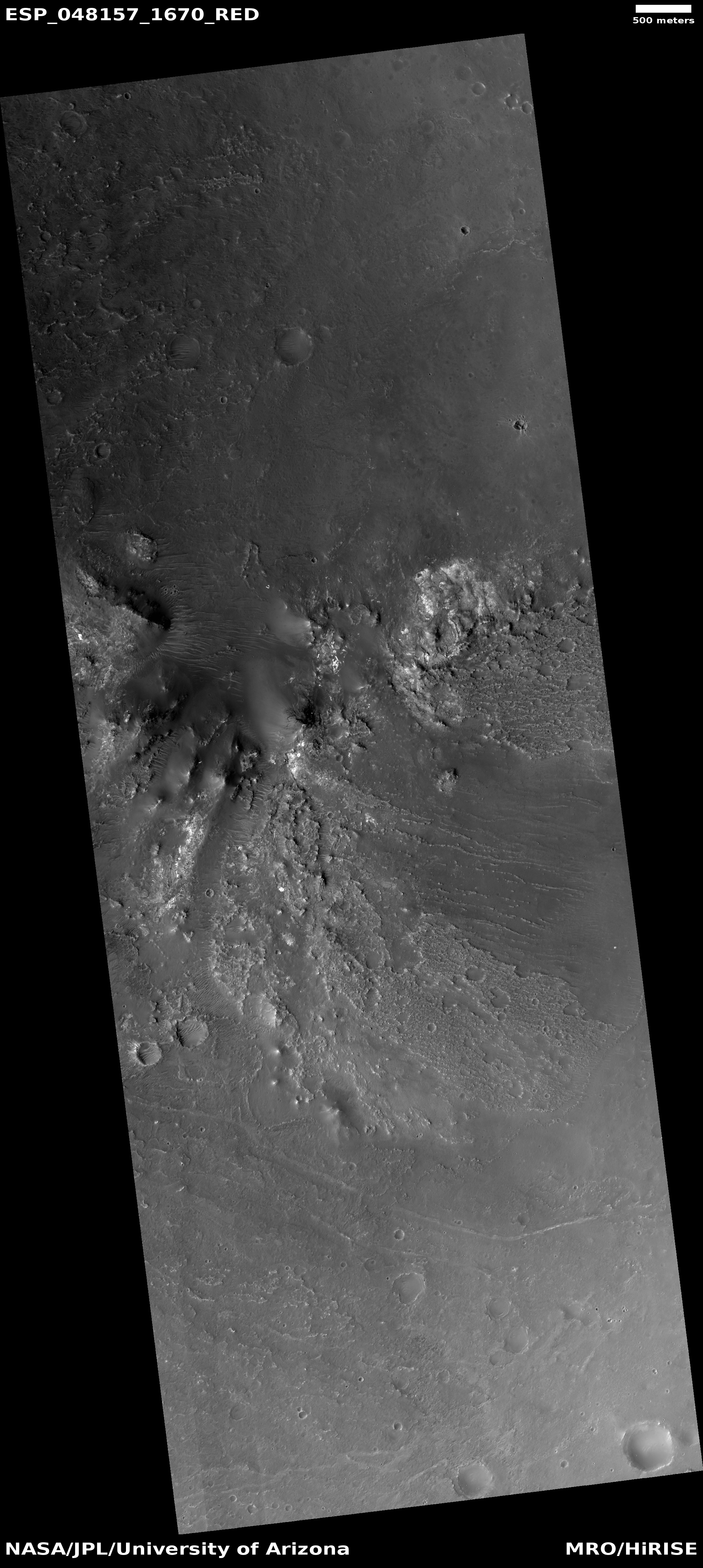
Click for full image.
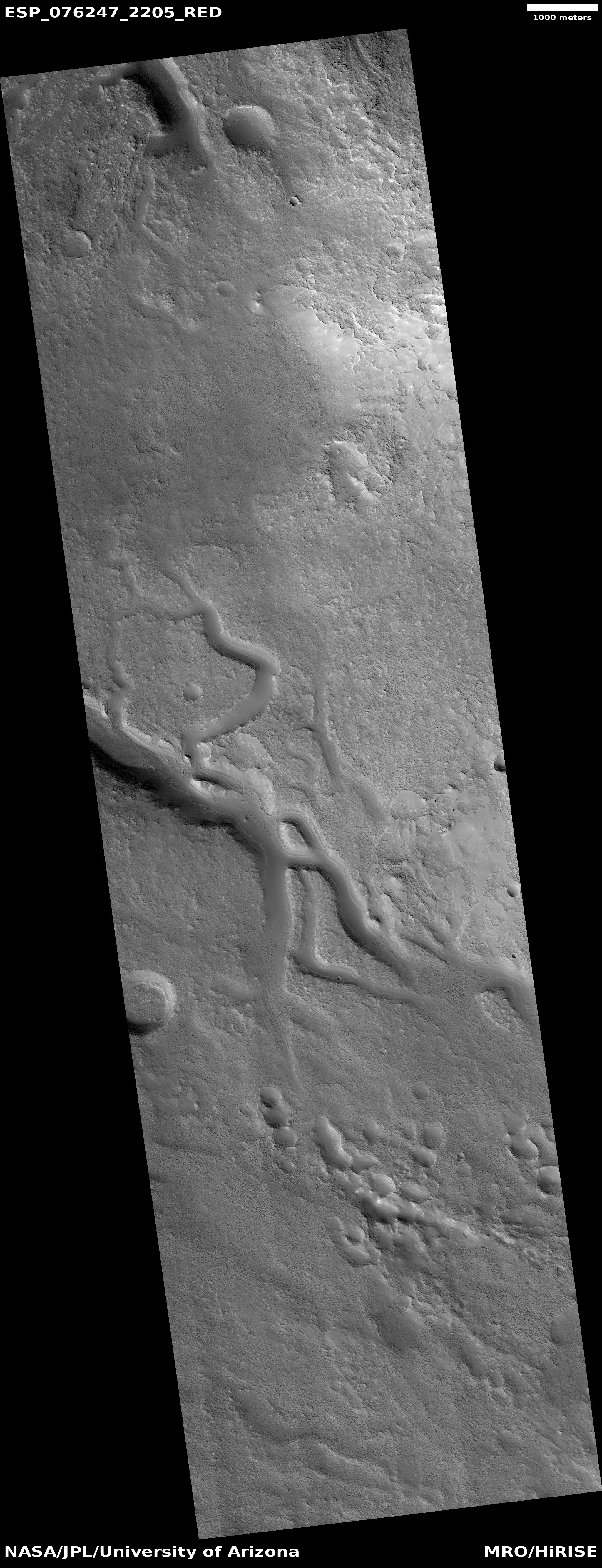
Cool image time! The picture to the right, cropped, reduced, and sharpened to post here, was taken on November 1, 2022 by the high resolution camera on Mars Reconnaissance Orbiter (MRO). It shows a wonderful example of a glacier-filled canyon on Mars, the ice apparently flowing both along and around mesas as it carves its way downhill.
I think the downhill grade here is to the north, but this could be wrong for the two side canyons on the main canyon’s north side.
Not only is the material in the canyon likely ice, covered with a protective layer of trapped dust and ash that makes the glacier surface look so smooth, the mesa tops are likely impregnated with ice as well. The mesas however have little dust, so the plateaus have a mottled stippled look likely caused by sublimation of that underground ice.
The location of these canyons explains the presence of ice.
» Read more


