
Ingenuity update: Dust storm caused issues; 20th flight upcoming
Click for interactive map.
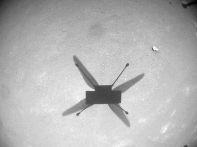
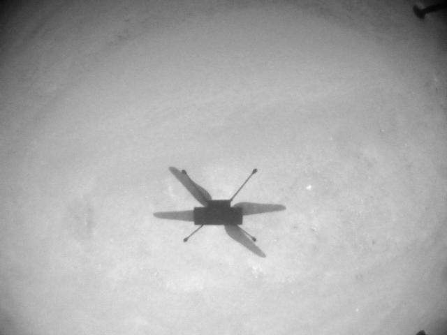
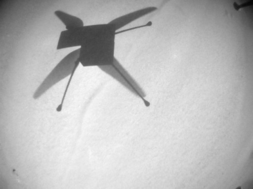
According to the Ingenuity engineering team in an update today, the Mars helicopter is getting ready for its 20th flight, scheduled for no earlier than today, even as the team successfully dealt with dust that settled on the helicopter’s various parts prior to flight 19.
The dust storm did, however, leave the Ingenuity team with two additional challenges to deal with: a dirty navigation camera window and dust in the swashplate assemblies.
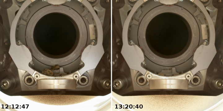
Comparing navigation camera images taken before and after the dust storm revealed that the storm deposited debris on the ground-facing navigation camera window, specifically around the periphery of the camera’s field of view. Debris on the navigation camera window is problematic because Ingenuity’s visual navigation software may confuse the debris with the actual ground features that it tries to track during flight, which can cause navigation errors. Fortunately, Ingenuity’s software provides a tool for dealing with this issue: The team can provide an updated image mask file that tells the visual navigation software to ignore certain regions of the image. The operations team made use of this feature and performed an image mask update late last month.
The dust storm also deposited dust and sand in Ingenuity’s swashplate assemblies. On Mars as well as on Earth, a helicopter’s swashplates are very important because they control the pitch (angle from horizontal) of the rotor blades, which is essential for stable and controlled flight. Ingenuity’s swashplate issue was first detected when the rotorcraft reported a failure during its first automated swashplate actuator self-test since the dust storm on Jan. 28, 2022 (Sol 335 of the Perseverance mission). Data revealed that all six swashplate servo actuators were experiencing unusual levels of unusual levels of resistance while moving the swashplates over their range of motion.
The engineers subsequently tested a procedure, planned before launch, for cleaning the swashplates, and found that it worked.
The data from that activity showed a significant improvement – a reduction in servo loading, so the team followed it up with seven back-to-back servo wiggles on Sol 341. Remarkably, by the end of that activity, Ingenuity’s servo loads appeared nearly identical to nominal loads seen prior to the dust storm.
After dealing with both dust issues, flight 19 proceeded successfully, as planned.
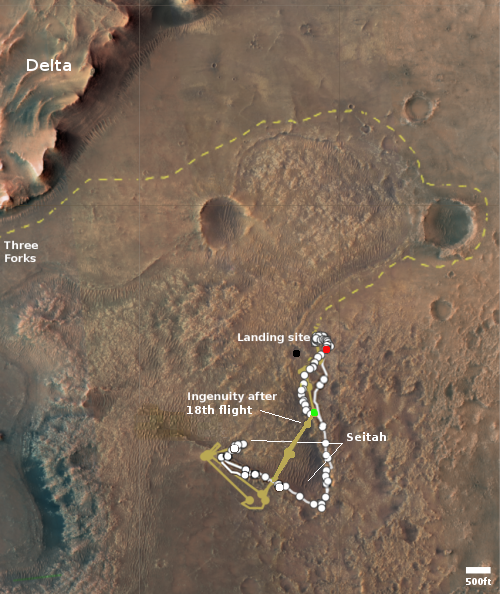
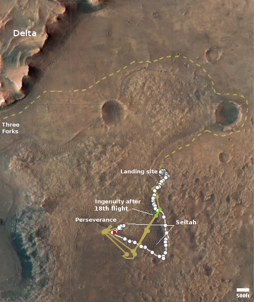
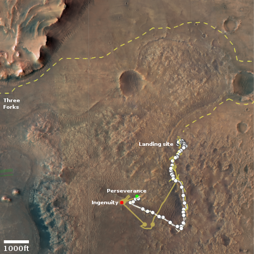
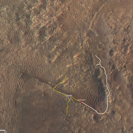
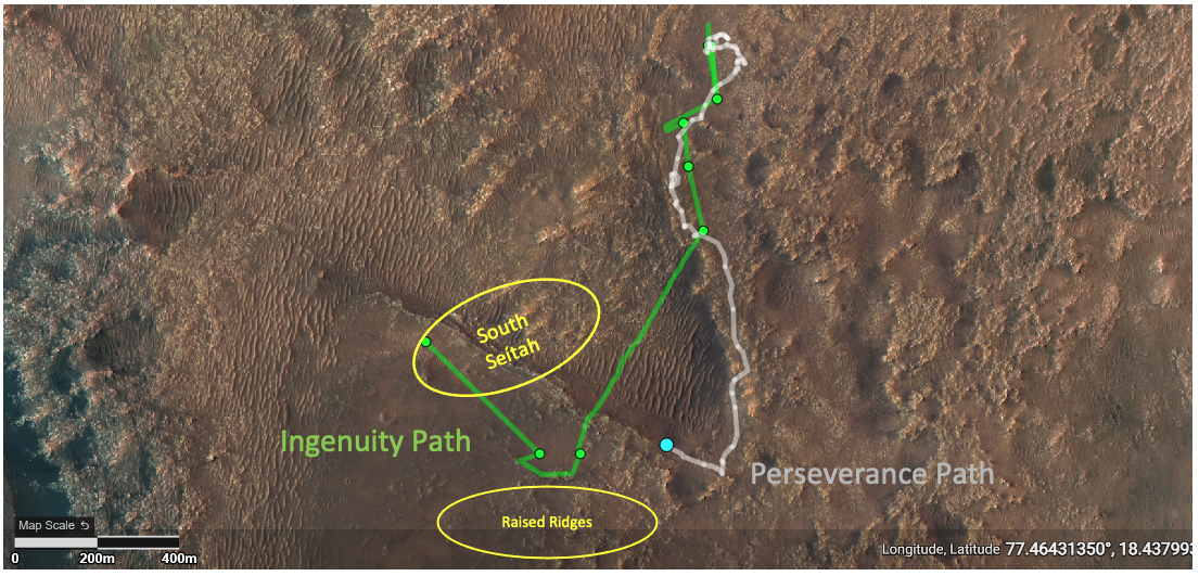
The overview map above shows the present location of Perseverance as the red dot, the present location of Ingenuity by the green dot, and the approximate landing site for the helicopter’s 20th flight by the black dot. The tan dotted line shows Perseverance’s planned route.
Perseverance itself has been traveling fast since Ingenuity’s last flight on February 9th, almost completely retracing its steps to return almost to its landing site.
Click for interactive map.
According to the Ingenuity engineering team in an update today, the Mars helicopter is getting ready for its 20th flight, scheduled for no earlier than today, even as the team successfully dealt with dust that settled on the helicopter’s various parts prior to flight 19.
The dust storm did, however, leave the Ingenuity team with two additional challenges to deal with: a dirty navigation camera window and dust in the swashplate assemblies.
Comparing navigation camera images taken before and after the dust storm revealed that the storm deposited debris on the ground-facing navigation camera window, specifically around the periphery of the camera’s field of view. Debris on the navigation camera window is problematic because Ingenuity’s visual navigation software may confuse the debris with the actual ground features that it tries to track during flight, which can cause navigation errors. Fortunately, Ingenuity’s software provides a tool for dealing with this issue: The team can provide an updated image mask file that tells the visual navigation software to ignore certain regions of the image. The operations team made use of this feature and performed an image mask update late last month.
The dust storm also deposited dust and sand in Ingenuity’s swashplate assemblies. On Mars as well as on Earth, a helicopter’s swashplates are very important because they control the pitch (angle from horizontal) of the rotor blades, which is essential for stable and controlled flight. Ingenuity’s swashplate issue was first detected when the rotorcraft reported a failure during its first automated swashplate actuator self-test since the dust storm on Jan. 28, 2022 (Sol 335 of the Perseverance mission). Data revealed that all six swashplate servo actuators were experiencing unusual levels of unusual levels of resistance while moving the swashplates over their range of motion.
The engineers subsequently tested a procedure, planned before launch, for cleaning the swashplates, and found that it worked.
The data from that activity showed a significant improvement – a reduction in servo loading, so the team followed it up with seven back-to-back servo wiggles on Sol 341. Remarkably, by the end of that activity, Ingenuity’s servo loads appeared nearly identical to nominal loads seen prior to the dust storm.
After dealing with both dust issues, flight 19 proceeded successfully, as planned.
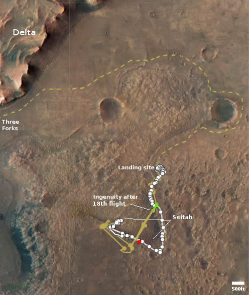
The overview map above shows the present location of Perseverance as the red dot, the present location of Ingenuity by the green dot, and the approximate landing site for the helicopter’s 20th flight by the black dot. The tan dotted line shows Perseverance’s planned route.
Perseverance itself has been traveling fast since Ingenuity’s last flight on February 9th, almost completely retracing its steps to return almost to its landing site.


