
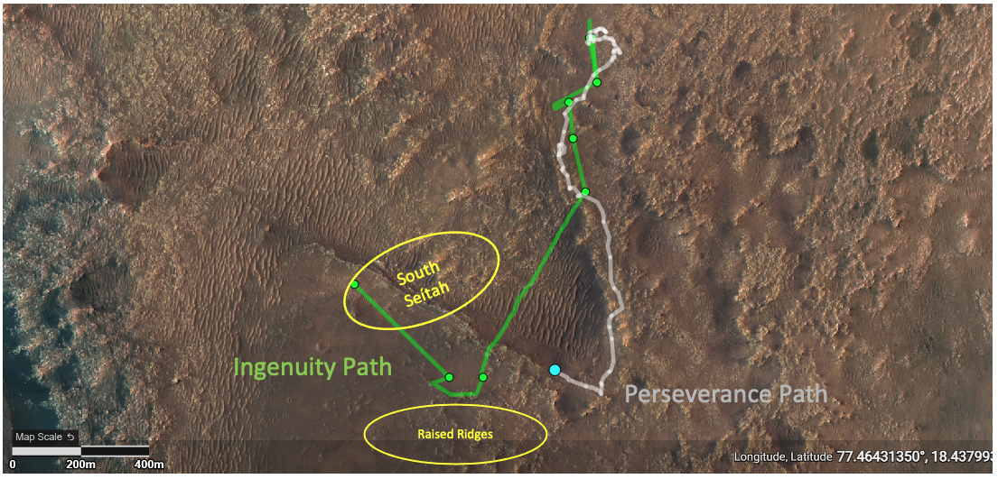
Ingenuity’s 12th flight successful
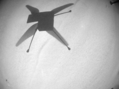
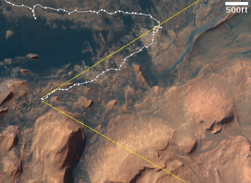
According to the Perseverance science team, the Mars helicopter Ingenuity successfully completed its twelfth flight on Mars early yesterday, making a short scouting round trip over an area called South Seitah to provide images that the team can use to plan the rover’s future route.
All told, Ingenuity flew just under 1,500 feet flying about 30 feet above the ground for just under three minutes. The picture to the right was taken just before landing, and shows the helicopter’s shadow on the ground. It is one of six so far downloaded. The remaining images will follow later.
The announcement was made on Twitter, and included some embarrassingly over-the-top prose:
The #MarsHelicopter’s latest flight took us to the geological wonder that is the “South Séítah” region.
South Seitah is hardly a “geological wonder”. It is a sandy area with some rocks and interesting geology.
I’m not sure why, but the Perseverance rover team seems prone to do this with their press releases and announcements. The claim they make over and over that Perseverance’s prime mission is to look for ancient life is junk Now they call a relatively undistinguished and small area on a crater floor a “wonder.”
Makes one think they somehow feel a need to justify what they are doing, something that is patently absurd. They are controlling a robotic rover and helicopter tens of millions of miles away as both explore a place on another planet no one had ever visited before. That certainly is spectacular enough, and does not need purple prose to justify.


