Some more “What the heck?” geology on Mars
Click for original image.
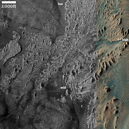
Cool image time! The picture to the right, rotated, cropped, reduced, and sharpened to post here, was taken on January 1, 2024 by the high resolution camera on Mars Reconnaissance Orbiter (MRO). It shows a small part of a region dubbed Iani Chaos, but what this geology shows is way beyond my pay grade.
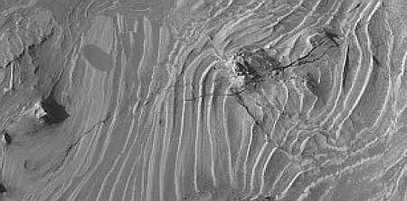
Why there are those tiny aligned mounds, oriented at right angles to the slope, is not clear at all. Nor is it obvious what created the lighter chaotic terrain at the base of the slope.
The elevation difference between the low and high points is about 400 feet. The slope continues up to the west for another 600 feet to the top of a north-south ridgeline. The patterns here suggest vaguely some flows downhill, such as that widening east-to-west gap, but only vaguely.
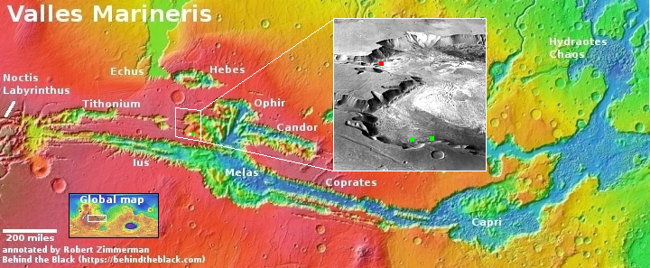
The look at the overview map only compounds the mystery.
» Read more
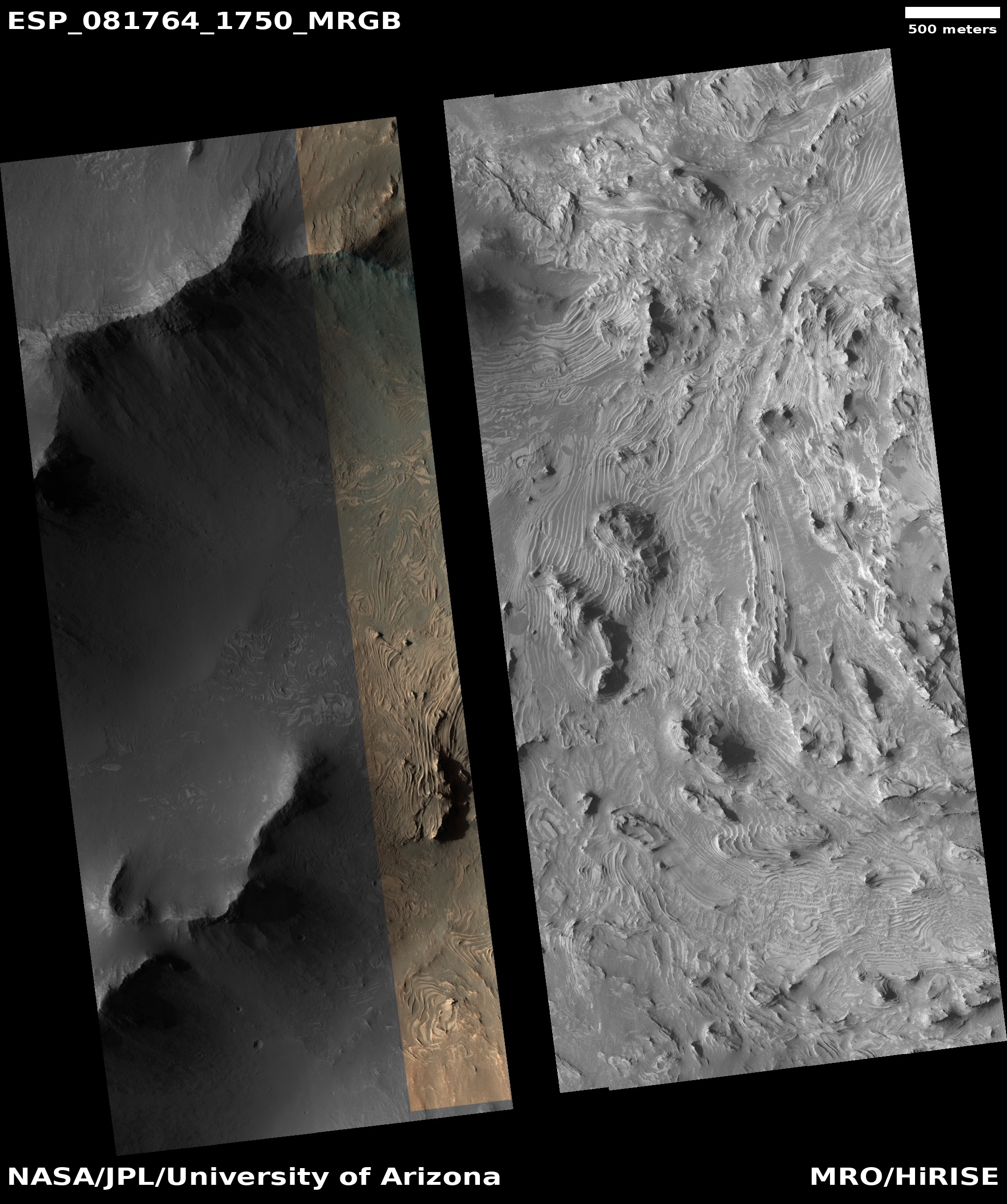
Click for original image.
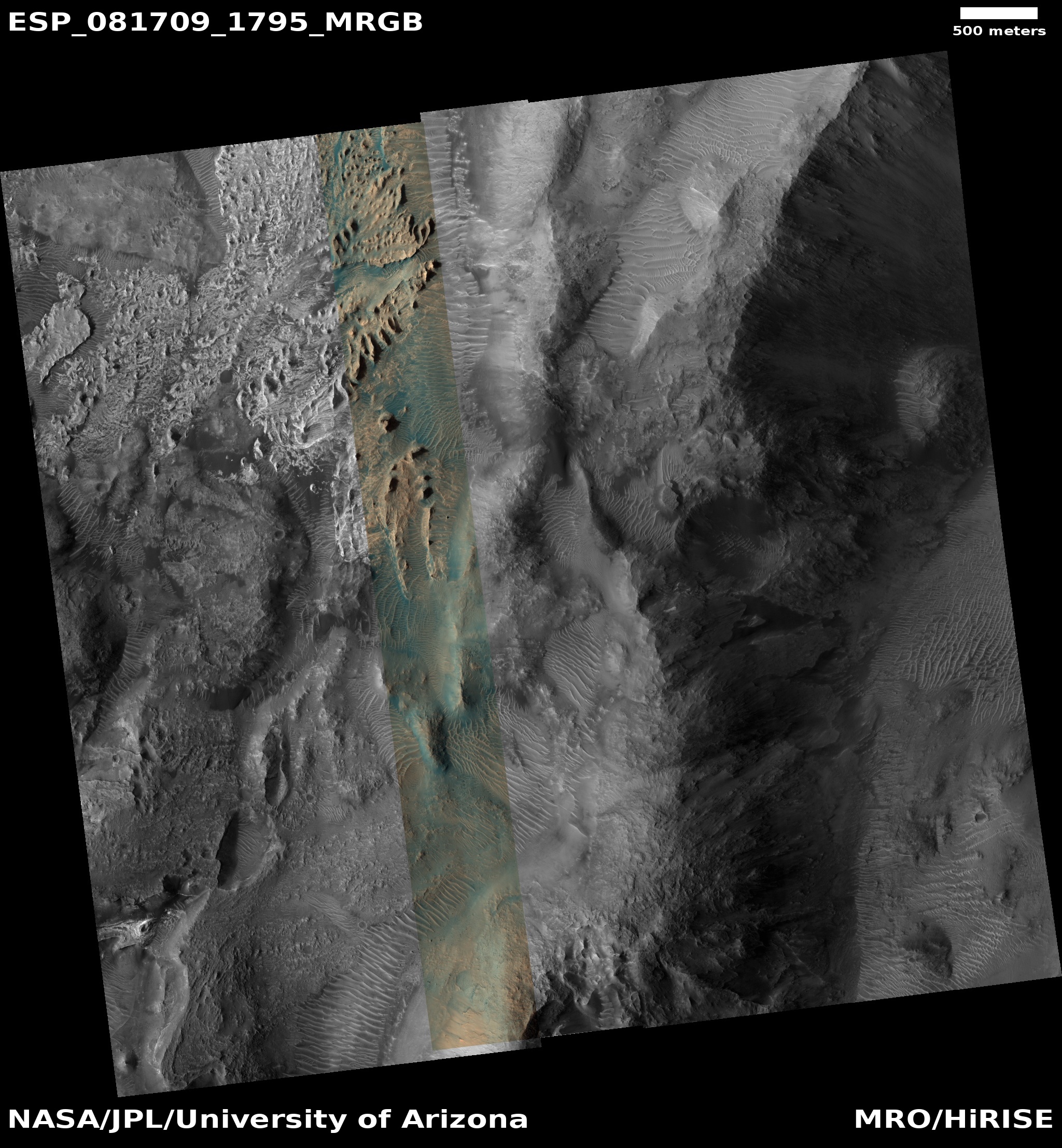
Cool image time! The picture to the right, rotated, cropped, reduced, and sharpened to post here, was taken on January 1, 2024 by the high resolution camera on Mars Reconnaissance Orbiter (MRO). It shows a small part of a region dubbed Iani Chaos, but what this geology shows is way beyond my pay grade.
Why there are those tiny aligned mounds, oriented at right angles to the slope, is not clear at all. Nor is it obvious what created the lighter chaotic terrain at the base of the slope.
The elevation difference between the low and high points is about 400 feet. The slope continues up to the west for another 600 feet to the top of a north-south ridgeline. The patterns here suggest vaguely some flows downhill, such as that widening east-to-west gap, but only vaguely.
The look at the overview map only compounds the mystery.
» Read more