Sublimating ice in the Martian dry tropics?

Click for original image.
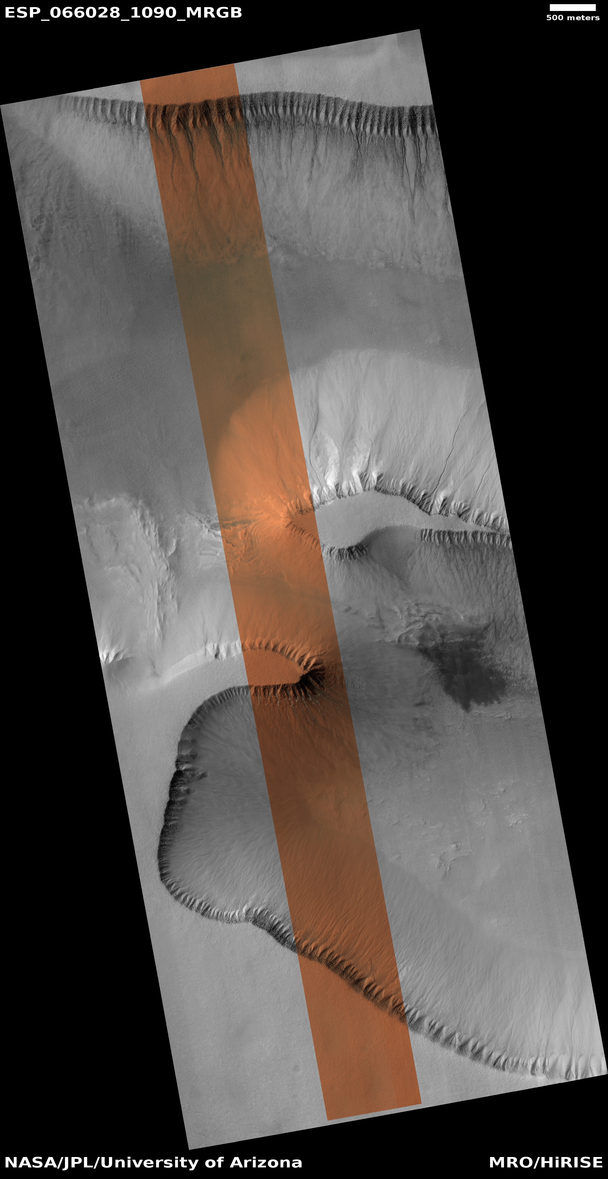
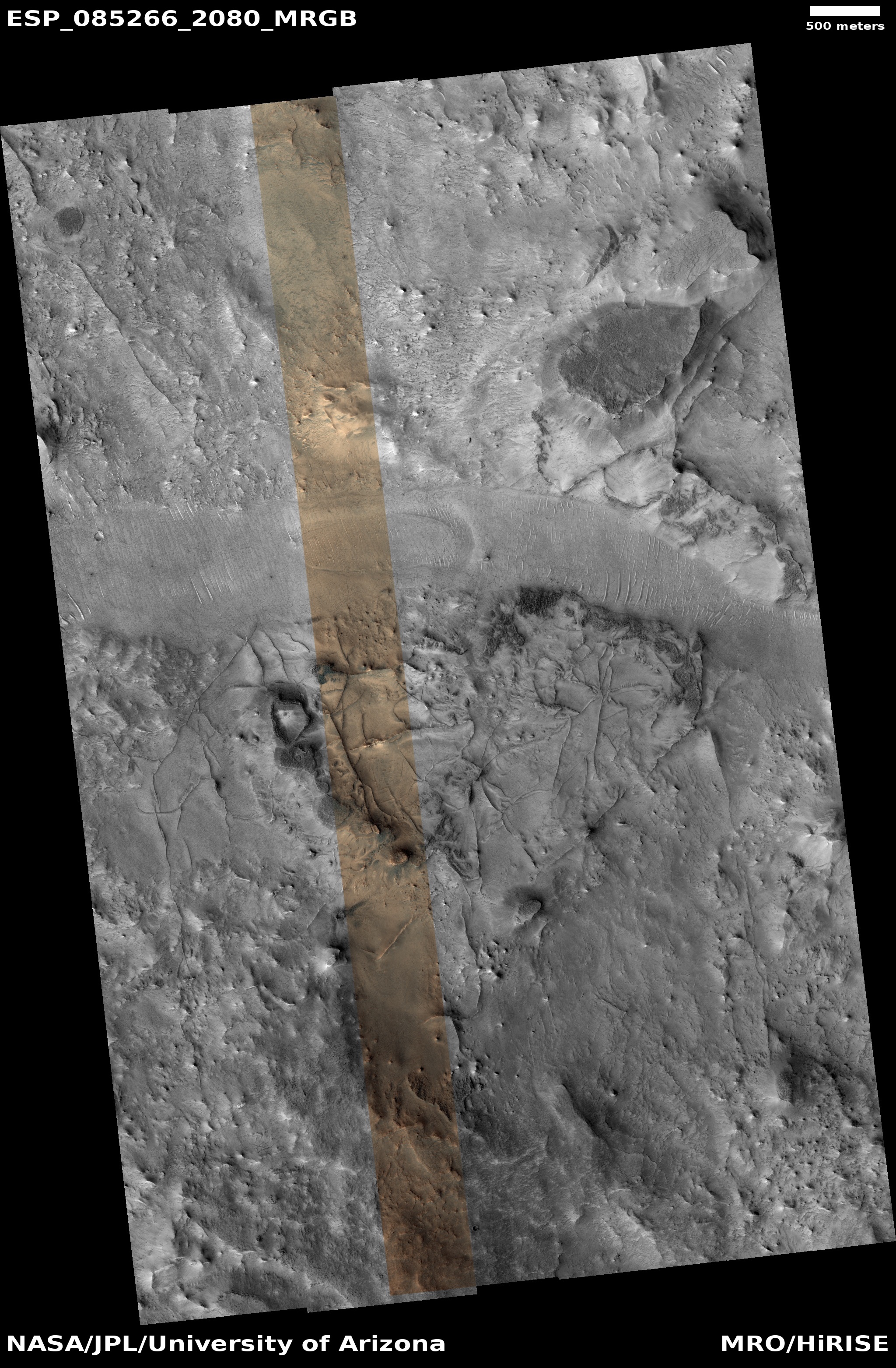
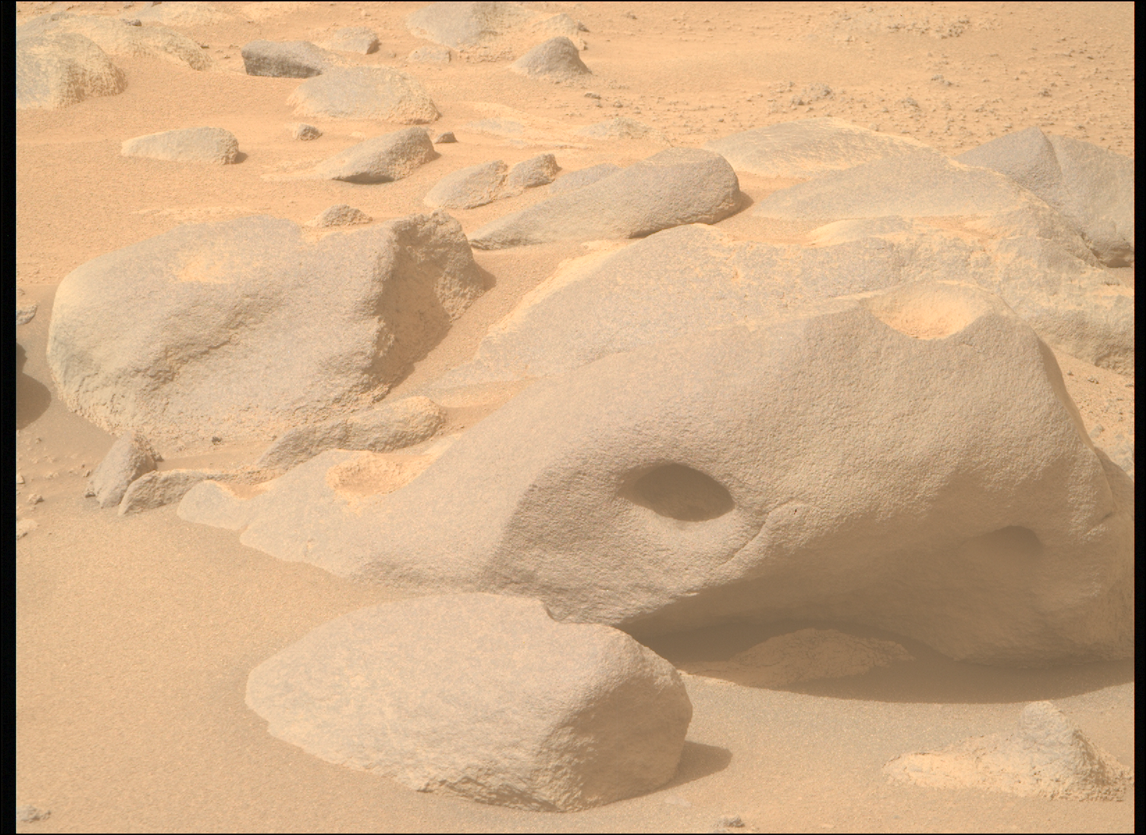
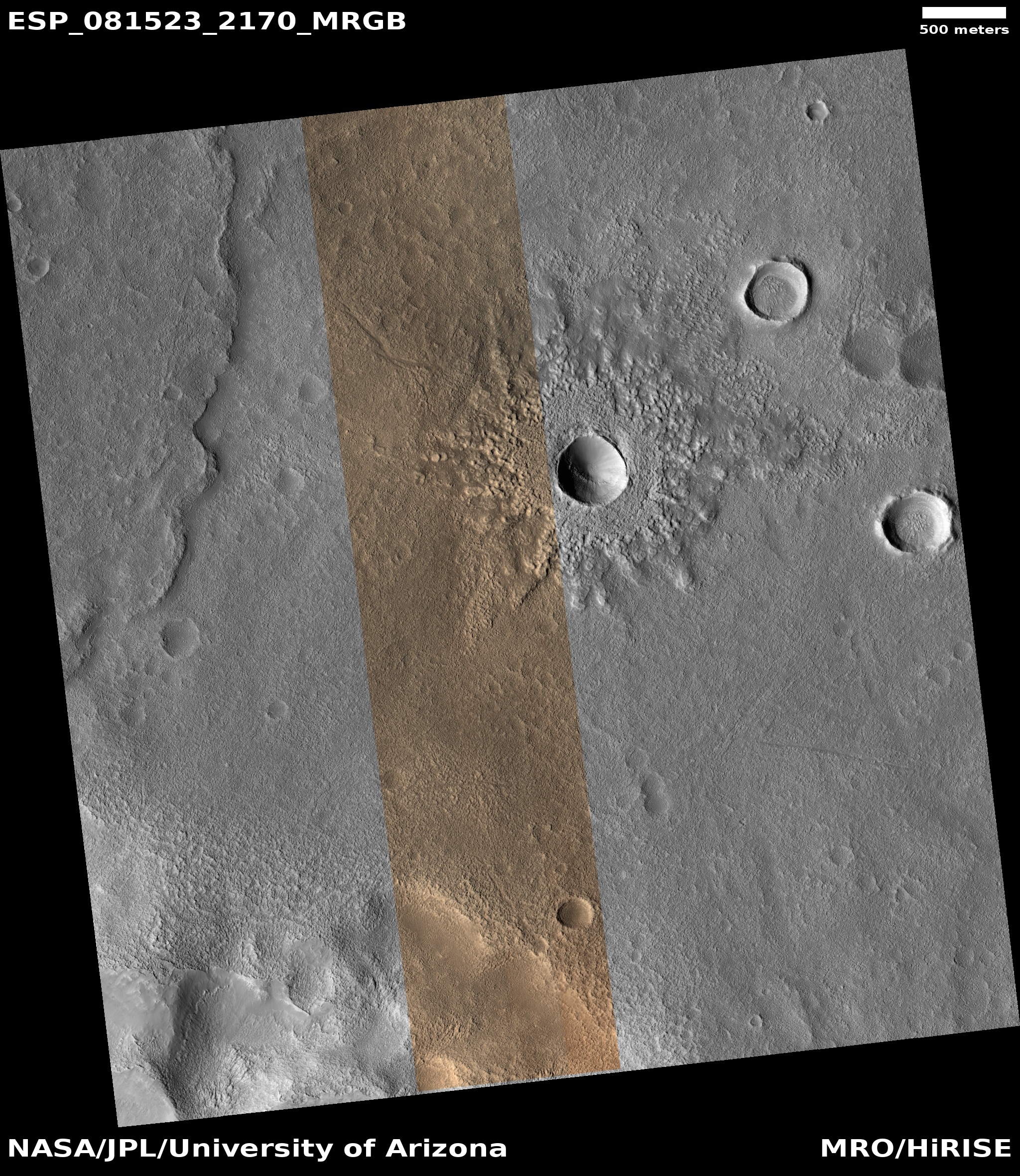
Cool image time! The picture to the right, cropped, reduced, and sharpened to post here, was taken on May 3, 2025 by the high resolution camera on Mars Reconnaissance Orbiter (MRO). Labeled merely as a “terrain sample,” it was likely snapped not as part of any specific research project but to fill a gap in the camera’s schedule so as to maintain the camera’s proper temperature.
When the MRO camera team does this, they try to pick features of interest at the time required, and I think succeed more often than not. In this case, they captured this one-mile-wide unnamed crater that appears to be filled with sublimating glacial debris. Similarly, the plateau surrounding the crater seems to also show signs that some sublimation is occurring of ice just below the surface, producing the areas that appear filled with pockmarks.
The location however suggests that if near surface ice here is sublimating away, it hints at a find of some significance.
» Read more
Click for original image.
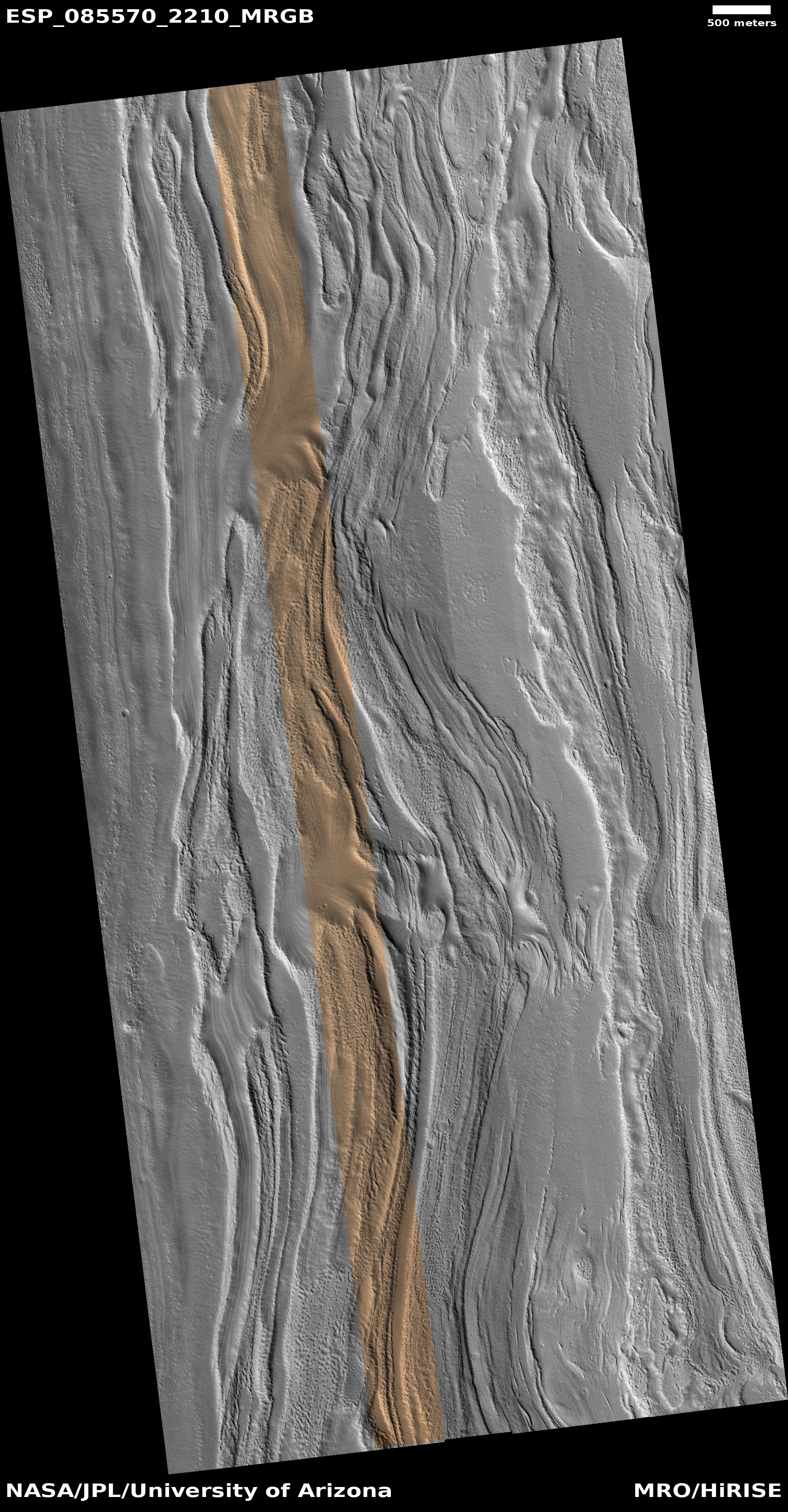
Cool image time! The picture to the right, cropped, reduced, and sharpened to post here, was taken on May 3, 2025 by the high resolution camera on Mars Reconnaissance Orbiter (MRO). Labeled merely as a “terrain sample,” it was likely snapped not as part of any specific research project but to fill a gap in the camera’s schedule so as to maintain the camera’s proper temperature.
When the MRO camera team does this, they try to pick features of interest at the time required, and I think succeed more often than not. In this case, they captured this one-mile-wide unnamed crater that appears to be filled with sublimating glacial debris. Similarly, the plateau surrounding the crater seems to also show signs that some sublimation is occurring of ice just below the surface, producing the areas that appear filled with pockmarks.
The location however suggests that if near surface ice here is sublimating away, it hints at a find of some significance.
» Read more