
Martian layers everywhere!
Click for full image.
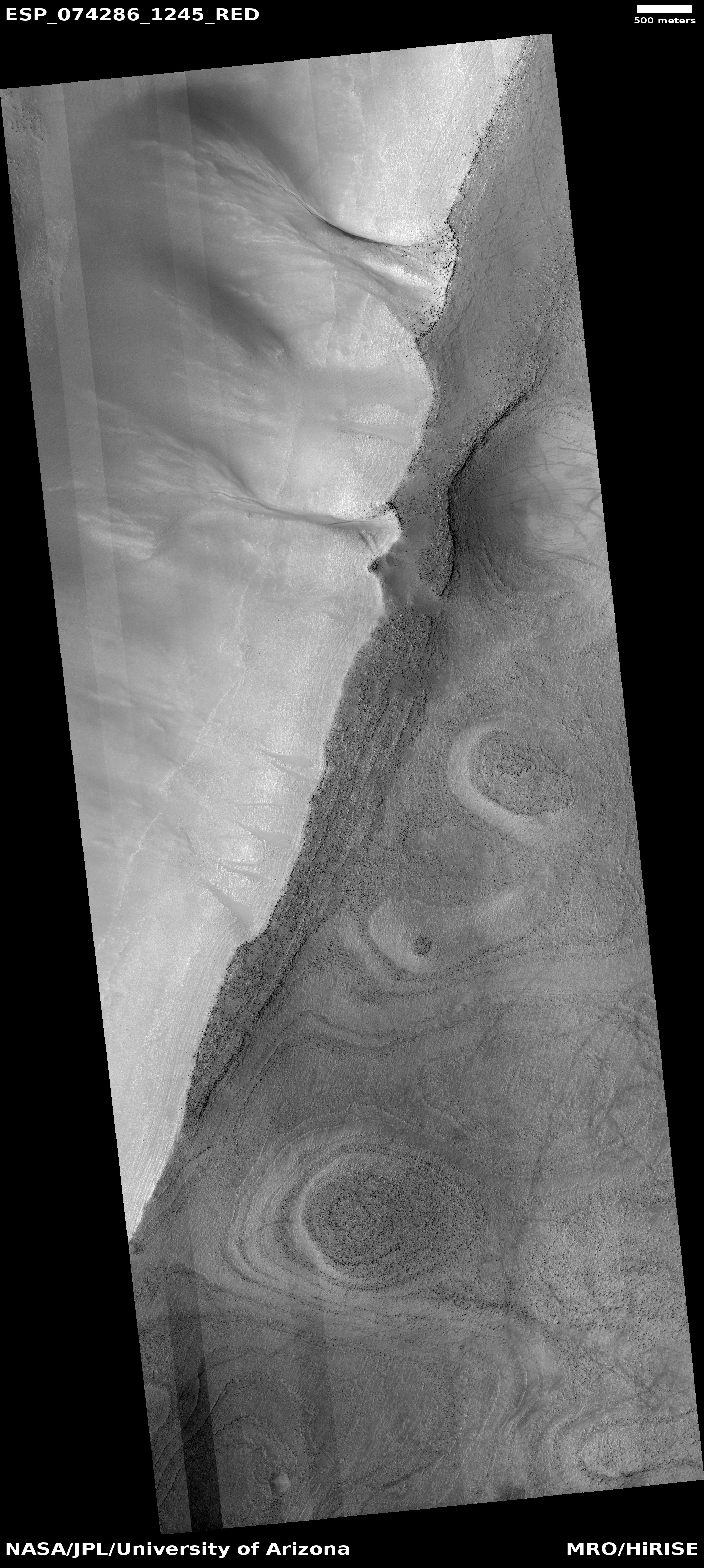
Cool image time! The photo to the left, rotated, cropped, and reduced to post here, was taken on June 1, 2022 by the high resolution camera on Mars Reconnaissance Orbiter (MRO). It shows the rim edge to a fifteen-mile-wide canyon, with many apparent layers exposed on the high plateau.
The layers are intriguing in that they suggest several things. First, they give us a glimpse into the top and youngest layers that make up the interior canyon wall. Second, they tell us that erosion has removed much of those top and youngest layers, resulting in the mesas on that plateau.
Finally, the gullies flowing down into the canyon indicate further erosion processes, eating away at the canyon wall over time.
The location of this canyon is also intriguing.
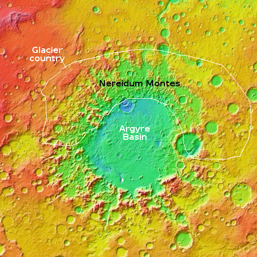
The small white rectangle in the southern part of Argyre Basin marks the location of this canyon. It is a strange teardrop-shaped canyon, suggesting some form of flow from the south to the north that washed away part of the basin’s floor.
Argyre Basin is the second largest basin on Mars, about 1,100 miles in diameter with its lowest elevation 17,000 feet below the surrounding southern cratered highlands. It is believed to have been formed by a giant impact billions of years ago. Since that impact this particular canyon formed, and it appears to have formed by some underground drainage flowing down from the mountains to the south. Since the basin sits entirely within the 30 to 60 degree mid-latitude band where many glaciers are found on Mars, assuming a glacier was a factor in forming this canyon is entirely reasonable, though obviously unproven at this time.
That there does not appear to be any obvious glacial material at this location in the full MRO image illustrates the uncertainty of this assumption. Yet, glaciers are found in this region. If they are not here now, they could likely have been here in the past, and thus might explain the canyon’s formation and later erosion processes.
The canyon’s shape also suggests the possibility that it formed by flowing water. It surely looks like the kinds of resurgences one sees in limestone karst regions on Earth, where underground rivers reach the surface as springs, and then subsequently flow on the surface, carving out canyons.
There is no water here now, however, either as liquid or ice. Figuring out the layers and formation of this canyon cannot be easily understood until someone can walk along its walls and take rock samples, in great numbers.

On Christmas Eve 1968 three Americans became the first humans to visit another world. What they did to celebrate was unexpected and profound, and will be remembered throughout all human history. Genesis: the Story of Apollo 8, Robert Zimmerman's classic history of humanity's first journey to another world, tells that story, and it is now available as both an ebook and an audiobook, both with a foreword by Valerie Anders and a new introduction by Robert Zimmerman.
The print edition can be purchased at Amazon or from any other book seller. If you want an autographed copy the price is $60 for the hardback and $45 for the paperback, plus $8 shipping for each. Go here for purchasing details. The ebook is available everywhere for $5.99 (before discount) at amazon, or direct from my ebook publisher, ebookit. If you buy it from ebookit you don't support the big tech companies and the author gets a bigger cut much sooner.
The audiobook is also available at all these vendors, and is also free with a 30-day trial membership to Audible.
"Not simply about one mission, [Genesis] is also the history of America's quest for the moon... Zimmerman has done a masterful job of tying disparate events together into a solid account of one of America's greatest human triumphs."--San Antonio Express-News
Some martian colonists from Earth will be geologists. Geo: earth.
What are martian geologists going to be called? Dejahologists?
Aresologists?
Mangalogists?