
Monitoring Martian pits not near Arsia Mons
Click for full image.
In reviewing the August image release from the high resolution camera on Mars Reconnaissance Orbiter (MRO), I came upon two different new pit images, the more interesting of which is highlighted on the right, cropped to post here..
Finding new pit images from MRO isn’t surprising, since the spacecraft has been photographing pits almost monthly since November (see: November 12, 2018, January 30, 2019, February 22, 2019, April 2, 2019, May 7, 2019, and July 1, 2019).
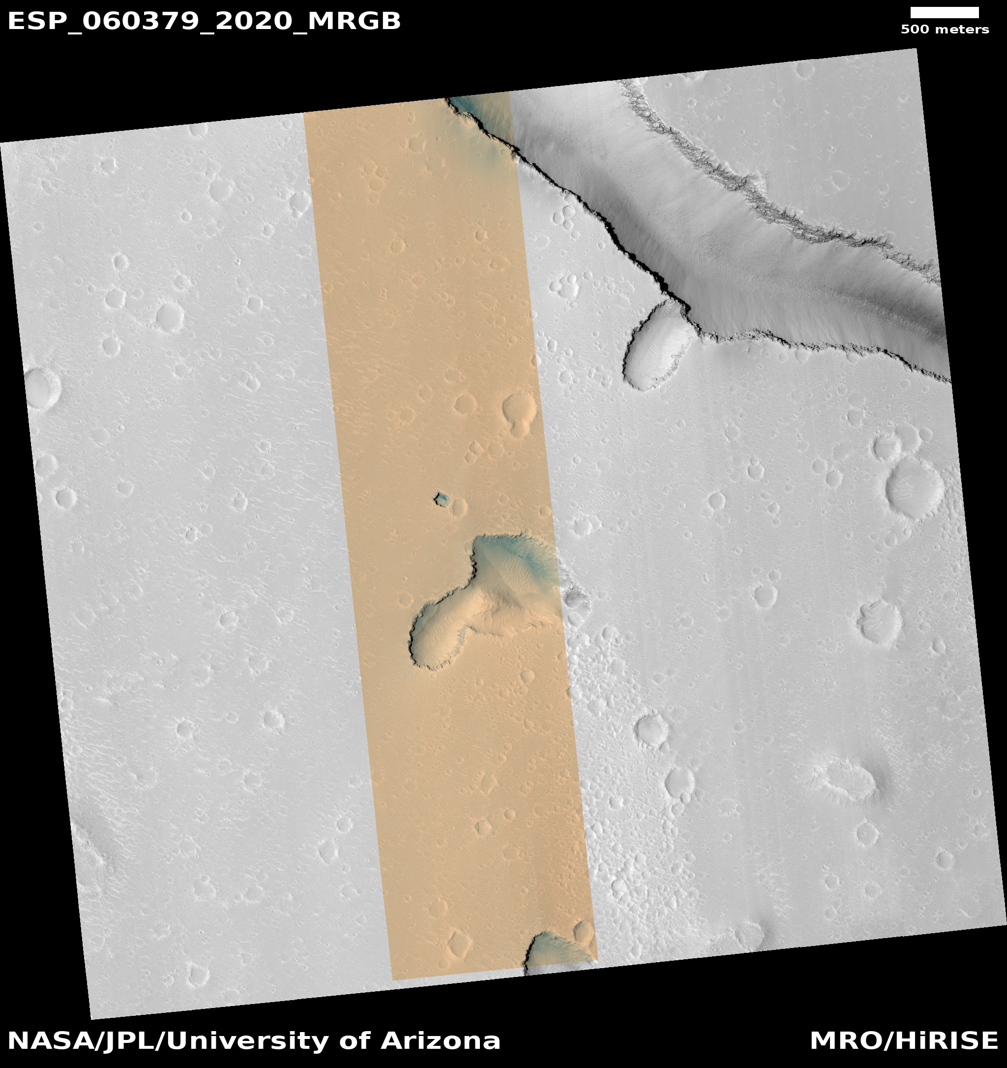
What makes these two new pit images more intriguing are their location, and the fact that both pits were previously photographed by MRO and posted on Behind the Black on June 5, 2018 and July 24, 2018. Both are located in Hephaestus Fossae, a region of fissures on the edge of the great Martian northern lowlands to the west of the great volcano Elysium Mons.
Almost all the pits from past MRO images have been found on the slopes of Arsia Mons, the southernmost of the three giant volcanoes southeast of Olympus Mons. In fact, last month I even asked the question, “Why so many pits there, and so few pits elsewhere?” The explanation from Chris Okubo of the U.S. Geological Survey, who is requesting these images, was that maybe it was due to geology, or maybe it was because we simply do not yet have enough information and might not have identified the many caves/pits elsewhere.
It appears that this same question had already been on the minds of Okubo and his partner, Glen Cushing, also of the USGS. As Okubo wrote me when I asked him about these new images:
Since these are unusual (i.e., not on a volcano) we decided to invest in a stereo pair in case it helps figure out what’s going on.
In other words, the new image can be compared with the first to determine very precise elevation data. Okubo added that once the stereo pair was created
…someone could develop a digital elevation model of the pit, and then look at it’s shape and the topography of the surrounding plains to see if there’s anything in the surface topography that could provide a clue as to how the pit formed.
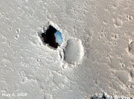
The older image is to the right. Not only will the new image, compared to this, allow them to get a better idea of what formed the pit, the different lighting also reveals how dangerous it is to assume too much from one photograph. The shadows in the older image indicate strongly that the northern lip of the pit is overhung. The new image above, with no shadows on the pit’s north side, instead makes it look like the cliff slopes down smoothly, with no break, though the color changes indicates a change in geology and chemical make-up as we move across layers.
Which is it? Likely the former, with an overhang, hidden by the lack of shadows in the newer image.
Click for full image.
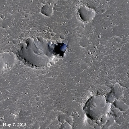
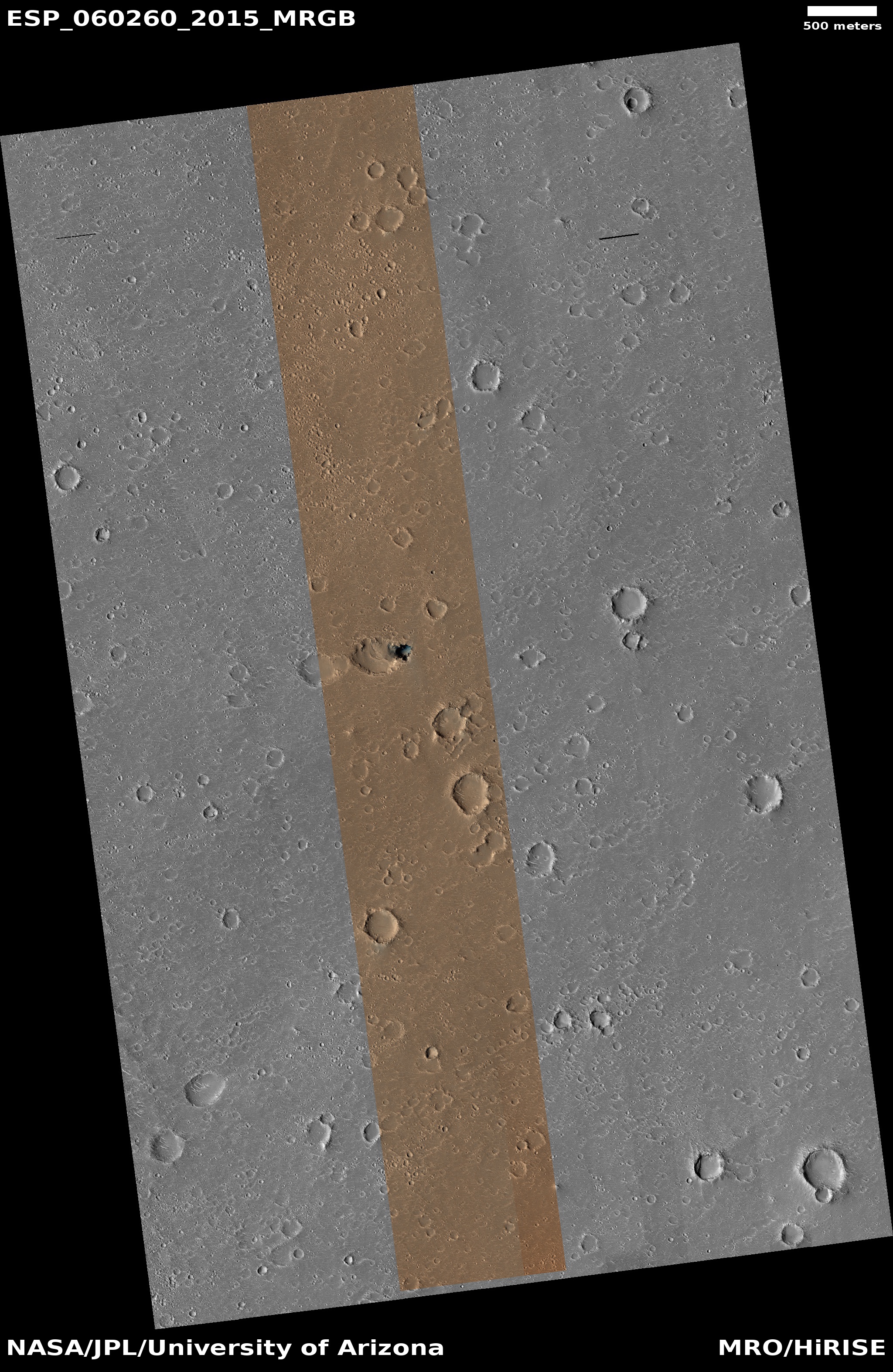
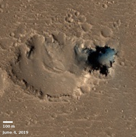
To the right is the new image of the second Hephaestus Fossae pit, with the older image below.
First, in my first post about this image I got the scale wrong. The pit is not about 100 meters across, it is about three times that width.
Second, unlike the two images of the first pit above, the lighting between these two images is almost the same, making it harder to see differences. This does not mean scientists can’t create a stereo image and determine the depth more precisely, it just means that gleaning this new information can’t easily done by eye.
Third, the apparent lack of change, even in the dust in the adjacent sink, illustrates the slowness of change on Mars. The atmosphere is very thin, and can move dust only slowly. While some places show change quickly, the bulk of Martian features take a long time to change. This pit appears no different, and in fact is not that different than pits and caves on Earth, which actually change slowly themselves. For a caver to see a major collapse or rockfall in an Earth cave is quite unusual.
Regardless, these pits suggest that many of the surrounding depressions, especially those that are irregular in shape, are likely not impact craters, but sinks indicating the presence of underground voids. (Click on the images to look at the full images to see what I mean.)
The possibilities are intriguing indeed, are they not?

On Christmas Eve 1968 three Americans became the first humans to visit another world. What they did to celebrate was unexpected and profound, and will be remembered throughout all human history. Genesis: the Story of Apollo 8, Robert Zimmerman's classic history of humanity's first journey to another world, tells that story, and it is now available as both an ebook and an audiobook, both with a foreword by Valerie Anders and a new introduction by Robert Zimmerman.
The print edition can be purchased at Amazon or from any other book seller. If you want an autographed copy the price is $60 for the hardback and $45 for the paperback, plus $8 shipping for each. Go here for purchasing details. The ebook is available everywhere for $5.99 (before discount) at amazon, or direct from my ebook publisher, ebookit. If you buy it from ebookit you don't support the big tech companies and the author gets a bigger cut much sooner.
The audiobook is also available at all these vendors, and is also free with a 30-day trial membership to Audible.
"Not simply about one mission, [Genesis] is also the history of America's quest for the moon... Zimmerman has done a masterful job of tying disparate events together into a solid account of one of America's greatest human triumphs."--San Antonio Express-News
Great images for thought Mr. Z., thank you.
I recalled an article regarding the Chesapeake Bay impact crater, and then followed similar articles:
So, I began with this site:
https://phys.org/news/2019-08-largest-impact-crater-million-years.html
Then side tracked to this site:
https://phys.org/news/2018-10-crater-dinosaurs-reveals-broken-liquid.html
Then to the binary asteroids site, which is very cool, :
https://phys.org/news/2013-02-group-chicxulub-crater-binary-asteroids.html
“The possibilities are intriguing indeed, are they not?” Yes Sir, they truly are !
Are they pits, as in dug or natural holes, or are they vent shafts for the population that lives below?