
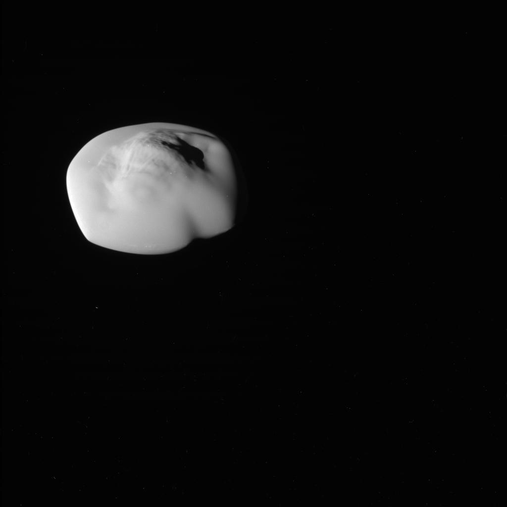
Pluto’s floating mountains of frozen ice

Click for original image.
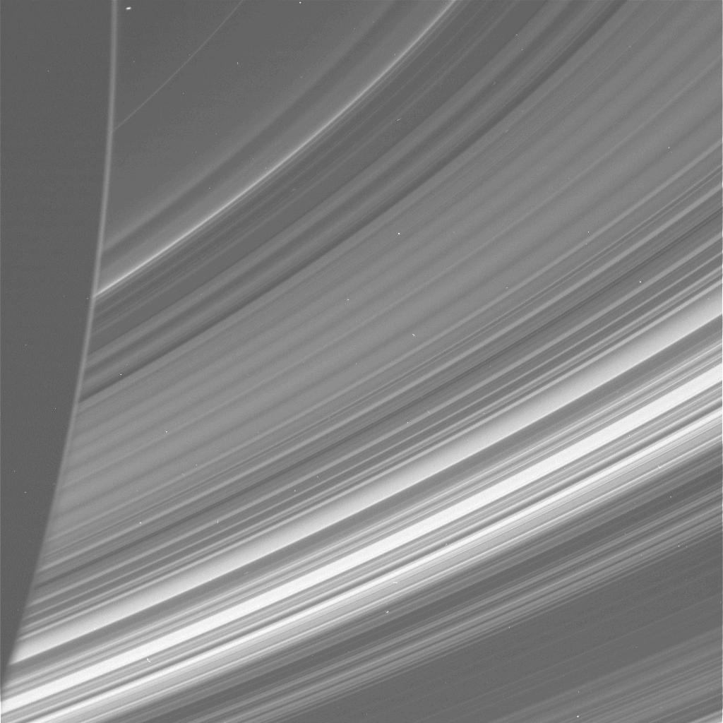
Cool image time! The picture to the right, rotated, cropped, and sharpened to post here, was taken by New Horizons on July 14, 2015 when it made its close fly-by of Pluto.
The picture looks at the part of Pluto that was close to sunset. Hence the mountain’s long dramatic shadow. The raw image webpage provides little information, including a scale of 0.0 meters, which means nothing. My guess is that these mountains could be several hundred to several thousand feet high based on data from other New Horizon mountain images, but that is a pure guess.
What we think we know is that these mountains are likely made of ice, which at Pluto’s eternally cold environment is as hard as granite. We also think we know that they float on a layer of frozen nitrogen, but because that nitrogen can sublimate into gas when Pluto’s climate warms as its orbit brings it closer to the Sun, the foundation of these mountains is quite unstable. They can roll and drift about, even if they are the size of the Appalachian mountains in the eastern U.S.
I continue to delve into the New Horizons’ archive, and have discovered a trove of quite amazing pictures that hadn’t been featured by the science team during the fly-by. Pluto really is an alien place. Stay tuned, there is more to come!


