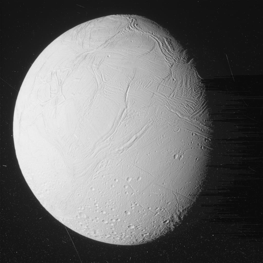
Click for original image.
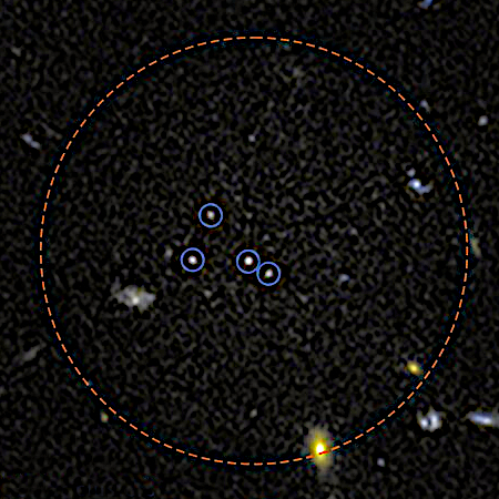
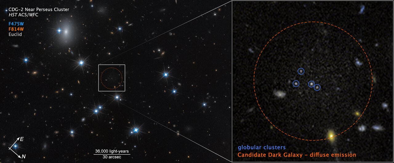
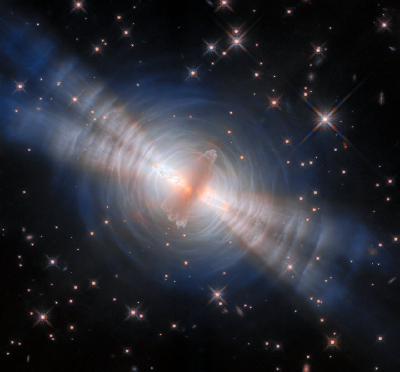
The uncertainty of science: Using ground-based and orbiting telescopes, astronomers think they have identified what might be the dimmest galaxy yet discovered, revealed almost entirely not from its stars but from the four globular clusters that reside within or near it.
The image to the right, cropped and sharpened to post here, shows that galaxy, dubbed CDG-2, along with those four globular clusters. From the press release:
To confirm one of the dark galaxy candidates, astronomers employed a trio of observatories: the NASA/ESA Hubble Space Telescope, ESA’s Euclid space observatory, and the ground-based NAOJ Subaru Telescope in Hawaii. Hubble’s high-resolution imaging revealed a close collection of four globular clusters in the Perseus galaxy cluster, 300 million light-years away. Follow-up studies using Hubble, Euclid, and Subaru data then revealed a faint, diffuse glow surrounding the star clusters – strong evidence of an underlying galaxy.
“This is the first galaxy detected solely through its globular cluster population,” said David. “Under conservative assumptions, the four clusters represent the entire globular cluster population of CDG-2.”
Preliminary analysis suggests CDG-2 has the luminosity of roughly 1 million Sun-like stars, with the globular clusters accounting for 16% of its visible content.
The scientists next claim that 99% of the galaxy’s mass is made up of dark matter, a material no one has yet detected except for the gravitational influence its invisible mass imposes on visible objects. It appears the astronomers don’t believe the mass that has been detected is sufficient to hold this galaxy together, and thus they need dark matter to explain its existence.
I simply wonder if the distances involved simply make the matter hard to see.
No matter. This is a cool discovery, because it tells us there is much out there hidden in the darkness we will always find difficult if not impossible to detect.


