
Terraced serrated layered mesas on Mars
Click for original image.
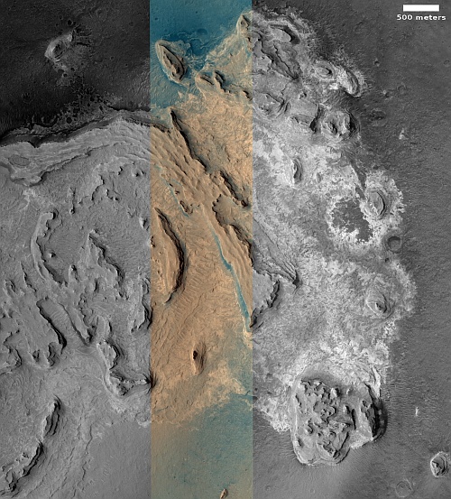
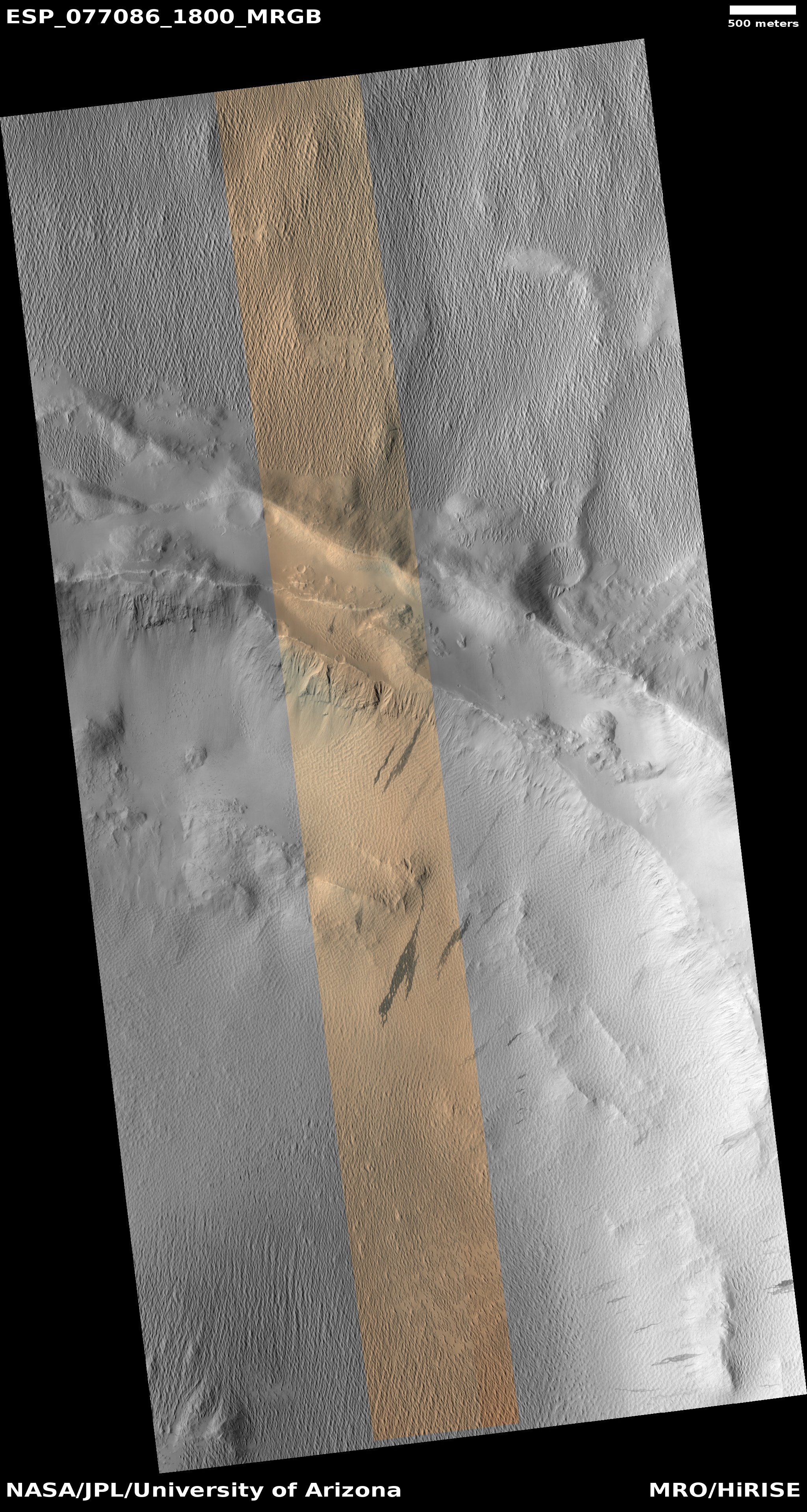
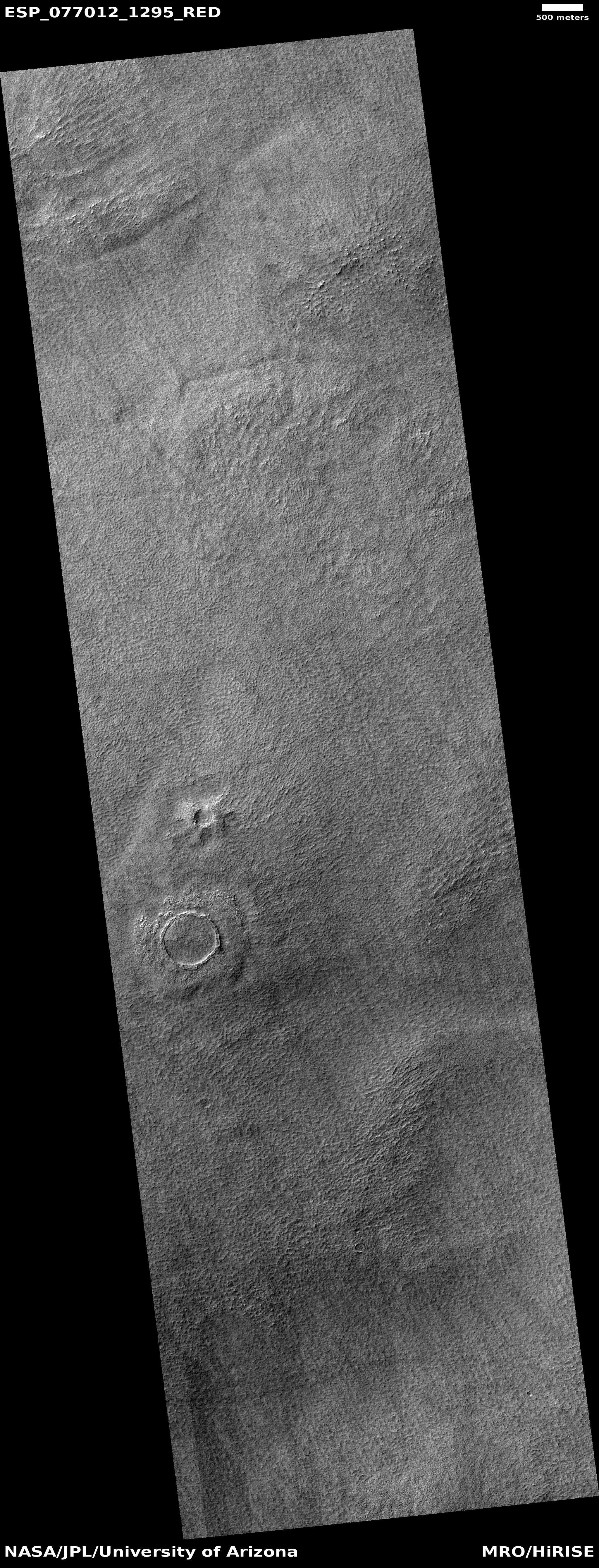
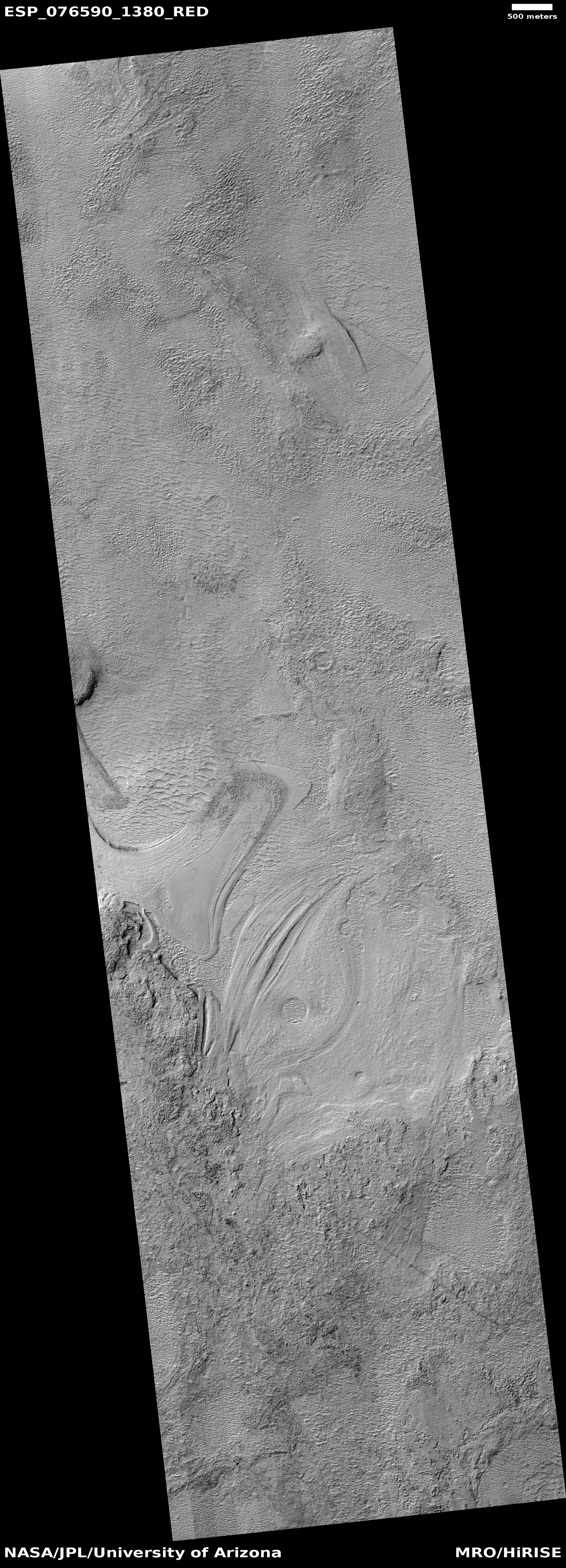
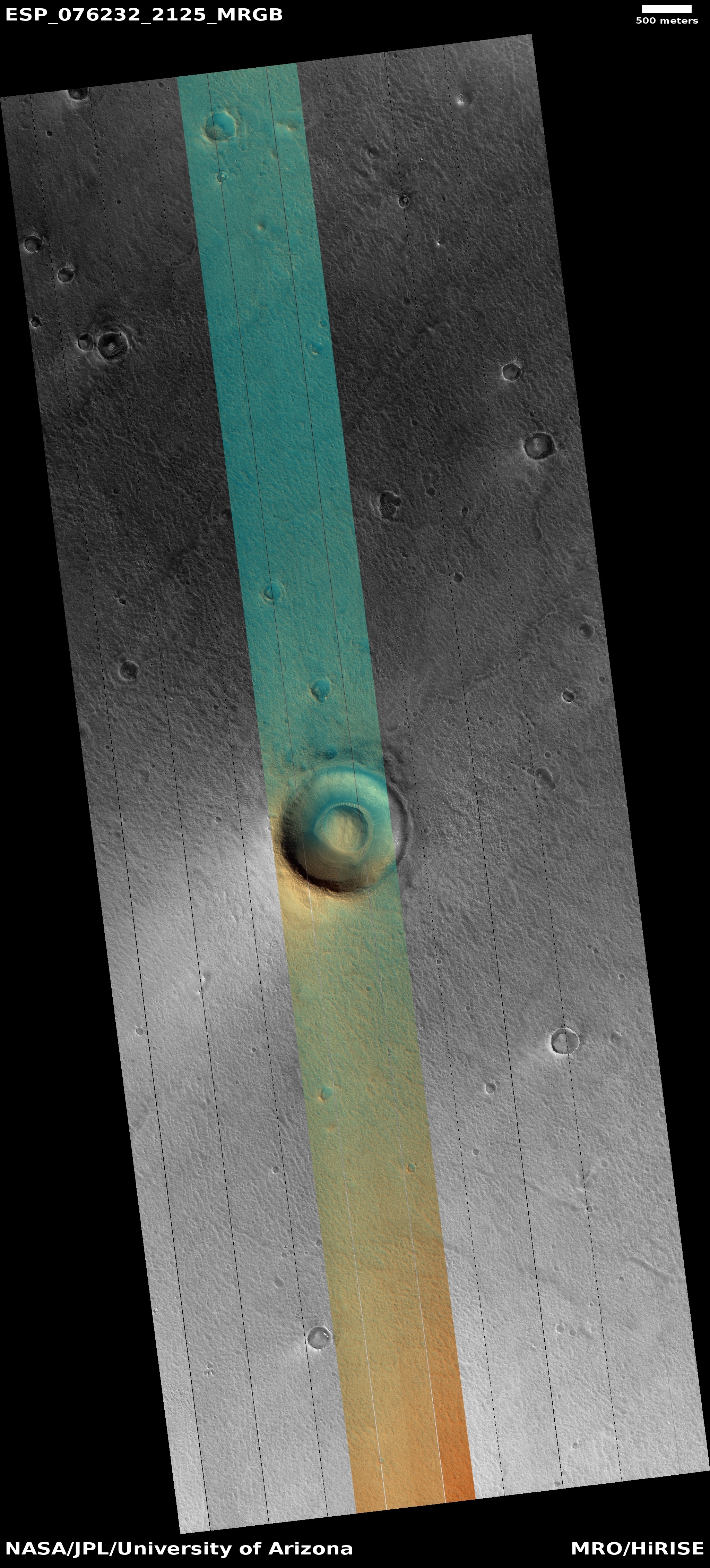
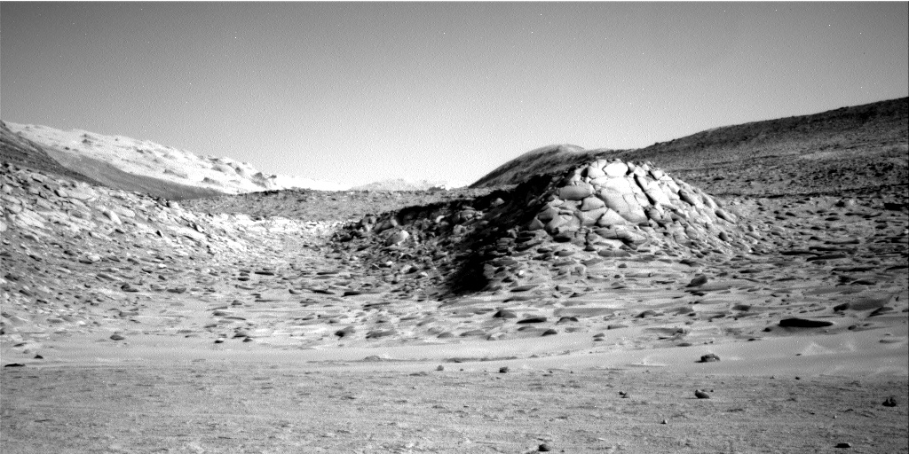
Cool image time! The picture to the right, rotated, cropped, reduced, and sharpened to post here, was taken on November 19, 2022 by the high resolution camera on Mars Reconnaissance Orbiter (MRO). It shows a collection of terraced mesas covered with dust of a variety of colors.
The bluish colors suggest exposed bedrock, while the different shades of tan suggest areas covered by dust and volcanic ash. That the tan areas are likely dust is strengthened in that it is found between and on these rough mesas, where dunes are also seen. The dust gets blown in but gets trapped there.
The tan colors however could also indicate different types of bedrock, especially because different terraces seem to be of different shades. We will need more data to determine which, or whether this is a combination of all these geological processes.
» Read more
Click for original image.
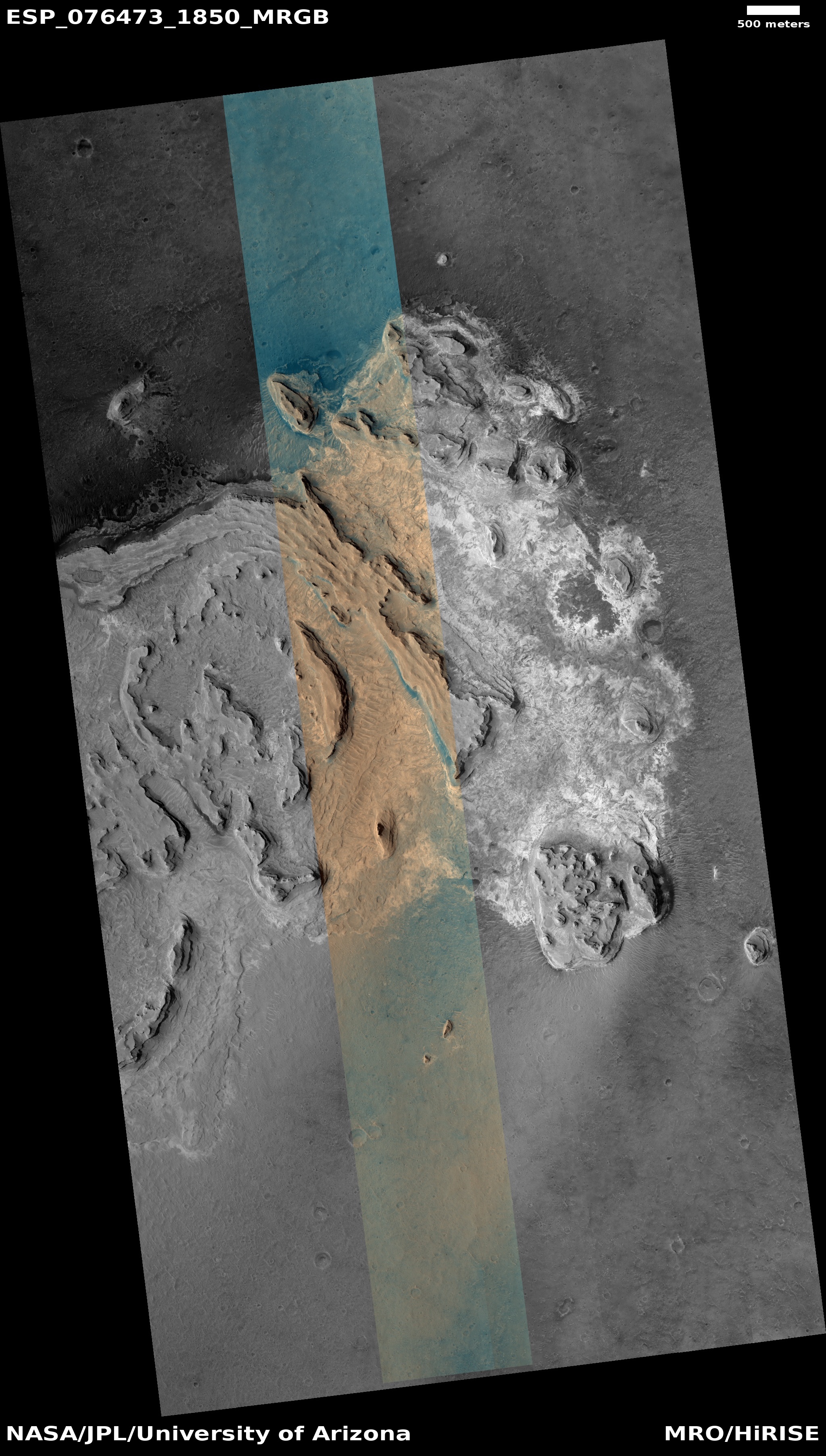
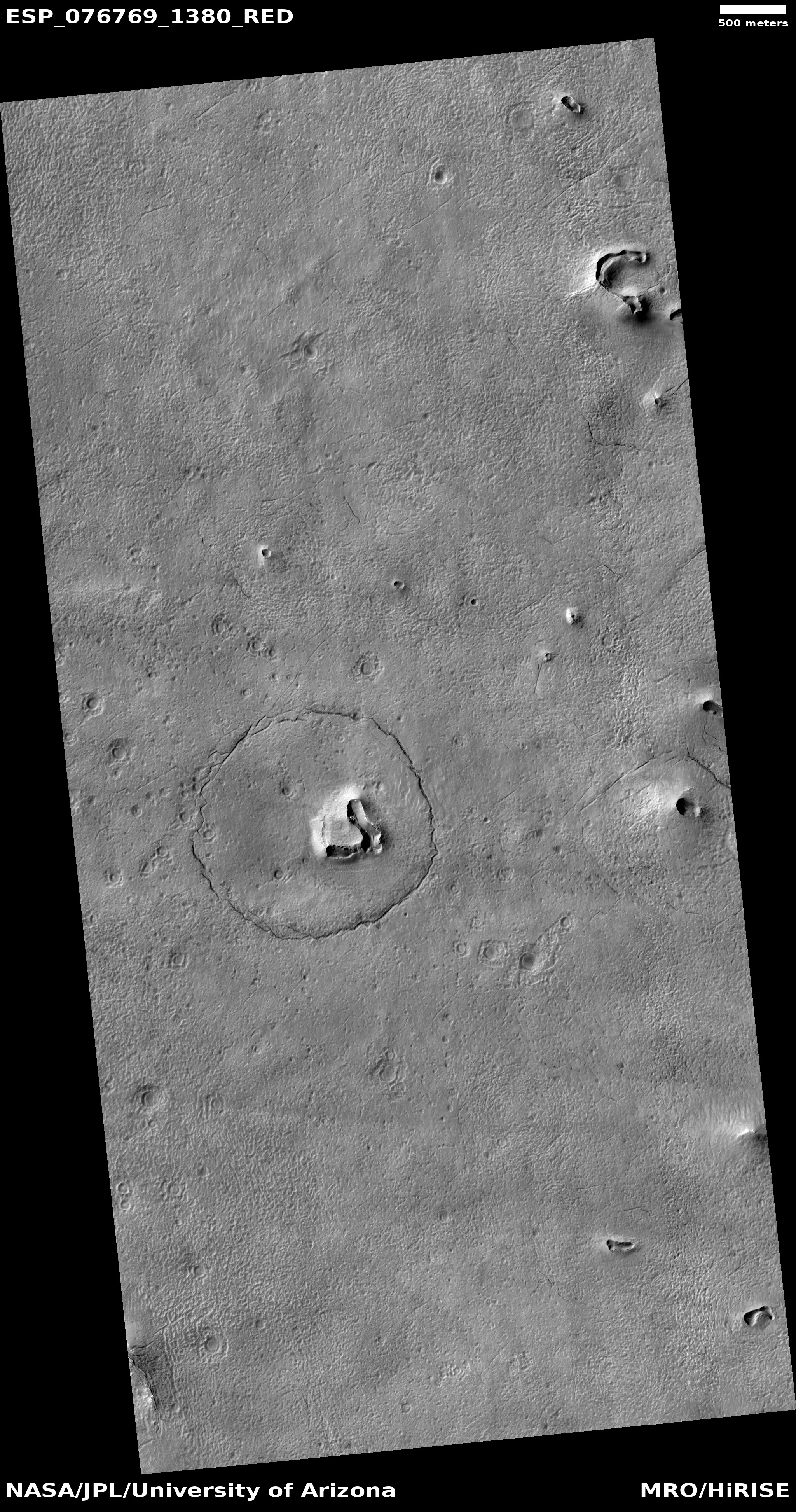
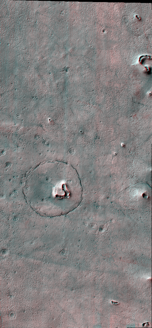
Cool image time! The picture to the right, rotated, cropped, reduced, and sharpened to post here, was taken on November 19, 2022 by the high resolution camera on Mars Reconnaissance Orbiter (MRO). It shows a collection of terraced mesas covered with dust of a variety of colors.
The bluish colors suggest exposed bedrock, while the different shades of tan suggest areas covered by dust and volcanic ash. That the tan areas are likely dust is strengthened in that it is found between and on these rough mesas, where dunes are also seen. The dust gets blown in but gets trapped there.
The tan colors however could also indicate different types of bedrock, especially because different terraces seem to be of different shades. We will need more data to determine which, or whether this is a combination of all these geological processes.
» Read more


