Crashing moonlets orbiting Saturn

By comparing data from the Voyager fly-bys of Saturn in the 1980s with new data collected by Cassini in the past decade scientists think they can now explain the changes that have occurred in Saturn’s outer F ring.

“The F ring is a narrow, lumpy feature made entirely of water ice that lies just outside the broad, luminous rings A, B, and C,” notes French. “It has bright spots. But it has fundamentally changed its appearance since the time of Voyager. Today, there are fewer of the very bright lumps.” The bright spots come and go over the course of hours or days, a mystery that the two SETI Institute astronomers think they have solved.

“We believe the most luminous knots occur when tiny moons, no bigger than a large mountain, collide with the densest part of the ring,” says French. “These moons are small enough to coalesce and then break apart in short order.”

Confirmed: Life in buried Antarctic lake

American scientists have confirmed that water samples from the buried Antarctic Lake Whillans, first obtained in January 2013, contained almost 4,000 different species of life.

Samples from the lake show that life has survived there without energy from the Sun for the past 120,000 years, and possibly for as long as 1 million years. And they offer the first look at what may be the largest unexplored ecosystem on Earth — making up 9% of the world’s land area. “There’s a thriving ecosystem down there,” says David Pearce, a microbiologist at Northumbria University, UK, who was part of a team that tried, unsuccessfully, to drill into a different subglacial body, Lake Ellsworth, in 2013.

Rosetta arrives

Rosetta has successfully achieved orbit around Comet 67P/C-G and has transmitted its first close up images. More information here and here about the rendezvous and what science the mission scientists plan to do as they orbit the comet.

The image below is looking down and past the comet’s smaller component as it casts a shadow on the neck and the larger component beyond. As with the earlier images, the comet’s pitted and corroded surface, lacking any obvious craters, is reminiscent to me of a pile of dirty snow that has been dissolving away. In fact, when I lived in New York I would see this kind of look every winter. When the city would get a big snowfall snowplows would push it into large mounds on the side of the road. As time passed these piles would get dirty from the city’s soot and grime, and also slowly melt away. After several weeks it would look almost exactly like the surface of Comet 67P/C-G.

The images and data that will come down from Rosetta over the next year and half as it orbits the comet in its journey around the Sun will be most fascinating. Stay tuned!

67P/C-G up close

Scientists struggle with earthquake data in the Pacific northwest

The uncertainty of science: A second look at cores drilled in the Pacific northwest has raised doubts about the previous conclusions that the region faces the threat of megaquakes every few centuries.

The bottom line is that though geologists are very confident the northwest faces the threat of future quakes, they can’t yet predict with any confidence their rate or intensity.

The early bombardment of the Earth

Using computer models based on the Moon’s crater record, scientists have developed a simulation of the great early bombardment of the Earth around 4 billion years ago.

The model suggests that the biggest asteroids to hit Earth would have been as large as 3,000 kilometres across. Between one and four would have been 1,000 kilometres wide or larger, it predicts, with a total of three to seven exceeding 500 kilometres in width. The most recent of these would have hit around 4.2–4.3 billion years ago.

In comparison with Earth’s mass, the amount of rock hitting the planet would have been tiny. But it would have had an enormous effect on Earth’s surface, says Marchi. A 10-kilometre-wide asteroid was enough to kill the dinosaurs, and studies4 show that one 500 kilometres across would vaporize all of the planet’s oceans. “At 1,000 kilometres, the effects would be so wide the planet would probably be completely resurfaced with material from the mantle,” he says.

More here, including animated gifs showing this bombardment unfold.

Mapping the inside of Mt St. Helens

A new array of seismometers, combined with a series of planned explosions, will be used to map the interior of the Mt. St. Helens volcano to a depth of eighty kilometers or fifty miles.

To get the job done, starting next week roughly 65 people will fan out across the mountain to deploy 3,500 small seismometers along roads and back-country trails. They will drill 24 holes some 25 metres deep, drop in industrial explosives used for quarrying, and refill the holes (see ‘Under the dome’). The plan is to detonate the explosives in separate shots over four nights. Each blast will shake the ground as much as a magnitude-2 earthquake.

Results from the active blasts will be combined with the passive seismic part of the experiment, which is already under way: 70 larger seis­mometers around the mountain are measuring how long waves from natural earthquakes take to travel through the ground. Their data can be used to probe as far as 80 kilo­metres down, says Vidale.

Glaciers on Mars!

A geological study of orbital images of Gale Crater has led scientists to conclude that the crater was once covered in glaciers.

To carry out the study, the team has used images captured with the HiRISE and CTX cameras from NASA’s Mars Reconnaissance Orbiter, together with the HRSC onboard the Mars Express probe managed by the European Space Agency (ESA).

Analyses of the photographs have revealed the presence of concave basins, lobated structures, remains of moraines and fan-shaped deposits which point to the existence of ancient glaciers on Gale. In fact they seem to be very similar to some glacial systems observed on present-day Earth. “For example, there is a glacier on Iceland –known as Breiðamerkurjökull– which shows evident resemblances to what we see on Gale crater, and we suppose that is very similar to those which covered Gale’s central mound in the past,” says Fairén.

This is not the first place on Mars where scientists believe glaciers once flowed. The northwestern slopes of Arsia Mons, one of Mars’s giant volcanoes in the Tharsis Bulge, is also believed to have once harbored glaciers.

A new analysis of Apollo lunar rocks provides strong new evidence for the theory that the Moon was formed when the Earth was hit by a Mars’ sized planet.

A new analysis of Apollo lunar rocks provides strong new evidence for the theory that the Moon was formed when the Earth was hit by a Mars’ sized planet.

The abstract from this just released science paper summarizes the scientific problem.

Earth formed in a series of giant impacts, and the last one made the Moon. This idea, an edifice of post-Apollo science, can explain the Moon’s globally melted silicate composition, its lack of water and iron, and its anomalously large mass and angular momentum. But the theory is seriously called to question by increasingly detailed geochemical analysis of lunar rocks. Lunar samples should be easily distinguishable from Earth, because the Moon derives mostly from the impacting planet, in standard models of the theory. But lunar rocks are the same as Earth in O, Ti, Cr, W, K, and other species, to measurement precision. Some regard this as a repudiation of the theory; others say it wants a reformation. Ideas put forward to salvage or revise it are evaluated, alongside their relationships to past models and their implications for planet formation and Earth.

The new analysis has found that lunar rocks do differ from Earth in certain ways. Not surprisingly, however, the results have uncertainties.

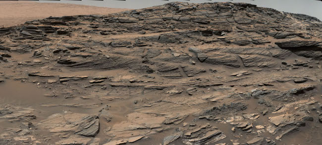
Engineers commanded Curiosity to drill its third drill hole on Tuesday on what looks like an outcrop of sandstone in Gale Crater.

Engineers commanded Curiosity to drill its third drill hole on Tuesday on what looks like an outcrop of sandstone in Gale Crater.

This hole is shallow and is merely a test to see if a deeper full bore would be worthwhile geological.

That Curiosity has only drilled three holes, and is now only doing a test bore first is partly because engineers fear that using the drill too much will cause a short circuit that will disable the rover entirely. This fear is because of a design flaw in the construction of the rover and the drill.

Scientists have verified that a large gold nugget is actually a gigantic single crystal, the largest known.

Scientists have verified that a large gold nugget is actually a gigantic single crystal, the largest known.

Gold found in the ground will generally have a polycrystalline structure, meaning it is made up of many crystallites, varying in shape and size. Gold of a mono-crystalline structure, where the material is unbroken, are rarer and of significantly higher value.

The nugget is now worth about 100 times more than its typical weight in gold.

Geologists, using computer models, have reconstructed the size and impact velocity of a giant asteroid that hit the Earth approximately 3.26 billion years ago.

Geologists, using computer models, have reconstructed the size and impact velocity of a giant asteroid that hit the Earth approximately 3.26 billion years ago.

This is a fascinating result, but it is very important to recognize its very large uncertainties. The article for example says almost nothing about how these conclusions were reached, except for this one paragraph:

Lowe, who discovered telltale rock formations in the Barberton greenstone a decade ago, thought their structure smacked of an asteroid impact. The new research models for the first time how big the asteroid was and the effect it had on the planet, including the possible initiation of a more modern plate tectonic system that is seen in the region, according to Lowe. [emphasis mine]

I have highlighted that one word because it reveals a great deal. What they did was to create a computer model of the data they had, which was merely very unusual geology spread over a certain region called the Barberton Greenstone Belt. Note also that this region is not where the impact occurred. “The study’s co-authors think the asteroid hit the Earth thousands of kilometers away from the Barberton Greenstone Belt, although they can’t pinpoint the exact location.”

A new analysis of data from Messenger suggests that violent explosive volcanism occurred throughout much of Mercury’s history.

A new analysis of data from Messenger suggests that violent explosive volcanism occurred throughout much of Mercury’s history.

What is interesting about this result is that previously it was believed that explosive volcanism didn’t happen at all on Mercury.

On Earth, volcanic explosions like the one that tore the lid off Mount St. Helens happen because our planet’s interior is rich in volatiles — water, carbon dioxide and other compounds with relatively low boiling points. As lava rises from the depths toward the surface, volatiles dissolved within it change phase from liquid to gas, expanding in the process. The pressure of that expansion can cause the crust above to burst like an overinflated balloon.

Mercury, however, was long thought to be bone dry when it comes to volatiles, and without volatiles there can’t be explosive volcanism. But that view started to change in 2008, after NASA’s MESSENGER spacecraft made its first flybys of Mercury. Those glimpses of the surface revealed deposits of pyroclastic ash — the telltale signs of volcanic explosions — peppering the planet’s surface. It was a clue that at some point in its history Mercury’s interior wasn’t as bereft of volatiles as had been assumed.

The new conclusions have not only found evidence of explosive volcanism, it found a wide range of ages for these deposits, indicating that the explosive volcanism took place across an extended period of time.

New geological research suggests that the hydrogen levels that have detected on the moon — which are used to predict the presence of water — might be a false positive and not exist at the levels predicted.

The uncertainty of science: New geological research suggests that the hydrogen levels that have been detected on the moon — which are used to predict the presence of water — might be a false positive and not exist at the levels predicted.

Instead, what scientists thought was hydrogen in water molecules might be calcium as part of a mineral called apatite. If so, this would mean that the Moon has a lot less water than hoped. This data might also explain the lack of water seen in the Apollo samples as compared to what is suggested should be there from more recent orbital data. This also might explain the conflicting results from instruments on Lunar Reconnaissance Orbiter.

Before and after images from Mars Reconnaissance Orbiter have discovered the formation of a new gully on Mars sometime between November 2010 and May 2013.

Before and after images from Mars Reconnaissance Orbiter have discovered the formation of a new gully on Mars sometime between November 2010 and May 2013.

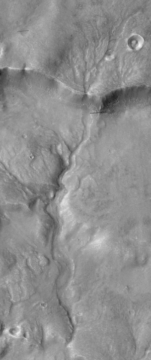
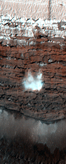
The winding gully seems to have poured out from an existing ribbon channel in a crater in Mars’ Terra Sirenum region. The leading hypothesis on how the gully formed is that debris flowed downslope from an alcove and eroded a new channel. Though it looks water-carved, the gully is much more likely to have been formed when carbon dioxide frost accumulated on the slope and grew heavy enough to avalanche down and drag material down with it.

Scientists think they have detected active volcanoes on Venus.

Scientists think they have detected active volcanoes on Venus.

We should hear more about this story in the next couple of days, after the scientists give their presentation at a science conference today. Note too that this result would only confirm other data, such as the fluctuating levels of sulfur in Venus’s atmosphere, that have suggested active volcanoes hidden under that planet’s thick cloud cover.

Orbital images from Mars Reconnaissance Orbiter have confirmed that the mysterious rock that appeared near Opportunity was not ejecta from a nearby meteorite impact.

Orbital images from Mars Reconnaissance Orbiter have confirmed that the mysterious rock that appeared near Opportunity was not ejecta from a nearby meteorite impact.

The scientists theorized that there was a very remote chance that a nearby impact has thrown the rock into place, but the images show nothing nearby. Moreover, if there had been an impact we probably would have seen more rocks raining down all around. The images are further confirmation that the rock was kicked up by the rover itself as it rolled along.

The geological history of Venus: What’s known, not known, and unknown.

The geological history of Venus: What’s known, not known, and unknown.

This is a very clearly written overview by James Head, one of the world’s preeminent planetary geologists, of what has been learned about the geology of Earth’s sister planet, the planet of a million volcanoes. Key quote:

Many features on Venus (folded mountain belts, rift zones, tesserae) were like Earth, but there were few signs of Earth-like plate tectonics, so that Venus seemed to have a single lithospheric plate that was losing heat conductively and advectively. But the cratering record presented a conundrum. First, the average age of the surface was <20% of the total age of the planet, and second, the average was not a combination of very old and very young surfaces, such as Earth’s continents and ocean basins. Third, the lack of variability in crater density, and of a spectrum of crater degradation, meant that all geological units might be about the same age. This implied that the observed surface of Venus must have been produced in the past hundreds of millions of years, possibly catastrophically, with very little volcanic or tectonic resurfacing since then! Suddenly, Venus was not like Earth, nor like the Moon, Mars, or Mercury.

Some scientists even believe that Venus was essentially resurfaced in a massive volcanic event about a half billion years ago. Others disagree. Meanwhile, the European probe Venus Express has gotten hints that volcanic activity is still going on.

As Head concludes, it has been 20 years since the last spacecraft arrived at Venus to do geological research. It is time to return.

Photos taken 33 years ago by a photographer who died in the Mt. St. Helens eruption have been discovered and developed.

Photos taken 33 years ago by a photographer who died in the Mt. St. Helens eruption have been discovered and developed.

Reid Blackburn took the photographs in April 1980 during a flight over the simmering volcano. When he got back to The Columbian studio, Blackburn set that roll of film aside. It was never developed. On May 18, 1980 — about five weeks later — Blackburn died in the volcanic blast that obliterated the mountain peak.

Those unprocessed black-and-white images spent the next three decades coiled inside that film canister. The Columbian’s photo assistant Linda Lutes recently discovered the roll in a studio storage box, and it was finally developed.

1 51 52 53 54 55 60