
Perseverance peers towards the rim of Jezero Crater
Click for full image.
Click for interactive map.
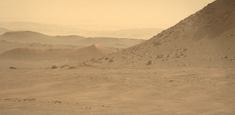
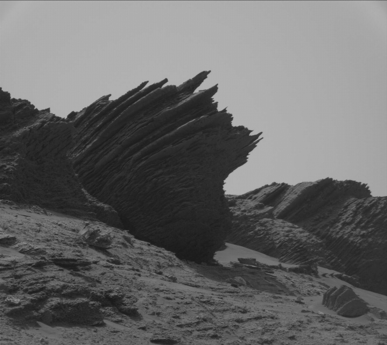
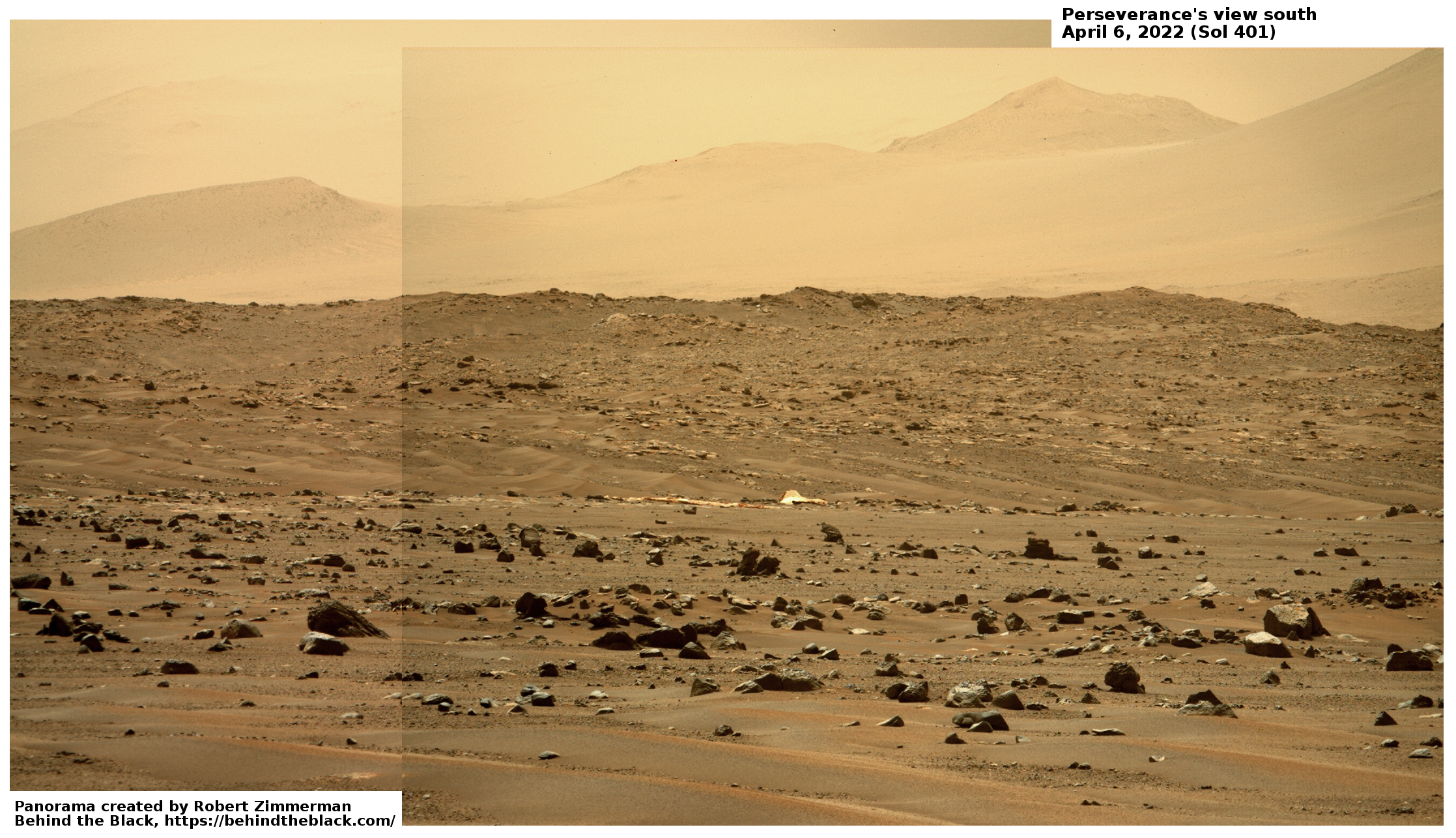
In our second cool image from Mars today, the Mars rover Perseverance gives us its own long distance view of the dusty winter air inside Jezero Crater. The photo above, cropped and reduced to post here, was taken on June 16, 2022 by the rover’s left high resolution camera, and looks to the southwest towards the crater’s western rim.
As with today’s previous cool image from Curiosity, we can see several ranges, each with distance faded more by the dust that hangs in the air during the winter on Mars. In the foreground right is the nearest cliff of the delta that flowed into Jezero over time in the past. Next is a knob and ridge line, also part of that delta flow but farther away. Third are some farther ridges that might have been part of that flow but maybe not.
Faintest of all are the highest mountains that form the western ridge of Jezero Crater, barely visible in the haze.
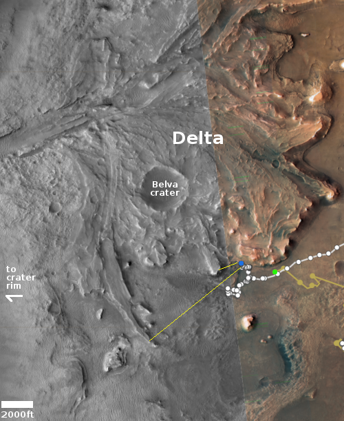
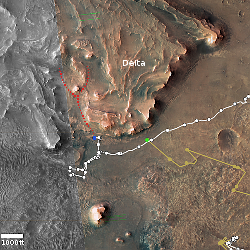
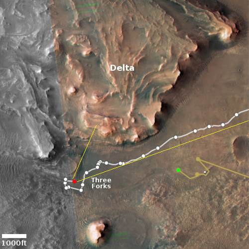
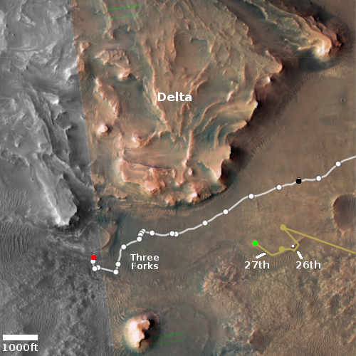
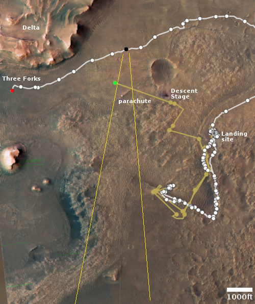
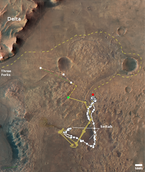
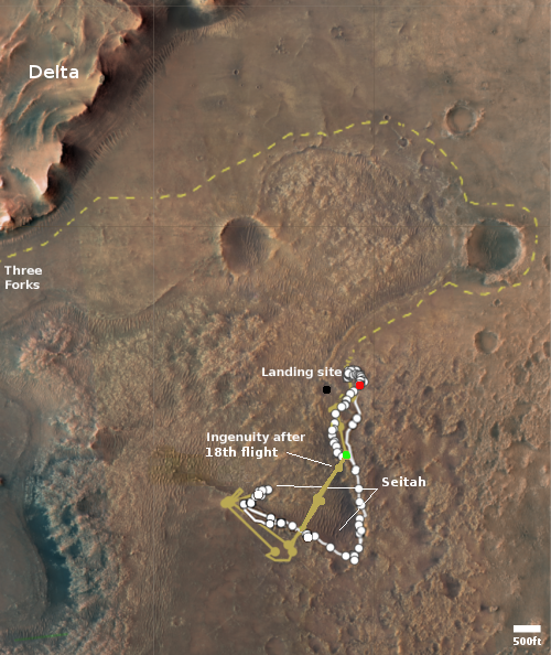
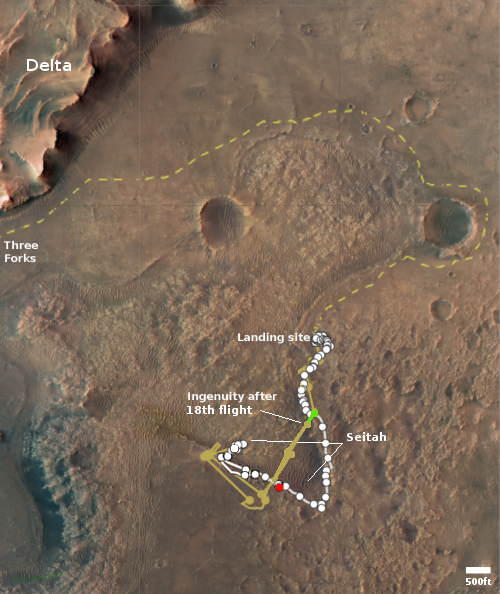
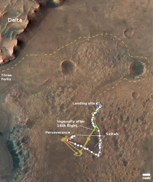
The blue dot in the overview map to the right marks Perseverance’s approximate position when the photo was taken. The yellow lines my guess as to the area covered by the photo. The green dot marks Ingenuity’s present position after its last flight, much closer to the delta that I had predicted.
Click for full image.
Click for interactive map.
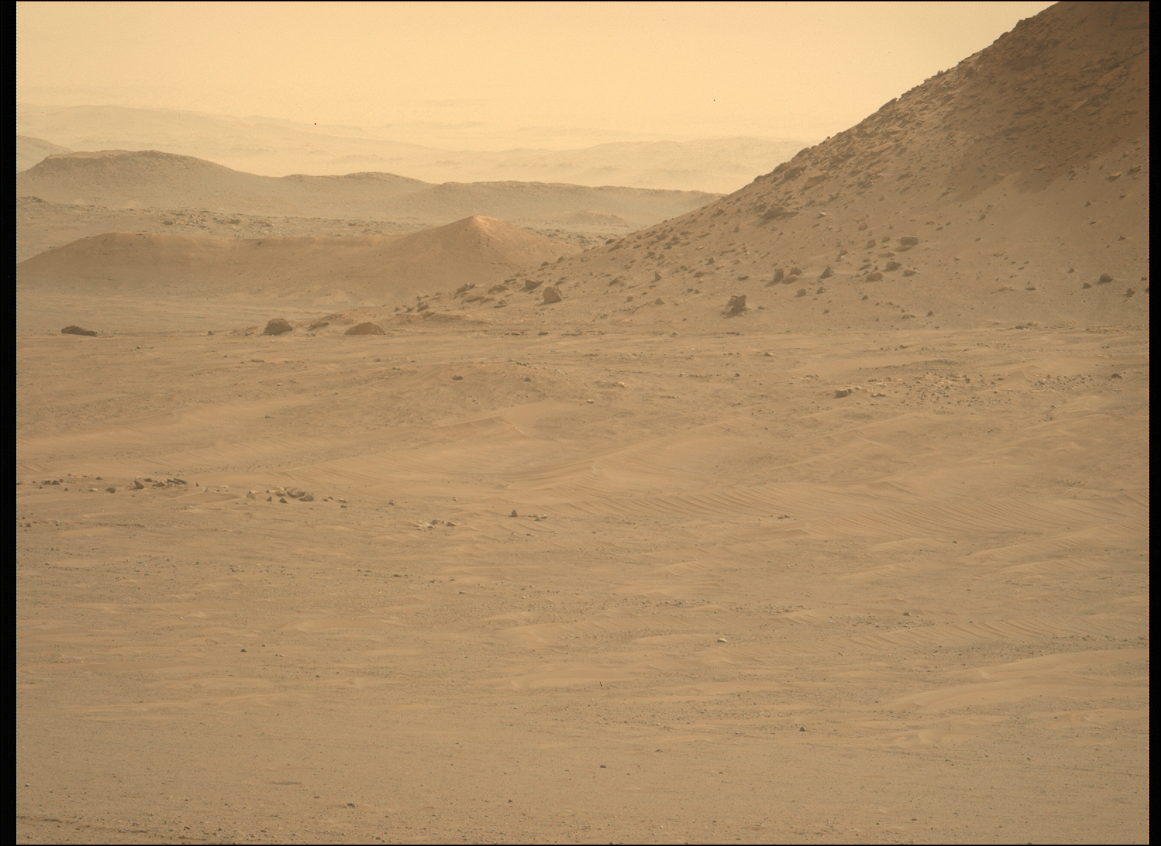
In our second cool image from Mars today, the Mars rover Perseverance gives us its own long distance view of the dusty winter air inside Jezero Crater. The photo above, cropped and reduced to post here, was taken on June 16, 2022 by the rover’s left high resolution camera, and looks to the southwest towards the crater’s western rim.
As with today’s previous cool image from Curiosity, we can see several ranges, each with distance faded more by the dust that hangs in the air during the winter on Mars. In the foreground right is the nearest cliff of the delta that flowed into Jezero over time in the past. Next is a knob and ridge line, also part of that delta flow but farther away. Third are some farther ridges that might have been part of that flow but maybe not.
Faintest of all are the highest mountains that form the western ridge of Jezero Crater, barely visible in the haze.
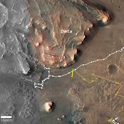
The blue dot in the overview map to the right marks Perseverance’s approximate position when the photo was taken. The yellow lines my guess as to the area covered by the photo. The green dot marks Ingenuity’s present position after its last flight, much closer to the delta that I had predicted.


