
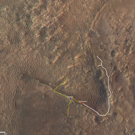
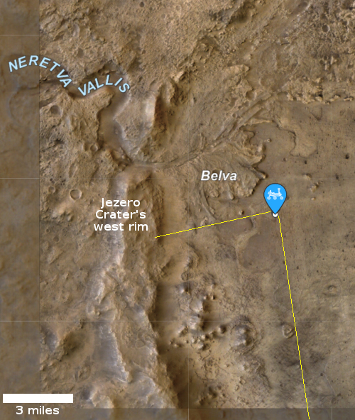
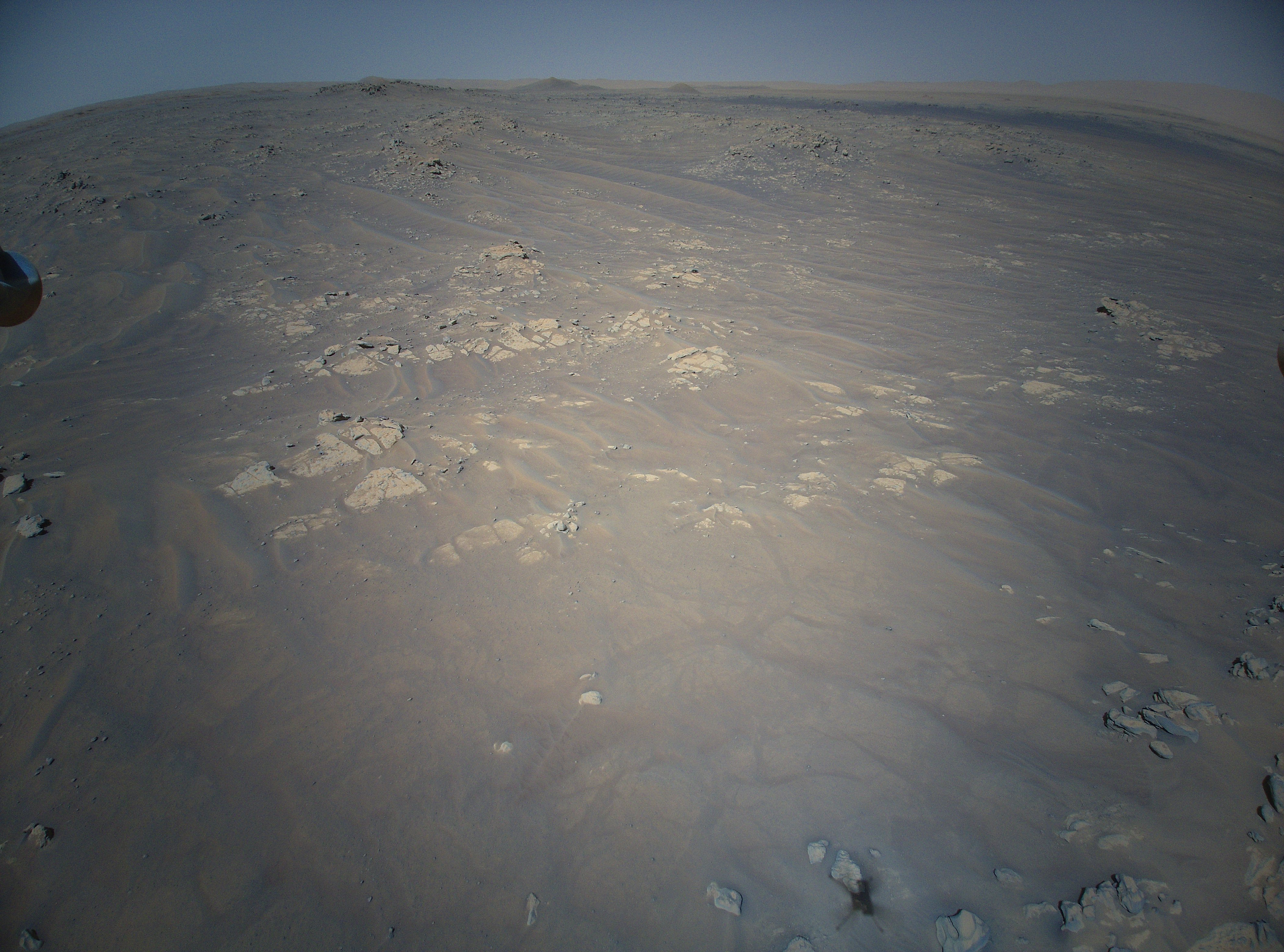
Where Ingenuity and Perseverance presently sit in Jezero Crater
Click for interactive map.
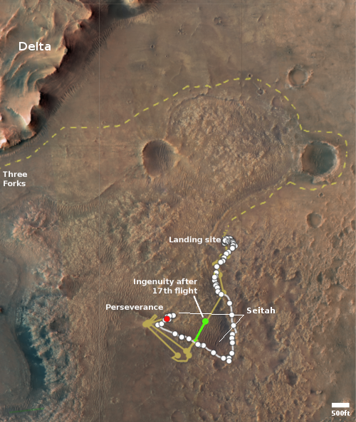
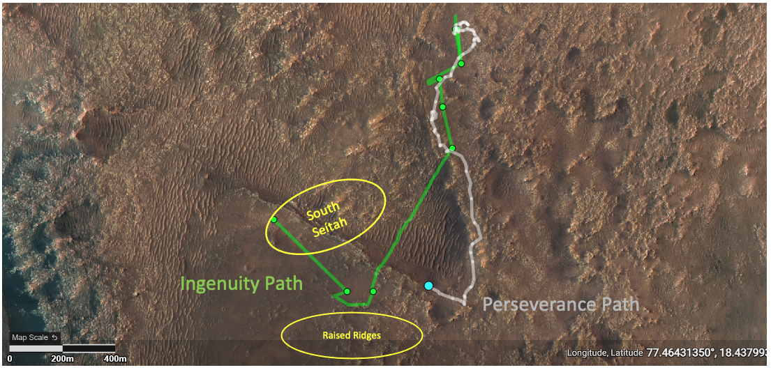
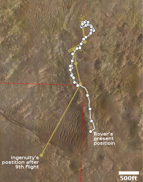
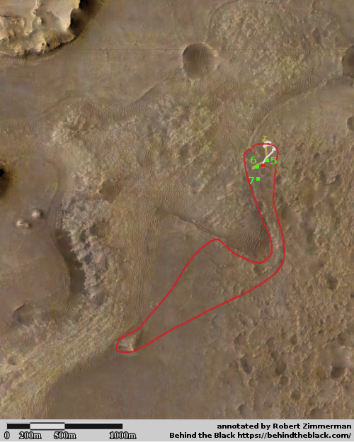
The map to the right, annotated to post here, shows the present location of the rover Perseverance (the red dot) in relation to the 17th flight of the helicopter Ingenuity (indicated by the green line and dot) that successfully occurred on December 5, 2021.
Perseverance has been very very very very slowly retreating south, following the same route it took to move into the rough sand dune region the scientists have dubbed Seitah. Based on their long term plans, the rover will retrace its path (the white dotted line) to its landing site, and then continue along the yellow dashed line to eventually reach the base of the delta, dubbed Three Forks, that in the distant past poured through a gap in the rim of Jezero Crater.
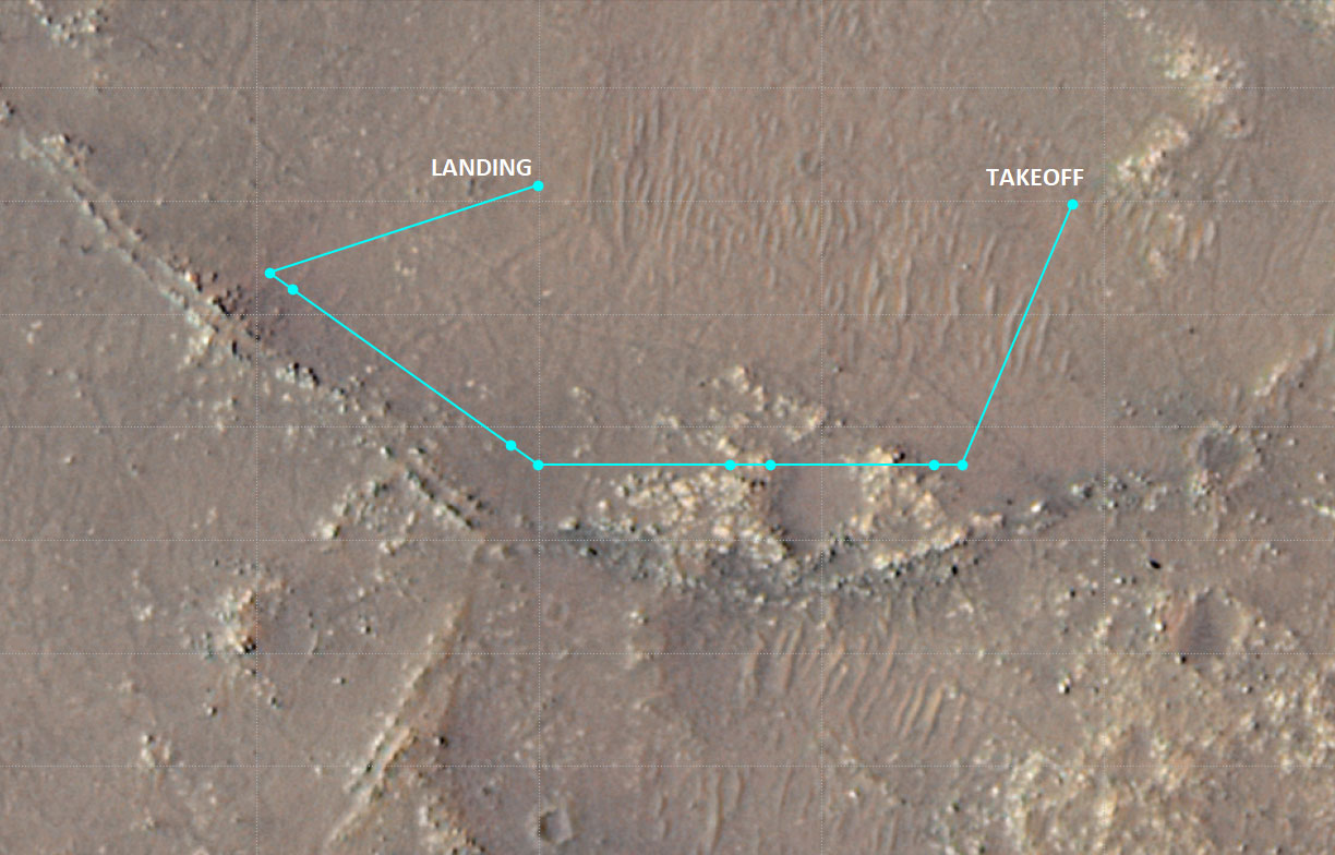
The helicopter meanwhile is also retracing its flights, heading north to the spot where Perseverance first placed it on the ground. Because of the seasonally thinner atmosphere, the helicopter’s flights during that return journey must be shorter, which is why the 17th flight only traveled halfway across Seitah. In crossing it the first time it had done so in one flight. Now it will take two.
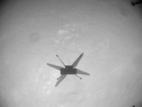
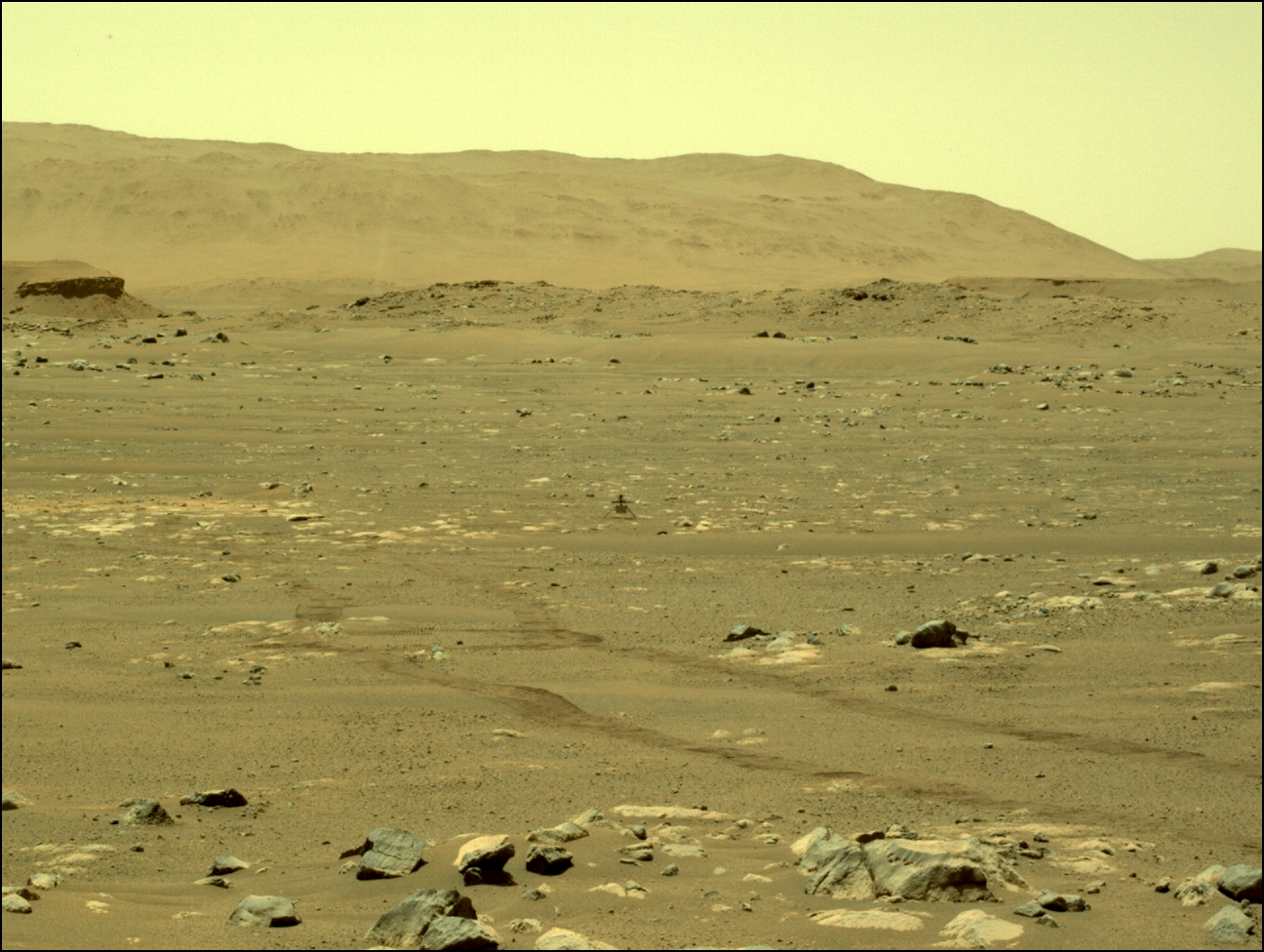
During that 17th flight it appears that the topography between the rover and the helicopter’s landing site caused a loss of communications as the helicopter was landing.
The Ingenuity team believes the 13-foot (4-meter) height difference between the Perseverance rover and the top of Bras [an outcrop] contributed to the loss of communications when the helicopter descended toward the surface at the end of its flight.
That loss of communications apparently caused no problems, but it will likely mean that Ingenuity will do no more flights until Perseverance can get closer and better positioned.
Click for interactive map.
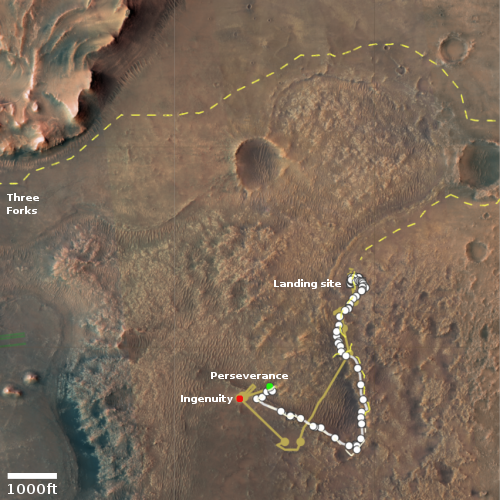
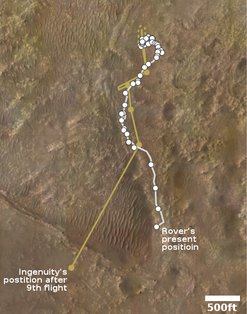
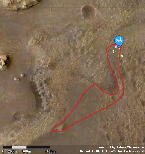
The map to the right, annotated to post here, shows the present location of the rover Perseverance (the red dot) in relation to the 17th flight of the helicopter Ingenuity (indicated by the green line and dot) that successfully occurred on December 5, 2021.
Perseverance has been very very very very slowly retreating south, following the same route it took to move into the rough sand dune region the scientists have dubbed Seitah. Based on their long term plans, the rover will retrace its path (the white dotted line) to its landing site, and then continue along the yellow dashed line to eventually reach the base of the delta, dubbed Three Forks, that in the distant past poured through a gap in the rim of Jezero Crater.
The helicopter meanwhile is also retracing its flights, heading north to the spot where Perseverance first placed it on the ground. Because of the seasonally thinner atmosphere, the helicopter’s flights during that return journey must be shorter, which is why the 17th flight only traveled halfway across Seitah. In crossing it the first time it had done so in one flight. Now it will take two.
During that 17th flight it appears that the topography between the rover and the helicopter’s landing site caused a loss of communications as the helicopter was landing.
The Ingenuity team believes the 13-foot (4-meter) height difference between the Perseverance rover and the top of Bras [an outcrop] contributed to the loss of communications when the helicopter descended toward the surface at the end of its flight.
That loss of communications apparently caused no problems, but it will likely mean that Ingenuity will do no more flights until Perseverance can get closer and better positioned.


