
Martian mountains amidst a deep sea of sand

Click for original image.
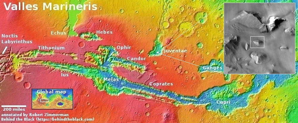
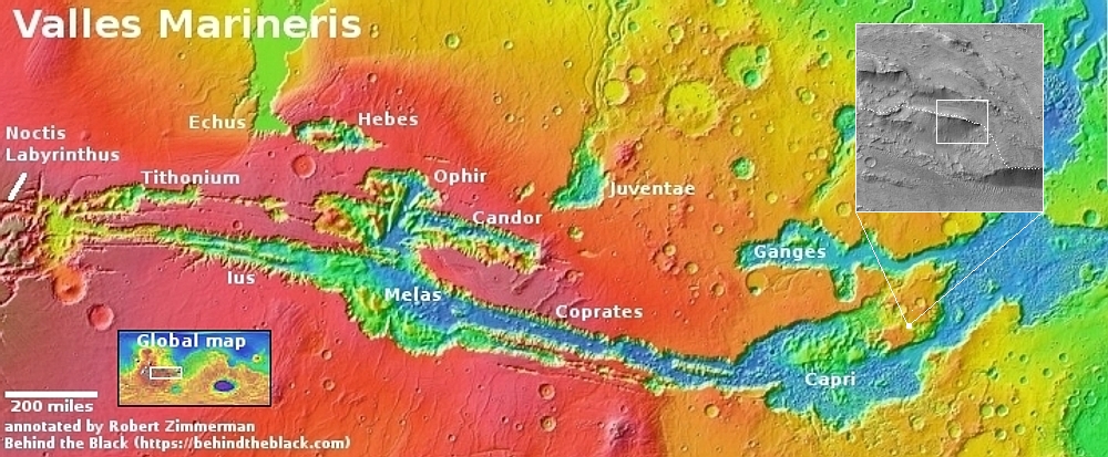
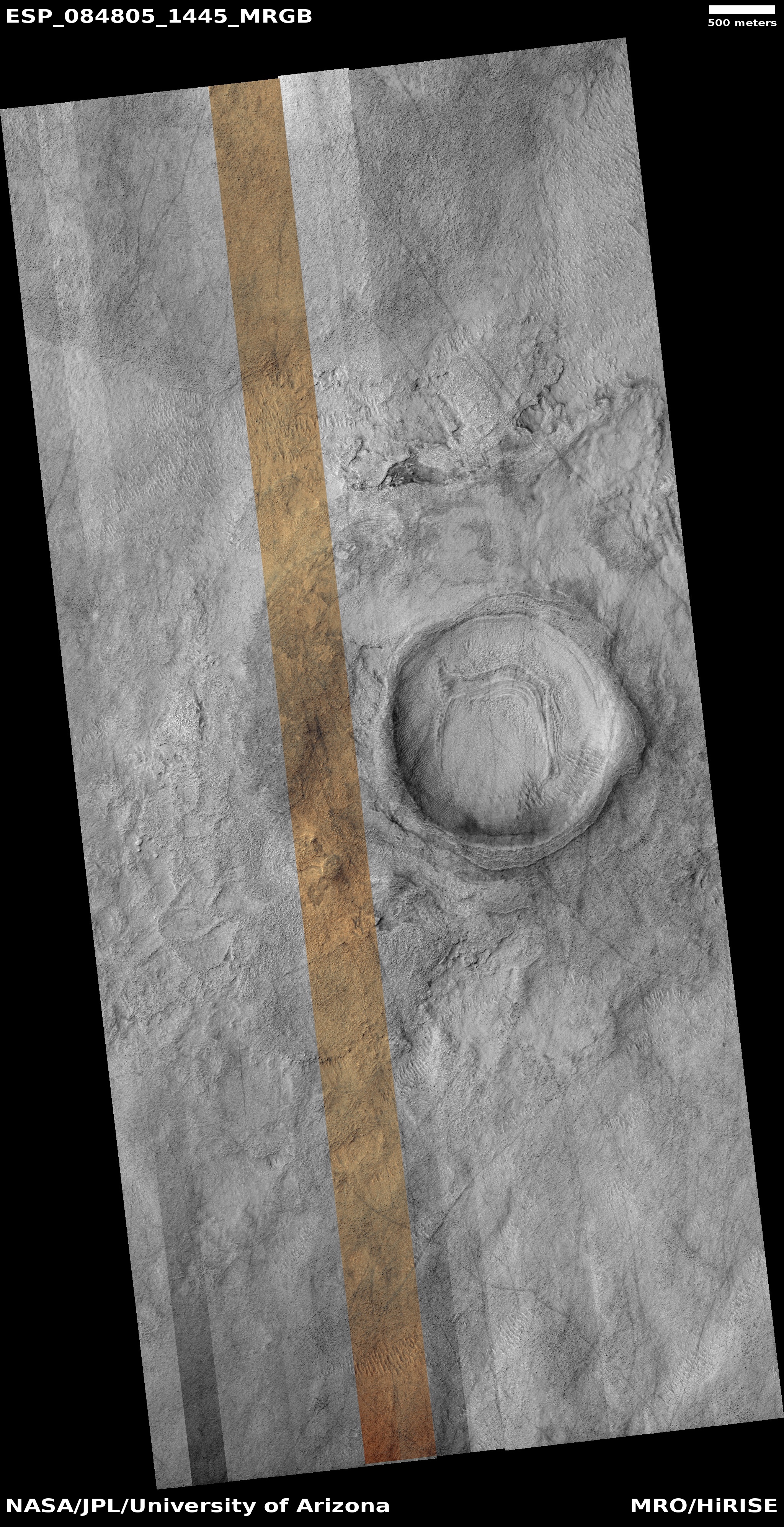
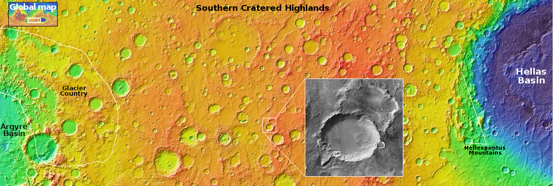
Cool image time! The picture to the right, cropped, reduced, and sharpened to post here, was taken on July 9, 2024 by the high resolution camera on Mars Reconnaissance Orbiter (MRO). The white dot on the overview map above marks the location, inside the deep enclosed and very large 130-mile-wide depression dubbed Juventae Chasma.
The mountain in the picture raises above the sand sea that surrounds it from 1,000 to 2,300 feet, depending on direction, as the downhill grade of the sand sea is to the east. Thus, on the west the mountain rises less, while on the east the height is the greatest.
The inset illustrates the extent of the sand sea. It covers the ground for many miles in all directions. The way the sand surrounds these mountains suggests the prevailing winds blow from the west to the east. In fact, the facts suggest that this sand is volcanic ash that was blown into Juventae from many eruptions that occurred over time to the west, where it got trapped. The wind and gravity deposited the sand into the 20,000 to 25,000-foot-deep chasm, where the wind was insufficient to lift it out again.
One wonders how deep that sand sea might be. The lack of any surface features at all suggests it could be quite deep, burying everything but the highest peaks. In fact, if a geologist could drill a core through that sand I suspect he or she might be able to document the entire eruption history of much of Mars.


