
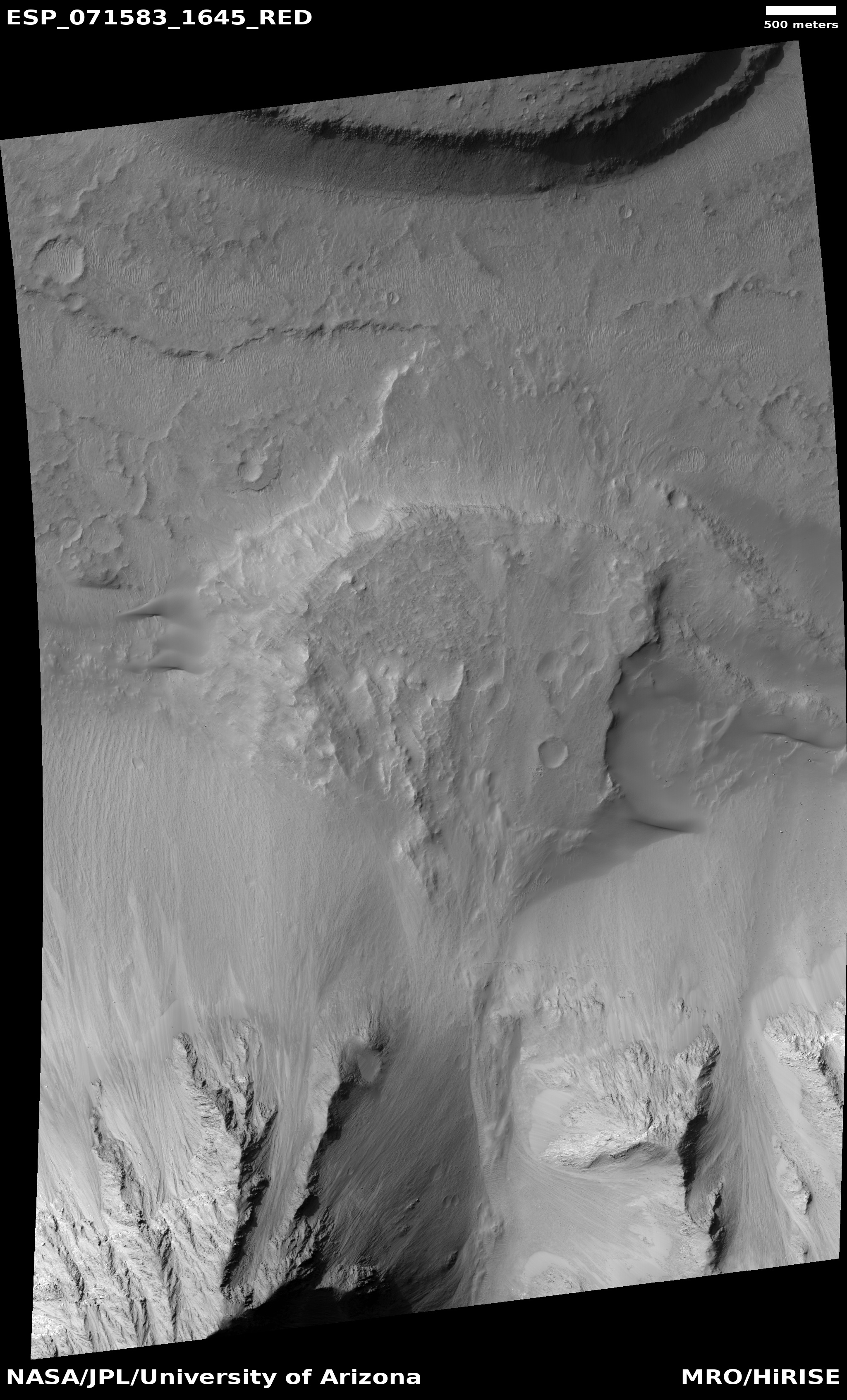
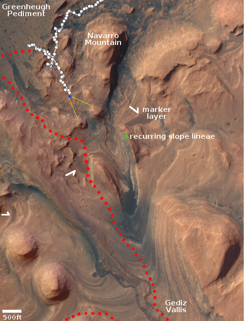
A thick and syrupy flow on Mars
Click for full image.
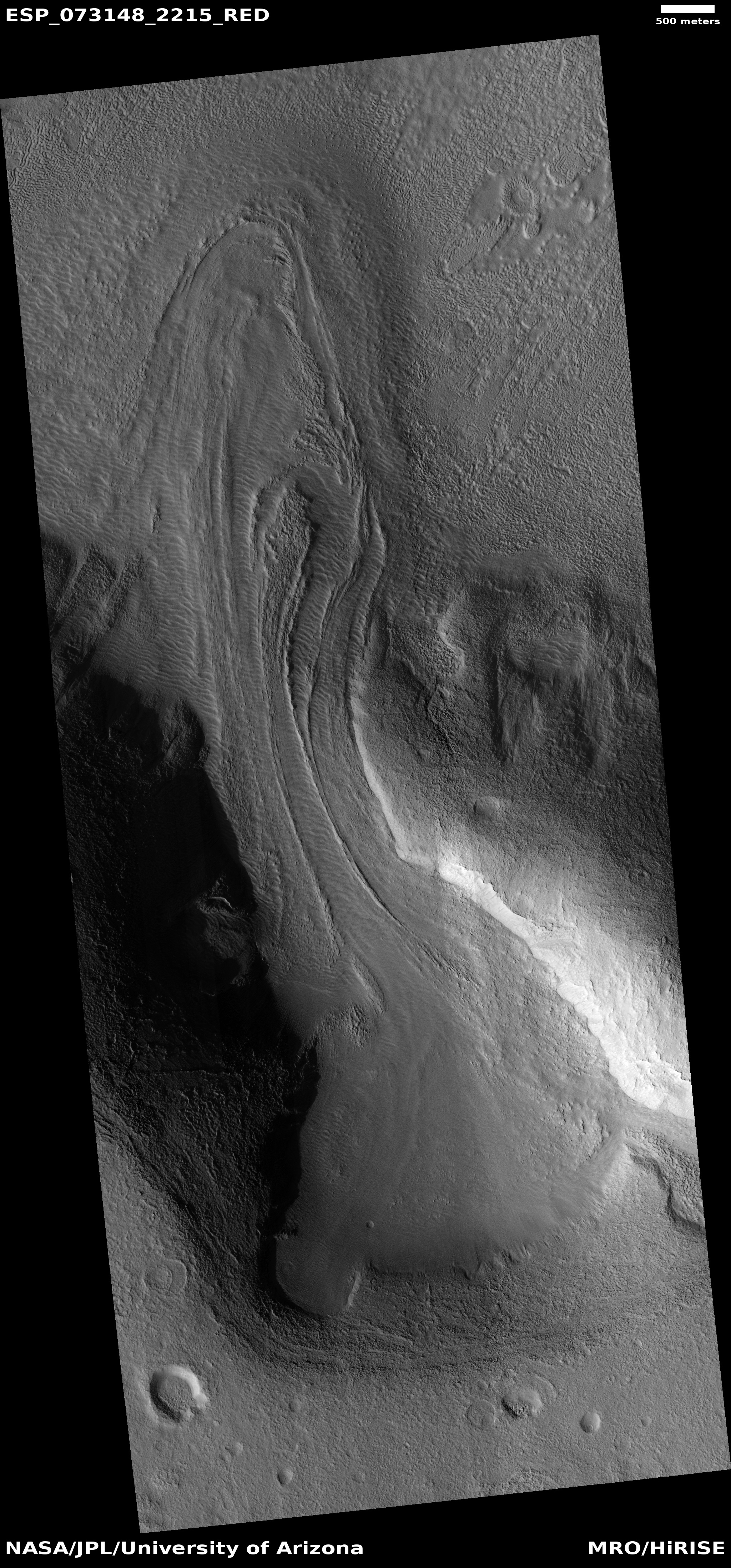
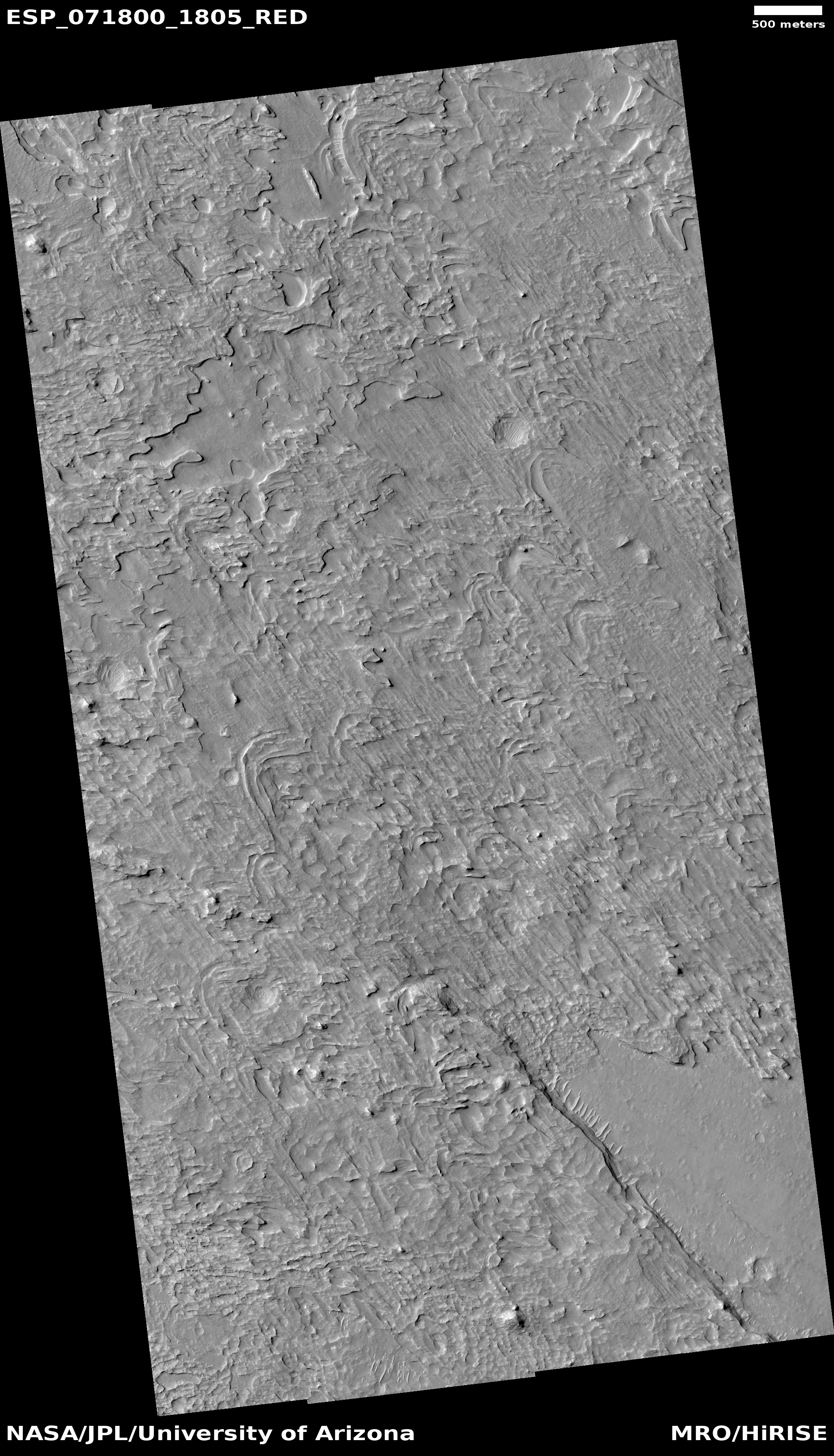
Cool image time! The photo above, rotated, cropped, and reduced to post here, was taken on March 5, 2022 by the high resolution camera on Mars Reconnaissance Orbiter (MRO). It shows what the scientists label as a “viscous flow feature,” which is another way of saying the flow was thick and syrupy.
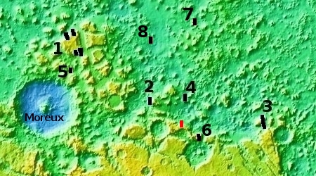
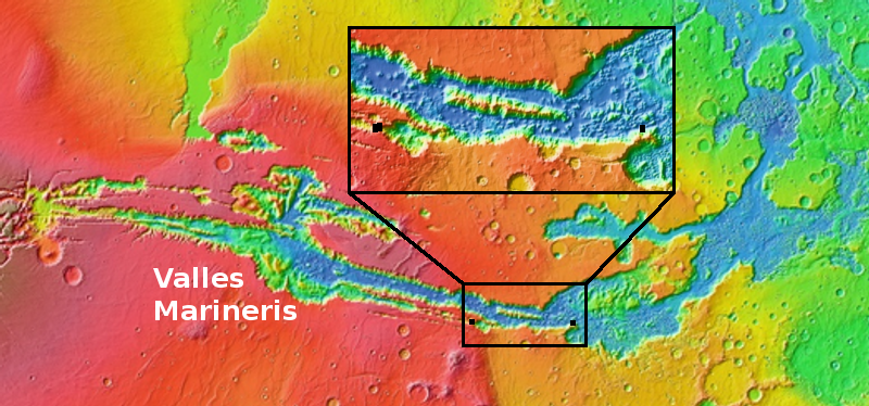
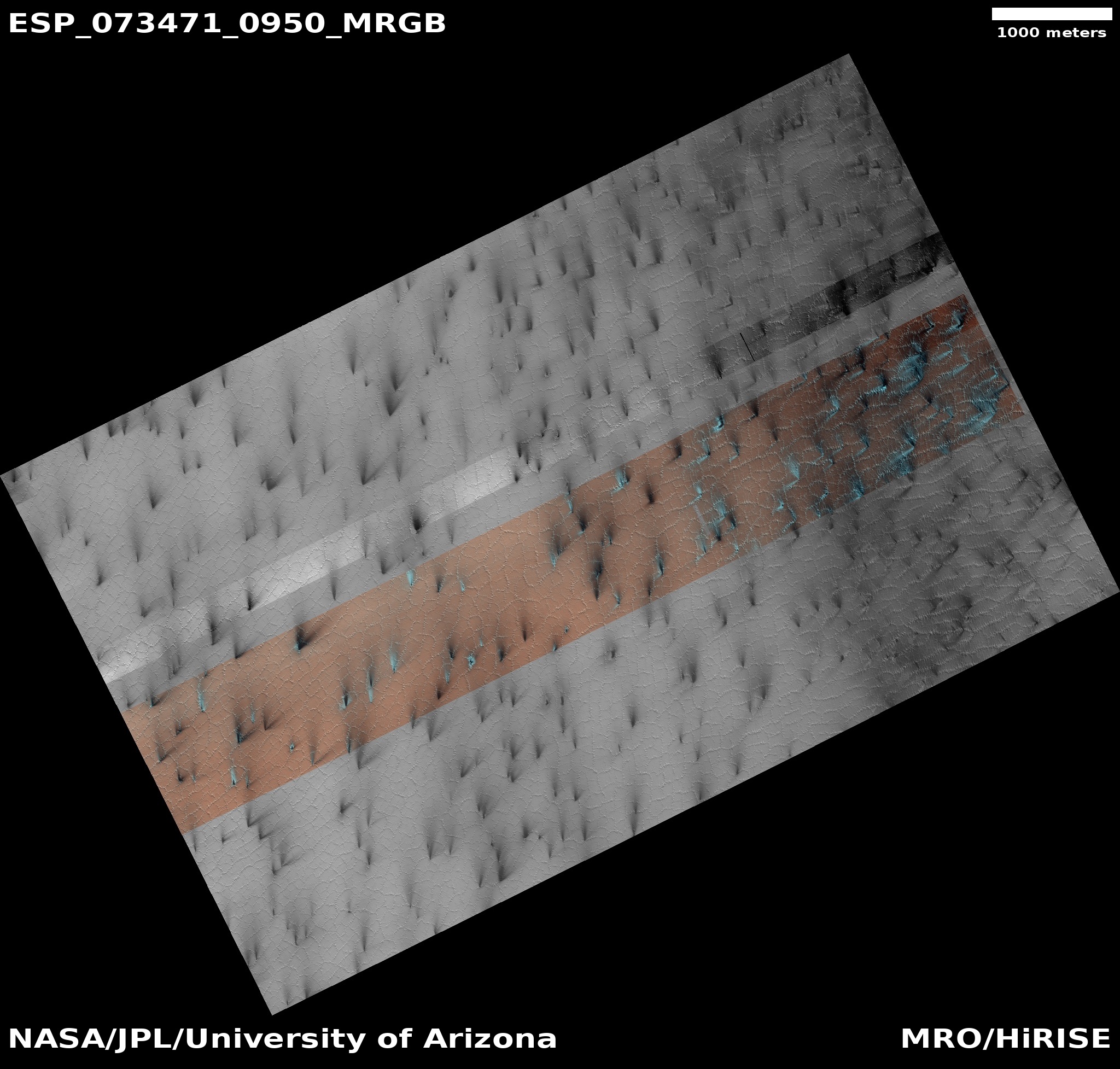
Nor is such a flow unusual in this area of Mars. It is located in a region of chaos terrain dubbed Protonilus Mensae, which is also the central mensae region in the 2,000-mile-long strip in the northern mid-latitudes of Mars I label glacier country. The overview map above of Protonilus Mensae — covering about 500 miles in width — shows how common such flows are in this place. The black rectangles mark the locations of other cool images I have featured, as follows:
- 1. Buried glaciers flowing off of Martian mesa
- 2. Brain Terrain on Mars
- 3. How to spot a glacier on Mars
- 4. Glacier country on Mars
- 5. Revisiting Mars’ glacier country
- 6. Back to Mars’ glacier country
- 7. A cracking Martian glacier?
- 8. Ice-filled craters in Mars’ glacier country?
The red rectangle indicates the location of today’s cool image.
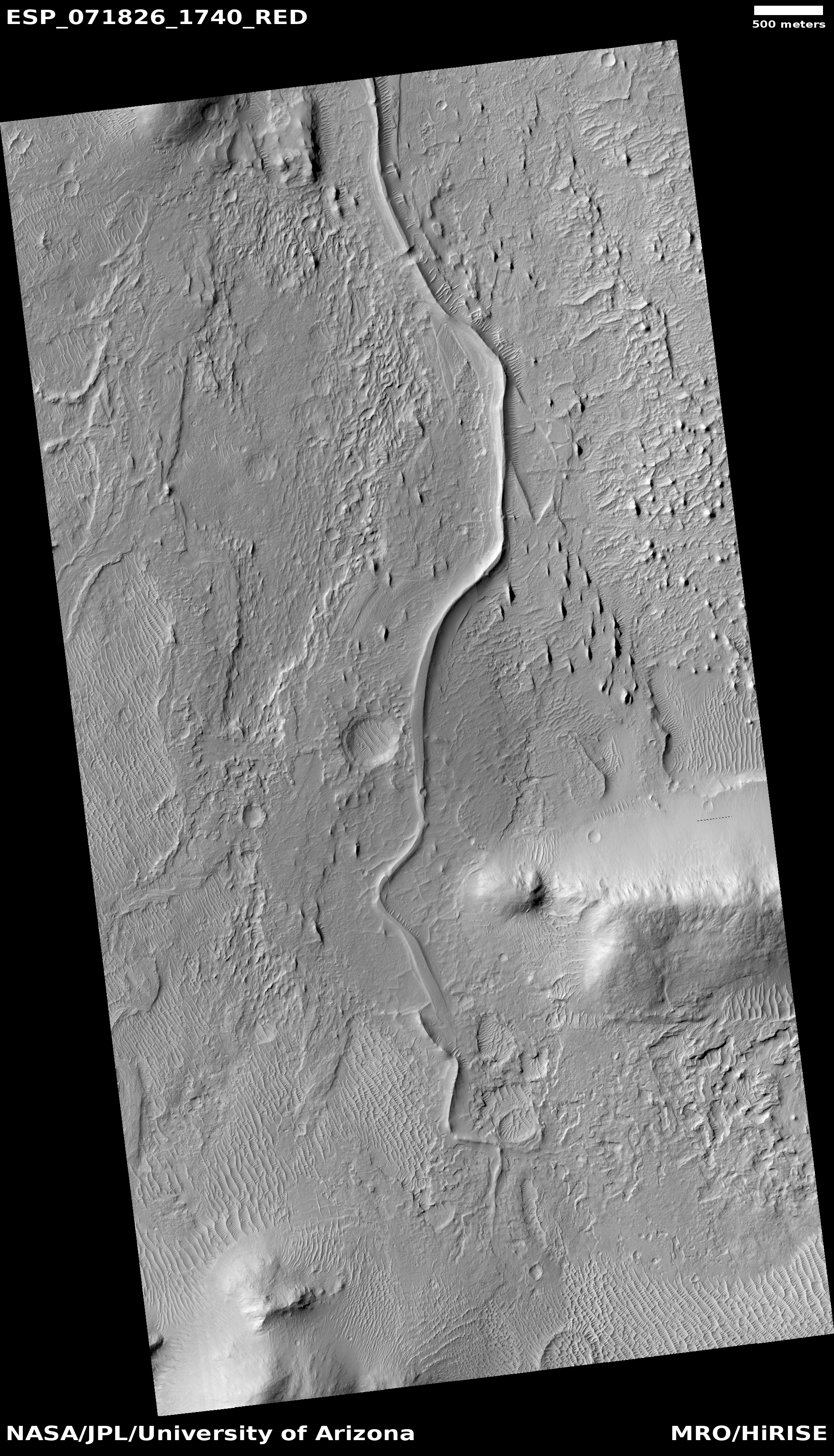
The glacial aspect of everything in this region is even more emphasized by the wider view provided by MRO’s context camera below.
» Read more


