What will the Republicans controlling Tennessee’s statehouse do now that Nashville’s City Council has reinstated their expelled representative?
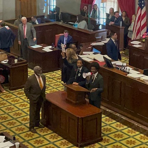
L to R, Gloria Johnson, Justin Jones and Justin Pearson stand at
the podium, using a bullhorn to lead protester chants.
Bring a gun to a knife fight? When the Tennessee House first moved to expel two members, Justin Jones and Justin Pearson, because of their participation in a riot that shut down the legislature on March 30, 2023, I noted the following:
Note that this gigantic Republican majority [75 to 24] reflects the wishes of the voters of Tennessee. If that majority fails to expel these three misbehaving Democrats, just because it is intimidated by the loud and almost violent actions of small minority, it will then prove not only how worthless it is, but that the voters themselves might not have the courage to stand up to these leftist thugs. As I say, the elected officials reflect the wishes of the voters. Weakness now in the statehouse will indicate weakness at all levels.
Subsequently the House did expel two of the three offending representatives (the third surviving by a single vote). In response, the Nashville city council moving to quickly reinstate its expelled representative, Justin Jones. It is expected that tomorrow the local county commission that Justin Pearson represented will reinstate him as well.
We have now reached the bottom line: What will the Republicans who control the statehouse in Tennessee by very wide margins do?
The immediate answer appears to be to capitulate.
» Read more