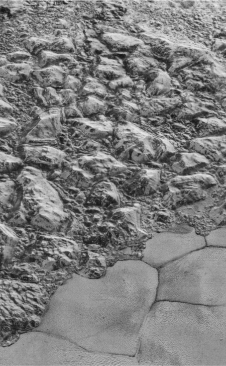
The shoreline of Pluto’s frozen nitrogen sea
Click for full resolution. For original
images go here and here.
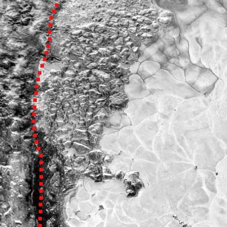
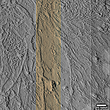
Cool image time! In my continuing exploration of the New Horizons’ image archive, I keep finding things that I do not remember ever seeing before. The two New Horizon pictures used to create the panorama to the right (here and here) were taken by the spacecraft only thirteen minutes before its closest approach to Pluto at 7,800 miles on July 14, 2015. It shows the Al-Idrisi mountains — thought to be made up of frozen ice as hard as granite — and the frozen nitrogen sea that pushes against those mountains and squeezes them into their jumbled shape. For scale, the image is estimated to be fifty miles wide.
In December 2015 the science team released a small section of one of two images, focused specifically at that nitrogen sea shoreline, noting:
Great blocks of Pluto’s water-ice crust appear jammed together in the informally named al-Idrisi mountains. Some mountain sides appear coated in dark material, while other sides are bright.
The team however did not release this wider panorama produced by both images, which I think gives a better perspective of what we are looking at.
I posted an even wider shot of this shoreline on January 29, 2026. If you look closely at that picture, you can spot the features to the right, but much smaller seen from a greater distance.
For the larger context, below is a wide shot of Pluto indicating the part of the planet where this image is located.
» Read more


