
There likely is little or no ice in the Moon’s permanently shadowed craters

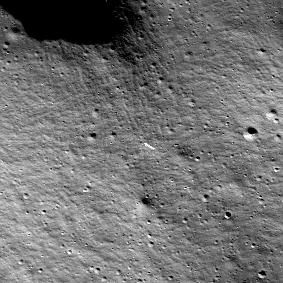
The floor of Shackleton Crater showing no obvious ice deposits,
as seen by Shadowcam. The black cross marks the south pole.
Click for original image.
This week the 55th annual Lunar and Planetary Science Conference is being held in Texas. The conference was originally established in connection with the Apollo missions to allow scientists to release their Moon research results. It quickly morphed into an annual event covering research from the entire planetary research community.
I have reviewed the abstracts for this year’s meeting, and culled what I think are the most significant new results from the conference, which I will report on in the next few posts.
We begin however with possibly the most important result from the conference, given by the science team for the ShadowCam instrument on South Korea’s Danuri lunar orbiter. That low-light camera was designed to take high resolution pictures of the permanently-shadowed craters of the Moon, to see if there was any visible or obvious ice hidden there. Though the science team presented a number of papers, the summary paper [pdf] by the instrument’s principal investigator, Mark Robinson of Arizona State University, gave the bottom line:
The data so far is finding very little evidence of water ice in these dark regions.
» Read more


