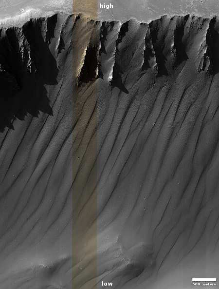
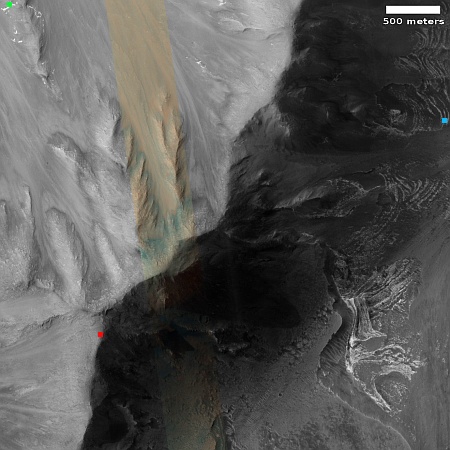
The eroding north wall of glacial-filled Harmakhis Valles

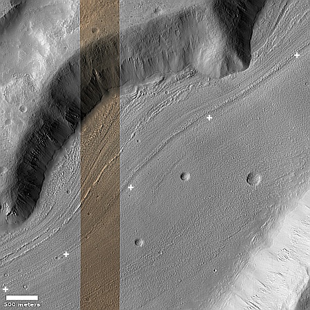
The north wall of Harmakhis Valles
Click for original image.

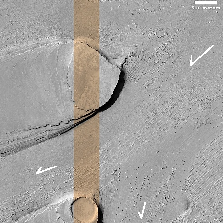
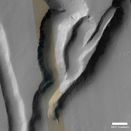
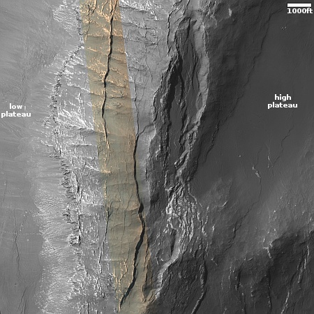
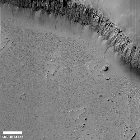
Cool image time! The picture to the right, cropped and reduced to post here, was taken on February 8, 2023 by the high resolution camera on Mars Reconnaissance Orbiter (MRO).

We are looking at the 2,400-foot-high cliff, its lower walls clearly cracking horizontally as they sag downward, with other large sections higher up appearing to have been eroded away in larger pieces.

Yet, the ground below this cliff wall appears to have no debris piles, the kind you would expect below a landslide. Instead, that ground appears to be very glacial in nature, with many linear parallel lines suggesting layers.

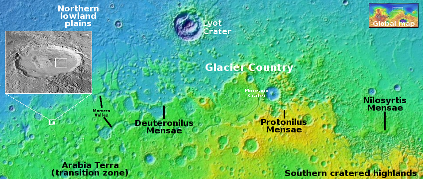
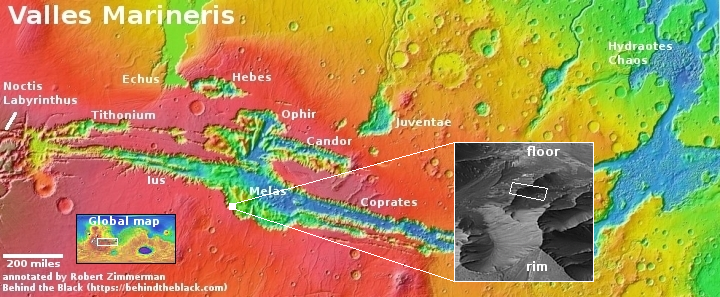
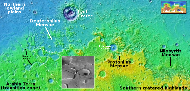
The overview map below provides us the context, and an explanation as to where that debris has gone.
» Read more
Relativity and Impulse are now targeting ’26 launch window for 1st private mission to Mars

According to officials from the two companies, Relativity and Impulse have now delayed the launch date of their joint private unmanned lander to Mars from the ’24 launch window to the ’26 launch window.

The companies have also shared few technical details about the lander, but noted they plan to leverage designs and technologies developed for NASA’s InSight Mars lander, such as its heat shield. “We’re not trying to reinvent the wheel,” Brost said. “Doing a clean-sheet design of a lander is an insane, monumental engineering feat.”

Relativity is tasked with launching the probe, using its Terran-R rocket, which is under development and has its first launch scheduled in 2026. Impulse, which is building the lander, is at this point simply trying to develop its first small rocket engine. It appears therefore that this proposed Mars lander is designed mostly to make NASA willing to consider it when it starts hiring private companies to land probes on Mars. Its chances of launching in ’26 is quite small.

Knobs on the floor of a Martian caldera

Knobs on the floor of a Martian caldera
Click for original image.

Cool image time! The picture to the right, rotated, cropped, reduced, and sharpened to post here, was taken on February 14, 2023 by the high resolution camera on Mars Reconnaissance Orbiter (MRO) and shows what the scientists have dubbed as “enigmatic knobs” located on the caldera floor of a Martian shield volcano.

The knobs themselves, while puzzling, aren’t that interesting on their own. They are no more than 100 to 200 feet high, and are relatively featureless. Since most lack a pit at their peaks, they are probably not some form of small volcanic vent, though this conclusion is uncertain. The location, at about 30 degrees south latitude, suggests the faint possibility of near surface ice, which could make these mud volcanoes, or a very specific Arctic-type permafrost mound dubbed pingos, but once again the lack of any central pit at their peaks makes these origins also doubtful.

What the knobs however revealed to me was a giant Martian shield volcano I had never noticed before, even though it was hiding in plain sight.
» Read more
Frozen waves of Martian lava?

Frozen waves of Martian lava?
Click for original image.

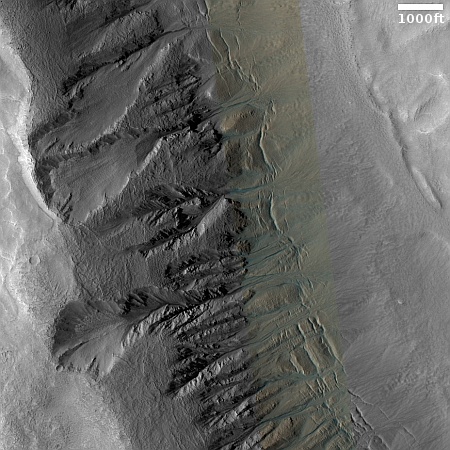
Cool image time! The picture to the right, rotated, cropped, reduced, and sharpened to post here, was taken on March 17, 2023 by the high resolution camera on Mars Reconnaissance Orbiter (MRO). The science team labeled this a terrain sample image, which implies it was taken not as part of any specific request, but to fill a gap in the camera’s schedule in order to maintain its proper temperature.

What are we looking at? This stippled terrain with curved ridges actually extends quite a distance beyond this image. A MRO context camera picture taken on July 22, 2020 shows its full extent, about 10 miles wide but extending to the north and south about 30 miles total, butting up against a north-south mountain chain to its east that is about seventy miles long with its highest peak about 8,000 feet above this plain.
» Read more
Ancient volcano vent in the Martian southern cratered highlands?

Ancient volcano vent on Mars?
Click for original image.

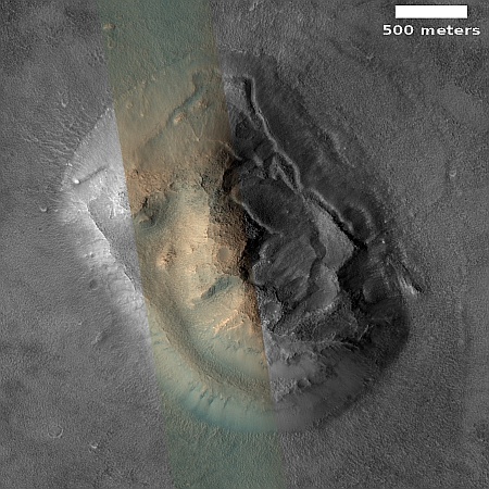
The nature of today’s cool image suggests both ancient and more recent geological activity, each coming from entirely different sources but both helping to shape the alien Martian surface.

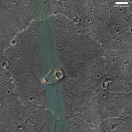
The picture to the right, rotated, cropped, reduced, and sharpened to post here, was taken on March 13, 2023 by the high resolution camera on Mars Reconnaissance Orbiter (MRO). It shows what the science team has labeled an “elongated depression,” sitting in the middle of a relatively flat but very rough stippled circular plain about 60 miles in diameter. An MRO context camera picture, taken on February 19, 2012, covered the central strip of this plain, and shows that its surface is equally rough and stippled everywhere, with only a few craters and one or two slight changes in elevation.

So, how does this feature tell us both about the ancient and recent geological history of this spot on Mars?
» Read more
Buried dying glacier in the Martian dry equatorial regions?

Buried glacial ice in dry equatorial regions?
Click for original image.

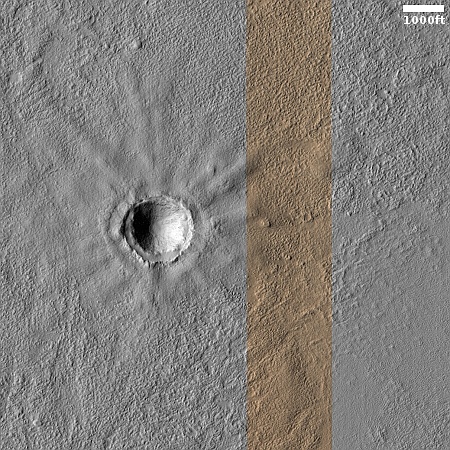
Today’s cool image from Mars is not so much unique visually as it is unique in terms of its location. The picture to the right, rotated, cropped, reduced, and sharpened to post here, was taken on January 31, 2023 by the high resolution camera on Mars Reconnaissance Orbiter (MRO). It shows the northern rim of a small crater, with its floor filled with an intriguing mound of material.

The picture was labeled a “terrain sample”, which suggests it wasn’t taken as part of any specific research project by instead to fill a gap in the camera’s schedule. To maintain the camera’s proper temperature, it is necessary to take pictures regularly, and when the camera team finds a gap that is too long, they fill it by choosing some almost random target in that gap that might be interesting. Sometimes it is, sometimes not.

In this case I strongly suspect this target was hardly random. The picture title also mentions MRO’s now retired radar CRISM instrument, which was used to detect evidence of underground ice. My guess is that the camera team thus likely decided to image this crater in high resolution because that radar data suggested the presence of underground ice.

This guess is strongly confirmed by a context camera picture taken of this crater on September 1, 2008. The crater appears surrounded by the typical splash apron one routinely sees around impact craters in the mid- and high-latitude northern lowland plains, where there is a lot of near surface ice.

The bumpy mound seen in high resolution on the floor of this crater could very well be buried glacial ice, as it mimics similar features in the many craters in the mid-latitudes of Mars. But is it buried ice? The location says otherwise.
» Read more
Chaos in the southern cratered highlands of Mars

Chaos in the southern cratered highlands of Mars
Click for full image.vi

Today’s cool image takes us to a part of the cratered southern highlands of Mars that I have not featured much previously. The picture to the right, rotated, cropped, and reduced to post here, was taken on March 7, 2023 by the high resolution camera on Mars Reconnaissance Orbiter (MRO). It shows what appears to be a collection of rough hills and mesas surrounded by a sea of smooth ground that at the base of the cliffs seems to end abruptly.

The smooth ground is probably mantled by a layer of dust and debris. Since this location is at 36 degrees south latitude, there is also probably near surface ice under that layer. The abrupt edges likely indicate where the increasing slope next to the mesas and mounds caused that ice to be exposed and thus sublimate away.

As for the location, we must go to the overview map.
» Read more
Alien textured Martian lava

Alien textured Martian lava
Click for original image.

Cool image time! The picture to the right, cropped to post here, was taken on February 17, 2023 by the high resolution camera on Mars Reconnaissance Orbiter (MRO), and shows what the science team labels “regularly textured ground on Pavonis Mons.”

The arrow in the picture indicates the downhill trend. If you look at the full image, you will see that this texture pattern extends in all directions for a considerable distance, both uphill and down, and even covers the entire floor of a depression that appears to contour along the grade instead of going downhill.

The latitude here is very close to the equator. So, even though the elevation is high, being on the slopes of a giant volcano, there is probably no near surface ice here.
» Read more
Brain terrain in and around pedestal crater on Mars

Brain terrain in and around a pedestal crater on Mars
Click for original image.

Cool image time! The picture to the right, cropped, reduced, and sharpened to post here, was taken on March 10, 2023 by the high resolution camera on Mars Reconnaissance Orbiter (MRO).

As I noted in a cool image only two weeks ago, brain terrain is a geological feature wholly unique to Mars that planetary geologists still do not understand or can explain. They know its knobby interweaving nodules (resembling the convolutions of the human brain) are related to near surface ice and its sublimation into gas, but no one has much confidence in any of the theories that posit the process that forms it.

In this case the brain terrain not only fills the crater, it appears to surround it as well, but only appearing at spots where a smooth top layer has begun to break apart. Moreover, the crater appears to be a pedestal crater, whereby much of the less dense surrounding terrain has vanished, leaving the compacted crater sitting higher.
» Read more

Glacial sinkhole in the Martian southern cratered highlands?

Overview map

Glacial sinkhole in the Martian southern cratered highlands?
Click for original image.

Cool image time! The picture to the right, cropped to post here, was taken on February 21, 2023 by the high resolution camera on Mars Reconnaissance Orbiter (MRO). This is a terrain sample image, which means it was snapped not as part of any specific research project but to fill a gap in the schedule in order to maintain the camera’s proper temperature. As usual, the camera team tried to pick something of interest, and I think they succeeded.

The two large depressions in the center of the picture do not resemble impact craters. They have no rim of ejected material and their shape is very distorted. Instead, both appear to be places where a top layer of ice/debris has sublimated away into gas, exposing a lower layer of glacial material that itself is sublimating away to form the bumpy mounds that fill the floor of the depressions.

The white dot inside the inset box on the overview map above marks this location, just south of the northern wall of a large 30-mile-wide canyon, with its northern floor even more depressed, as if the material in that raised middle a flat pile of glacial debris flowing to the southwest after leaving the gap in the crater to the northeast. An MRO context camera picture taken on January 6, 2016 gives a wider view, showing that there are a lot of these type depressions on the surface of this wide middle upraised floor, as well as some obvious impact craters.

This location is in the mid-latitude band where many glacial features are found. In this part of the southern cratered highlands there is also a lot of evidence of top layers sublimating away, as if the glacial material is a large buried ice sheet that is beginning to disappear at places where it has been exposed by impacts or shifting motion. The depression in the picture above appears to be an example.

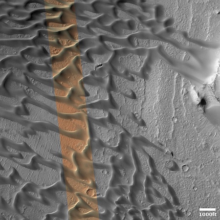
Endless dunes amidst Mars’ giant volcanoes

Endless dunes amidst Mars' giant volcanoes
Click for originial image.

Past cool images on Behind the Black showing endless dune fields on Mars have generally focused on two places, the giant Medusae Fossae Formation volcanic ash deposits in the dry equatorial regions of Mars and the Olympia Undae dune sea that surrounds the Martian north pole.

Today’s image to the right, rotated, cropped, reduced, and sharpened to post here, takes us to a completely different dune sea. Taken on February 14, 2023 by the high resolution camera on Mars Reconnaissance Orbiter (MRO), the picture also shows an endless dune sea, though there is faint evidence on those dune fields of buried features, such as the meandering east-west feature in the picture’s center.

This dune sea is also in the dry equatorial regions, like Medusae, but it is much farther east, and sits surrounded by Mars’ biggest volcanoes.
» Read more

Perseverance data suggests a strong river rushed down the delta in Jezero Crater

Skrinkle Haven on Mars
Click for original image.

Based on the images and geology so far gathered by the Mars rover Perseverance as it has climbed up onto the delta that flowed into Jezero Crater sometime in the far past, scientists now think a roaring river once flowed down that delta.

Years ago, scientists noticed a series of curving bands of layered rock within Jezero Crater that they dubbed “the curvilinear unit.” They could see these layers from space but are finally able to see them up close, thanks to Perseverance.

One location within the curvilinear unit, nicknamed “Skrinkle Haven,” is captured in one of the new Mastcam-Z mosaics [a section of which is posted to the right]. Scientists are sure the curved layers here were formed by powerfully flowing water, but Mastcam-Z’s detailed shots have left them debating what kind: a river such as the Mississippi, which winds snakelike across the landscape, or a braided river like Nebraska’s Platte, which forms small islands of sediment called sandbars.

When viewed from the ground, the curved layers appear arranged in rows that ripple out across the landscape. They could be the remnants of a river’s banks that shifted over time – or the remnants of sandbars that formed in the river. The layers were likely much taller in the past. Scientists suspect that after these piles of sediment turned to rock, they were sandblasted by wind over the eons and carved down to their present size.

The press release say nothing about glacial activity here, but I am willing to bet the scientists have considered this. As it requires a greater leap into the unknown, involving geological processes not yet understood on an alien planet, it is makes sense that they have put it aside at this point. I also am willing to bet that it will pop up again, with time and additional data.

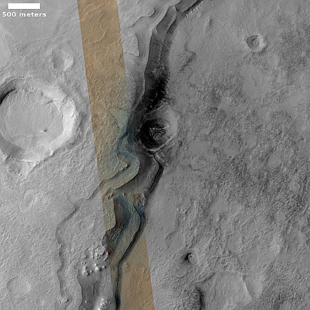
Is this ice or lava in the death valley of Mars?

Ice or lava on Mars?
Click for original image.

Cool image time! The picture to the right, rotated, cropped, reduced, and sharpened to post here, was taken on February 28, 2023 by the high resolution camera on Mars Reconnaissance Orbiter (MRO).

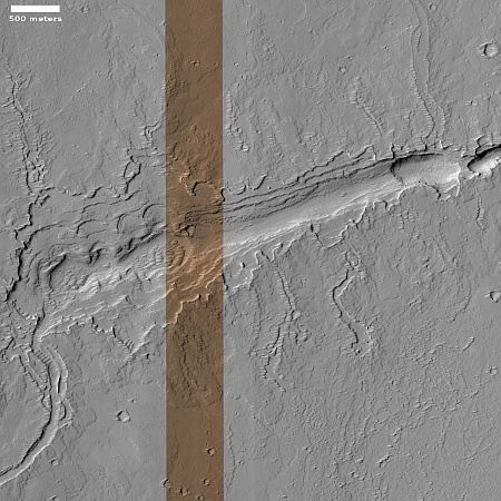
To put it mildly this is strange terrain. The curving east-west feature resembles a glacial flow, but it also has features that say otherwise. For example, what could cause that gap in the middle of the picture? Such things are not usually seen in an ice flow. Then there is that filled crater on the center left edge of the picture, inside the flow. Though filled with material, the flow itself does not flow around the crater, suggesting the impact occurred after the flow. Moreover the crater is a pedestal crater, whereby the surrounding terrain has eroded away so that the crater ends up standing above it.

These facts suggest that this flow is very old, and has not flowed for a very very very long time. This in turn suggests it isn’t ice but solidified lava, though for a lava flow it also has features that are anomalous when compared to typical flood lava on Mars.
» Read more

A rash on Mars

A Martian rash
Click for original image.

Cool image time! The picture to the right, rotated, cropped, reduced, and sharpened to post here, was taken on January 30, 2023 by the high resolution camera on Mars Reconnaissance Orbiter (MRO). The science team labeled this a “Circular Outcrop of Bright Rock.

What I see is a Martian skin rash. Based on the ripple pattern below the ridge one might think we are looking at sand dunes, except that the rash above the cliff has no such pattern. Instead, the ground in this one particular area looks very roughened in a random sort of way.

The location at 27 degrees south latitude suggests there is little near surface ice at this location to cause this feature. The overview map below provides another but not very helpful possibility.
» Read more

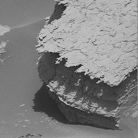
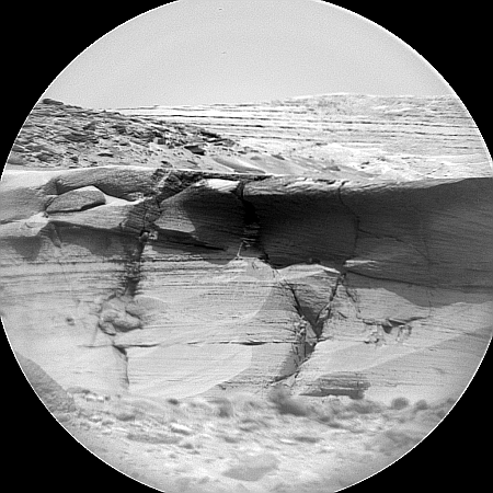
Paperwork on Mars

Paperwork on Mars
Click for original image.

Cool image time! The picture to the right, cropped, reduced, and sharpened to post here, was taken on April 15, 2023 by the close-up camera on the Mars rover Curiosity. From the caption:

NASA’s Curiosity Mars rover took this close-up view of a rock nicknamed “Terra Firme” that looks like the open pages of a book, on April 15, 2023, the 3,800th Martian day, or sol, of the mission, using the Mars Hand Lens Imager (MAHLI) on the end of its robotic arm. The rock is about an inch across (2.5 centimeters).

Strange looking rocks like this have not been rare during Curiosity’s travels in Gale Crater, though it seems to me that the variety and strangeness has increased as the rover has climbed higher on Mount Sharp. In this case, the tall flake in the center — as well as the shorter flakes to the left — were among the many thin layers seen in this area. These layers however were clearly made of much harder material than the layers above and below. Those weaker layers eroded away over the eons, leaving behind these thin sheets.

Also, if you own red-blue 3D glasses, take a look at the anaglyph here.

Sinuous ridge inside Martian canyon

Sinuous ridge inside a Martian canyon
Click for original image.

Cool image time! The picture to the right, cropped, reduced, and sharpened to post here, was taken on February 7, 2023 by the high resolution camera on Mars Reconnaissance Orbiter (MRO). It shows what the camera team labels a “sinuous ridge within valley.”

The location is at 30 degrees south latitude, right on the edge of the southern of the two 30-60 degree mid-latitude bands where orbital images show many glacial features. Closer to the equator and there is little or no evidence of near surface ice on Mars. Farther from the equator from this latitude and the evidence of near surface ice increases, becoming very dominant the closer to the poles you get.

At this spot, it appears there is little near surface ice. The channel has ripple sand dunes inside it, and the sinuous ridge appears to be bedrock. Similarly, the plateau above the channel also appears like bedrock, the craters showing no evidence of splatter that is common where there is near surface ice.

What made the channel? And what made that a sinuous ridge inside it?
» Read more

Brain terrain on top of Martian mountains

Brain terrain at high elevation on Mars
Click for original image.

Cool image time! The picture to the right, cropped and reduced to post here, was taken on March 26, 2023 by the high resolution camera on Mars Reconnaissance Orbiter (MRO). It is labeled by the scientists “Brain Terrain on Floor of Crater in Warrego Valles.”

Brain terrain is a geological feature entirely unique to Mars that remains unexplained in any way by geologists. The scientists know it is almost certainly related to near-surface ice and its sublimation into gas, but their theories as to its precise formation process remain incomplete and unconvincing, even to them.

In this case the brain terrain’s interweaving nodules seem to show flow patterns, but strangely those patterns go around depressions and hollows. Yet, the overall flow direction also seems to point downhill towards the slope on the image’s right edge.
» Read more

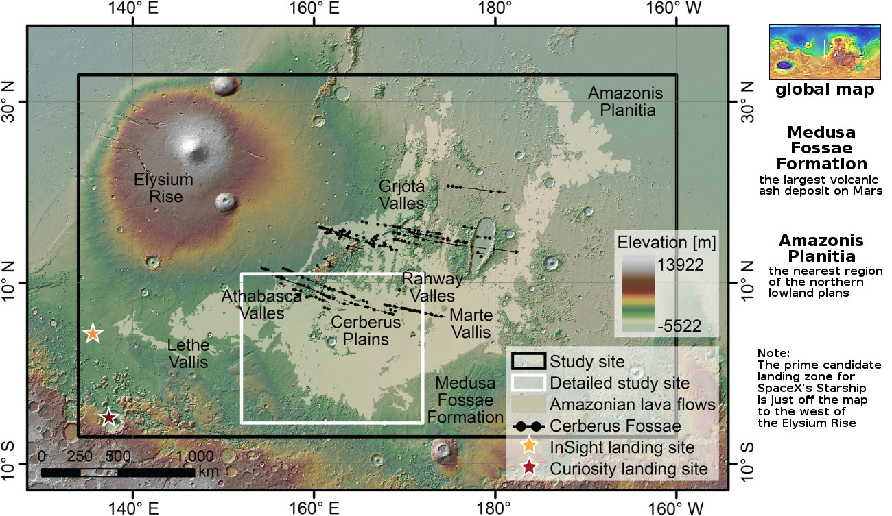
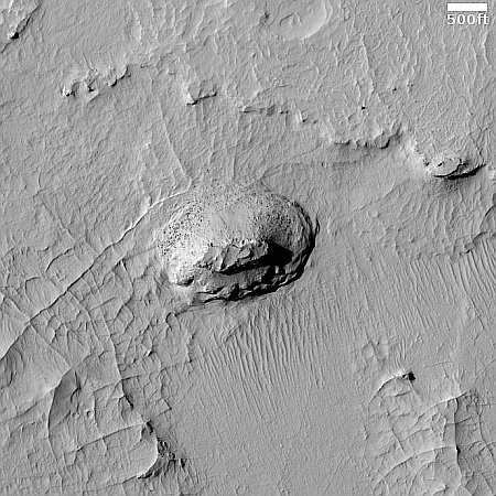
Weird dome near Starship candidate landing zone on Mars

Weird dome near Starship candidate landing zone on Mars
Click for original image.

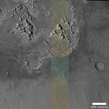
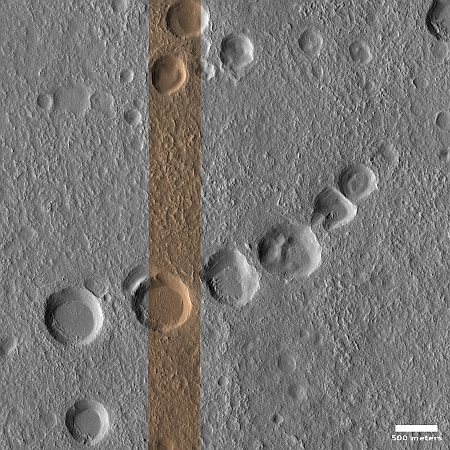
Cool image time! The picture to the right, rotated, cropped, reduced, and sharpened to post here, was taken on February 27, 2023 by the high resolution camera on Mars Reconnaissance Orbiter (MRO). It shows what the scientists label as domes in Arcadia Planitia, one of the many large northern lowland plains of Mars.

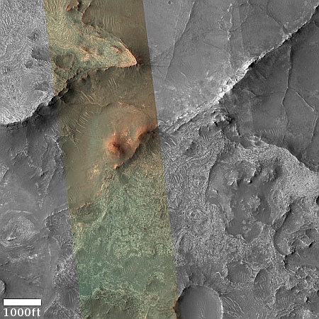
This to me is a “What the heck?” image. I won’t dare try to explain the warped concentric ringed pattern at the top of the mesa, nor the bright and dark splotch that surrounds it. The small craters around it appear to have glacier material within them, and the terrain here likely has a lot of near surface ice, being at 37 degrees north latitude in a region where the data suggests such ice exists. The different colors here likely indicate the difference between dust (orange) and coarser material (aqua).

The location, as shown in the overview map below, makes this mesa more tantalizing.
» Read more

In a Martian cold cauldron, boil and bake

bubbles and boiling ground
Click for original image.

Cool image time! My headline paraphrases slightly the witches’ chant from Shakespeare’s MacBeth, if only to make it more accurately describe the picture to the right, cropped and reduced to post here. Taken on January 5, 2023 by the high resolution camera on Mars Reconnaissance Orbiter (MRO), it shows a patch of mid-latitude terrain in the icy northern lowland plains of Mars.

While some of the craters here were certainly caused by impact, it is also likely that most were instead cryo-volcanic in nature, whereby ice bubbles up from below as changing temperature conditions — none of which need to be very warm — cause it to either melt temporarily into liquid or sublimate directly into a gas. The dark pimplelike hole on the picture’s right edge is a perfect example, with the hole sitting at the top of a cone.
» Read more

The cliff wall of ancient Martian lava channel

The cliff wall of an ancient Martian lava channel
Click for original image.

Cool image time! The picture to the right, cropped, reduced, and sharpened to post here, was taken on January 17, 2023 by the high resolution camera on Mars Reconnaissance Orbiter (MRO) by the camera team not as part of any particular research project but in order to fill a gap in the camera’s schedule so as to maintain its proper temperature. In such cases the camera team tries to pick potentially interesting spots.

This cliff, about 1,100 feet high, is the north wall of a major volcano channel flowing across the Tharsis Bulge, the lava plains that surround Mars’ giant volcanoes. Located in the dry equatorial regions, there is no near surface ice here, but a lot of dust, much of it likely volcanic ash. In the full picture are several ancient craters, all of which are almost entirely buried by this dust and ash.

The cliff wall itself is made up of numerous layers, each representing a past volcanic flood lava event that covered this region with a new flow of material. These events occurred over more than a billion years.
» Read more

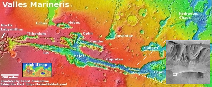
Exploring just one small corner of Valles Marineris, Mars’ Grand Canyon

One corner of Valles Marineris
Click for original image.

Cool image time! The picture to the right, rotated, cropped, reduced, and sharpened to post here, was taken on February 19, 2023 by the high resolution camera on Mars Reconnaissance Orbiter (MRO). It shows the many many many layers that are found in the cliffs of Valles Marineris, the largest known canyon in the solar system and far far larger that Earth’s Grand Canyon.

The elevation difference between the red dots is just under 4,000 feet. Yet that high point is still more than 7,000 feet below the rim of the canyon, more than thirty miles to the south. And the lower dot is still about 18,000 feet above the low point in this side canyon of Valles Marineris, about thirty miles away to the northeast.

In other words, in sixty miles from rim to floor the canyon at this location drops about 25,000 feet, only 4,000 feet less than the height of Mount Everest. Compare that with the Grand Canyon’s slopes, which drops in eleven miles about 5,000 feet, beginning at the main south rim lookout at the start of Bright Angel trail.
» Read more

Glacier layers on the border of Hellas Basin

Dipping glacial layers
Click for original image.

Cool image time! The picture to the right, cropped and reduced to post here, was taken on February 21, 2023 by the high resolution camera on Mars Reconnaissance Orbiter (MRO). It shows what the scientists label as “dipping layers”, referring specifically to the mesas with the terraces on their western flanks.

The layers obviously signify past cycles of geological events on Mars. That the terraces are only on one side of the mesas suggests that they are tilted, with the downhill grade to the east.

These layers however pose several mysteries. First, why are they located so specifically in only certain places of this region? It appears that the layered terrain is only found in the lower hollows and valleys. Why?

Second, why are they tilted at all?
» Read more

Frozen waves of lava on Mars

Frozen waves of lava on Mars

Cool image time! The picture to the right, cropped and reduced to post here, was taken on January 15, 2023 by the high resolution camera on Mars Reconnaissance Orbiter (MRO). It shows an area where the ground suddenly transitions from a crazy quilt of criss-crossing hollows and ridgelines to a very flat and smooth plain.

The location is at 21 degrees south latitude, so this is in the dry equatorial regions. Though it has a small resemblance to the chaos terrain that is found in many places on Mars, mostly in the mid-latitudes where glaciers are found, the scale here is too small and the ridges and canyons are not as sharply drawn. While chaos terrain usually forms sharply defined large flat-topped mesas with steep cliffs, here the ridges are small and the slopes to the peaked tops are somewhat gentle.
» Read more

One instrument on Mars Reconnaissance Orbiter ends its mission

Because Mars Reconnaissance Orbiter’s (MRO) CRISM instrument needed to be cooled to low temperatures to use infrared wavelengths for detecting underground minerals and ice on Mars, and the cryocoolers have run out of coolant, the science team has shut the instrument down.

In order to study infrared light, which is radiated by warm objects and is invisible to the human eye, CRISM relied on cryocoolers to isolate one of its spectrometers from the warmth of the spacecraft. Three cryocoolers were used in succession, and the last completed its lifecycle in 2017.

All the remaining instruments on MRO, including its two cameras, continue to operate nominally.

In its final task, CRISM produced a global map showing water related minerals on Mars, released last year, and a global map showing iron deposits, to be released later this year.

The breakup of a Martian glacier

The breakup of a Martian glacier
Click for original image.

Cool image time! The picture to the right, cropped and reduced to post here, was taken on January 29, 2023 by the high resolution camera on Mars Reconnaissance Orbiter (MRO). It shows what the scientists label a “contact” in the glacier country in the northern mid-latitudes of Mars.

The contact is clearly the region of breakup in the middle of the picture. To the right the surface is whole and very smooth. As we move to the left that surface begins to show cracks and holes until those holes and cracks eliminate that surface entirely, revealing a lower layer that is soft-looking and stippled.

In other words, this is the edge of a glacier, and is the place in which it is breaking up. Unlike Earth glaciers however this breakup process is entirely different.
» Read more

Review of InSight data allows scientists to further refine their model of Mars’ interior

Using archive data from the now defunct InSight Mars lander, especially two seismic detections that came from the planet’s far side, scientists now believe that Mars’ central core is significantly different than Earth’s, being entirely liquid and made up of much lighter materials than expected.

To determine these differences, the team tracked the progression of two distant seismic events on Mars, one caused by a marsquake and the other by a large impact, and detected waves that traveled through the planet’s core. By comparing the time it took those waves to travel through Mars compared to waves that stayed in the mantle, and combining this information with other seismic and geophysical measurements, the team estimated the density and compressibility of the material the waves traveled through. The researchers’ results indicated that Mars most likely has a completely liquid core, unlike Earth’s combination of a liquid outer core and solid inner core.

Additionally, the team inferred details about the core’s chemical composition, such as the surprisingly large amount of light elements (elements with low atomic numbers)—namely sulfur and oxygen—present in Mars’ innermost layer. The team’s findings suggested that a fifth of the core’s weight is made up of those elements. This high percentage differs sharply from the comparatively lesser weight proportion of light elements in Earth’s core, indicating that Mars’ core is far less dense and more compressible than Earth’s core, a difference that points to different conditions of formation for the two planets.

These differences, if confirmed, would certainly affect the way Mars’ surface evolved over the eons, and might help explain its giant volcanoes as well as the planet’s lack of a magnetic field.

The results however remain uncertain, because InSight provided only one seismometer on Mars. To better triangulate the data will require more than one, in the future.

Ingenuity snaps picture of Perseverance during its 51st flight on Mars

Ingenuity's view on 51st flight, April 22, 2023
Click for original image.

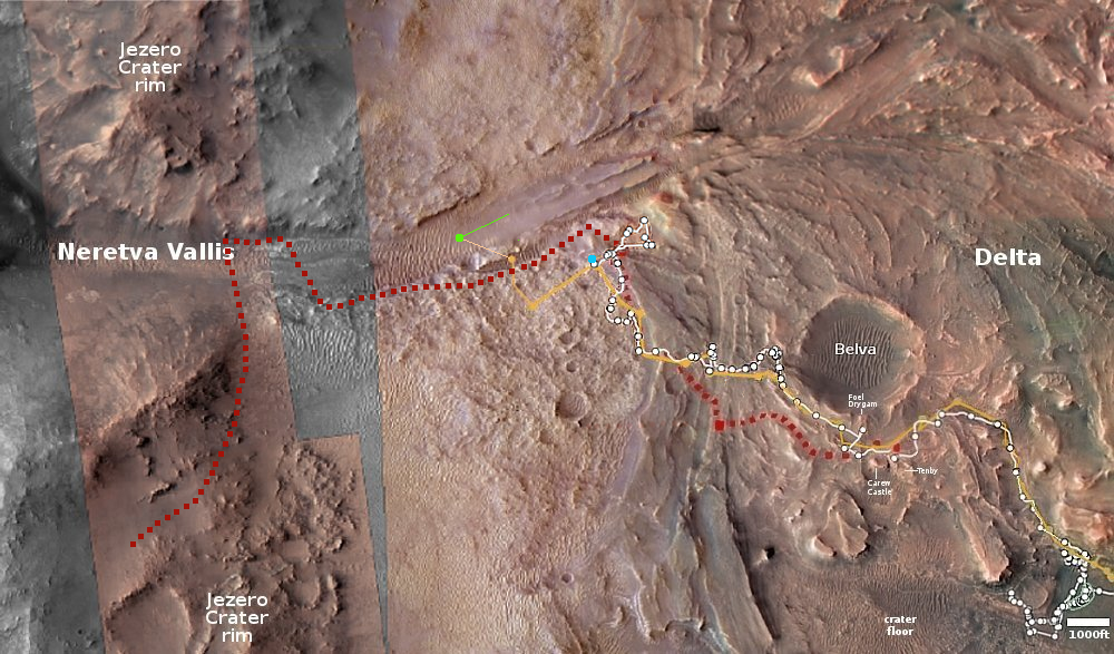
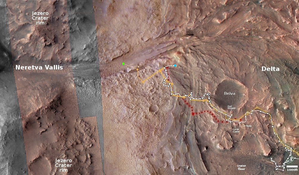
Overview map
Click for interactive map.

On April 22, 2023 the Mars helicopter Ingenuity completed its fifty-first flight on Mars, flying 617 feet west for about 136 seconds at an altitude of about 39 feet. As has been routine for the past dozen or so flights, all these numbers were slightly higher than the flight plan, probably because the helicopter took extra time to find a good landing spot.

The panorama above, cropped, reduced, and enhanced to post here, was taken by Ingenuity about halfway through the flight. Unlike the black and white images that the helicopter takes looking straight down, this color image looks at an oblique angle of 22 degrees below the horizon. The colors are not corrected. The view looks east, looking backwards into Belva Crater. You can see Perseverance on the left, with its tracks cutting across the frame. Belva is filled with ripple dunes.

The blue dot on the overview map to the right marks Perseverance’s present position. The green dot marks Ingenuity’s take-off point, with the green line indicating the approximate flight path.

The climb into Gediz Vallis

Panorama on Sol 3808, April 24, 2023
Click for original image.

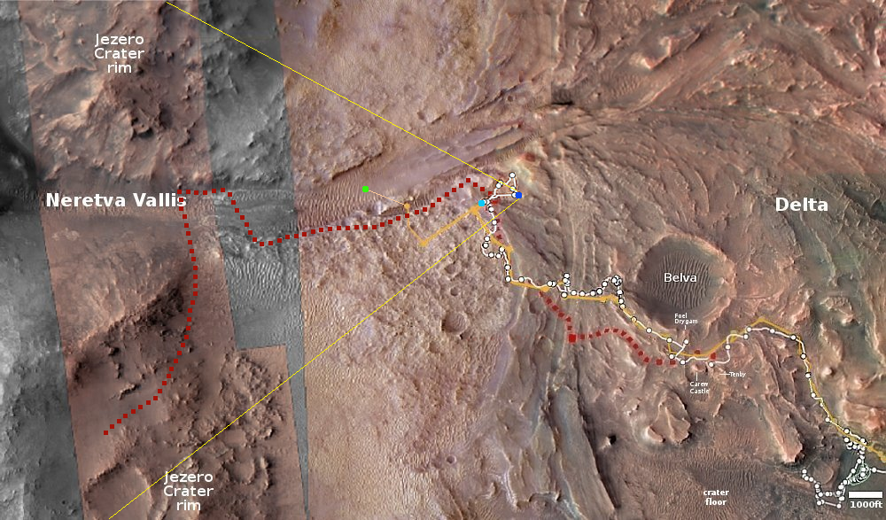
Overview map
Click for interactive map.

After three months traversing the geological layer that the scientists have dubbed the Marker Band, Curiosity has now climbed higher, passing what I dubbed the Hill of Pillows on the west so that it is now in a position to return to its planned route up Mount Sharp, as indicated by the red dotted line in the overview map to the right and the panorama above.

The panorama, cropped, reduced, and annotated to post here, was created on April 24, 2023 using 31 images from the rover’s right navigation camera. The yellow lines on the overview map indicate approximately the area covered, with the blue dot marking Curiosity’s present position.

For scale, the top of Kukenan is about 5,200 feet above Curiosity, while the top of Chenapua is only about 115 feet higher. The white flanks are about 3,200 feet above Kukenan, and are about 4 to 5 miles away.

Looking back, the rim of Gale Crater on the far left of the panorama is about 20 miles away.

Al-Amal snaps first close-up images of Martian moon Deimos

Deimos with Mars in the background
Click for full movie.

During its first close fly-by of the Martian moon Deimos on March 10, 2023, the United Arab Emirates Mars orbiter Al-Amal (“Hope” in English) obtained the first close-up images of the moon.

The picture to the right show Deimos with Mars in the background. The full set of images, compiled into a movie, can be seen by clicking on the image.

The results were outlined by science lead Hessa Al Matroushi at a conference today.

During the 10 March fly-by, the mission team used all three onboard instruments to take readings spanning from the infrared to the extreme ultraviolet. The relatively flat spectrum the scientists saw is suggestive of the type of material seen on Mars’s surface, rather than the carbon-rich rock often found in asteroids, suggesting that Deimos was formed from the same material the planet. “If there were carbon or organics, we would see spikes in specific wavelengths,” she says.

These results probably put an end to the theory that Mars’ moons came from the asteroid belt. Instead, they either formed when the planet did, or were thrown free and settled into orbit after a very large impact, such as the ones that created either the Hellas or Argyre basins, both of which happened several billion years ago and thus provide ample time for the space environment to smooth the moon’s surface and add some craters.

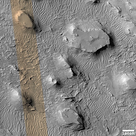
The strange terrain in the basement of Mars

Strange terrain inside Hellas Basin
Click for original image.

I’ve posted numerous cool images about the weird and alien terrain found routinely in what is Mars’ death valley, Hellas Basin. Today is no different. The picture to the right, rotated, cropped, reduced, and sharpened to post here, was taken on February 23, 2023 to fill a gap in the schedule of the high resolution camera on Mars Reconnaissance Orbiter (MRO). Thus, it isn’t linked to any particular research, and its target was chosen by the camera science team almost at random.

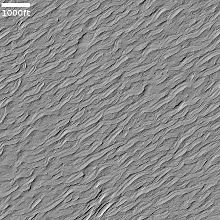
What it shows is a strangely striated plain interspersed with rounded mesas and partly buried craters. The shape of the striations suggests that they were formed from wind blowing consistently from the north. This hypothesis is reinforced by the material that seems piled up at the base of the two bottom mesas, as if it was blown there.

Is ice or lava however?
» Read more

1 11 12 13 14 15 78