
A cliff of ice on Mars
Click for original image.
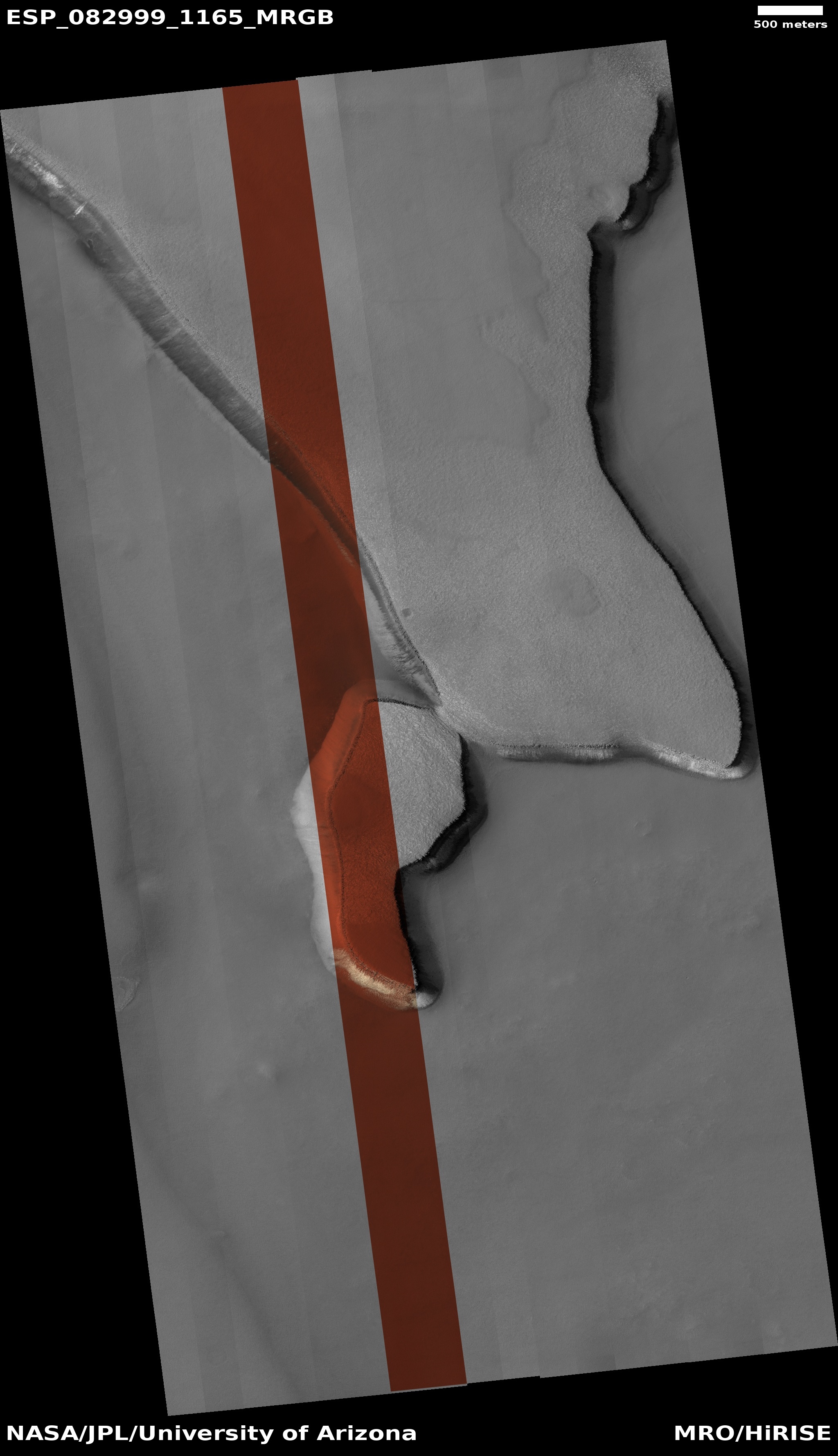
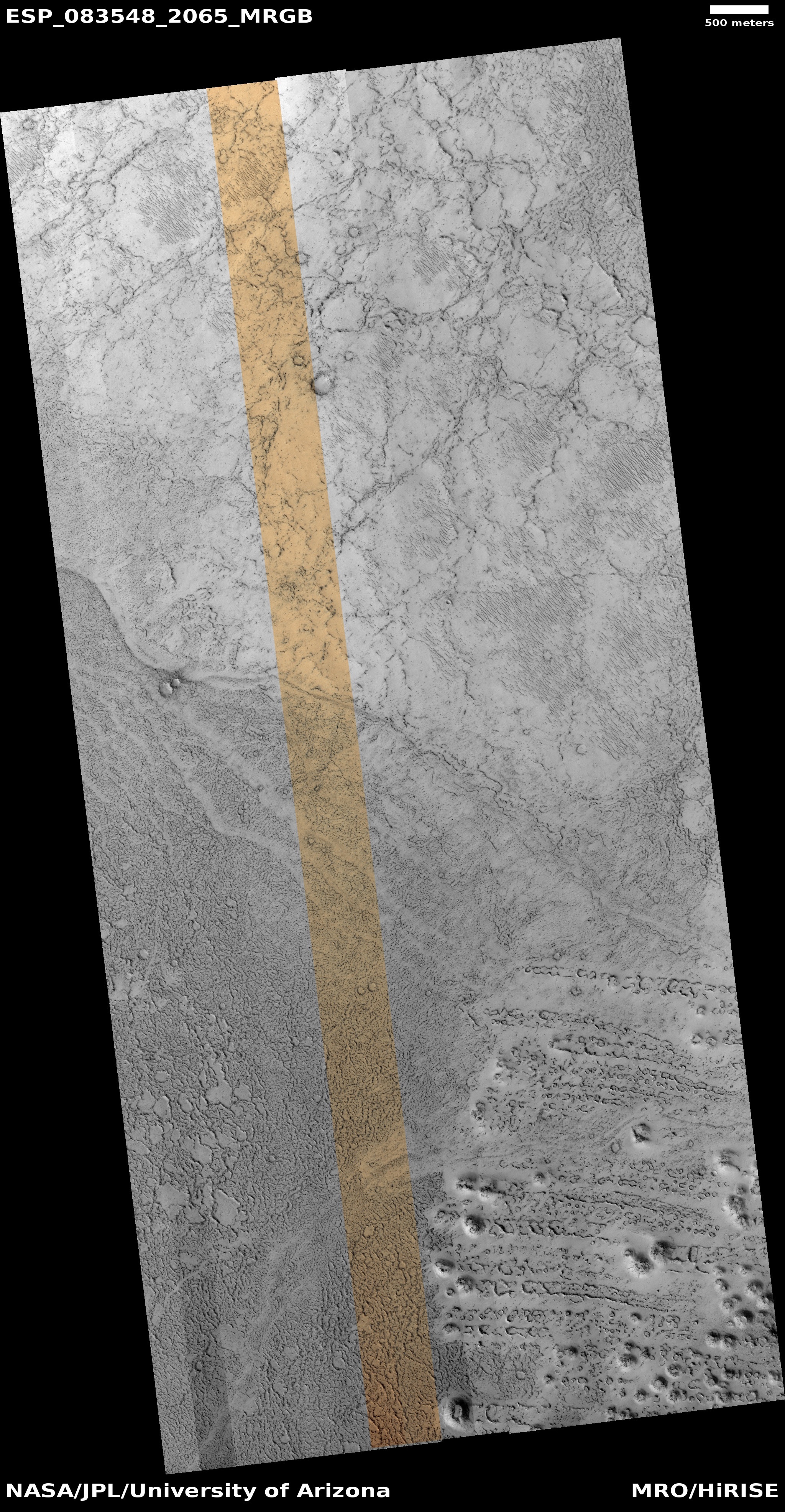
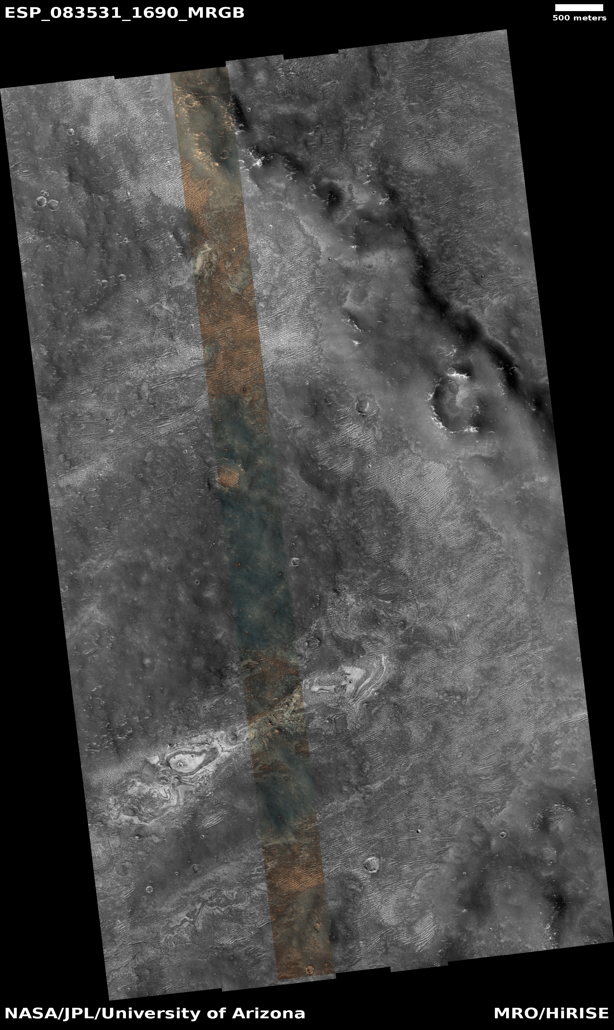
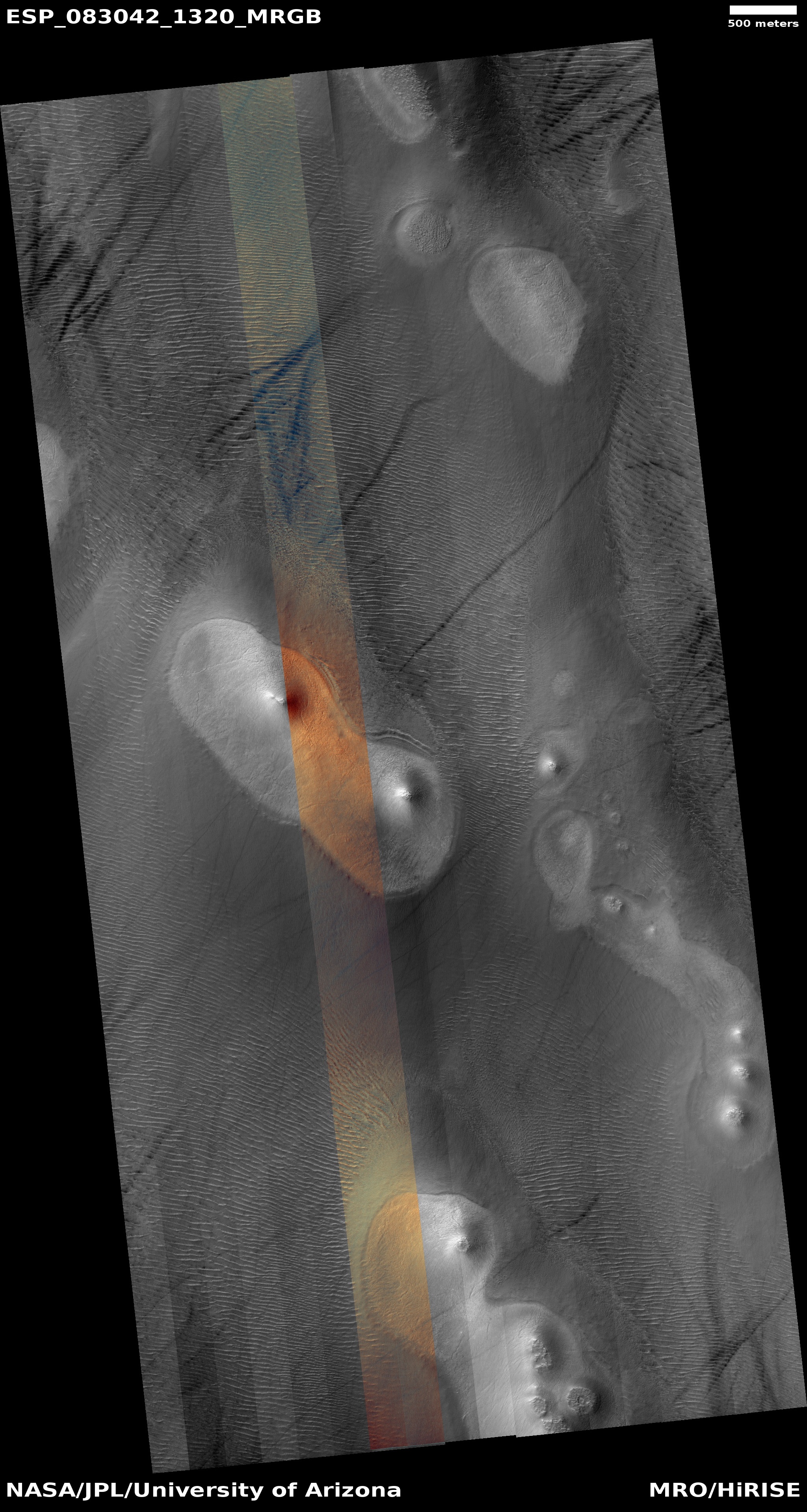
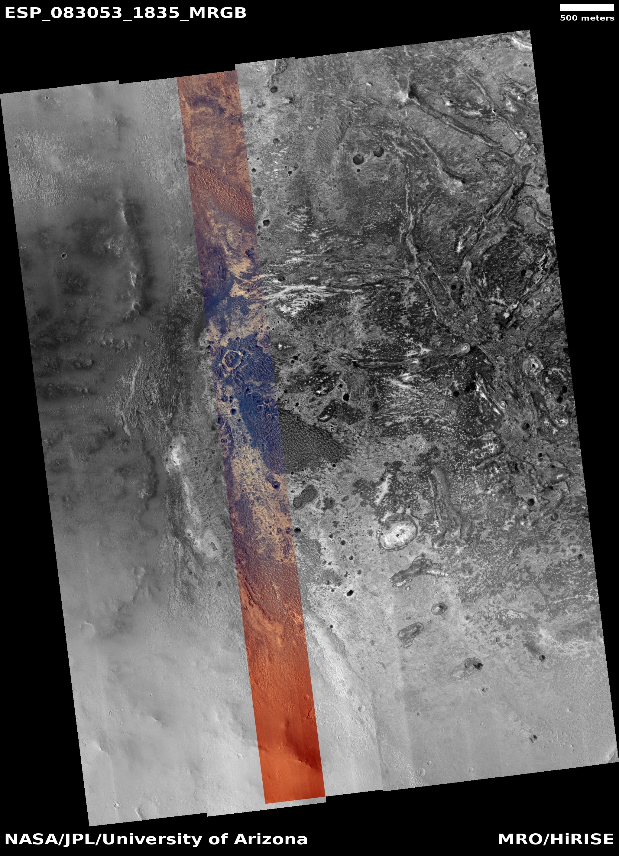
Cool image time! The picture to the right, cropped to post here, was taken on April 10, 2024 by the high resolution camera on Mars Reconnaissance Orbiter (MRO). It shows the southern nose of a large plateau located in the deep south of Mars, at 63 degrees south latitude. This cliff is only about 20-25 feet high, but within that small distance orbital imagery as revealed what appears to be an underground layer of ice. When this photo was released in late June, it came with a short caption, which noted:
On these steep scarps, ice can still be seen on the south facing walls of the scarp towards the end of the Southern Hemisphere’s winter.
Note the white sections on that cliff wall, both inside and outside the color strip. The surrounding orange suggests dust and sand. This photo suggests that during the dark winter underground ice leaches out on these slopes, and is then sublimated away when the Sun returns in the spring. Since the south-facing walls remain in shadow the longest, the ice there lasts the longest, leaving behind these patches we see now.
It is also possible that this is not water ice and there is no underground ice layer. Instead, this might be the last leftover of the dry ice mantle that falls as snow and covers all of the Martian high latitudes during the winter, and then sublimates away come spring.
» Read more


