
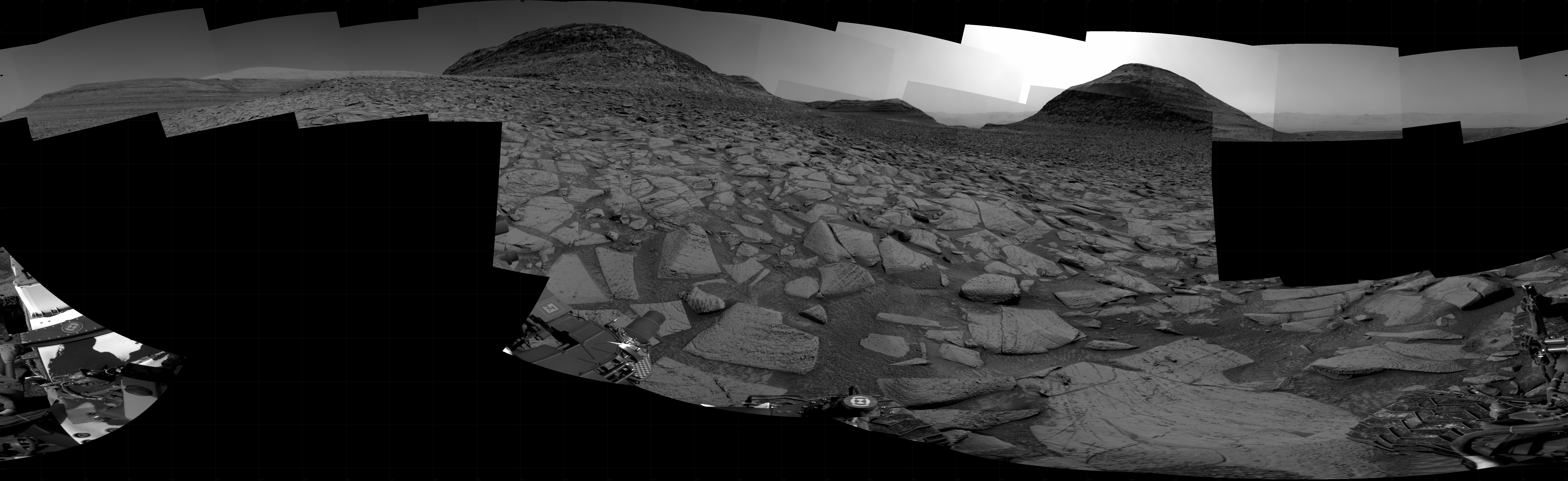
A 360 degree view from Perseverance
Click for interactive map.
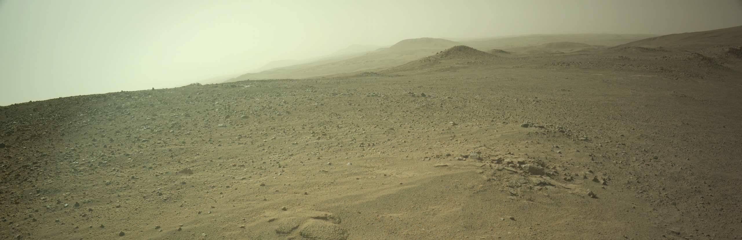
Andrew Bodrov from Mars360 has created another 360 degree mosaic using 854 high resolution images taken by the rover Perseverance when it stood at Lookout Hill, at the top of the rim of Jezero Crater. I have embedded it below. From his announcement:
The panorama provides a complete view of Perseverance, allowing you to examine its intricate design in incredible detail. Every component is visible, showcasing the engineering brilliance that powers this groundbreaking mission.
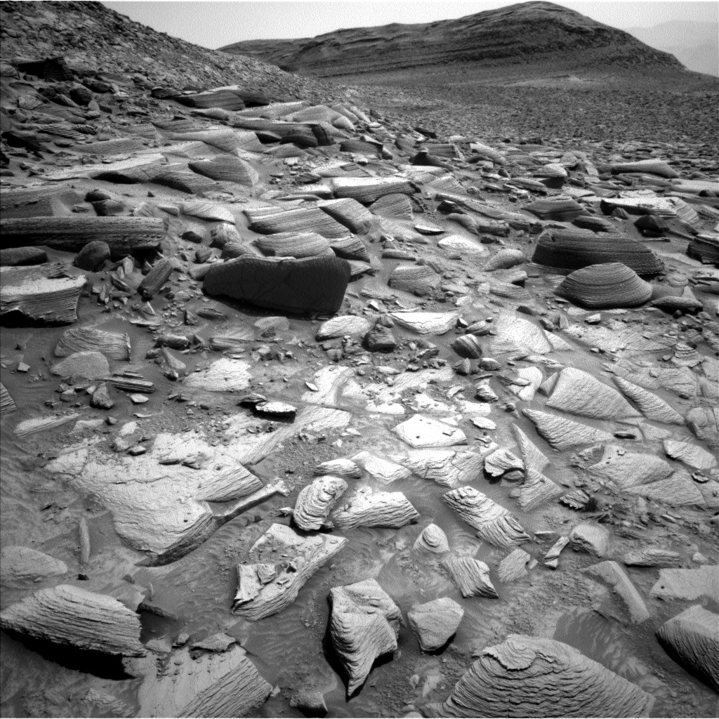
The Martian terrain stretches out around the rover, with its tracks cutting a path into the distance. The Jezero Crater rim, visible on the horizon, features rugged rock formations and textured sands that add depth to this remarkable scene.
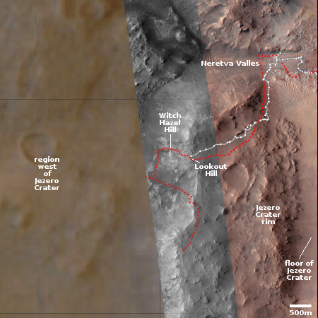
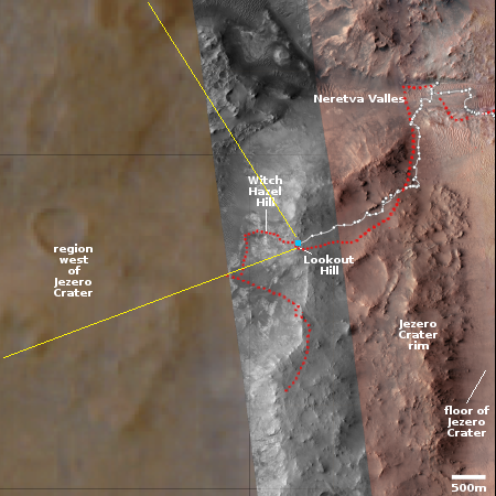
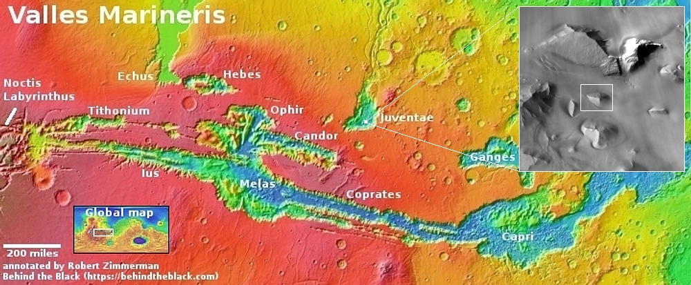
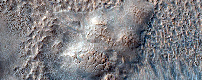
The overview map to the right provides the context. The view begins by looking south, at the crater rim. If you rotate to the left you will see the tracks of Perseverance, indicating its previous travels, and then the rim to the north. Next the view looks outside the crater to the west.
» Read more
Click for interactive map.
Andrew Bodrov from Mars360 has created another 360 degree mosaic using 854 high resolution images taken by the rover Perseverance when it stood at Lookout Hill, at the top of the rim of Jezero Crater. I have embedded it below. From his announcement:
The panorama provides a complete view of Perseverance, allowing you to examine its intricate design in incredible detail. Every component is visible, showcasing the engineering brilliance that powers this groundbreaking mission.
The Martian terrain stretches out around the rover, with its tracks cutting a path into the distance. The Jezero Crater rim, visible on the horizon, features rugged rock formations and textured sands that add depth to this remarkable scene.
The overview map to the right provides the context. The view begins by looking south, at the crater rim. If you rotate to the left you will see the tracks of Perseverance, indicating its previous travels, and then the rim to the north. Next the view looks outside the crater to the west.
» Read more


