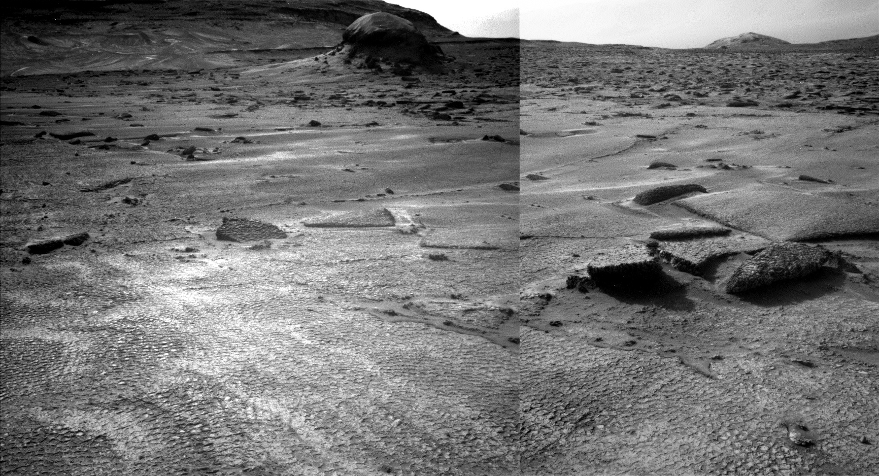
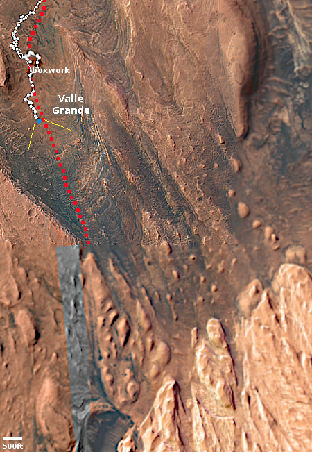
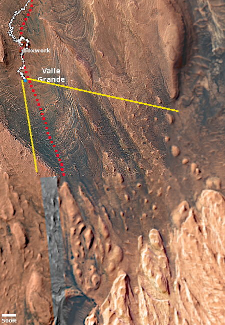
New study finds ice is better at dissolving iron than liquid water

In a result that could have a direct bearing on trying to understand the inexplicable geology of Mars, a new study has found that ice actually does a better job at releasing iron from mineral deposits than liquid water.

It was once believed that when iron-rich mineral deposits were locked in ice, the iron would stay put, but a new study from Sweden’s Umeå University shows that the ice itself is actually working better than permafrost melt to release the iron. The study showed that ice at -10 °C (14 °F) releases more iron from mineral deposits than liquid water at 4 °C (39.2 °F). “It may sound counterintuitive, but ice is not a passive frozen block,” says study co-author Jean-François Boily. “Freezing creates microscopic pockets of liquid water between ice crystals. These act like chemical reactors, where compounds become concentrated and extremely acidic. This means they can react with iron minerals even at temperatures as low as minus 30 degrees Celsius.”

The researchers also found that the seasonal freeze/thaw cycle helped this process, and that brackish fresh water did better in dissolving the iron than seawater.

The significance for Mars geology is that this suggests glacial ice in the alien Mars climate might be the catalyst for creating its meandering canyons that so much resemble features on Earth produced by liquid water. On Mars however no model yet has been convincingly successful in creating past conditions where liquid water could flow on the surface. Mars has either been is too cold or its atmosphere too thin to allow it.

This study suggests ice however could do the work. It also fits with other Martian data that suggests the same, that at the base of the Martian glaciers pockets of liquid water could exist that act to shape the canyons.

All of this is speculation on my part, but it seems that the planetary scientists who are studying Mars should take a close look at this research.

A Martian landscape of volcanic pimples

A Martian landscape of volcanic pimples
Click for original image.

Cool image time! The picture to the right, cropped, reduced, and sharpened to post here, was taken by the high resolution camera on Mars Reconnaissance Orbiter (MRO) and downloaded on August 3, 2025. Labeled as a “terrain sample,” such images are usually taken not as part of any specific research request but because the camera team needs to fill a gap in the camera’s schedule so as to maintain its proper temperature. When they do this, they always try to pick interesting targets within the time window, and usually succeed.

In this case, the camera team picked a location in the middle of Isidis Planitia, one of Mars’ four biggest basins thought to have been formed from a major impact several billion years ago, focusing on an area covered with these strange knobs that have craterlike depressions at their peaks.

According research published in 2010 [pdf], it is believed these cones — all of which are only a few feet high — are the result of volcanic activity following the impact that formed Isidis four billion years ago. In a sense, they are leftover pimples from that impact and the subsequent volcanic activity within that melted basin.
» Read more

European engineers develop a tumbling rover design moved by the Martian wind

Tumbleweed being tested on sandy ground
Tumbleweed being tested on sandy ground. Click for video.

European engineers at Aarhus University in Denmark have now developed and tested a tumbling rover design that is propelled solely by the Martian wind. You can read their most recent paper here.

Not surprisingly, they call it “Tumbleweed.” The screen capture to the right comes from a video of a wind tunnel test proving the Martian atmosphere could move a prototype on sandy ground. The engineers also did similar tests successfully on rocky and coarse ground.

In July 2025, Team Tumbleweed conducted a week-long experimental campaign, supported by Europlanet, at Aarhus University’s Planetary Environment Facility. Using scaled prototypes with 30-, 40- and 50-centimetre diameters, the team carried out static and dynamic tests in a wind tunnel with a variety of wind speeds and ground surfaces under a low atmospheric pressure of 17 millibars.

Results showed that wind speeds of 9-10 metres per second were sufficient to set the rover in motion over a range of Mars-like terrains including smooth and rough surfaces, sand, pebbles and boulder fields. Onboard instruments successfully recorded data during tumbling and the rover’s behaviour matched fluid-dynamics modelling, validating simulations. The scale-model prototypes were able to climb up a slope of 11.5 degrees in the chamber – equivalent to approximately 30 degrees on Mars – demonstrating that the rover could traverse even unfavourable slopes.

Their concept is to send a swarm of Tumbleweeds to Mars, where they could cheaply document prevailing wind and speeds globally. More sophisticated versions could act as full weather stations, as well as provide in situ data about the landscapes they traverse.

The concept is still in its development stage. The next stage of testing will see if Tumbleweed will work with some science sensors attached.

Blobby Martian crater filled with ice

Overview map

A blobby Martian crater filled with ice
Click for original image.

Cool image time! The picture to the right, rotated, cropped, reduced, and sharpened to post here, was taken on August 4, 2025 by the high resolution camera on Mars Reconnaissance Orbiter (MRO).

The science team labels this a “concentric fill crater,” a term used by planetary scientists for Martian craters that appear to be filled with glacial material. That certainly appears to be the case, but this 3.5-mile-wide unnamed crater also appears to have been warped by the ice that impregnates the ground all around it.

The overview map above explains why. The white dot marks the location, on the eastern end of the 2,000-mile-long northern mid-latitude strip that I label glacier country, because almost every image in this region shows similar glacial features. Though it is hard to tell from the inset, all the craters here have similar glacial material within them, and the ground surrounding them also appears glacial in nature.

This particular location is at 40 degrees north latitude. While it might be difficult to establish a colony here, on ground that appears so unstable, going 700 to 800 miles to the southeast would put you in what is considered one of Mars’ prime mining regions. Thus, with the right equipment mining operations would have accessible water not that far away.

Perseverance data suggests multiple past wet periods occurred in Jezero Crater

Perseverance's travels inside Jezero Crater
Figure 1 of the paper, showing Perseverance’s travels inside Jezero Crater. PIXL is an instrument on the rover. The numbers indicate the Martian days since landing. The Three Forks Depot is where Perseverance placed its first cache of sample cores. Click for original.

Scientists analyzing data taken by the Mars rover Perseverance while it traversed the floor and delta inside Jezero Crater strongly suggests that the landscape there experienced multiple past wet periods.

In Jezero, the 24 mineral species reveal the volcanic nature of Mars’ surface and its interactions with water over time. The water chemically weathers the rocks and creates salts or clay minerals, and the specific minerals that form depend on environmental conditions. The identified minerals in Jezero reveal three types of fluid interactions, each with different implications for habitability.

The first suite of minerals — including greenalite, hisingerite and ferroaluminoceladonite — indicate localized high-temperature acidic fluids that were only found in rocks on the crater floor, which are interpreted as some of the oldest rocks included in this study. The water involved in this episode is considered the least habitable for life, since research on Earth has shown high temperatures and low pH can damage biological structures.

…The second suite of minerals reflects moderate, neutral fluids that support more favorable conditions for life and were present over a larger area. Minerals like minnesotaite and clinoptilolite formed at lower temperatures and neutral pH with minnesotaite detected in both the crater floor and the upper fan region, while clinoptilolite was restricted to the crater floor.

Finally, the third category represents low-temperature, alkaline fluids and is considered quite habitable from our modern Earth perspective. Sepiolite, a common alteration mineral on Earth, formed under moderate temperatures and alkaline conditions and was found widely distributed across all units the rover has explored. The presence of sepiolite in all of these units reveals a widespread episode of liquid water creating habitable conditions in Jezero crater and infilling sediments.

You can read the peer-reviewed paper here. The uncertainty of these results is important to note. The analysis did not actually look at real samples. It took data obtained by Perseverance and used computer models and AI to analyze it. The research also assumes the minerals formed based on our understanding of such geological processes on Earth. On Mars conditions are very alien, and could result from chemistry we as yet do not understand, or are unaware even exists.

Monitoring the largest recent impact detected by InSight’s seismometer

Overview

Cool image time! On December 24, 2021 the seismometer of the Mars lander InSight detected a four magnitude earthquake, the largest detected up until then. Because its nature suggested that it had been caused by an impact, not an internal shifting, the science team for Mars Reconnaissance Orbiter (MRO) immediately started searching for new impact craters in the area of Mars where the data suggested the quake came from.

Two months later they found it, in the northern lowland plains just south of the prime landing zone chosen by SpaceX for its Starship spacecraft. The black cross on the overview map to the right indicates the position. The four red spots are the prime Starship landing sites. The white dots indicate other locations considered. The black dots were images taken for a proposed Dragon landing. This impact is thus only about 100 miles away from the nearest possible Starship landing spot.
» Read more

Bubbling lava frozen in a Martian crater

Bubbling lava frozen in a Martian crater
Click for original image.

Cool image time! The picture to the right, cropped, reduced, and sharpened to post here, was taken on June 23, 2025 by the high resolution camera on Mars Reconnaissance Orbiter (MRO). This one-mile-wide unnamed crater was a featured image last week by the science team. As noted in the caption, written by Chris Okubo of the U.S. Geological Survey:

This area was covered by a large flood of lava, which we see as the generally flat areas surrounding the crater. As the lava flowed across, some of it flowed into this crater through a low spot along the crater rim.

Once in the crater, the lava heated ground water or ground ice in the floor, causing the water to boil and turn into steam. This steam then exploded through the overlying lava and created small, ring-shaped formations. These are called ”rootless cones,” and they record the presence of ground water or ground ice in the crater floor at the time of the lava eruptions.

In other words, when this crater was flooded with hot lava, it was filled with ice or water. That fact is significant because of the crater’s location, as shown in the overview map below.
» Read more

NASA promotes the non-discovery of life on Mars by Perseverance

It's all a game of Kibuki theater
It’s all a game!

In what can only be called a kabuki theater stunt, NASA today held a press conference and issued a press release promoting what is essentially the non-discovery of life on Mars by the science team operating the rover Perseverance.

Agency officials, led by acting NASA administrator Sean Duffy, proudly claimed the discovery justified the oft-stated goal of Perseverance, to find life on Mars.

“This finding by Perseverance, launched under President Trump in his first term, is the closest we have ever come to discovering life on Mars. The identification of a potential biosignature on the Red Planet is a groundbreaking discovery, and one that will advance our understanding of Mars,” said acting NASA Administrator Sean Duffy.

This is all garbage. First, Perseverance’s real objective has never been to find life on Mars. It is there to study the planet’s geology. If it should happen to detect a biosignature that would be great, but doing so has always been highly unlikely.

Second, the discovery that Duffy touts is itself quite underwhelming. The key quote from the press release that immediately precedes Duffy’s claim is very telling:

A potential biosignature is a substance or structure that might have a biological origin but requires more data or further study before a conclusion can be reached about the absence or presence of life.

Furthermore, the biosignature that Duffy touts is actually not really a biosignature. They found “a distinct pattern of minerals” that might be sometimes be related to life processes, but not always.

The combination of these minerals, which appear to have formed by electron-transfer reactions between the sediment and organic matter, is a potential fingerprint for microbial life, which would use these reactions to produce energy for growth. The minerals also can be generated abiotically, or without the presence of life. [emphasis mine]

In other words, the data is very uncertain. It certainly doesn’t merit the loud push NASA and Duffy is giving it.

I suspect this push is the result of NASA’s fundamental lie about Perseverance’s so-called search for life, a lie that can never really be fulfilled. It is also related to hiding Perseverance’s limited capabilities. For example, Curiosity has a small lab allowing scientists to analyze samples in great detail. If Curiosity came across a real biosignature, it would be able to identify it.

Perseverance lacks this ability, because in its stead it has equipment for preserving core samples for later pick-up. All it really was designed to do was to gather those core samples. It can’t really do the same kind of ground analysis as Curiosity.

Has Curiosity stumbled upon a small slope streak?

Is that a slope streak in the lower right?
Click for original.

Overview map
Click for interactive map

In reviewing the pictures downloaded today by the Mars rover Curiosity, I noticed something very intriguing in the pictures taken by rover’s two navigation cameras. One such picture is above, taken by the right navigation camera and looking west across the boxwork ridges that Curiosity has been traversing for the past two months. You can see two such ridges in the right foreground, cutting diagonally from left to right.

The overview map to the right gives the context, with the blue dot marking Curiosity’s position. The white and red dotted lines indicate its actual and planned routes respectively, with the top inset zooming in to show the recent travels more clearly. The yellow lines show the approximate area covered by the picture above.

Note the dark streak in the lower right of the picture. The bottom inset on the overview map shows this streak more closely. To my eye, it strongly resembles a slope streak, a strange geological feature unique to Mars.

If I am right, expect the rover team to focus in on this streak. The cause of slope streaks remains unknown. From orbit, the streaks look like avalanches at first glance, but they don’t change the topography, have no debris pile at their base, and sometimes even travel up and over rises as they head downhill. They can occur randomly throughout the year, can be bright or dark, can occur anywhere, and fade with time.

There are a number of theories (see here, here, and here) attempting to explain their cause, but none has been confirmed. If this is a streak, it will be the first that any scientist can see up close.

It is also very likely my guess is wrong, and this is not a streak. Stay tuned for updates.

Yesterday’s Senate hearing on Artemis: It’s all a game!

Ted Cruz, a typical
Ted Cruz, a typical Congressional porkmeister

The Senate hearing that was held yesterday, entitled “There’s a Bad Moon on the Rise: Why Congress and NASA Must Thwart China in the Space Race”, was clearly organized by Senator Ted Cruz (R-Texas) to promote a continuation of the SLS, Orion, and Lunar Gateway parts of NASA’s Artemis program. And he was able to do so because senators from both parties felt the same way. They all want to continue this pork, and don’t really care whether those expensive assets can really accomplish what they promise.

Furthermore, the hearing was also structured to allow these politicians to loudly proclaim their desire to beat China back to the Moon, using this pork. They want the U.S. first, but they are almost all want to do this through a government-run program.

As such, the choice of witnesses and the questions put to them were carefully orchestrated to push this narrative. To paraphrase: “We have to beat China to the Moon! And we have make sure a NASA program runs the effort! And above all, we mustn’t let Donald Trump cut any of NASA’s funding, anywhere!”

It was therefore not surprising that the most newsworthy quote from the hearing was the comments by former NASA administrator Jim Bridenstine about Starship and how its choice as a manned lunar lander was a bad one, and that it was likely going to the prime reason China will put humans back on the Moon ahead of us.
» Read more

Patterned frozen lava in Mars’ volcano country

Patterned frozen lava
Click for original image.

Cool image time! The picture to the right, cropped, reduced, and enhanced to post here, was taken on May 31, 2025 by the high resolution camera on Mars Reconnaissance Orbiter (MRO).

The camera team label this “patterned ground.” And it is indeed. Though the topography is almost flat for large distances, the ground itself has these various patterns on it, from meandering small ridges to stippled roughness to very smooth sections.

The location is at 4.6 degrees north latitude, in the dry equatorial regions of Mars. No near surface ice created these features. All we can deduce from this picture is that this landscape is relatively young, as there are no craters seen.

So what caused these features? The location as always provides a clue.
» Read more

“What the heck?!” glaciers on Mars

Overview map

Another
Click for original image.

Cool image time! The picture to the right, cropped, reduced, and sharpened to post here, was taken on June 29, 2025 by the high resolution camera on Mars Reconnaissance Orbiter (MRO). It falls into what I call my “What the heck?!” category of Martian land-forms, simply because their shape is so strange and inexplicable it is difficult to conceive a geological process that could create them.

Nor does it help much that we know what these land-forms are made of. The white dot on the overview map above marks the location, inside the 2,000-mile-wide northern mid-latitude strip I label glacier country, because almost every image taken shows glacial features. In this case, this strange geology is located on the floor of a canyon that is part of a large region of chaos terrain, a landscape typical of glacier country. This floor, as well as all the low areas, seems filled with glacial flows. This particular canyon appears to roughly flow downhill to the northwest, though the downhill grade in the entire region varies widely in all directions.

Based on all the orbital data, these flows are glacial in nature, the ice protected by a thin top layer of dirt and debris. The strange features at the top of all the small mesas in the picture above suggest that the wind possibly blew off the dirt and debris, exposing the ice and allowing it to sublimate away. This in turn produced the knobby hollows at the top of each mesa.

I am guessing, and no one should trust my guess considering I only make believe I’m a geologist on the internet.

Perseverance looks west

Perseverance looks west
Click for full resolution. For original images go here and here.
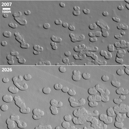
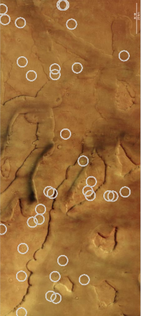
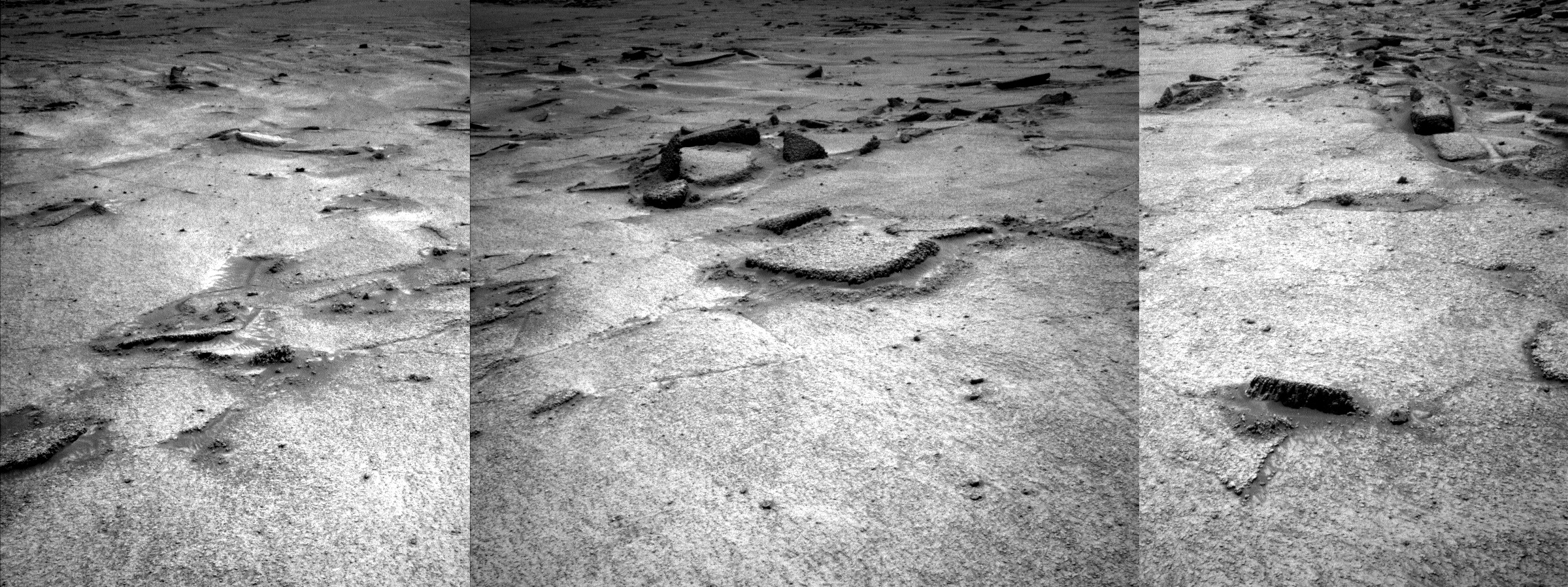
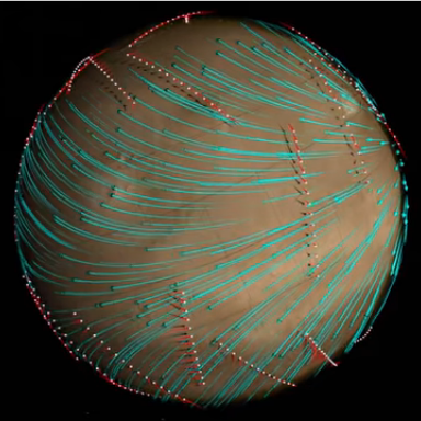
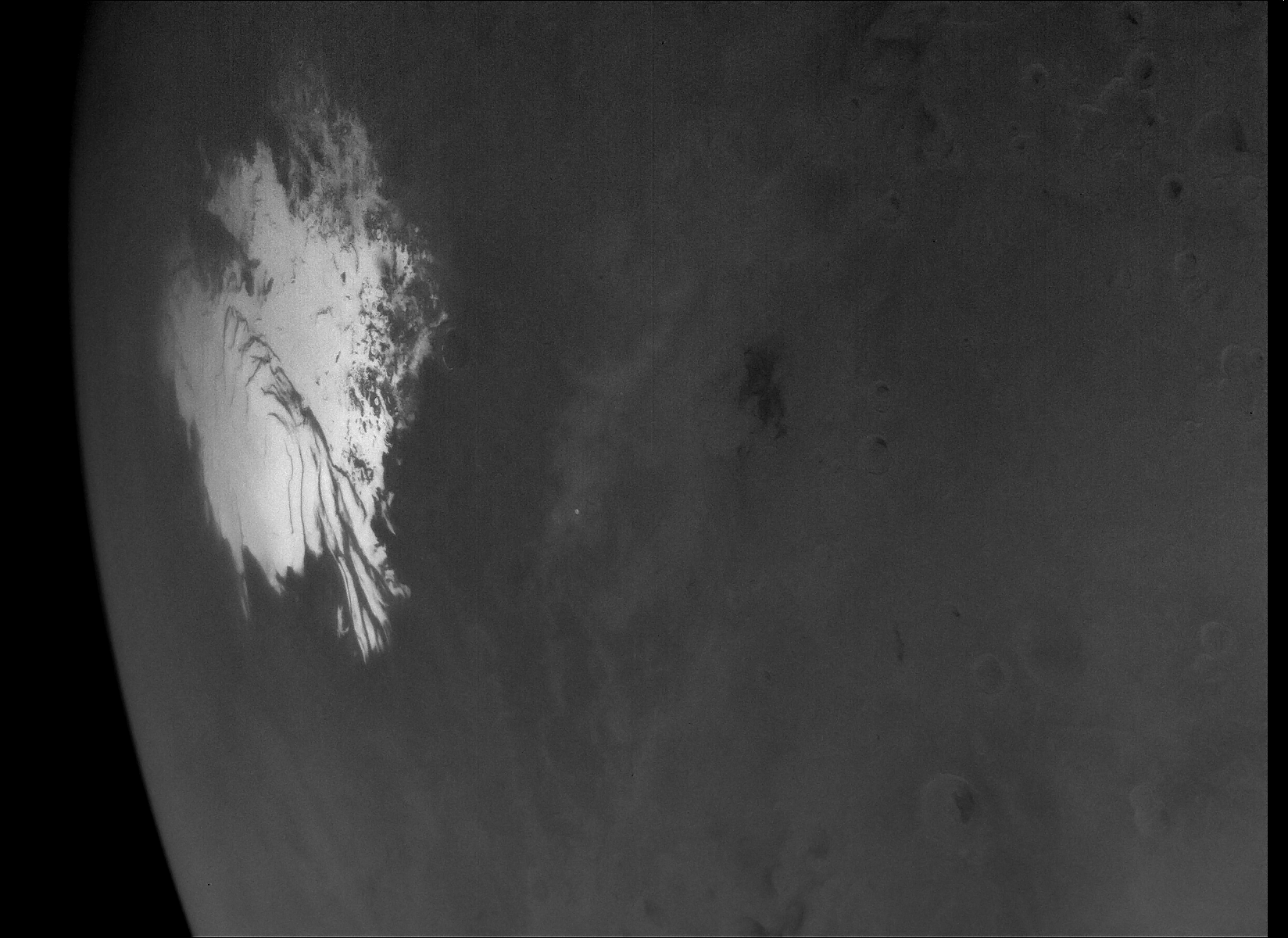
Overview map
Click for interactive map.

Cool image time! The panorama above, reduced and sharpened to post here, was created using two pictures taken on August 28, 2025 by the left navigation camera on the Mars rover Perseverance (here and here).

The blue dot on the overview map to the right marks Perseverance’s location when it took these pictures. The yellow lines indicate the approximate area covered by the panorama. The red dotted line indicates the rover’s planned route, with the white dotted line its actual travels.

The recent geological research focused on the lighter-colored ridge on the right center, dubbed Soroya. From the August 27, 2025 update by the science team:

Soroya was first picked out from orbital images as a target of interest because, as can be seen in the above image, it appears as a much lighter color compared to the surroundings. In previous landscape images from the surface, Mars 2020 scientists have been able to pick out the light-toned Soryoa outcrop, and they noted it forms a ridge-like structure, protruding above the surface. Soroya was easily identifiable from rover images as Perseverance approached since it indeed rises above the surrounding low-lying terrain.

The view is looking downhill away from Jezero Crater. The curve of the horizon is an artifact of the navigation camera’s wide view, accentuated by the slope that the rover sits on. The low resolution of this western region on the overview map is because the science team has not yet had Mars Reconnaissance Orbiter (MRO) get highest resolution pictures there yet.

Note the utter barrenness of this terrain. This is Mars, a lifeless world that has only the future potential for life, once we humans start to colonize it. Whether there was ever any past life remains uncertain, but the nature of its terrain as seen by both Perseverance and Curiosity suggests strongly that past life never existed, or if it did it barely survived and was quickly wiped out, a long time ago.

Mars’ interior is more chaotic than Earth’s

Martian quake map as seen by InSight
The largest quakes detected by InSight, indicated
by the red dots.

Using archival quake data from the Mars lander InSight, scientists now believe that the upper layers in the interior of the red planet are not as coherently layered as the Earth’s, that its mantle is broken up in a much more chaotic manner. From the paper’s abstract:

We report the discovery of kilometer-scale heterogeneities throughout Mars’ mantle, detected seismically through pronounced wavefront distortion of energy arriving from deeply probing marsquakes. These heterogeneities, likely remnants of the planet’s formation, imply a mantle that has undergone limited mixing driven by sluggish convection. Their size and survival constrain Mars’ poorly known mantle rheology, indicating a high viscosity.

These “heterogeneities” are large blocks of material, some as large as two to three miles wide, that are thought left over from the planet’s initial formation. These initial pieces of the mantle were layered like the Earth, but subsequent impacts during the accretion process cracked them and shifted them about.

These results have some uncertainty, as so far only one seismometer, InSight’s, has be placed on Mars. It will require more sensors and years of data to fully map the interior with greater precision and reliability.

Another great hiking location on Mars

Another great hiking location on Mars
Click for original image.

In honor of our just completed visit to the south rim of the Grand Canyon, today’s cool image takes us to another location on Mars that to me appears a perfect place to install some hiking trails. The picture to the right, cropped, reduced, and sharpened to post here, was taken on June 30, 2025 by the high resolution camera on Mars Reconnaissance Orbiter (MRO).

The image shows a two-mile wide canyon with a number of scattered narrow mesas within. The north and south rims rise about 550 feet above the canyon floor. The two mesas labeled “A” and “B” rise about 200 and 100 feet respectively.

The hiker in me immediately imagines what a great hike it would be to go up the western nose of either ridge and walk along its crest. The knife-edge nature of ridge “A” would mean that for a large majority of the hike you’d be at the north and south edges at the same time.
» Read more

Sand dunes inside the Martian north polar icecap

Sand dunes inside the Martian north polar icecap
Click for original image.

Today’s cool image returns to the Martian north pole. The picture to the right, rotated, cropped, reduced, and enhanced to post here, was taken on July 3, 2025 by the high resolution camera on Mars Reconnaissance Orbiter (MRO). It shows the top of a ridge near the edge of that icecap, with dunes visible in the hollow several thousand feet below.

The angle of this picture does not show us the many layers on the cliff leading down to those dunes. It does show evidence, however, of the top few layers on the flat crest of that ridge. The white lines delineate those layers, each line marking the edge of a series of wide terraces.

The dunes in the canyon below are of interest because their source is likely the dust that is mixed into thick icecap’s ice. As that ice sublimates away on the face of the cliff, the dust falls into the canyon, where it is trapped.
» Read more

The beauty of Mars’ many-layered northern icecap

The beauty of Mars' ice cap
Click for original image.

Cool image time! The picture to the right, rotated, cropped, reduced, and sharpened to post here, was taken on July 1, 2025 by the high resolution camera on Mars Reconnaissance Orbiter (MRO).

The science team labels it clumsily as “North Polar layered deposits structural geology in icy layers”. What we see are the many layers that make up the north polar cap, produced by the red planet’s many climate cycles that scientists think Mars has undergone over the eons as the red planet’s rotational tilt, or obliquity, rocked back and forth from 11 degrees inclination to as much as 60 degrees. At the extremes, the ice cap was either growing or shrinking, while today (at 25 degrees inclination) it appears to be in a steady state.

These layers are a mixture of ice and dust. The variations from dark to light likely indicate changes in the amount of dust in the atmosphere. Dark layers suggest the atmosphere was more dusty due to volcanic eruptions. Light layers suggest the planet’s volcanic activity was more subdued.

At least that’s one hypothesis.
» Read more

Wind-eroded terrain on the edge of Mars’ largest volcanic ash field

Wind-eroded terrain in Mars' largest volcanic ash field

Cool image time! The picture to the right, cropped and sharpened to post here, was taken on July 2, 2025 by the high resolution camera on Mars Reconnaissance Orbiter (MRO).

Labeled simply as “wavy terrain” by the MRO science team, it shows a relatively flat plain of hollows and terraced ridges that suggest the prevailing winds come from the west-southwest. As they blow, they slowly cause the layers of material to peel away, exposing those terraces.

This wavy landscape extends for many miles to the west, covering a region 135 by 160 miles in area. The layering and wavy nature of the terrain suggests the material here is fragile and easily peeled away by the winds of Mars’ very thin atmosphere. Think of the sandstone that forms Monument Valley and Canyonlands in the southwest United States, shaped almost entirely by wind.

And in fact, the overview map below confirms this.
» Read more

Slumping landslide in Mars’ glacier country

Overview map

Slumping landslide in Mars' glacier country
Click for original image.

Cool image time! The picture to the right, rotated, cropped, reduced, and sharpened to post here, was downloaded on July 1, 2025 from the high resolution camera on Mars Reconnaissance Orbiter (MRO).

Labeled by the science team as a “flow,” it shows what appears to be a major collapse of the canyon’s south wall. The white dot on the overview map above marks the location, near the center of the 2,000-mile-long strip in the northern mid-latitudes of Mars that I label “glacier country” because almost every single high resolution image of this region shows glacial features.

This picture is no exception. First, the canyon appears filled with a glacial material, though its flow direction is unclear. Orbital elevation data suggests that this collapse is actually at the canyon’s high point, with the drainage going downhill to the east and west.

Second, the collapse itself doesn’t look like an avalanche of rocks and bedrock, but resembles more a mudslide. Since liquid water cannot exist in Mars’ thin atmosphere and cold climate, the soft nature of the slide suggests it is dirt and dust impregnated with ice. At some point, either because of the impacts that created the craters on its southern edge or because the sun warmed the ice causing it sublimate away thus weakening the ground structurally, the entire cliff wall slumped downward to the north.

The canyon itself is about 800 feet deep. It likely formed initially along a fault line, with ice acting over time to widen and extend it.

Gullies on a crater wall in the icy north of Mars

Gullies on a crater wall
Click for original image.

Cool image time! The picture to the right, cropped, reduced, and sharpened to post here, was taken on July 4, 2025 by the high resolution camera on Mars Reconnaissance Orbiter (MRO). It shows the lower right quadrant of a five-mile-wide unnamed crater in the high northern mid-latitudes of Mars.

The science team in its label for this picture focuses on the gullies visible on the crater’s interior wall. To my Earth-bound eye, these gullies look like recent erosion caused by underground ice sublimating into gas, causing the surface to collapse downward into the crater. This however is a purely uneducated guess.

The floor of the crater however shows features that resemble glacial fill, seen in numerous high latitude craters on Mars. This is not surprising, as the crater is located at 59 degrees north latitude, close enough to the pole for there to be a lot of near surface ice to be present.
» Read more

Slope streaks within Mars’ largest mountain region

Overview map

Today’s cool image revisits Lycus Sulci, the largest mountain range on Mars, about 1,400 mile wide and 1,800 miles long. The overview map to the right gives a sense of the roughness and chaotic nature of this region, extending north from Mars’ largest volcano, Olympus Mons.

At present scientists are unsure of the geology that formed Lycus Sulci, and how it is linked with Olympus Mons. The wide view to the right suggests it is the remains of a very ancient lava flow descending from the volcano that over time has become eroded to produce this wildly knobby terrain. That hypothesis remains unproven however. There is also evidence that the material here might instead be volcanic ash, deposited in many layers and eroded away with time.

The location of the cool image below is marked by the white dot, with the inset providing us a wider view of the surrounding terrain. Note the two craters to the north and west. Both appear to have been partly filled by flows coming from the south and east, respectively, adding weight to the theory that this region formed from lava flow.
» Read more

When Martian lava meets a Martian mountain

When Martian lava meets a Martian mountain
Click for original image.

Cool image time! The picture to the right, rotated, cropped, reduced, and sharpened to post here, was taken on April 24, 2025 by the high resolution camera on Mars Reconnaissance Orbiter (MRO), and was posted yesterday by the science team to illustrate the vast lava flows that cover much of Mars. From the caption:

This image captures the edge of a lava flow that partially buries older terrain in the Martian Southern Highlands. Where the edge of the lava flow made contact with the higher-standing topography, it formed a rumpled and ridged surface.

This lava flow is one of many massive flows that extend southwest from Arsia Mons, one of the largest shield volcanoes on Mars.

The mountain to the south rises about 3,700 feet above that rumpled lava ocean at its base.
» Read more

Strange rocks on Mars

Coral on Mount Sharp!
Click for original image.

Float rock in Jezero Crater
Click for original image.

Time for two cool images, from two different craters separated by thousands of miles on Mars! The first image to the right, cropped, reduced, and sharpened to post here, was taken on July 24, 2025 by the Mars Hand Lens Imager (MAHLI) at the end of the robot arm of Mars rover Curiosity, and shows a really strange rock formation that resembles a piece of coral on Earth.

Curiosity has found many small features like this one, which formed billions of years ago when liquid water still existed on Mars [in this region]. Water carried dissolved minerals into rock cracks and later dried, leaving the hardened minerals behind. Eons of sandblasting by the wind wore away the surrounding rock, producing unique shapes.

The second image, cropped, reduced, and sharpened to post here, was taken on August 5, 2025 by the left high resolution camera on the rover Perseverance. It shows what appears what geologists call a “float rock”, something that was created geologically somewhere else and transported to this location later.

In this case the rock appears lavalike in nature. Since Perseverance is exploring the exterior rim of Jezero Crater, we could be looking at the impact melt created when the bolide hit the ground to create the crater. Material would be instantly melted as well as flung outward as ejecta, with this strangely shaped rock an example.

The problem with this theory however is that the rock appears to have solidified well before it hit the ground at this location. Its shape also suggests it solidified within a crack, thus molding it to this shape, with its top once at the bottom, the lava flowing downward. The mystery then is how it ended up as we see it, upside down and exposed.

Italy to fly experiments on first Starship flights to Mars

According to a tweet by SpaceX’s president and chief operating officer Gywnne Shotwell today, the Italian Space Agency (ASI) has signed an agreement to fly experiments on first Starship flights to Mars that will carrying customer payloads. She quoted a tweet by ASI’s president, Teodoro Valente:

ASI_Spazio and SpaceX have signed a first-of-its-kind agreement to carry Italian experiments on the first Starship flights to Mars with customers. The payloads will gather scientific data during the missions. Italy continues to lead in space exploration!

Little other information has yet been released, but expect more details in the coming days.

UPDATE: ASI’s press release on August 8th added this detail:

The payloads will include a plant growth experiment, a weather monitoring station and a radiation sensor. The goal is to collect scientific data in the approximately six-month interplanetary flight phase from Earth to Mars and then on the Martian surface.

Hat tip to reader Gary.

Curiosity looks back

Curiosity looks back
Click for original image.

Cool image time! The picture to the right, reduced and enhanced to post here, was taken on July 28, 2025 by the left navigation camera on the Mars rover Curiosity. It looks to the north, down the flanks of Mount Sharp and across the floor of Gale Crater to its mountainous rim about 30 miles way, seen on the horizon.

The view is so clear because of the season, as noted in the science team’s blog post today:

We’re still in the time of year where the atmosphere at Gale is reasonably dust-free (at least, compared to later in the year), allowing us to look all the way out to and beyond the Gale crater rim. The upper slopes of Mount Sharp have also re-emerged to our east after spending months hidden behind the walls of Gediz Vallis. There’s a bit more sand and dust in this location than we’ve seen recently, so we can also see the trail left behind by the rover’s wheels as we drove to this location

The ridge in the foreground is an example of the boxwork Curiosity is presently traversing. It is now on one of those ridges, and will be moving along it in short drives as the science team studies the geology here. The rover’s tracks leading up to this position can be seen clearly.
» Read more

Thales Alenia ships the orbit insertion module for the Mars sample return mission

Though the entire project remains in limbo at NASA and might be cancelled, the European aerospace company Thales Alenia this week completed construction of the orbit insertion module for the Mars sample return mission that will place the orbiter — also built by European companies — in Mars orbit and will eventually bring the samples back to Earth.

On 28 July, Thales Alenia Space announced that the module had passed its test campaign with “excellent results.” According to the update, the company had packed and shipped the Orbit Insertion Module from its Turin facilities to Airbus in Stevenage a few days earlier. The delivery marks a key milestone in the development of the Mars Return Orbiter.

The broader Earth Return Orbiter project passed a key milestone in July 2024 with the completion of the Platform Critical Design Review. This review confirmed the performance, quality, and reliability of the mission’s systems. With its successful conclusion, Airbus advanced to full spacecraft development, including the integration and testing of its various components, among them the Orbit Insertion Module.

Under the project’s present very complex design, NASA is supposed to provide the ascent rocket and capsule to bring the samples to Europe’s return orbiter. At the moment it is unclear who will build this, or even if it will ever get built. Thus, Europe might be building a very expensive Mars orbiter with no clear mission.

Mars and its two moons seen in the infrared by Europa Clipper

Mars and its two moons
Click for original.

Cool image time! The infrared image to the right, cropped, reduced, and enhanced to post here, was taken by Europa Clipper on February 28, 2025 just before it flew past Mars on its way to Jupiter.

Deimos is in the upper left corner, while Phobos is close to Mars.

When the image was taken by the mission’s Europa Thermal Emission Imaging System (E-THEMIS), the spacecraft was about 560,000 miles (900,000 kilometers) from the Red Planet. The image is composed of 200 individual frames, part of a continuous scan of 1,100 frames taken roughly a second apart over a period of 20 minutes. Scientists are using the tiny, point-like images of the moons to check the camera’s focus.

As this is an infrared image (measuring heat), it shows Mars’ northern polar cap as the dark oval at the top of the planet. The bright (and thus warmer) oval to the lower left is the shield volcano Elysium Mons.

This data suggests Europa Clipper’s thermal instrument is working as intended, which is essential for observing the ice content (if any) on Europa once it enters Jupiter orbit in 2030.

The glaciers on Mars are almost pure ice with only a thin cover of dust and debris

A map of glaciers on Mars
A map of glaciers on Mars.

According to new research, scientists now think that the glaciers on Mars are almost pure ice, protected from sublimation by a thin cover of dust and debris.

Work over the last 20 years has demonstrated that at least some of these glaciers are mostly pure ice with only a thin cover of rock and dust, but according to a new paper published in Icarus, glaciers all over the planet actually contain more than 80% water ice, a significant finding. Ultimately, this means that Mars’s glacial ice deposits are nearly pure across the globe, providing a clearer understanding of Mars’ climate history and a possible resource for future utilization.

The researchers analyzed mid-latitude glaciers at five different locations in both the north and south hemispheres, and found that at every location the data suggested almost pure ice.

The map to the right, from earlier research, shows the prevalence of near-surface ice once you get above 30 degrees latitude. From the poles to the mid-latitudes it appears there is an ice sheet or “ice table” just below the surface. In the mid-latitudes glaciers dominate, as this appears to be the region where that ice is beginning to dissipate. In the equatorial regions little or no near-surface ice has been detected, though there has been some evidence in some places of ice at deeper depths.

This data once again demonstrates that Mars is not a desert like the Sahara, as we once believed. Instead, it more resembles Antarctica, where there is ice everywhere that simply needs to be processed for use.

Curiosity amid the boxwork

Curiosity amid the boxwork, looking uphill
Click for original image.

Overview map
Click for interactive map.

Cool image time! The panorama above, cropped to post here, was taken on July 20, 2025 by the left navigation camera on the Mars rover Curiosity. It looks uphill to the south into the canyon that Curiosity will eventually travel, with the white chaotic upper flanks of Mount Sharp on the horizon. The mountain’s peak itself is out of view, about 25 miles away.

The overview map to the right provides the context. The blue dot marks Curiosity’s present position, on the northern edge of the large patch of very distinct boxwork ridges visible from orbit. You can see these ridges in the foreground of the panorama above.

The yellow lines indicate the approximate area covered by the panorama. The red dotted line roughly indicates the rover’s future travels. At the moment, however, it is going nowhere, as the science team is focused on studying these boxwork ridges in the hope they can determine their origin. Such features are usually associated with cracking later filled with lava, with the polygon-shaped cracking usually associated with a formerly wet environment drying.

Mars meteorite sells at auction for $5.3 million

The largest Mars meteorite found so far on Earth sold yesterday at auction for $5.3 million, a million dollars more than expected.

The 54-pound (25-kilogram) rock named NWA 16788 was discovered in the Sahara Desert in Niger by a meteorite hunter in November 2023, after having been blown off the surface of Mars by a massive asteroid strike and traveling 140 million miles (225 million kilometers) to Earth, according to Sotheby’s. The estimated sale price before the auction was $2 million to $4 million.

The identity of the buyer was not immediately disclosed. The final bid was $4.3 million. Adding various fees and costs, the official bid price was about $5.3 million.

Most Mars’ meteorites found on Earth are scooped up in Antarctica as part of government funded research. Thus, they are not available for sale. This rock was found by a private meteorite hunter, who then owned the rock free and clear and could do with it as he or she liked. It appears the hunting paid off handsomely.

1 2 3 82