A unique place where waves repeatedly crash against each other

The phenomenon this post describes is hard to believe, but a group of bodyboard enthusiasts have discovered a specific spot in the ocean where the underground topography causes waves to smash against each other from four different directions, and do so with such tremendous force that water is flung hundreds of feet into the air.

And it’s not two waves converging – in many cases it’s actually two giant 12-footers colliding with another two smaller waves backwashing out from the shore, plunging simultaneously into a gap left by hydrodynamic forces over a reef close to the surface, causing a huge volume of water to rocket skyward as if a depth charge has gone off underneath the waves.

That footage has got to be seen to be believed, so I have embedded it below. This collision of waves happens again and again, at the same exact spot. There isn’t any unique physics or science going on however. What we are looking at is simply the amazing possibilities that ordinary physics presents to our infinite universe.
» Read more

7 comments

European sea-level satellite releases first data

First data from Sentinel-6B
Click for original.

The European Space Agency’s (ESA) Sentinel 6B satellite, launched a month ago, has now released its first sea-level data.

Following its launch on 17 November 2025, the first data from Sentinel-6B was captured on 26 November by the satellite’s Poseidon-4 altimeter. The image [to the right] is a combination of altimeter data from both the Sentinel-6 sea-level tracking satellites: Sentinel-6B and its twin, Sentinel-6 Michael Freilich, which was launched in 2020. The image shows the Gulf Stream current in the North Atlantic Ocean, off the eastern coasts of the US and Canada.

The Gulf Stream is a hugely important area of the North Atlantic Ocean, not only for the role it plays in global weather patterns and climate, but also because it’s a busy shipping route as well as a key ecosystem for marine species and therefore an important fishing zone.

What makes this particular government press release unusual is that though it is about a climate-related satellite, it makes no mention of global warming and how the sea level rise that has been recorded by the string of similar orbital satellites going back to 1993 is going to eventually drown us all. Maybe that’s because that total rise measured since 1993 equals only about 4 inches. That’s 4 inches of rise detected in more than three decades. At that rate, a little over an inch per decade, it will take centuries to drown anyone, but only those who refuse to walk a few feet to higher ground.

It could be the scientists and government PR hacks that are involved in writing this release also realized that the gig is up, and everyone now knows it, and it would only embarrass them further to push the global-warming hoax again.

4 comments

Two new NASA science spacecraft achieve “first light”

First lights from Carruthers and IMAP

According to two different NASA announcements today, two new science spacecraft designed to study the Sun’s environment have successfully demonstrated that their cameras and instruments are working as planned, having taken their “first light” data after their recent launches.

That data is to the right. On top is the first light data from the Carruthers Geocorona Observatory. From the caption:

The images were taken on Nov. 17, 2025, from a location near the Sun-Earth Lagrange point 1 by the spacecraft’s Wide Field Imager (left column) and Narrow Field Imager (right column) in far ultraviolet light (top row) and the specific wavelength of light emitted by atomic hydrogen known as Lyman-alpha (bottom row). Earth is the larger, bright circle near the middle of each image; the Moon is the smaller circle below and to the left of it. The fuzzy “halo” around Earth in the images in the bottom row is the geocorona: the ultraviolet light emitted by Earth’s exosphere, or outermost atmospheric layer. The lunar surface still shines in Lyman-alpha because its rocky surface reflects all wavelengths of sunlight — one reason it is important to compare Lyman-alpha images with the broad ultraviolet filter. The far ultraviolet light imagery from the Narrow Field Imagery also captured two background stars, whose surface temperatures must be approximately twice as hot as the our Sun’s to be so bright in this wavelength of light.

This data will help map the corona or Sun’s atmosphere, near the Sun.

On bottom is the first light data from IMAP (Interstellar Mapping and Acceleration Probe), which will work to map the very fringes of the solar system, the heliosphere that separates the Sun’s environment from interstellar space.

To map the heliosphere’s boundaries, IMAP is equipped with three instruments that measure energetic neutral atoms: IMAP-Lo, IMAP-Hi, and IMAP-Ultra. These uncharged particles, called ENAs for short, are cosmic messengers formed at the heliosphere’s edge that allow scientists to study the boundary region and its variability from afar.

…As IMAP travelled away from Earth, the IMAP-Ultra instrument looked back at the planet and picked up ENAs created by Earth’s magnetic environment. These terrestrially made ENAs, which overwhelm ENAs coming from the heliosphere in sheer numbers, is a reason why IMAP will be stationed at L1. There the spacecraft will have an unobstructed view of ENAs coming from the heliosphere’s boundaries.

…Earth’s magnetic environment can be seen glowing bright. … Earth sits at the center of the red donut-shaped structure.

Both spacecraft are still on their way to their final operational position at L1, so actual science operations have not yet begun.

0 comments

Three launches and one scrub overnight

Falcon 9 1st stage after landing for 30th time

In the past twelve hours there was one launch abort at T-0 and three successful launches.

First, Japan’s space agency JAXA attempted to launch a GPS-type satellite using its H3 rocket, built by Mitsubishi. The countdown reached T-0 but then nothing happened. The launch was then scrubbed because of an issue in the ground systems. No new date was announced.

Next, Arianespace, the commercial division of the European Space Agency (ESA), launched two European Union GPS-type satellites, Galileos 33 and 34, its Ariane-6 rocket lifting off from French Guiana.

This was Arianespace’s seventh launch in 2025, the most it has achieved since 2021, though still about 20-30% lower than the numbers it generally managed in the 2010s.

Finally, SpaceX followed with two launches on opposite coasts. First, its Falcon 9 rocket launched 29 Starlink satellites from the Kennedy Space Center in Florida, the first stage completing its sixth flight by landing on a drone ship in the Atlantic.

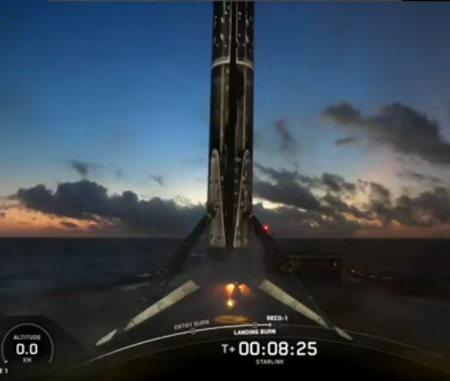
Shortly thereafter the company launched another 27 Starlink satellites, its Falcon 9 rocket lifting off from Vandenberg Space Force Base in California. The first stage (B1063) completed its 30th flight, landing on a drone ship in the Pacific. This stage is now the third Falcon 9 booster to reach 30 reuses:
» Read more

11 comments

December 16, 2025 Quick space links

Courtesy of BtB’s stringer Jay. This post is also an open thread. I welcome my readers to post any comments or additional links relating to any space issues, even if unrelated to the links below.

15 comments

Mars Reconnaissance Orbiter’s high resolution camera takes its 100,000 picture

Oblique view
Click for original image.

Cool image time! On October 7, 2025, the science team that operates HiRISE, the high resolution camera on Mars Reconnaissance Orbiter (MRO), took its 100,000th picture since entering Mars orbit in March 2006.

The objective of this observation is to better resolve sand dunes and the rocky material underneath them. These dark, eroded rocks may be the source for some of these Syrtis Major sand dunes. Our image was suggested by a high school student enrolled in the Jefferson County Executive Internship program in Colorado in 2023, one of many public outreach programs the HiRISE Team engages in.

To celebrate this accomplishment and the fantastic geology of the scene, students and staff in the HiRISE Photogrammetry lab constructed this digital terrain model. This oblique image highlights the hummocky mounds of the plains that border Jezero Crater, which are among the oldest on Mars.

That oblique image, cropped, reduced, and sharpened to post here, is to the right. The location is about 50 miles to the southwest of Jezero Crater where the rover Perseverance landed.
» Read more

6 comments

Astronomers propose a new explanation for “Bright Blue Outbursts”

Among the number of quick transient events discovered by the new automated survey telescopes on the ground and in space that have been built in the past two decades are something astronomers have labeled “bright blue outbursts”, bright flashes of blue and ultraviolet light that appear quickly and then fade away, leaving behind X-ray and radio emissions.

There are several theories as to what causes these flashes, but none are accepted whole-heartedly. Now a team of astronomers have looked at one flash and proposed a new theory.

This curious class of objects is known as luminous fast blue optical transients (LFBOTs), and with slightly more than a dozen discovered so far, astronomers have debated whether they are produced by an unusual type of supernova or by interstellar gas falling into a black hole.

Analysis of the brightest LFBOT to-date, named AT 2024wpp and discovered last year, shows that they’re neither. Instead, a team led by researchers from the University of California, Berkeley, concluded that they are caused by an extreme tidal disruption, where a black hole of up to 100 times the mass of our Sun completely shreds its massive star companion within days.

… “The sheer amount of radiated energy from these bursts is so large that you can’t power them with a core collapse stellar explosion — or any other type of normal stellar explosion,” says Natalie LeBaron, UC Berkeley graduate student and first author on the paper presenting the Gemini data [1]. “The main message from AT 2024wpp is that the model that we started off with is wrong. It’s definitely not just an exploding star.”

The researchers hypothesize that the intense, high-energy light emitted during this extreme tidal disruption was a consequence of the long parasitic history of the black hole binary system. As they reconstruct this history, the black hole had been sucking material from its companion for a long time, completely enshrouding itself in a halo of material too far from the black hole for it to swallow.

Need I mention that this theory, while better explaining the data, remains unconfirmed and decidedly uncertain.

2 comments

France and U.S. militaries complete rendezvous maneuvers in orbit

According to a statement by France’s military, the U.S. and France have successfully completed planned rendezvous maneuvers by two of their satellites in orbit.

These operations also apparently included the United Kingdom.

While the neither the US nor its allies have made public the satellites involved in any of the joint RPOs, the private space tracking firm COMSPOC said Sept. 19 that the maneuvers with the UK involved a US Geosynchronous Space Situational Awareness Program (GSSAP) neighborhood watch bird. The GSSAP satellite, USA 271, began moving on Sept. 5 and on Sept. 12 stopped just 13 kilometers (8.1 miles) from the UK’s SKYNET 5A military communications bird, the firm explained.

COMSPOC also watched the Franco-American pas-de-deux, which a company spokesperson told Breaking Defense involved another GSSAP, USA 324, and France’s SYRACUSE 3A. The satellites performed three sets of maneuvers: Nov. 11-14; Nov. 22-23; and Nov. 28-29, according to COMSPOC’s observations. “In all these movements, SYRACUSE 3A seems to lead and USA 324 seems to follow as the maneuvers performed by USA 324 is lagged by a day,” the spokesperson said, with the closest approach being about 25.1 kilometers (15.6 miles). [emphasis mine]

I have highlighted the distances above because these military maneuvers are actually quite unimpressive when compared with similar recent commercial rendezvous and proximity tests in orbit. The just completed Impulse/Starfish test for example got within 1.25 kilometers. And in 2024 Japan’s Astroscale did proximity operations within 50 meters of an old abandoned upper stage.

I suspect the best thing these militaries could do is to stop wasting money trying to do this themselves, and just hire the commercial companies instead. They’d do much better.

3 comments

Two launches early today

Both China and the American company ULA successfully completed launches since yesterday.

First, China placed the third satellite in an new Earth observation constellation, its Long March 4B rocket lifting off from its Taiyuan spaceport in northeast China.

Developed by the China Academy of Space Technology, the satellite will join the Ziyuan III 02 and 03 satellites already in orbit to form a high-precision observation constellation. Equipped with a stereoscopic mapping camera, multispectral camera, and laser altimeter, it will capture high-resolution 3D imagery critical for geographic data collection and natural resource management.

It appears however that this constellation is used by China’s military, so I suspect its purposes do not exactly match this description. China’s state-run press also provided no information as to where the rocket’s lower stages, using very toxic hypergolic fuels, crashed inside China.

Next, ULA launched another 27 Leo satellites for Amazon, its Atlas-5 rocket lifting off from Cape Canaveral in Florida. Amazon now has 181 satellites in orbit, with a requirement to get about 1,600 in orbit by July 2026 to meet its FCC license obligations. As it took about eight months to get those first 181 satellites into space (with SpaceX launching 72), Amazon’s three launch providers, ULA (42 launches), Arianespace (18 launches), and Blue Origin (27 launches), will have to ramp up their launch rate significantly to get even close to meeting those obligations in the next six months. There is also a question whether Amazon can manufacture enough satellites at a fast enough pace for those rockets.

As for the rocket, ULA now has only ten Atlas-5 rocket left in stock, with four reserved for Leo launches and six for Boeing’s Starliner manned capsule.

This was also ULA’s sixth launch in 2025. The leaders in the 2025 launch race:

166 SpaceX
84 China (a new record)
16 Rocket Lab
15 Russia

SpaceX now leads the rest of the world in successful launches, 166 to 138.

3 comments

Updates on the status of two Mars missions, Maven and Escapade

NASA today posted two separate updates on the status of two of its missions to or at Mars.

First, it appears there is an issue with one engine on one of the two Escapade orbiters on their way to their parking orbit where they will await the right moment to head to Mars.

During trajectory correction maneuvers for NASA’s twin ESCAPADE spacecraft on Dec. 8 and Dec. 12, the mission operations team noticed low thrust during the burn for one of the spacecraft. The team is working to identify the cause and will attempt a trajectory correction maneuver in the coming weeks.

The other spacecraft has successfully completed its two trajectory correction maneuvers, as planned. Both spacecraft are operating normally otherwise, and currently there are no long-term impacts from the trajectory correction delay.

While not the best news, this issue does not at this moment appear critical.

The second update however was even more negative. It appears engineers have not yet been able to re-establish contact and control of the Mars orbiter Maven.

To date, attempts to reestablish contact with the spacecraft have not been successful. Although no spacecraft telemetry has been received since Dec. 4, the team recovered a brief fragment of tracking data from Dec. 6 as part of an ongoing radio science campaign. Analysis of that signal suggests that the MAVEN spacecraft was rotating in an unexpected manner when it emerged from behind Mars. Further, the frequency of the tracking signal suggests MAVEN’s orbit trajectory may have changed. The team continues to analyze tracking data to understand the most likely scenarios leading to the loss of signal. Efforts to reestablish contact with MAVEN also continue.

It appears the loss of Maven is also impacting communications with the two Mars rovers Curiosity and Perseverance. While NASA has use of three orbiters at present, Mars Reconnaissance Orbiter, Mars Odyssey, and Europe’s Trace Gas Orbiter, to relay data from the ground to Earth, the loss of Maven reduces that communications network by 25%. Engineers are revising plans to make up some of the loss, but operations for both rovers will be for the time being reduced somewhat.

15 comments
1 6 7 8 9 10 182