
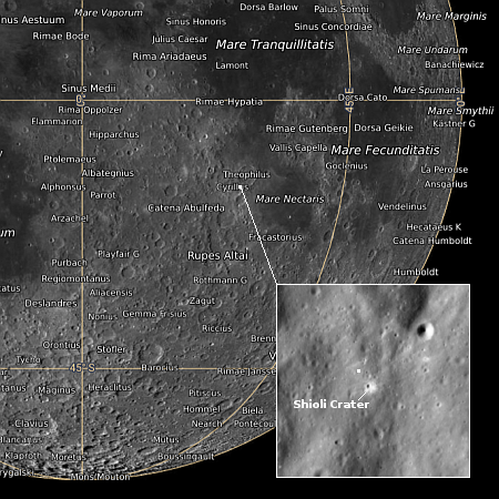
Chandra: New X-ray composite images of galaxies and supernovae remnants
Click for original image.
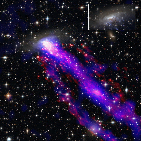
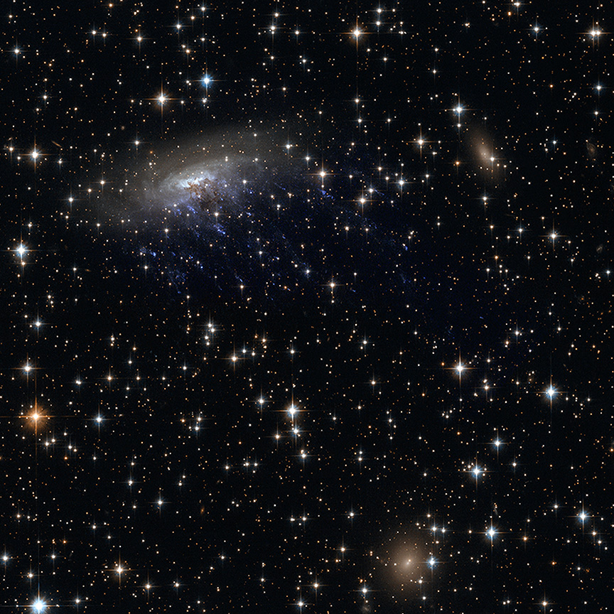
The science team for the Chandra X-Ray observatory today released five new composite images of two galaxies, two supernovae remnants, and the center of the Milky Way, combining data from multiple telescopes looking in radio, infrared, optical, and X-ray wavelengths.
The image to the right, reduced and sharpened to post here, is one of those pictures. From the press release:
As the galaxy moves through space at 1.5 million miles per hour, it leaves not one — but two — tails behind it. These tails trailing after ESO 137-001 are made of superheated gas that Chandra detects in X-rays (blue). ESO’s Very Large Telescope shows light from hydrogen atoms (red), which have been added to the image along with optical and infrared data from Hubble (orange and cyan).
The inset shows just the Hubble optical image, reduced by about 50%, to get a clearer sense of the galaxy itself. It appears to be a jelly-fish galaxy, flying through space at right angles to its plane and with tendrils of stars trailing off below.
The other four images are as interesting. The full set, including separate images in the individual wavelengths prior to combination, can be found here.
Click for original image.
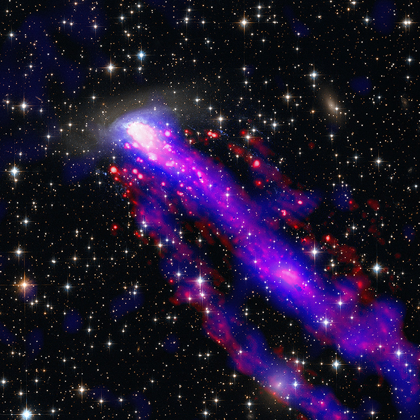
The science team for the Chandra X-Ray observatory today released five new composite images of two galaxies, two supernovae remnants, and the center of the Milky Way, combining data from multiple telescopes looking in radio, infrared, optical, and X-ray wavelengths.
The image to the right, reduced and sharpened to post here, is one of those pictures. From the press release:
As the galaxy moves through space at 1.5 million miles per hour, it leaves not one — but two — tails behind it. These tails trailing after ESO 137-001 are made of superheated gas that Chandra detects in X-rays (blue). ESO’s Very Large Telescope shows light from hydrogen atoms (red), which have been added to the image along with optical and infrared data from Hubble (orange and cyan).
The inset shows just the Hubble optical image, reduced by about 50%, to get a clearer sense of the galaxy itself. It appears to be a jelly-fish galaxy, flying through space at right angles to its plane and with tendrils of stars trailing off below.
The other four images are as interesting. The full set, including separate images in the individual wavelengths prior to combination, can be found here.


