Bursting ice sheets on Mars

Ice sheets on Mars
Click for original image.

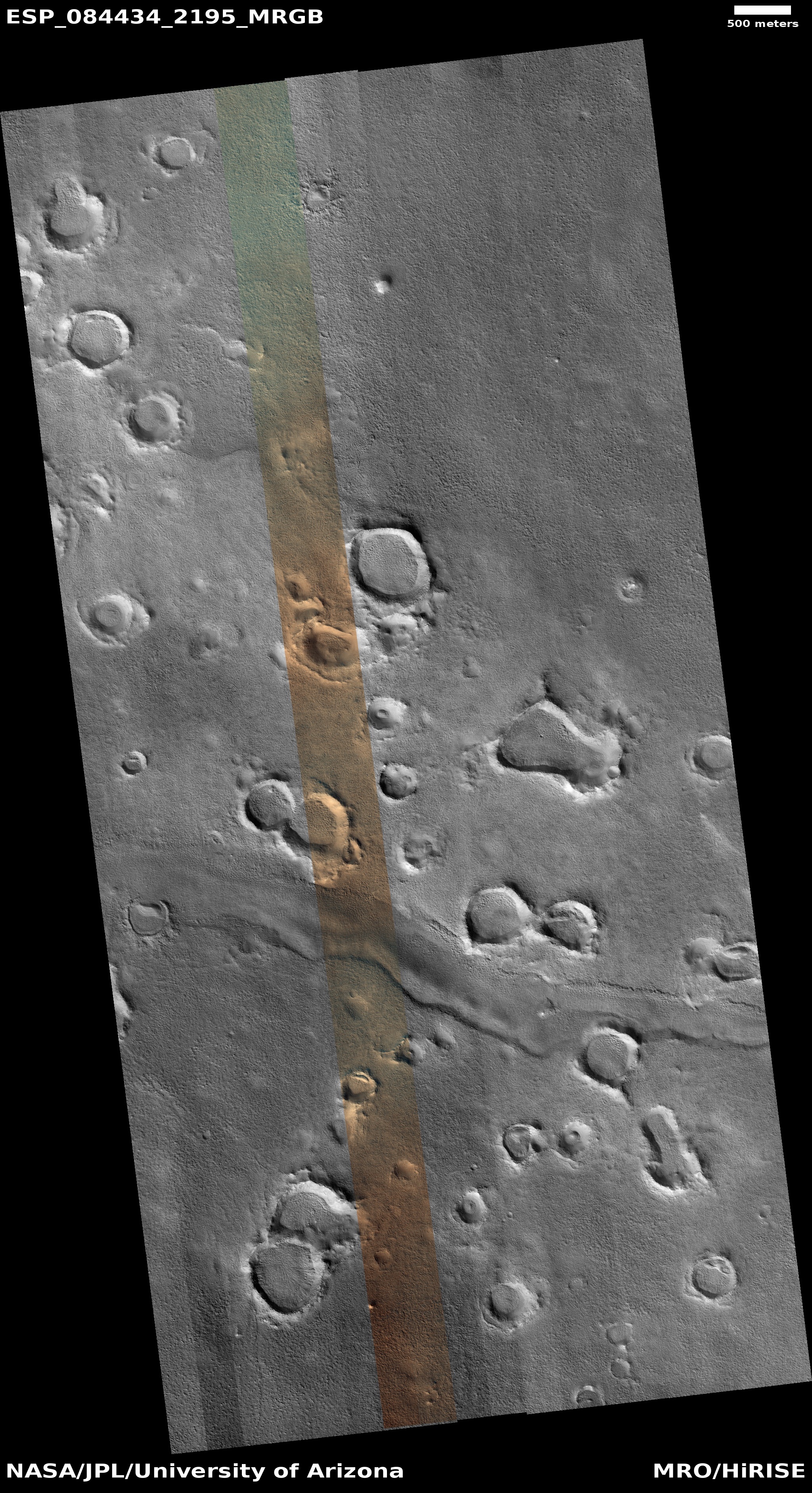
Cool image time! The picture to the right, cropped, reduced, and sharpened to post here, was taken on July 31, 2024 by the high resolution camera on Mars Reconnaissance Orbiter (MRO). Labeled simply as a “terrain sample” by the camera team, it was likely taken not as part of any specific research project but to fill a gap in the camera’s schedule in order to maintain its proper operating temperature.

In this case the camera team picked a spot in the northern lowland plains at 39 degrees north latitude. What they got was another great piece of evidence of the existence of a lot of near surface ice on Mars, so much so at this location that the craters have become distorted and blobby. The ice in the ground is unstable enough that nothing here can really hold its shape from season to season and from decade to decade.

As I have noted repeatedly in the past six years, MRO data is proving that Mars is not a dry desert like the Sahara, but an icy desert like Antarctica. Except for the planet’s dry tropics below 30 degrees latitude, Mars appears to have a lot of frozen water available relatively near the surface.
» Read more
0 comments

Mars geology at its strangest

Strange Martian geology
Click for original image.

Cool image time! The picture to the right, cropped and reduced to post here, was taken on July 29, 2024 by the high resolution camera on Mars Reconnaissance Orbiter (MRO). It shows the northeast quadrant of a weirdly distorted unnamed 3-mile-wide crater in the northern lowland plains of Mars. The crater rim is the ridgeline that enters from picture’s left edge to curve down to exit at bottom right.

The geological feature of interest however is the strange mound to the left of that rim, inside the crater. It certainly appears, based on shadows, that the top of this mound popped off at some time in the past, leaving behind that sharp-edged hollow.

Note however that there is no eruption debris. When a volcano erupts, the debris covers the nearby mountainside. Here we see no evidence of anything that was flung out from this small eruption.
» Read more

0 comments

Ridges from fractures at the head of a 300+mile-long Martian drainage channel

Ridges from fractures on Mars
Click for original image.

Cool image time! The picture to the right, cropped, reduced, and sharpened to post here, was taken on October 4, 2024 by the high resolution camera on Mars Reconnaissance Orbiter (MRO).

The science team labels this “Exhumed Fracture Network,” referring to the criss-crossing ridges on the eroded mesa at the picture’s center. That mesa only rises about sixty feet from the east-west channel at the top of the picture, but the location is actually on the outside northern rim of an unnamed 70-mile-wide very eroded ancient crater. The rim itself rises another 500 feet to the south before descending 10,000 feet to the crater floor.

I am assuming by the title that the geologists believe this ridges were originally cracks that got filled with more resistant material, probably lava. The fracture network then got covered over. More recent erosion removed the material around the cracks, but the material in the cracks resisted that erosion.

The most intriguing feature in this picture however might actually be that nondescript channel.
» Read more

7 comments

The mysteries buried in the Martian south pole ice cap

The mysterious layers in Mars' south pole ice cap
Click for original image.

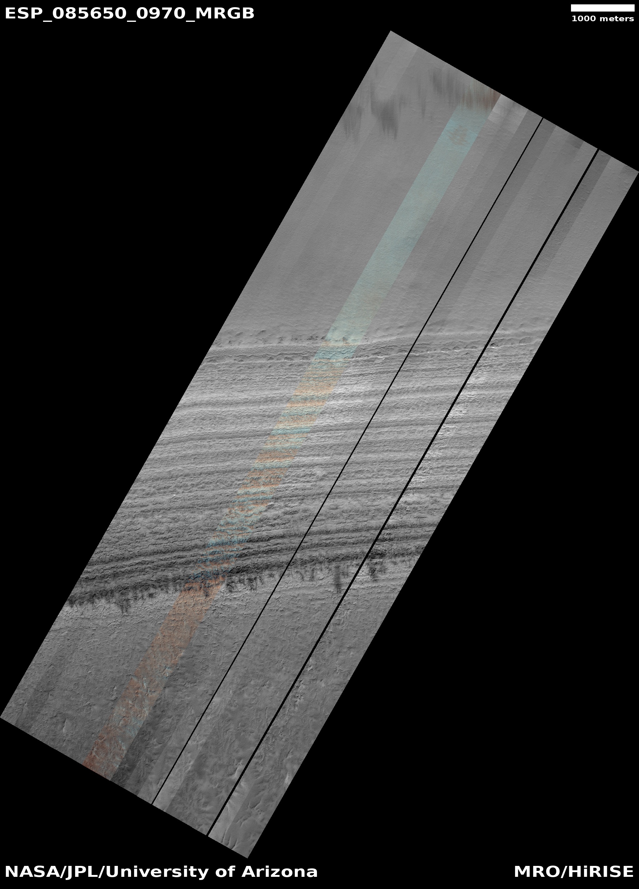
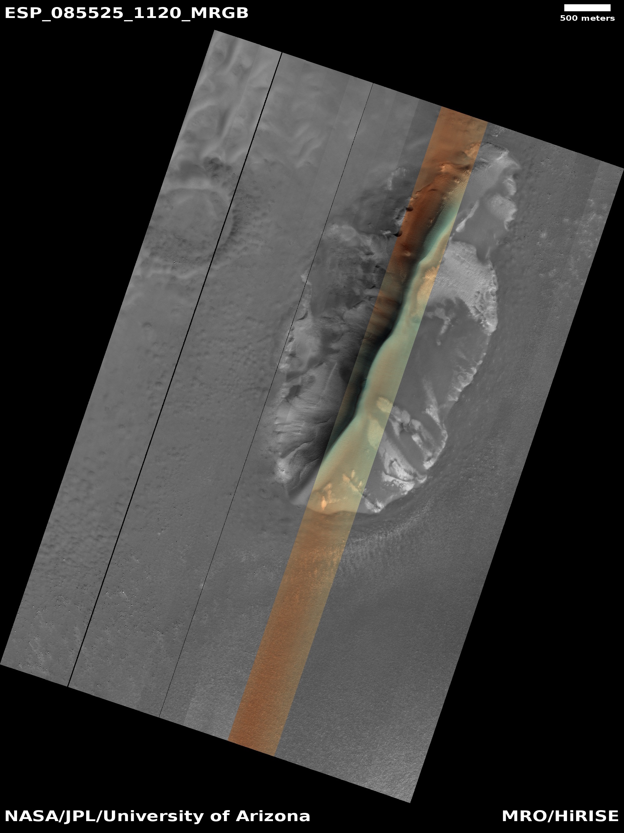
Cool image time! The picture to the right, cropped and color-enhanced to post here, was taken on November 3, 2024 by the high resolution camera on Mars Reconnaissance Orbiter (MRO).

The picture is labeled as a “terrain sample,” which means it was likely taken not as part of any specific research project, but to fill a gap in the camera schedule in order to maintain the camera’s proper temperature. In this case the camera team tries to choose interesting features, though sometimes they can’t due to timing.

In this case they were able to target a nice piece of geology, a layered 2,000 foot cliff on the outer edge of the south pole ice cap. The color strip illustrates the possibilities within those layers. I have significantly enhanced the colors to bring out the differences. The orange suggests dust, the aqua-blue water ice, though these colors could also indicate interesting mineralogies.
» Read more

0 comments

Graceful beauty found within the mid-latitude glaciers of Mars

Overview map

Graceful beauty found within the glacial mid-latitudes of Mars
Click for original image.

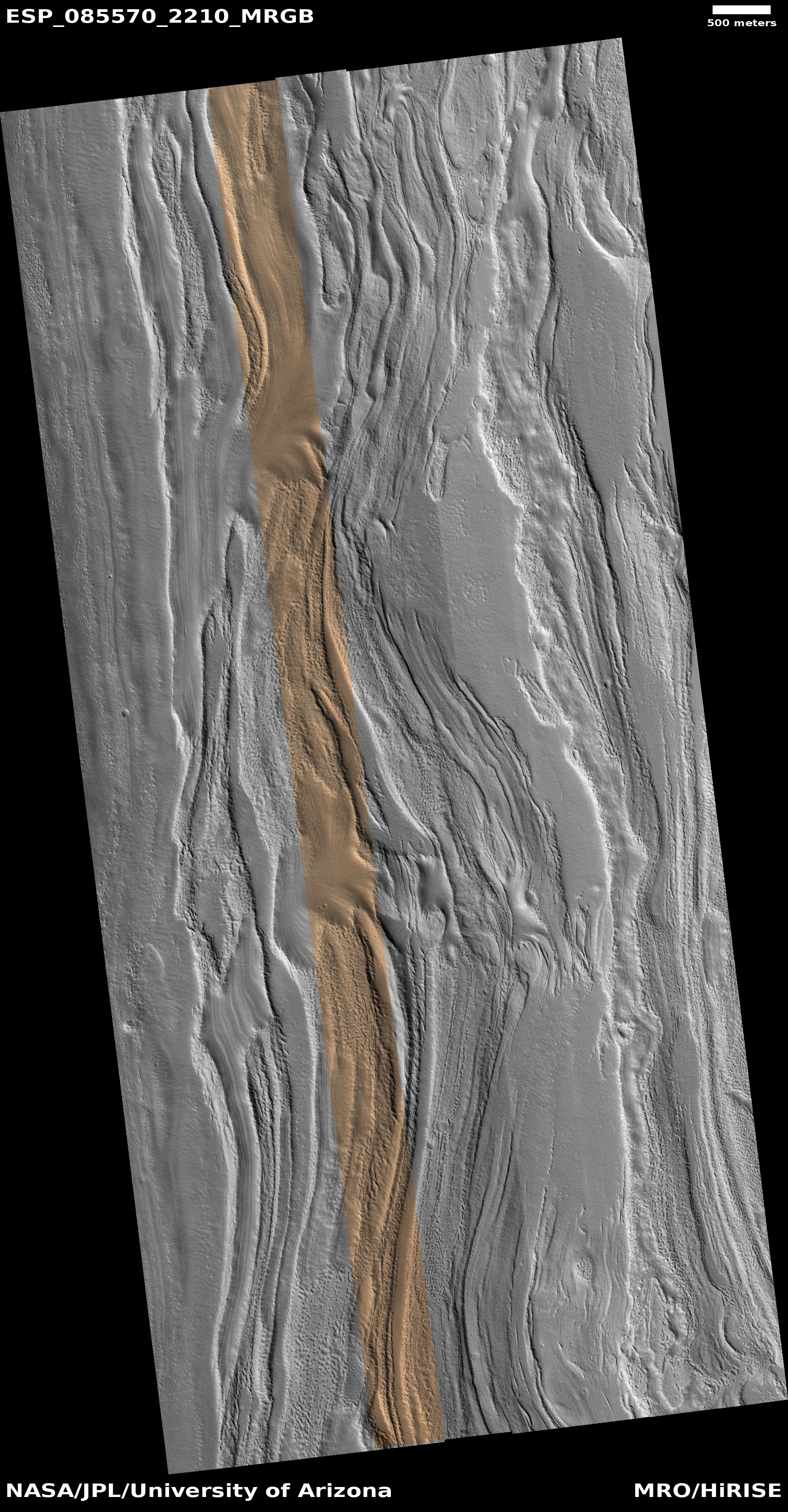
Cool image time! The picture to the right, rotated, cropped, reduced, and sharpened to post here, was taken on October 27, 2024 by the high resolution camera on Mars Reconnaissance Orbiter (MRO).

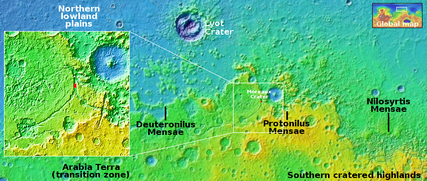
The red dot on the overview map above marks the location, about 35 miles southwest of the rim of 80-mile-wide Moreau Crater. This location is also deep within the 2,000-mile-long northern mid-latitude strip I label glacier country, as almost every high resolution picture from MRO shows glacial features.

This picture is no different, in that it shows the typical lineated parallel grooves seen on the surface of glaciers both on Earth and Mars, and especially found on glaciers flowing within a narrow canyon, as this glacier is. The parallel grooves are caused by the waxing and waning of the glacier. Each layer represents a past period when ice was being deposited on the surface, with the grooves indicates times when that ice was sublimating away. The graceful curves of the grooves is due to the drift of the glacier itself downhill.

This canyon is about seven miles wide at this point, formed from the confluence of two southerly tributaries to the south. The downward grade is to the north, but the low point is not where you would expect, out into the northern lowland plains. Instead, I have marked the low point in the inset with a white dot, inside the canyon itself. It appears this glacier drains into this low spot, but then this debris-covered ice appears to vanish.

It can’t really vanish, but there is a geological mystery here that involves the alien nature of Mars. For some reason the glacier dies at this point, its material sublimating away. Is there a drainage here that sends the ice to the north by underground passages? Your guess is as good as mine.

The lineated nature of this glacial flow however is no mystery in one respect. It is quite beautiful, as seen from space.

0 comments

Mars gives us another “What the heck?” image

Another
Click for original image.

Cool image time! The picture to the right, rotated, cropped, reduced, and sharpened to post here, was taken on October 2024 by the high resolution camera on Mars Reconnaissance Orbiter (MRO).

The science team labels this “layered rock.” I label it another one of my “What the heck is that?” images on Mars. If I didn’t know this was an orbital image looking down at an alien planet, I’d think it was a paisley pattern on a piece of dark fabric.

The converging “streams” suggest flows, but there really is no clear downhill grade, the landscape generally flat. The lighter patches suggest either higher terrain the flows went around, or places where something bubbled up from below. Or maybe the “flows” are actually cracks that the bubbling material filled as it rose.

I have no idea if any of these theories is right.
» Read more

0 comments

A strange dune in the high southern latitudes of Mars

A strange dune in the high latitudes of Mars
Click for original image.

Cool image time! The picture to the right, rotated, cropped, reduced, and sharpened to post here, was taken on October 24, 2024 by the high resolution camera on Mars Reconnaissance Orbiter (MRO). I have also rotated the image so that north is to the top.

The scientists label this a “dune with seasonally persistent light-toned features.” As the location is in the high southern latitudes, only about 800 miles from the south pole, light-toned features should vary by seasons, as such features usually signal the coming and going of frost, whether it be water ice or dry ice. In this case however the light tones remain from season to season, which suggests the lighter colors are intrinsic to the ground and possibly signal some interesting geology or mineralogy.

The color strip down the center of the dune is an effort to decipher this question. According to the explanation about the colors [pdf] provided by the science team, the orange and light green probably indicates fine dust, while the greenish area along the ridge’s rim as well as its eastern slope suggests frost. Thus, based on the superficial information available to the public, the colors tell us little.
» Read more

1 comment

A fading supernova 650 million light years away

A fading supernova 650 million light years away
Click for original image.

Cool image time! The picture to the right, cropped, reduced, and sharpened to post here, was taken by the Hubble Space Telescope in March 2024, and shows the fading blue light of a supernova that was first discovered by another survey telescope six weeks earlier. The galaxy, dubbed LEDA 22057, is estimated to be about 650 million light years away.

The supernova is the bright spot in the galaxy’s southeast quadrant near the edge of the galaxy’s bright body. From today’s caption release:

SN 2024PI is classified as a Type Ia supernova. This type of supernova requires a remarkable object called a white dwarf, the crystallised core of a star with a mass less than about eight times the mass of the Sun. When a star of this size uses up the supply of hydrogen in its core, it balloons into a red giant, becoming cool, puffy and luminous. Over time, pulsations and stellar winds cause the star to shed its outer layers, leaving behind a white dwarf and a colourful planetary nebula. White dwarfs can have surface temperatures higher than 100,000 degrees and are extremely dense, packing roughly the mass of the Sun into a sphere the size of Earth.

While nearly all of the stars in the Milky Way will one day evolve into white dwarfs β€” this is the fate that awaits the Sun some five billion years in the future β€” not all of them will explode as Type Ia supernovae. For that to happen, the white dwarf must be a member of a binary star system. When a white dwarf syphons material from a stellar partner, the white dwarf can become too massive to support itself. The resulting burst of runaway nuclear fusion destroys the white dwarf in a supernova explosion that can be seen many galaxies away.

The rate in which this supernova fades will help astronomers untangle the processes that cause these gigantic explosions. Though the caption makes it sound as if we know how this happens, we really don’t. There are a lot of assumptions and guesses involved in the description above, based on the limited knowledge astronomers have gathered over the past few centuries looking at many supernovae many millions of light years away.

1 comment

Why this place in Valles Marineris is NOT a good place to establish trails and inns

Overview map

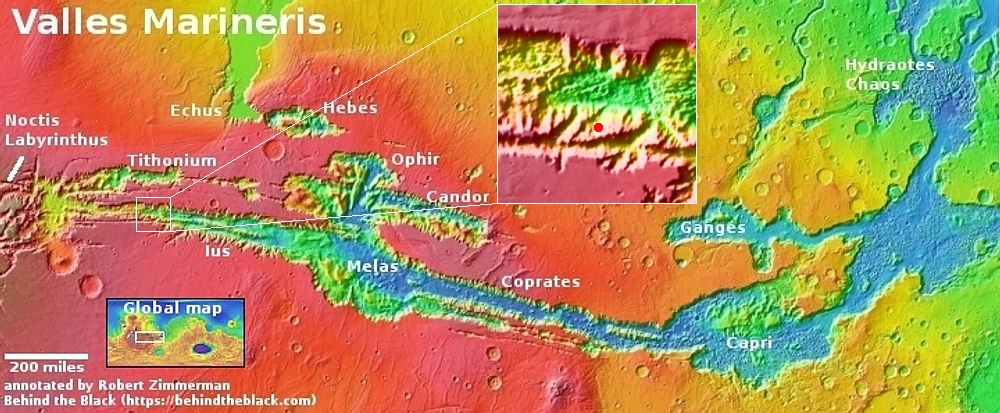
North rim and the top of the trail
Click for original image.

In my cool image yesterday I highlighted a location along the north rim of the gigantic Valles Marineris canyon on Mars that appeared a great place to establish a hiking trail. The trail would take hikers down from the rim to the floor of the canyon, a distance of more than 20 miles with an elevation loss of more than 31,000 feet, more than the height of Mount Everest. The image to the right shows the top of that trail, at the rim. The white dot on the overview map above shows its location in Valles Marineris.

Because of the trail’s length I also suggested that future colonists would likely set up inns along the way, so that hikers would have places to stay as they worked their way downhill day-by-day.

There is however one major reason not to build at this particular location, and it involves the most significant geological detail I noticed in the picture to the right. Note the arrows in both this image as well as the inset above. In the picture they mark a sudden drop paralleling the rim. In the inset they also show a series of parallel cracks further north.

The cliff and the cracks suggest that the entire cliff of this part of the north rim has subsided, and is in fact beginning to separate from the plateau, and will soon (in geological terms) collapse into a spectacular avalanche. If you look at the cliff face in the inset you can see two extended outflow piles that apparently came from smaller earlier such collapses.

Could this entire cliff face, the size of Mount Everest, actually separate and crash into the canyon? If you have doubts, then take a look at the image below.
» Read more

3 comments

Just one of many potential hiking trails down into Valles Marineris

Overview map

Just one of many potential trails into Valles Marineris
Click for original image.

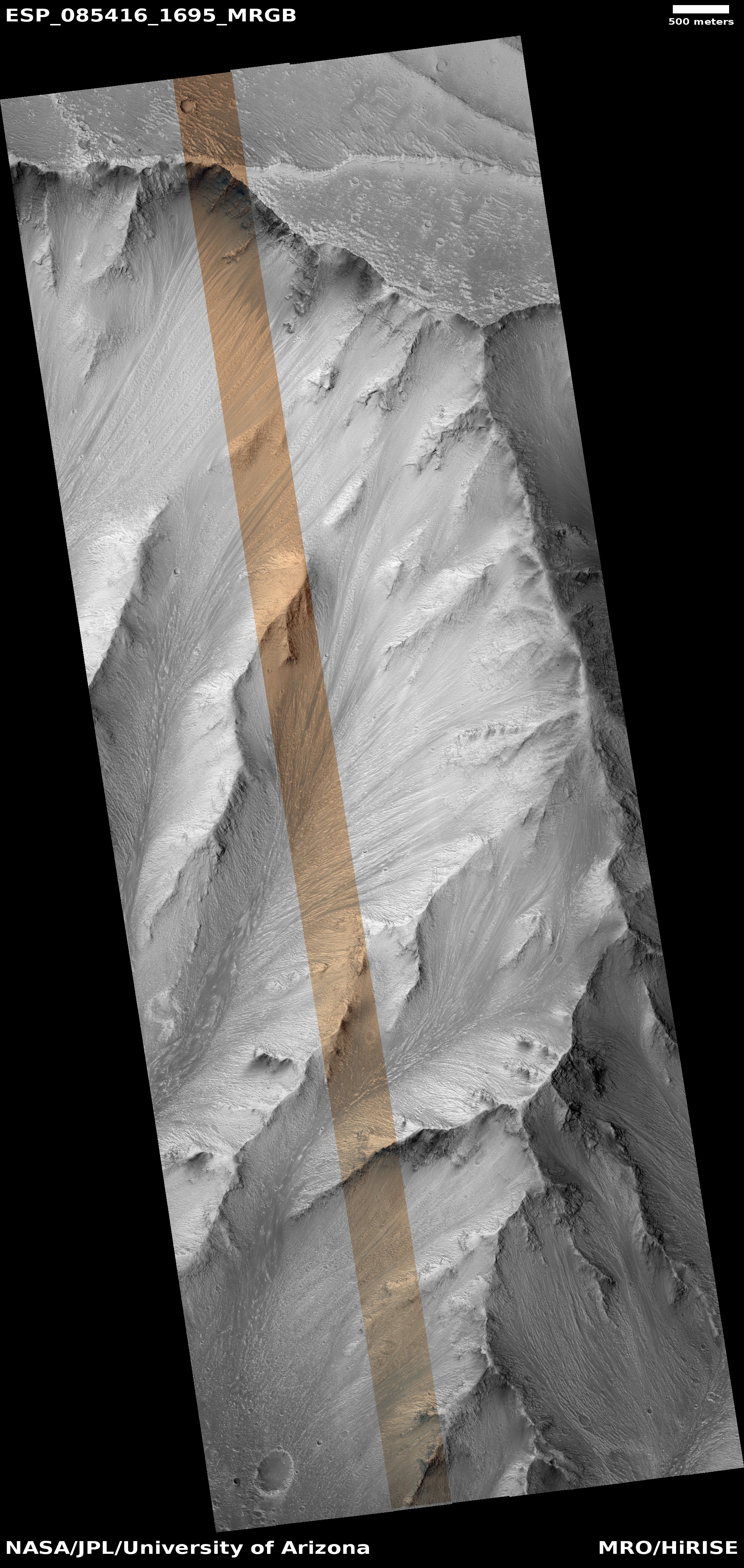
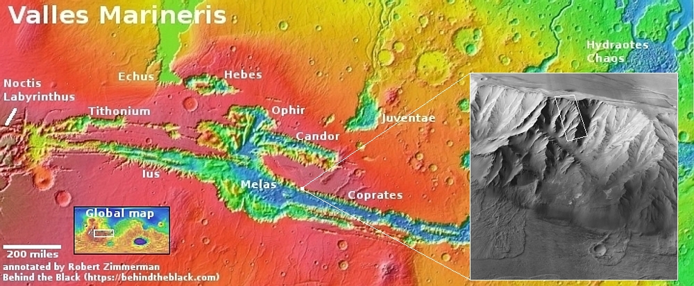
Cool image time! The picture to the right, rotated, cropped, reduced, and sharpened to post here, was taken on October 15, 2024 by the high resolution camera on Mars Reconnaissance Orbiter (MRO). The white dot on the overview map above shows the location, on the northern interior wall of the vast Valles Marineris canyon on Mars.

As my readers know, I tend to look at the spectacular Martian photos coming back from the orbiters and rovers as much from a tourist perspective as that of a scientist. Thus, for this picture, my first thought was to consider the possibility of a trail weaving its way down the nose of that ridgeline and into the canyon. In the Grand Canyon such ridgelines often provide a route down where walking is possible the entire way, with no need for climbing or ropes.

To illustrate my thought, I have indicated the potential trail with the white line. All told this trail covers about 7.2 miles, and drops 12,500 feet. Such a drop is very steep for trails on Earth, with an average grade of 14 degrees and about three times the grade considered reasonable. On Mars, however, with its one-third gravity, I think a grade this steep would be reasonable, though certainly daunting mentally. You would not only be descending on a very steep slope, you would be doing so on the peak of this ridge, with drops of one to two thousand feet on either side.

Amazingly, the inset on the overview map shows that this trail gets you less than halfway to the bottom. All told, the drop from canyon rim to floor at this location is about 31,000 feet over 20 miles, a drop that is greater than climbing down from the top of Mount Everest. If I was to install a trail here I’d also build an inn or two along the way as rest stops for hikers.

What the trail would do is get you to the bottom of this particular ridgeline. From here the trail would have to drop off into the western hollow and from then on descend on top of its alluvial fill. The slope would be as steep, but it would be possible to alleviate that by putting in switchbacks. This would lower the grade, but increase the distance traveled significantly.

Geologically, this image shows to my eye one particular feature that is quite significant, at the rim. I will discuss this tomorrow, in my next cool image.

3 comments

A Martian river of sand

Overview map

A Martian river of sand

Cool image time! The picture to the right, rotated, cropped, reduced, and sharpened to post here, was taken on July 26, 2024 by the high resolution camera on Mars Reconnaissance Orbiter (MRO). The red dot in the overview map above marks the location, within the western reaches of the vast Martian canyon dubbed Valles Marineris.

The picture looks at the flow of dust and sand going down the canyon’s southern rim, with particular focus on the central canyon in the picture’s center. The photo was taken as part of a long-term project, begun in 2020 to monitor this river of sand to see if any changes occur over time. Clearly the sand is flowing downhill, almost like a river, with the dunes almost resembling waves. The geological issue is to determine how fast. Based on the resolution available to me, it is impossible to tell it there have been any changes in the past four years, but the full MRO dataset might reveal more information.

To get an idea of scale, the elevation loss from the top to the bottom in this picture is about 6,000 feet. While this seems like a substantial amount, it pales when placed in the context of Valles Marineris. For example, the elevation loss for the canyon’s northern wall is about 25,400 feet, making that wall exceed in height most of the mountains in the Himalayas. And that wall extends for more than 1,500 miles.

Valles Marineris’ southern wall is more complex. It rises about 18,000 feet from the floor of the canyon to the top of the peak on which this slope sits, but then drops 6,700 feet into a parallel side canyon. From there the rise to the southern rim is about 11,000 feet. All told the southern rim sits about 23,000 feet above the canyon floor, once again a drop that would exceed most mountains on Earth.

0 comments

Perseverance takes its first good look west at its future journey

Peservance looks west
Click for original image.

Cool image time! The picture to the right, reduced and enhanced to post here, was taken today by the left navigation camera on the Mars rover Perseverance. Though I am not 100% certain, I think this picture looks almost due west, and is aimed not only at the rover’s near term target, Witch Hazel Hill, but the rover’s long term and very important goal, the Nils Fossae ridge and canyon that appears to be crack formed during the impact that created giant 745-mile-wide Isidis Basin. Jezero Crater sits on the western rim of that impact basin.

The rover team expects to reach Witch Hazel Hill within days. To get there quickly the team has moved the rover more than a thousand feet west and dropped down from the rim about 170 feet in just the past ten days.
» Read more

0 comments

Land of dust devils

Land of dust devils
Click for original image.

Today’s cool image to the right demonstrates that the atmosphere and climate of Mars is truly different in different places. The picture, rotated, cropped, reduced, and sharpened to post here, was taken on July 22, 2024 by the high resolution camera on Mars Reconnaissance Orbiter (MRO). Labeled simply as a “terrain sample”, it was likely taken not as part of any specific research project but to fill a gap in the camera’s schedule in order to maintain its proper temperature.

I post it today almost to illustrate the difference between this location and the spot where the lander Insight landed on Mars. Earlier this week the MRO camera team released a short movie created by images of the lander taken over six years, showing how the dust around it had changed over time. I noted further how those images showed a very small number of dust devil tracks, which explained why no dust devil every crossed over the lander’s solar panels to clean them of dust.

For the picture on the right, however, there are a lot of dust devil tracks, so many near the bottom that they almost completely darken the ground.
» Read more

0 comments

Curiosity looks down and across Gale Crater

Curiosity looks down across Gale Crater
Click for original image.

Cool image time! The picture to the right, cropped, reduced, and enhanced to post here, was part of a panorama created by 24 photos taken by the right navigation camera on the Mars rover Curiosity on December 16, 2024.

The view looks west at the foothills that fill the lower slopes of Mount Sharp. In the far distance, about 20 to 30 miles away, can be seen the western rim of Gale Crater, obscured by the dust in the Martian atmosphere.

Curiosity is presently contouring west along the mountain slope. As it goes it will pass a series of canyons coming down the mountainside. The goal is to eventually reach the canyon the science team has chosen to take for climbing that mountain.

Note the rocky ground. One of the surprises found as Curiosity left the crater floor and started climbing Mount Sharp about four years ago is the rockiness of the terrain. Unlike Earth, Mars’s atmosphere and environment does not have the activity to smooth out this landscape. While science data suggests flowing water was once present here, it wasn’t here long enough to smooth things out. And the atmosphere is just too thin.
» Read more

0 comments

Land of knobs

Land of knobs
Click for original image.

Cool image time! The picture to the right, rotated, cropped, reduced, and sharpened to post here, was taken on July 17, 2024 by the high resolution camera on Mars Reconnaissance Orbiter (MRO). Labeled merely as a “terrain sample,” it was likely taken not as part of any specific research project, but to fill a gap in the camera’s schedule in order to maintain its proper temperature.

When the camera team does this, they try to pick interesting targets. In this case, they targeted this 400-foot-high pointy-topped hill. The smoothness of its slopes suggest this hill is made up largely of packed dust, possibly a hardened former dune. This hypothesis seems strengthened by the erosion on the eastern slopes, which appears to be areas where that packed sand has worn or blow away.

Think of sandstone in the American southwest. It is made of sand that has hardened into rock, but wind and water and friction can easily break it back into dust particles, resulting often in the spectacular and weird geological shapes that make the southwest so enticing.

But is this sand?
» Read more

2 comments

“Thar’s ice in them hills!”

Overview map

Thar's ice in them hills!
Click for original image.

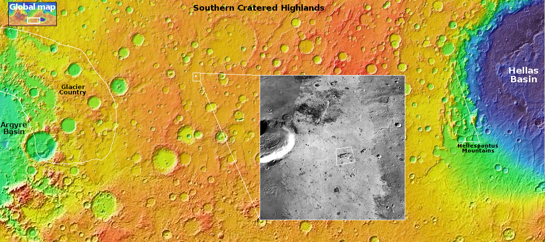
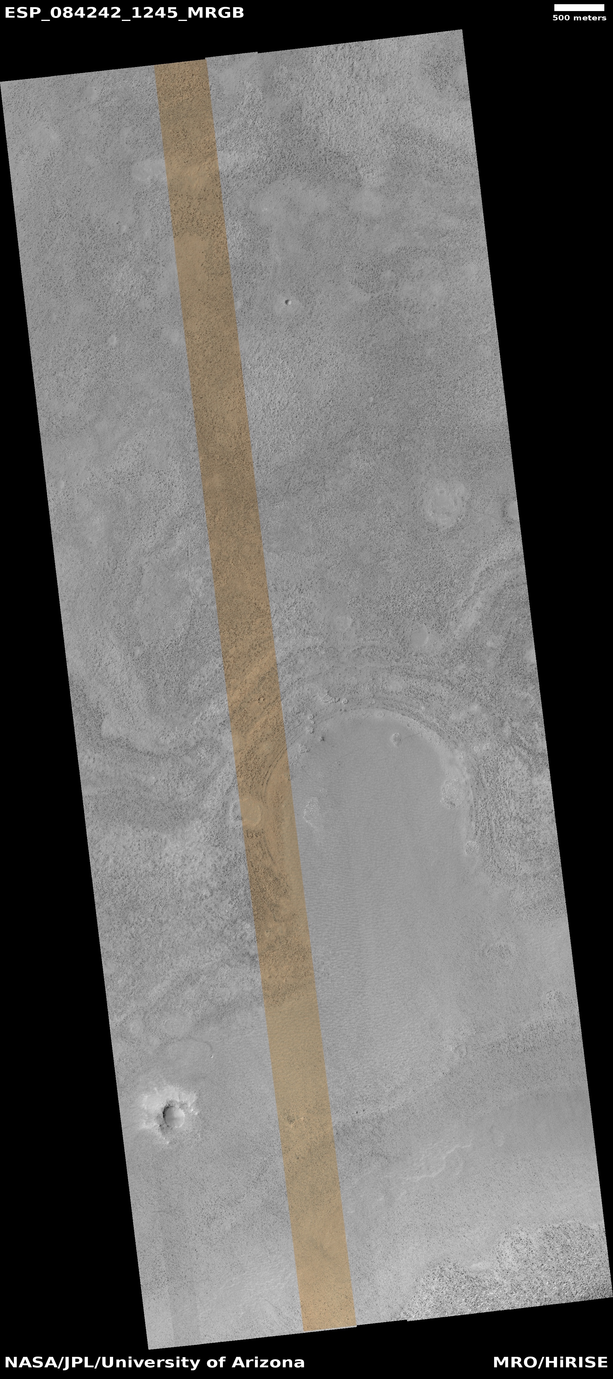
Cool image time! The picture to the right, cropped, reduced, and sharpened to post here, was taken on September 25, 2024 by the high resolution camera on Mars Reconnaissance Orbiter (MRO). It shows what the camera team labels as a “mound in the southern highlands.”

The mound in question sits in the center of the sunken depression, and at the highest resolution shows its top to be cracked and broken, as if something is attempting to break out by pushing up from below.

Everything about this picture screams near-surface ice. The cracked mound suggests ice sublimating into gas, which applies pressure to the surface and thus the cracks. The depression suggest that much of the near-surface ice at this location has already disappeared, causing the ground to sag. All the craters lack upraised rims. If caused by impacts, the ground here was soft enough that the impactor simply sank into the ground. Imagine dropping a rock you’ve heated into snow. It would simply leave a hole.

But there’s more. The white dot in the overview map above marks the location. In the inset, the lighter area surrounding this depression resembles an ice sheet that is slowly sublimating away. There are also other similar depressions in that lighter area. The lighter area also has fewer craters than the darker regions nearby, suggesting that this ice sheet covers the older impacts.

The location is in the southern cratered highlands in a mid-latitude region where many images indicate the existence of layers of ice deep below ground. This picture is more evidence of the same, but it also indicates the presence of ice very close to the surface as well.

The orbital data continues to tell us that Mars is not a dry desert like the Sahara, but an icy desert like Antarctica. There will be plenty of water for future colonists. All they will have to do is stick a shovel in the ground, dig it up, and process it.

0 comments

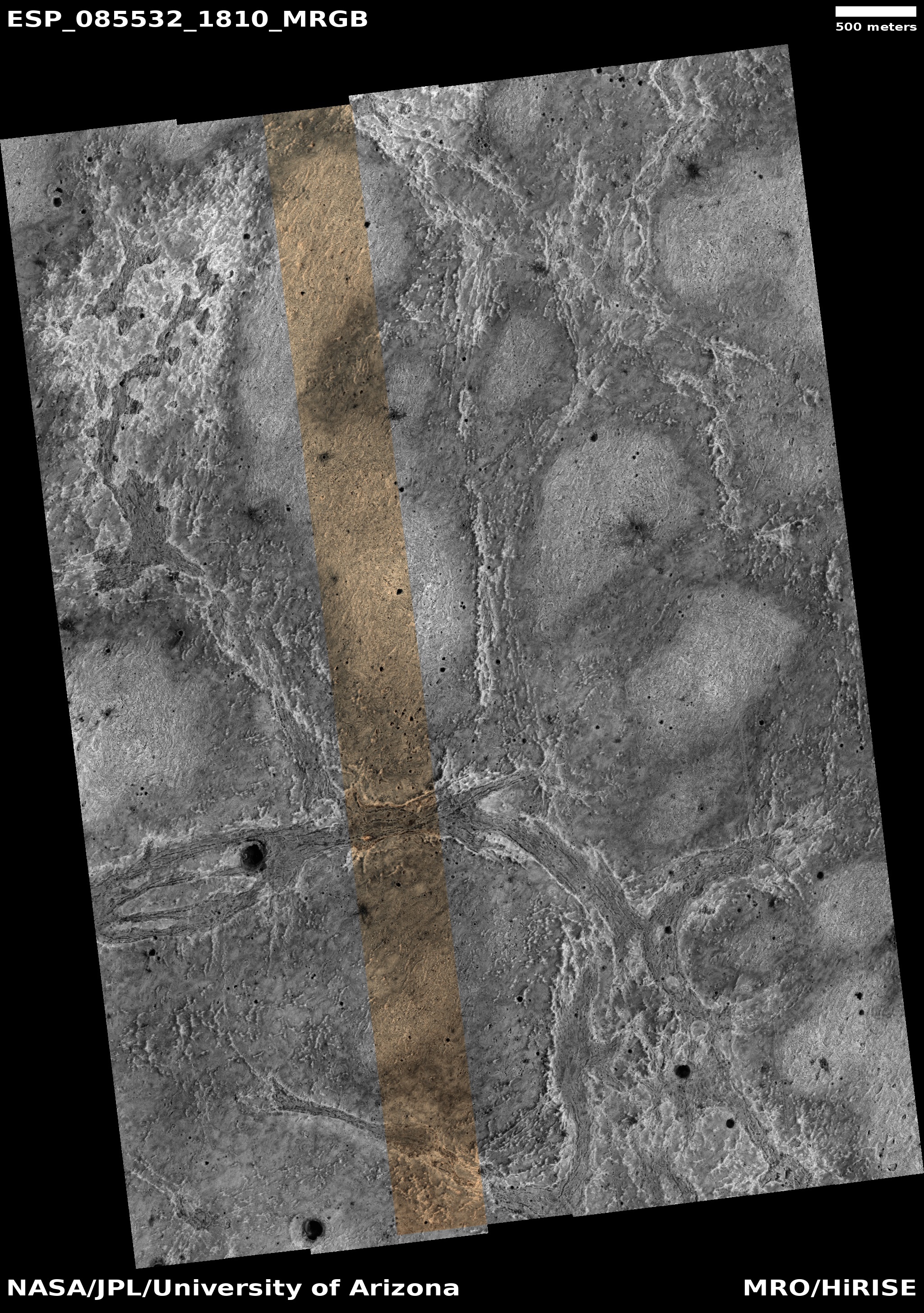
Strange flat layers on Mars

Strange layers on Mars

Cool image time! The picture to the right, rotated, cropped, reduced, and enhanced to post here, was taken on July 16, 2024 by the high resolution camera on Mars Reconnaissance Orbiter (MRO). It shows what MRO’s camera team labels as “layers near ridge in Argyre Planitia.”

The layers are strange because there is so little topographic difference between them. Though the ground slopes downward from the south to the north, dropping about 1,300 feet, it does so almost smoothly. The layers show relatively little topographic relief.

And what caused the circular shape? Is it evidence of a buried crater? And if so, why so little relief at its rim?

As always, the overview map provides some answers.
» Read more

0 comments

The strange beginning of a 300-mile-long meandering canyon on Mars

Overview map

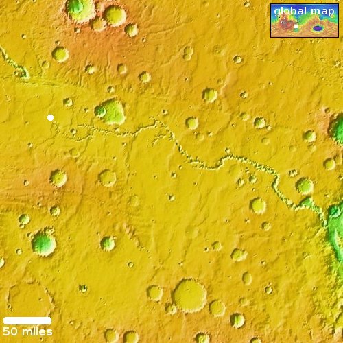
Today’s cool image will be unlike most cool images, in that we will begin not with the image but with the overview map to the right. The long meandering canyon at the center of this map is Nirgal Vallis, a 300-mile long canyon on Mars that eventually drains to the east into a much larger drainage system that runs south-to-north several thousand miles into the Martian northern lowland plains.

At first glance Nirgal Vallis invokes a river system. It starts in the west as several branches that combine to form a single major canyon meandering eastward until it enters that south-to-north system. To our Earth eyes, this canyon suggests it was carved by water flowing eastward, the many drainage routes combining as they flowed downhill.

Today’s the cool image, its location indicated by the white dot, tells us however that liquid water might not have been what created this canyon.
» Read more

1 comment

Strange mesas in the glacier country of Mars

Overview map

Strange mesas in the glacier country of Mars

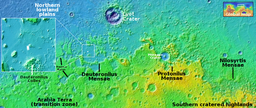
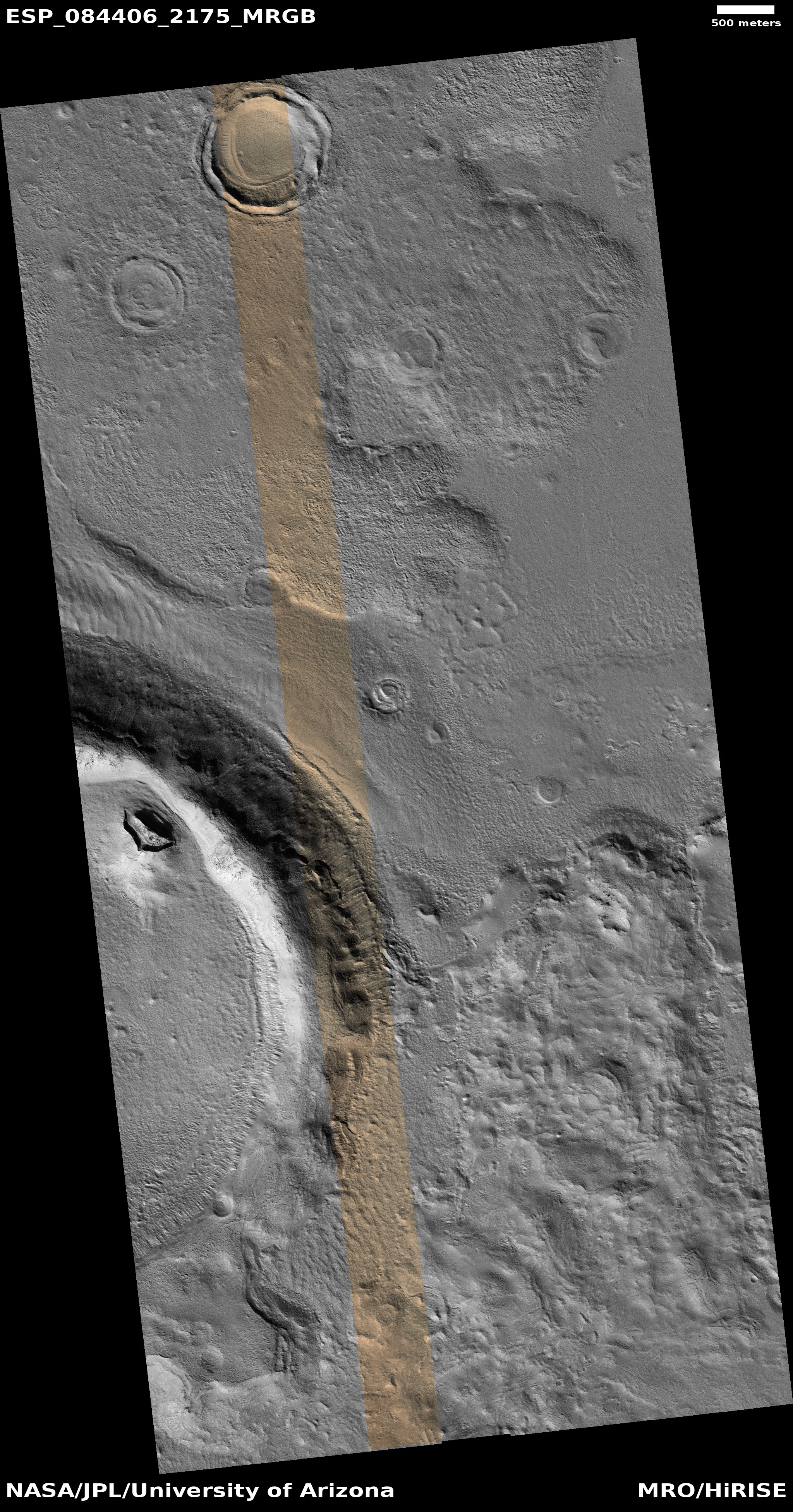
Cool image time! The picture to the right, cropped, reduced, and sharpened to post here, was taken on October 2, 2024 by the high resolution camera on Mars Reconnaissance Orbiter (MRO). The white dot in the overview map above marks the location, inside the chaos terrain of Deuternilus Mensae and part of the 2,000-mile-long mid-latitude Martian strip I label “glacier country,” because practically every image of every part of its landscape has glacial features. For example, the splash apron around the picture’s largest crater as well as the material within it all suggest some form of glacial activity and near-surface ice.

The scientists label what they see here as “Mesas in Small Craters.” These features are located in a low flat plain that geologists think was created when the ground eroded away, leaving behind scattered high plateaus that indicate the previous surface elevation. The geological map [pdf] of this plain describes it as follows:

Smooth, relatively featureless materials with regions of variable albedo north of continuous cratered highlands; exhibits scattered clusters of small circular to irregular knobs.

Based on the many accumulated photos from MRO, the general conclusion is that we are looking at a sheet of ice/dirt and covered by a thin dust layer that acts to protect that ice from sublimating away. When wind blows that dust off and the summer sun hits that near-surface ice, however, it does sublimate in bursts, which thus provides an explanation for the erosion that caused these low featureless plains.

As for these strange terraced mesas inside these distorted hollows, my guess is that the mesas predate the icesheet and are made of material with less ice impregnated within it. As that ice sublimates away it creates the craters within which the mesas remain. The terraces suggest a earlier series of geological sedimentary history.

0 comments

Unusual light-colored Martian dunes

Unusual light-colored Martian dunes
Click for original image.

Cool image time! The picture to the right, cropped, reduced, and sharpened to post here, was taken on September 27, 2024 by the high resolution camera on Mars Reconnaissance Orbiter (MRO).

The picture was simply labeled a “terrain sample,” which usually means it was taken not as part of any specific research request, but to fill a gap in the schedule so as to maintain the camera’s proper temperature. When such gap-filler pictures are necessary, the MRO camera team tries to snap something of interest. Sometimes the pictures end up somewhat boring. This time however the picture highlights a dune field that is unusually light in color.

Since most Martian sand is volcanic in origin, it tends to look dark in orbital pictures. That this sand looks bright could be because it is inherently different, or it could be that lighting conditions make what normally looks dark to look bright instead.
» Read more

0 comments
1 22 23 24 25 26 57