Lucy makes course correction in preparation for 1st asteroid fly-by
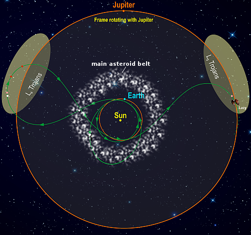
Lucy's route through the solar system
Lucy’s route through the solar system

The asteroid probe Lucy on May 9, 2023 fired its engines to successfully make a minor course correction in preparation for a fly by of the asteroid Dinkinesh, located in the main asteroid belt between Mars and Jupiter.

Even though the spacecraft is currently travelling at approximately 43,000 mph (19.4 km/s), this small nudge is enough to move the spacecraft nearly 40,000 miles (65,000 km) closer to the asteroid during the planned encounter on Nov. 1, 2023. The spacecraft will fly a mere 265 miles (425 km) from the small, half-mile- (sub-km)-sized asteroid, while travelling at a relative speed of 10,000 mph (4.5 km/s).

Dinkinesh, the white dot inside the main asteroid belt in the lower left of the map to the right, is the first of eight asteroids Lucy will fly past.

1 comment

Chaos in the southern cratered highlands of Mars

Chaos in the southern cratered highlands of Mars
Click for full image.vi

Today’s cool image takes us to a part of the cratered southern highlands of Mars that I have not featured much previously. The picture to the right, rotated, cropped, and reduced to post here, was taken on March 7, 2023 by the high resolution camera on Mars Reconnaissance Orbiter (MRO). It shows what appears to be a collection of rough hills and mesas surrounded by a sea of smooth ground that at the base of the cliffs seems to end abruptly.

The smooth ground is probably mantled by a layer of dust and debris. Since this location is at 36 degrees south latitude, there is also probably near surface ice under that layer. The abrupt edges likely indicate where the increasing slope next to the mesas and mounds caused that ice to be exposed and thus sublimate away.

As for the location, we must go to the overview map.
» Read more

0 comments

Astronomers discover Earth-sized planet 90 light years away

Using data from a variety of space- and ground-based telescopes astronomers have discovered Earth-sized exoplanet orbiting a red dwarf star 90 light years away.

The exoplanet is dubbed LP 791-18 d, and is thought to be slightly bigger than the Earth. Its orbit, close to the star, causes it to be tidally-locked, with one hemisphere always facing the star. In addition, the presence of another much larger exoplanet in the system causes other tidal effects.

Astronomers already knew about two other worlds in the system before this discovery, called LP 791-18 b and c. The inner planet b is about 20% bigger than Earth. The outer planet c is about 2.5 times Earthโ€™s size and more than seven times its mass.

During each orbit, planets d and c pass very close to each other. Each close pass by the more massive planet c produces a gravitational tug on planet d, making its orbit somewhat elliptical. On this elliptical path, planet d is slightly deformed every time it goes around the star. These deformations can create enough internal friction to substantially heat the planetโ€™s interior and produce volcanic activity at its surface. Jupiter and some of its moons affect Io in a similar way.

The press release makes a big deal about the volcanism, even suggesting it could produce an atmosphere that, because the exoplanet sits on the inner edge of the habitable zone, could make the exoplanet habitable. These speculations are silly, considering the uncertainties, the exoplanet’s evolving orbit, and the star it orbits, and are being pushed mostly because the press office thinks this will be the only way the public will have any interest in the discovery.

While there is an infinitesimal chance there could be life here, a more likely scenario is that it is a lifeless volcano world like Jupiter’s moon Io. Even more probably however is that it is completely different than anything we have yet observed, in ways we can’t yet predict. To find out however we would need close-up observations that will likely not be possible without an interstellar mission.

4 comments

Final assembly of Chandrayaan-3 begins for launch still targeting mid-July


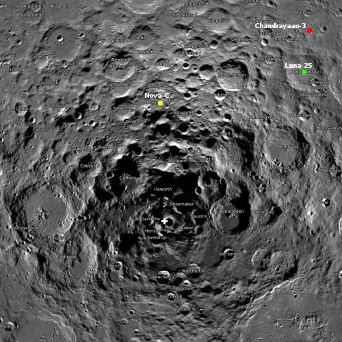
Click for interactive map.

Engineers at India’s space agency ISRO have begun the installation of the payloads onto its lunar lander/rover, Chandrayaan-3, which is still targeting a mid-July launch.

The map shows the landing location (red dot) near the Moon’s south pole (indicated by the cross). Nova-C is Intuitive Machines private lander, now aiming for a late summer launch at the earliest. Luna-25 is Russia’s first lunar lander since the 1970s, and is also targeting a launch in July.

India’s first attempt, Chandryaan-2, to land a rover at this spot on the Moon failed in 2019. This new mission is essentially a re-do, except that it does not include an orbiter, since the orbiter from Chandrayaan-2 is still operational and can do the job.

All in all, it increasingly looks like the next six months will see a lot of new landing attempts on the Moon.

0 comments

Alien textured Martian lava

Alien textured Martian lava
Click for original image.

Cool image time! The picture to the right, cropped to post here, was taken on February 17, 2023 by the high resolution camera on Mars Reconnaissance Orbiter (MRO), and shows what the science team labels “regularly textured ground on Pavonis Mons.”

The arrow in the picture indicates the downhill trend. If you look at the full image, you will see that this texture pattern extends in all directions for a considerable distance, both uphill and down, and even covers the entire floor of a depression that appears to contour along the grade instead of going downhill.

The latitude here is very close to the equator. So, even though the elevation is high, being on the slopes of a giant volcano, there is probably no near surface ice here.
» Read more

1 comment

What kind of barred spiral galaxy is the Milky Way?

Three types of barred spiral galaxies
Click for original image.

The uncertainty of science: Though astronomers have long believed that the Milky Way galaxy is a barred spiral galaxy, defined as having a major straight arm coming out in two directions from its nucleus with other spiral arms surrounding it, determining the exact structure has been difficult because of our presence within the galaxy.

The image to the right, taken from a paper just published, shows three different types of barred spirals. On the left is one where the surrounding spiral arms hardly exist. In the center the central bar is surrounded by multiple arms. On the right is a barred spiral with just one major spiral arm.

Though it has been generally accepted that the Milky Way belongs in the center category, astronomers remain unsure about the actual spiral structure. Previous work had suggested the galaxy actually had four major arms, not two as seen by most barred spirals. As noted in the paper, “If that is the case, the [Milky Way] may be an atypical galaxy in the universe.”

The research from the new paper however now proposes that the Milky Way is actually not atypical, but instead more resembles the center image, with two main arms and multiple segmented arms beyond. From the abstract:

Using the precise locations of very young objects, for the first time, we propose that our galaxy has a multiple-arm morphology that consists of two-arm symmetry (the Perseus and Norma Arms) in the inner parts and that extends to the outer parts, where there are several long, irregular arms (the Centaurus, Sagittarius, Carina, Outer, and Local Arms).

The astronomers cheerfully admit that this conclusion is uncertain, and will need many further observations for confirmation.

5 comments

Brain terrain in and around pedestal crater on Mars

Brain terrain in and around a pedestal crater on Mars
Click for original image.

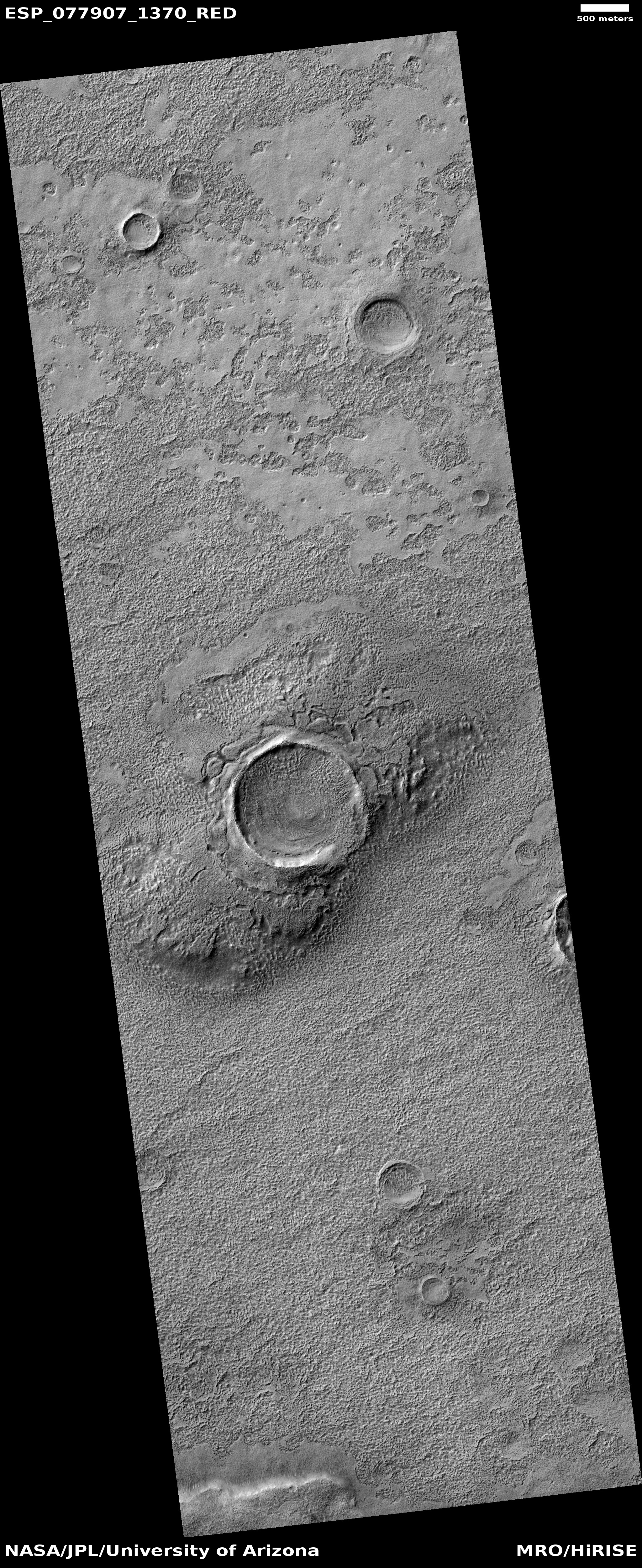
Cool image time! The picture to the right, cropped, reduced, and sharpened to post here, was taken on March 10, 2023 by the high resolution camera on Mars Reconnaissance Orbiter (MRO).

As I noted in a cool image only two weeks ago, brain terrain is a geological feature wholly unique to Mars that planetary geologists still do not understand or can explain. They know its knobby interweaving nodules (resembling the convolutions of the human brain) are related to near surface ice and its sublimation into gas, but no one has much confidence in any of the theories that posit the process that forms it.

In this case the brain terrain not only fills the crater, it appears to surround it as well, but only appearing at spots where a smooth top layer has begun to break apart. Moreover, the crater appears to be a pedestal crater, whereby much of the less dense surrounding terrain has vanished, leaving the compacted crater sitting higher.
» Read more

0 comments

Glacial sinkhole in the Martian southern cratered highlands?

Overview map

Glacial sinkhole in the Martian southern cratered highlands?
Click for original image.

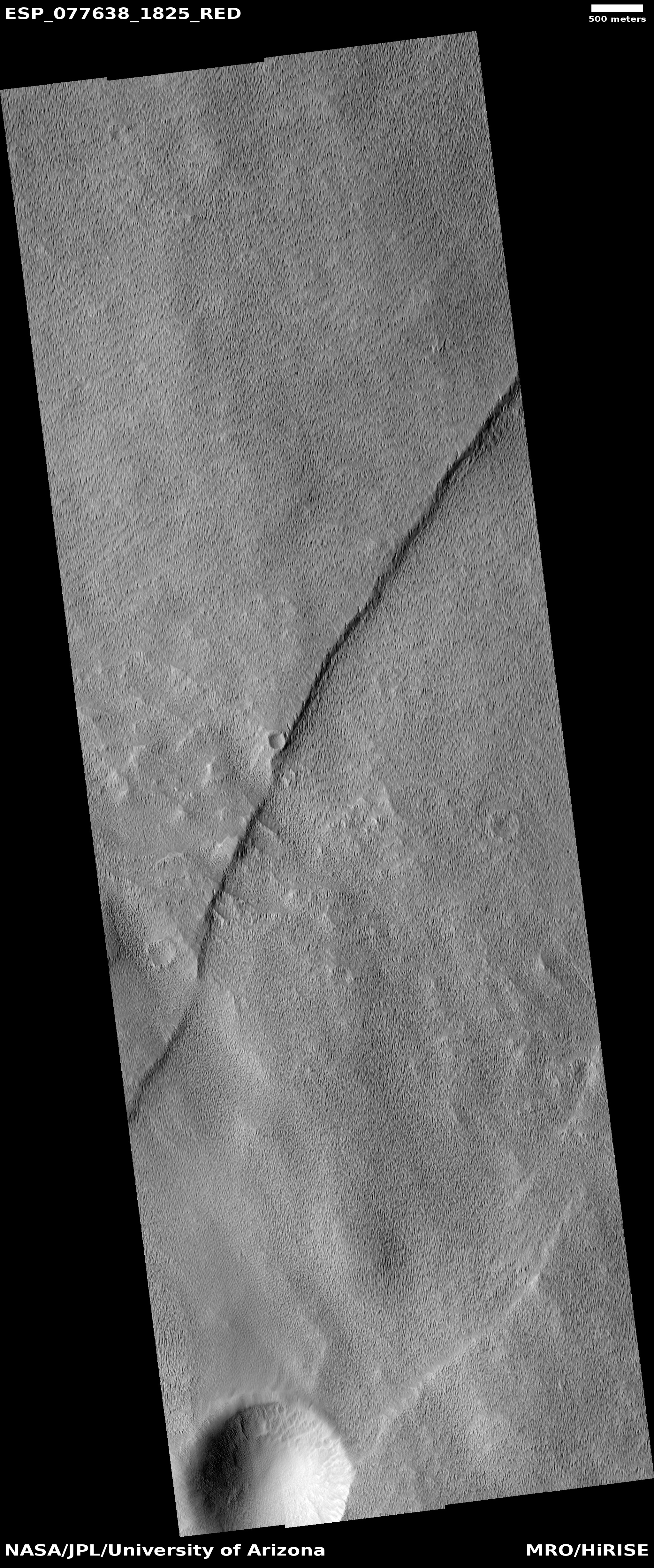
Cool image time! The picture to the right, cropped to post here, was taken on February 21, 2023 by the high resolution camera on Mars Reconnaissance Orbiter (MRO). This is a terrain sample image, which means it was snapped not as part of any specific research project but to fill a gap in the schedule in order to maintain the camera’s proper temperature. As usual, the camera team tried to pick something of interest, and I think they succeeded.

The two large depressions in the center of the picture do not resemble impact craters. They have no rim of ejected material and their shape is very distorted. Instead, both appear to be places where a top layer of ice/debris has sublimated away into gas, exposing a lower layer of glacial material that itself is sublimating away to form the bumpy mounds that fill the floor of the depressions.

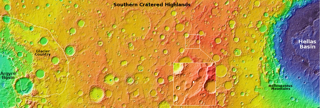
The white dot inside the inset box on the overview map above marks this location, just south of the northern wall of a large 30-mile-wide canyon, with its northern floor even more depressed, as if the material in that raised middle a flat pile of glacial debris flowing to the southwest after leaving the gap in the crater to the northeast. An MRO context camera picture taken on January 6, 2016 gives a wider view, showing that there are a lot of these type depressions on the surface of this wide middle upraised floor, as well as some obvious impact craters.

This location is in the mid-latitude band where many glacial features are found. In this part of the southern cratered highlands there is also a lot of evidence of top layers sublimating away, as if the glacial material is a large buried ice sheet that is beginning to disappear at places where it has been exposed by impacts or shifting motion. The depression in the picture above appears to be an example.

0 comments

Engineers free stuck radar antenna on Juice probe to Jupiter’s big moons

Engineers have successfully freed the 52-foot wide radar antenna on the Juice probe to Jupiter, shaking it enough to release a pin that was blocking deployment.

The pin was freed by employing “back-to-back jolts”. Imagine when you roll your car back and forth to get it freed from mud or snow. It appears this is what they did with the pin.

Juice will arrive in Jupiter orbit in 2031, where it will make numerous fly-bys of Europa, Calisto, and Ganymede, and then settle into an orbit around Ganymede alone. The radar antenna was essential for probing the ice content of these worlds, below the surface.

Hat tip to reader Mike Nelson.

6 comments

Endless dunes amidst Mars’ giant volcanoes

Endless dunes amidst Mars' giant volcanoes
Click for originial image.

Past cool images on Behind the Black showing endless dune fields on Mars have generally focused on two places, the giant Medusae Fossae Formation volcanic ash deposits in the dry equatorial regions of Mars and the Olympia Undae dune sea that surrounds the Martian north pole.

Today’s image to the right, rotated, cropped, reduced, and sharpened to post here, takes us to a completely different dune sea. Taken on February 14, 2023 by the high resolution camera on Mars Reconnaissance Orbiter (MRO), the picture also shows an endless dune sea, though there is faint evidence on those dune fields of buried features, such as the meandering east-west feature in the picture’s center.

This dune sea is also in the dry equatorial regions, like Medusae, but it is much farther east, and sits surrounded by Mars’ biggest volcanoes.
» Read more

0 comments

Perseverance data suggests a strong river rushed down the delta in Jezero Crater

Skrinkle Haven on Mars
Click for original image.

Based on the images and geology so far gathered by the Mars rover Perseverance as it has climbed up onto the delta that flowed into Jezero Crater sometime in the far past, scientists now think a roaring river once flowed down that delta.

Years ago, scientists noticed a series of curving bands of layered rock within Jezero Crater that they dubbed โ€œthe curvilinear unit.โ€ They could see these layers from space but are finally able to see them up close, thanks to Perseverance.

One location within the curvilinear unit, nicknamed โ€œSkrinkle Haven,โ€ is captured in one of the new Mastcam-Z mosaics [a section of which is posted to the right]. Scientists are sure the curved layers here were formed by powerfully flowing water, but Mastcam-Zโ€™s detailed shots have left them debating what kind: a river such as the Mississippi, which winds snakelike across the landscape, or a braided river like Nebraskaโ€™s Platte, which forms small islands of sediment called sandbars.

When viewed from the ground, the curved layers appear arranged in rows that ripple out across the landscape. They could be the remnants of a riverโ€™s banks that shifted over time โ€“ or the remnants of sandbars that formed in the river. The layers were likely much taller in the past. Scientists suspect that after these piles of sediment turned to rock, they were sandblasted by wind over the eons and carved down to their present size.

The press release say nothing about glacial activity here, but I am willing to bet the scientists have considered this. As it requires a greater leap into the unknown, involving geological processes not yet understood on an alien planet, it is makes sense that they have put it aside at this point. I also am willing to bet that it will pop up again, with time and additional data.

0 comments

Is this ice or lava in the death valley of Mars?

Ice or lava on Mars?
Click for original image.

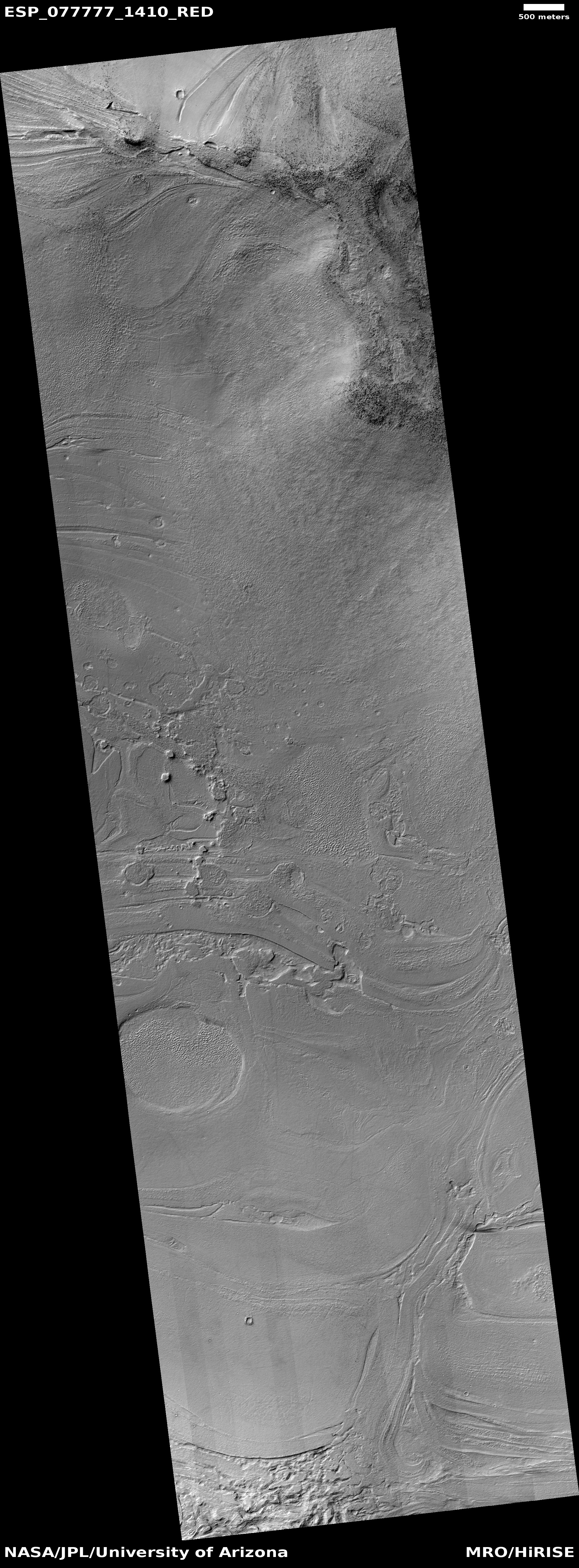
Cool image time! The picture to the right, rotated, cropped, reduced, and sharpened to post here, was taken on February 28, 2023 by the high resolution camera on Mars Reconnaissance Orbiter (MRO).

To put it mildly this is strange terrain. The curving east-west feature resembles a glacial flow, but it also has features that say otherwise. For example, what could cause that gap in the middle of the picture? Such things are not usually seen in an ice flow. Then there is that filled crater on the center left edge of the picture, inside the flow. Though filled with material, the flow itself does not flow around the crater, suggesting the impact occurred after the flow. Moreover the crater is a pedestal crater, whereby the surrounding terrain has eroded away so that the crater ends up standing above it.

These facts suggest that this flow is very old, and has not flowed for a very very very long time. This in turn suggests it isn’t ice but solidified lava, though for a lava flow it also has features that are anomalous when compared to typical flood lava on Mars.
» Read more

1 comment
1 69 70 71 72 73 89