
A frozen bubbly caldron on Mars
Click for original image.
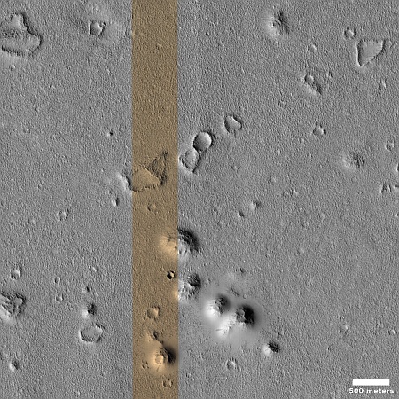
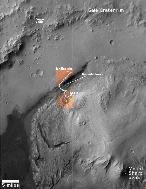
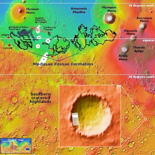
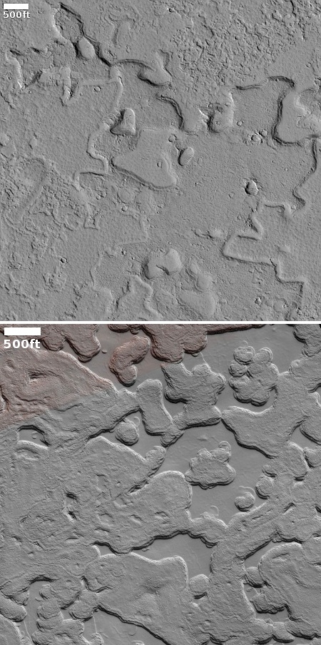
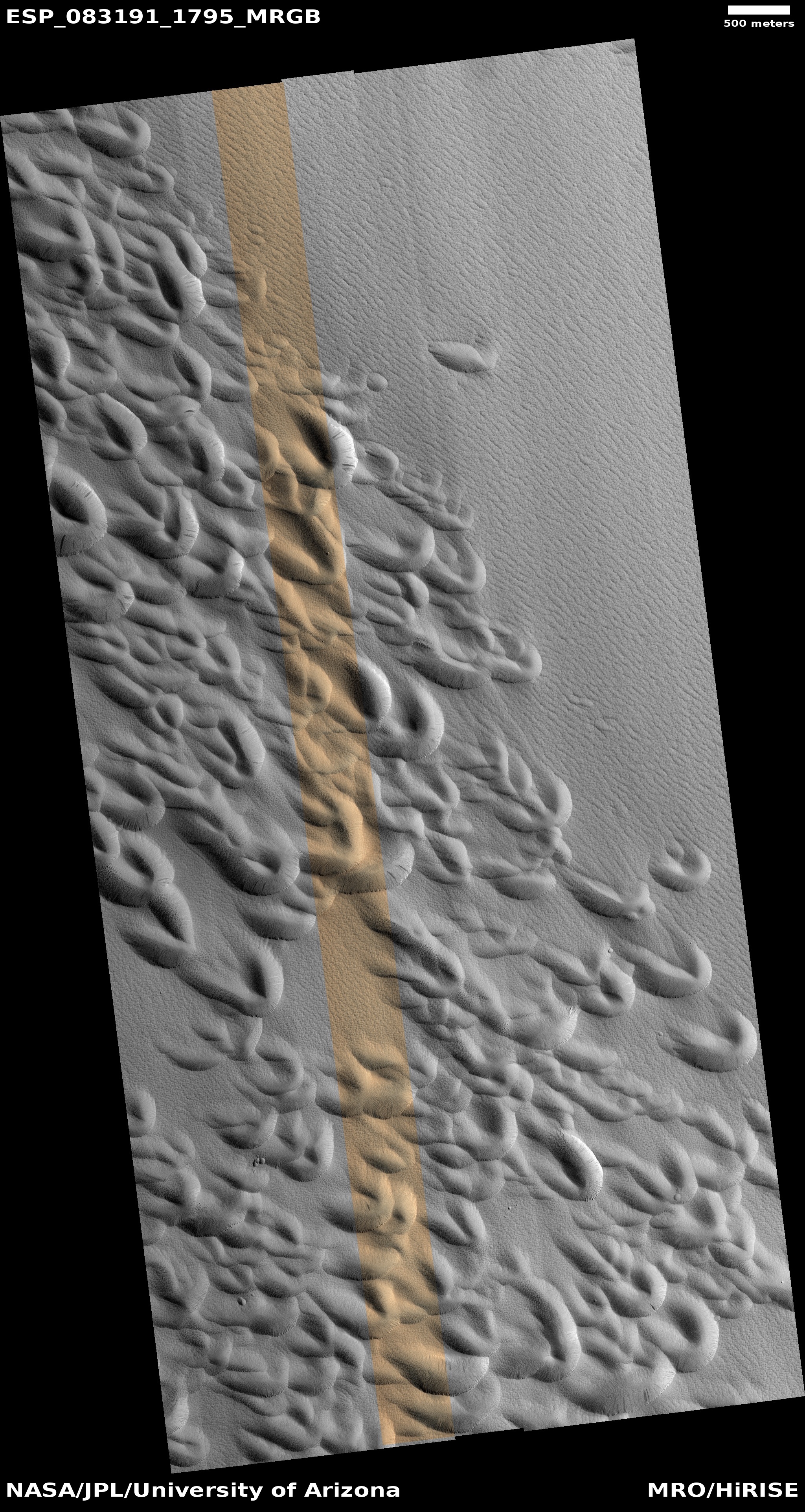
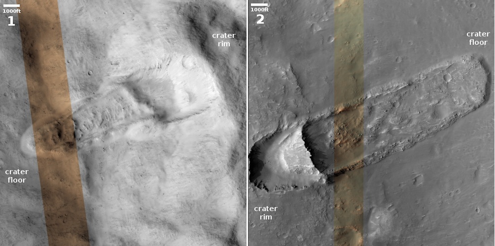
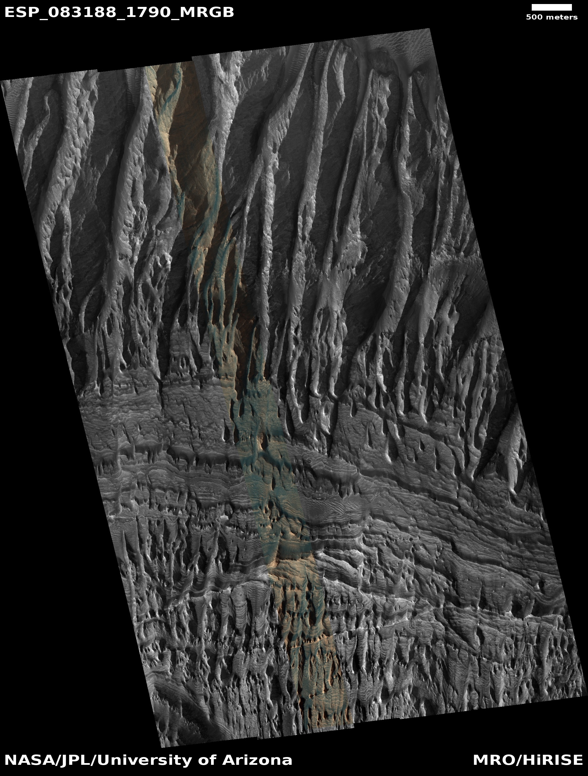
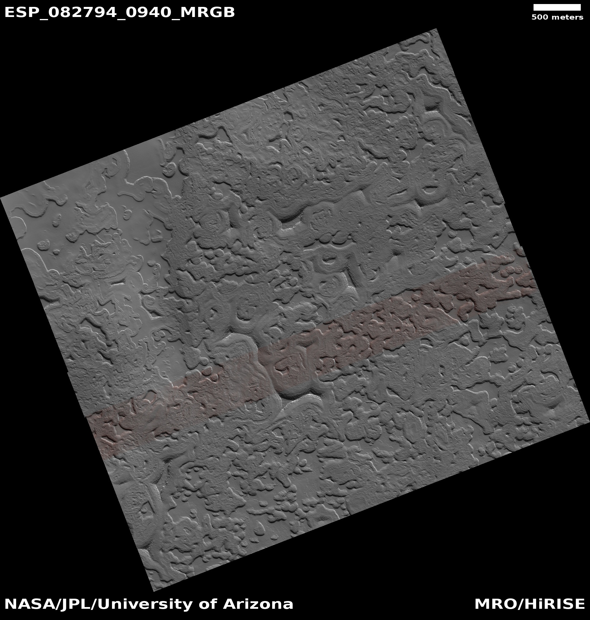
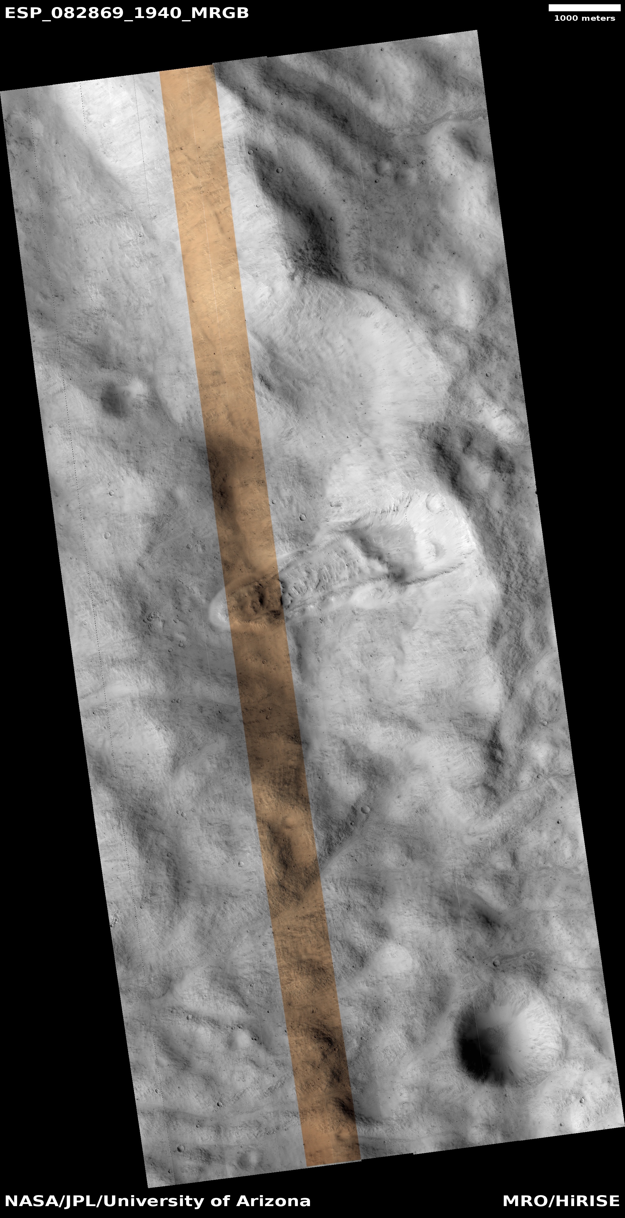
Cool image time! The picture to the right, rotated, cropped, reduced, and sharpened to post here, was taken on April 11, 2024 by the high resolution camera on Mars Reconnaissance Orbiter (MRO). It shows a nice collection of what the scientists label “irregular ring structures,” interspersed with clusters of small mesas ranging in heights from 13 to 75 feet.
The location is at 27 degrees north latitude, so the presence of near surface ice, which might explain these strange rings, is less likely though not impossible. The stipled nature of the flat ground suggests that near surface ice might be here, resulting in sublimation of that ice and leaving behind a flat but rough surface.
The location however suggests another possibility, which though vastly different in some ways, is almost identical in others.
» Read more
Click for original image.
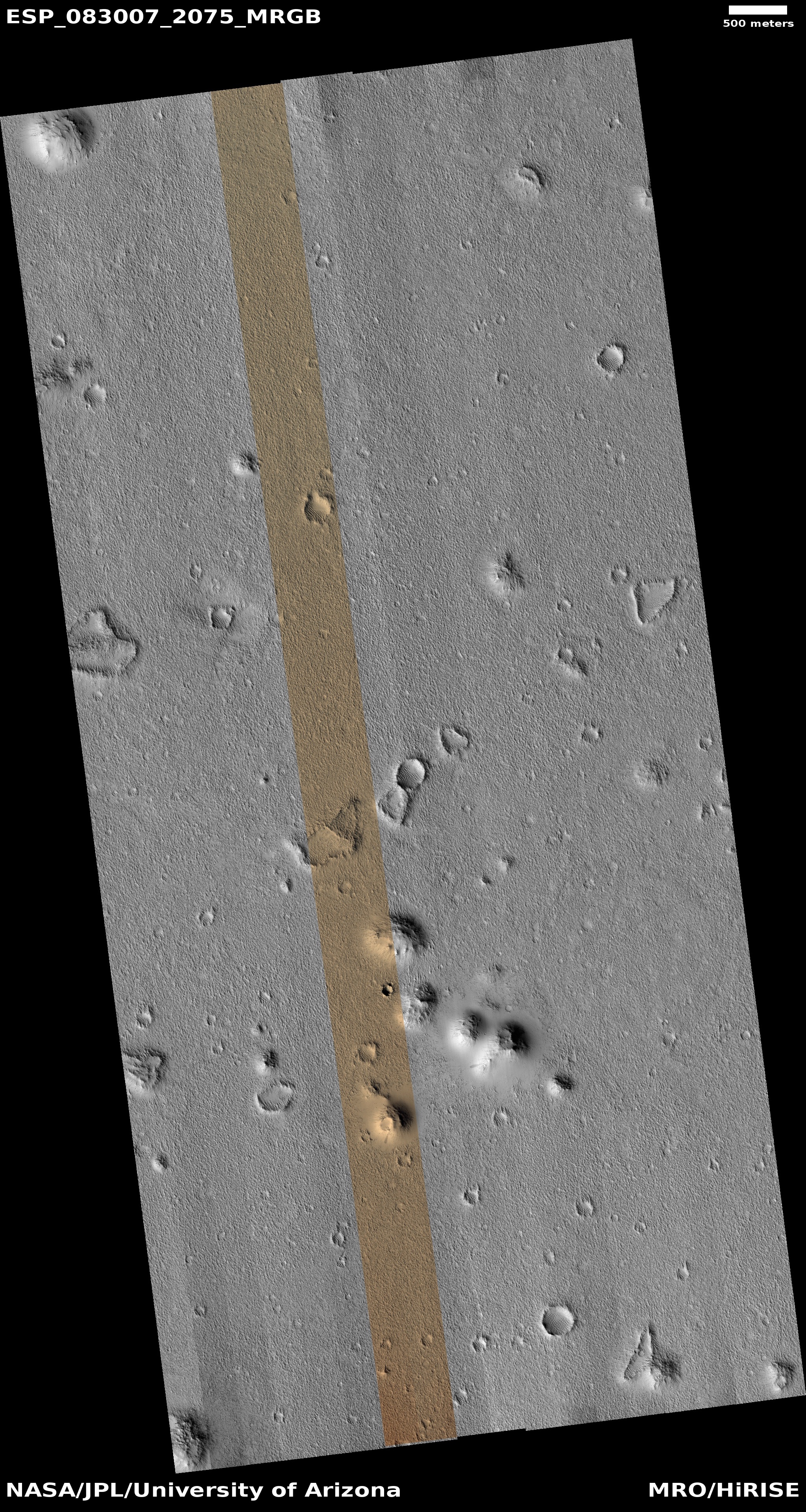
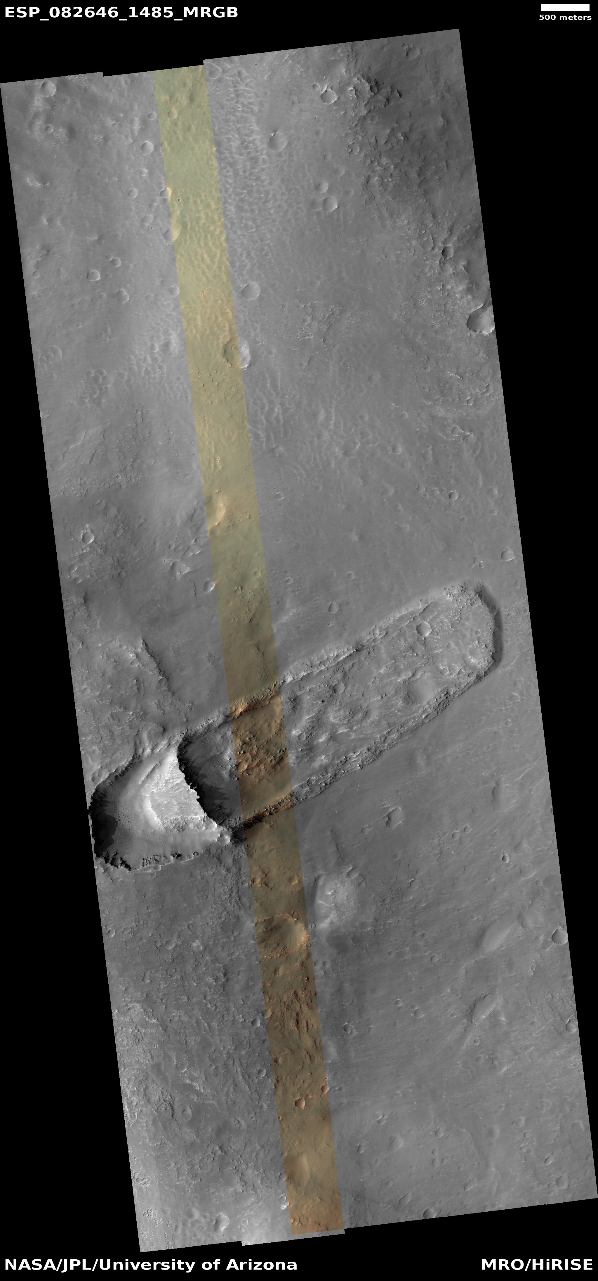
Cool image time! The picture to the right, rotated, cropped, reduced, and sharpened to post here, was taken on April 11, 2024 by the high resolution camera on Mars Reconnaissance Orbiter (MRO). It shows a nice collection of what the scientists label “irregular ring structures,” interspersed with clusters of small mesas ranging in heights from 13 to 75 feet.
The location is at 27 degrees north latitude, so the presence of near surface ice, which might explain these strange rings, is less likely though not impossible. The stipled nature of the flat ground suggests that near surface ice might be here, resulting in sublimation of that ice and leaving behind a flat but rough surface.
The location however suggests another possibility, which though vastly different in some ways, is almost identical in others.
» Read more


