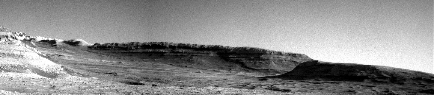
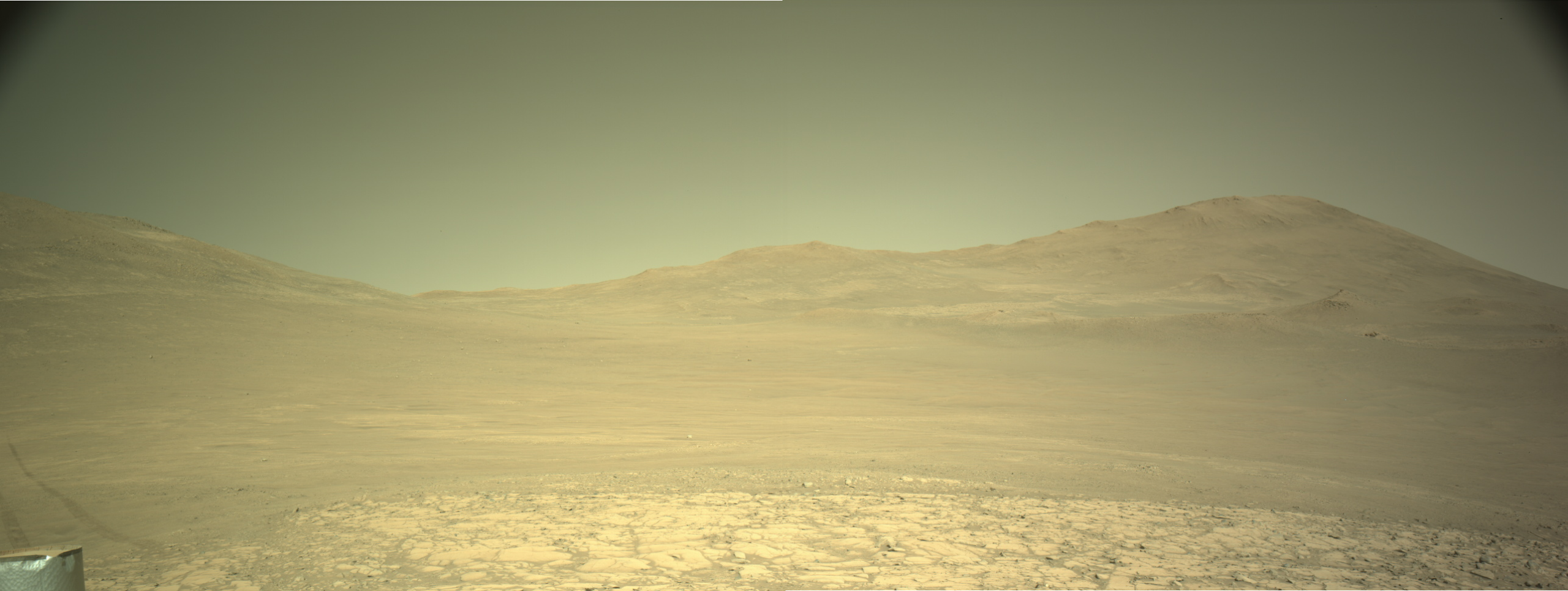
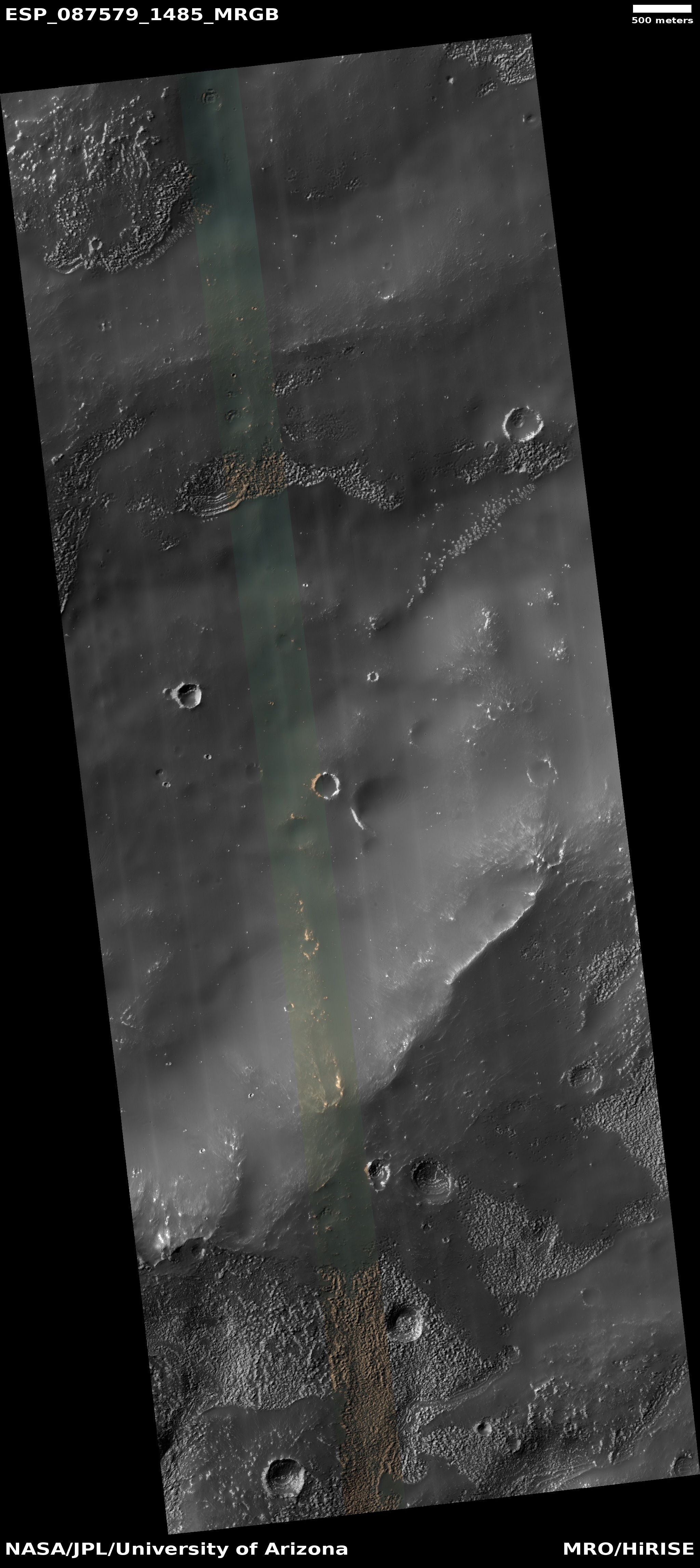
Scientists believe they have detected the actual process in which Mars loses its atmosphere

The uncertainty of science: Scientists using three different instruments on the Mars orbiter MAVEN now believe they have detected evidence of the actual process in which Mars loses its atmosphere, dubbed “sputtering”.

To observe sputtering, the team needed simultaneous measurements in the right place at the right time from three instruments aboard the MAVEN spacecraft: the Solar Wind Ion Analyzer, the Magnetometer, and the Neutral Gas and Ion Mass Spectrometer. Additionally, the team needed measurements across the dayside and the nightside of the planet at low altitudes, which takes years to observe.

The combination of data from these instruments allowed scientists to make a new kind of map of sputtered argon in relation to the solar wind. This map revealed the presence of argon at high altitudes in the exact locations that the energetic particles crashed into the atmosphere and splashed out argon, showing sputtering in real time. The researchers also found that this process is happening at a rate four times higher than previously predicted and that this rate increases during solar storms.

This sputtering is believed to be the process in which Mars lost the thick atmosphere that scientists believe must have existed in the past so that liquid water could exist on the planet’s surface. When MAVEN arrived in Mars orbit ten years ago the scientists actually thought the spacecraft would detect it relatively quickly. That it took ten years to finally find some evidence it is occurring suggests something is not quite right with their theories.

1 comment

The canyon that Curiosity will eventually climb

The canyon that Curiosity will eventually climb
Click for full resolution. For original images go here and here.

Overview map
Click for interactive map.

Cool image time! The panorama above, created from two photographs taken on May 23, 2025 by the left navigation camera (here and here) on the Mars rover Curiosity, looks south uphill into the canyon that Curiosity is eventually going to climb.

The overview map to the right provides the context. The blue dot marks Curiosity’s present position, the white dotted line its past travels, the red dotted line its initial planned route, and the green dotted line its future route. The yellow lines indicate the approximate area seen in the panorama above.

If you look on the horizon to the left, you can see very bright terrain higher up the mountain. This is the pure sulfate-bearing unit that is Curiosity’s next major geological goal. It won’t reach that terrain for quite some time however because first the scientists want to spend some time studying the boxwork geology that Curiosity is now approaching. That boxwork suggests two past geological processes, as yet unconfirmed. First it suggests the ground dried like mud, forming a polygon pattern of cracks that then hardened into rock. Second, lava seeped up from below and filled those cracks. The lava, being more resistant to erosion, ended up becoming the boxwork of ridges as the material around eroded away.

This proposed history however is not proven. They hope to find out when Curiosity gets there.

Meanwhile, despite having traveled almost 22 miles, the rover is more than 25 miles from the peak of Mount Sharp, which remains out of sight. That peak is also about 15,000 feet higher.

0 comments

Scientists: Jezero Crater’s theorized lake overflowed intermittently four times in the past

The inlet and outlet valleys of Jezero Crater
Click for original image.

Scientists analyzing the Martian geology of the meandering outflow canyon from Jezero Crater, now think it was formed by four different very short-lived events when the theorized lake inside the crater overflowed the crater rim.

The map to the right, figure 1 of the paper (cropped and annotated to post here), provides the context. Two canyons, Sava Vallis and Neretva Vallis feed into Jezero Crater, and one canyon, Pliva Vallis, flows out. From the abstract:

By examining the shape of the valley, we noticed that Pliva Vallis was not like valleys carved by continuous rivers on Earth and propose instead that the valley was carved by at least four episodes of lake overflow. To give a minimum estimate of the duration of these events, we use a numerical model to simulate the overflow of a lake and the incision of a valley. Modeling suggests that the four (or more) episodes identified each incised part of the valley and that each episode lasted a few weeks at maximum.

The researchers also considered whether Pliva Vallis could have been carved by glacial flows, but rejected that possibility partly because “the general morphology of the valley shows a decrease in depth and width downstream, while subglacial channels [on Earth] tend to remain of similar width or become larger, as the flow regime does not decrease downstream.”

These conclusions of course carry a great deal of uncertainty. For one, they are based solely on orbital data. No ground truth exists as yet. Secondly, they assume the geology on Mars behaves in the same manner as on Earth. It could very well be for example that the reason the valley shrinks in size is because its Martian glacier sublimated away as flowed downhill, something that doesn’t happen on Earth.

Regardless, the data strongly suggests that water shaped Jezero in some manner.

0 comments

Perseverance moves across the barren outer rim of Jezero Crater

Looking back at the rim of Jezero Crater
Click for full resolution. For original images go here and here.

Overview map
Click for interactive map.

Cool image time! While most of the mainstream press will be focusing today on the 360 degree selfie that the Perseverance science team released yesterday, I found the more natural view created above by two pictures taken by the rover’s right navigation camera today (here and here) to be more immediately informative, as well as more evocative.

After spending several months collecting data at a location dubbed Witch Hazel Hill on the outer slopes of the rim of Jezero Crater, the science team has finally had the rover move south along its planned route. The overview map to the right provides the contest. The blue dot marks Perseverance’s present location, the red dotted line its planned route, and the white dotted line its actual travels. The yellow lines mark what I think is the approximate area viewed in the panorama above.

That panorama once again illustrates the stark alienness of Mars. It also shows the startling contrast between the rocky terrain that the rover Curiosity is seeing as it climbs Mount Sharp versus this somewhat featureless terrain traveled so far by Perseverance. Though Perseverance is exploring the ejecta blanket thrown out when the impact occurred that formed Jezero Crater, that event occurred so long ago that subsequent geological processes along with the red planet’s thin atmosphere have been able to smooth this terrain into the barren landscape we now see.

And barren it truly is. There is practically no place on Earth where you could find the surface so completely devoid of life.

Some would view this as a reason not to go to Mars. I see it as the very reason to go, to make this terrain bloom with life, using our fundamental human ability to manufacture tools to adapt the environment to our needs.

Meanwhile, the science team operating Perseverance plans to do more drilling, as this ejecta blanket probably contains material thrown out from the impact that is likely quite old and thus capable of telling us a great deal about far past of Mars’ geological history.

0 comments

Terraced Martian butte

Terraced Martian butte
Click for original image.

Cool image time! The picture to the right, cropped, reduced, and sharpened to post here, was taken on April 1, 2025, by the high resolution camera on Mars Reconnaissance Orbiter (MRO).

The scientists label this as a “Layered Butte.” Seems like a good description. From top to bottom there appear to at a minimum about a dozen terraces, each of which represents a specific geological era on Mars.

I post this mostly because I think it shows us another example of the alien beauty of the Martian landscape. The scientific question of course is what do these layers represent. In a general sense, they indicate that over a long time period one by one these layers were laid down, and then over a likely equally long time period the top layers were worn away, one by one. The mesa is just a random spot where that erosion process was not complete, leaving behind this terraced 400-foot-high tower.
» Read more

1 comment

New research suggests the two types of streaks on Mars are caused by dry events

A Martian slope streak caused by a dust devil?
A Martian slope streak caused by a dust devil? From
data taken in 2023. Click for original image.

Scientists using a computer machine learning algorithm to assembly and analyze global maps of all known slope streaks and recurring slope lineae (RSL) — the two different types of streaks found on Mars whose cause as yet remain unexplained — have concluded that these streaks are likely caused by dry processes, not wet brine seeping from underground.

Slope streaks can occur randomly throughout the year, can be bright or dark, can occur anywhere, and fade with time. Recurring slope lineae instead appear seasonally in the same locations and are always dark.

You can read the published paper here. It essentially provides further details on research that was first announced at a conference in March. From its conclusion:

[O]ur observations suggest that slope streak and RSL formation may be predominantly controlled by two independent, dry drivers, 1) the seasonal delivery of dust onto topographic inclines, and 2) the spontaneous activation of accumulated dust by energetic triggers โ€“ wind and impacts for slope streaks, as well as dust devils and rockfalls for RSL.

…Our results underline the fundamental differences between slope streaks and RSL, despite their visual resemblance. Streak and RSL populations occur on opposite hemispheres (north vs south), at different topographic elevations (mostly lowlands vs mostly highlands), in opposite thermal inertia terrain (low vs high), in different wind speed regimes (above-average vs below-average), in dissimilar diurnal thermal amplitude and heat flux terrain (above-average vs average), in different WEH, H2O, H, and water vapor column terrain (average vs below-average), and in terrain that provides suitable (theoretical) conditions for liquid water at different seasons (Ls ~90ยฐ vs Lsโ€‰~โ€‰270ยฐ).

This data suggests both types of streaks form in connection with very fine Martian dust, but the researchers also admit that the actual method in which these avalanche-type streaks form remains unclear. In both cases the streaks cause no change in the topography (sometimes even traveling uphill for short distances), produce no debris piles at their base, as avalanches typically do, and do not appear to have an obvious cause or source at the top of the streak.

0 comments

Curiosity looks uphill at boxwork and future travels

Curiosity's view uphill
Click for original image.

Overview map
Click for interactive map.

Cool image time! The panorama above, taken on May 14, 2025 by the left navigation camera on the Mars rover Curiosity, takes a look uphill at the canyon that the rover is now entering.

The overview map to the right gives the context. The blue dot marks the rover’s location when the picture was taken, and the yellow lines indicate approximately the view of the panorama above. If you look closely at the ground at the base of the cliff on the right, you can see the boxwork ridges indicated on the overview map.

The red dotted line marks the original planned route of the rover. The science team abandoned that plan several months ago in order to get to the boxwork geology as quickly as possible. It expects to reach that boxwork sometime in the next month or so.

Based on the proposed route posted in September 2023, after the scientists have completed their observations of the boxwork the rover will continue uphill within this canyon, bearing east as it parallels that 100-foot-high cliff seen on the horizon. The green dotted line indicates roughly that future route.

0 comments

NASA: Perseverance observed the first visible-light aurora in March 2024

According to a NASA/JPL press release today, Perseverance successfully observed the first visible-light aurora on another world when in March 2024 it photographed a faint aurora overhead, caused by a strong solar flare.

The images at the link are quite unexciting, so much so that I don’t see a reason to include it here. The aurora observed is barely noticeable. Moreover, this is not really a new discovery. Previous observations in the ultraviolet had determined that Mars does have a weak aurora. That in rare circumstances a strong solar event can have it also appear in visible wavelengths is hardly news.

Normally I would have considered this story unimportant enough to list merely as a quick link at the end of the day, but I post it now because of how the mainstream propaganda press has latched onto it as if it is a big deal. The New York Times, the Washington Post, and the Associated Press all posted stories, giving it far more play than it deserves.

My impression from all these articles is that their reporters know almost nothing about Mars and the research that is going on there, and were easily bamboozled by the press people at NASA and JPL to report this relatively minor story loudly. They no longer have anyone who covers science and space on a regular basis and thus understand the larger context, so therefore their coverage is often shaped entirely by the public relations departments at NASA.

More proof that in today’s internet world, if you want good information the last place you should go is the old dinosaur press.

5 comments

The global distribution of dust devils on Mars

Global map of dust devils on Mars
Click for original image.

Scientists reviewing the dust devil tracks in orbital images produced by Mars Reconnaissance Orbiter (MRO) have now created a global map that also provides insight into the ground conditions that cause the dust devils to form. From the abstract:

In the first global study of these tracks using high-resolution satellite images from 2014 to 2018, we find tracks in 4% of the images, mostly near 60ยฐ north and south latitudes. These tracks are more common during local summers, especially in the southern hemisphere, coinciding with the peak of Mars’ dust storm season, when active dust devils are also more common. Surprisingly, dust devil track (DDT) formation does not depend on elevation, indicating it is not related to the ambient atmospheric pressure. Instead, they occur in darker areas where surface dust covers coarser material, which is revealed as the dust devil moves past.

The white dots on the map above, figure 5 of the paper, shows those MRO images where dust devil tracks were seen. The redish-orange regions are where the data suggests more dust devils should occur, while the blue areas of regions of few dust devils.

The map also notes the locations where Spirit, Opportunity, and InSight landed. Opportunity clearly landed in a region that had more dust devil activity, which explains why its solar panels were cleaned off so regularly by wind. Spirit did not land in such a region, but somehow it was lucky in getting wind events that cleared its panels of dust. InSight had no such luck, and having landed in a region with little dust devil activity, its panels steadily became covered with dust, eventually forcing the end of the mission.

As the paper notes, “To maximize mission lifetimes, future solar powered assets should favor regions where we have identified numerous [dust devil tracks] and where many active [dust devils] are present.” This proposal makes sense, for many reasons. For one, it shifts missions to higher latitudes where many glacial and near-surface ice features are found. Up until now the science community has sent all the landers and rovers to the Martian dry tropics, which has no such near surface ice. For future colonies it is imperative we begin studying Mars’ wetter regions.

This study provides another practical reason for doing so.

3 comments

Scientists: Martian gullies formed by CO2 frost, not water flows

Frost on Martian hillside
Dry ice frost on Martian cliffs. From a 2020 post.
Click for full image.

A new analysis of the gullies found on cliffs on Mars, usually on the interior rims of craters, has concluded that carbon dioxide frost is the cause of the erosion, not ancient flows of water.

This conclusion eliminates the need for liquid flowing water in the Martian past, at least in conjunction with gullies. From the paper’s conclusion:

These results show that CO2 frost is capable of producing Martian gully morphologies. Since flows powered by this process are known to be ongoing and capable of transporting the necessary volume of material, it is the simplest explanation for their formation. Variations in the frequency and fluidity of flows could have occurred over time due to variations in the CO2 cycle. CO2-driven gully formation would indicate that there was not necessarily regular, recurring meltwater during high-obliquity periods. This removes a constraint on recent climate, and also addresses a paradox: if obliquity regularly exceeds the current value as generally thought, and if gullies formed via snow melting at high obliquity, the Late Amazonian Epoch should have included regular snowmelt and widespread aqueous processes. Gully formation by CO2 frost processes is consistent with a cold-desert Late Amazonian with rare or small amounts of liquid water and little aqueous weathering, consistent with the observed mineralogy.

…Gullies, one of the most-discussed lines of evidence for liquid water on Mars, may in fact have no direct connection to H2O. CO2 frost-fluidized gully formation also has broader implications for geomorphology, widening an emerging field of new landform types and processes without Earth analogs. Similar processes could occur on other worlds with erodible substrates on steep slopes and volatile ices at their frost point, although we currently lack the high-resolution images needed to test this hypothesis. Such ices include N2 on Pluto and Triton, and SO2 on Io. [emphasis mine]

In other words, though the gullies appear at first glance to our Earth eyes to have been caused by water flowing downhill, in fact the data now suggests the annual CO2 frost cycle of Mars is the prime cause, even in the distant past. No surface water was required. And since no one has yet come up with a good model for liquid surface water even existing in the Martian past (the atmosphere being too cold and thin), this conclusion helps eliminate this conflict.

The paper also notes the lack of water likely eliminates the need for any planetary protection efforts at these gullies, as the lack of water makes the likelihood of any microbiology nil.

As these conclusions are based on lab work and analysis of images, there remains great uncertainty. Nonetheless, the results help reinforce the arguments that the geological features we see on Mars were formed not by flowing liquid water but by other processes, such as glaciers of ice.

4 comments

NASA releases thermal image of Mars taken by Europa Clipper

Mars as seen by Europa Clipper in thermal
Click for original image.

NASA yesterday released a thermal image of Mars taken by during Europa Clipper’s March 1, 2025 fly-by of the red planet on its way to Jupiter. From the caption:

This picture of Mars is a composite of several images captured by Europa Clipperโ€™s thermal imager on March 1. Bright regions are relatively warm, with temperatures of about 32 degrees Fahrenheit (0 degrees Celsius). Darker areas are colder. The darkest region at the top is the northern polar cap and is about minus 190 F (minus 125 C).

The press release doesn’t identify the bullseye feature on the left. I think the bright area inside the bullseye might be the shield volcano Syrtis Major, with the dark area to the right Isidis Basin, which means this is also a snapshot of Perseverance, sitting on the basin’s western perimeter. The dark feature on the right edge of the image might be the giant volcano Elysium Mons. These however are total guesses and likely wrong.

The mission team used this fly-by to test the spacecraft’s science instruments, and have so far found all to be working as expected.

Europa Clipper will do one more fly-by of Earth in December 2026, allowing it to reach Jupiter in April 2030.

0 comments

Bright material on the high points of a Martian mountain

Bright material on top of a Martian mountain
Click for original image.

Today’s cool image is mostly an example of the present unknowns of Mars. The picture to the right, cropped, reduced, and sharpened to post here, was taken on April 2, 2025 by the high resolution camera on Mars Reconnaissance Orbiter (MRO).

The science team quite rightly labels this vaguely as “bright materials,” referring to the bright rim of that crater as well as the scattered bright patches on the surrounding plain. This vagueness tells us that the scientists don’t have enough data yet to definitively identify this stuff, though they know it is distinctly unique because of its inexplicable bright albedo compared to everything around it.

That the crater rim (as well as all the crater rims in the full picture) exhibit this same brightness suggests this material was excavated from below when the impacts hit. The surrounding patches suggest that erosion has exposed this buried material at these points.
» Read more

0 comments
1 10 11 12 13 14 212