For the original images go here and here.
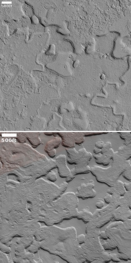
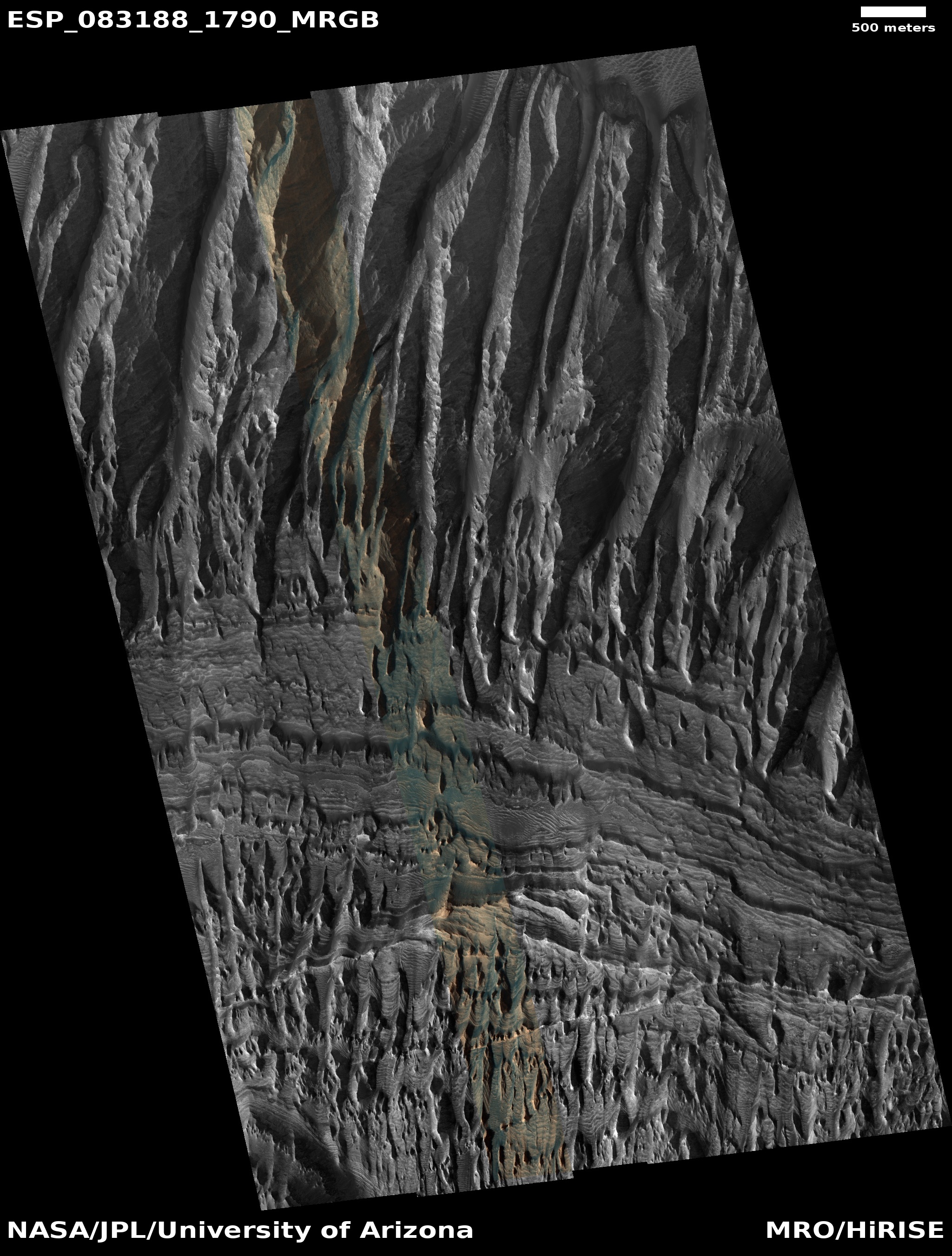
Today’s cool image is actually a comparison of two different high resolution images from Mars Reconnaissance Orbiter (MRO), both of which illustrate why it is very dangerous to come to any conclusions about such images without knowing a lot more about them.
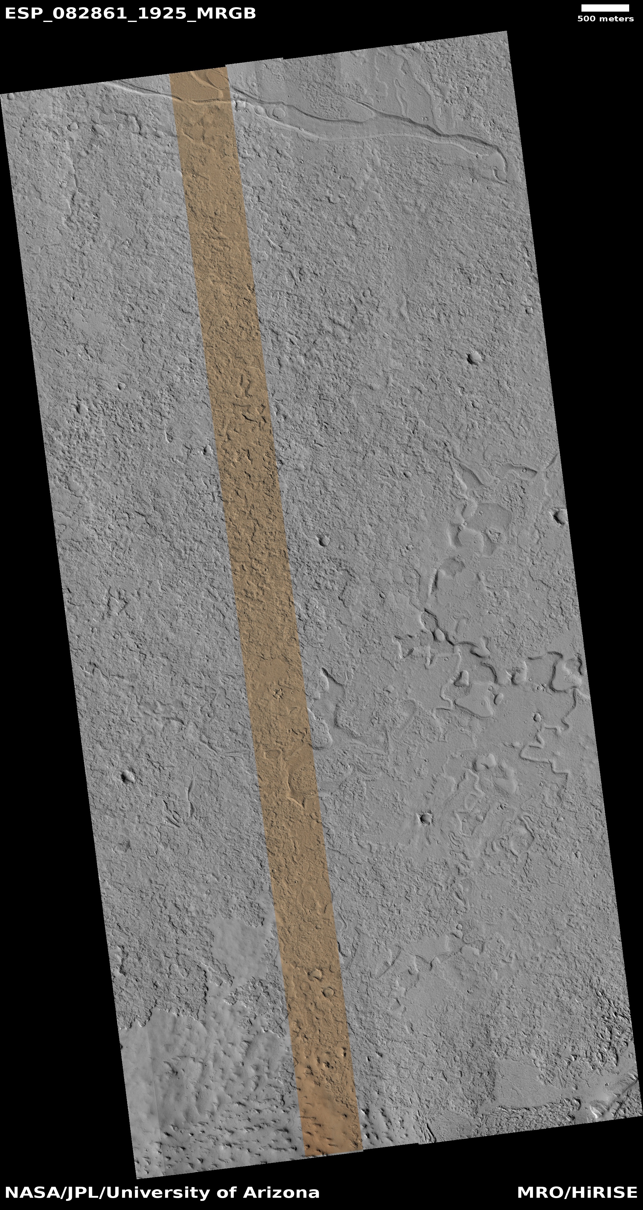
The top image to the right, cropped to post here, was a terrain sample image taken on March 30, 2024. Such images are usually taken not to complete any particular research project, but are taken to fill a gap in the schedule in order to maintain the camera’s proper temperature. When the camera team has to do this, they attempt to pick a spot that might have some geological interest. Sometimes they get something surprising. Often however the features in the picture are boring.
In this case they spotted a place where the ground appears appears to be eroding away in a random pattern.
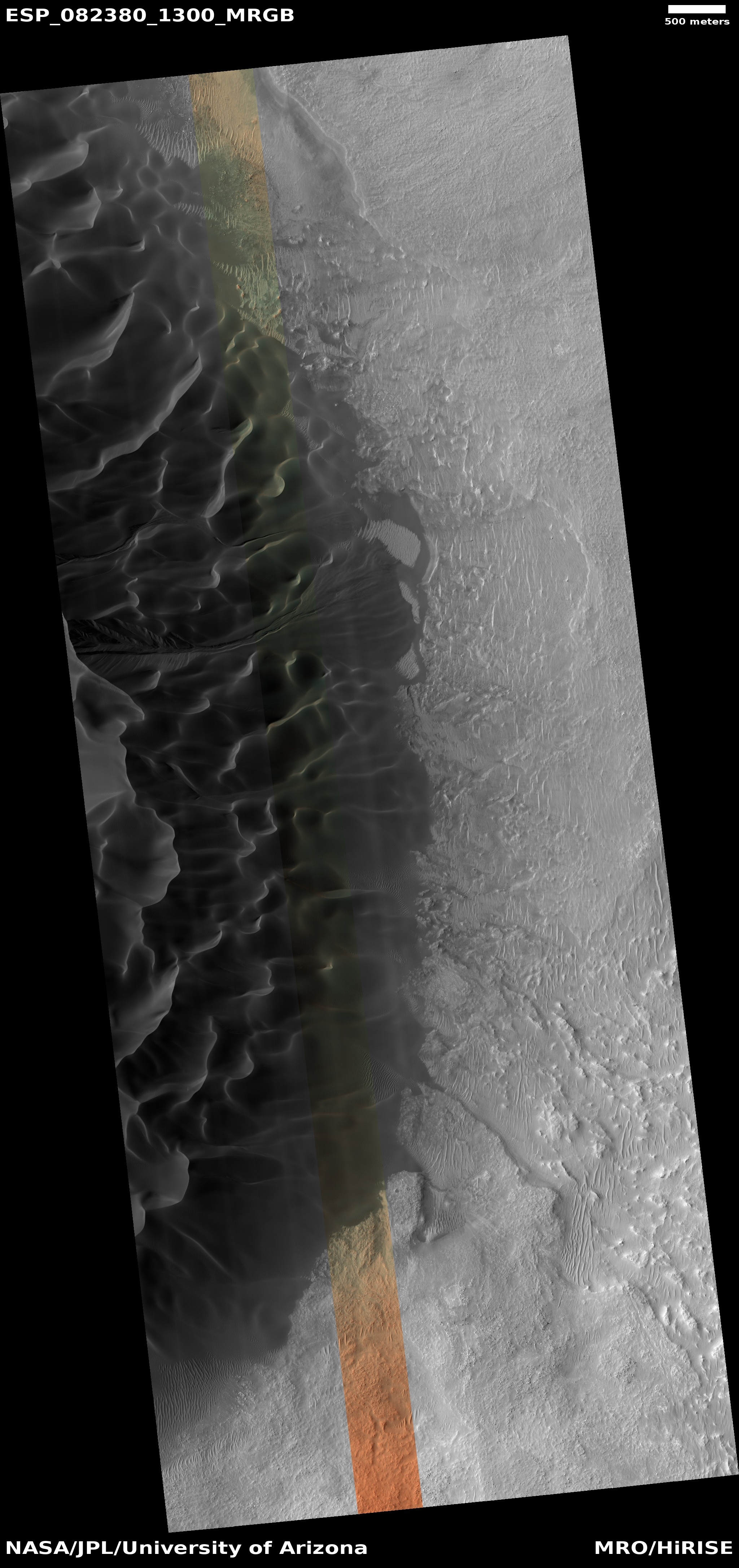
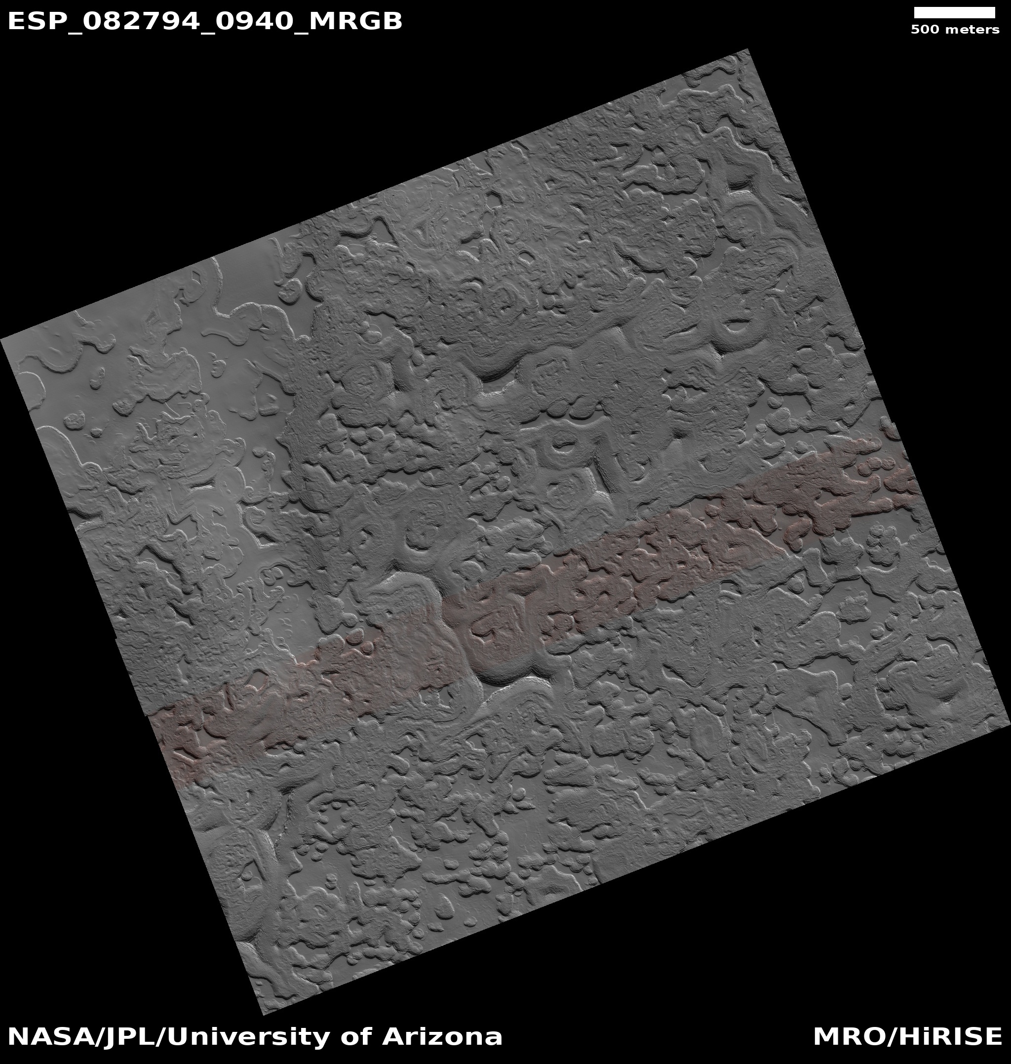
The bottom image, cropped, reduced, and enhanced to post here, was taken on March 24, 2024 and was part of planned research. It shows a section of the Martian south ice cap, specifically the area where scientists believe there is a residual permanent small cap of dry ice on top of a thick underlying water ice cap.
Like the top image, the features here suggest some sort of erosion process eating away randomly at the ground’s upper layers.
The two images illustrate the difficulty of interpreting orbital images. At first glance the geological features of both appear very similar. Yet the top image is located in the very dry equatorial regions of Mars, and in fact is inside the Medusae Fossae Formation, the largest field of volcanic ash on the red planet. The layers here are likely ash, and the erosion that carved out the hollows likely came from wind. If there ever was near-surface ice at this location, it was many eons ago.
The bottom image however likely shows the sublimation process that is slowly eating away at the residual dry ice cap at the south pole. The Martian north pole does not have residual permanent cap of frozen carbon dioxide, and the reasons why the two caps are different in this way are complex and not completely understood.
Both images show erosion that produces features that look similar. But the materials involved and the causes are completely different.
Remember this when you look at any orbital picture taken of Mars, or any other planetary object. Without the larger context (location, make-up, known history), any guess about the nature of the features there is nothing more than a wild guess, no different than throwing darts at a wall while wearing a blindfold.


