The empty desolation west of Jezero crater
Click for full resolution image. For original images go here and here.
Click for interactive map.
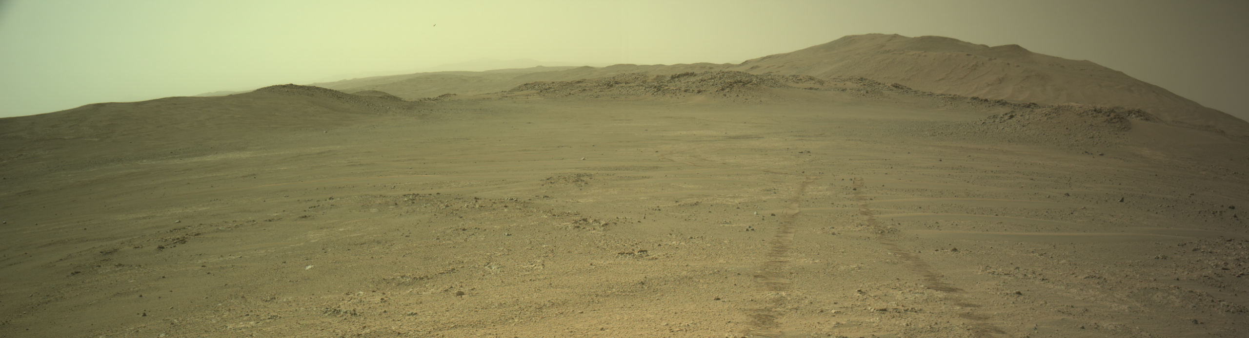
Cool image time! The panorama above was created from two pictures taken on July 1, 2026 (here and here) by the left navigation camera on the Mars rover Perseverance.
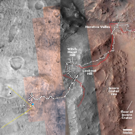
The overview map to the right provides the context. The white dotted marks the rover’s travels, with the blue dot marking Perseverance’s last posted location as of July 6, 2026. The yellow lines indicate roughly the area viewed by the panorama, taken five days earlier at a previous location.
The panorama looks west, at a low ridge line about 1,000 feet from the rover (the white dot), with a distant hill beyond (the black dot), about 4,500 feet away. The ridge is only about 50-60 feet high, while the hill rises about 600 feet. The rover’s tracks can be seen on the left.
Once again, the view from Perseverance indicates starkly the lifeless nature of Mars. Maybe it once had microbiology (though this is certainly not indicated so far by any solid evidence), but if it did, it is long long gone, and in fact likely never prospered at this location at all. NASA might claim repeatedly that Perseverance’s mission is to search for life, but every geologist on the mission knows this is a very low priority. What they are doing is studying the alien geology of another world. This image gives one a hint of its alienness.
Most specifically, Perseverance is studying a region in the dry tropics of Mars, where no near surface water remains, but also carries ample evidence of potentially valuable mineralogy. Orbital data strongly suggests the region west of Jezero crater will become a major mining region for future settlers. It might not contain any life, but it carries resources that will sustain the life that is soon to come from Earth.
The Perseverance team has been scouting this region now for the last four months, without doing any additional drilling. In fact, the last drill samples were taken at Witch Hazel Hill, in the spring of 2025. It appears they are taking their time to look for the best place to get core samples.