
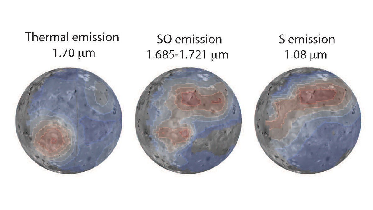
Cracking scallops in the Mars
Click for original image.
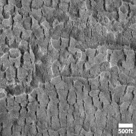
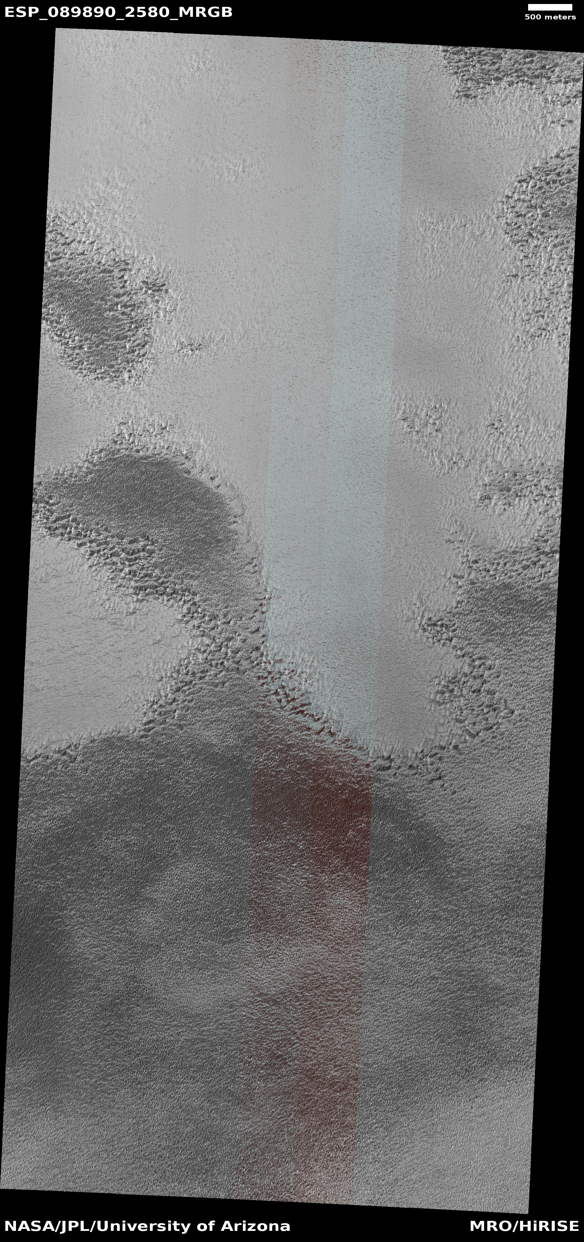
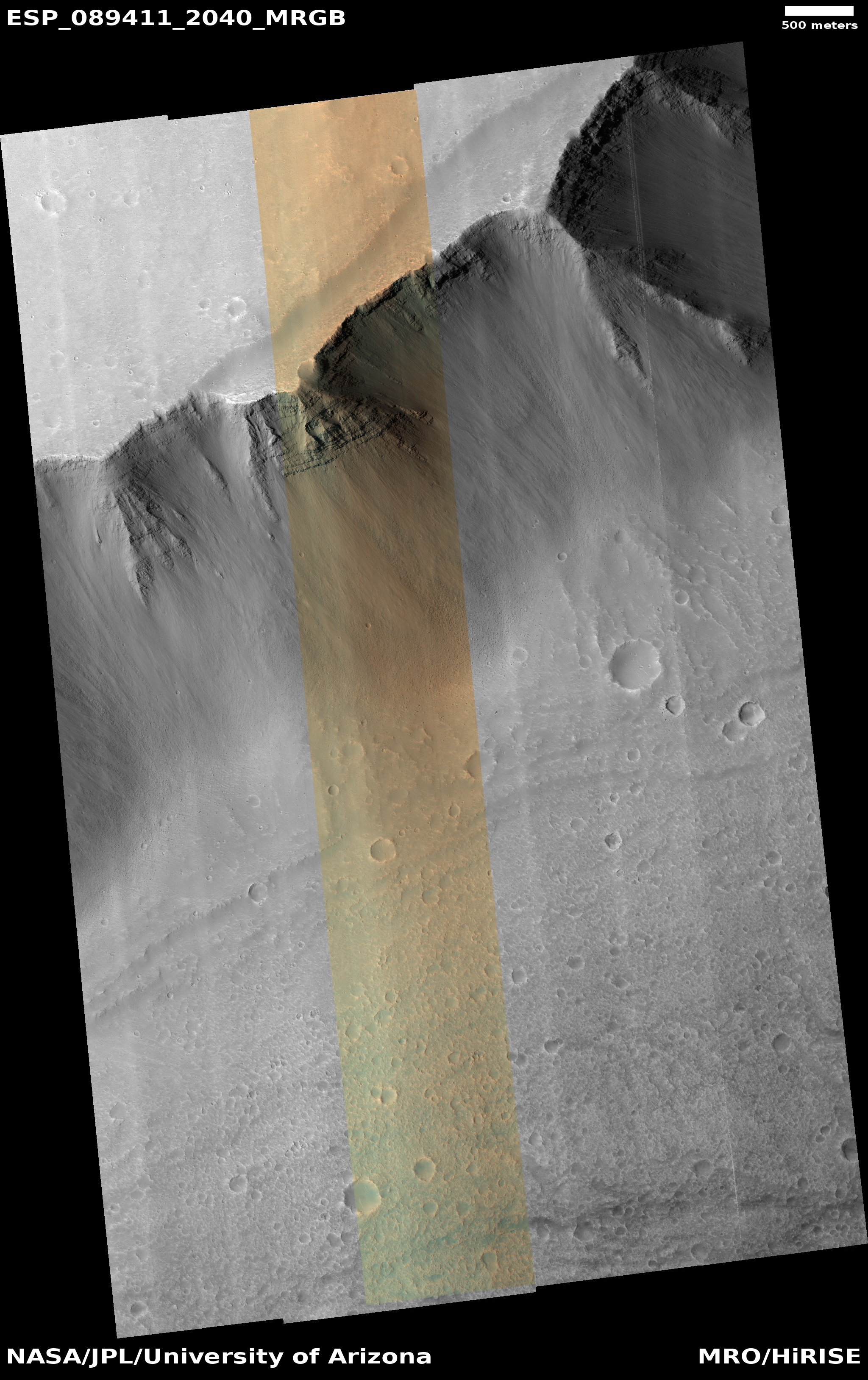
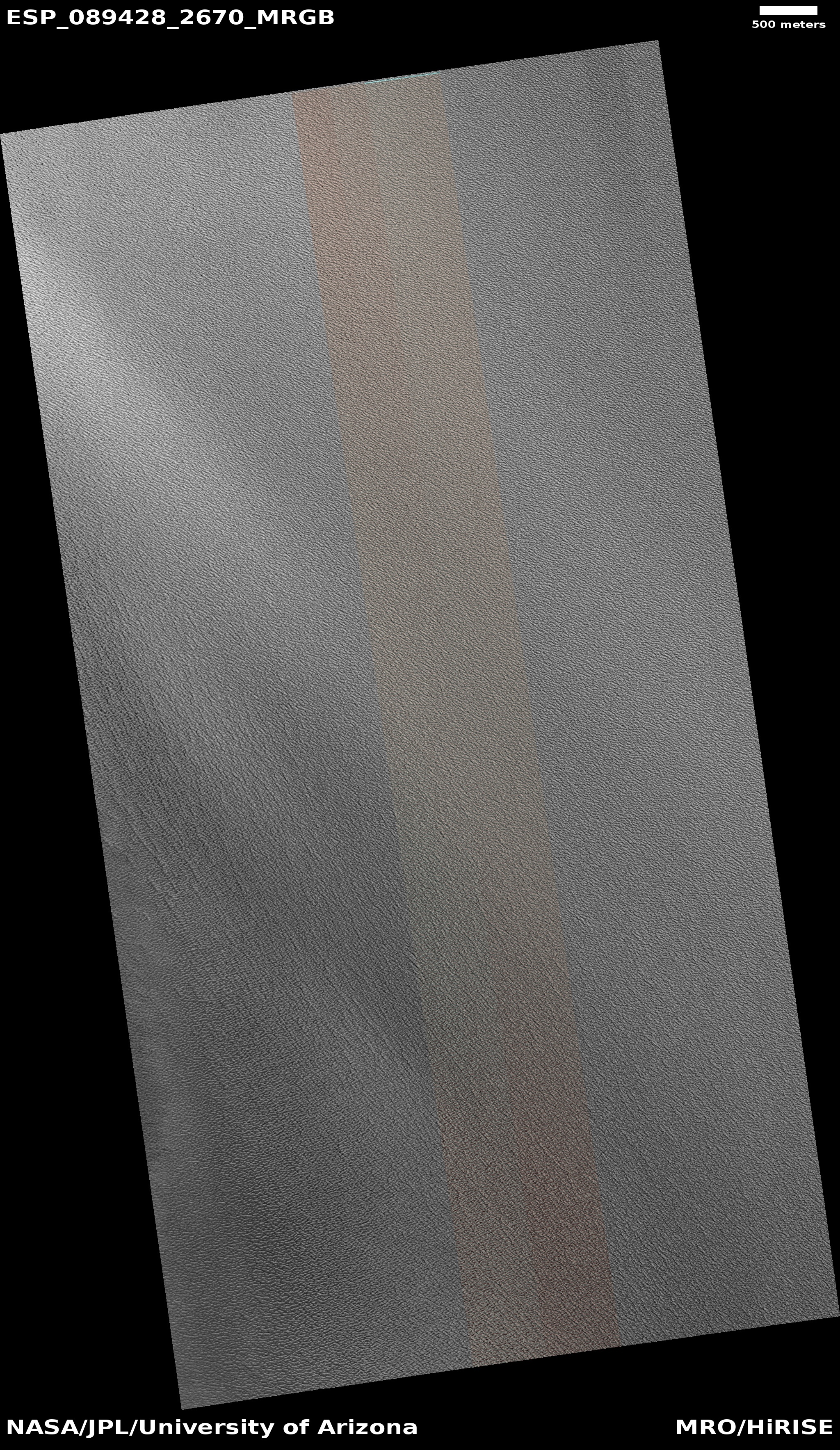
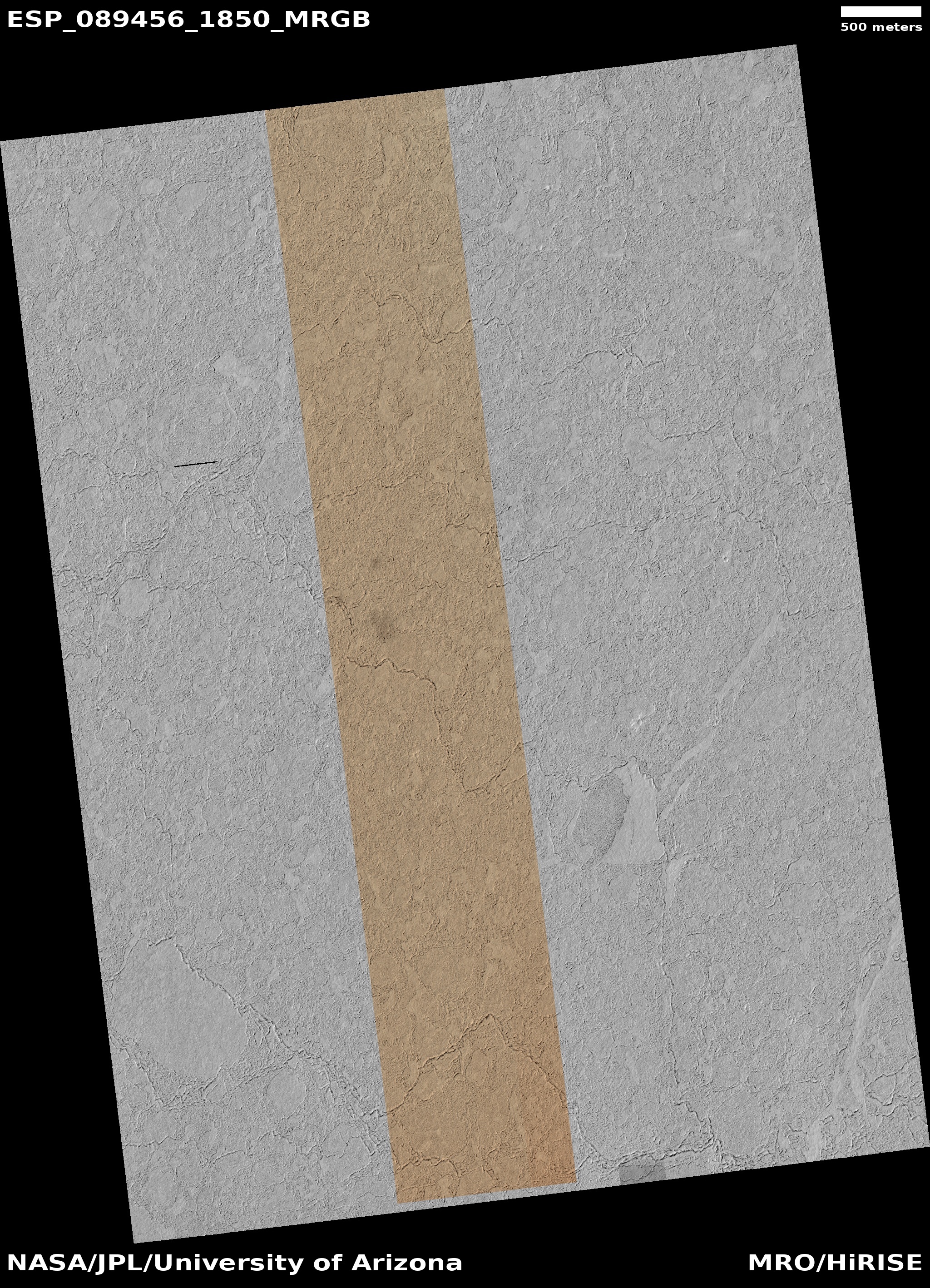
Cool image time! The picture to the right, cropped to post here, was taken on September 27, 2025 by the high resolution camera on Mars Reconnaissance Orbiter (MRO).
The science team labels this “scallop-hosting mantle”. In other words, the surface here has a mantle of material that is for a variety of reason cracking and producing these north-facing scallops. That mantle also appears layered, since it descends downward in terraced steps as you travel north. This particular terrace drops about 40 feet.
Scientists believe [pdf] these scallops are formed in connection with the sublimation of underground ice.
According to [one hypothesis] scallop formation should be ongoing at the present time. Sublimation of interstitial ice could induce a collapse of material, initially as a small pit, then growing southward because of greater solar heating on the southern side. Nearby scallops would coalesce together as can be seen to have occurred.
In the case of the image to the right, this sublimation is also accompanied by a drying process similar to cracks one sees in dried mud. As the ice sublimates away the remain material shrinks and cracks.
» Read more
Click for original image.
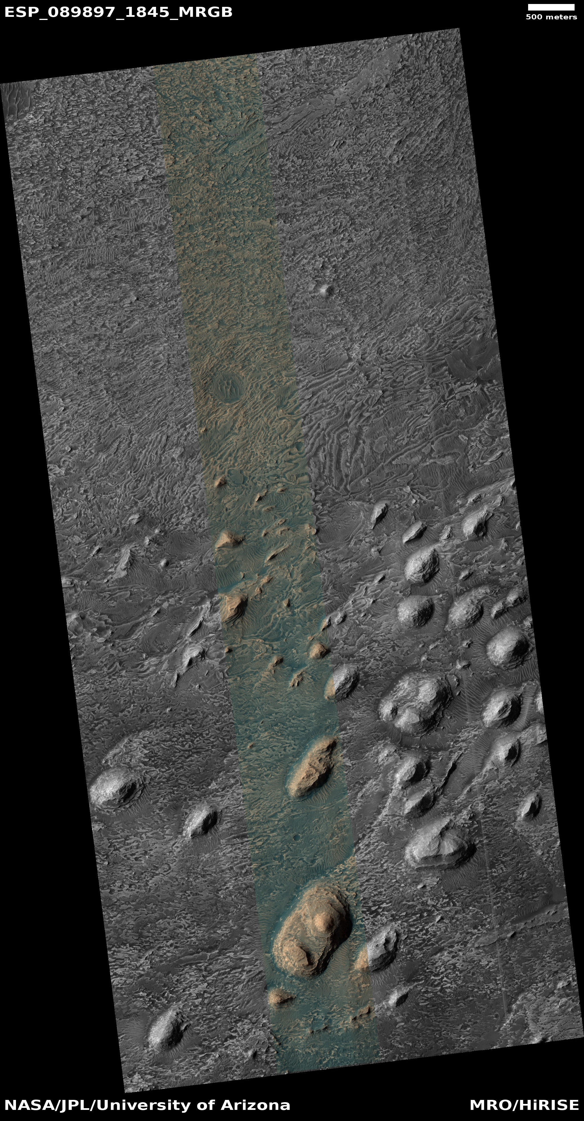
Cool image time! The picture to the right, cropped to post here, was taken on September 27, 2025 by the high resolution camera on Mars Reconnaissance Orbiter (MRO).
The science team labels this “scallop-hosting mantle”. In other words, the surface here has a mantle of material that is for a variety of reason cracking and producing these north-facing scallops. That mantle also appears layered, since it descends downward in terraced steps as you travel north. This particular terrace drops about 40 feet.
Scientists believe [pdf] these scallops are formed in connection with the sublimation of underground ice.
According to [one hypothesis] scallop formation should be ongoing at the present time. Sublimation of interstitial ice could induce a collapse of material, initially as a small pit, then growing southward because of greater solar heating on the southern side. Nearby scallops would coalesce together as can be seen to have occurred.
In the case of the image to the right, this sublimation is also accompanied by a drying process similar to cracks one sees in dried mud. As the ice sublimates away the remain material shrinks and cracks.
» Read more


