Cave boxwork on the Martian surface

Boxwork in Wind Cave on Earth
Boxwork inside Wind Cave, South Dakota, mere inches across.

Anyone who has ever visited either Wind or Jewel caves in South Dakota has likely seen some wonderful examples of the cave formation boxwork, formed when the material in cracks is more resistant to erosion that the surrounding bedrock, which once eroded away leaves behind the criss-crossing ridges seen in the picture to the right.

Today’s cool image provides us what appears to be an example of boxwork on Mars. However, unlike on Earth it is not in a cave but on the surface. It is also much larger. Instead of the ridges being almost paper thin and stretching for inches or feet, this Martian boxwork is feet wide with ridges extending hundreds of feet in size, as shown by today’s cool image below.
» Read more

A deep south Martian dune with bright patches

Dune with bright patches
Click for full image.

Cool image time! Last week the MRO science team posted a new captioned image entitled “Bright and Dark Dunes” featuring a particularly large single dune in the floor of a 25-mile-wide unnamed crater located at about 68 degrees south latitude. The photo to the right, rotated, cropped, reduced, and color enhanced to post here, shows that dune. According to the caption, written by Colin Dundas of the U.S. Geological Survey’s Astrogeology Science Center in Arizona,

This image shows a large sand dune with bright patches. Martian dunes near the poles often have bright patches in the spring, when seasonal frost is lingering. However, this image is from late summer, when frost is long gone. What is going on here?

A close-up look with [MRO’s high resolution camera] provides some clues. The bright patches are made up of large ridges that look like wind-blown bedforms. Additionally, the bright patches are yellowish in the infrared-red-blue image. In enhanced color, most sand on Mars is blue but dust is yellow. This suggests that the bright bedforms are either built from, or covered by, dust or material with a different composition.

Thus, the bright patches reveal either aspect of the dune’s underlying structure, either inherent in the bedrock itself, or the texture of its surface that allows it to hold more dust. As Dundas adds, “I think more study would be needed to determine the answer in this particular case.”

There are other aspects of this dune that can be seen by a look at the wider view afforded by MRO’s context camera below.
» Read more

Looking into one of Jupiter’s smaller cyclones

A northern cyclone on Jupiter
Click for full image.
Cool image time! The photo to the right, cropped and reduced to post here, was taken by the Juno probe orbiting Jupiter and enhanced first by citizen scientist Kenneth Gill and then further enhanced by citizen scientist Navaneeth Krishnan.

Sadly all the link tells us about this storm is that it is in the northern hemisphere. Based upon the colors, my guess is that it located at the high latitude where Jupiter’s bands transition to the chaotic region of storms at the poles, as seen in this earlier wide image of the gas giant’s south pole.

No scale is provided, but an earlier image of other northern hemisphere storms suggests this storm would probably cover the state of Arizona.

Study: Only 10% chance of catching COVID from infected person within household

Holy moley! A new study of more than 7,000 households in Boston with at least one infected person has found that there is only 10% chance that another member of the household will become infected also.

US researchers analysed data from more than 7,000 homes in Boston and found more than 25,000 people lived there between March 4 and May 17, 2020. In this time frame 7,262 people caught Covid but they only passed it on to a further 1,809 people they lived with, a transmission rate of 10.1 per cent.

The paper also found the likelihood of passing the virus on to someone you live with was lower for bigger hosueholds. For example, someone in a home with three to five people — one of whom was infected — was 20 per cent less at risk than a two-person house.

The study also found that infection was closely correlated with other illnesses. If you had other health issues, such asthma, cancer, were overweight, or had liver disease your chances of getting infected rose significantly.

This report is consistent with other research, that has found infection rates in households ranged from 16.6 to 19.5 percent. All tell us that even if you spend a lot of time with someone infected, if you are healthy your risk of catching COVID is relatively low. And if you are healthy your chances are dying are almost nil.

So I ask: When you are out hiking by yourself in the great outdoors, why the heck are you wearing a mask? And why do you stupidly put one on when you might pass someone else five feet away for about two seconds? Are you that fearful of life?

Skiing dry ice boulders on Mars, captured in action!

Grooves in dune created by sliding dry ice blocks
Click for full image.
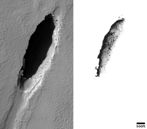
Today’s cool image is an update on a previous cool image published in April 2020 about how scientists believe the grooves seen on the slope of a giant dune in Russell Crater on Mars are believed to be formed by frozen blocks of carbon dioxide sliding down the slope when spring arrives. The photo to the right, taken on March 3, 2020 by the high resolution camera on Mars Reconnaissance Orbiter (MRO) and rotated and cropped to post here, shows these grooves. As I wrote then,

Because the block is sublimating away, the gas acts as a lubricant so that it can slide down the hill. If large enough, the dry ice block will stop at the base of the hill to disappear in a small pit. If small enough, it actually might completely vaporize as it slides, explaining the grooves that appear to gradually fade away.

The scientists actually did a test on Earth, buying a dry ice block at a grocery store and releasing it at the top of a desert dune. Go to my April 2020 link above to see the very cool video.

Several planetary scientists did further combing through many MRO photos of this dune and now think they have spotted examples where the camera actually captured a block as it was sliding downhill.
» Read more

Searching for ice in the Martian low latitudes

Low latitude crater with intriguing debris on its floor
Click for full image.
Today’s cool image well illustrates the effort of planetary scientists to map out the range of buried ice on the Martian surface. Taken on December 13, 2020 by the high resolution camera on Mars Reconnaissance Orbiter (MRO) and rotated, cropped, and reduced to post here, it shows a 3.5-mile-wide crater located in the southern cratered highlands, but for those cratered highlands at the very high northern latitude of 24 degrees.

The black streaks on the crater’s interior slopes are probably slope streaks, but these are not the subject of this article. Instead, it is the material that covers the crater’s floor. These features resemble the glacial fill material that scientists have found widespread in the latitude bands between 30 to 60 degrees latitude. However, this crater is farther south, where such ice would not be stable and should have sublimated away.

Could there still be ice here? I emailed the scientist who requested the photo, Colin Dundas of the U.S. Geological Survey’s Astrogeology Science Center in Arizona, and asked him what I was looking at. His answer:
» Read more

Parker looks at Venus

Venus as seen by the Parker Solar Probe
Click for full image.

During its July 2020 fly-by of Venus, the Parker Solar Probe used its wide field camera to snap a picture of the planet, cropped and reduced to post here on the right.

The photo surprised the scientists in that it apparently was able to detect some major surface features through Venus’ thick cloud cover.

WISPR is designed to take images of the solar corona and inner heliosphere in visible light, as well as images of the solar wind and its structures as they approach and fly by the spacecraft. At Venus, the camera detected a bright rim around the edge of the planet that may be nightglow — light emitted by oxygen atoms high in the atmosphere that recombine into molecules in the nightside. The prominent dark feature in the center of the image is Aphrodite Terra, the largest highland region on the Venusian surface. The feature appears dark because of its lower temperature, about 85 degrees Fahrenheit (30 degrees Celsius) cooler than its surroundings.

That aspect of the image took the team by surprise, said Angelos Vourlidas, the WISPR project scientist from the Johns Hopkins Applied Physics Laboratory (APL) in Laurel, Maryland, who coordinated a WISPR imaging campaign with Japan’s Venus-orbiting Akatsuki mission. “WISPR is tailored and tested for visible light observations. We expected to see clouds, but the camera peered right through to the surface.”

“WISPR effectively captured the thermal emission of the Venusian surface,” said Brian Wood, an astrophysicist and WISPR team member from the U.S. Naval Research Laboratory in Washington, D.C. “It’s very similar to images acquired by the Akatsuki spacecraft at near-infrared wavelengths.”

This surprising observation sent the WISPR team back to the lab to measure the instrument’s sensitivity to infrared light. If WISPR can indeed pick up near-infrared wavelengths of light, the unforeseen capability would provide new opportunities to study dust around the Sun and in the inner solar system. If it can’t pick up extra infrared wavelengths, then these images — showing signatures of features on Venus’ surface — may have revealed a previously unknown “window” through the Venusian atmosphere.

The streaks in the picture come from cosmic rays.

Land of rovers

Overview map

Today’s cool image is in honor the two newest Martian rovers, Perseverance (which now sits quite comfortably in Jezero Crater, ready to begin what will probably be more than a decade of exploration on the Martian surface) and China’s yet-to-be-named rover (set to hopefully soft land on Mars some time in late April).

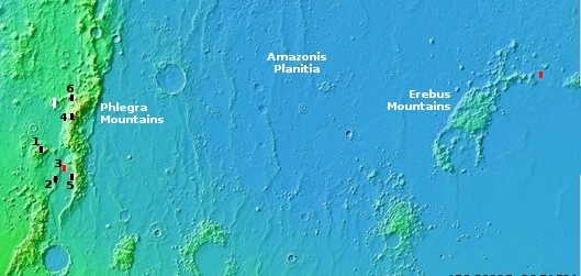
The overview map to the right shows us the region where both rovers shall wander. The black box in Jezero Crater is where Perseverance now sits. The red cross about 1,400 miles away is the believed landing zone for China’s rover, located in Utopia Planitia at about 25 degrees north latitude. The Viking 2 landing site is just off the edge of the northeast corner of the map.

The latitude of 30 degrees, as indicated by the white line, is presently an important dividing line based on our present knowledge of Mars. South of that line the terrain is generally dry, though there is evidence that water in some form (liquid or ice) was once present. North of that line scientists have found evidence of considerable ice below the surface, with its presence becoming increasingly obvious the farther north you go.

Today’s cool image, shown below, is north of that line at 33 degrees latitude in Utopia Planitia, and is marked by the white cross, about 500 miles to the northwest of the Chinese rover’s landing site.
» Read more

India officially delays both its manned mission and next lunar lander

The new colonial movement: India has now officially delayed the launch of both its manned mission Gaganyaan as well as its next lunar lander/rover Chandrayaan-3.

They hope to launch an unmanned test Gaganyaan mission before the end of this year, but the manned mission will not occur until after a second unmanned mission scheduled very tentatively in the 2022-2023 time frame.

As for Chandrayaan-3, they had initially hoped to launch it last fall, but they panic over the coronavirus that shut down their entire space industry for a years has now apparently pushed that launch back ’22, a delay of more than a year.

Tianwen-1 enters parking orbit around Mars

The new colonial movement: According to the Chinese state-run press, the Tianwen-1 orbiter has entered the parking orbit around Mars that it will use for the next three months to conduct reconnaissance of its lander/rover’s landing site.

At 6:29 a.m. (Beijing Time), Tianwen-1 entered the parking orbit, with its closest point to the planet at 280 km and the farthest point at 59,000 km. It will take Tianwen-1 about two Martian days to complete a circle (a Martian day is approximately 40 minutes longer than a day on Earth), the CNSA said.

Tianwen-1, including an orbiter, a lander and a rover, will run in the orbit for about three months.

The CNSA added that payloads on the orbiter will all be switched on for scientific exploration. The medium-resolution camera, high-resolution camera and spectrometer will carry out a detailed investigation on the topography and dusty weather of the pre-selected landing area in preparation for a landing.

China has also begun prepping the rocket that will launch Tianhe, the first module in its space station, sometime this spring. A total of eleven launches are planned over the next two years to assemble the station.

Martian pits or dark splotches?

Martian pits or dark splotches?
Click for full image.

Cool image time! The photo to the right, cropped to post here, was taken on January 2, 2021 by the high resolution camera on Mars Reconnaissance Orbiter (MRO). It shows a windswept sandy region of ridges and dunes with two dark features nestled between ridges.

What are these dark patches? At the available resolution they appear to be deep pits, with the one on the right having a significant overhang. And if these are pits, they would appear significantly different than most of the previously identified Martian pits, which are usually somewhat circular in shape. These features have very complex shapes, as if the pit is conforming itself to the terrain that surrounds it.

The resolution, however, is not good enough to confirm this interpretation. These dark patches could also be exposed volcanic material, darker than the surrounding terrain. The location, as shown in the overview map below, adds weight to this interpretation.
» Read more

Astronomers detect 1st evidence of neutron star left behind after 1987 supernova

The uncertainty of science: More than three decades after the 1987 supernova in the Large Magellanic Cloud, the only naked eye supernova in the 400 years, astronomers think they might finally have detected evidence of the neutron star left over from that blast and buried within the explosion’s wake.

“Astronomers have wondered if not enough time has passed for a pulsar to form, or even if SN 1987A created a black hole,” said co-author Marco Miceli, also from the University of Palermo. “This has been an ongoing mystery for a few decades and we are very excited to bring new information to the table with this result.”

The Chandra and NuSTAR data also support a 2020 result from ALMA that provided possible evidence for the structure of a pulsar wind nebula in the millimeter wavelength band. While this “blob” has other potential explanations, its identification as a pulsar wind nebula could be substantiated with the new X-ray data. This is more evidence supporting the idea that there is a neutron star left behind.

If this is indeed a pulsar at the center of SN 1987A, it would be the youngest one ever found.

The data is still somewhat tentative and unconfirmed, but intriguing nonetheless. The pulsar itself, if it really is a pulsar, remains buried in the explosion’s expanding cloud, and has as yet not been seen directly.

First panorama from Perseverance

The Perseverance science team has released the first panorama taken by the Perseverance rover after landing on Mars February 18th.

Below the fold however I have embedded something far better than the science team’s mosaic. Andrew Bodrev has taken these same navigation camera images and created a 360 degree virtual reality panorama, one that you can pan and tilt at your own pleasure. The view also includes the sounds of the Martian winds from the rover’s microphone. If you pause it you won’t hear the sounds, but you can scan and rotate for as long as you want.

» Read more

Movie of Perseverance’s descent and landing

Cool movie time! The science team for Perseverance today released movie footage obtained by the rover as it descended and landed on Mars in Jezero Crater. That video is embedded below.

If you compare what this movie sees with the orbital images from Mars Reconnaissance Orbiter (MRO) that I posted earlier today, you can recognize the features in the crater and anticipate exactly where the rover is going to land.

The COVID epidemic really IS ending

CDC infection detections of COVID
CDC graph

Though we all know that our fear-driven society and its power-hungry leaders will refuse to recognize this reality in order to permit life to return to a sane normality, the evidence now shows that the ’20-’21 winter season of COVID is now ending.

The big news is that there has been a drastic decline in reported infections since the beginning of the year.

According to the CDC COVID Data Tracker, there were 283,640 new cases on January 2, 2021. As of February 17, there were 69,165 cases. That represents a drop of 75.05 percent in six weeks — for all you fact-checkers out there.

First, we must recognize that the high numbers this season that seem to dwarf last year are caused largely by the increased effort to test everyone. The numbers also do not indicate COVID cases (where someone is sick from the disease) but include everyone who was tested and found positive, even if they were not sick at all. To call all positive detections as COVID cases is dishonest, and would have never been done in the past. Sadly, the idea of honest reporting has long disappeared.

Second, we must remember that these numbers are likely also inflated because it is financially advantageous for medical officials to report a coronavirus detection, even if it has not been clearly established. There has also been an effort to distort the numbers to make them seem worse than they are.

Finally, most news sources have been combining the statistics from last year’s COVID season with this year’s in order to inflate the numbers. This is bad reporting. The proper thing to do is to report them as separate seasons. If you did this you find that the numbers make the coronavirus not much different than the Hong Kong flu, when adjusted for population. It might be worse, but not unduly so.

For COVID, separating its annual seasons has been made more little difficult because the lockdowns and the insistence that everyone wear masks (almost all of which were worn improperly) I think caused a second unprecedented COVID summer season. That summer rise would likely not have happened if we had allowed people to behave normally in the summer weather, when such respiratory illnesses fade. Instead, everyone wore unsanitary masks that they touched constantly (increasing the changes they were exposed to the pathogen) while confining them indoors where such viruses prosper.

Regardless, the data strongly suggests this year’s coronavirus season is waning, as always happens with such respiratory diseases with the coming of spring. And certainly the arrival of vaccines against COVID is contributing to this decline as well.

All good news. Are you ready to cheer, or will you find ways to see only the half-filled part of the glass?

Nor is this news all. Two more stories in the past few weeks now give us a far better and hopeful sense of the disease’s scope and future.
» Read more

New 3D atlas of all binary stars within 3,000 light years of Sun

Using data from Europe’s Gaia satellite, astronomers have now compiled a 3D map of every binary star within 3,000 light years of the the Sun — 1.3 million — including many widely spaced binaries that were previously not identified.

The one-of-a-kind atlas, created by Kareem El-Badry, an astrophysics Ph.D. student from the University of California, Berkeley, should be a boon for those who study binary stars — which make up at least half of all sunlike stars — and white dwarfs, exoplanets and stellar evolution, in general. Before Gaia, the last compilation of nearby binary stars, assembled using data from the now-defunct Hipparcos satellite, included about 200 likely pairs. “This is just a massive increase in sample size,” said El-Badry. “And it is an increase in what kinds of evolutionary phases we find the binaries in. In our sample, we have 17,000 white dwarfs alone. This is a much bigger census.”

The data has also shown that the bulk of these binaries are made up of twins, stars similar in mass, something that is surprising and as yet unexplained, especially for binaries where the stars are widely separated.

All systems on Perseverance so far check out good

The Perseverance science team reported this past weekend that all systems on the rover have so far reported back and are operating as expected, including the test helicopter Ingenuity.

Some more images were sent back, all visible at the Perseverance raw image website. The most spectacular new image of Perseverance released however was one taken by the high resolution camera on Mars Reconnaissance Orbiter (MRO) and posted below.
» Read more

Ham picks up signal from China’s Tianwen-1 Mars orbiter

An amateur ham radio operator announced on February 10th that he has been able to pick up a radio transmission from China’s Tianwen-1 Mars orbiter.

As reported on Spaceweather.com, Canadian radio amateur Scott Tilley, VE7TIL, has snagged another signal from deep space. His latest conquest has been to copy the signal from China’s Tianwen-1 (pronounced “tee-EN-ven”) probe, which went into orbit around Mars on February 10. Tilley told Spaceweather.com that the probe’s X-band signal was “loud and audible.”

“It was a treasure hunt,” Tilley told Spaceweather.com. He explained that while the spacecraft did post its frequency with the International Telecommunication Union (ITU), it was too vague for precise tuning (X band is between 8 GHz and 12 GHz).

What makes this detection especially interesting is that it indicates the possibility that in the somewhat near future some ham might actually be able to win the Elser-Mathes Cup. According to this article [pdf] from the national ham radio magazine QST, by the late 1920s there was a desire to create a new challenge for hams, as by then they had managed to devise methods for communicating across the entire globe.

Amid this disillusionment, [Colonel Fred Johnson Elser] visited ARRL [the national ham radio organization] and had the pleasure of meeting League co-founder and first president Hiram Percy Maxim, whose many interests included Mars. Elser reported that Maxim even owned a globe of the planet, with all of its known features demarcated.

Elser returned to his home in Manila and befriended Stanley Mathes, a Lieutenant Commander in the Navy who had been stationed in the Philippines. Based on their shared belief that Amateur Radio technology would improve at a prodigious rate, Elser and Mathes devised an award for the most ambitious Amateur Radio contact they could imagine. In honor of Hiram Percy Maxim’s love of the Red Planet, Elser and Mathes established the Elser-Mathes Cup, to be awarded for the “First Amateur Radio Two-Way Communication Earth & Mars.”

That cup has remained unclaimed since it was established in 1929, more than ninety years. The detection by Tilley above using ham equipment suggests that a winner might soon be able to lay claim to the cup. However,

Fred Elser and Stanley Mathes stipulated that the contact must be two-way, and that the transmission on the Mars end of the contact cannot be generated by a “robot.” Until we can put a ham on Mars, the Elser-Mathes Cup will go unclaimed.

As almost all astronauts are also hams, all that must happen is for an astronaut to get to Mars, land, and communicate back to Earth using ham equipment. While this will not happen soon, the possibility it will happen in the not-too-distant future is finally becoming a reality. Stay tuned.

Hat tip to ham Don Huddler N4RRT.

Giant Antarctic iceberg disintegrates, missing South Georgia Island

NASA photo of disintergrating iceberg

Chicken Little was wrong again! The giant Antarctic iceberg, that some scientists were terrified would crash into South Georgia Island and harm the wildlife that lives there, has done exactly what every other iceberg has done since scientists began tracking them by satellite, disintegrate and float around the island, doing it no harm at all.

The NASA satellite photo to the right shows the situation on February 11, 2021. In November the iceberg was almost exactly the same shape and size as South Georgia island, and was heading right for it. (See the graphics from my earlier post.) At that time there were cries of impended disaster from our typically panicky and fear-driven scientists of the environmental community, claiming that the berg might become grounded against the island to do harm to the wildlife there, even though thousands of bergs of all sizes have all routinely floated around the island harmlessly.

Since then the iceberg has broken up and (surprise!) floated around the island harmlessly, as shown by the satellite photo. The doomsayers were wrong again, as they are and have been routinely for decades.

Considering the terrible track record of predictions by the environmental movement, you’d think people would stop buying into its cries that the sky is falling, but sadly they still do, and apparently will continue to do so for the foreseeable future.

Partly ice-filled Martian crater?

Partly ice-filled Martian crater?
Click for full image.

Time for another cool Martian image. The photo to the right, rotated, cropped, and reduced to post here, was taken on January 3, 2021 by the high resolution camera on Mars Reconnaissance Orbiter (MRO). The section I have focused on is a single crater about a mile and a half wide.

What makes this crater interesting is the material that appears piled up against the crater’s northern half. Furthermore, both the floor of the crater as well as this piled up material looks like it is eroding away, kind of like a block of ice which is having warm water sprayed on it.

So, is this glacial ice?
» Read more

Perseverance has successfully landed

Cheers in the control room

First image from Perseverance on the ground

The rover Perseverance has successfully landed in Jezero Crater on Mars.

The picture to the right is a screen capture of everyone cheering in the control room on hearing the good news.

The second image is the first image beamed back, from the rover’s hazard camera used mostly for guiding it in future travels. The haze is from the dust kicked up during landing.

The engineering narrator indicated that they also know exactly where the rover landed, and it is a good location, but NASA’s live stream appears uninterested in telling us this critical information. Right now they are spending time blathering on with more NASA propaganda.

I should get this information during the post-landing press conference, which begins at 5:30 (Eastern).

UPDATE: The press conference started 30 minutes late, and then spent the first 25 minutes letting the top NASA managers claim credit for everything. Then we finally got to hear from actual mission managers to tell us where the rover landed and what should happen next.
» Read more

Eroded mound in Mars’ glacier country

Eroded mound in Mars' glacier country
Click for full image.

Cool image time! The image to the right, reduced to post here, was a captioned release today by the science team of the high resolution camera on Mars Reconnaissance Orbiter (MRO). It is located in Deuteronilus Mensae, a region of chaos terrain in the transition zone between the northern lowland plains and the southern cratered highlands that is also part of a 2,000 mile-long band that I call Mars’ glacier country. From the caption, written by Dan Berman, senior scientist at the Planetary Science Institute in Arizona:

Lobate debris aprons are commonly found surrounding dissected plateaus in the Deuteronilus Mensae region of Mars. They have been interpreted as debris-covered glaciers and radar data have shown their interiors to be composed of pure ice.

The mound in this image is slightly removed from most of the other plateaus, and the [debris apron] surrounding it is highly degraded. The sharp scarps on the western and eastern sides of the mound indicate that a great deal of the ice once found in these landforms has since sublimated away, leaving behind these collapsed debris cliffs.

I wonder if further research might find an ice layer in those cliff walls, especially because this photo strongly suggests that much of this mound is made of ice that is sublimating away or has flowed downward to form the debris aprons as well as that central gully.

The overview map below shows its location in Deuteronilus Mensae as well as showing almost all of the entire band of Mars’ glacier country.
» Read more

Perseverance’s possible travel route on Mars

Perseverance's planned driving routes
Click for full image.

In touting the plans of NASA and the European Space Agency (ESA) to someday launch a rover to Jezero Crater designed to pick up the cached samples that Perseverance is going to leave behind, NASA today published the map to the right, showing Perseverance’s planned driving routes in the crater, on the large delta that poured into the crater in the past, and beyond that crater.

The yellow lines indicate Perseverance’s planned route, beginning somewhere in that red landing ellipse. The green lines indicated the many proposed landing sites and pathways the proposed follow-on sample retrieval mission can take to grab Perseverance samples.

The planned route looks like they will spend a lot of time exploring the top of delta, then will move out of the crater and to the southwest towards what had been another candidate landing site for Perseverance, now dubbed the Midway ellipse.

What route the science team will eventually take at the delta depends greatly on exactly where Perseverance lands today. We will know more in only a few hours.

Hungarian company awarded NASA contract to develop Moon mini-rover

A Hungarian company has won a NASA contract worth $225K to develop what the company calls its Puli Moon mini-rover.

Named after a Hungarian breed of dog, the Puli rover is a low-cost platform designed to carry different payloads, including the ice water snooper, which won the 2020 “Honey, I Shrunk the NASA Payload” challenge, a competition organised by the U.S. space agency. Weighing less than 400 grammes (14 oz), its purpose is to probe for water ice by identifying and mapping the subsurface hydrogen content of the lunar soil.

The “news article” at the link appears to be a poorly researched article distributed by Reuters that has now been reprinted without changes by such stalwart American mainstream news outlets like the New York Post and MSN.com, to name two. Neither bothered to do any further research.

The article falsely claims that the airplane-based SOFIA telescope recently confirmed there is water on the Moon. It also claims that this rover will be on a lunar mission next year, something that does not seem likely at all.

A look at the company’s website clarifies things. The company competed in a NASA contest offering its design of a very tiny lightweight rover, won, and was then awarded a larger development contract of $225K. No launch is presently set, though if the company is successful in building it for this cost, they will likely get a berth on a later unmanned mission.

An update on coronavirus from an Arizona doctor

My personal GP doctor in Arizona, Robert Lending, has for the last year sent out weekly detailed updates to his patients on the on-going COVID-19 epidemic. I thought I provide my readers his carefully researched doctor’s perspective, with his permission of course.

First he updates us on the state of the epidemic in Arizona:

The surge in AZ and in Pima County is over; with dramatic decreases in Cases, Case Fatality Rates (CFR), and Case Hospitalization Rates (CHR). The hospitalization utilizations including beds and ventilators, etc. are markedly decreased. {{{Tucson Medical Center is down to 10.5% Inpatient Covid-19, and they will resume elective surgeries.}}} The initial reductions began before vaccinations, but now may have been helped by the vaccinations. On the other hand, the virus acts as it will; independent of most of society’s attempts to control or modify it, no matter what the politicians and health department officials state. [emphasis mine]

The highlighted text matches what I have been saying for the past year, that the panicky effort to “stop the spread of COVID-19” was foolish, counterproductive, and entirely useless. And the evidence now a year later supports that conclusion. Nothing done by any government anywhere in the world has stopped the virus from spreading, whether it be lockdowns, masks, or quarantines. In the U.S. and Europe especially places that imposed fewer restrictions on their citizens seemed to fare about the same as places where the government stamped down hard. And those former places also had less negative consequences for their economies and for the freedoms of their citizens.

Meanwhile, the evidence is that the epidemic in Arizona is fading. And as far as I can see, during its height it affected almost no one in the general population. Like the flu it impacted the elderly sick the most, but everyone else either didn’t see it at all, or if they got sick they almost always recovered.

Unfortunately, it doesn’t matter that the epidemic is fading and that a vaccine is now available. The unreasonable rules imposed during the panic remain in force, and likely will never go away. And I speak from experience. For example, in trying to schedule an appointment with another doctor, I was told by his office that even if I had tested negative for COVID, received the vaccine, and quarantined myself between its receipt and my appearance at the office, I would still be required to wear a mask.

Think about that. I would be totally healthy and have no symptoms and could in no way transmit the virus, and yet the mask would still be required. We are now a society that irrationally sees all other humans as a threat to be avoided, at all times.

As for the flu, Lending noted some very intriguing data.
» Read more

Strange corroding features on Mars

Strange corroding features on Mars
Click for full image.

Cool image time! The photo to the right, rotated, cropped, and enhanced to post here, was taken by the high resolution camera on Mars Reconnaissance Orbiter (MRO) on October 4, 2020. It shows what appears to be features that are either corroding or eroding away, with the lower areas filled with rippling sand dunes.

The circular features might be ancient craters. The material that partly fills them might be a layer of dust or sand that the wind is slowly blowing away to dig out the depressions along the southern cliff wall.

According to the MRO science team’s interpretation of the colors produced by the high resolution camera [pdf], the dark blue colors here are likely “coarser-grained materials (sand and rocks)”, while the orange-red material on the higher terrain is likely dust.

Could this material be evidence of buried ice eroding away? At first I thought so, and then I took a look at the photo’s location, as shown in the overview image below.
» Read more

Watching Perseverance’s landing on Mars

Because it will take eleven minutes for radio communications from Mars to reach Earth, no one on Earth will have any direct contact with the American rover Perseverance as comes in to land in Jezero Crater on Mars on February 18th. When NASA broadcasts the landing here on Earth it will already have happened.

Nonetheless, if you want see as soon as possible if the landing was successful, you can go to NASA public channel here at NASA or here at Youtube. I have also embedded the live stream telecast below the fold in this post.

The landing itself is set for about 3:55 pm (Eastern) on Thursday, February 18th. NASA’s coverage is scheduled to begin at 2:15 pm (Eastern). Expect almost everything you watch to be seeped in NASA propaganda, though of course their overview of the rover, its landing, and its landing site will be informative.

One important note: NASA has been selling the false notion that the primary goal of Perseverance is to search for life on Mars, and sadly much of the mainstream press has been repeating this notion blindly. It is simply not true. The rover’s primary goal, first, last, and always, is to gain more knowledge of the geology of Mars and its past history. If along the way the rover detects evidence of life, all for the better, but that is not what it will be focused on doing during its journey in Jezero Crater.
» Read more

New paper: Underlying ice layer seen in Martian gullies at LOW mid-latitudes

Snow on Mars?
Click to see full image.

In a paper just published, scientists are proposing that bright areas seen in the low mid-latitude gullies on Mars are the underground ice table newly exposed as surface dust is removed.

This paper is a reiteration in more detail of a previous presentation [pdf] by these same scientists at the 2019 the 50th Lunar and Planetary Science Conference in Texas and reported here in March 2019.

The image to the right, from the paper, was taken by the high resolution camera of Mars Reconnaissance Orbiter (MRO) in 2009, and has been cropped to post here. The white streaks are what the scientists propose is that exposed underground ice table. At 32.9 south latitude, this particular gully would be the closest to the equator that such an ice layer has been identified. All the previous ice layer discoveries have been in the ice scarps found at latitudes above 50 degrees. As the paper’s lead author, Aditya Khuller at Arizona State University, explained in to me in an email, “We believe we are seeing exposures of dusty ice that likely originated as dusty snow.” From their paper:

We suggest … that the light-toned materials are exposed H2O ice. … [T]he appearance, and then subsequent disappearance of these light-toned materials, suggests that they are some form of volatile, such as dusty ice, rather than dust alone. … [The appearance] of these light-toned materials is similar to the >100m thick, light-toned ice deposits exposed on steep mid-latitude scarps, indicating that these materials are probably also ice, with some amount of dust on, and within the ice.

The layer would have likely been laid down as snow during a time period (a long time ago) when the rotational tilt of Mars, its obliquity, was much higher than today’s 25 degrees. At that time the mid-latitudes were colder than the poles, and water was sublimating from the polar ice caps to fall as snow in the mid-latitudes.

The overview map below reveals some additional intriguing possibilities.
» Read more

UAE releases first Al-Amal image of Mars

Al-Amal's first Mars image
Click for full image.

The new colonial movement: The leader of the United Arab Emirates (UAE) yesterday released on his twitter feed the first photo of Mars that was beamed back from its Al-Amal (“hope” in English) orbiter, taken shortly after achieving orbit.

That photo is to the right, cropped and reduced to post here. From the article at the link:

[The photo] was captured by Hope’s EXI instrument from an altitude of 24,700 km (15,350 miles) above the Martian surface at 20:36 GMT on Wednesday – so, one day after arriving at the Red Planet.

The north pole of Mars is in the upper left of the image. At centre, just emerging into the early morning sunlight, is Olympus Mons, the largest volcano in the Solar System. Look right on the boundary between night and day, the so-called terminator.

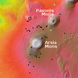
The three shield volcanoes in a line are Ascraeus Mons, Pavonis Mons, and Arsia Mons. Look east, to the limb of the planet, and you can see the mighty canyon system, Valles Marineris. It’s part covered by cloud.

Right now the spacecraft’s orbit is very eccentric, ranging from 600 to 30,000 miles above the Martian surface. After several orbital trims, Al-Amal will end up in an orbit about 14,000 by about 27,000 miles, with an inclination of about 25 degrees. From that high orbit it will then focus on studying the Martian atmosphere.

Thus, future images will likely be similar to this, global and mostly aimed at tracking visible phenomenon in the atmosphere (dust storms and clouds).

Rover update: The rovers are coming! The rovers are coming!

With the imminent landing on Mars of both the American rover Perseverance only days away on February 18th followed by China’s rover in April, I think it time for a new rover update, not only providing my readers a review of the new landing sites but a look at the most recent travels of Curiosity on Mars and Yutu-2 on the Moon.

Curiosity

Curiosity's view of the base of Mount Sharp, February 12, 2021
Click for full resolution image.

Overview map of Curiosity's most recent and future travels

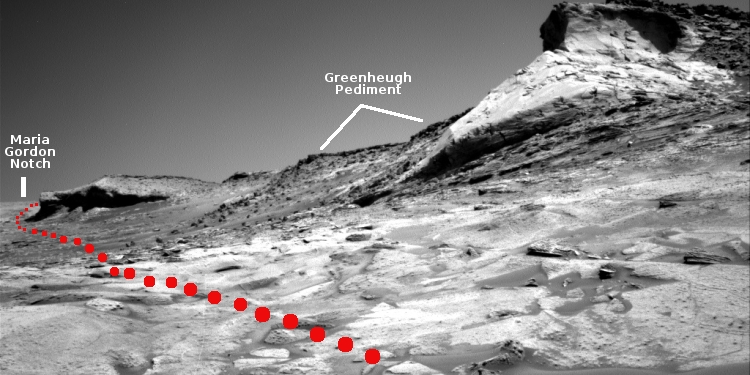
The panorama above, made from four images taken by Curiosity’s right navigation camera on February 12, 2021 (found here, here, here, and here), looks south to the base of Mount Sharp, now only a short distance away. The yellow lines on the overview map to the right show the area this panorama covers. The white line indicates Curiosity’s previous travels. The dotted red line in both images shows Curiosity’s planned route.

The two white dots on the overview map are the locations of the two recurring slope lineae along Curiosity’s route, with the plan to get reasonable close to the first and spend some time there studying it. These lineae are one of Mars’ most intriguing phenomenon, seasonal dark streaks that appear on slopes in the spring and fade by the fall. There are several theories attempting to explain their formation, most proposing the seepage of a brine from below ground, but none has been accepted yet with any enthusiasm.
» Read more

1 80 81 82 83 84 276