New evidence suggest lake once existed in Gale Crater

Scientists have concluded that mineral veins seen by Curiosity in Gale Crater were created when a lake existed there.

The study suggests that the veins formed as the sediments from the ancient lake were buried, heated to about 50 degrees Celsius and corroded. Professor John Bridges from the University of Leicester Department of Physics and Astronomy said: β€œThe taste of this Martian groundwater would be rather unpleasant, with about 20 times the content of sulphate and sodium than bottled mineral water for instance!”

3 comments

Heading directly for Balanced Rock

Curiosity's course to Balanced Rock

As I predicted Sunday, the Curiosity science team is aiming the rover directly towards the gap in the mesas, dubbed the Murray Buttes, that also has the balanced rock seen in earlier images.

The image on the right shows the rover’s most recent two traverses, superimposed on a Mars Reconnaissance Orbiter image. I have cropped it to focus in on the area of most interest.

Based on the rover’s general rate of travel, I would expect them to enter the gap after about two or three more traverses. This means they will be there in about a week, since after each traverse they usually stop and do science and reconnaissance before resuming travel.

7 comments

Curiosity’s way forward

Panorama with balanced rock

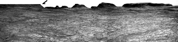
As Curiosity moves up into the foothills of Mount Sharp the terrain is getting increasingly interesting. The image above is a panorama I have created from three Left Navigation Camera images posted here on Sunday evening. It shows what I think will be the general direction mission scientists wish to send Curiosity. (Note that the top of the leftmost mesa is not as flat as shown, as its top was cut off in the original image.)

Below is a Mars Reconnaissance Orbiter image showing Curiosity’s present position from above. I have annotated it to show the general view as shown in the above image. I have also marked on both the location of the balanced rock first photographed on July 7.
» Read more

1 comment

Route to Balanced Rock

Route to Balanced Rock on Mars

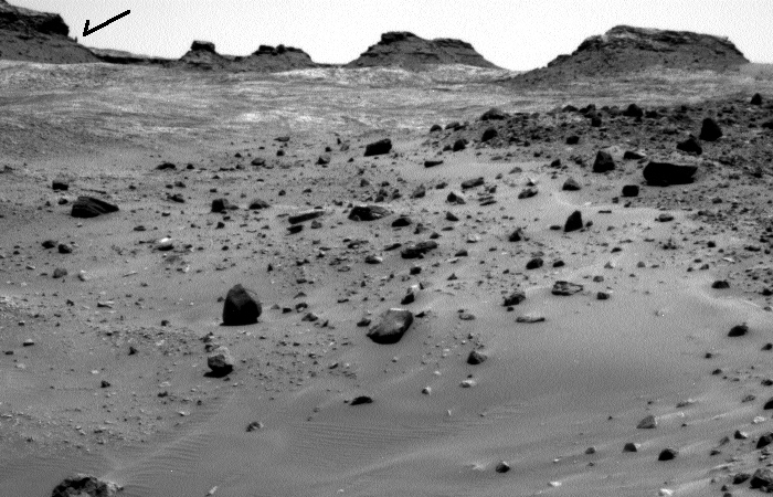
The image above is a panorama I have created from the raw images taken by Curiosity’s left navigation camera today, using this image for the left half and this image for the right half. They show the terrain in front of the rover, including the balanced rock on the horizon, indicated by the arrow.

I have no idea what route the science team plans, but looking at all of the images, as well as their desire to get a closer look at the rock, I suspect they will head up to the left on the smoother ground, aiming almost directly at the balanced rock. I also suspect that they will eventually veer right before getting to the rock, since the rover can’t go over the rough terrain in that area. Stay tuned to find out.

4 comments

Balanced rock on Mars

Balanced rock on Mars

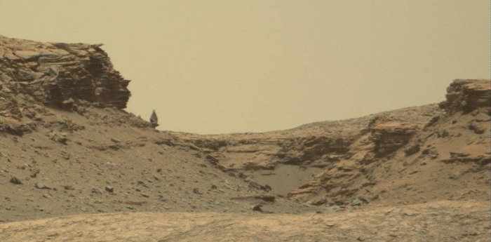
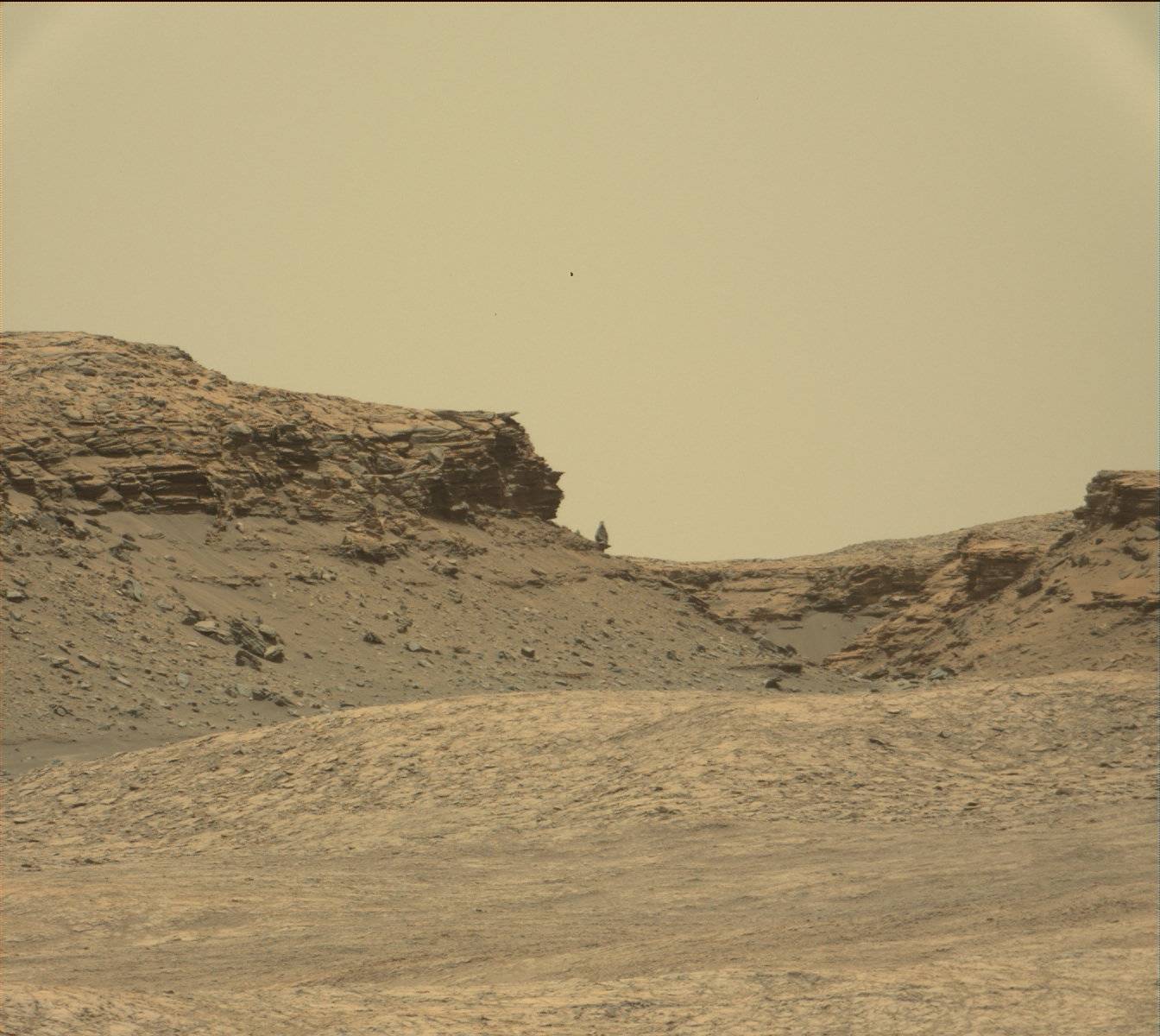
Cool image time! Prior to going into safe mode Curiosity’s mast camera took a series of images of its surroundings, as is routine as the rover travels. Among those images was the image above, though I have cropped it and reduced its resolution to show here. It reveals a balanced rock on the horizon. It also shows, as do the other survey images, how increasingly rough the terrain is becoming that Curiosity is traveling through.

The Curiosity science team has no intention of getting too close to this rough terrain, but they do hope to get better views of this rock as they continue the rover’s journey uphill.

1 comment

Curiosity in safe mode

For the first time in three years, Curiosity has entered safe mode.

On July 2, Mars rover Curiosity ceased science operations on the slopes of Mount Sharp after a fail safe was tripped, forcing the nuclear-powered robot into a low-power “safe mode.” According to a NASA Jet Propulsion Laboratory report, preliminary information communicated by Curiosity suggests an “unexpected mismatch between camera software and data-processing software in the main computer” may have been the culprit and the rover’s automated systems took over, preventing any permanent damage from being caused.

They are in communications with the rover, and expect a full recovery.

0 comments

Curiosity heads south

After four years of southwest travel to skirt a large dune field at the base of Mount Sharp, Curiosity has finally turned due south to aim directly up the mountain.

“Now that we’ve skirted our way around the dunes and crossed the plateau, we’ve turned south to climb the mountain head-on,” said Curiosity Project Scientist Ashwin Vasavada, of NASA’s Jet Propulsion Laboratory, Pasadena, California. “Since landing, we’ve been aiming for this gap in the terrain and this left turn. It’s a great moment for the mission.”

1 comment

Curiosity’s wheels handling rough terrain

Good news: The Curiosity engineering team has found that the rough and fractured rocky terrain the rover has been recently traveling across on Naukluft Plateau has not significantly increased the wear & tear on the rover’s wheels.

The rover team closely monitors wear and tear on Curiosity’s six wheels. “We carefully inspect and trend the condition of the wheels,” said Steve Lee, Curiosity’s deputy project manager at NASA’s Jet Propulsion Laboratory, Pasadena, California. “Cracks and punctures have been gradually accumulating at the pace we anticipated, based on testing we performed at JPL. Given our longevity projections, I am confident these wheels will get us to the destinations on Mount Sharp that have been in our plans since before landing.”

Inspection of the wheels after crossing most of the Naukluft Plateau has indicated that, while the terrain presented challenges for navigation, driving across it did not accelerate damage to the wheels.

0 comments

Curiosity drills again

The Curiosity science team has paused the rover’s journey up Mt Sharp in order to drill another hole, this time on the fractured rock covering the surface of Naukluft plateau.

The drill effort was a success, and they are now gathering data from the hole and the material from it. At the same time, the drilling process drained the rover’s batteries, which means they are now taking a break from science to let them recharge.

0 comments

Curiosity reaches Naukluft Plateau

The view from Naukluft

Apropos to my post yesterday on Curiosity’s journey on Mars, the rover this week reached the flat area the science team has dubbed Naukluff Plateau.

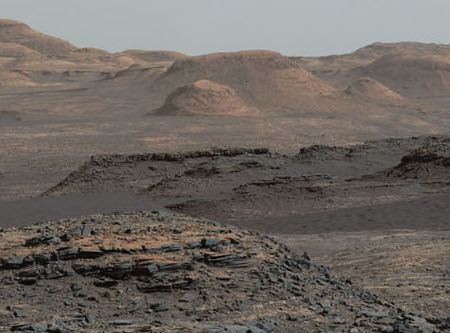
The Sol 1281 drive completed as planned, crossing the Murray/Stimson contact at the edge of the Naukluft plateau. Now that we have a better view of the plateau, we are ready to start driving across it. But first, ChemCam and Mastcam will observe targets “Orupembe” and “Witvlei” on the bedrock in front of the rover. Mastcam will also take pictures of the rocks in front of the rover and targets “Natab East” and “Natab West” on either side of the vehicle before the Sol 1282 drive. After the drive, in addition to the usual post-drive imaging, the Left Mastcam will acquire a full 360-degree panorama, as the view from the new location (near the left edge of the image above) is expected to be good. We are looking forward to seeing the new data!

The second link above leads to the rover’s daily update site. It was here that the science team reported an issue with the rover’s scoop back in early February. Since then, however, they have never revealed if the problem was solved. Nor have they used the scoop in any way since then. I now wonder if it is no longer operational and am considering pursuing that question a bit to find out.

2 comments

Pinpointing Curiosity’s location in Gale Crater

Curiosity's traverse

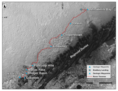
The Curiosity science team recently released a new Mars Reconnaissance Orbiter image, showing Curiosity’s overall route since its landing on Mars in August 2012. I have posted a reduced version on the right.

Similarly, on the Curiosity website you can view this more detailed map of its traverse route. This map is updated regularly as Curiosity continues its climb up Mount Sharp.

Neither of these maps is to me very satisfying or useful, however. Neither shows the overall location of Curiosity within Gale Crater. Nor do they give one a sense of how far it is has come on its climb up the mountain. In fact, it is very unclear how close the rover actually is to the peak from either image.

Thus, I decided to do a little research to get some better context of Curiosity’s position and its overall journey.
» Read more

13 comments

Getting higher on Mount Sharp

Looking across Gale Crater

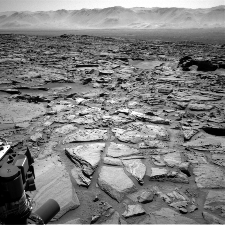
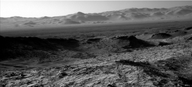
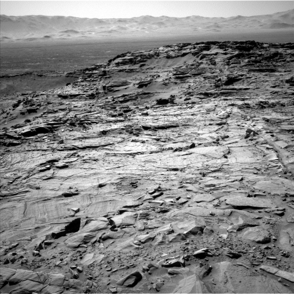
Cool image time! The above image, cropped and reduced slightly for presentation here, was taken by one of Curiosity’s navigation cameras on March 2. Though the science team has not captioned it, I think it is looking down from the heights that Curiosity has climbed and across the plains of Gale Crater to its rim in the far distance. The image itself appears to have been taken after the rover spent several days climbing up to what they have dubbed Naukluft Plateau.

Be sure to check out the full resolution image that can be found here.

0 comments

Curiosity moves on, scoop still not working

Curiosity’s science team has finished its work at Namib Dune and has decided to move on, even though they are still analyzing an unspecified issue with the rover’s scoop instrument.

So far, in the week since they first had a problem while sifting sand from the dune, they have not described in any way what the problem is. All they have said is this:

Unfortunately, the CHIMRA behaved in an unexpected way during processing of the third scoop on Sol 1231, which prevented completion of the arm activities planned for last weekend.

The robot arm functions, and they used it yesterday to get some extreme close-ups of the sand, but it appears they cannot use the scoop at this time.

0 comments

An issue with Curiosity’s scoop

The unit at the end of Curiosity’s robot arm that scoops up sand and processes it through sieves experienced “an anomaly” on January 25, causing a halt in arm operations.

The instrument has been scooping up sand from the sand dune that the rover has been studying recently. So far there has been no details at all about the “anomaly”, so it is unclear how serious the problem is. In the meantime the rover has been using its cameras and other instruments to do other observations.

0 comments

Curiosity heads for the dunes

Bagnold Dunes

The Curiosity science team has decided to send the rover towards some large active dunes, visible in its journey ahead up Mt. Sharp.

On its way to higher layers of the mountain where it is investigating how Mars’ environment changed billions of years ago, NASA’s Curiosity Mars rover will take advantage of a chance to study some modern Martian activity at mobile sand dunes.

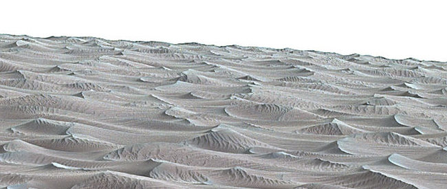
In the next few days, the rover will get its first close-up look at these dark dunes, called the “Bagnold Dunes,” which skirt the northwestern flank of Mount Sharp. No Mars rover has previously visited a sand dune, as opposed to smaller sand ripples or drifts. One dune Curiosity will investigate is as tall as a two-story building and as broad as a football field. The Bagnold Dunes are active: Images from orbit indicate some of them are migrating as much as about 3 feet (1 meter) per Earth year. No active dunes have been visited anywhere in the solar system besides Earth.

In the image on the right the target dune is in the center beyond the dark ridge line in the foreground. It looks kind of like a pointed mesa. the dark sandy area on the center right just below the dark ridge line in the center of the image. (Newer images released today gave me a more correct idea of the dunes as shown in this image.) Click here to see the full image. The rover is presently about 200 yards from the first dune, and should reach it in the next few days.

0 comments

More confirmation from Curiosity of past lakes in Gale Crater

New data from Curiosity has now provided further confirmation that the deeper sedimentary layers seen in Gale Crater were likely formed far in the past by flowing water.

“Paradoxically, where there is a mountain today there was once a basin, and it was sometimes filled with water,” said John Grotzinger, the former project scientist for Mars Science Laboratory at the California Institute of Technology in Pasadena, and lead author of the new report. “We see evidence of about 250 feet (75 meters) of sedimentary fill, and based on mapping data from NASA’s Mars Reconnaissance Orbiter and images from Curiosity’s camera, it appears that the water-transported sedimentary deposition could have extended at least 500 to 650 feet (150 to 200) meters above the crater floor.”

Furthermore, the total thickness of sedimentary deposits in Gale Crater that indicate interaction with water could extend higher still, perhaps up to one-half mile (800 meters) above the crater floor.

Above 800 meters, Mount Sharp shows no evidence of hydrated strata, and that is the bulk of what forms Mount Sharp. Grotzinger suggests that perhaps this later segment of the crater’s history may have been dominated by dry, wind-driven deposits, as was once imagined for the lower part explored by Curiosity.

This was always the reason to go and climb Mount Sharp. As Curiosity heads uphill it begins to map out the geological history of Mars, first as a wet place with liquid water, then as a dry place in which the water is gone.

0 comments
1 14 15 16 17 18 22