
Ice, lava, quakes, and faults, all in one Martian image

Click for full image.
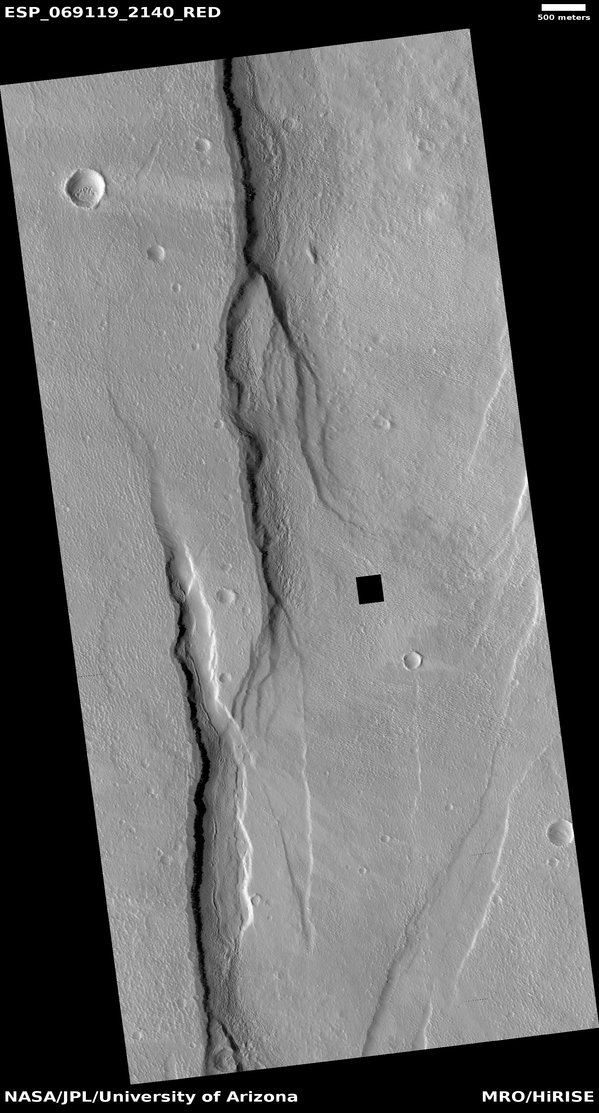
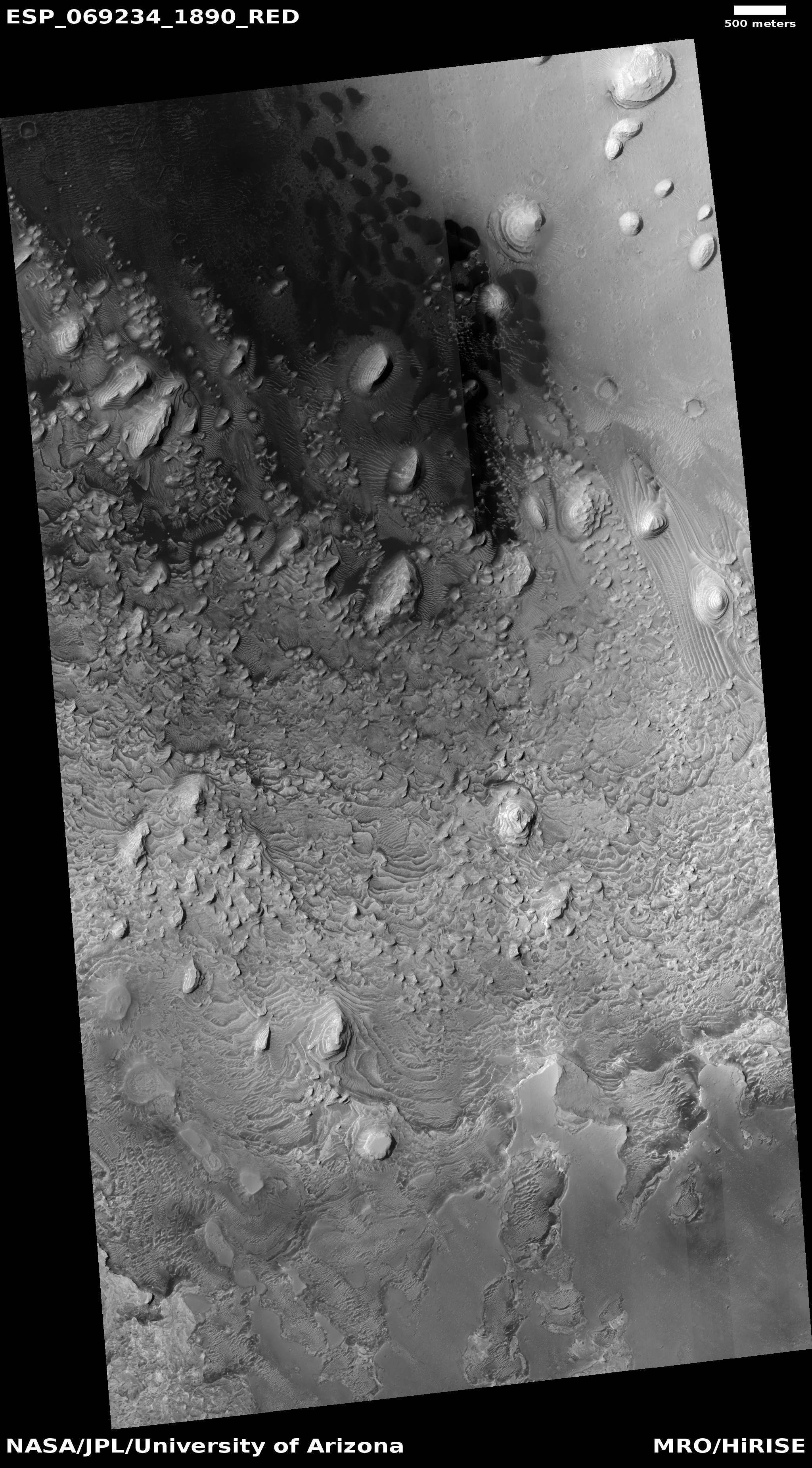
Cool image time! The photo to the right, rotated, cropped, and reduced to post here, was taken by the high resolution camera on Mars Reconnaissance Orbiter (MRO) on April 25, 2021. It grabbed my attention because it possibly captures a whole range of Martian geological processes, all in one place, including evidence of quakes, of lava, of faults, and possibly of glaciers.
First, ignore the black rectangle, which is merely a small section of lost data.
The picture itself shows a wide north-south fissure, as indicated by the distinct western cliff and the fainter and less pronounced eastern cliff. This fissure, likely formed along a fault, was created when the crust was pushed and stretched upward by the pressure of underground volcanic magma, part of the long series of eruptions that formed the many similar and parallel north-south fissures south of the shield volcano Alba Mons.
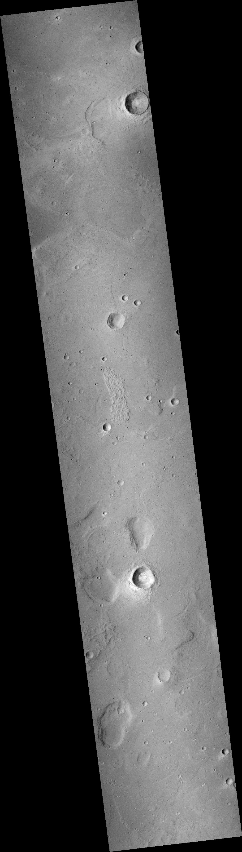
The overview map below illustrates this fissure’s relationship with Alba Mons.
» Read more
Click for full image.
Cool image time! The photo to the right, rotated, cropped, and reduced to post here, was taken by the high resolution camera on Mars Reconnaissance Orbiter (MRO) on April 25, 2021. It grabbed my attention because it possibly captures a whole range of Martian geological processes, all in one place, including evidence of quakes, of lava, of faults, and possibly of glaciers.
First, ignore the black rectangle, which is merely a small section of lost data.
The picture itself shows a wide north-south fissure, as indicated by the distinct western cliff and the fainter and less pronounced eastern cliff. This fissure, likely formed along a fault, was created when the crust was pushed and stretched upward by the pressure of underground volcanic magma, part of the long series of eruptions that formed the many similar and parallel north-south fissures south of the shield volcano Alba Mons.
The overview map below illustrates this fissure’s relationship with Alba Mons.
» Read more


