Unknown Mars

MRO context camera mosaic
Click for interactive global mosaic.

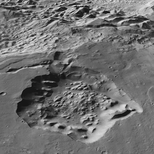
Cool image time! The picture to the right was created from a global mosaic of all the context camera images taken by Mars Reconnaissance Orbiter (MRO) since it entered Mars orbit in 2006. It shows an unnamed 17-mile-wide-depression located only about seven miles south of the southern rim of Valles Marineris.

I highlight this particular depression because, despite seventeen years in orbit, MRO’s high resolution camera has at this time still not taken any pictures inside or around it. This is a place on Mars that remains unstudied in detail, in any way, even though its depth is comparable to the Grand Canyon and its features strongly suggest its is a collapse feature, created when the roof over an underground void gave way. If so, it suggests an origin for Valles Marineris that conflicts with present theories.
» Read more

0 comments

Hubble image shows several dozen boulders flung from Dimorphos

Boulders drifting from Dimorphos
Click for original image.

Using the Hubble Space Telescope, astronomers have photographed several dozen boulders that were flung off of the asteroid Dimorphos following the impact by the space probe DART. The picture to the right, reduced and brightened to more clearly show those boulders, was taken on December 19, 2022, four months after DART’s impact.

These are among the faintest objects Hubble has ever photographed inside the Solar System. The ejected boulders range in size from 1 meter to 6.7 meters across, based on Hubble photometry. They are drifting away from the asteroid at around a kilometre per hour.

The blue streak is the dust tail that has streamed off of Dimorphos since the impact, pushed away from the sun by the solar wind.

2 comments

Ancient lava vent high on a Martian volcano

Ancient lava vent high on a Martian volcano
Click for original image.

Today’s cool image illustrates the once violent and active volcanic past of Mars, now long dormant. The picture to the right, cropped, reduced, and sharpened to post here, was taken on May 11, 2023 by the high resolution camera on Mars Reconnaissance Orbiter (MRO). It shows what the scientists label as a “vent and channel” located high on the northeast flanks of the giant volcano Arsia Mons.

The rim around the vent suggests that lava had once bubbled up out of the vent and hardened around it, as most of the lava flowed downhill along the channel. And though this vent appears to be the source of this channel, it is not. The channel continues to the southwest uphill until it reaches the edge of Arsia Mons’ caldera, a region where there are many such vents, many much larger and deeper than this one.
» Read more

0 comments

Glacial evidence in the dry equatorial regions of Mars?

Is this evidence of glacial ice in the Martian dry equatorial regions?
Click for original image.

Cool image time! The picture to the right, rotated, cropped, rotated, and sharpened to post here, was taken on June 3, 2023 by the high resolution camera on Mars Reconnaissance Orbiter (MRO). It shows the eastern half of a six-mile-wide unnamed crater with a depth of about 1,500 to 2,000 feet from rim to floor.

What makes this picture significant is the patchy material in the center of that crater floor, some of which looks almost like very old peeling paint. It also resembles the kind of glacial features routinely seen in many craters poleward of 30 degrees latitude on Mars.

Is this another example of such glacial features? If so, its location is what makes it significant.
» Read more

0 comments

Flat-topped Martian mesa

Flat-topped mesa on Mars
Click for original image.

Cool image time! The picture to the right, rotated, cropped, and reduced to post here, was taken on April 18, 2023 by the high resolution camera on Mars Reconnaissance Orbiter (MRO). It shows only one of many flat-topped mesas in a chaos terrain region dubbed Oxia Chaos.

The mesa top is about 540 feet above the floor of the canyon to the north, which in turn is about 840 feet below the flat terrain north of it. That flat terrain to the north is not part of the chaos terrain, however, but the northern rim of the plateau that surrounds the chaos. Moreover, this particular piece of rim is separating from the plateau, as shown near the top of this January 16, 2008 context camera image from MRO. At some point in the future it will break off and fall into that canyon and on top of this mesa.
» Read more

0 comments

Chandrayaan-3 completes second orbital maneuver

Chandrayaan-3's mission profile

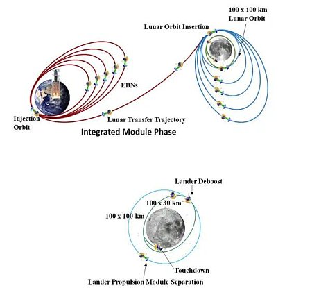
According to India’s space agency ISRO, its lunar lander/rover Chandrayaan-3 today completed second orbital maneuver, raising the spacecraft’s orbit around the Earth from 41,762 by 173 kilometers to 41,603 x 226 kilometers.

The graphic to the right shows the entire mission profile of Chandayaan-3. It still has three more orbital adjustments to make in Earth orbit before it does its trans-lunar-injection burn to send it to the Moon. Once it arrives in lunar orbit it will then have to make six orbital adjustments to lower its orbit before making the descent to the surface.

The lunar landing itself is presently scheduled for August 23, 2023.

0 comments

Another look at the vastness of Valles Marineris on Mars

The vast Valles Marineris
Click for interactive map.

This week I have returned several times to the giant Valles Marineris canyon on Mars in an attempt to capture its incomprehensible and glorious scale. Without question this canyon is going to become one of the prime tourist spots when humans begin living and working throughout the solar system. Fortunately, its vast size will mean that it will take many many centuries before it even becomes close to crowded there.

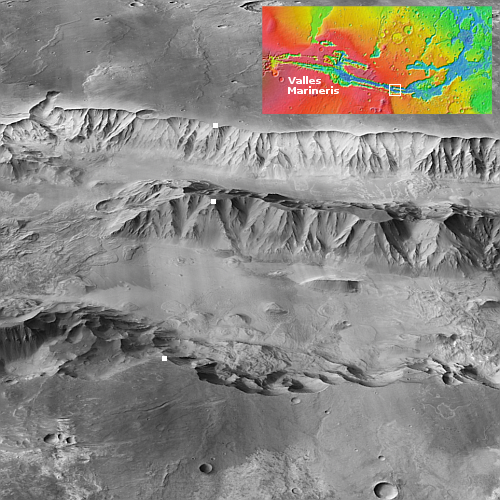
Today I try a different approach, using the global mosaic created by scientists at Caltech from the context camera images taken by Mar Reconnaissance Orbiter (MRO). That mosaic processes the images to allow one to see the surface from an oblique angle. The picture to the right covers one small part of the eastern end of Valles Marineris (the white rectangle in the inset), but though small the scale once again is gigantic.

The three white dots are our reference points, one on the north rim, one on the south, and one in the middle on the peak of that central mountain chain. Beginning from the south, the distance from the rim to the middle mountain peak is 43 miles, with the elevation dropping almost 13,000 feet to the floor of the south canyon, than rising almost 10,000 feet to the middle peak. The northern canyon is smaller. From the peak to the north rim is 27 miles, dropping about 9,300 feet and then rising about 8,500 feet to the north rim.

From rim to rim the distance is about 70 miles. Since the middle mountain chain about 18 miles wide, it fills only about 25% of the entire canyon.

In every case, the Grand Canyon would be merely be a small side canyon here. The depths are twice as deep, and the distances are many times larger. In width alone at this point Valles Marineris is seven times wider than the widest part of the Grand Canyon, and this is by far not Valles Marineris’s widest point.
» Read more

0 comments

India successfully launches Chandrayaan-3


Click for interactive map.

India today successfully launched its Chandrayaan-3 lunar lander/rover probe toward the Moon, carried aloft by its LV-M3 rocket (a variation of its GSLV) from its coastal spaceport in Sriharikota.

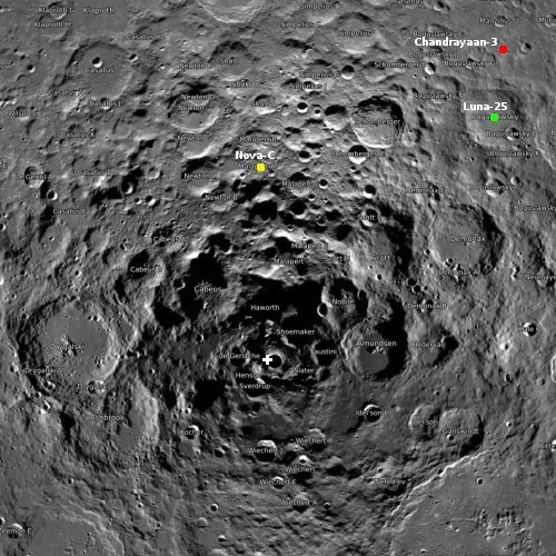
Chandrayaan-3 carries the Vikram lander, which will bring the Pragyan rover to the surface. Pragyan will spend about two weeks operating on the lunar surface. The location is indicated by the red dot on the map to the right, in the high southern latitudes. The white cross marks the lunar south pole. Russia’s Luna-25 is scheduled to launch sometime in mid-August.

It will take time to get Chandrayaan-3 into the right lunar orbit for landing, which is presently scheduled for August 13, 2023.

For India this was its fifth successful launch for the year, the most since 2019, before it panicked over COVID. The leaders in the 2023 launch race:

46 SpaceX
26 China
9 Russia
5 Rocket Lab
5 India

American private enterprise still leads China in successful launches 52 to 26, and the entire world combined 52 to 45, while SpaceX by itself still leads the rest of the world (excluding other American companies) 46 to 45.

1 comment

A Martian gully formed by disappearing glacial ice?

Puzzling Martian gully
Click for original image.

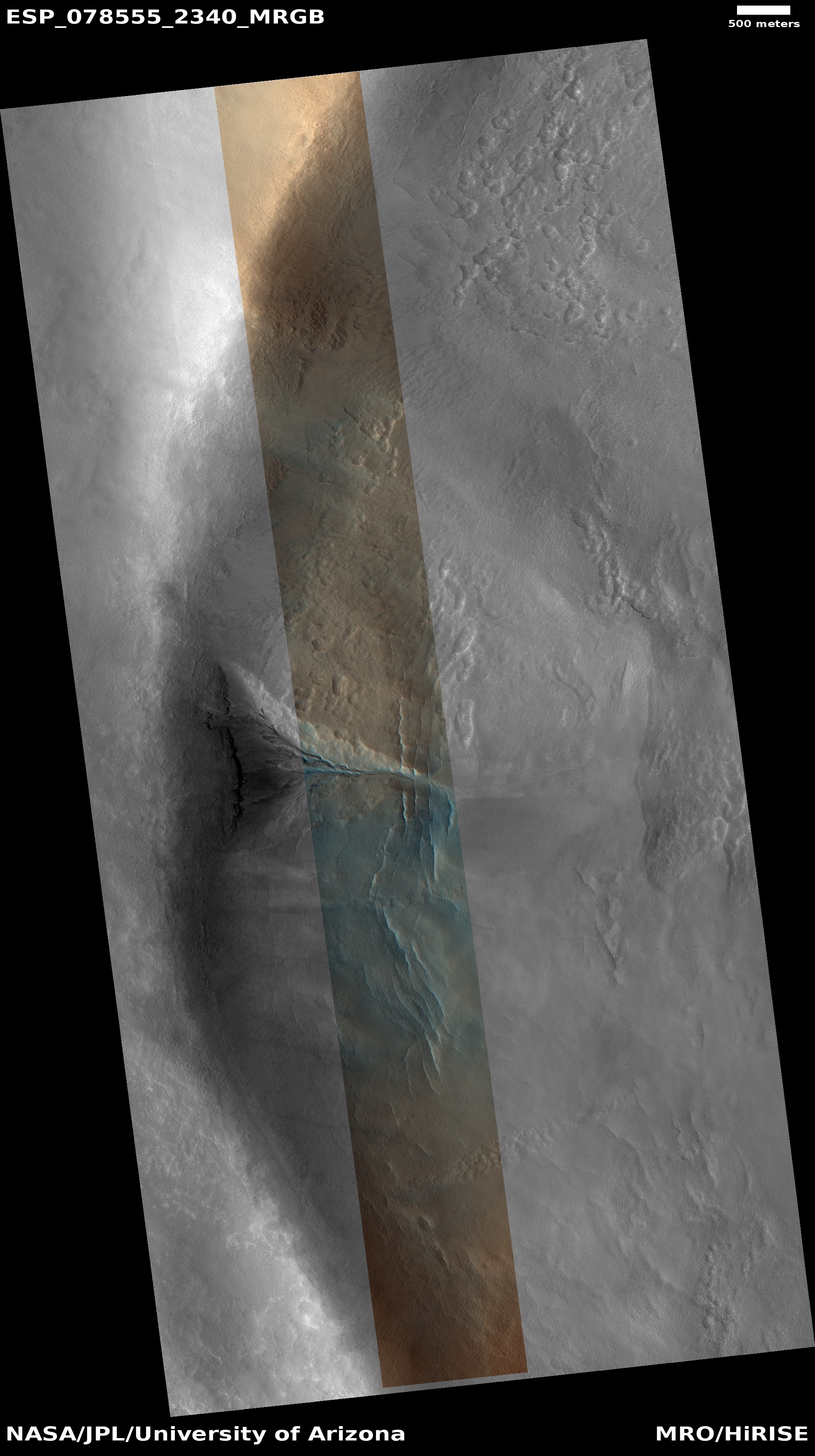
Cool image time! The picture to the right, cropped and reduced to post here, was taken on April 30, 2023 by the high resolution camera on Mars Reconnaissance Orbiter (MRO). It shows the rim of a seventeen-mile wide crater, and was the scientists label a “gully without apron,” meaning that though something has caused material to disappear within that gully, beginning high on the rim wall, there does not appear to be any piled up apron or debris at the gully’s base.

The blue colors imply the possibility of frost within the gully, while the orange suggests dust or coarse surface material.

The cracks emanating away at right angles from the gully’s base suggest glacial ice, which makes sense based on the location.
» Read more

0 comments

More sightseeing in Valles Marineris on Mars

More sightseeing on a mesa in Valles Marineris
Click for original image.

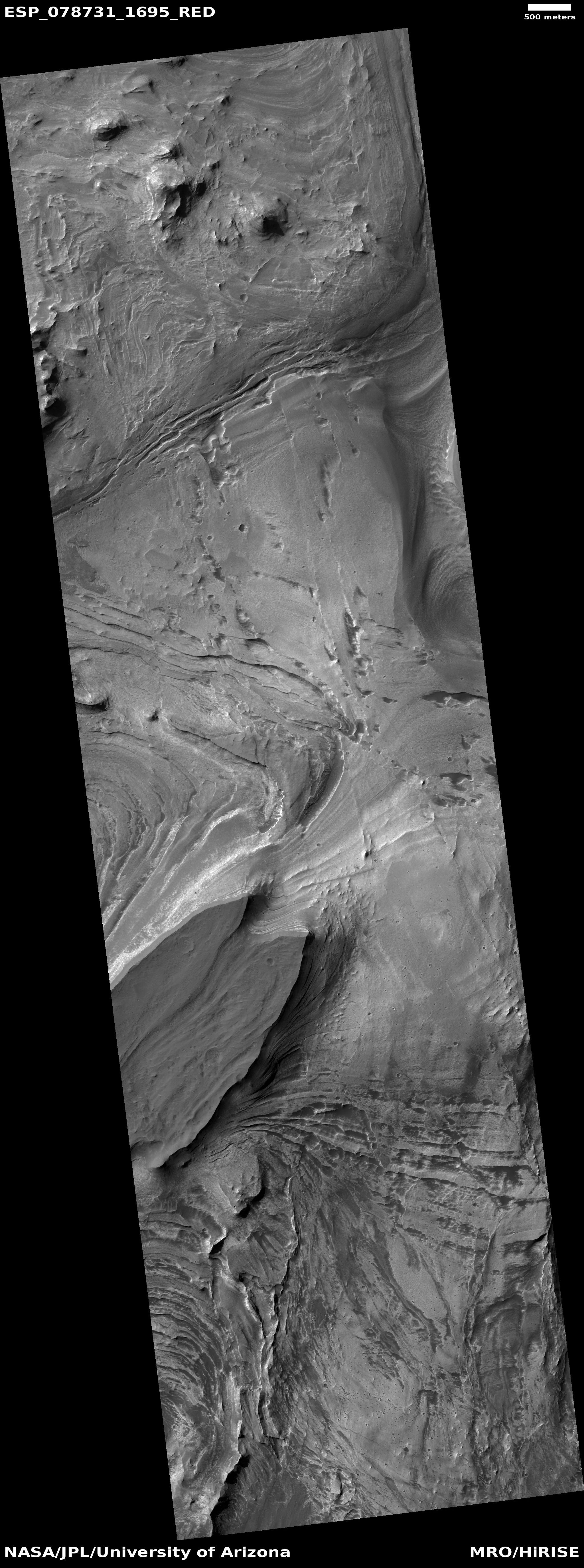
The opportunity to see more mind-blowing examples of spectacular views on Mars compels me to post another great view of a mesatop within Valles Marineris, the biggest known canyon in the solar system. The picture to the right, rotated, cropped, and reduced to post here, was taken on May 14, 2023 by the high resolution camera on Mars Reconnaissance Orbiter (MRO). It shows an 800-foot-high mesa with two points at its end, the cliff wall below highlighted by numerous layers, many alternating between light and dark material.

The erosion features on the top of the mesa suggests some flow down its middle and into the gap between its two end points. This is the dry equatorial region of Mars, so no near surface water is presently found. In the far past maybe ice, or theorized catastrophic floods of water, caused this erosion.
» Read more

0 comments

Amidst the mountains on Mount Sharp on Mars

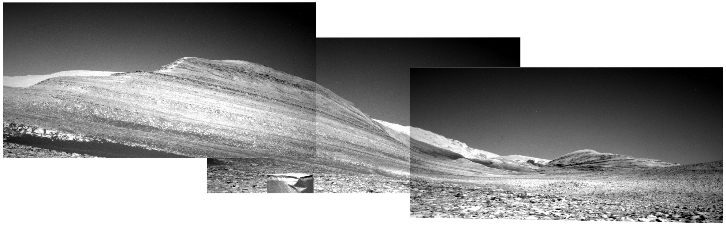
Panorama from Curiosity, July 12, 2023
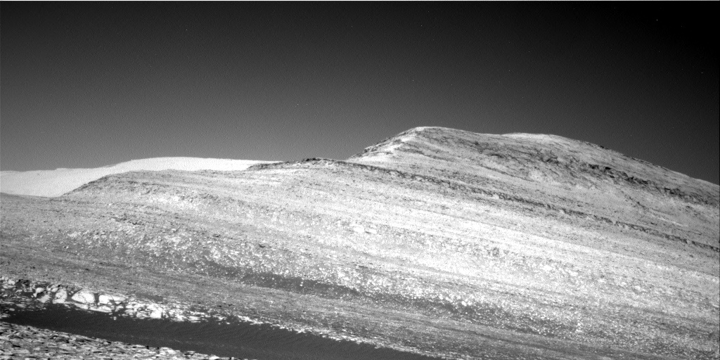
Click for higher resolution. Original images can be found here, here, and here.

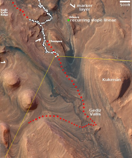
Overview map
Click for interactive map.

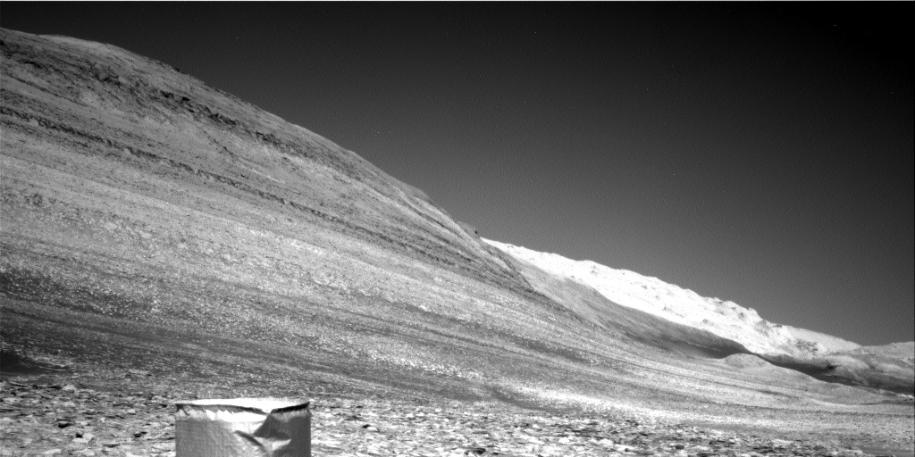
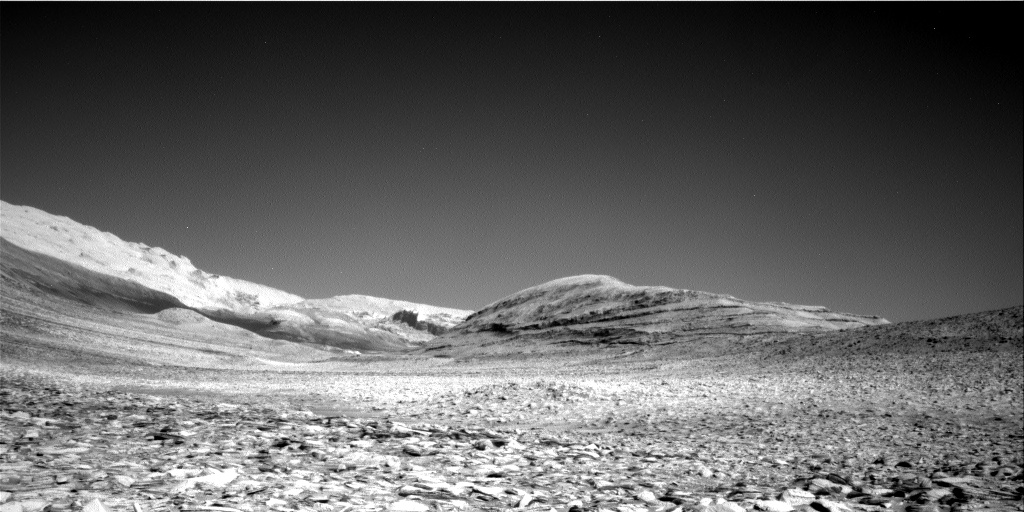
The panorama above, created from three images, was taken by Curiosity on July 12, 2023 using its right navigation camera. It looks south in the direction that the science team eventually plans to send the rover, as indicated by the red dotted line on both the panorama and the overview map to the right. The yellow lines on the overview map indicate approximately the area covered by the panorama. Kukenan’s peak rises about 500 feet above the rover, and I guarantee there will be many planetary geologists that are going to study the pictures of its many layers for many years.

At present however Curiosity is heading west, away from that planned route, to visit the small craters about 500 feet away. For almost all of the rover’s decade-long journey in Gale Crater, it has seen relatively few craters, and since it left the floor of the crater and began its climb up the flanks of Mount Sharp three years ago, it has seen none.

Inspecting the floors and surrounding ejecta of these small craters will give the scientists a look at materials that are presently below the surface. While it is likely that material will be of geological layers Curiosity has already traveled over lower down the mountain, it is also possible there will be surprises. The scientists decided they couldn’t pass up this opportunity to find out.

Why have there been so few craters in Gale Crater? Though Mars is hardly as active as Earth, its geological history is almost as dynamic. The surface of Gale has been reshaped by the processes that created Mount Sharp, processes that destroyed craters from early in Mars’ history. The craters the rover is about to see are almost certainly relatively young.

0 comments

The Earth and Moon, as seen by Mars Express in Mars orbit

The Earth and Moon, as seen from Mars
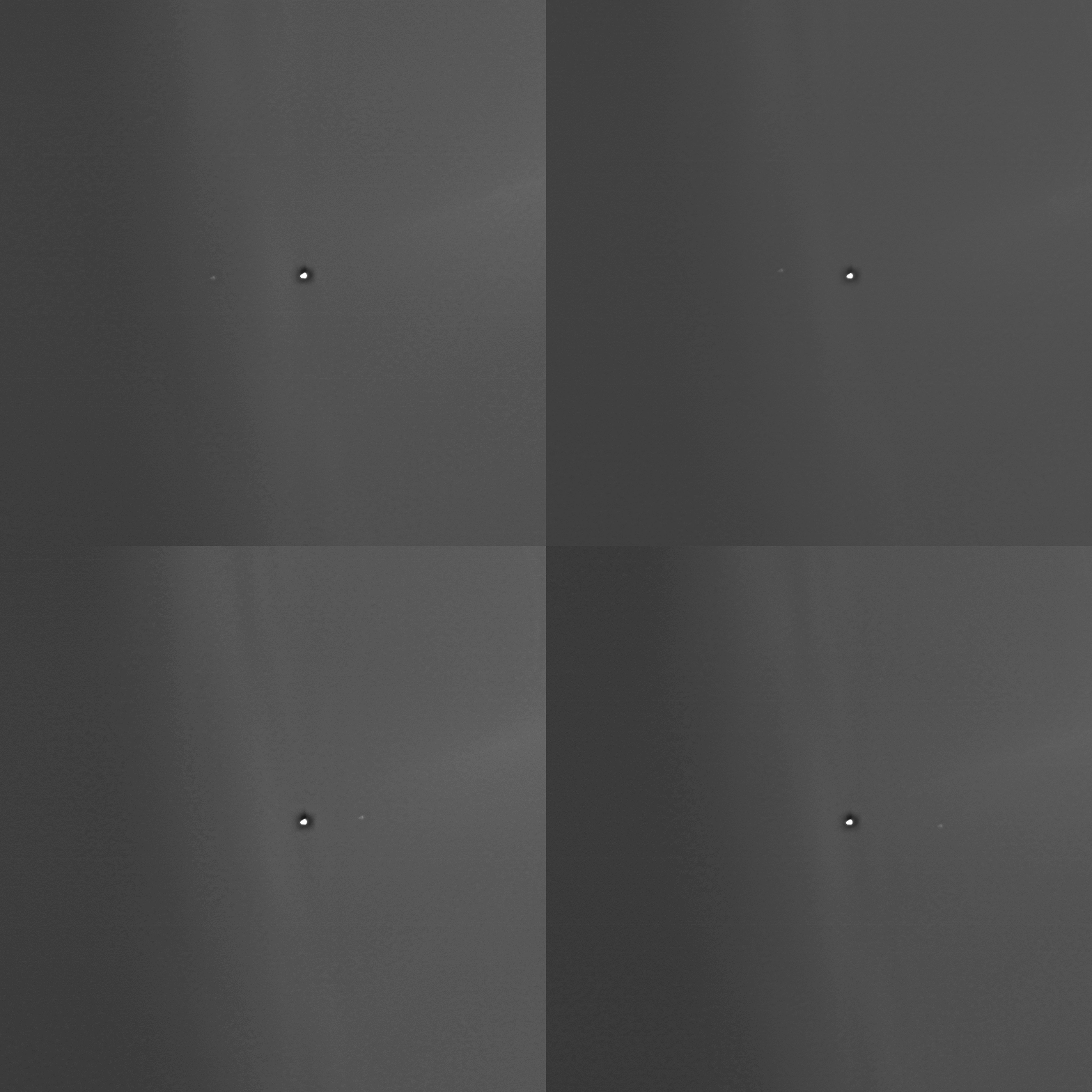
Click to see four image movie.

The science team for Europe’s Mars Express orbiter recently turned the spacecraft’s camera upward to capture a sequence of four images of the Earth with the Moon circling around it.

The images were taken at 14:08, 03:10 and 19:49 UTC on 15, 21, 27 May 2023 respectively, and at 15:00 UTC on 2 June 2023. This covers a bit more than half of the Moon’s monthly motion around the Earth. The distance between Earth and Mars varied from 279 186 624 km to 301 016 265 km during this time. The image resolution is about 2570 km per pixel.

To the right is the June 2nd image, cropped and enhanced to post there. The Earth is the larger spot to the left. The picture gives a sense of what the Earth-Moon double planet system looks like from Mars. Unlike all other planets, where the size difference between planet and moon is great, the Earth/Moon system is comprised of a Moon quite large in comparison to its central planet.

4 comments
1 63 64 65 66 67 89