Webb takes infrared (heat) image of Saturn

Saturn in infrared
Click for original image.

Using the Webb Space Telescope, scientists on June 25, 2023 took the wonderful false color infrared (heat) image of Saturn above, cropped to post here, as part of a research project [pdf] to take a number of long exposures of the ringed planet in order to test Webb’s ability to see its small moons. From the press release:

Saturn itself appears extremely dark at this infrared wavelength observed by the telescope, as methane gas absorbs almost all of the sunlight falling on the atmosphere. However, the icy rings stay relatively bright, leading to the unusual appearance of Saturn in the Webb image.

…This new image of Saturn clearly shows details within the planet’s ring system, along with several of the planet’s moons – Dione, Enceladus, and Tethys. Additional deeper exposures (not shown here) will allow the team to probe some of the planet’s fainter rings, not visible in this image, including the thin G ring and the diffuse E ring. Saturn’s rings are made up of an array of rocky and icy fragments – the particles range in size from smaller than a grain of sand to a few as large as mountains on Earth.

The picture also shows differences between Saturn’s northern and southern hemispheres, caused by the seasonal differences between the two.
1 comment

A new theory for making liquid water once possible on Mars

In order to explain the many gullies on Mars, scientists at Brown University have now proposed a new model that says liquid water could exist periodically on the surface of Mars, caused by the cyclical changes in the planet’s rotational tilt, ranging from 11 to 60 degrees.

From editor’s summary of the paper:

Some steep slopes on Mars have gullies with morphologies suggesting that they were formed by a fluid. However, the planet’s current climate is not conducive to the melting of water ice at those locations, and mechanisms involving carbon dioxide ice do not explain the distribution of the gullies. [This paper] simulated how the climate of Mars differed when its axis tilted by different amounts over the past few million years. At a tilt of 35 degrees, the ice caps partially melted, raising the atmospheric pressure, and there were higher summer temperatures. Under these conditions, the atmospheric pressure at the gullies would be above the triple point of water, so it could melt to form a liquid.

The paper estimates these conditions last existed on Mars about 630,000 years ago, though the process repeated itself many times over the past several million years, each time causing some water ice to melt and flow down to form gullies. As the planet’s inclination then changed, conditions changed as well, producing colder temperatures at these latitudes so the water froze once again.

Though this is only a model with many uncertainties, it suggests a more reasonable explanation for the past existence of liquid surface water on Mars, temporary, periodic, and rare, than most other models. Combined with the possibility that ice glaciers themselves could have contributed to the formation of many of Mars’ riverlike channels, it seems that scientists are beginning to form a rough concept explaining how Mars evolved to what it is today.

5 comments

The icy floor of one of Mars’ most ancient craters

Overview map

The icy floor of one of Mars' most ancient craters
Click for original image.

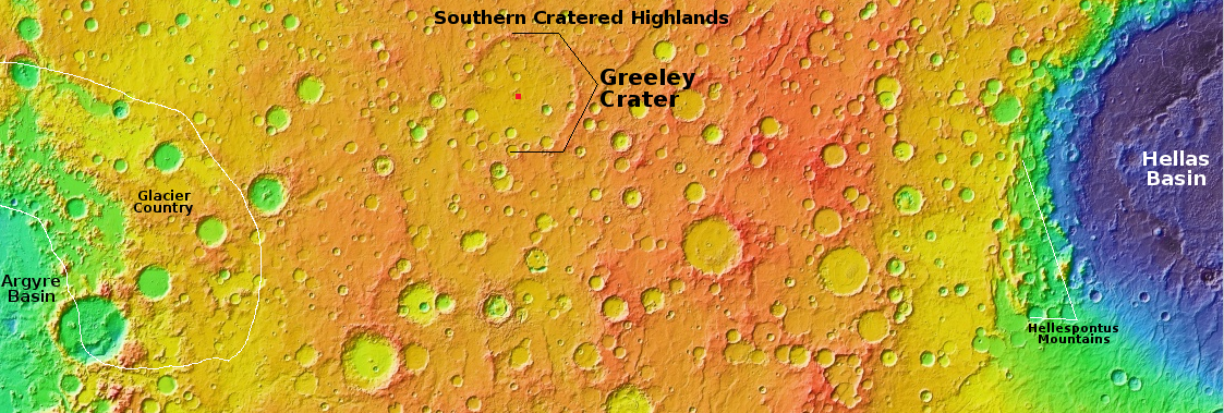
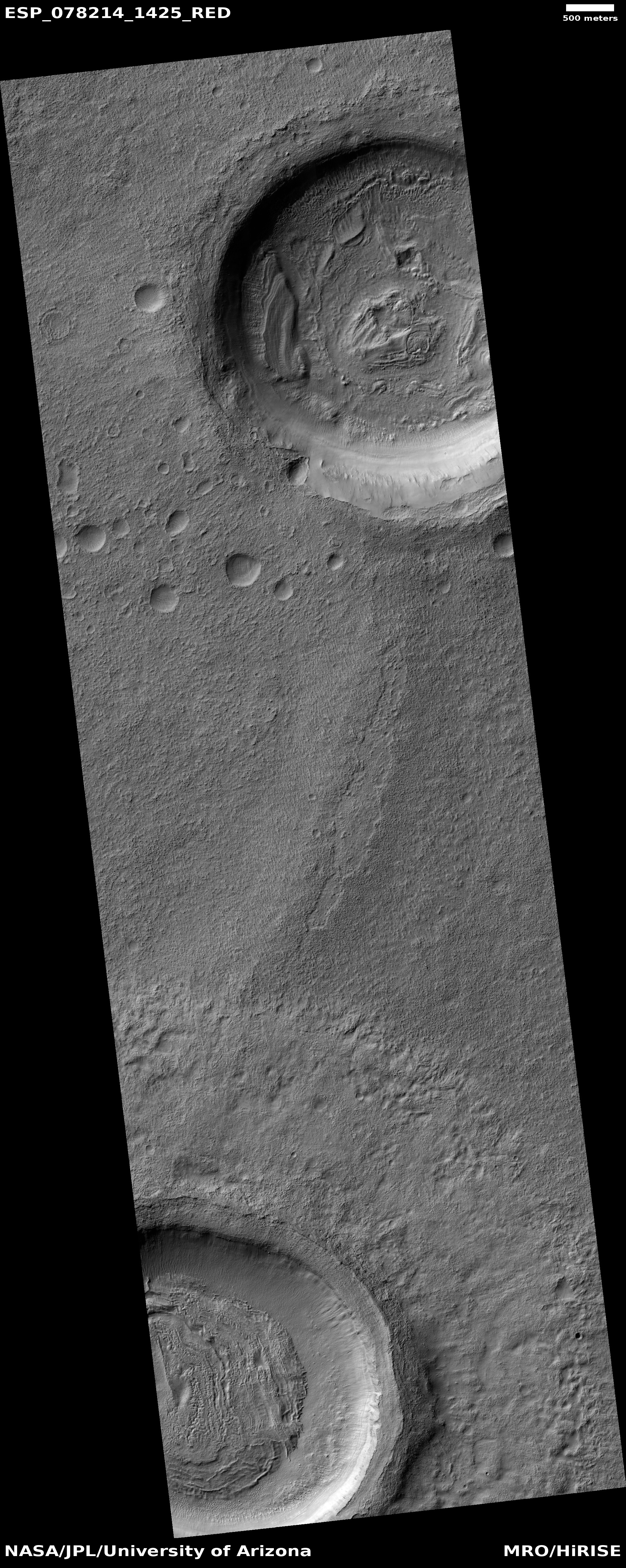
Cool image time! The picture to the right, rotated, cropped, reduced, and sharpened to post here, was taken on April 3, 2023 by the high resolution camera on Mars Reconnaissance Orbiter (MRO). It focuses on a small crater in the center of 265-mile-wide Greeley Crater, named in 2015 after the late Ron Greeley, who had been involved in almost every planetary mission from the 1960s until his passing in 2011.

Greeley Crater is intriguing because of its age, estimated to be about four billion years old, as indicated by crater counts and the crater’s heavily eroded condition.

This ancient crater, which has already been heavily eroded and filled with sediment, is difficult to make out against the Martian landscape due to its relatively shallow depth of only 1.5 kilometres – indeed, the crater rim has disappeared altogether in places.

Greeley is also intriguing by its location in the southern mid-latitudes. On the overview map above the red dot inside Greeley marks the location of today’s picture. This is a region with lots of evidence of ice and glacial features inside craters. The picture shows a small two-mile-wide crater about 500 feet deep inside Greeley. Both inside and outside the crater the surface suggests ice, either in glacial formations on the crater floor or as a soft flat plain that allows impacts to sink in without producing a rim or much ejecta.

While research has suggested a large number of glaciers in the outlined region on the western edge of the overview map, the evidence continues to build that near-surface ice exists everywhere throughout the mid-latitudes of Mars.

1 comment

Perseverance spots a doughnut-shaped rock

Doughnut-shaped rock in Jezero Crater
Click for original image.

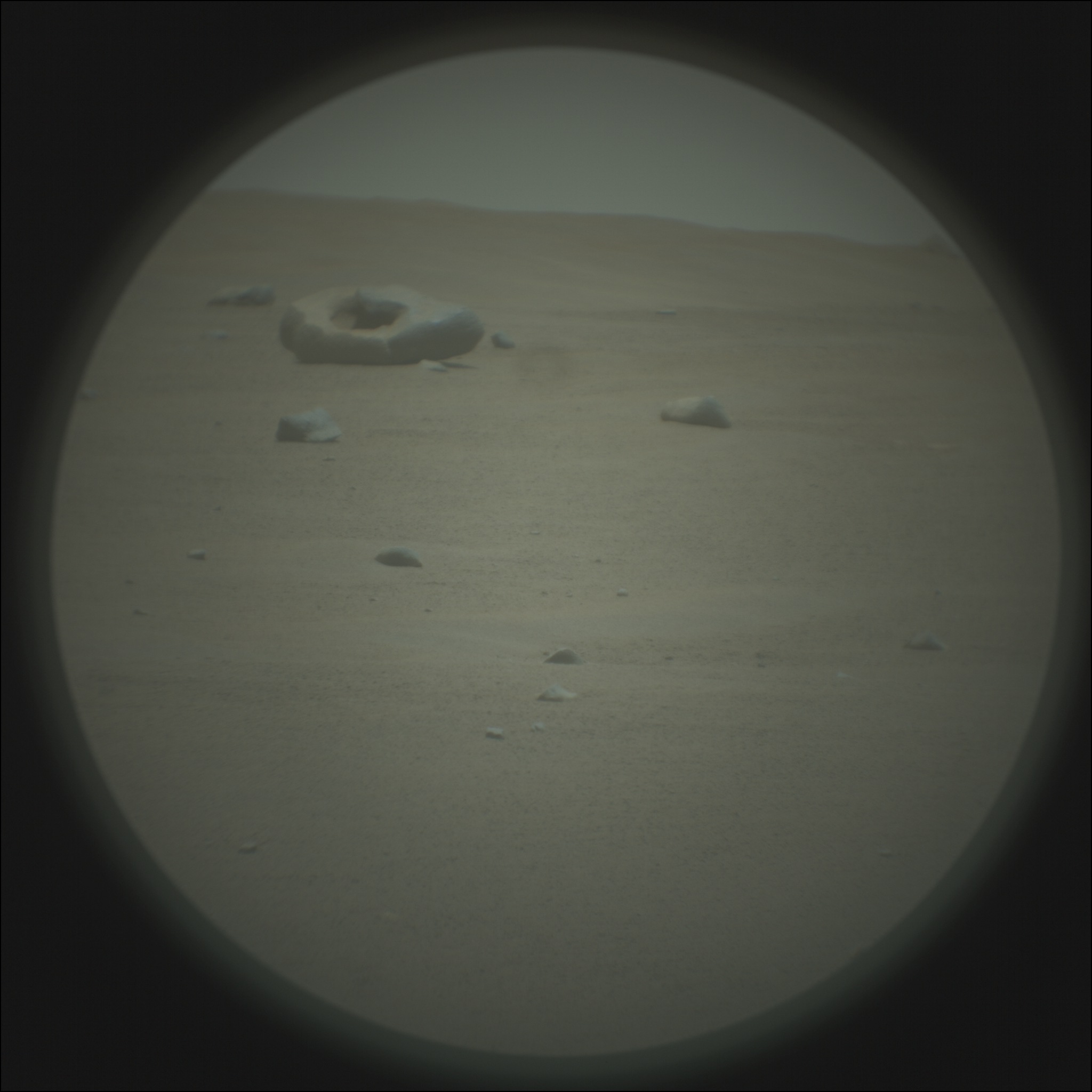
The Mars rover has spent the last few months exploring just beyond the western rim of half-mile-wide Belva crater, which sits on top of the delta that eons ago flowed into 30-mile-wide Jezero Crater. During that time the science team has been using its various cameras to study the surrounding terrain.

One of those cameras is the SuperCam Remote Micro Imager. This camera is a variation of Curiosity’s ChemCam, designed initially to look very closely at nearby objects. The Curiosity team however discovered they could also use ChemCam to look at distant objects, and in this case the Perseverance team was doing the same with SuperCam, gazing outward at more remote features.

The result was the picture to the right, cropped, reduced, brightened, and sharpened to post here. It was taken on June 23, 2023, and shows what appears to be a several-foot-wide rock with a hole in its center. According to the SETI Institute’s tweet that publicized the picture, the rock might be “a large meteorite alongside smaller pieces.”

If this was Curiosity I would be certain the science team would take the rover close to the rock. The Perseverance team however seems to have different goals, mostly centered on finding drill spots for obtaining its core samples for later return to Earth. It has not therefore been as exploratory as Curiosity. It seems to have rarely diverged from its planned route, and when it has it has not done so to look at singular features like this. We shall see what they finally decide.

8 comments

Another tourist site for future Starship passengers on Mars

Another tourist site for future Starship passengers on Mars
Click for original image.

Cool image time! The picture to the right, rotated, cropped, reduced, and sharpened to post here, was taken on April 11, 2023 by the high resolution camera on Mars Reconnaissance Orbiter (MRO). It shows the northwest quadrant of a 7-mile-wide crater whose western rim was smashed by the later impact that created a smaller 2.8-mile-wide crater.

What makes this location interesting is what fills both craters, and how that material appears to flow through a gap in the smaller crater. The color strip suggests the peaks of the rim and small knobs are dust-covered, while the flat materials below are either “coarser-grained materials” that might also have elements of frost or ice within them. The science team thinks ice is involved, having labeled this picture “Ice Flow Features between Craters.”
» Read more

1 comment

Spring near the Martian north pole

Spring near the Martian north pole
Click for original image.

Overview map

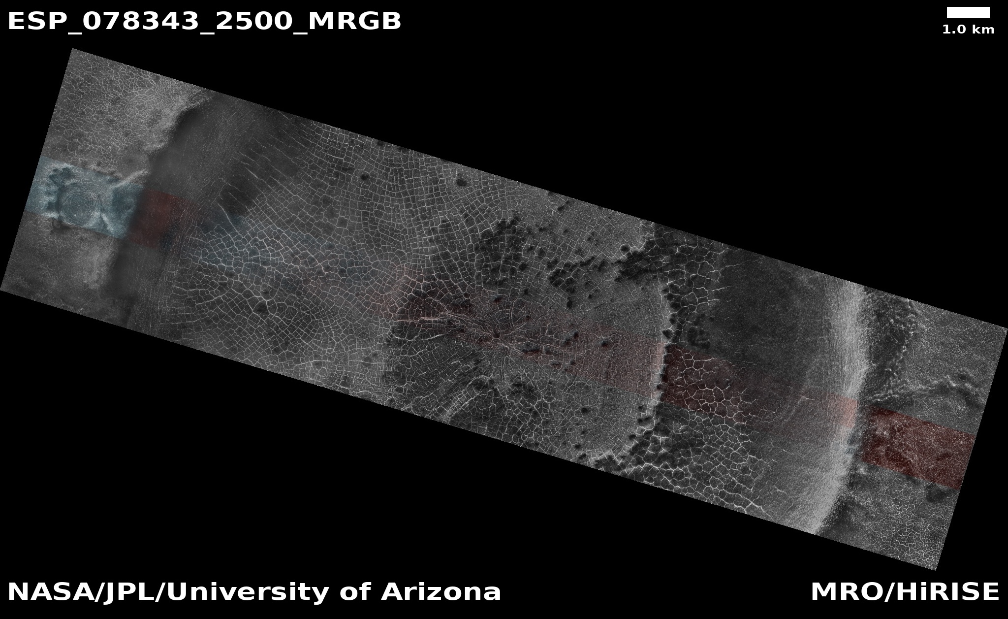
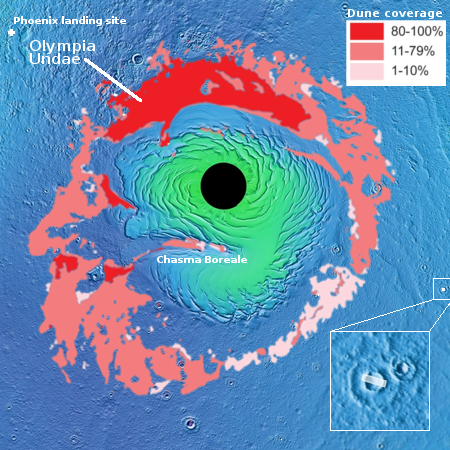
Cool image time! The picture above, rotated, reduced, and brightened slightly to post here, was taken on April 13, 2023 by the high resolution camera on Mars Reconnaissance Orbiter (MRO). It cuts a swath across an eleven-mile-wide crater only about 500 miles from the edge of Mars’ north pole ice cap.

The overview map to the right marks its location, as indicated by the white dot on the right edge of the map. The inset shows the soft and likely icy nature of the surface in which this impact occurred. The crater resulted in a secondary outside ripple, that quickly hardened after impact.

The image was taken during spring, shortly after the sun’s light hit this crater. The cracks in the ice indicate long term sublimation that is slowly reducing the amount of water ice inside the crater. Like mud cracks in the desert after a puddle has evaporated, the ice here is cracking to produce polygon fractures.

It is also very likely that everything here is coated with a thin mantle of clear dry ice, deposited as snow from the atmosphere in the winter and then sublimating away with the coming of spring. That spring dry ice sublimation is likely ongoing, and this picture is probably an attempt by scientists to detect that process.

Why the surface colors shift from aquablue to orange might have to do with that sublimation process, or it might be revealing areas covered with dust (orange). That the northern parts of the strip is blue and the southern parts orange suggests the former. Or not. I don’t have enough information to answer this question with any confidence.

0 comments

Zhurong data shows very weak magnetic field at landing site

Using data accumulated by Zhurong while it was still rovering on Mars, Chinese scientists have determined that the weak Martian magnetic field at Utopia Basin where the rover landed was very weak, much weaker than expected.

Results from NASA’s Mars’ lander InSight, which landed about 2,000 km southeast of Zhurong, have revealed that the crustal magnetic field at InSight’s landing site was an order stronger than that inferred from orbital measurement. Measurements from Zhurong, however, revealed the opposite result, with the average intensity an order less than that inferred from orbit.

The weak field suggests that the crust under Utopia Basin was never magnetized, or was demagnetized by some large later impact.

Meanwhile, no word on Zhurong itself, which either remains in hibernation or has died due to lack of power caused by the dusty Martian winter.

0 comments

China conducts parachute tests for returning asteroid sample to Earth

China has successfully conducted tests of the parachute design that will be used by the sample return capsule of its Tianwen-2 mission to grab samples from the near Earth asteroid dubbed 469219 Kamoʻoalewa.

The mission will launch on a Long March 3B rocket in 2025, and rendezvous with the asteroid in 2025. After getting its samples and releasing the sample return capsule, the plan is to then send Tianwen-2 to Comet 311P/PANSTARRS, arriving in the 2030s.

The probe uses fanlike solar panels, apparently copied from those used by NASA’s Lucy asteroid probe. China also has copied the touch-and-go sample grab methods used by OSIRIS-REx and Hayabusa-2, but it will also try its own original idea, to anchor to the asteroid and use drills in the probe’s landing legs.

1 comment

A northern lowland ice sheet on Mars?

A northern lowland ice sheet on Mars?
Click for original image.

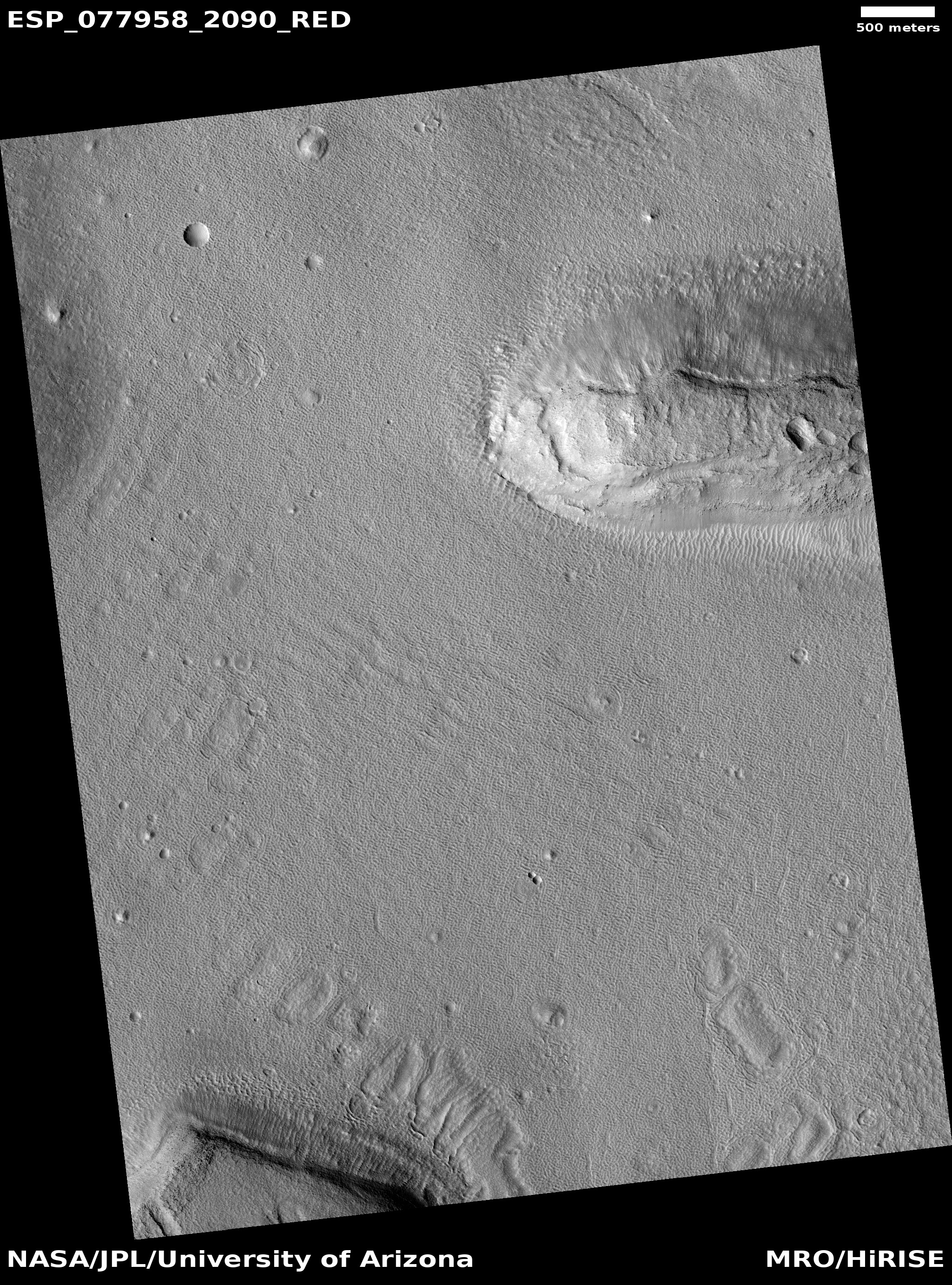
Cool image time. The picture to the right, cropped to post here, was taken on March 14, 2023 by the high resolution camera on Mars Reconnaissance Orbiter (MRO). Dubbed simply a “terrain sample,” this image was likely taken not as part of any specific research project, but to fill a gap in the camera’s schedule in order to maintain its temperature by taking regular images. When the camera team needs to do this, they try to find interesting locations not previously photographed. Sometimes the photos turn out somewhat boring. Most of the time however they capture something very intriguing.

In this case, the intriguing feature of this picture is its stippled surface that seems to overlay a relatively flat surface underneath, with some faint covered craters visible. On top are several more recent craters that suggest either the impact landed in very soft material, thus producing little ejecta and no crater rims or the craters are not craters but sinks, places where the ground is subsiding due to some underground process.
» Read more

0 comments

Webb makes first detection of one particular carbon molecule

The uncertainty of science: Using the Webb Space Telescope, astronomers have made the first detection of methyl cation (pronounced cat-eye-on) (CH3+) in space, located in a baby solar system the star-forming region of the Orion nebula about 1,350 light years away.

While the star in d203-506 is a small red dwarf, the system is bombarded by strong ultraviolet (UV) light from nearby hot, young, massive stars. Scientists believe that most planet-forming disks go through a period of such intense UV radiation, since stars tend to form in groups that often include massive, UV-producing stars.

Typically, UV radiation is expected to destroy complex organic molecules, in which case the discovery of CH3+ might seem to be a surprise. However, the team predicts that UV radiation might actually provide the necessary source of energy for CH3+ to form in the first place. Once formed, it then promotes additional chemical reactions to build more complex carbon molecules.

Broadly, the team notes that the molecules they see in d203-506 are quite different from typical protoplanetary disks. In particular, they could not detect any signs of water. [emphasis mine]

In the next day or so we shall likely see a number of stories in the mainstream press shouting some variation of “Webb finds key element of life!” Webb has done no such thing. It has found a carbon molecule not seen previously, which simply provides scientists another small data point in trying to understand the development of complex solar systems.

The highlighted sentences make clear the uncertainty in this field and the general shallow amount of knowledge. For example, why carbon molecules but no water, which is made up of hydrogen and oxygen, both ubiquitous throughout the universe and found in large amounts in star-forming regions?

5 comments

Determining whether a Martian crater is impact or volcanic

Determining whether a Martian crater is impact or volcanic
Click for original image.

Overview map

Cool image time! The picture above, rotated, cropped, reduced, and sharpened to post here, was taken on March 22, 2023 by the high resolution camera on Mars Reconnaissance Orbiter (MRO). The camera team labeled this “Crater rim and ejecta,” which subtly reveals the picture’s scientific purpose.

The white dot on the overview map to the right indicates the location of this 15-mile-wide unnamed crater, about 150 miles northwest of where the rover Opportunity landed and traveled south to the rim of Endeavour Crater. It also shows in the inset that the crater appears to sit in the center of an upraised mound, suggesting it was formed not by impact but by volcanic processes.

This picture however says otherwise. The many small mounds and mesas to the south of the crater rim are not what one would expect on the apron of a volcano. Instead, they suggest this crater is an impact, with those mounds the eroded ejecta from that impact, now also partly buried by dust. This hypothesis is strengthened by the data from Opportunity, which found a great deal of impact ejecta during its travels, possibly from the very event that created this crater.

6 comments

A spectacular Martian glacier

Overview map

A spectacular Martian glacier
Click for original image.

Mars appears to be a planet filled with past surface flows, none of which are active today but all of which came from widely different geological processes. Yesterday’s Martian cool image showed the hardened remains of a lava flow on Mars. Today’s cool image shows us what might one of the best examples of the kind of glacial evidence orbital images have been finding throughout the mid-latitudes of Mars.

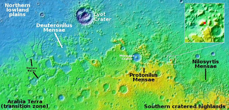
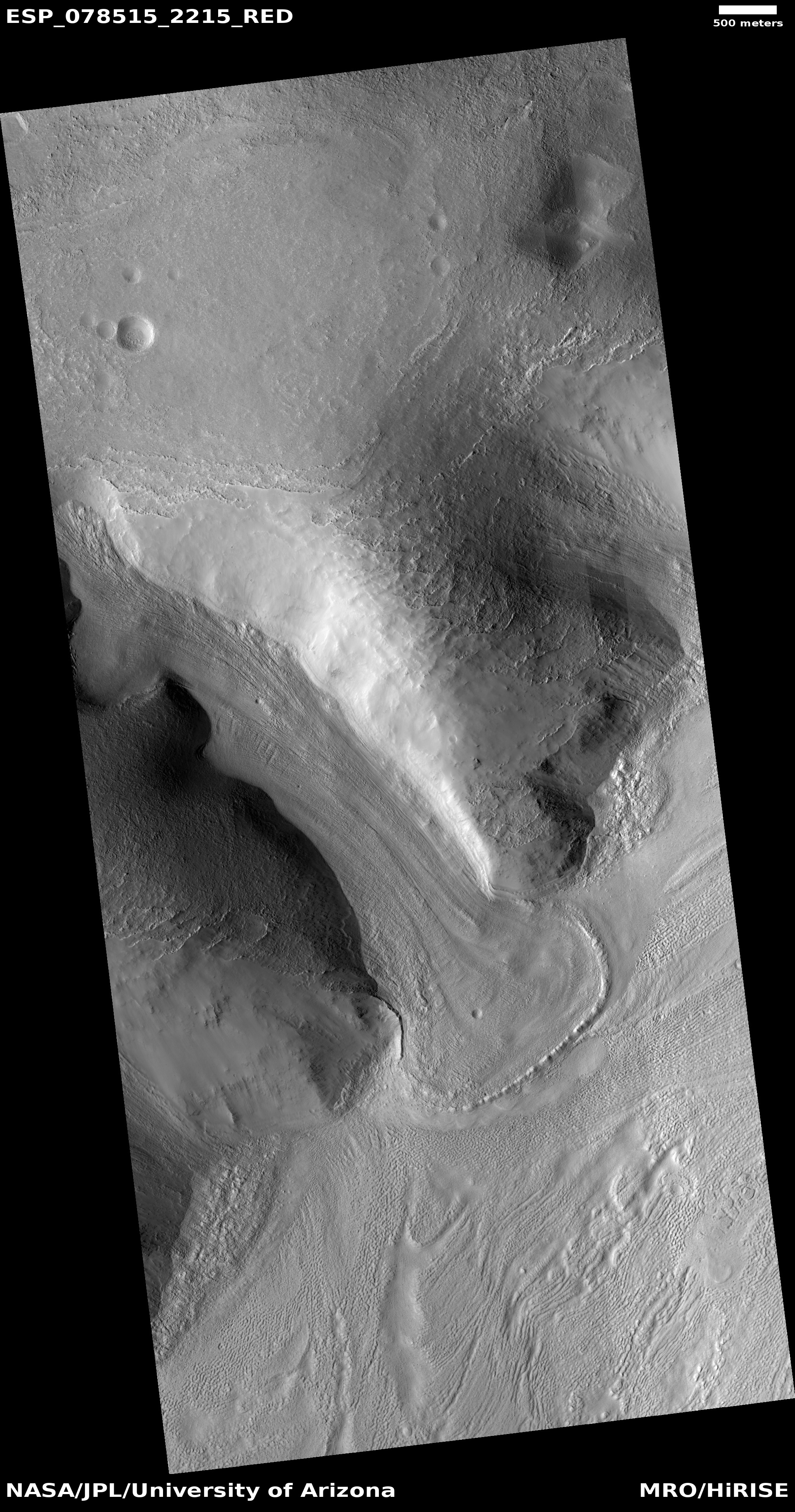
The picture to the right, rotated, cropped, reduced, and sharpened to post here, was taken on April 27, 2023 by the high resolution camera on Mars Reconnaissance Orbiter (MRO). The red dot in the inset on the overview map above indicates its location on Mars, in the chaos region dubbed Protonilus Mensae that forms the central part of the 2,000-mile-long Martian region in the north mid-latitudes I dub glacier country. In this region almost every high resolution image shows evidence of glaciers, all protected by a thin layer of dust and debris so they do not sublimate away.

This particular glacier fills a canyon carved into the southern cliff of a mile-high mesa five miles by ten miles in size, and drops dramatically almost 4,700 feet in about four miles. In fact, it so epitomizes what glaciers look like that the camera team for MRO’s high resolution camera used a 2020 image to give a quick lesson on how to spot a glacier on Mars.

This 2023 picture was likely taken as part of a long term monitoring program. Though planetary scientists presently do not think the glaciers on Mars are active and moving, this assumption is not yet confirmed. Taking repeated pictures of this same glacier over time will eventually answer this question.

0 comments
1 65 66 67 68 69 89