Ingenuity completes 47th flight, scouting ahead of Perseverance
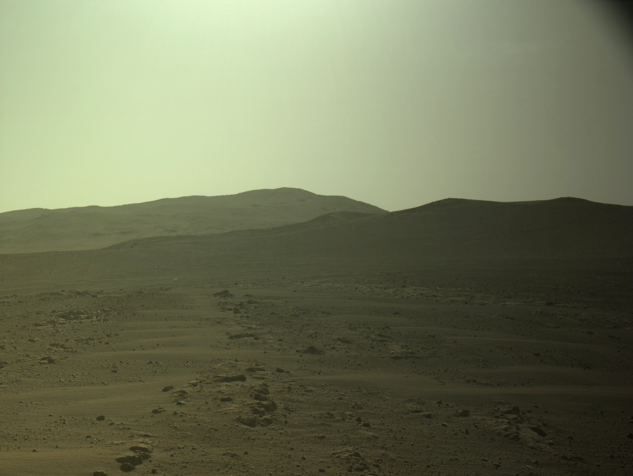
Ingenuity sitting ahead of Perseverance, on the delta
Click for original image.

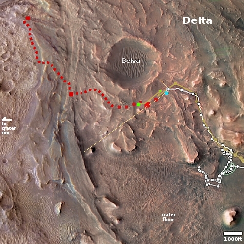
Overview map
Click for interactive map.

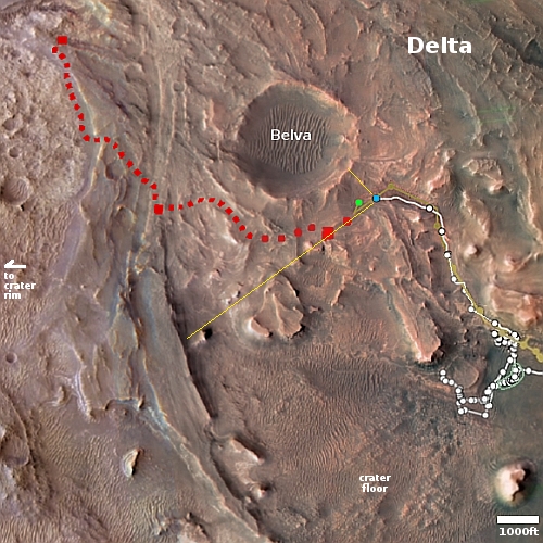
Though the science team has not, as of this posting, added the flight to Ingenuity’s flight log, according to the interactive map showing the positions of both Ingenuity and Perseverance on Mars, the helicopter completed its 47th flight yesterday as planned.

An annotated version of that map is to the right. The larger green dot marks Ingenuity’s new position. The smaller green dot marks its position when the panorama above was taken on February 27, 2023, capturing the helicopter in the distance (as indicated by the arrow). The yellow lines indicate the approximate area covered by that panorama. The blue dot marks Perseverance’s present position.

The flight’s planned distance was to go 1,410 feet to the southwest and “image science targets along the way.” As the helicopter also flew above Perseverance’s planned route, as indicated by the red dotted line, it also provided the rover team information about the ground Perseverance will travel along the way. Since the terrain here is generally not very rough, the information is not critical for route-picking. It might however spot some geological feature that bears a closer look that would not have been noticed by the rover alone.
1 comment

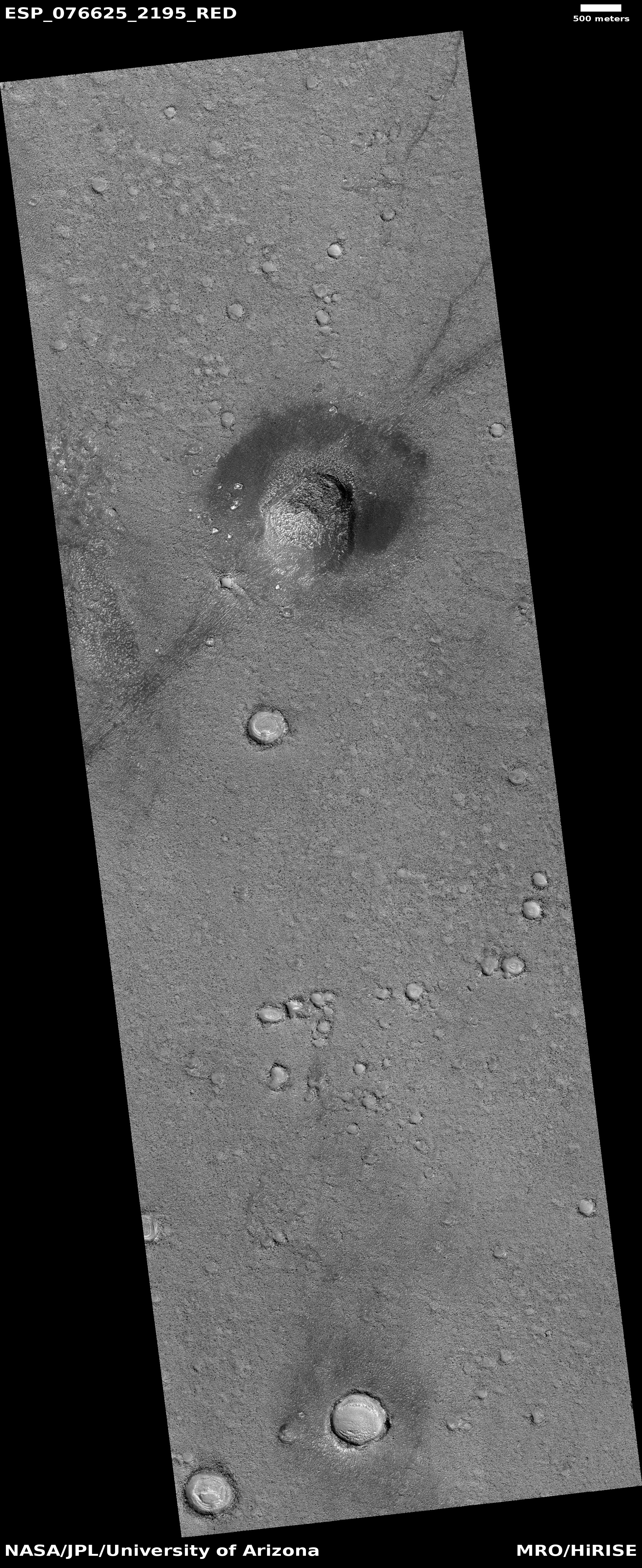
Ice volcano in the Martian high northern latitudes?

Ice volcano on Mars
Click for original image.

That the Martian surface becomes increasingly icy as one approaches its poles is becoming increasingly evident from orbital images. Today’s cool image provides us another data point.

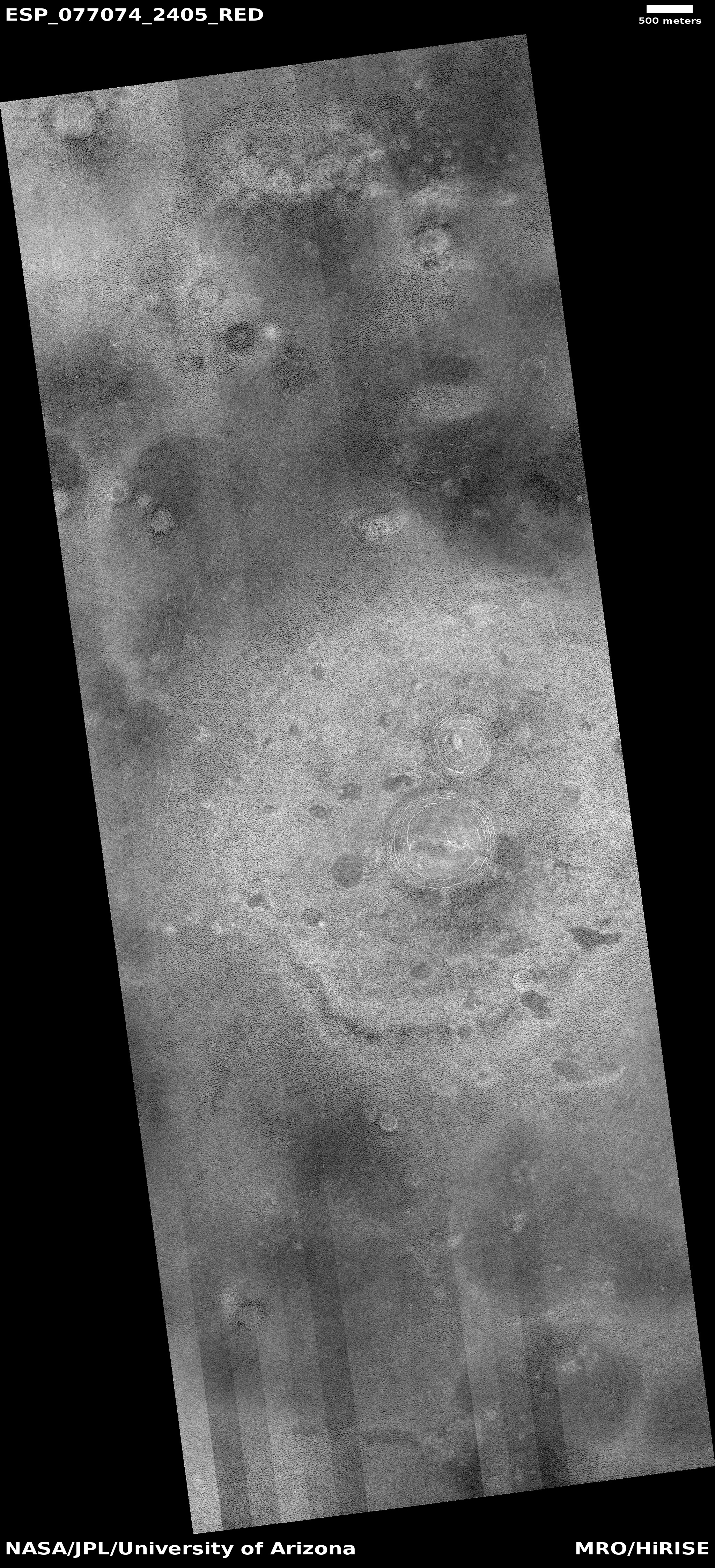
The picture to the right, rotated, cropped, reduced, and enhanced to post here, was taken on January 4, 2023 by the high resolution camera on Mars Reconnaissance Orbiter (MRO). It is once again another terrain sample image, taken not as part of any particular research project but to fill a gap in the camera’s schedule so as to maintain its temperature. With such pictures, it is hard to predict what will be seen, though the scientists try to find interesting things. In this case the camera team succeeded quite nicely, capturing what appears to me to be a small volcano with two calderas.

This volcano however has almost certainly not spouted lava but mud and water.
» Read more

1 comment

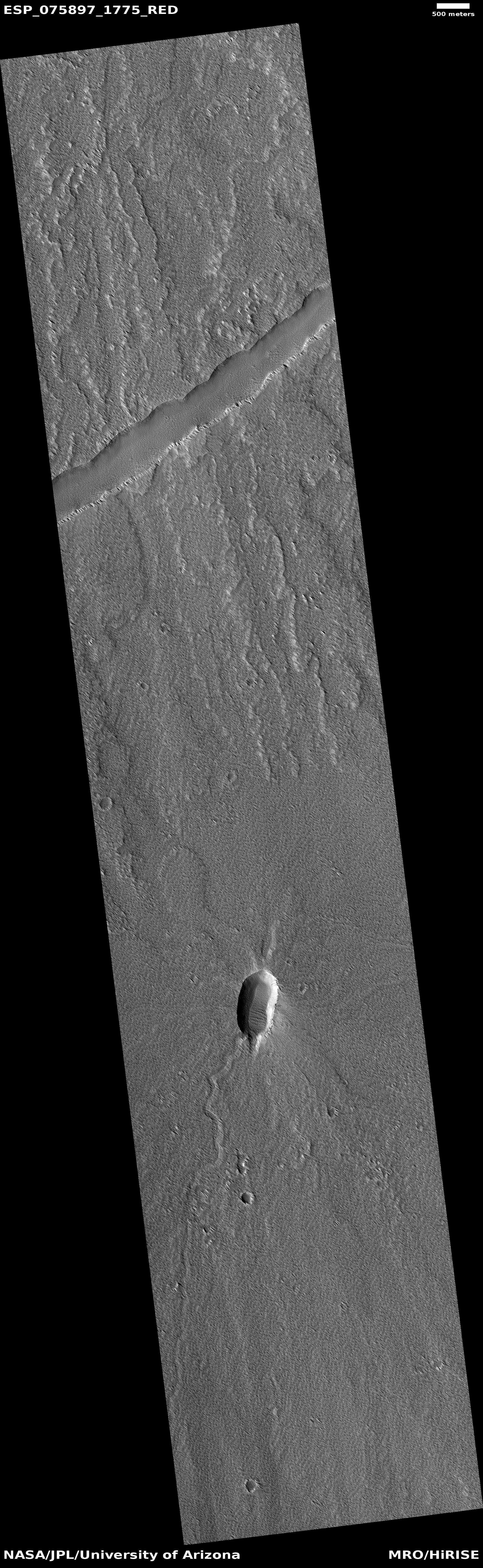
Cracks in Martian lava

Cracks in Martian lava
Click for original image.

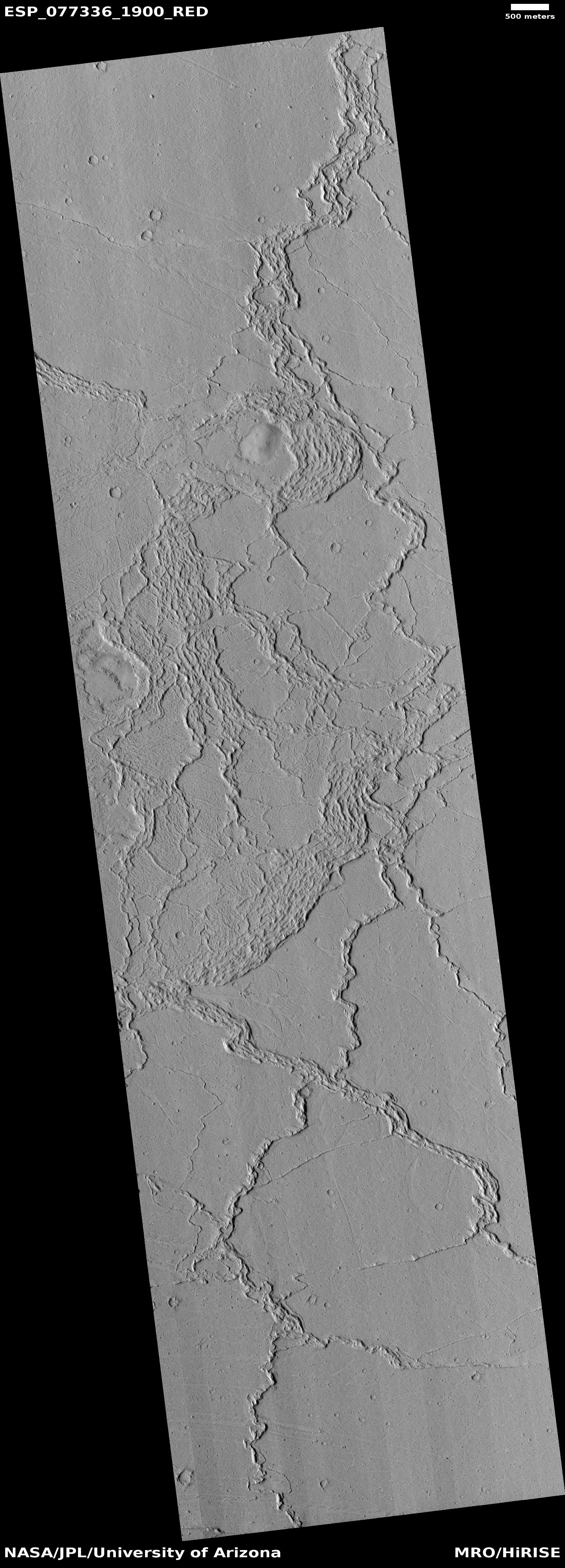
Cool image time! The picture to the right, rotated, cropped, and reduced to post here, was taken on January 25, 2023 by the high resolution camera on Mars Reconnaissance Orbiter (MRO). It was taken not as part of any specific research project, but to fill a gap in MRO’s picture-taking schedule in order to maintain the camera’s temperature. When such pictures need to be taken, the camera team tries to find something of interest in the area to be shot. Sometimes the picture is boring. Sometimes fascinating. Today’s picture I think falls into the latter category.

This is a lava flood plain, as shown in the overview map below. The meandering ridges are likely what geologists call lava dikes, places where lava was extruded out through a fissure. This suggests that the flat flood lava was an older crust, and that there was hot molten lava below it that eventually pushed its way up through cracks in that crust.

This hypothesis however is not certain, as the meandering nature of the ridges does not correspond well with what one would expect from such crustal cracks.
» Read more

0 comments

Flat-topped mesas in the icy northern lowland plains of Mars

Flat-topped Martian craters
Click for full image.

Cool image time! The picture to the right, cropped and rotated to post here, was taken on December 27, 2022 by the high resolution camera on Mars Reconnaissance Orbiter (MRO), and shows what the scientists have labeled “flat topped hills in Utopia Planitia.”

Utopia Planitia is the largest impact basin on Mars, approximately 2,100 miles across and located in the northern lowland plains.

Orbital evidence strongly suggests it is a region with a lot of near surface ice. The picture to the right reinforces that conclusion, as the entire flat plain surrounding these buttes appears like an ice field. Moreover, the full image shows many craters filled with glacial features, most of which also have softened features, as if with time the ice that impregnates their material has sublimated away.
» Read more

0 comments

Curiosity’s most recent cloud campaign

A cloud on Mars
Click for original image.

On January 30, 2023 I posted the picture to the right, taken by the high resolution camera on the Mars rover Curiosity. The picture was part of their ongoing cloud survey, running from January to March ’23 and using the rover’s hi-res camera to look for clouds during twilight. Today the rover science team issued a press release describing some of the results of that campaign. For example, on February 2nd the rover captured a sunset with sun rays, sunlight illuminating the bottom of clouds after the Sun has set. The release also provided this explanation for the cloud on the right.

In addition to the image of sun rays, Curiosity captured a set of colorful clouds shaped like a feather on Jan. 27. When illuminated by sunlight, certain types of clouds can create a rainbowlike display called iridescence. โ€œWhere we see iridescence, it means a cloudโ€™s particle sizes are identical to their neighbors in each part of the cloud,โ€ said Mark Lemmon, an atmospheric scientist with the Space Science Institute in Boulder, Colorado. โ€œBy looking at color transitions, weโ€™re seeing particle size changing across the cloud. That tells us about the way the cloud is evolving and how its particles are changing size over time.โ€

In the case of Mars, the clouds are not made of liquid water droplets like on Earth, but ice particles, sometimes water and sometimes dry ice.

0 comments

An inactive volcanic vent on Mars

An inactive volcanic vent on Mars
Click for full image.

Cool image time! The picture to the right, rotated, cropped, and reduced to post here, was taken on October 5, 2022 by the high resolution camera on Mars Reconnaissance Orbiter (MRO). Labeled by the science team as “Vents and Lava Flows on Flank of Pavonis Mons,” the section to the right shows the picture’s largest vent. The downhill grade is to the south.

In the full photo you can see that this vent sits on top of a flat mound of hardened lava, all of which flowed from the vent in the distant past. The main flow of course went to the south, out the channel and down the flanks of Pavonis Mons, the middle volcano in the line of three just to the west of Mars’ giant Valles Marineris canyon. The caldera peak of Pavonis Mons is about 35 miles away, and sits at a height of 47,000 feet elevation, far higher than Mount Everest but still only the fourth highest Martian volcano.

In the full picture, the entire surface also generally flows south, except for a crack that goes from northeast to southwest, possibly caused when the mountain flank sagged to the south.
» Read more

2 comments

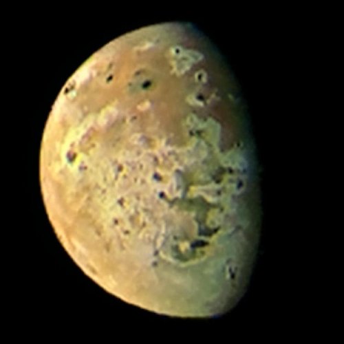
Juno captures close-up images of Jupiter’s moon Io

Io as seen by Juno

On March 1, 2023 the Jupiter orbiter Juno passed within 33,000 miles of the gas giant’s moon Io, getting its first close-up images.

Several citizen scientists have processed those images. The photo to the right, cropped and reduced to post here, was created by Andrew R Brown. This particular picture was one of five taken by Juno during the fly-by. Jason Perry processed all five here, with this caption:

Most of the dark spots seen across Io’s surface are the result of volcanic eruptions. These include East Girru, a dark spot that was not seen the last time Io was seen at this resolution during the New Horizons encounter with Jupiter in February 2007. East Girru was undergoing a major eruption at the time but hadn’t had time to produce a new lava flow before the end of the week-long encounter. This small flow field, measuring 3,200 square kilometers (1,390 square miles) in size, may have also been reactivated during an eruption in October 2021, as seen by Juno JIRAM.

Another apparent surface change is at Chors Patera, which has undergone a significant reddening since Galileo last observed it in October 2001. Reddish materials on Io are indicative of the presence of short-chain sulfur and are often associated with high-temperature, silicate volcanism. Additional dark spots near the terminator, the boundary between Io’s day and night sides, are the shadows of tall mountains. The dark spot at middle right in the upper right image may be due a mountain 5500 meters (18,000 feet) tall.

The smallest object resolved in this image is about 22 miles across.

3 comments

Sightseeing in the region near the Starship Mars landing zone

Sightseeing in the region near Starship's landing zone
Click for original image.

Cool image time! The picture to the right, cropped and reduced to post here, was taken on November 30, 2022 by the high resolution camera on Mars Reconnaissance Orbiter (MRO). It shows a bulbous hill in the icy northern lowland plains of Mars. That it is icy here is indicated by the glacier features that appear to fill the small crater near the bottom of the picture.

You can get a better sense of stark alien nature of this terrain by looking at an MRO context camera image of the same area, taken on April 1, 2008. The subject hill is the first hill on the image’s west side, going from the top. This is a flat plain interspersed with crater splats, mounds of a variety of sizes, and a puzzling meandering dark line that suggests a crack from which material is oozing.

The geology to be studied here might be endless but for tourists the views will be astounding in their alienness.
» Read more

2 comments

A Martian glacier waterfall?

A Martian glacier waterfall?
Click for original image.

Cool image time! The photo to the right, cropped, reduced, and sharpened to post here, was taken on October 25, 2022 by the high resolution camera on Mars Reconnaissance Orbiter (MRO). It shows a small meandering canyon that appears to drain into a larger side canyon, all part of a region of chaos terrain dubbed Galaxias Chaos in the Martian northern mid-latitudes.

Though the latitude is 35 degrees north, where we should see lots of evidence of glacial features, especially because this is chaos terrain — terrain unique to Mars — that generally appears formed by such processes, I find few outright obvious glacial features in this cropped portion or in the full image.
» Read more

2 comments

The barren and icy northern lowland plains of Mars

The barren and icy northern lowland plains of Mars
Click for original image.

Cool image time! The picture to the right, cropped and sharpened to post here, was taken on January 2, 2023 by the high resolution camera on Mars Reconnaissance Orbiter (MRO). Taken to fill a gap in the camera’s planned image schedule in order to maintain its temperature, the location was in this sense picked not for any particular scientific research project, but because the camera team decided they might find something interesting at this spot.

What they found is a vast flat plain of polygons, a feature found frequently on the surface of Mars and thought to be formed from processes similar to the drying that creates similar polygon cracks in dried mud here on Earth. In this case, the cracks are almost certainly in ice. As Colin Dundas of the U.S. Geological Surveyโ€™s Astrogeology Science Center in Arizona explained to me previously,
» Read more

0 comments

Layers upon layers on Mars

Layers on Mars
Click for original image.

Today’s cool image once again illustrates that the geology of Mars will almost certainly center on a study of layers, as increasingly the orbital and rover images are telling us that the red planet is covered with innumerable layers, one after another, each created by another cycle, some seasonal, some global, and some related to climate and the planet’s fluctuating rotation tilt as well as its orbit around the Sun. And some might also be random volcanic events, unrelated to the cycles.

The picture to the right, rotated, cropped, reduced, and sharpened to post here, was taken on October 10, 2022 by the high resolution camera on Mars Reconnaissance Orbiter (MRO). Labeled by the science team “Layering in western Arabia Terra”, this section only shows a small amount of the layering visible in the full image. From east to west the ground rises in a series of terraces, each representing a different layer of distinct geology.
» Read more

0 comments

Perseverance snaps picture of its scout Ingenuity

Ingenuity sitting ahead of Perseverance, on the delta
Click for original image.

Overview map
Click for interactive map.

The panorama above, cropped, enhanced, and annotated to post here, was taken by left navigation camera on the Mars rover Perseverance on February 27, 2023, looking ahead at its future path on the delta that flowed into Jezero Crater sometime into the past. The arrow points at Ingenuity, now sitting ahead of the rover after completing its 46th flight sometime this weekend.

On the overview map to the right, Perservance’s present location is indicated by the blue dot. The green dot marks Ingenuity’s position, and the yellow lines indicate the approximate area viewed by the panorama above. The red dotted line indicates Perseverance planned future route, though it is likely the science team will make many side trips along the way. The bigger dots are points of special interest, where the scientists hope to drill for core samples.

The ridge on the right is the rim of Belva Crater. The higher mountain behind it is likely the rim of Jezero Crater itself, about four miles away. The helicopter sits about 250 feet away.

Unlike the rocky terrain where Curiosity is presently traveling in the foothills of Mount Sharp in Gale Crater, the terrain here in Jezero Crater appears much more benign, almost like a sand desert of dunes. This is not sand, nor are the hills dunes, but wind erosion and dust appear to have smoothed and hidden the geology more than in Gale Crater.

3 comments
1 76 77 78 79 80 89