Spotting dozens of Martian dust devils in one observation
Overview map

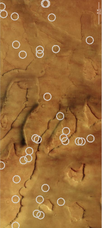
Dozens of active dust devils in one image
Click for source.

Using Europe’s Mars Express orbiter, scientists have found it is possible to identify multiple active dust devils at a time on the surface of Mars.

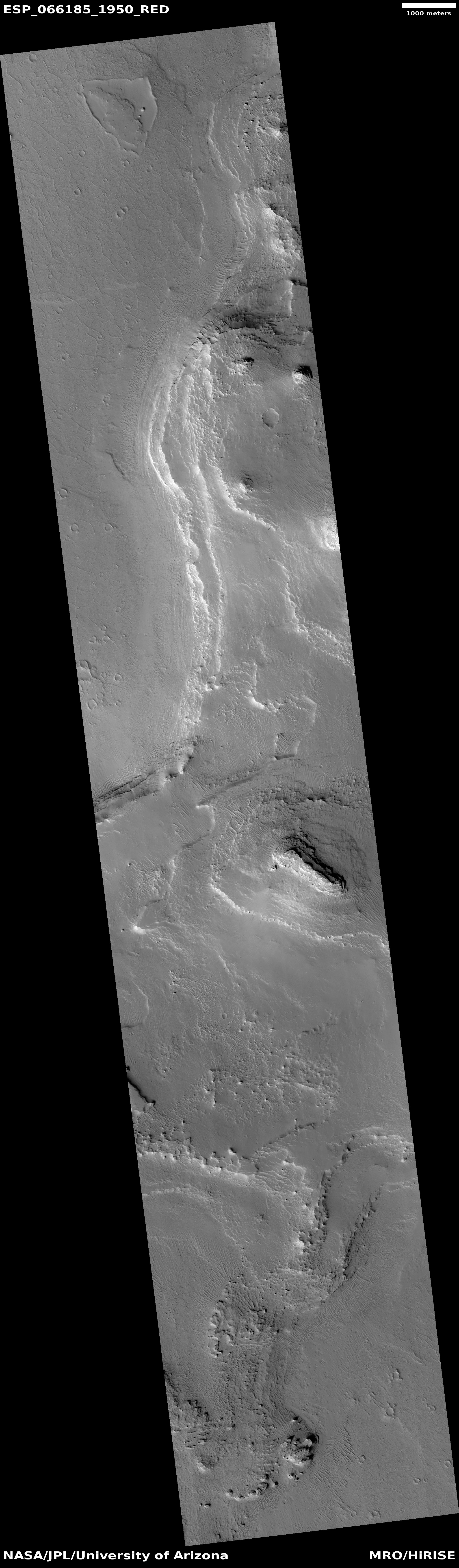
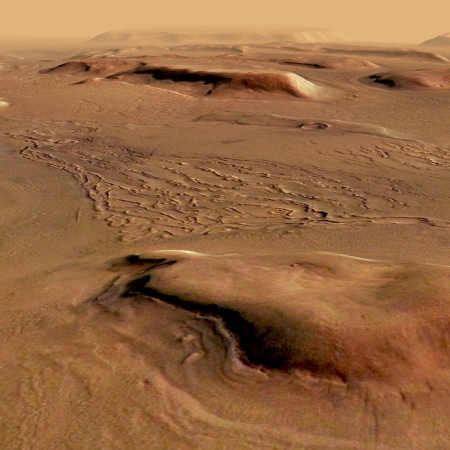
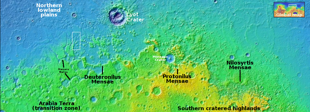
The circles on the image to the right shows dozens of such dust devils, at the outlet region of a valley on Mars dubbed Mamers Valles, located at the western end of the 2,000-mile-long mid-latitude strip I dub glacier country (as shown on the overview map above), because practically every image of this region shows glacial features. This location is where Mamer Valles drains into the northern lowland plains.

Mars Express is uniquely equipped to spot these mini whirlwinds. To form a single image using its High Resolution Stereo Camera โ€“ the instrument responsible for these new snapshots โ€“ the spacecraft combines sequential views from up to nine separate camera channels (which look at Mars in a different colour, from a different direction, or a mix of the two). If nothing changes on the martian surface while these are being taken, the multiple perspectives align โ€“ but if something is moving about, it stands out clearly from its surroundings.

In this new set of images, Mars Express captures not one but dozens of active dust devils.

The image to the right covers about a hundred miles from top to bottom. It is part of a long term project using Mars Express to map the dust devil activity on the entire Martian surface. Not surprisingly, dust devils do not occur everywhere in equal amounts. It appears they favor certain locations, with more generally found in the high latitudes of the cratered southern hemisphere.
6 comments

The movement of surface ash on Mars over a half century

Viking and Mars Express images side-by-side for comparison
Go here and here for original images.

Overview map

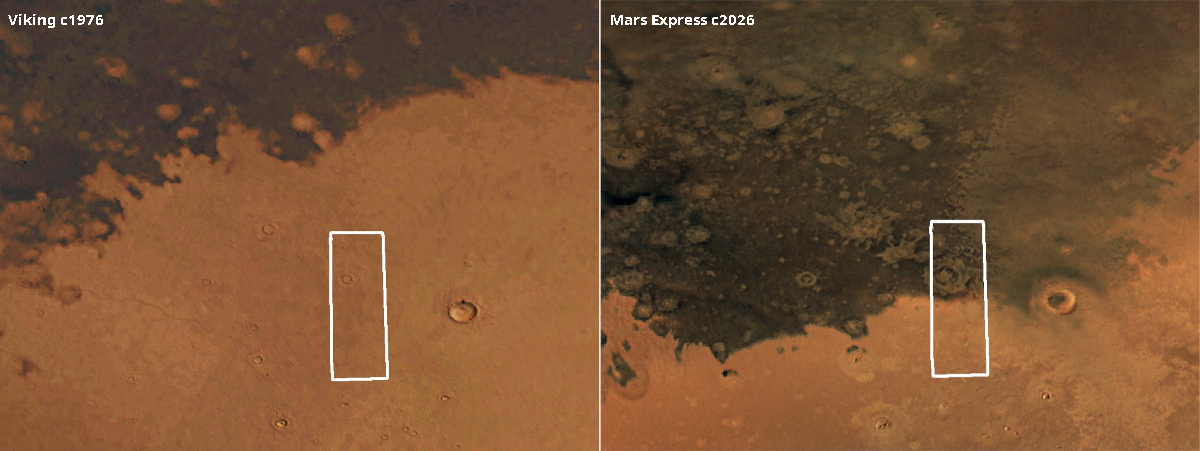
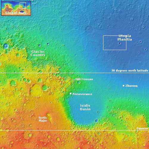
Cool image time! In comparing images of one location on Mars taken a half century apart, scientists using Europe’s Mars Express orbiter have discovered that the dark ash covering this region has shifted south by about 200 miles.

The two images above show the change, with a Viking orbiter image taken sometime in 1976 on the left and the Mars Express image taken in 2026 on the right. Both images have been enhanced to match each other, with the white box marking an area seen in close-up by Mars Express.

The overview map to the right provides the context. This region is inside Utopia Basin, one of the largest ancient impact basins on Mars, thought to have been formed by an impact that occurred a little more than four billion years ago. Much of Mars’ dark volcanic dust is thought to come from the Medusae Fossae Formation, a gigantic volcanic ash field the size of India and located on the other side of the planet, in between all of the red planet’s largest volcanoes. Over the eons that ash has gotten distributed across the globe.

In this case, it not only covers large areas of Utopia Basin, but over a half century the prevailing winds in the thin Martian atmosphere has been enough to shift the edge of this particular ash field south by 200 miles.

1 comment

First image from Mars of interstellar Comet 3I/Atlas

Comet 3I/Atlas as seen from Mars
Click for original image.

Using the Europe’s Trace Gas Orbiter (TGO) presently orbiting Mars, scientists have successfully obtained the first images from Mars of interstellar Comet 3I/Atlas using its Colour and Stereo Surface Imaging System (CaSSIS).

They have compiled a short movie of those images, with one of those pictures to the right, cropped to post here. As expected, the observation was difficult and somewhat limited in the data it could obtain.

CaSSIS could not distinguish the nucleus from the coma, because 3I/ATLAS was too far away. Imaging this kilometre-wide nucleus would have been as impossible as seeing a mobile phone on the Moon from Earth.

But the coma, measuring a few thousand kilometres across, is clearly visible. The coma is created as 3I/ATLAS approaches the Sun. The Sunโ€™s heat and radiation is bringing the comet to life, causing it to release gas and dust, which collects as this halo surrounding the nucleus. The full size of the coma could not be measured by CaSSIS because the brightness of the dust decreases quickly with distance from the nucleus. This means that the coma fades into the noise in the image.

Typically, material from the coma is swept into a long tail, which can grow up to millions of kilometres long as the comet moves closer to the Sun. The tail is much dimmer than the coma. We canโ€™t see the tail in the CaSSIS images, but it may become more visible in future observations as the comet continues to heat up and release more ice.

The science team for Europe’s Mars Express orbiter also attempted to get data of the comet, but have not yet been able to detect it. Both orbiters also tried to get spectroscopy, but no data was obtained because the comet is presently too faint and distant for these instruments.

More observations are planned, not only from these orbiters but also from Europe’s Juice spacecraft on its way to Jupiter but presently in the inner solar system somewhat near the Sun. It will make its observations in November, but won’t be able to transmit the data back until February, after it has gotten more distant from the Sun.

0 comments

A cloud atlas of Mars

Different clouds on Mars interacting
Click for original image.

Using data obtained from one of the instruments on the European Space Agency’s (ESA) Mars Express orbiter, scientists have now published an atlas of the clouds of Mars and made it available to the public.

The picture to the right, cropped, reduced, and sharpened to post here, is just one example of the images in the atlas. From the caption:

This image displays two atmospheric phenomena: the white curved lines are gravity wave clouds, while the brown areas are dust lifted from the ground by wind. The colour shift visible in the dust lifting event might be indicative of very fast winds, a phenomenon currently under investigation by other members of the team.

The atlas contains more than 300 images of various Martian cloud formations, from the one to the right to images of cirrus clouds on the top of Olympus Mons, Mars’ largest volcano. You can download it here (the file is a very large spreadsheet).

0 comments

Scientists: Water frost detected in calderas of four Martian volcanos

Frost found on four Martian volcanoes

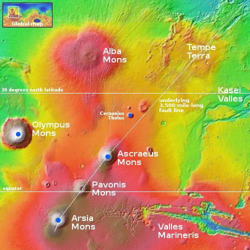
Scientists using data from two European Mars orbiters think they have detected patches of transient water frost in the calderas of four Martian volcanos, all located in the dry equatorial regions of Mars where previously no near-surface ice has been seen.

According to the study, the frost is present for only a few hours after sunrise before it evaporates in sunlight. The frost is also incredibly thin โ€” likely only one-hundredth of a millimeter thick or about the width of a human hair. Still, itโ€™s quite vast. The researchers calculate the frost constitutes at least 150,000 tons of water that swaps between the surface and atmosphere each day during the cold seasons. Thatโ€™s the equivalent of roughly 60 Olympic-size swimming pools.

You can read the research paper here. The volcanoes with frost were Olympus Mons, Arsia Mons, Ascraeus Mons, and Ceraunius Tholus, as shown by the blue dots on the overview map to the right. All are in the dry tropics of Mars.

The researchers believe the frost comes from the atmosphere, like dew forming in the morning on Earth. For it to take place at these high elevations on Mars however is astonishing. At these high elevations the atmosphere is extremely thin. Furthermore, the dry tropics have so far been found to contain no near-surface water or ice to fuel these processes.

2 comments

Scientists: Evidence of large deposits of buried ice along Martian equator

Theorized buried ice deposits on Mars
Click for original figure from paper.

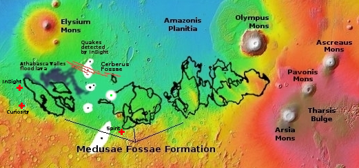
Using data obtained from Europe’s Mars Express orbiter, scientists believe they have detected evidence of a very large and extensive deposit of buried ice in the dry Martian equatorial regions, buried within the Medusae Fossae Formation, what is thought to be the largest volcanic ash deposit on Mars.

The blue-to-orange areas inside the Medusae on the map to the right, taken from figure 5 of the paper, shows where they have detected potential buried ice, at depths ranging from one to two thousand feet below the surface. The orange areas indicate the thickest ice deposits, as much as two miles thick. From the paper’s abstract:

The MARSIS radar sounder [on Mars Express] detects echoes in Medusae Fossae Formation deposits that occur between the surface and the base which are interpreted as layers within the deposit like those found in Polar Layered Deposits of the North and South Poles. The subsurface reflectors suggest transitions between mixtures of ice-rich and ice-poor dust analogous to the multi-layered, ice-rich polar deposits.

Assuming this detection is real, this would be the largest reservoir of potential water in the dry equatorial regions found yet, comparable to another similar buried detection deep below the giant canyon Valles Marineris but much larger.

Accessing this water however will not be simple, as it is deep underground. You couldn’t just drill a well, as it is ice, not a liquid water table. It would have to mined like minerals on Earth. There are uncertainties about this conclusion as well. It is possible the detection is not water but volcanic ash or dust compacted in a way that mimics an ice detection.

1 comment

Review of orbital images confirms source of largest Mars quake was not an impact

Location of May quake
The white patches mark the locations on Mars of the largest quakes
detected by InSight. The green dotted patch marks this particular 4.7 quake.

Scientists reviewing images from several different orbiters have confirmed that the source of the largest Mars quake detected by InSight, 4.7 magnitude, was not caused by a meteorite impact and thus proves that movement in the interior of Mars is still occurring.

The quake, which had a magnitude of 4.7 and caused vibrations to reverberate through the planet for at least six hours, was recorded by NASAโ€™s InSight lander on Wednesday 4 May 2022. Because its seismic signal was similar to previous quakes known to be caused by meteoroid impacts, the team believed that this event (dubbed โ€˜S1222aโ€™) might have been caused by an impact as well, and launched an international search for a fresh crater.

…During its time on Mars, InSight (which was co-designed by the University of Oxford) recorded at least 8 marsquake events caused by meteoroid impacts. The largest two of these formed craters around 150m in diameter. If the S1222a event was formed by an impact, the crater would be expected to be at least 300m in diameter. Each group examined data from their satellites orbiting Mars to look for a new crater, or any other tell-tale signature of an impact (e.g. a dust cloud appearing in the hours after the quake).

After several months of searching, the team announced today that no fresh crater was found.

You can read their paper here. To do the survey, the team used data from the American orbiters Mars Reconnaissance Orbiter and Mars Odyssey, and also enlisted help from scientists controlling the data from Europe’s Mars Express, China’s Tianwen-1, India’s Mangalyaan, and the United Arab Emirates’ Al-Mal.

The results suggest the quake occurred at “a dip-slip fault in the mid-crust, consistent with an origin between 18 and 28 km depth,” as stated in the conclusion of their paper. More analysis is necessary, but this result proves that the Martian interior still active enough to produce relatively large quakes..

0 comments

The Earth and Moon, as seen by Mars Express in Mars orbit

The Earth and Moon, as seen from Mars
Click to see four image movie.

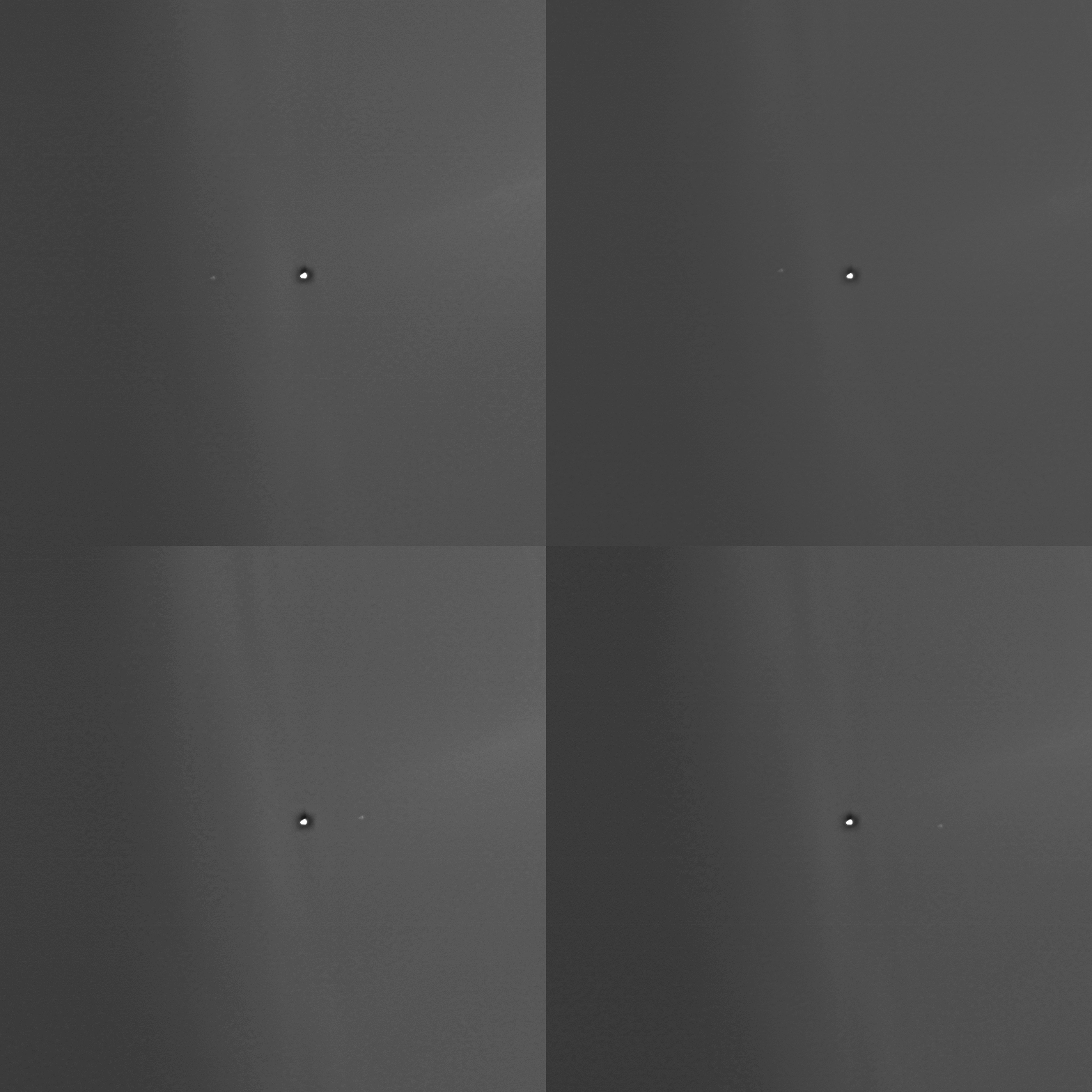
The science team for Europe’s Mars Express orbiter recently turned the spacecraft’s camera upward to capture a sequence of four images of the Earth with the Moon circling around it.

The images were taken at 14:08, 03:10 and 19:49 UTC on 15, 21, 27 May 2023 respectively, and at 15:00 UTC on 2 June 2023. This covers a bit more than half of the Moonโ€™s monthly motion around the Earth. The distance between Earth and Mars varied from 279 186 624 km to 301 016 265 km during this time. The image resolution is about 2570 km per pixel.

To the right is the June 2nd image, cropped and enhanced to post there. The Earth is the larger spot to the left. The picture gives a sense of what the Earth-Moon double planet system looks like from Mars. Unlike all other planets, where the size difference between planet and moon is great, the Earth/Moon system is comprised of a Moon quite large in comparison to its central planet.

4 comments

ESA to live-stream image downloads from Mars Express

To celebrate Mars Express’s 20th year in orbit around Mars, the European Space Agency (ESA) has announced that tomorrow it will for one hour live-stream the image downloads coming from the orbiter.

I have embedded that live stream below. According to the press release, new images will arrive about once every 50 seconds. The camera that will be taking the pictures however is not one of Mars Express’s main instruments, but designed instead to simply monitor the separation of the Beagle-2 lander from the orbiter in 2003. Since 2007 however the science team has used its low resolution global images of Mars for public relations, education, and even some science research.

That the science team is not providing the live feed from its high resolution camera however illustrates why Mars Express gets so little press coverage, compared to Mars Reconnaissance Orbiter (MRO). All MRO images are released to the public, usually only a month or so after they reach Earth. The ESA however has never made the archive of Mars Express accessible, as far as I have been able to discover. All it does is periodically issue a press release about once every few months touting one new image, even though the spacecraft is taking dozens daily.
» Read more

0 comments

Crater at the edge of the Martian south pole ice cap

Oblique view of south pole crater
Click for full image.

Overview map

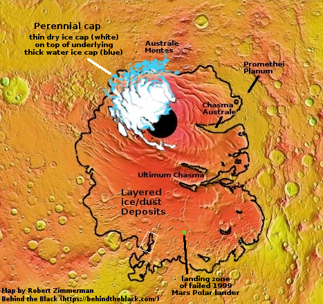
Cool image time! The oblique panorama above, reduced and sharpened to post here, was created from an image taken on May 19, 2022 by the European orbiter Mars Express. Its location on edge of the layered deposits of ice and dust that form most of the Martian southern ice cap is indicated by the white rectangle on the overview map to the right. From the press release:

While it may look like a winter wonderland, it was southern hemisphere spring at the time and ice was starting to retreat. Dark dunes are peeking through the frost and elevated terrain appears ice-free.

Two large impact craters draw the eye, their interiors striped with alternating layers of water-ice and fine sediments. These โ€˜polar layered depositsโ€™ are also exposed in exquisite detail in the rusty red ridge that connects the two craters.

The scattered white patches are either water frost, or the winter mantle of dry ice, both now sublimating away with the coming of spring.

The black line on the overview map indicates the extent of the layered deposits, and suggest that the ridgeline is not considered part of that ice cap layer, in contradiction to the press release language above.

Which is it? I would guess the answer is simply the uncertainty of science. Some scientists took a look here and decided the ridge was actually a base layer sticking up through the layered deposits. The European scientists who took this picture have instead concluded, based on the image, that the ridge is part of the layer deposits.

4 comments

A global map of Mars’ future mining regions

A global map of Mars' future mining regions
Click for labeled image.

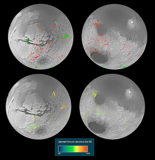
Using data accumulated in the past decade from orbiters, scientists have now published a global map of Mars, showing the regions on the red planet where there are high concentrations of hydrated minerals, minerals formed in the past in conjunction with the presence of water.

The maps to the right show those regions in various colors, indicating different types of minerals.

On Earth, clays form when water interacts with rocks, with different conditions giving rise to different types of clays. For example, clay minerals such as smectite and vermiculite form when relatively small amounts of water interact with the rock and so retain mostly the same chemical elements as the original volcanic rocks. In the case of smectite and vermiculite those elements are iron and magnesium. When the amount of water is relatively high, the rocks can be altered more. Soluble elements tend to be carried away leaving behind aluminium-rich clays such as kaolin.

The big surprise is the prevalence of these minerals. Ten years ago, planetary scientists knew of around 1000 outcrops on Mars. This made them interesting as geological oddities. However, the new map has reversed the situation, revealing hundreds of thousands of such areas in the oldest parts of the planet.

Though this data once again suggests that liquid water once flowed on the surface of Mars, for future colonists it is more important in that it identifies the regions where the most valuable resources will likely be found. For example, most of the colored regions on the map are located in the dry equatorial parts of Mars. However, south of the giant canyon Valles Marineris is a mineral region at about 30 to 40 degrees south latitude, to the northwest of Argyre Basin. This is also a region with a high concentration of glacial features. The two combined will likely make this region very valuable real estate.

1 comment

Glaciers in the Phlegra Mountains on Mars

Glaciers in the Phlegra mountains
Click for full image.

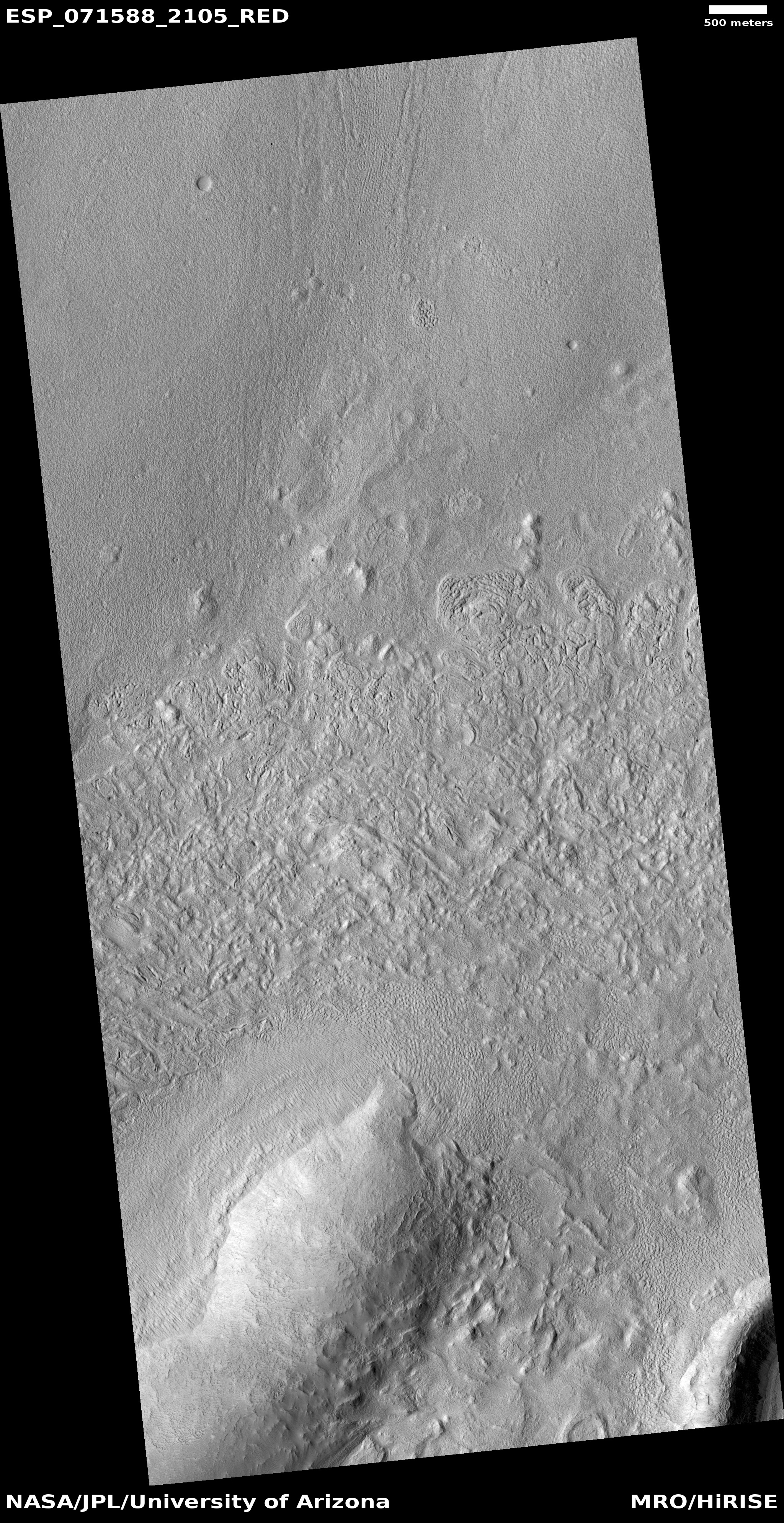
Cool image time! The photo to the right, cropped to post here, is just one of the many hundreds taken by the high resolution camera on Mars Reconnaissance Orbiter (MRO) as well as Europe’s Mars Express orbiter showing the thick icy glacial flows that surround practically every mountain or hill in the Phlegra mountains of Mars.

This picture was taken on November 3, 2021, and shows the eroding foot of an eroding glacial flow coming down from a small hill in a southeastern part of these mountains dubbed Phlegra Dorsa. The downward grade is to the north.

At 30 degrees north latitude it is not surprising these glacial flows are eroding, as they are at the southernmost limit of the mid-latitudes bands where such glaciers are found. Closer to the equator scientists have yet to find much evidence of ice.

The repeating arcs at the foot of this glacier suggest that it pushed downward in cycles, with each later cycle traveling a shorter distance. This supposition makes sense, considering scientists think the ebb and flow of these Martian glaciers has been determined by the cyclical changes in the planet’s rotational tilt.

The overview map below not only gives the context, it shows this location relative to the candidate landing sites for SpaceX’s Starship spacecraft.
» Read more

7 comments

Mars Express successfully relays data from Zhurong to Earth

The European Space Agency’s Mars Express orbiter has successfully been used to relay data from China’s Zhurong Mars rover to Earth and then to China.

In November, ESAโ€™s Mars Express and CNSAโ€™s Zhurong teams carried out a series of experimental communication tests in which Mars Express used this โ€˜in the blindโ€™ mode to listen for signals sent to it by the Zhurong Rover.

The experiments culminated in a successful test on 20 November. โ€œMars Express successfully received the signals sent by the rover, and our colleagues in the Zhurong team confirmed that all the data arrived on Earth in very good quality.โ€ says ESAโ€™s Gerhard Billig.

Apparently, normal communications would first involve “handshake” communications between the two, but that requires communications frequencies Zhurong does not use. Mars Express instead had to grab the data on the blind. The test was a success, which means the ESA will likely act as another communications relay for Zhurong, in addition to China’s Tianwen-1 orbiter, as the rover’s mission on Mars continues.

0 comments

Zhurong’s continuing travels on Mars

Zhurong overview map
Click for original map.

This past week the Chinese press released a new but limited update on the status of both its Mars orbiter Tianwen-1 and its Mars rover Zhurong.

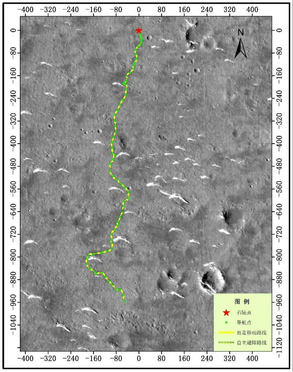
The map to the right uses as its background a high resolution picture from Mars Reconnaissance Orbiter. I have superimposed Zhurong’s route in green. You can get an idea of how far the rover has traveled since resuming communications with Earth in late October by comparing this map with the one I posted then. After stopping at a small sand dune (the crescent-shaped white features), it curved around to head to the southeast towards a rough area and a trough that is thought to be filled with sediment.

Meanwhile, the orbiter has shifted its orbit, changing from one dedicated mainly as providing a communications relay between Zhurong and Earth to one that now allows it to begin a two-year photographic survey of Mars.

To supplement the resulting gaps in communications for Zhurong, China and the European Space Agency (ESA) have made their first test using ESA’s Mars Express satellite as a relay satellite. Both hope to know soon whether it worked.

In either case, Zhurong’s travels will likely be slowed somewhat due to the reduction in communications access.

0 comments

Scientists question existence of liquid water lake under Martian south pole

The uncertainty of science: A re-analysis of the ground-penetrating radar data that suggested there was a liquid water lake under the Martian south pole has found that it might not be liquid water at all, but either “clays, metal-bearing minerals, or saline ice.”

The abstract can be read here.

The radar data, obtained by the European orbiter Mars Express, definitely shows a layer of bright reflection suggesting a layer of something different below the icecap. The research team decided to find out if other things besides liquid water could cause the difference.

They were able to determine what level of electric conductivity the material below the ice would need to have to match the observed signal from MARSIS. Then, they identified materials that are both conductive and present on Mars including clays, metal-bearing minerals and saline ice. โ€œSalty ice or conductive minerals at the base of the ice sheet are less flashy, but are more in line with the extremely cold temperatures at Mars’ poles,โ€ Bierson said.

While not explicitly excluding a liquid brine, the results open new potential explanations for the observed strong radar reflections, some of which do not require liquid brine beneath the Martian south polar ice cap.

Nothing is proven, one way or another. This research has simply underlined the uncertainty of the liquid water claim. We simply do not know what caused the bright radar reflection. All we know for certainty is that it is there.

7 comments

Scientists: Mars is losing water seasonally through its atmosphere

The uncertainty of science: Two new studies using data Europe’s Trace Gas Orbiter and Mars Express orbiters have found that Mars is losing water seasonally through its atmosphere.

The studies also found that global dust storms accelerate the process.

Anna and colleagues found that water vapour remained confined to below 60 km when Mars was far from the Sun but extended up to 90 km in altitude when Mars was closest to the Sun. Across a full orbit, the distance between the Sun and the Red Planet ranges from 207 million to 249 million km.

Near the Sun, the warmer temperatures and more intensive circulation in the atmosphere prevented water from freezing out at a certain altitude. โ€œThen, the upper atmosphere becomes moistened and saturated with water, explaining why water escape rates speed up during this season โ€“ water is carried higher, aiding its escape to space,โ€ adds Anna.

In years when Mars experienced a global dust storm the upper atmosphere became even wetter, accumulating water in excess at altitudes of over 80 km.

But wait, didn’t planetary scientists just announce that Mars hasn’t lost its water through the atmosphere, but instead lost it when it became chemical trapped in the planet’s soil? Yup, they did, but that was a model based on new ground data. This new result is based on atmospheric data.

Or to put it another way, the model was incomplete. While it could be true that a large bulk of Mars’ water is trapped chemically in the ground, that is not proven, only hypothesized. What has been proven, and is now confirmed by these two studies, is that, depending on weather and season, the water of Mars does leak into its upper atmosphere where it can escape into space, never to return.

What remains unknown is how much water escaped into space, and when. Moreover, the ground-based model could still be right, even if it is true that Mars is losing water through its atmosphere. At the moment the data is too incomplete to answer these questions with any certainty.

Meanwhile, this press release once again gives the false impression that the only water left on Mars is at its poles (and in this case, only the south pole). This is not accurate, based on numerous studies finding evidence of buried ice and glaciers everywhere on the planet down to the 30th latitude, in both the north and south hemispheres. Mars might have far less water now than it did billions of years ago, but it still has plenty, and that water is not found only at the poles.

2 comments

A majestic terraced butte on Mars

Majestic butte on Mars
Click for full image.

Cool image time! The photo to the right, rotated, cropped, and reduced to post here, was taken on September 8, 2020 by the high resolution camera on Mars Reconnaissance Orbiter (MRO). It shows an outstanding terraced butte that would rival any of the similar buttes scattered throughout the Grand Canyon, and is reminiscent especially of Wotans Throne.

What makes this butte intriguing are its terraces, the obvious result of the repeated deposition of new layers across the surface over time, and now exposed by erosion. What caused them?

As always, location provides the clues. First, this butte is found at about 15 degrees north latitude in the vast Arabia Terra transition region between the Martian northern lowland plains and the southern cratered highlands. At that latitude, we are not looking at any recent glacial features. While there might have been ice here once, it hasn’t likely been present, either on the surface or underground, for a very long time.

This conclusion becomes important once we look at the wider photo below, taken by the high resolution camera on the European orbiter Mars Express. This image gives us the immediate context.
» Read more

0 comments

New study confirms liquid water under Mars’ south pole

A new study has confirmed earlier work that suggested there were liquid lakes of water under the Martian south pole.

The data appears to indicate that the bodies are โ€œhypersaline solutionsโ€ โ€“a brine in which high concentrations of salt are dissolved in water โ€“ which is perhaps the reason they are able to stay liquid despite the very cold conditions of Marsโ€™s south pole.

The fact that there is a whole set of lakes suggests that they have probably formed relatively easily, and that versions of them may therefore have been present throughout the history of the planet. [emphasis mine]

There is one problem with hypothesis indicated by the highlighted words. Mars’ rotational tilt (its obliquity) shifts significantly, from 0 to 60 degrees. Right now it is tilted about 25 degrees, similar to Earth. The south pole as we see it today will have been very different at different obliquities, which means there is no way to assume these posited underground lakes would have been there.

1 comment

European planetary missions go dark because of Wuhan virus

The European Space Agency has suspended operations and shut down several planetary missions, including two Mars orbiters and two solar missions, because of lockdowns imposed because of COVID-19.

The problem is that they don’t have enough people in their mission controls to operate everything. They are shutting these down so that they can continue operations on their Mecury mission BepiColumbo, for example.

The article also tries to lay the blame for the recently announced launch delay of Europe’s Mars 2020 rover to 2022 on the virus, but that’s false. The mission was delayed because it simply wasn’t ready.

0 comments

Mars Express confirms ancient glaciers in northern Martian mid-latitudes

Perspective view of Deuteronilus Mensae
Click for full image.

The European Space Agency’s orbiter Mars Express has confirmed the presence of large fractured ice sheets suggestive of buried and ancient glaciers. These ice sheets are within one region on Mars located in the mid-latitudes where many such glacial features have been found. They are also in the transition zone between the northern lowlands and the southern highlands.

This landscape shows clear and widespread signs of significant, lasting erosion. As is common with fretted terrain, it contains a mix of cliffs, canyons, scarps, steep-sided and flat-topped mounds (mesa), furrows, fractured ridges and more, a selection of which can be seen dotted across the frame.

These features were created as flowing material dissected the area, cutting through the existing landscape and carving out a web of winding channels. In the case of Deuteronilus Mensae, flowing ice is the most likely culprit. Scientists believe that this terrain has experienced extensive past glacial activity across numerous martian epochs.

It is thought that glaciers slowly but surely ate away at the plains and plateaus that once covered this region, leaving only a scattering of steep, flat, isolated mounds of rock in their wake.

Smooth deposits cover the floor itself, some marked with flow patterns from material slowly moving downhill โ€“ a mix of ice and accumulated debris that came together to form and feed viscous, moving flows of mass somewhat akin to a landslide or mudflow here on Earth.

Studies of this region by NASAโ€™s Mars Reconnaissance Orbiter [MRO] have shown that most of the features seen here do indeed contain high levels of water ice. Estimates place the ice content of some glacial features in the region at up to 90%. This suggests that, rather than hosting individual or occasional icy pockets and glaciers, Deuteronilus Mensae may actually represent the remnants of an old regional ice sheet. This ice sheet may once have covered the entire area, lying atop the plateaus and plains. As the martian climate changed this ice began to shift around and disappear, slowly revealing the rock beneath.

Overall, the data coming from both Mars Express and MRO increasingly suggests that there is a lot of buried glacial ice in the mid-latitudes. Mars might be a desert, but it is increasingly beginning to look like much of the planet is a desert like Antarctica, not the Sahara.

4 comments
1 2 3