The mysterious shiny particles uncovered by Curiosity’s scoop are from Mars, not the rover.
The mysterious shiny particles uncovered by Curiosity’s scoop are from Mars, not the rover.
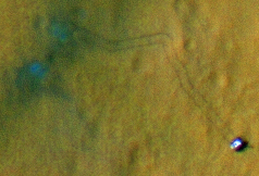
After last week’s plastic encounter, Curiosity’s science team worried the new particles might be man-made. Since they turned up in scoop holes, however, the granules must have been buried in the subsurface. They likely came from larger minerals that broke down. They might also represent the product of some geological soil process that generates a bright but unknown mineral.
These are not the same mysterious objects first seen when the rover began science operations. Those particles were on the surface, and looked like bits of plastic that might have come off the rover or its descent stage.