Ancient rain on Mars?

New data suggests that the many meandering canyons on Mars were partly formed by rain.

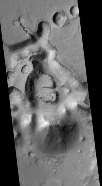
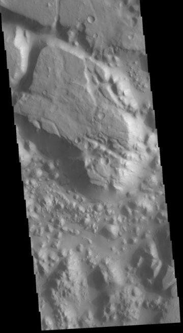
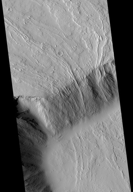
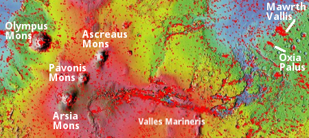
Although Mars is cold and dry today, channels on its surface look as if running water shaped them, leading researchers to think the planet was warm and wet in the past. But scientists have struggled to determine whether that water fell from the sky as rain or seeped upward from the ground.

To discern the water’s source, Hansjoerg Seybold at the Swiss Federal Institute of Technology (ETH) Zurich and his colleagues analysed the geometry of Martian valley channels. The channels branch off at relatively narrow angles, as do waterways in arid landscapes on Earth, such as the US Southwest. More-humid landscapes with a lot of groundwater — the Amazon rainforest, for example — host river channels that branch at wider angles.

The discovery bolsters the idea that the Martian channels were carved by surface runoff rather than by water percolating from below.

The paper itself is behind a paywall, so it is unclear whether they included in their analysis the consequences of Mars’s lighter gravity. Regardless, this result is intriguing, even if it has a lot of uncertainty.

1 comment

Trace Gas Orbiter releases new images

Uzboi Vallis entering Holden Crater

Cool image time! Europe’s Trace Gas Orbiter, now in its science orbit around Mars, has released some new pictures (the top five images at the link). The image above shows the very long and meandering canyon Uzboi Vallis as it cuts through the rim of Holden Crater, on the right. If you click on the image you can see a higher resolution version.

With this release the European Space Agency does a very poor job of providing relevant information. It does not provide the latitude/longitude of this image, its scale, or a context image. Thus, I can only guess at its precise location.

Regardless, this area, where Uzboi Vallis enters Holden Crater, is one of the candidate landing sites for the American 2020 Mars rover. Uzboi Vallis is thought to have been formed by flowing water as it cut through a number of craters in the southern high plains.

0 comments

The mysterious chaos terrain of Mars

In one of my weekly posts last month (dated May 14th) delving into the May image release from Mars Reconnaissance Orbiter’s (MRO) high resolution camera, I featured an image of what planetary geologists have labeled chaos terrain, a hummocky chaotic terrain that has no real parallel on Earth but is found in many places on Mars.

This month’s image MRO release included two more fascinating images of this type of terrain. In addition, the Mars Odyssey team today also released its own image of chaos terrain, showing a small part of a region dubbed Margaritifer Chaos. Below, the Mars Odyssey image is on the right, with one of the MRO images to the left. Both have been cropped, with the MRO image also reduced in resolution. The full MRO image shows what the MRO science team labels “possibly early stage chaos” on the rim of a canyon dubbed Shalbatana Vallis.

young chaos in Shalbatana Vallis

Margaritifer Chaos

» Read more

5 comments

Martian dust storm goes global

Data from orbit and from Curiosity at Gale Crater confirms that the dust storm that has shut down Opportunity is now a global storm, encircling Mars.

The Martian dust storm has grown in size and is now officially a “planet-encircling” (or “global”) dust event.

Though Curiosity is on the other side of Mars from Opportunity, dust has steadily increased over it, more than doubling over the weekend. The sunlight-blocking haze, called “tau,” is now above 8.0 at Gale Crater — the highest tau the mission has ever recorded. Tau was last measured near 11 over Opportunity, thick enough that accurate measurements are no longer possible for Mars’ oldest active rover.

This will be first global storm to occur on Mars since Curiosity landed in 2012, thus giving scientists the best opportunity to study such an event.

Meanwhile, Opportunity remains silent. This does not mean it is dead, but that it doesn’t have enough sunlight to charge its batteries. It might die during this storm if the storm lasts long enough, but we won’t know one way or the other until the storm finally eases.

8 comments

The epic lava flows of Olympus Mons

Lava flows off of Olympus Mons

The eruption of Kilauea volcano in Hawaii has garnered a lot of deserved press coverage, having added at least a 200 acres of new land and destroyed at least 700 homes. Similarly, the recent violent eruption of a volcano in Guatemala, killing 100 people in its wake, has also gotten much deserved news coverage.

The magnitude of both however would pale in comparison to the stupendous eruption that occurred several hundred million years ago at the solar system’s largest volcano, Olympus Mons on Mars. While Kilauea is about 100 miles across, Olympus Mons is about 370 miles wide, and is so large that because of the curvature of Mar’s surface it is literally impossible for a viewer on the ground to actually see the volcano, in its entirety.

Both volcanoes are shield volcanoes, however, which means the lava flows don’t necessarily come from the caldera, but often from vents on the volcano’s slopes. Eruptions might be violent, but they generally do not involve the powerful explosive force of the sudden eruption, as seen in Guatemala and at Mount St. Helens in 1980 in the U.S. Instead, the lava seeps out steadily and continuously, an unstoppable flow that steadily overwhelms the surrounding terrain.

Olympus Mons

The flows that created Olympus Mons however were an epic event probably lasting millions of years, which brings us to this post. In the June release of Mars Reconnaissance Orbiter high resolution images, I found the image above, cropped and reduced in resolution to post here. It shows lava flowing down off one of the many escarpments on the slopes of Olympus Mons. This is not at the edge of the volcano’s shield, but just inside it. The map at the right, created using the archive of MRO’s high resolution camera, indicates the location of this flow, shown by the left light blue rectangle on the southeast slope of the volcano’s shield. The red rectangles show all the other images MRO has taken of Olympus Mons.

The scale of the MRO image above gives an indication of how big that eruption at Olympus Mons was.
» Read more

2 comments

Curiosity on the march

It appears that, after a descent down off of Vera Rubin Ridge and then spending 30 sols sitting at one spot to do its first drilling in more than a year, Curiosity is about to resume travel up Mount Sharp.

With its newly resurrected drilling capabilities, Curiosity will do one last pass over the Vera Rubin Ridge units, now that the rest of the instrument suite onboard can have access to this and future drill samples.

It appears they will be returning to their planned route, across the ridge and down off it to head up towards one known recurring black streak that might be a seep of underground water.

They have not provided any details about the lab results from the drill sample, but that isn’t surprising. It will take some time to analyze it, and the scientists involved will want the glory of publishing their results once that analysis is complete. What is clear from the update is that the drilling worked, and that this particular drillhole is likely to produce some of the more significant findings from Curiosity.

0 comments

Contact with Opportunity lost

The Opportunity science team has lost contact with Opportunity as it automatically shuts down operations to survive low battery power due to the dust storm.

This does not necessarily mean the rover is dead. Depending on how long this period of low power lasts, the rover could return to life once the dust storm passes. Or not. We can only wait and see.

A press conference today on the dust storm and Opportunity’s status begins at 1:30 Eastern time today.

8 comments

The two candidate landing sites for ExoMars2020

The June release of new images from Mars Reconnaissance Orbiter (MRO) included three images of the two candidate landing sites for Europe’s 2020 ExoMars rover mission. All three images provide us as hint at what that rover might see when it arrives a few years from now.

ExoMars 2020 landing sites

The two candidate sites are locations on Mars dubbed Mawrth Vallis and Oxia Palas. The map to the right shows their general location to the east of Mars’s giant volcanoes and giant canyon Valles Marineris. The red splotches indicate the large number of images taken by MRO of these locations, partly to help the ExoMars science team choose which site to pick and partly to study the geology in these Martian locations. As you can see, both candidate sites are in the transition zone between the northern low plains and the southern highlands.

At first glance Mawrth Vallis seems the more spectacular site. Mawrth (Welsh for Mars) is one of the gigantic drainage canyons near Valles Marineris. Though tiny in comparison to Valles Marineris, on Earth it would easily rival the Grand Canyon in size, and in fact is slightly longer (400 miles versus 300 miles). Unlike the Grand Canyon, however, Mawrth Vallis doesn’t appear to have a distinct or obvious rim. This video, produced by the European Space Agency using images from its Mars Express orbiter, gives a sense of the canyon’s terrain as it flies upstream from the northern lowlands to the canyon’s high point in the southern highlands. The highlands on either side of the canyon more resemble the broken geology of Mars’s chaos regions that are found scattered about in this transition zone than the flat generally level Kaibab plateau that surrounds the Grand Canyon.

Mawrth Vallis

The image on the right is a tiny crop from the most recently released MRO image. The full image shows a strip of the upper plateau south of canyon and near its inlet from the southern highlands. This crop reveals a surface that is a wild mixture of colors and complex geology. In fact, in a 2017 MRO image release showing a different place in Mawrth Vallis, the canyon was dubbed a “painted desert.” To quote that release:

The clay-rich terrain surrounding Mawrth Vallis is one of the most scenic regions of Mars, a future interplanetary park. …The origin of these altered layers is the subject of continued debates, perhaps to be resolved by a future rover on the surface. We do know that these layers are very ancient, dating back to a time when the environment of Mars was wetter and more habitable, if there were any inhabitants.

Other MRO images of Mawrth Vallis here and here emphasize this description.

As for Oxia Palas, the other candidate landing site for ExoMars 2020, in the June MRO image release there were two images.
» Read more

0 comments

Growing Martian dust storm forces Opportunity to suspend operations

A growing Martian dust storm has forced the Opportunity science team to suspend science operations and to reconfigure the rover’s operations to increase its chances of surviving the storm.

In a matter of days, the storm had ballooned. It now spans more than 7 million square miles (18 million square kilometers) — an area greater than North America — and includes Opportunity’s current location at Perseverance Valley. More importantly, the swirling dust has raised the atmospheric opacity, or “tau,” in the valley in the past few days. This is comparable to an extremely smoggy day that blots out sunlight. The rover uses solar panels to provide power and to recharge its batteries.

Opportunity’s power levels had dropped significantly by Wednesday, June 6, requiring the rover to shift to minimal operations.

This isn’t Opportunity’s first time hunkering down in bad weather: in 2007, a much larger storm covered the planet. That led to two weeks of minimal operations, including several days with no contact from the rover to save power. The project’s management prepared for the possibility that Opportunity couldn’t balance low levels of power with its energy-intensive survival heaters, which protect its batteries from Mars’ extreme cold. It’s not unlike running a car in the winter so that the cold doesn’t sap its battery charge.There is a risk to the rover if the storm persists for too long and Opportunity gets too cold while waiting for the skies to clear.

In other words, there is a possibility that the rover might not make it through this period of low sunlight. Nonetheless, the rover did send four images down yesterday, though the four images are essentially dust filled, and are likely aimed at the far distance to help gauge the extent of the storm.

2 comments

Curiosity finds methane fluctuates seasonally in Gale Crater

Seasonal methane on Mars

In its second significant science release yesterday (the first relating to the discovery of organics), the Curiosity science team revealed that they have found over almost three Martian years the amount of methane in the atmosphere appears to fluctuate seasonally. The graph on the right illustrates this change.

[The data] show methane rises from just above 0.2ppb in the northern hemisphere winter to a fraction over 0.6ppb in the summer. The team’s best explanation is that methane is seeping up from underground, perhaps from stored ices, and is then being released when surface soils are warmed.

The team cannot positively identify the origin of the methane, but the researchers think they can close down one particular mechanism for its production. This involves sunlight breaking up carbon-rich (organic) molecules that have fallen to the planet’s surface in meteorites.

The variation in ultraviolet light over the course of the seasons is not big enough to drive the scale of the change seen in the methane concentration, says Dr Webster. “We know the intensity of the Sun and this mechanism should produce only a 20% increase in methane during the summer, but we’re seeing it increase by a factor of three,” he explained.

The change could be caused by either a chemical or a biological process. At this time there is no way to determine which.

18 comments

Curiosity finds evidence of complex carbon molecules

In a study released today, the Curiosity science team announced that earlier drill samples revealed evidence of complex organic carbon molecules, the possible remains of past life.

To unlock organic molecules from the samples, the oven baked them to temperatures of between 600°C and 860°C—the range where a known contaminant disappeared—and fed the resulting fumes to a mass spectrometer, which can identify molecules by weight. The team picked up a welter of closely related organic signals reflecting dozens or hundreds of types of small carbon molecules, probably short rings and strands called aromatics and aliphatics, respectively. Only a few of the organic molecules, sulfur-bearing carbon rings called thiophenes, were abundant enough to be detected directly, Eigenbrode says.

The mass patterns looked like those generated on Earth by kerogen, a goopy fossil fuel building block that is found in rocks such as oil shale—a result the team tested by baking and breaking organic molecules in identical instruments on Earth, at Goddard. Kerogen is sometimes found with sulfur, which helps preserve it across billions of years; the Curiosity scientists think the sulfur compounds in their samples also explain the longevity of the Mars compounds.

Earth’s kerogen was formed when geologic forces compressed the ancient remains of algae and similar critters. It’s impossible to say whether ancient life explains the martian organics, however. Carbon-rich meteorites contain kerogenlike compounds, and constantly rain down on Mars. Or reactions driven by Mars’s ancient volcanoes could have formed the compounds from primordial carbon dioxide. Monica Grady, a planetary scientist at The Open University in Milton Keynes, U.K., believes the compounds somehow formed on Mars because she thinks it’s highly unlikely that the rover dug into a site where an ancient meteorite fell. She also notes that the signal was found at the base of an ancient lake, a potential catchment for life’s remains. “I suspect it’s geological. I hope it’s biological,” she says.

It must be emphasized once again that they have not found evidence of past life. What they have found are the types of molecules that are often left behind by life, but can also form without the presence of life.

This result, from past drillholes in the Murray Formation, explains however why Curiosity headed back downhill to do its most recent drill test.

Curiosity has one last tool to help the team find out: nine small cups containing a solvent that frees organic compounds bonded in rock, eliminating the need to break them apart—and potentially destroy them—at high temperatures. In December 2016, rover scientists were finally prepared to use one of the cups, but just then the mechanism to extend the rover’s drill stopped working reliably. The rover began exploring an iron-rich ridge, leaving the mudstone behind. In April, after engineers found a way to fix the drill problem, the team made the rare call to go backward, driving back down the ridge to the mudstone to drill its first sample in a year and half. If the oven and mass spectrometer reveal signs of organics in the sample, the team is likely to use a cup. “It’s getting so close I can taste it,” says Ashwin Vasavada, Curiosity’s project scientist at the Jet Propulsion Laboratory in Pasadena, California.

The newest drillhole sample has now entered the mass spectrometer. Stay tuned!

4 comments
1 152 153 154 155 156 212