
Further damage to Curiosity’s wheels
For the original images, click here for the top photo and here and here
for the bottom photo.
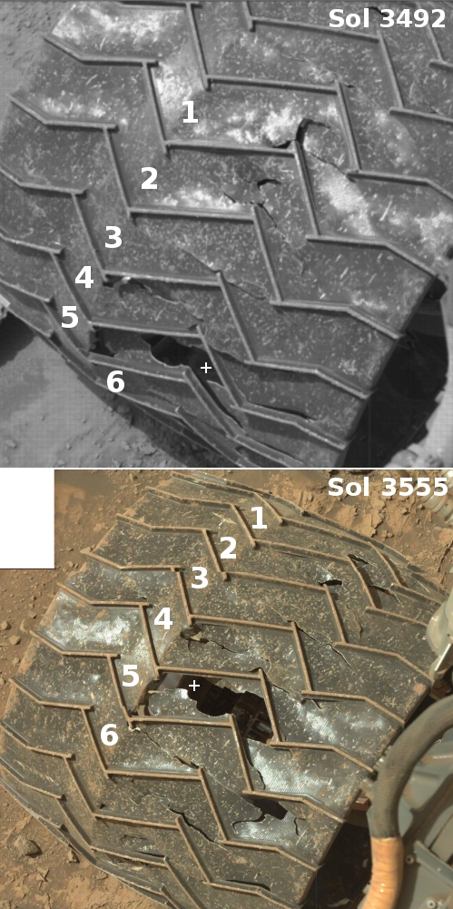
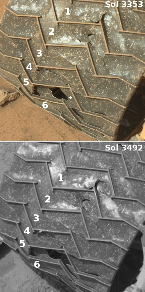
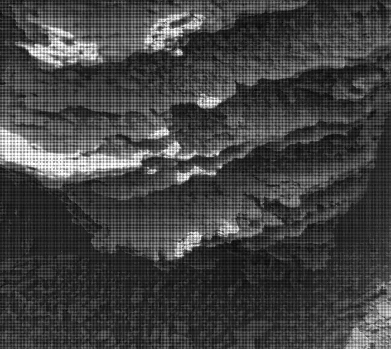
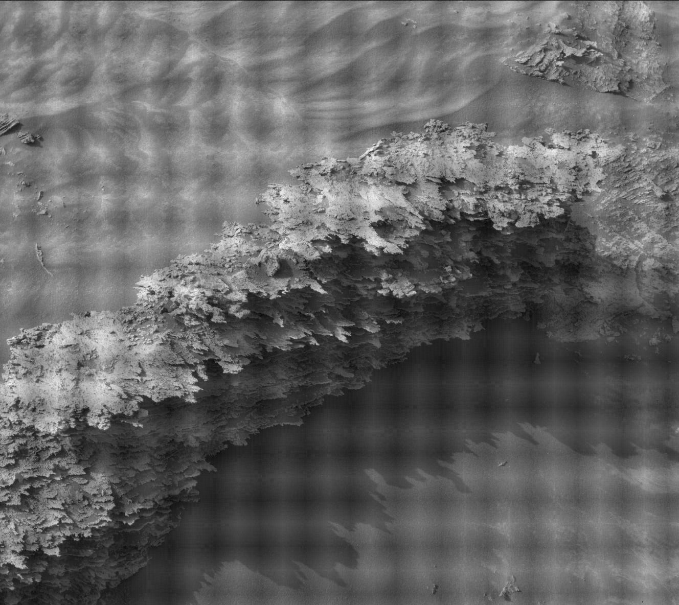
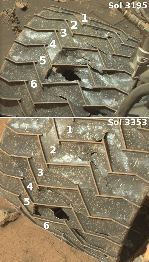
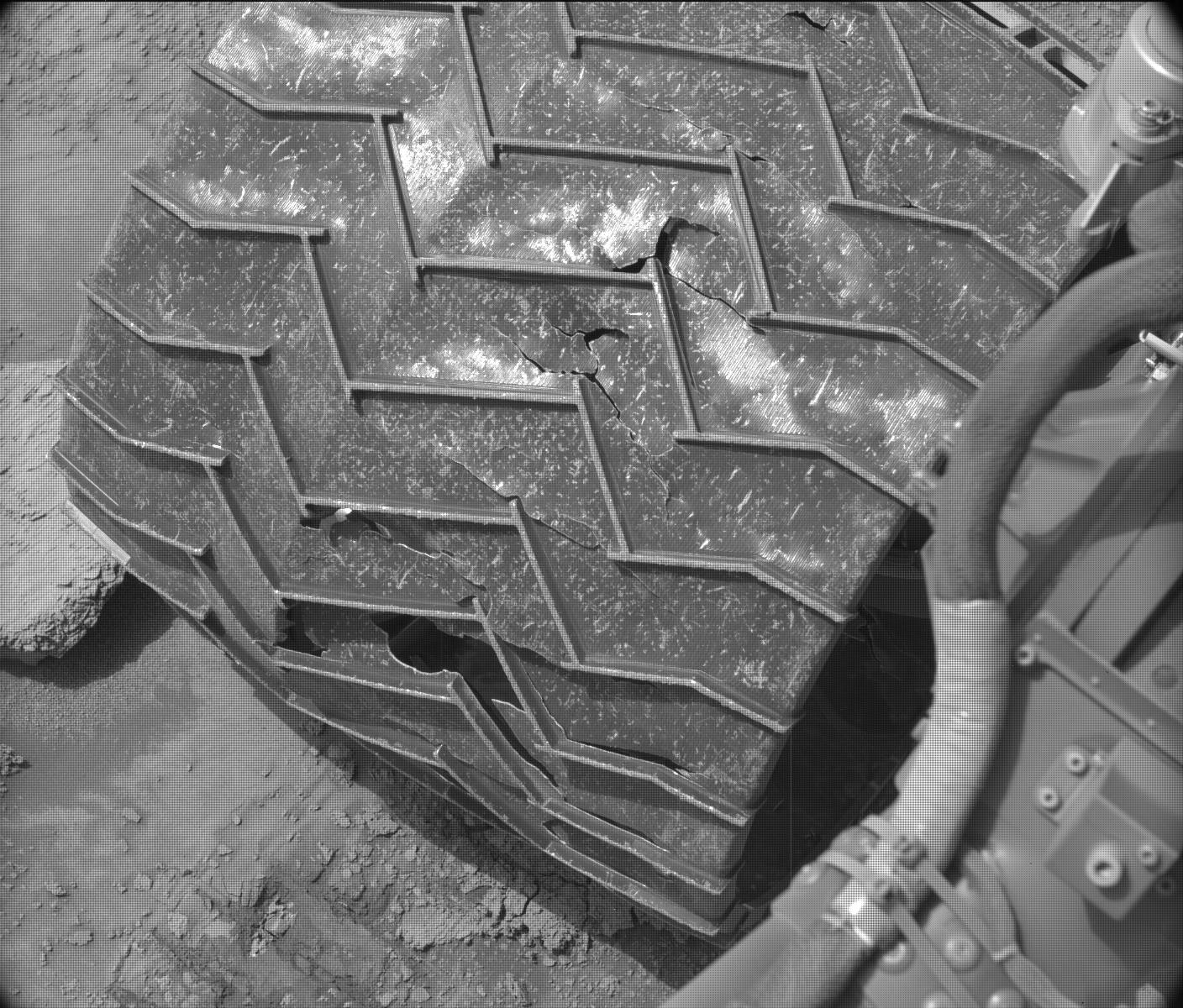
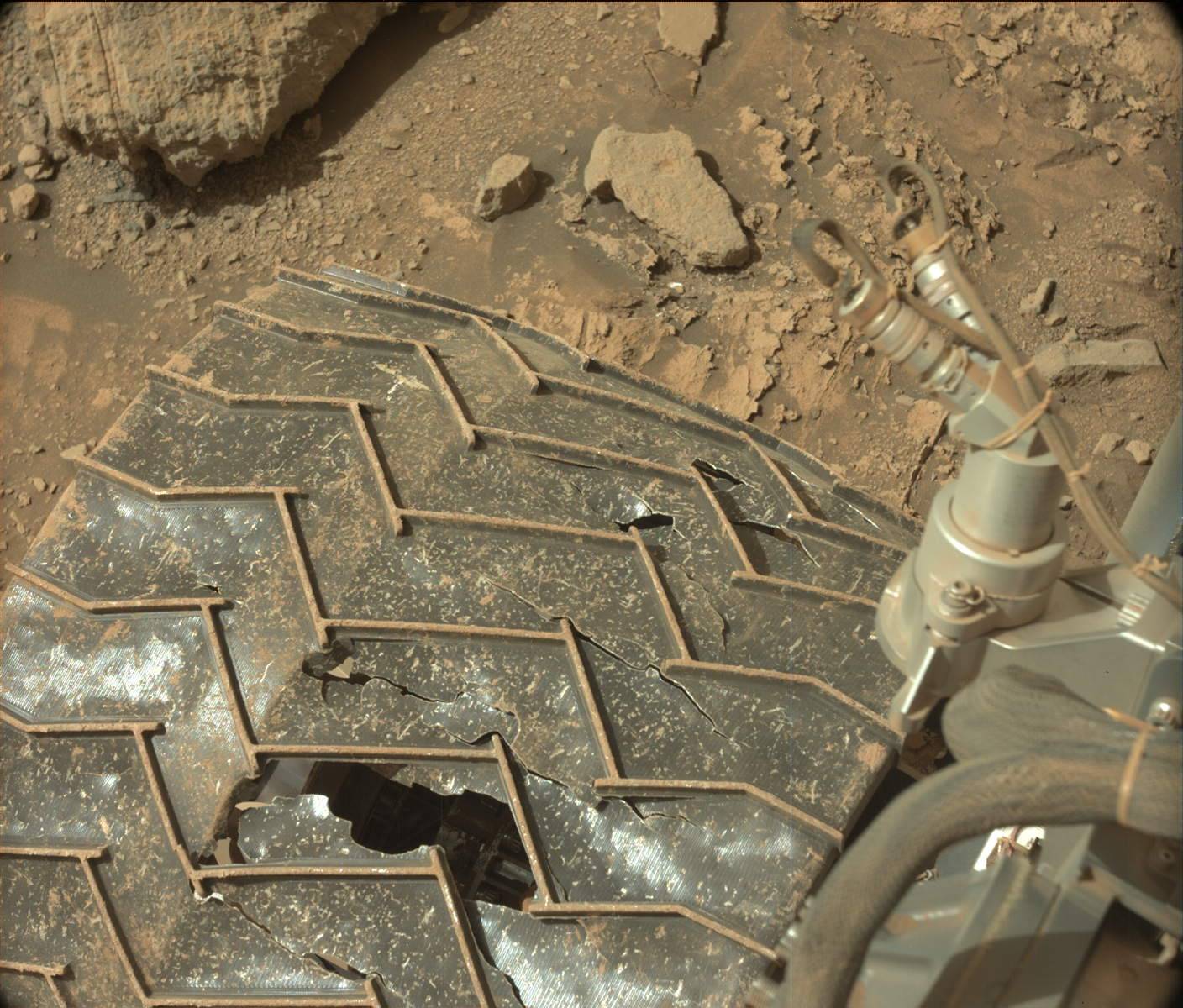
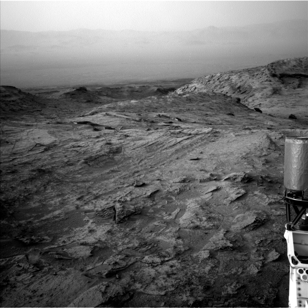
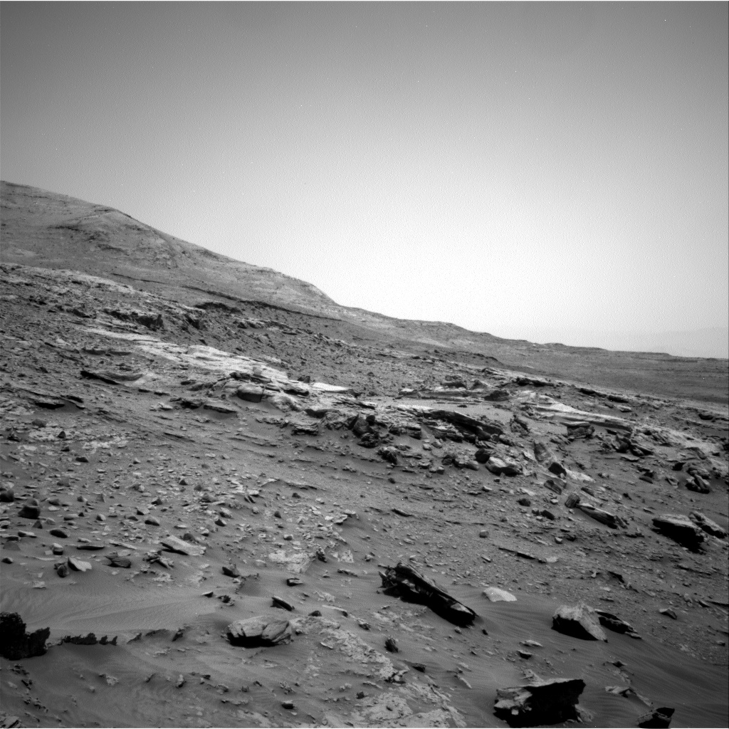
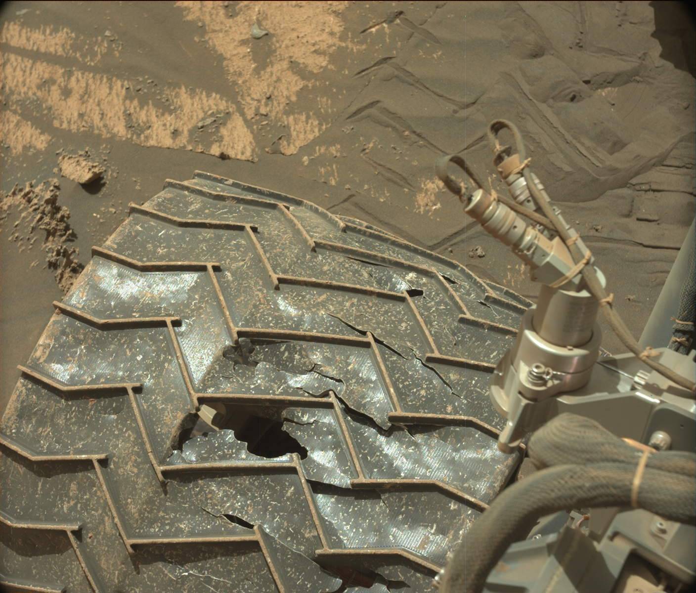
The photo comparison to the right, created from high resolution images taken by Curiosity on Mars two months apart, provides us a new update on the state of the rover’s damaged wheels. It shows damage on the same wheel that I have been tracking for several years.
The numbers indicate the same treads, or grousers as termed by the science team. The “+” sign indicates spots where new damage has occurred since the previous photo.
The top photo was taken on June 3, 2022, and was the first to show new damage in more than five years. The bottom photo was taken on August 6, 2022, and shows that another small piece on the same grouser has broken off during the past two months.
Other than this change, however, the rest of the grousers appear unchanged. Moreover, a comparison with an earlier image of this same wheel taken in the summer of 2021 shows that grouser #6 as well as the unnumbered one just below appear also unchanged.
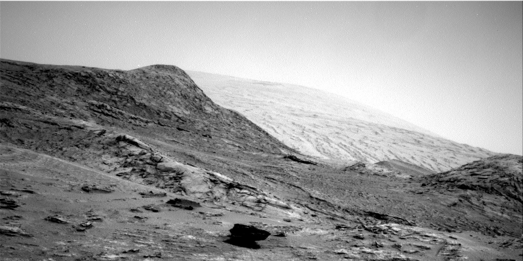
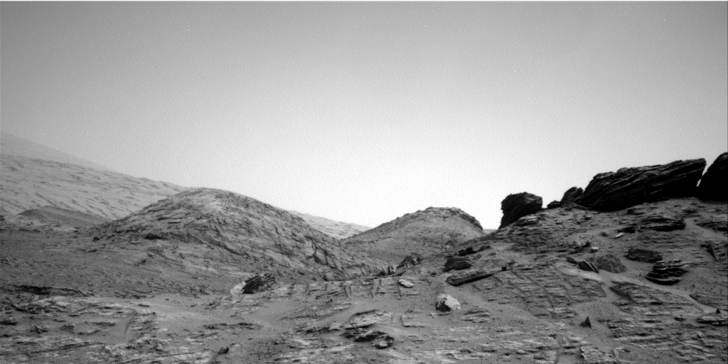
The damage in grouser #5 however is still concerning, and reflects the increasing roughness of the terrain as Curiosity climbs higher and higher on Mount Sharp. Though the science team has been very careful since the rover’s first few years on Mars to travel around obstacles that could damage the wheels, it apparently is becoming harder to do so.
However, even if this wheel eventually loses all the metal between the zig-zag grouser treads, the science team has said it has “proven through ground testing that we can safely drive on the wheel rims if necessary.” The team as also said they do not think that is likely, at least not for a long time, and based on the rate of damage documented by these pictures, this appears very true.
For the original images, click here for the top photo and here and here
for the bottom photo.
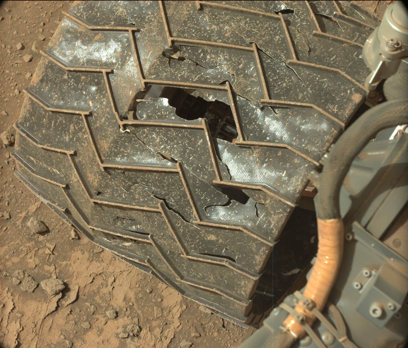
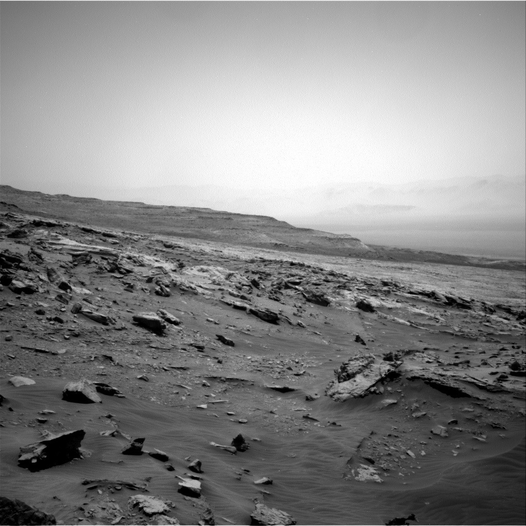
The photo comparison to the right, created from high resolution images taken by Curiosity on Mars two months apart, provides us a new update on the state of the rover’s damaged wheels. It shows damage on the same wheel that I have been tracking for several years.
The numbers indicate the same treads, or grousers as termed by the science team. The “+” sign indicates spots where new damage has occurred since the previous photo.
The top photo was taken on June 3, 2022, and was the first to show new damage in more than five years. The bottom photo was taken on August 6, 2022, and shows that another small piece on the same grouser has broken off during the past two months.
Other than this change, however, the rest of the grousers appear unchanged. Moreover, a comparison with an earlier image of this same wheel taken in the summer of 2021 shows that grouser #6 as well as the unnumbered one just below appear also unchanged.
The damage in grouser #5 however is still concerning, and reflects the increasing roughness of the terrain as Curiosity climbs higher and higher on Mount Sharp. Though the science team has been very careful since the rover’s first few years on Mars to travel around obstacles that could damage the wheels, it apparently is becoming harder to do so.
However, even if this wheel eventually loses all the metal between the zig-zag grouser treads, the science team has said it has “proven through ground testing that we can safely drive on the wheel rims if necessary.” The team as also said they do not think that is likely, at least not for a long time, and based on the rate of damage documented by these pictures, this appears very true.


