
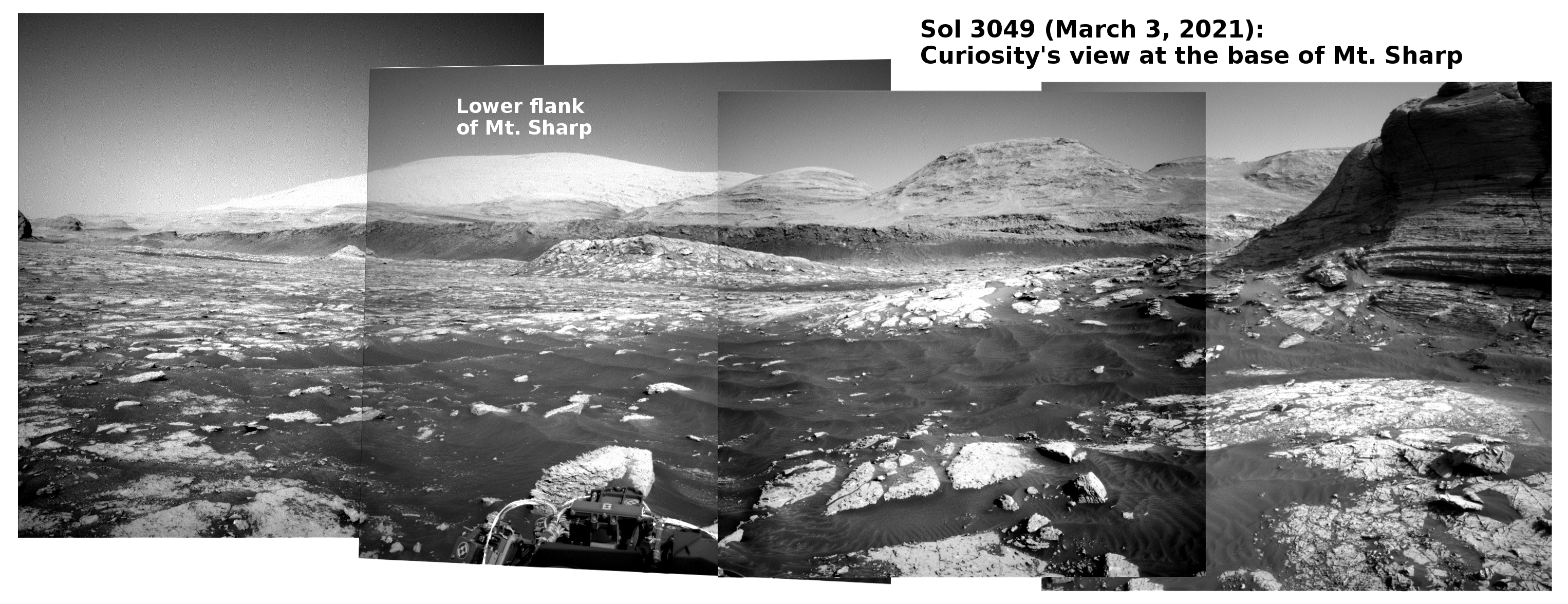
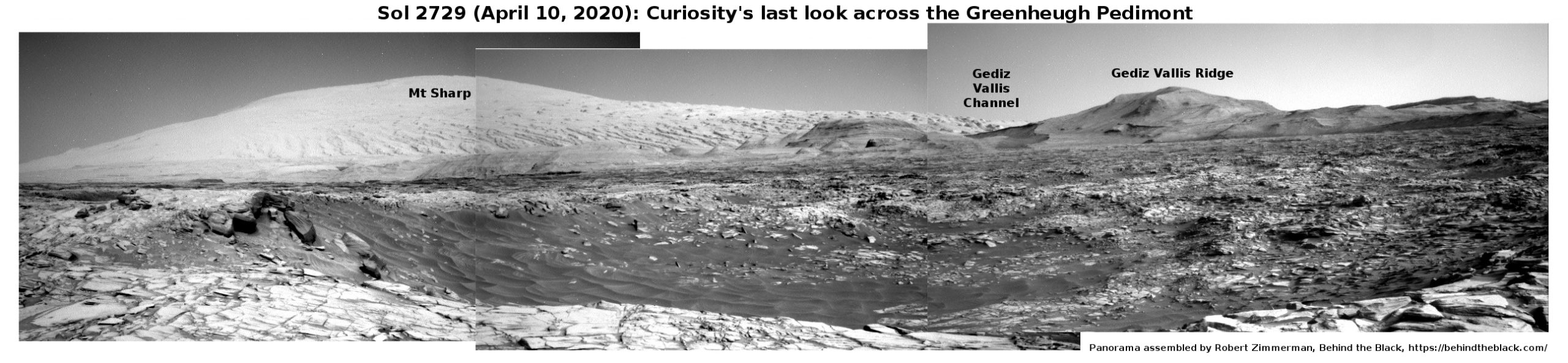
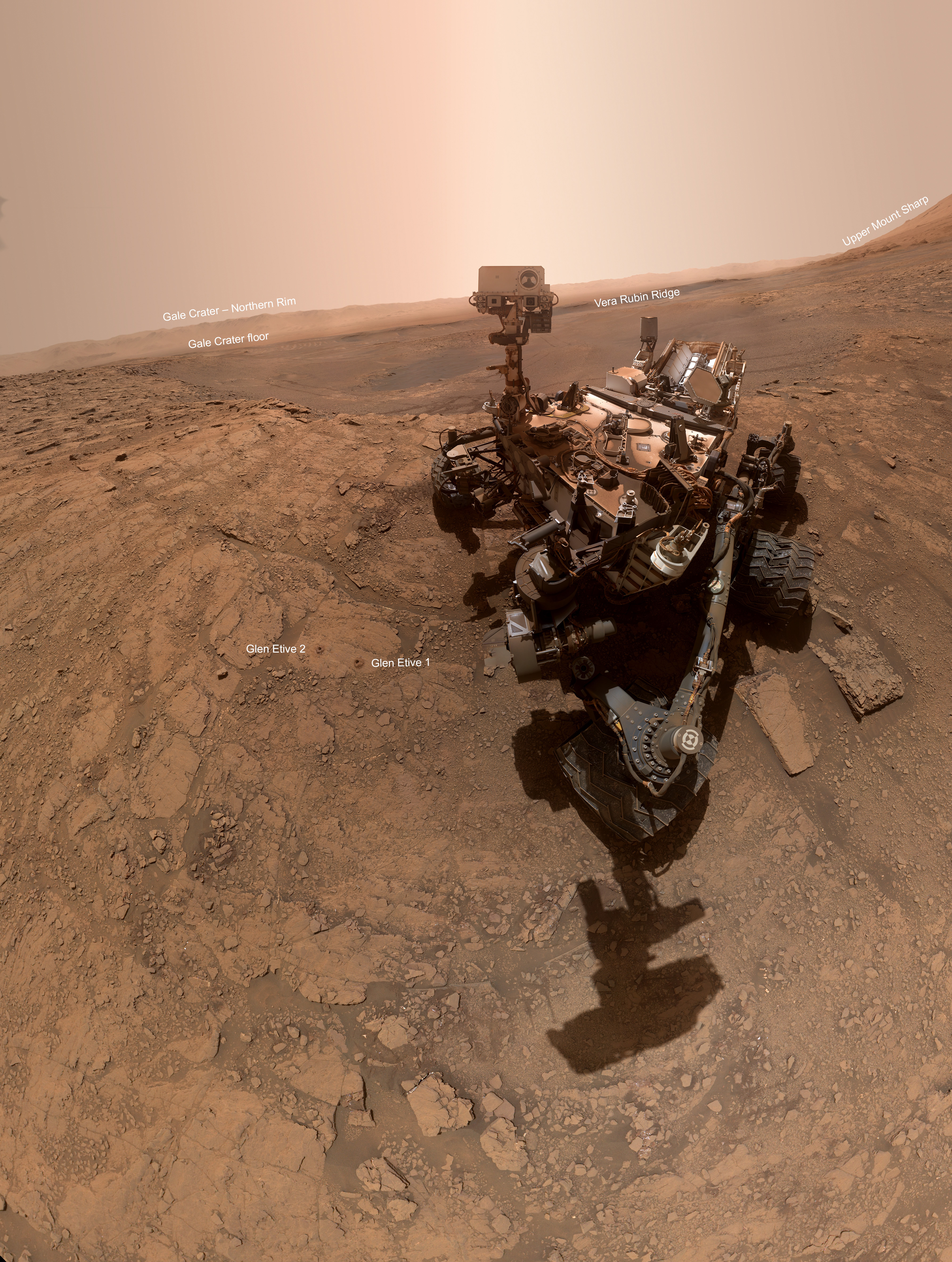
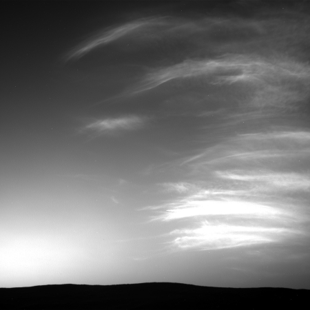
Curiosity moves into a mountain gap
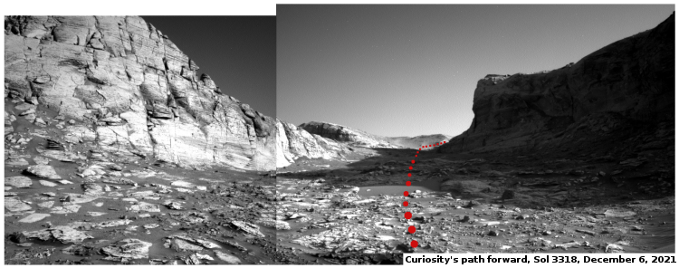
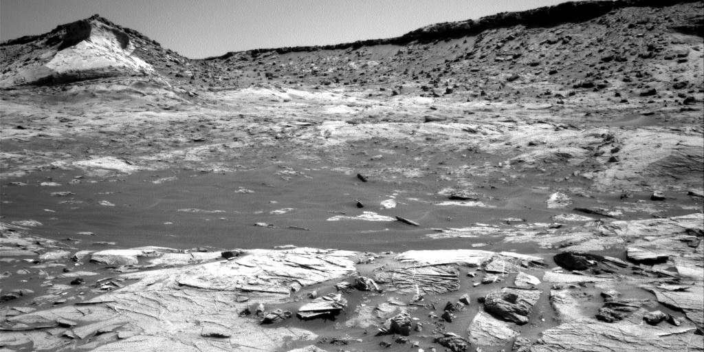
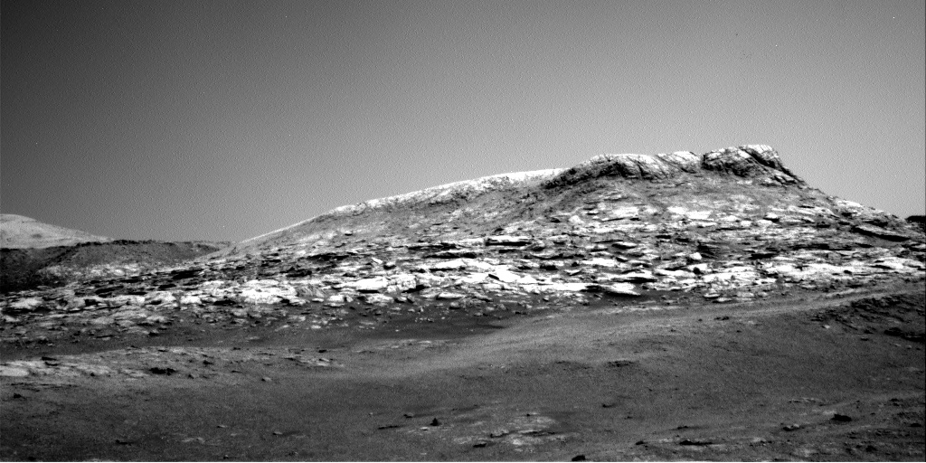
Click for full resolution version. Original images here and here.

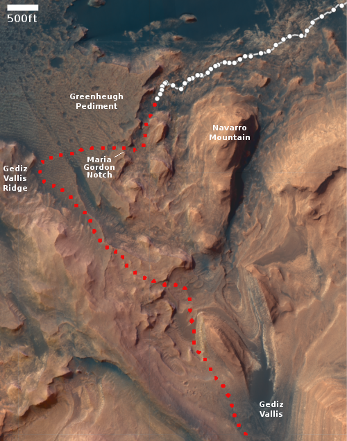
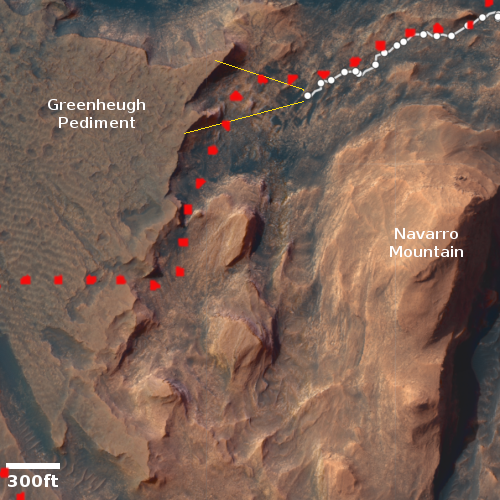
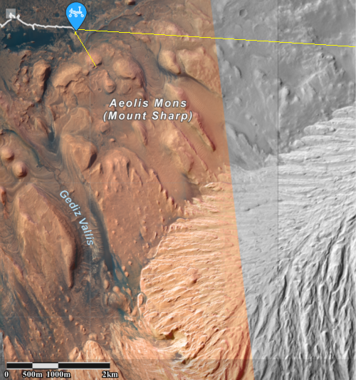
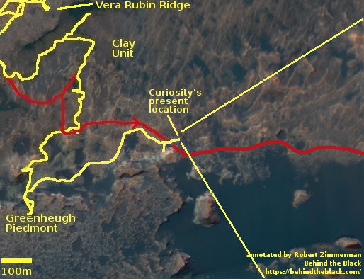
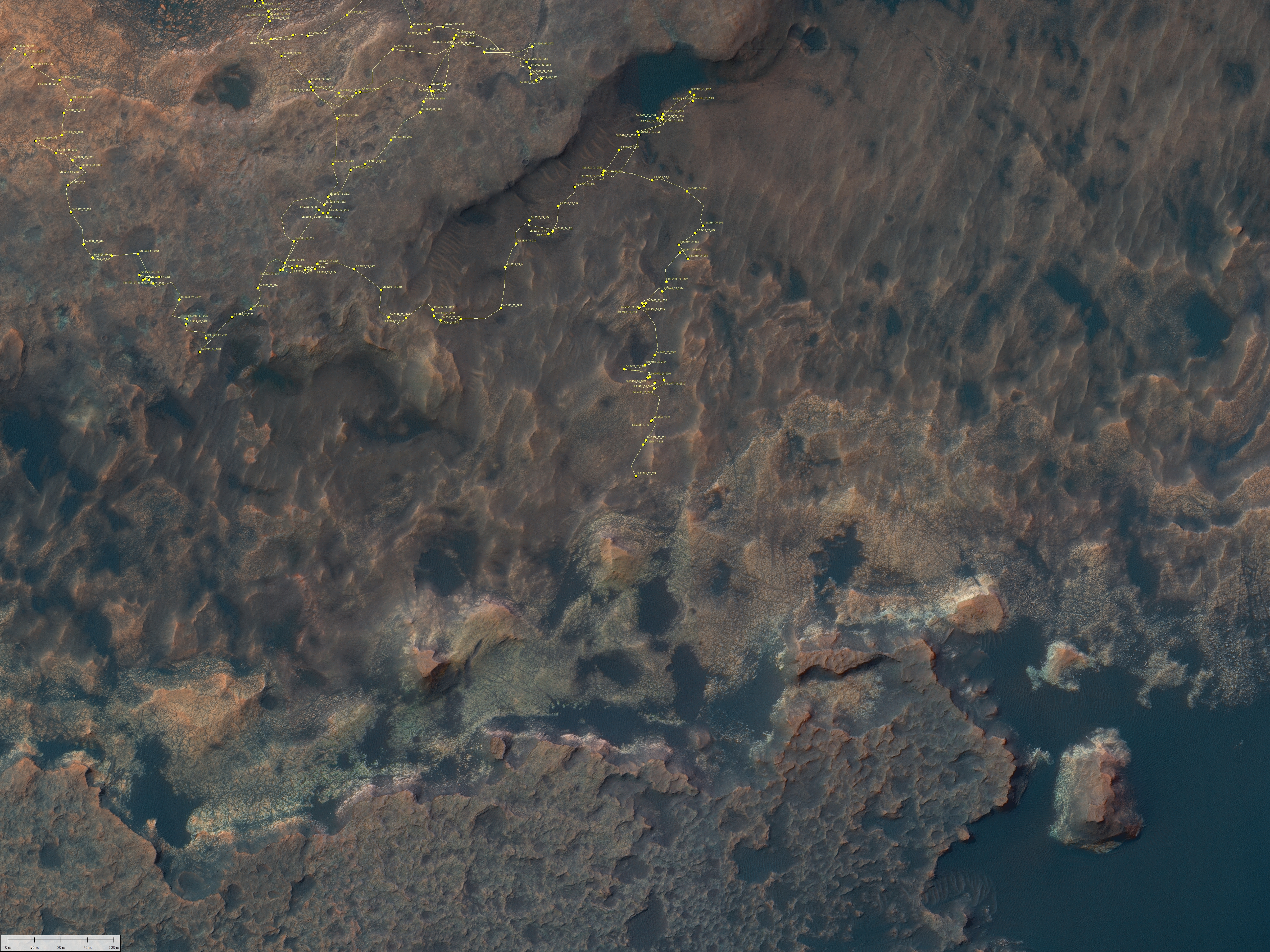
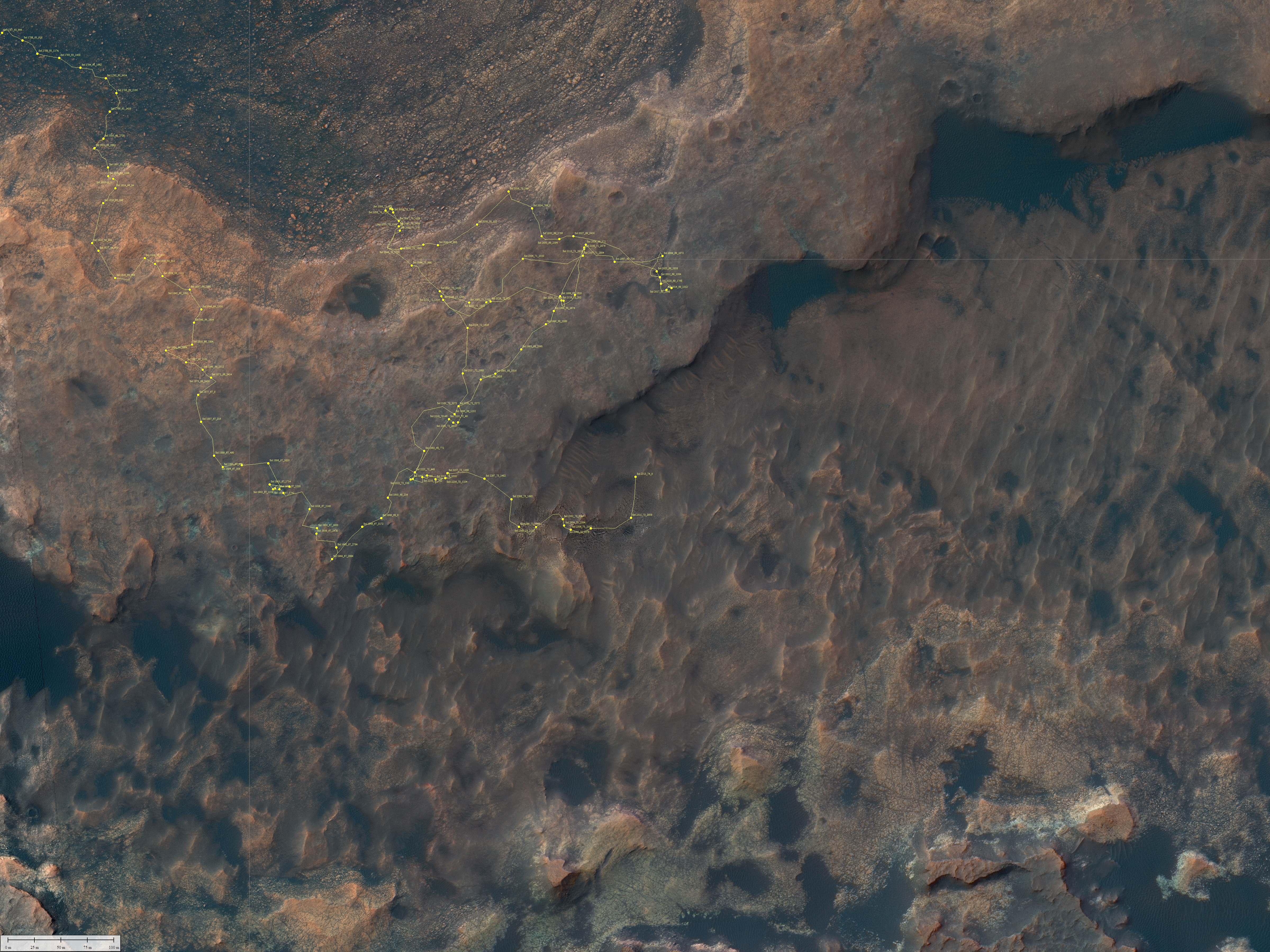
Click for interactive map.
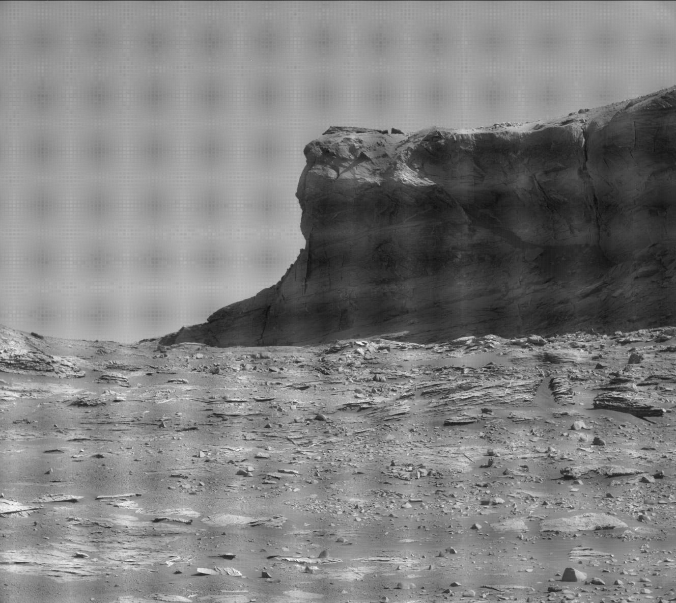
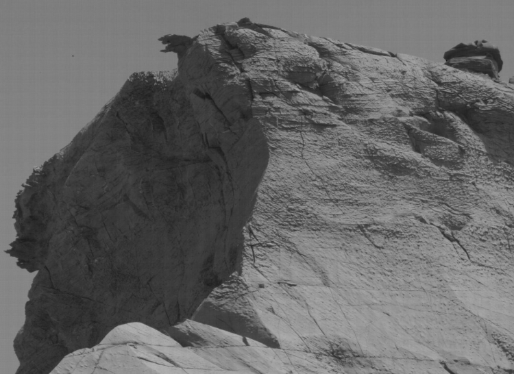
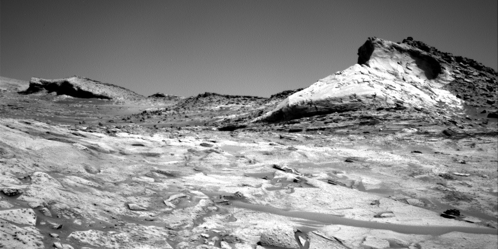
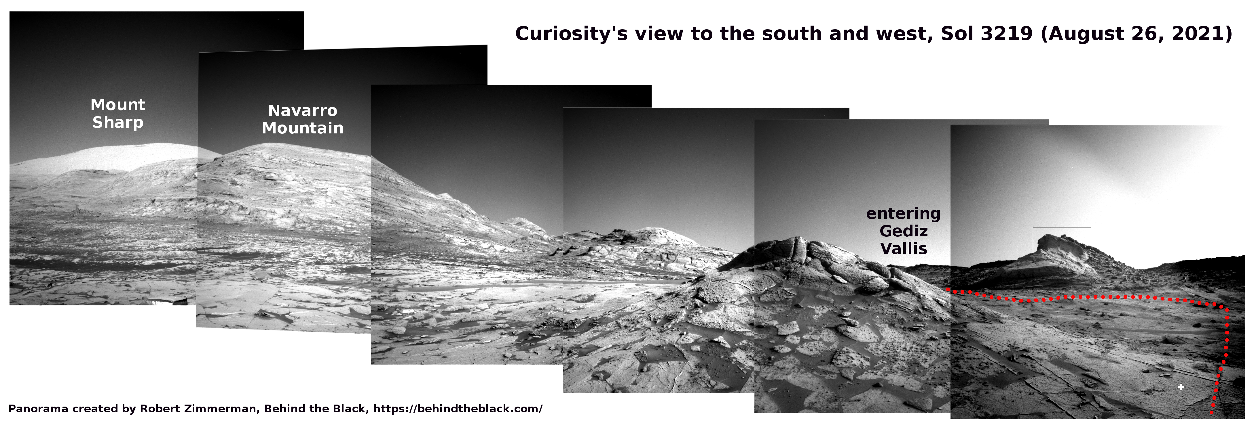
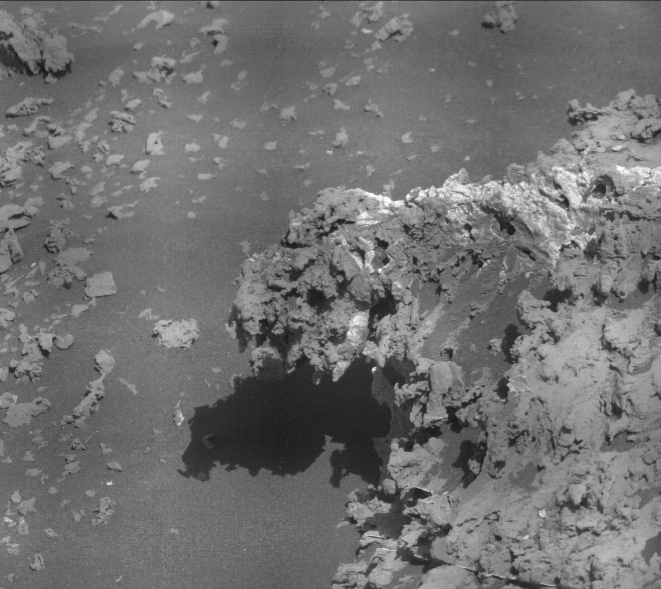
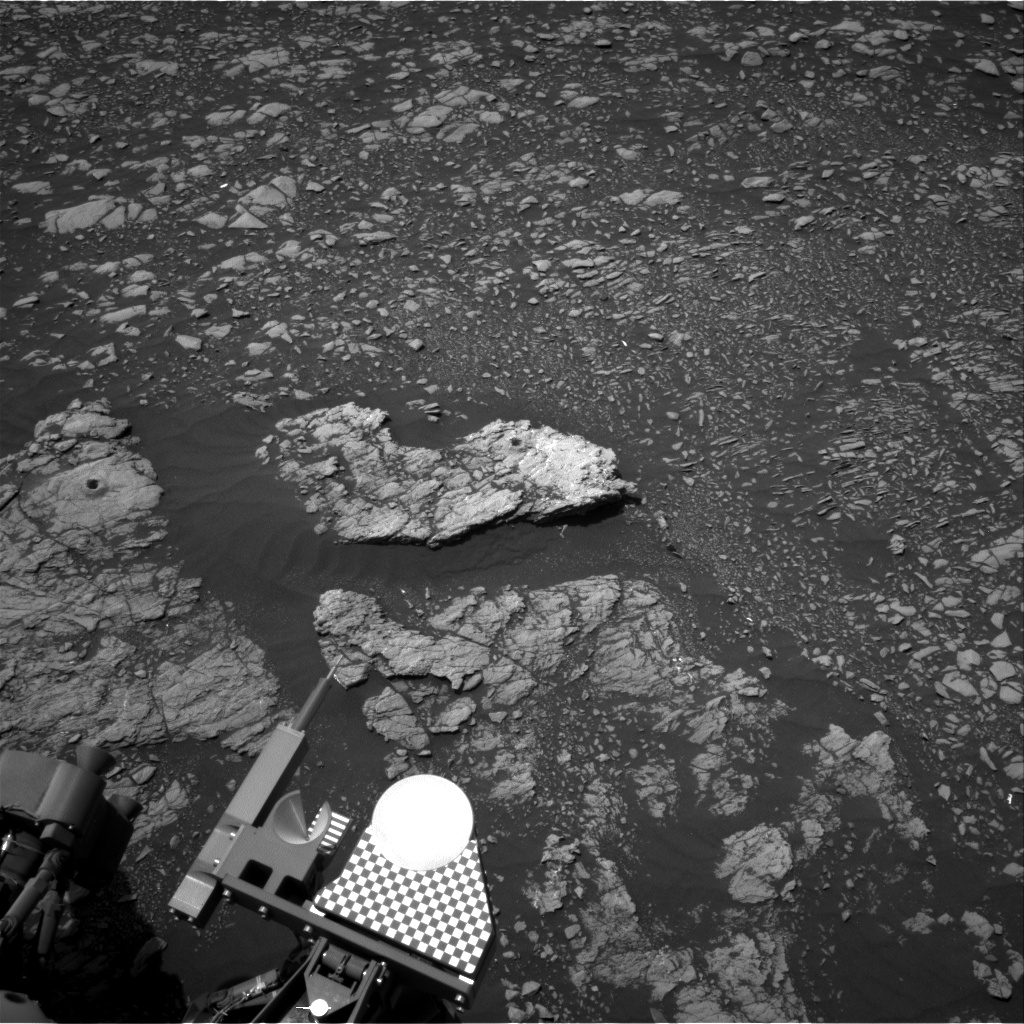
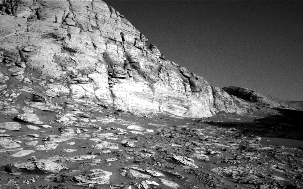
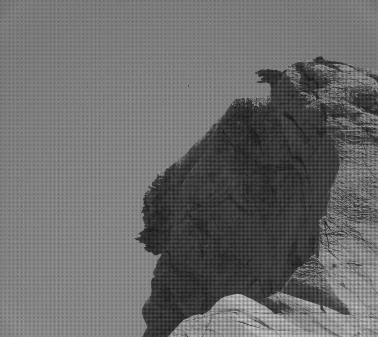
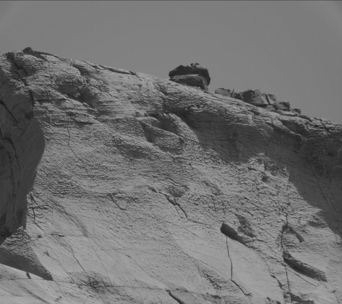
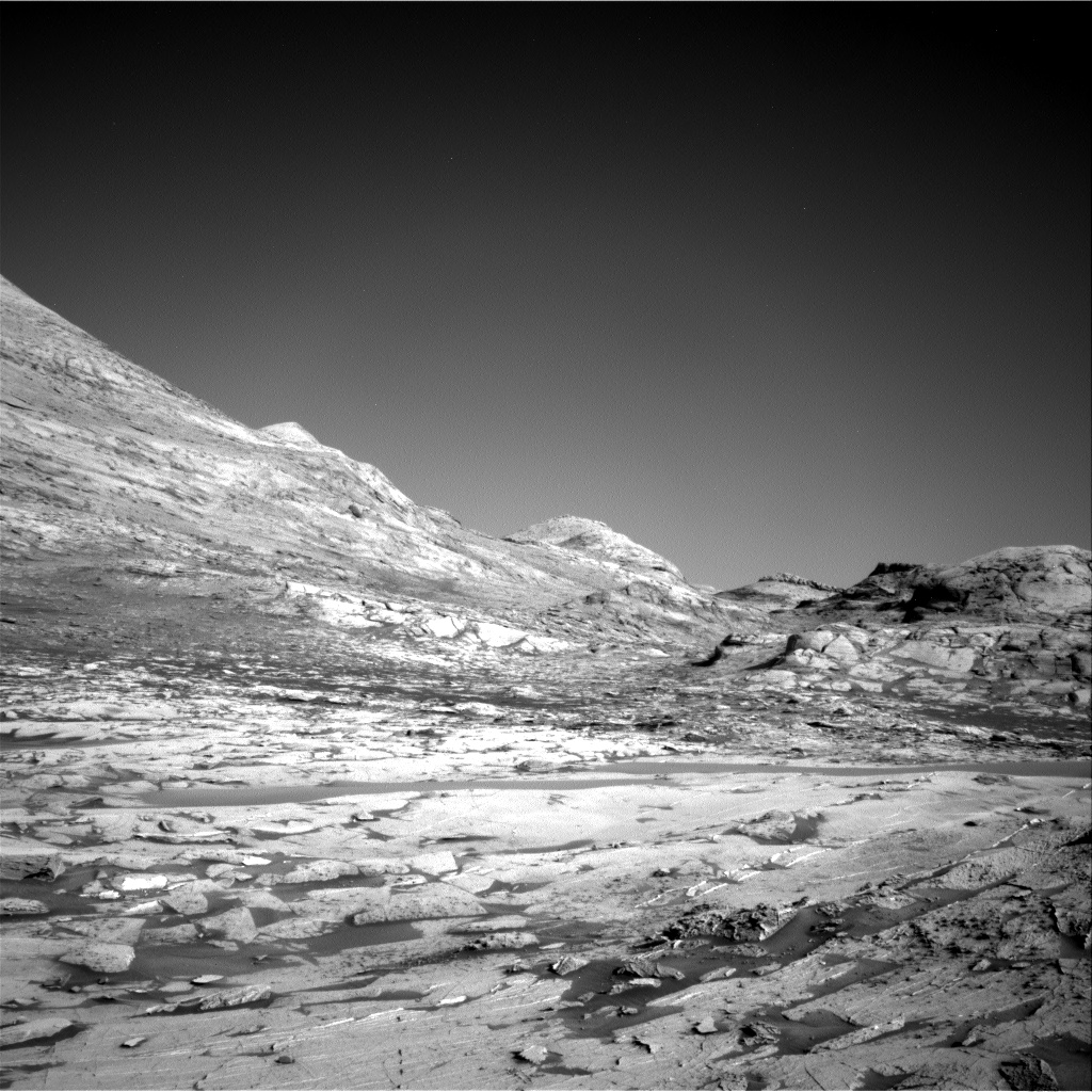
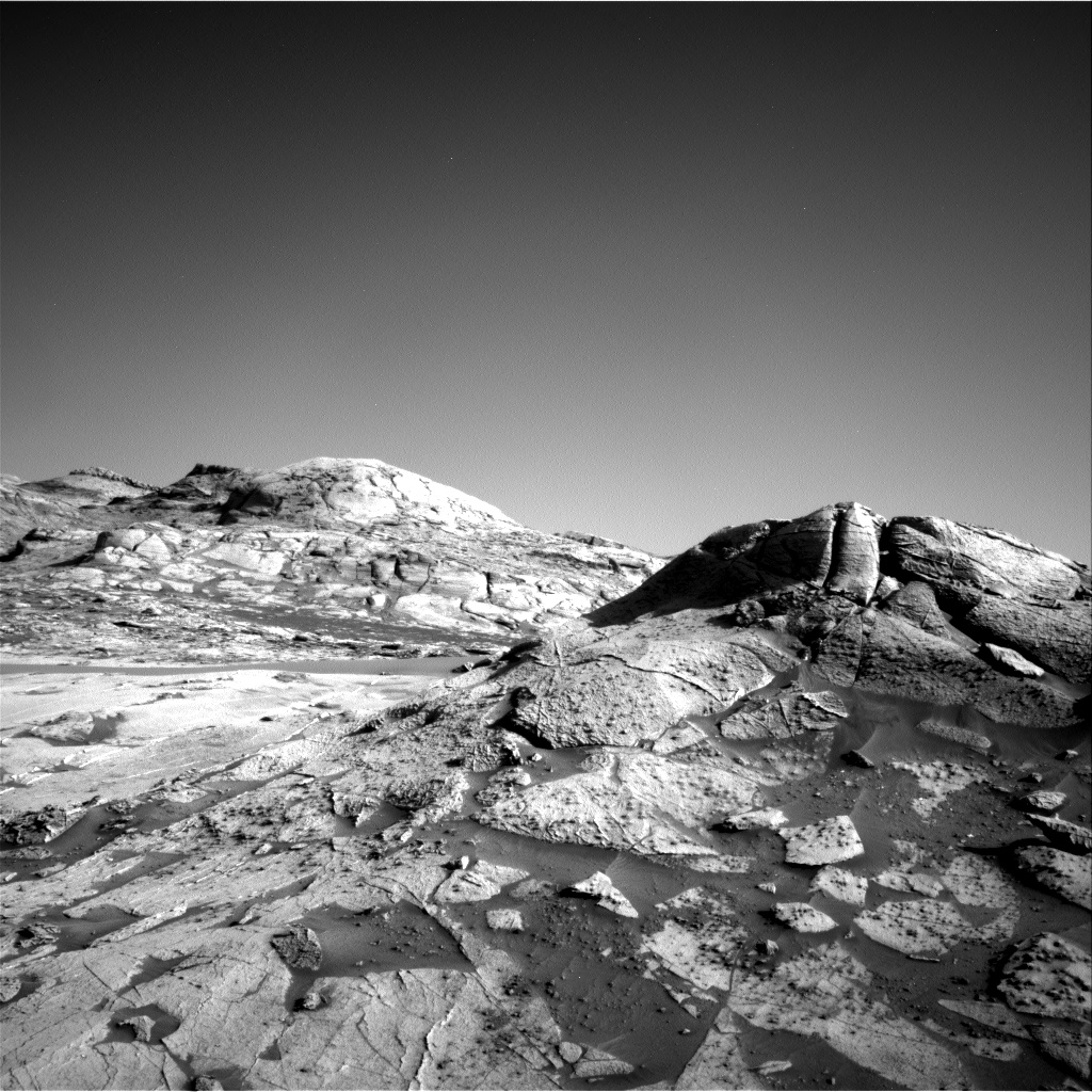
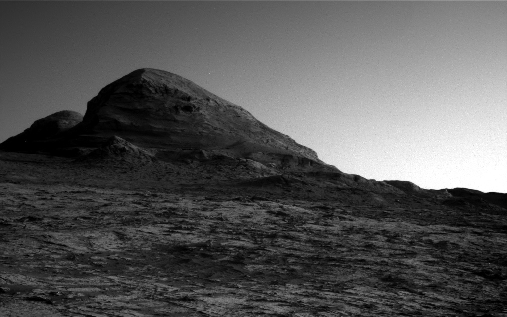
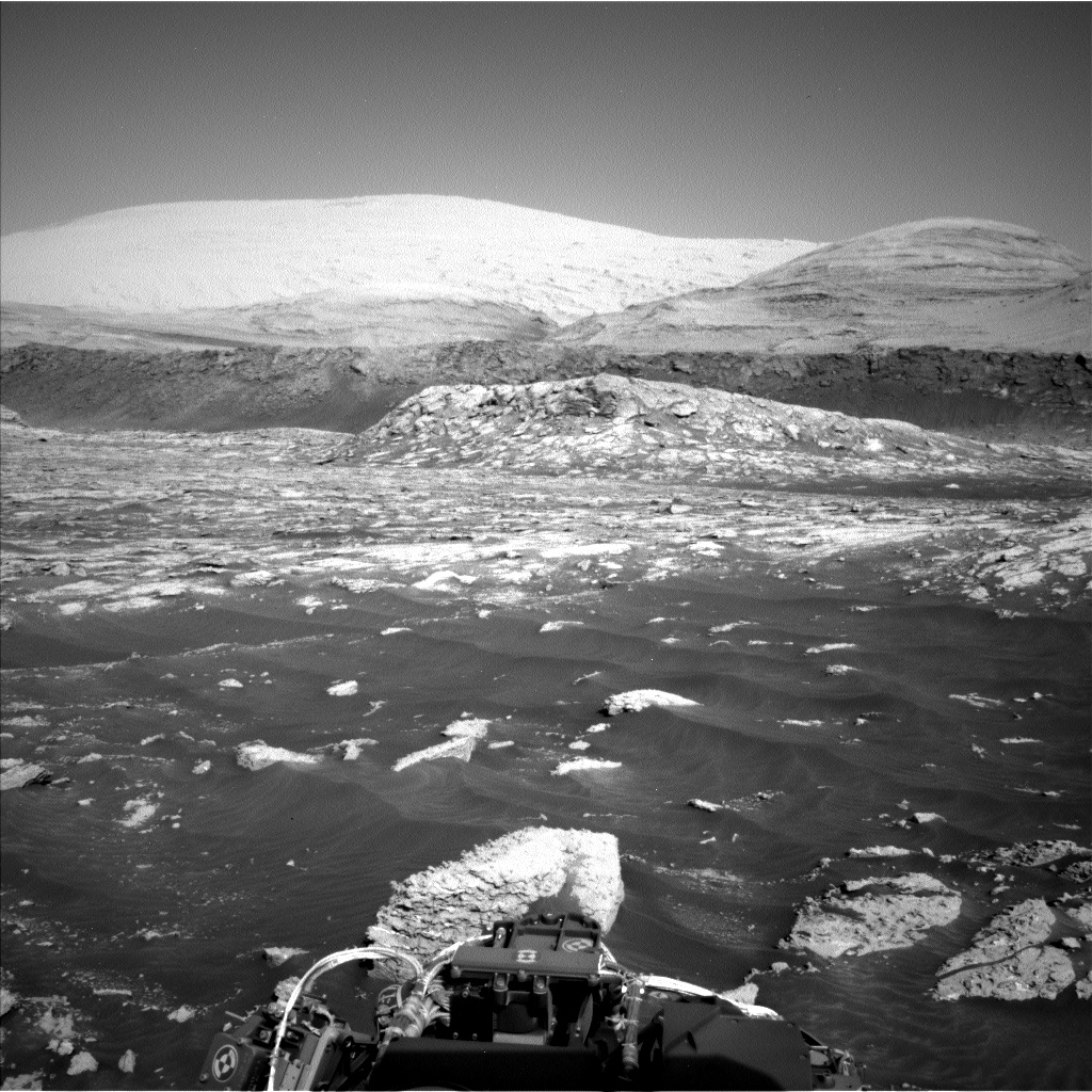
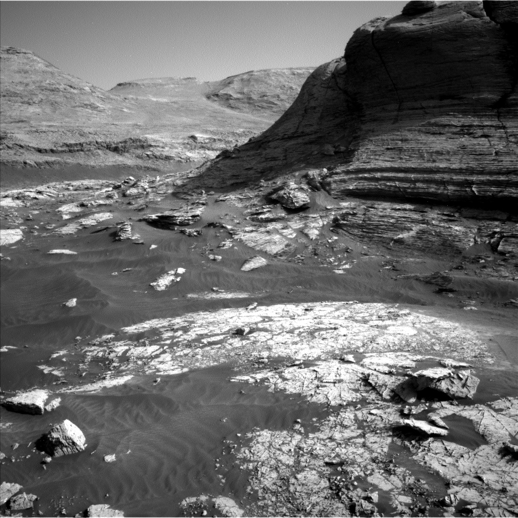
For the last three weeks the Curiosity science team has had the rover poking about at the base of the 40 foot cliff on the right of the panorama above. At that location many rocks and boulders had fallen from the top of the cliff, which gave them an opportunity to study the geology of the plateau above, even though it was literally beyond reach.
Beginning yesterday that work ended, and the science team finally made the commitment to move forward, into the gap above where the rover will turn right, climb up onto that plateau through a notch they have dubbed Maria Gordon Notch. The map to the right shows this coming route with the red dotted line.
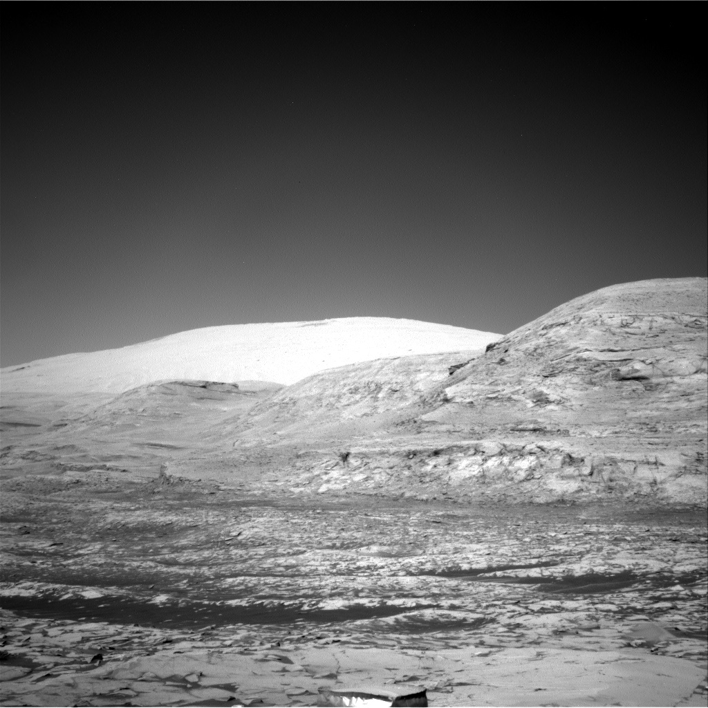
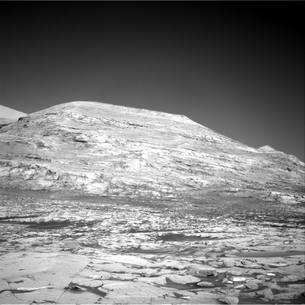
Once in that notch Curiosity will truly be in the mountains of Gale Crater, even if those mountains are only the foothills to Mount Sharp.
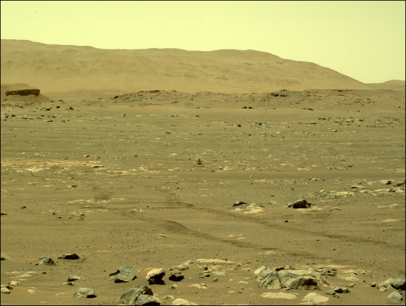
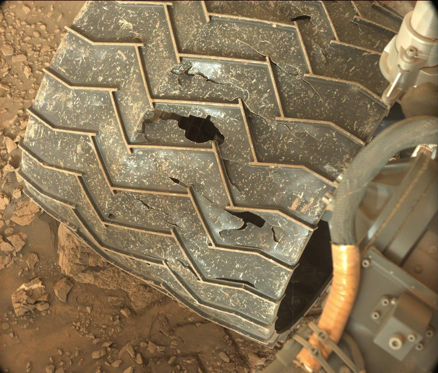
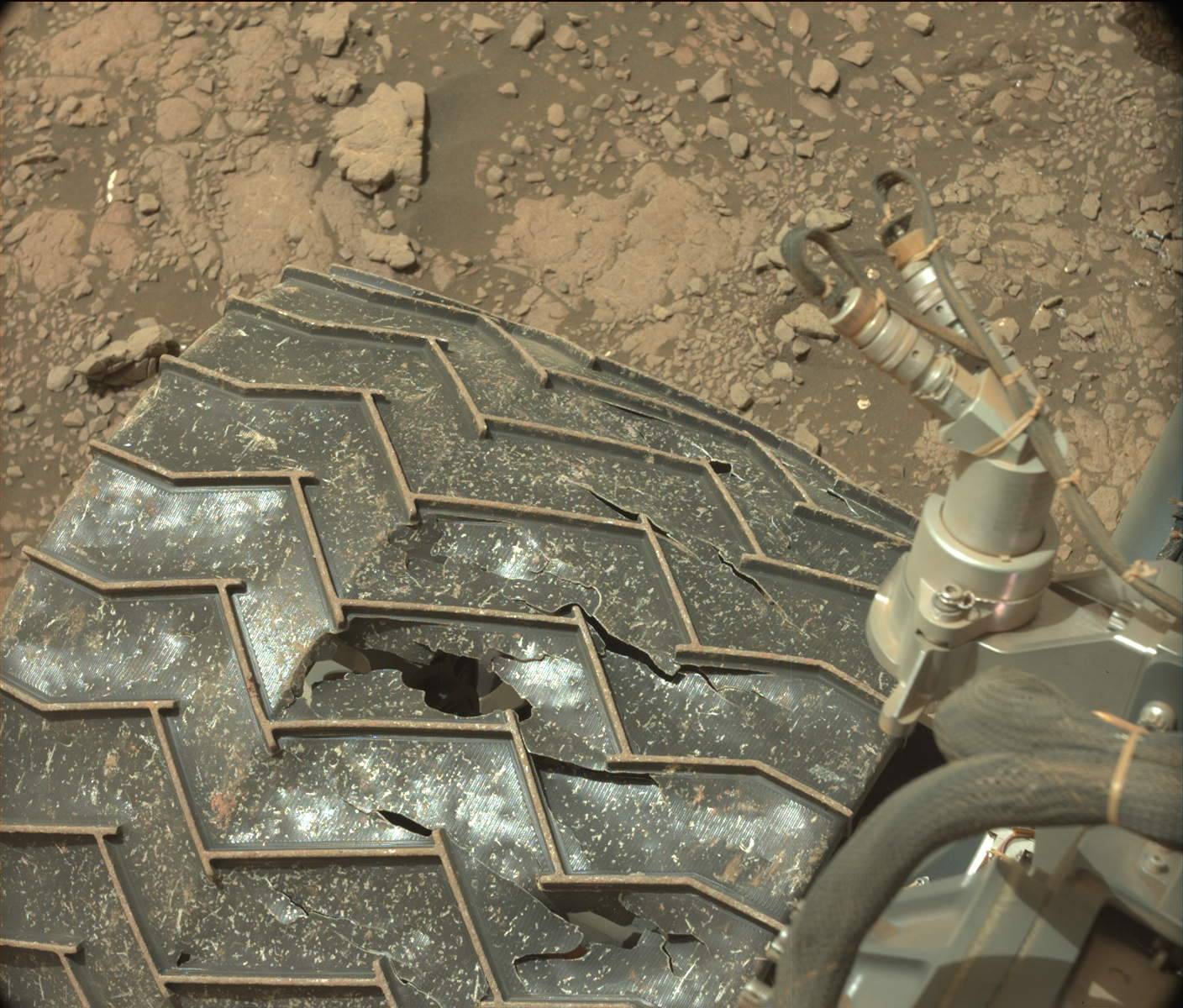
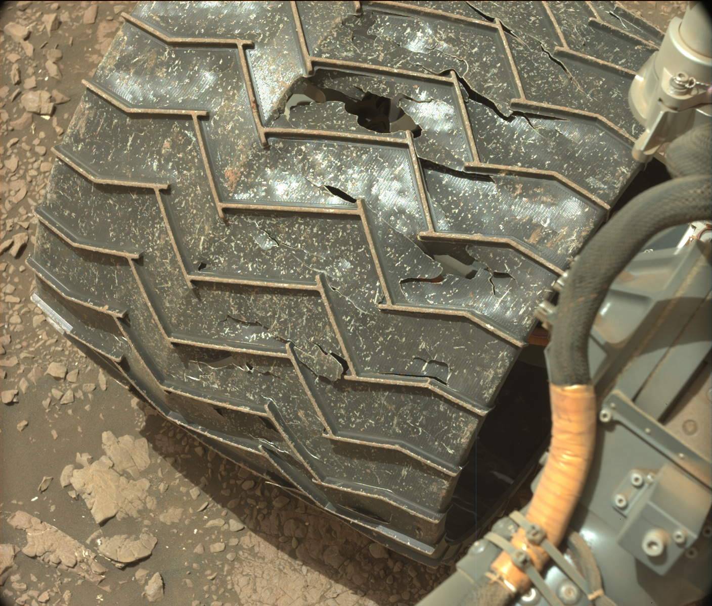
It is interesting to contrast the roughness of the terrain that Curiosity is now routinely traveling, with the relatively benign ground that Perseverance is traversing on the floor of Jezero Crater. While Curiosity is pushing forward into steeper and rougher terrain, the Perseverance team is retreating from the somewhat mild sand dune ground of South Seitah, even though that ground is far less challenging than anything faced by Curiosity. You can see this retreat at the interactive map here. Zoom in and place your cursor over each waypoint. Rather than push forward, the Perseverance team seems willing to have the rover retreat and retrace its route around Seitah, even though to retrace those steps will likely take a few weeks, during which they will cover no new ground and will likely learn little new.
Why the Perseverance team seems so timid is puzzling. It could be they are still working out the kinks of their operation. It could be that they want to take no risks at all this early in their mission. And it could also be that the team culture at Perseverance is simply less daring than that of the Curiosity team.
Only time will answer this question. I suspect as the Perseverance mission unfolds its scientists will become more bold. We just need to give them time.
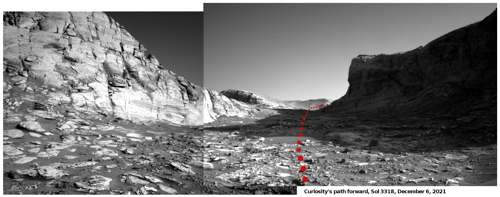
Click for full resolution version. Original images here and here.
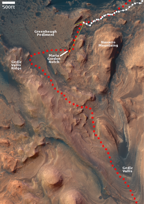
Click for interactive map.
For the last three weeks the Curiosity science team has had the rover poking about at the base of the 40 foot cliff on the right of the panorama above. At that location many rocks and boulders had fallen from the top of the cliff, which gave them an opportunity to study the geology of the plateau above, even though it was literally beyond reach.
Beginning yesterday that work ended, and the science team finally made the commitment to move forward, into the gap above where the rover will turn right, climb up onto that plateau through a notch they have dubbed Maria Gordon Notch. The map to the right shows this coming route with the red dotted line.
Once in that notch Curiosity will truly be in the mountains of Gale Crater, even if those mountains are only the foothills to Mount Sharp.
It is interesting to contrast the roughness of the terrain that Curiosity is now routinely traveling, with the relatively benign ground that Perseverance is traversing on the floor of Jezero Crater. While Curiosity is pushing forward into steeper and rougher terrain, the Perseverance team is retreating from the somewhat mild sand dune ground of South Seitah, even though that ground is far less challenging than anything faced by Curiosity. You can see this retreat at the interactive map here. Zoom in and place your cursor over each waypoint. Rather than push forward, the Perseverance team seems willing to have the rover retreat and retrace its route around Seitah, even though to retrace those steps will likely take a few weeks, during which they will cover no new ground and will likely learn little new.
Why the Perseverance team seems so timid is puzzling. It could be they are still working out the kinks of their operation. It could be that they want to take no risks at all this early in their mission. And it could also be that the team culture at Perseverance is simply less daring than that of the Curiosity team.
Only time will answer this question. I suspect as the Perseverance mission unfolds its scientists will become more bold. We just need to give them time.


