A Martian slope streak caused by a dust devil?

A Martian slope streak caused by a dust devil?
Click for original image.

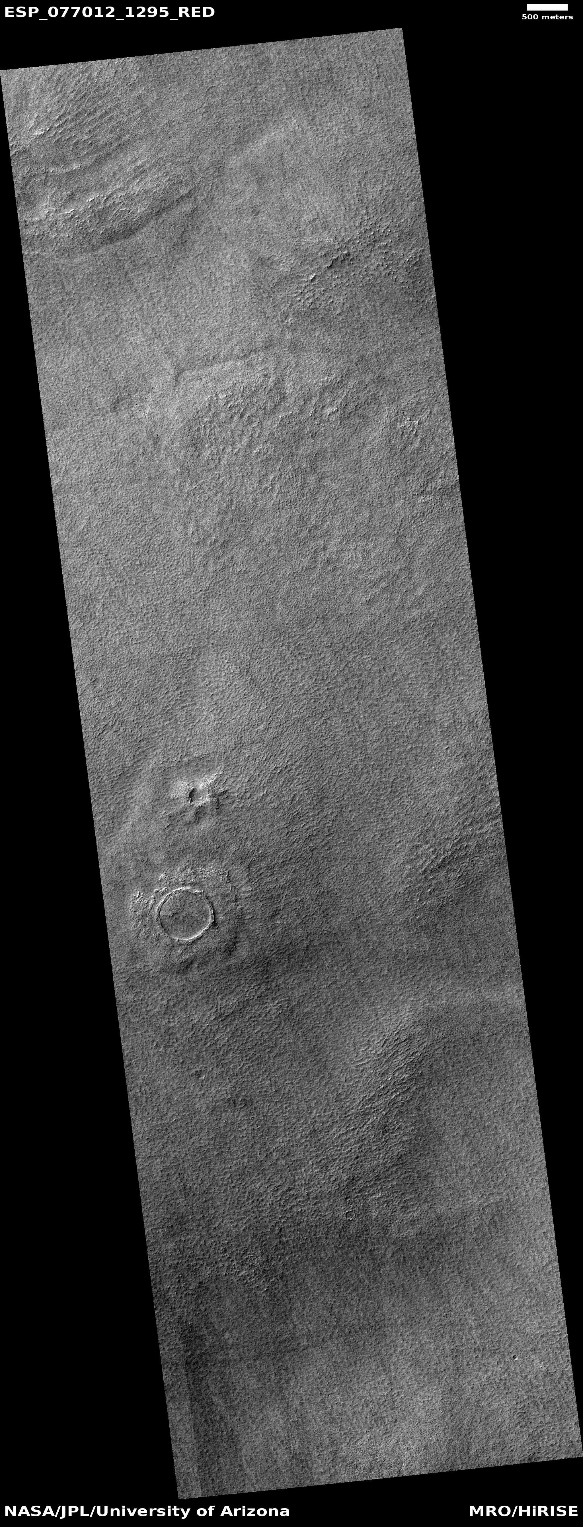
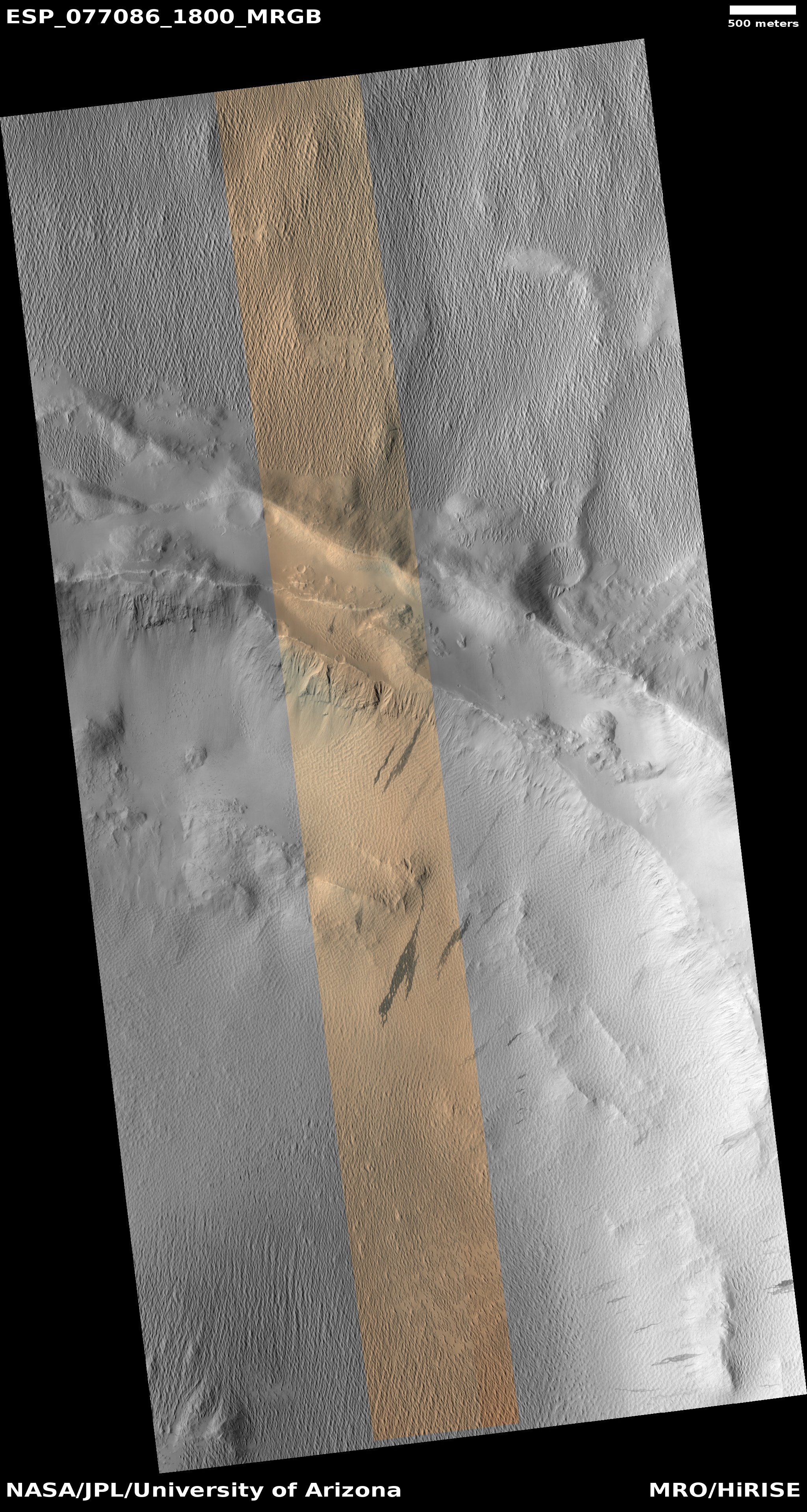
Cool image time! The photo to the right, cropped, sharpened, and enhanced to post here, was taken on January 5, 2023 by the high resolution camera on Mars Reconnaissance Orbiter (MRO). It shows the interior slope of an unnamed 9-mile-wide crater, located just south of the Martian equator.

On that slope are several slope streaks, their dark color suggesting they are relatively recent. Also on that slope is the track of a dust devil that traversed that across slope. The track and the top of one of those streaks match, suggesting the dust devil might have caused the streak.

Did it? Maybe. This image was certainly taken to try to find out. Right now scientists do not know what causes slope streaks, a phenomenon unique to Mars. Though they look like avalanches, they do not change the topography at all, and sometimes flow over rises. If anything, they appear to be a stain on the surface, caused by some unknown process.
» Read more
1 comment

Razor butte on Mars

Razor butte on Mars
Click for original image.

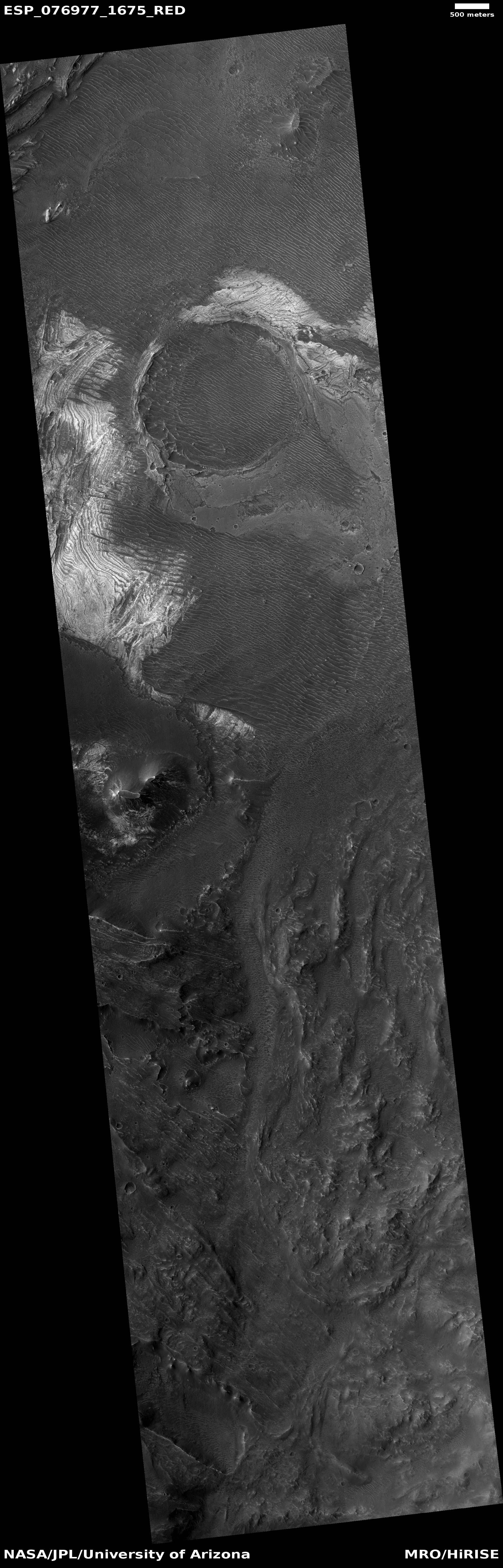
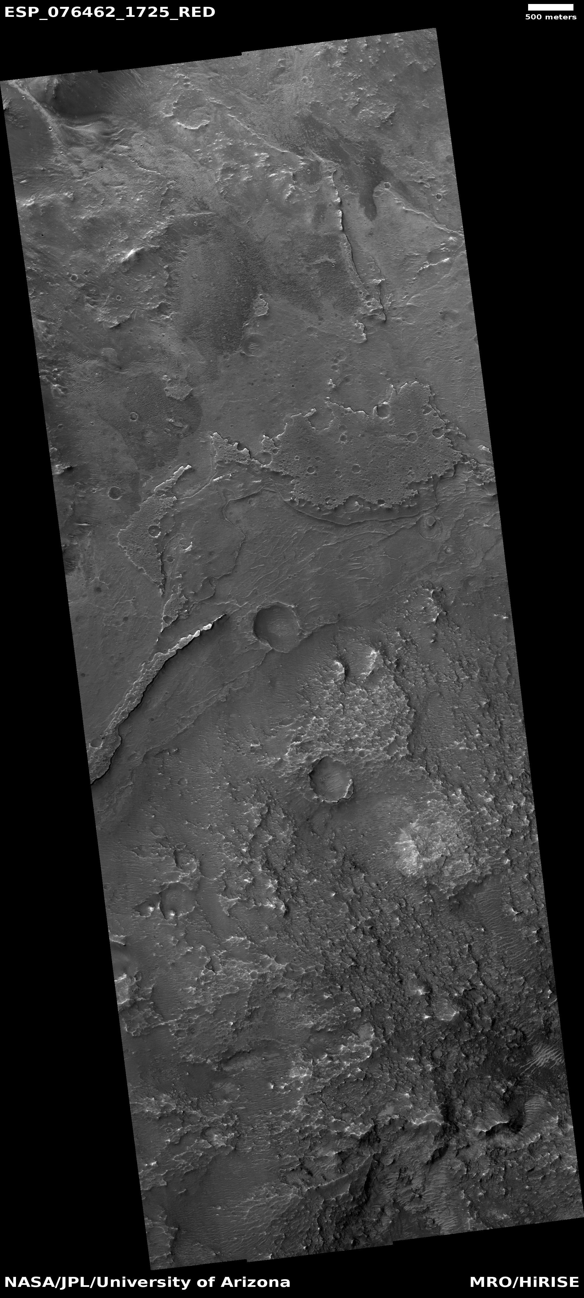
Cool image time! The picture to the right, cropped, reduced, and sharpened to post here, was taken on November 18, 2022 by the high resolution camera on Mars Reconnaissance Orbiter (MRO). The science team labeled this image “Inverted Channel and Possible Lake Deposits.” The sharp razor-like butte, which I estimate is about 200 to 400 feet high, is an example of the several inverted channels in the full image. The serrated-edged flat plateau at the top of this picture, one of several in the full image, is an example of those possible lake deposits.

Why do the scientists think a lake might have once been here? Located at 8 degrees north latitude in the dry equatorial regions of Mars, there is almost certainly no near surface ice here now.

As always, the overview map provides the context, and a possible explanation.
» Read more

3 comments

NASA switches lunar landing site for Astrobotic’s Peregrine lander

Peregrine landing site

NASA today announced that it has changed the planned landing site on the Moon for Astrobotic’s Peregrine lunar lander, presently scheduled for launch at the end of March on the first flight of ULA’s new Vulcan rocket.

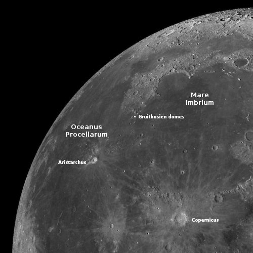
The original landing site for Astrobotic’s flight within Lacus Mortis, which is in the northeast quadrant of the lunar nearside of the Moon, was chosen by Astrobotic to suit its lander performance and safety, as well as Astrobotic’s preferences. However, as NASA’s Artemis activities mature, it became evident the agency could increase the scientific value of the NASA payloads if they were delivered to a different location. The science and technology payloads planned for this delivery to the Moon presented NASA scientists with a valuable opportunity, prompting the relocation of the landing site to a mare – an ancient hardened lava flow – outside of the Gruithuisen Domes, a geologic enigma along the mare/highlands boundary on the northeast border of Oceanus Procellarum, or Ocean of Storms, the largest dark spot on the Moon.

The white dot on the map to the right shows this location. The original location was to the west of Atlas Crater in the northeast quadrant of the Moon’s near side, where Ispace’s Hakuto-R lunar lander plans to touch down in April.

This decision by NASA was apparently prompted by the decision to send Intuitive Machines Nova-C lander to Vallis Schröteri in Oceanus Procellarum, which is the rill that flows west out of the crater Aristarchus. Gruithuisen Domes had been a potential landing site for Nova-C, and NASA probably did not want to lose an opportunity to go there.

3 comments

Curiosity spots foot-wide meteorite on Mars

Meteorite on Mars?
Click for original image.

Curiosity appears to have identified a foot-wide rock on the surface of Mars that is likely a meteorite.

While the JPL press release at this link is certain this is a meteorite, the Curiosity science team is properly more circumspect:

The rock we are parked in front of is one of several very dark-colored blocks in this area which seem to have come from elsewhere, and we are calling “foreign stones.” Our investigations will help determine if this is a block from elsewhere on Mars that just has been weathered in an interesting way or if it is a meteorite.

The image to the right surely does look like a meteorite. If so, this would be one of the largest found so far on Mars by any rover.

3 comments

Dramatic layers in Valles Marineris

Dramatic layers in Valles Marineris
Click for original image.

Cool image time! The picture to the right, rotated, cropped, and sharpened to post here, was taken on December 28, 2023 by the high resolution camera on Mars Reconnaissance Orbiter (MRO), and shows one tiny section of the interior slope of the giant Martian canyon Valles Marineris.

The while layers are not made of frost or ice, because they are light tan, as per the color image. Thus, the alternating layers of dark and light indicate different layering events. The dark layers are probably major lava flood events with a lot of dark ash intermixed, while the tan layers were flood lava events with little dark ash.

The dark lines that cut across these layers are ripple dunes formed from dust that has accumulated inside Valles Marineris.
» Read more

0 comments

Buried silo on Mars?

A buried silo on Mars?
Click for original image.

Cool image time! The picture to the right, rotated and cropped to post here, was taken on December 31, 2022 by the high resolution camera on Mars Reconnaissance Orbiter.

The headline is pure silliness, and should not be taken seriously. However, the geological feature is intriguing nonetheless. Its almost perfect circular shape suggests a partly buried or eroded crater, except that its consistent thickness, almost like a wall, does not match what the rims of any crater should look like. Crater rims are made up of ejected material pushed out during impact, and thus always include some chaotic features.

My guess is that this circular feature is volcanic in nature. Maybe this was once a caldera, and the circle indicates a final vent from which lava extruded and then solidified.

At least, that’s my story.

The feature is located in the southwest quadrant of Hellas Basin, the basement of Mars, at 49 degrees south latitude. While this also suggests that ice might help explain this, we must also remember that much of the geology in that basin remains unexplained. Thus, there is no reason not to add one more feature to the list.

2 comments

A Martian hill of pillows

Curiosity's future path, taken January 31, 2023
Click for original image.

The cool image above was taken on January 31, 2023 by the left navigation camera on the Mars rover Curiosity. The red dotted line indicates roughly the planned route forward for the rover, though as Curiosity gets closer to that hill the terrain is looking increasingly difficult. The white box in the panorama below, taken two weeks earlier when the rover was about five hundred feet away, indicates the area covered by this picture. Since then Curiosity has traveled about 200 feet closer.

I post this picture specifically because of the small hill to the right of that path. Probably no more than fifty feet high, its entire surface appears cloaked by a pile of large, pillow-like pavement stones, almost as if the ground below had been washed away so that the massive top layer fell downward over time. Later, wind erosion over eons smoothed the rough edges of those massive blocks, giving them their cushion-like shapes.

This is strange geology. You might see such strange geology on Earth, but rarely. On Mars however strange geology appears increasingly common.

Moreover, to get a 3D sense of this terrain, load into your browser (on separate tabs) the full images of this hill, taken by Curiosity’s right and left navigation cameras (here and here). If you switch back and forth quickly between those tabs, you will see the slight shift in position between the two cameras, and be able to perceive this hill in three dimensions.

Panorama taken January 17, 2023 by Curiosity

2 comments

Ingenuity successfully completes 41st flight

Overview map
Click for interactive map.

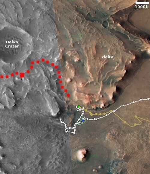
On January 27, 2023, the Mars helicopter Ingenuity successfully completed its 41st flight, flying about 600 feet total in an out-and-back flight that took 109 seconds, slightly longer in length and time than originally planned.

You can watch a very short animation from a handful of the pictures taken during the flight at the first link above. The green dot on the overview map to the right marks Ingenuity’s position before and after the flight, the blue dot Perseverance’s present location. The green line indicates the flight’s approximate path, designed to scout the route that Perseverance intends to follow, as indicated by the red dotted line. The actual flight path has not yet been published. I will add it to this map when the Ingenuity science team provides it.

Expect the next flight to duplicate this one, except it will likely not return but land somewhere out ahead.

0 comments

That ain’t snow on Mars

That ain't snow on Mars
Click for original image.

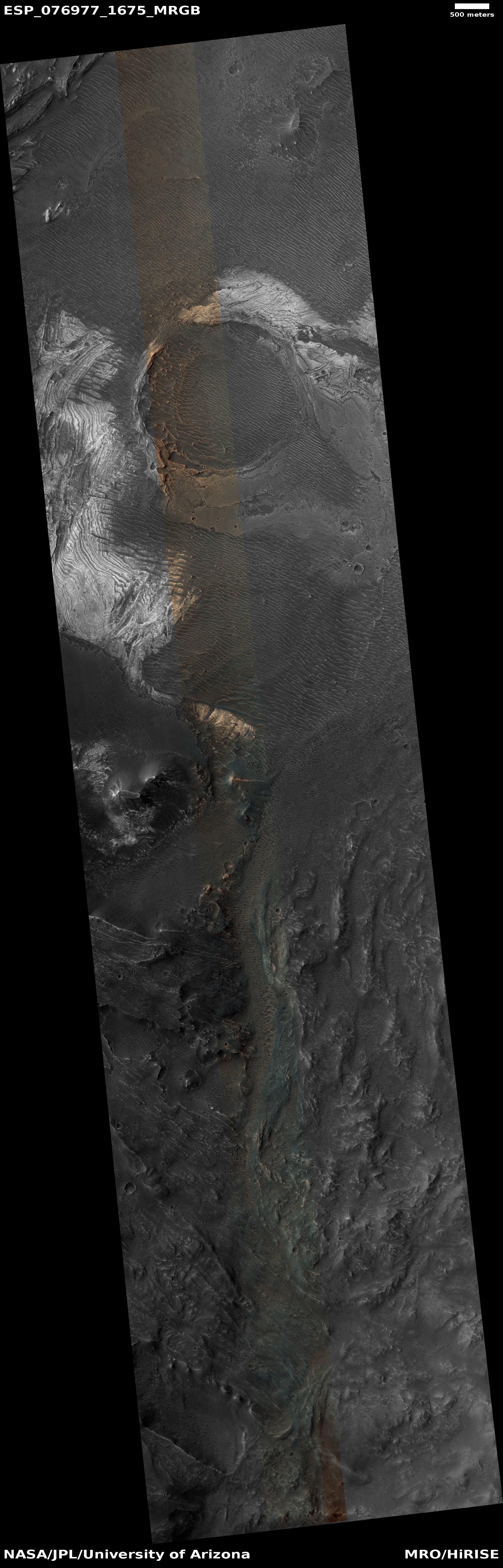
Today’s cool image proves once again that you must never too quickly jump to any conclusions when you first look at a picture from space. The photo to the right, cropped, reduced, and sharpened to post here, was taken on November 24, 2022 by the high resolution camera on Mars Reconnaissance Orbiter (MRO).

At first glance it appears that those ridges are topped with patches of snow or frost. Not. What appears white in this black and white photo is immediately revealed to be light-colored dust in the color image.

According the label assigned to this image by the science team, these ridges represent layers, likely tilted steeply so that when exposed they form the layered cliff edges where that light dust has now gathered.

The overview map below provides further evidence that the white patches are dust, not snow.
» Read more

0 comments

Perseverance completes placement of first ten samples for later pick up

Overview map
Click for interactive map.

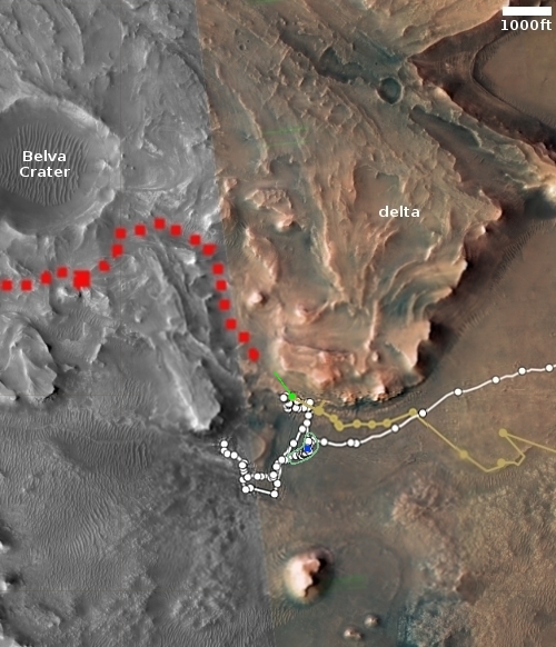
On January 29, 2023 the Perseverance science team completed the placement of the first ten core samples on the floor of Jezero Crater.

On the overview map to the right, the green outline indicates the location of this sample depot. The blue dot marks Perseverance’s present location, while the green dot marks Ingenuity. The red dotted line shows the planned route up onto the delta, which is Perseverance’s next goal.

The titanium tubes were deposited on the surface in an intricate zigzag pattern, with each sample about 15 to 50 feet (5 to 15 meters) apart from one another to ensure they could be safely recovered. Adding time to the depot-creation process, the team needed to precisely map the location of each 7-inch-long (18.6-centimeter-long) tube and glove (adapter) combination so that the samples could be found even if covered with dust. The depot is on flat ground near the base of the raised, fan-shaped ancient river delta that formed long ago when a river flowed into a lake there.

This mapping will be used by a future Mars helicopter to precisely land by each sample, grab it, and then take it to the ascent vehicle for return to Earth.

1 comment

Curiosity looking back

Panorama by Curiosity, looking back
Click for full image.

Overview map
Click for interactive map.

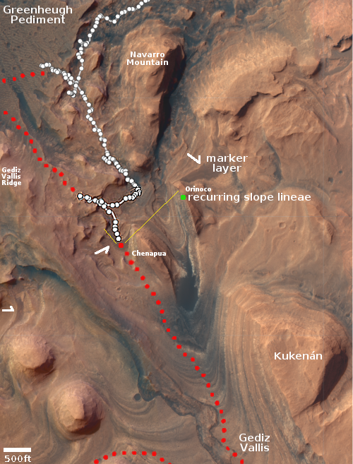
Curiosity is now about halfway across the flat marker band terrain it faced last week, and as part of its routine, used its right navigation camera on January 28, 2023 to create a 360 degree panorama mosaic of the Mount Sharp foothills that now surround it. The panorama above, cropped, reduced, and sharpened to post here, focuses on the part of that mosaic looking behind Curiosity.

You can see the rover’s recent tracks as it crossed this part of the marker band. In the far distance can be seen in the haze the rim of Gale Crater, approximately 20 to 40 miles away. The yellow lines in the overview map to the right show the approximate area covered by this section of the panorama. It is possible the peak of Navarro Mountain is peeking up in the center of this panorama, but more likely it is no longer visible, blocked by the smaller but closer hills.

As Curiosity is now inside the foothills of Mount Sharp, the floor of Gale Crater is no longer easily seen. The rover needs to be at a high lookout point, something that will likely not occur in its travels for many months if not years to come.

The Curiosity pictures I am featuring this morning are cool, and they are also the only real news in the space field at this moment. As is usual on Monday, it takes few hours for the news at the beginning of the week to make itself known.

1 comment

A cloud on Mars

A cloud on Mars
Click for original image.

Cool image time! The photo to the right, reduced and sharpened to post here, was taken on January 27, 2023 by Curiosity’s high resolution camera (dubbed Mastcam) as part of its periodic survey of the sky, looking for clouds. Most of the time the sky is either hazy or clear. This time the camera picked up this cloud, which resembles a cirrus cloud on Earth.

In March 2021 I posted another example of clouds found above Gale Crater by Curiosity. Two months later the science team released a press release about those clouds, which might help explain the cloud above.

The fine, rippling structures of these clouds are easier to see with images from Curiosity’s black-and-white navigation cameras. But it’s the color images from the rover’s Mast Camera, or Mastcam, that really shine – literally. Viewed just after sunset, their ice crystals catch the fading light, causing them to appear to glow against the darkening sky. These twilight clouds, also known as “noctilucent” (Latin for “night shining”) clouds, grow brighter as they fill with crystals, then darken after the Sun’s position in the sky drops below their altitude. This is just one useful clue scientists use to determine how high they are.

Even more stunning are iridescent, or “mother of pearl” clouds. “If you see a cloud with a shimmery pastel set of colors in it, that’s because the cloud particles are all nearly identical in size,” said Mark Lemmon, an atmospheric scientist with the Space Science Institute in Boulder, Colorado. “That’s usually happening just after the clouds have formed and have all grown at the same rate.”

Though usually formed from water-ice, there is a chance this cloud is formed from crystals of dry ice. More analysis will of course be necessary to make that determination.

0 comments
1 79 80 81 82 83 89