A spray of Martian hollows

A spray of Martian sinks
Click for full image.

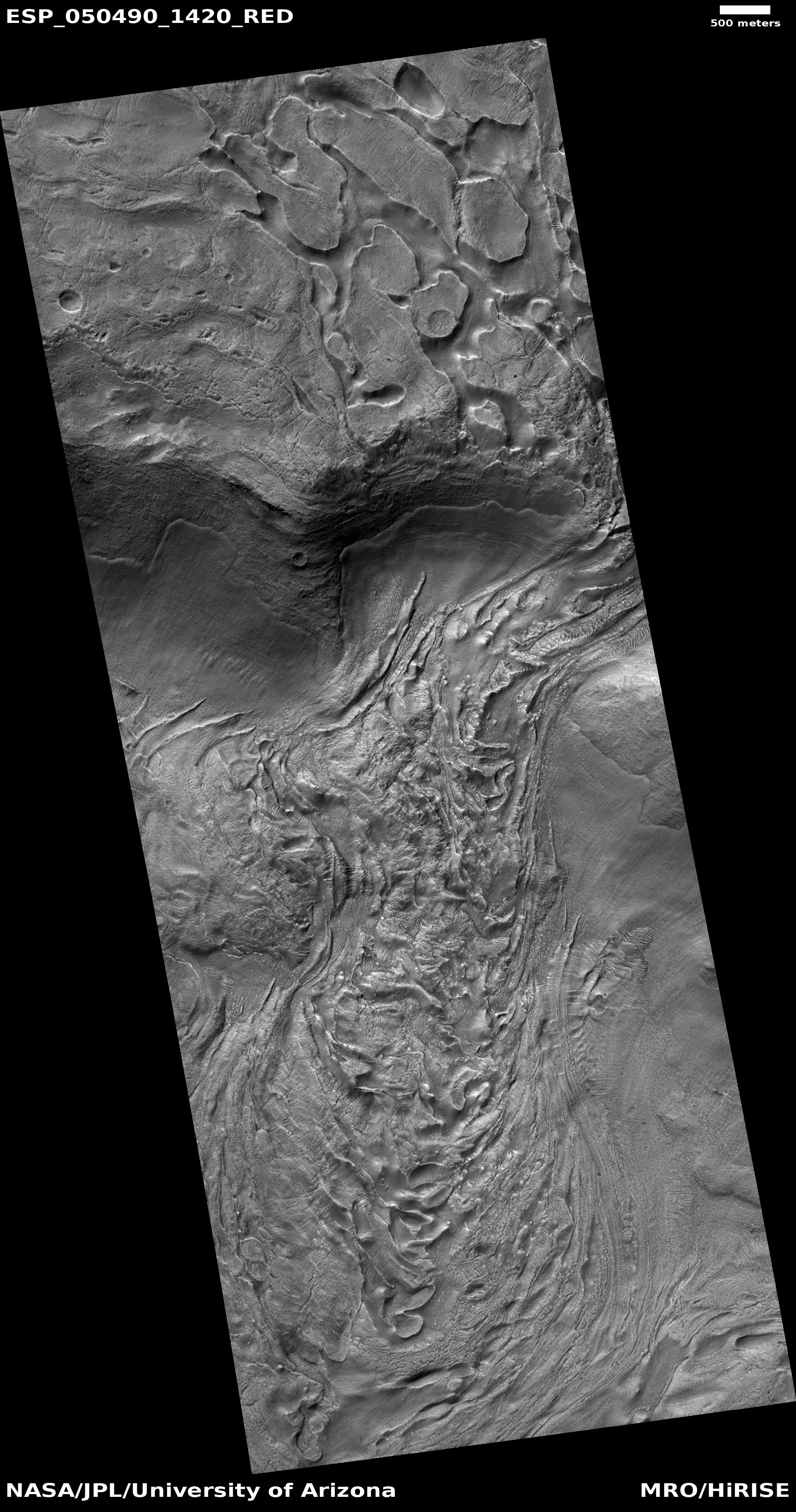
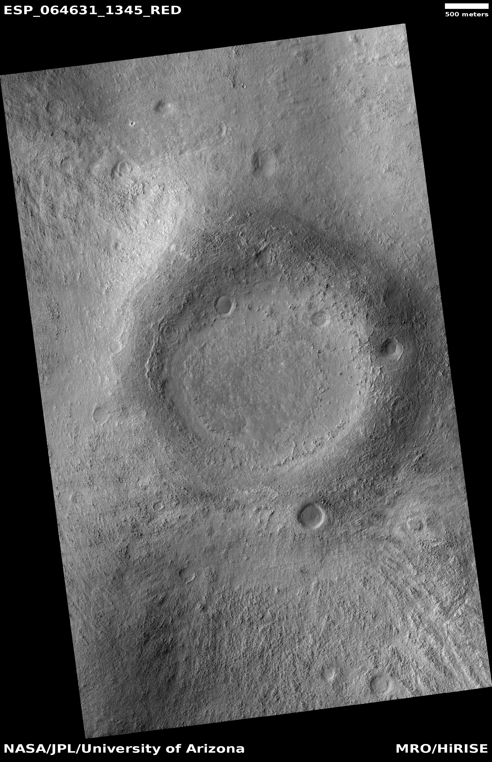
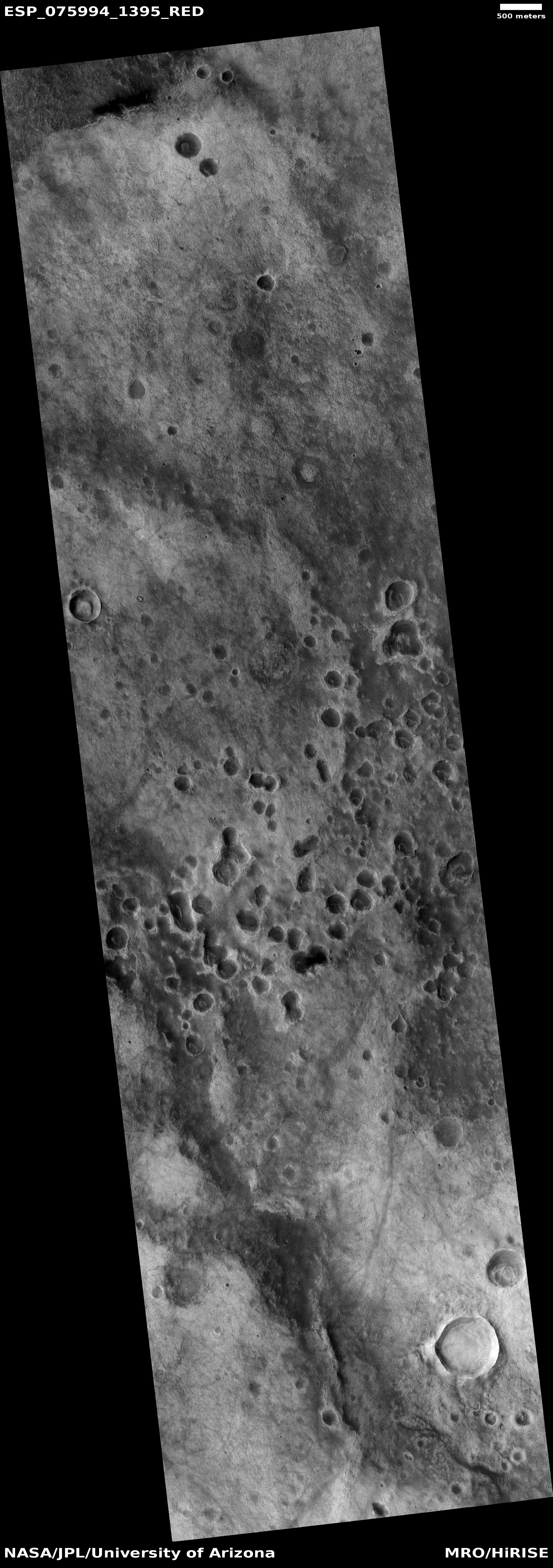
Cool image time! The photo to the right, rotated, cropped, reduced, and sharpened to post here, was taken on October 12. 2022 by the high resolution camera on Mars Reconnaissance Orbiter (MRO). Dubbed simply as a a “terrain sample” by the science team, the picture was not taken as part of any specific research project, but instead to fill a gap in the orbiter’s shooting schedule so as to maintain the camera’s proper temperature. When MRO’s science team does this, they try to pick something in the area below that might be interesting. Sometimes they succeed, but often the features in the picture are nondescript.

The white line delineates the rim of a faint and very eroded small crater. Are the depressions that are mostly concentrated just to its south and east sinks or past impact craters? I haven’t the faintest idea. The overview map below helps to answer this question, but only partly.
» Read more

1 comment

A hint at Mars’ past climate cycles

Terraced glaciers in Martian crater
Click for full image.

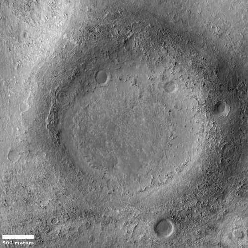
Cool image time! The photo to the right, cropped to post here, was taken on October 28, 2022 by the high resolution camera on Mars Reconnaissance Orbiter (MRO). It shows what the scientists label as a “layered feature” inside a small 4,500-foot-wide crater.

Located at 36 degrees north latitude, we are likely looking at glacial ice layers inside this crater, with each layer probably marking a different Martian climate cycle. The terraces suggest that during each growth cycle the glaciers grew less, meaning that less snow fell with each subsequent cycle. This in turn suggests a total loss of global water over time on Mars.

The overview map below gives us the wider context.
» Read more

0 comments

Finding Martian glaciers from orbit

Glacier flow on Mars
Click for full image.

Today’s cool image is a great example of the surprises one can find by exploring the archive of the high resolution pictures that Mars Reconnaissance Orbiter (MRO) has produced since it arrived in Mars orbit back in 2006. The picture to the right, rotated, cropped, and reduced to post here, was taken by MRO’s high resolution camera back on May 4, 2017. I only found it because I had picked out a October 24, 2022 high resolution image that covered a different area of this same flow feature just to the north east. In trying to understand that 2022 picture I dug to see other images had been taken around it, and found the earlier 2017 photo that was even more interesting.

Neither however really covered the entire feature, making it difficult to understand its full nature. I therefore searched the archive of MRO’s context camera, which has imaged the entire planet with less resolution but covering a much wider area per picture. The context camera picture below captures the full nature of this feature.
» Read more

1 comment

Traveling in the mountains of Mars

Traveling in the mountains of Mars
Click for full resolution. Original images can be found here and here.

Overview map
Click for interactive map.

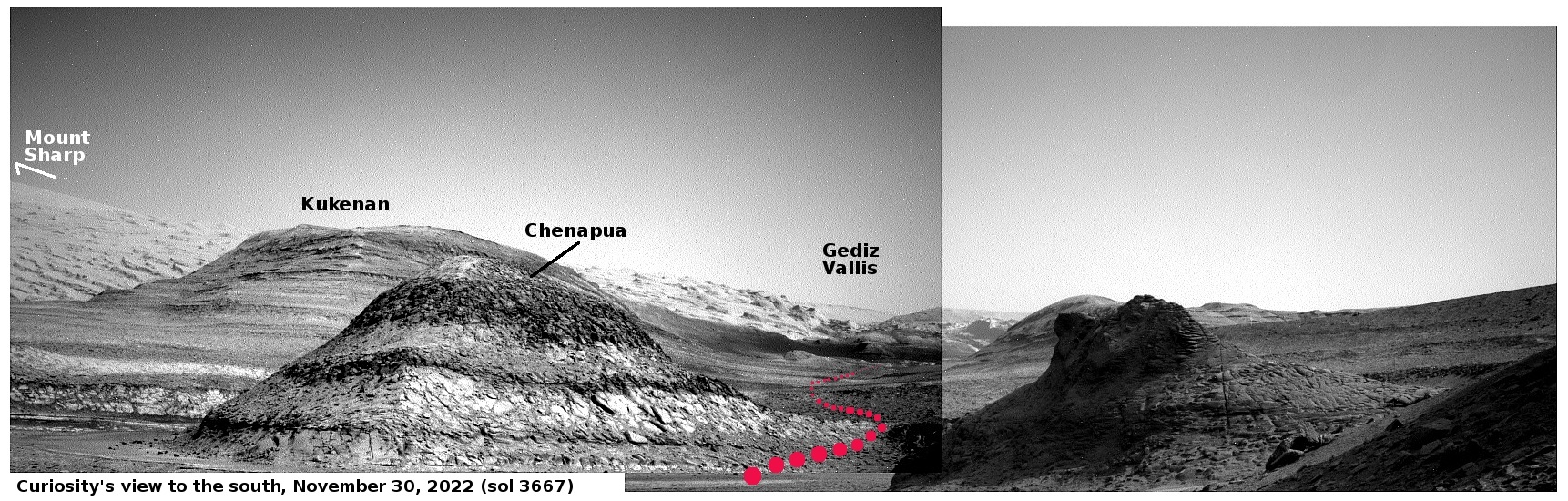
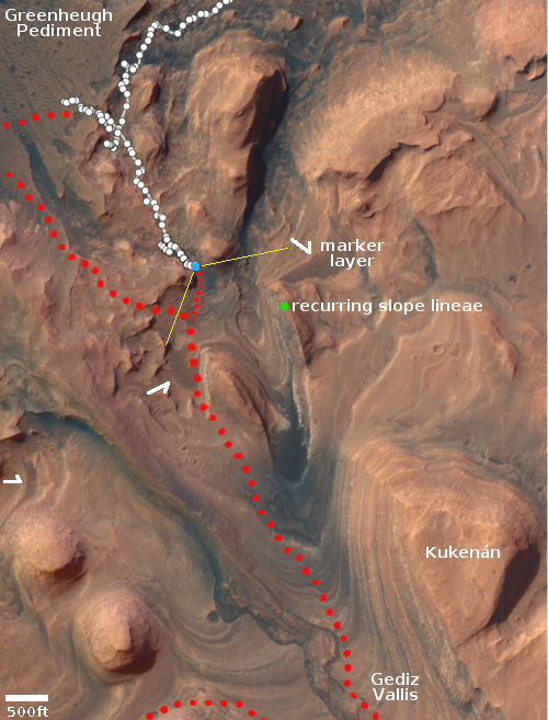
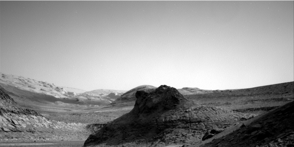
Cool image time! The panorama above was created by two photos taken by the Mars rover Curiosity’s right navigation camera on November 30, 2022. It looks to the south, into Gediz Vallis, the slot canyon that has been the rover’s major goal since it landed in Gale Crater a decade ago.

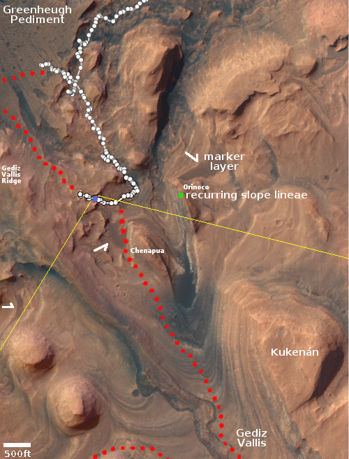
The blue dot on the overview map to the right marks Curiosity’s present position, now on its way east after making a short detour to the west towards Gediz Vallis Ridge. The yellow lines indicate the approximate area shown by this panorama. The red dotted line in both images marks the rover’s planned future route. The white arrows indicate what scientists have labeled the marker band, a distinct smooth layer seen at about the same elevation in many places on the flanks of Mount Sharp. According to the most recent update from the science team, the rover’s next drive will place it on that marker band, the second time it has been there.

From here the rover will continue south, climbing up into Gediz Vallis.

0 comments

Curiosity finally looks out into Gediz Vallis

First look into Gediz Vallis
Click to view full mosaic.

Overview map
Click for interactive map.

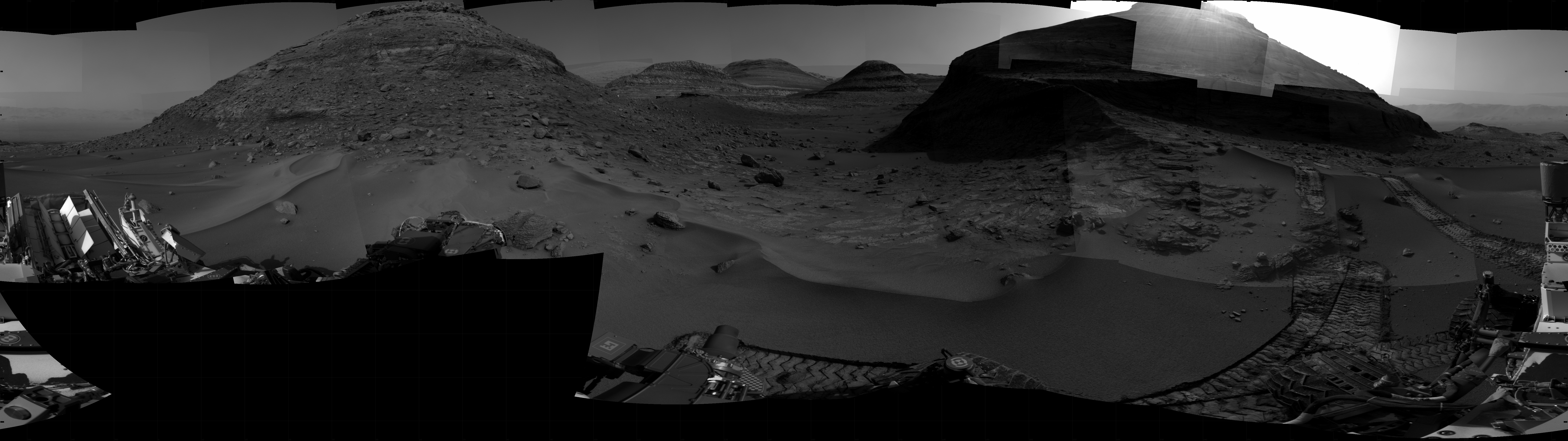
Cool image time! Curiosity’s right navigation camera today produced the mosaic above, cropped and reduced to post here, taking its first good look into Gediz Vallis, the canyon that the rover has been aiming for since it landed on Mars ten years ago.

The green dot on the overview map to the right marks the approximate location of a recurring slope lineae, a streak that comes and goes depending on the seasons whose cause remains uncertain. The yellow lines show the approximate area covered by the mosaic. The red dotted lines show Curiosity’s upcoming route. According to previously announced plans, the rover will not head straight into Gediz Vallis, but circle to the west or right of the mesa to the right of Kukenan.

The valley of course looks spectacular. For scale, the cliff face of Kukenan is estimated to be about 1,500 feet high.

The most important revelation from this image however is the ground terrain. It looks like Curiosity will have no problem moving forward into the canyon from this point, something the science team could not know for sure until the rover reached the saddle and could look down and actually see ahead.

0 comments

Navigating a rover on Mars

16 photos taken by Perseverance's right navigation camera on May 2, 2022

Overview map
Click for interactive map.

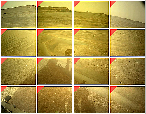
Cool image time! The photo to the right is actually a screen capture of 16 consecutive photos taken on May 2, 2022 by the right navigation camera on the Mars rover Perseverance.

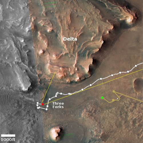
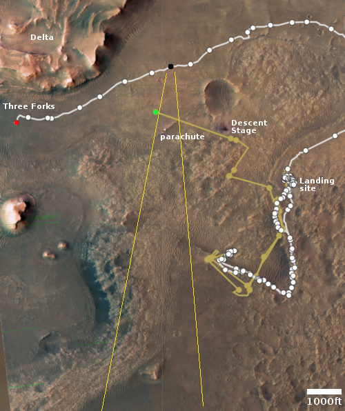
The overview map below gives the context. The red dot marks Perseverance’s position when the photos were taken. The green dot marks Ingenuity’s position. The small white dot marks the spot where the rover’s parachute landed. The yellow lines indicate I think the area covered by the sixteen navigation images.

There is a reason for showing this panorama in this somewhat crude form. The engineers who run Perseverance have programmed its navigation cameras to send back its pictures so that they immediately line up in this coherent pattern. There is no need to rearrange them upon arrival. The engineers thus can instantly see how each picture relates to the others, and thus get an immediate sense of the nearby terrain in which they must plot the rover’s next move.

Perseverance is now in its second science campaign, focused on studying the base of the delta. As the science team studies the delta’s cliff face, they are also studying the best route to continue uphill. To do both, they have begun slowly moving along that face, going from west to east.

The rough panorama above thus shows them the ground ahead as they continue that traverse. I expect the rover’s next move will be to the northeast, once again moving along the base of the nearest cliff. The panorama shows that while the ground in this area has a few ridges, none are so high as to cause Perseverance any problems.

0 comments

Perseverance spots its parachute

Perseverance spots its parachute
Click for full resolution. Original images found here and here.

Overview map
Click for interactive map.

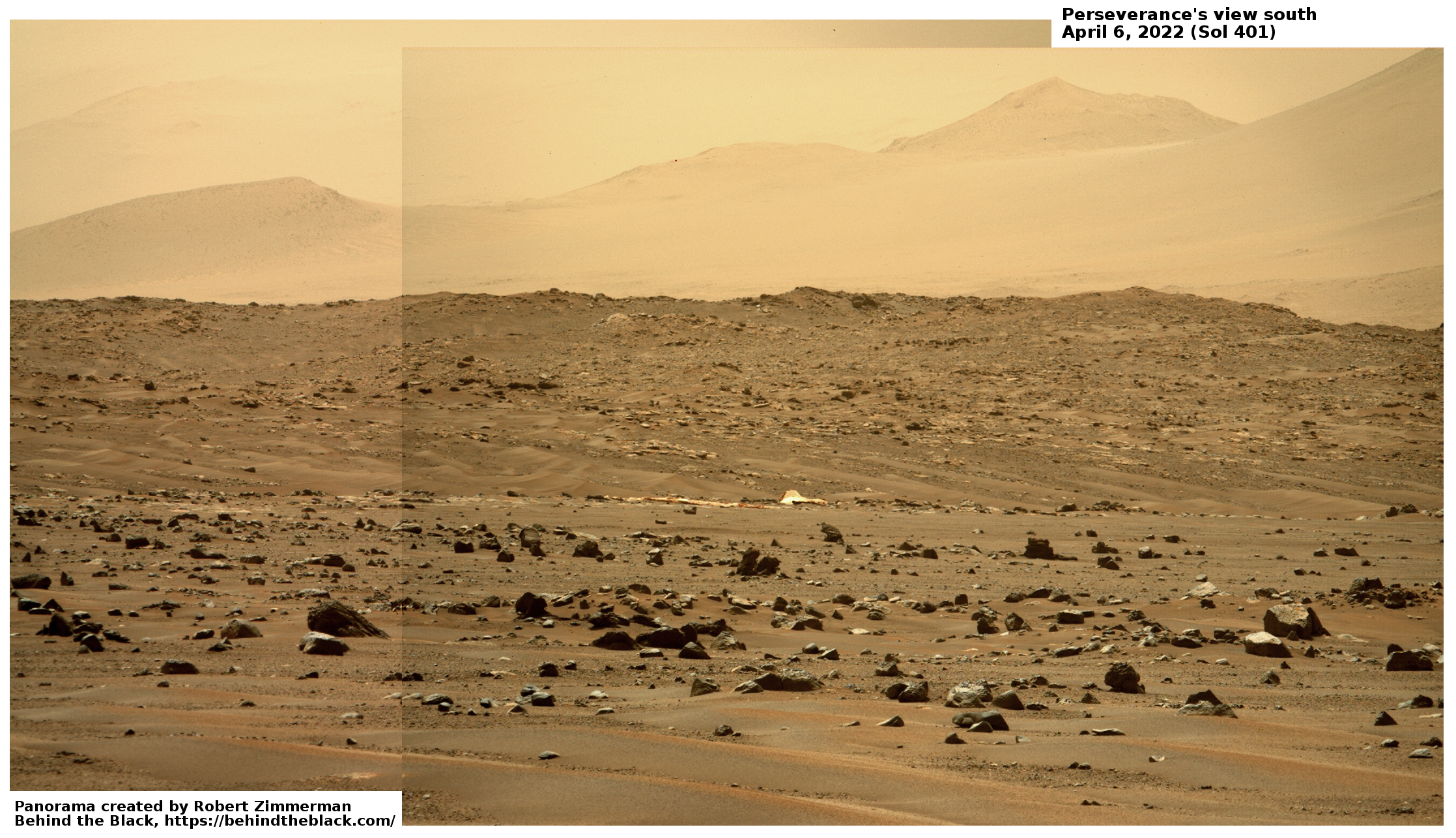
Cool image time! Today the Perseverance science team released two photos taken on April 6th that captured the parachute that the rover had used to land on Mars on February 18, 2021. The enhanced panorama above is from those images. The white feature near the center is the parachute. The mountains in the distance are the southern rim of Jezero Crater, about 40 miles away.

The overview map to the right gives the context. The red dot is Perserverance’s location as of yesterday, on sol 413. The black dot marks its location on April 6th, when it took the pictures. The green dot marks Ingenuity’s present position. The yellow lines indicate the approximate area covered by the panorama.

Ingenuity had not completed its 25th flight until April 8th, two days after these photos were taken, so it isn’t actually just off the edge of these photos, it is beyond the near ridgeline out of sight.

1 comment

Curiosity retreating from Greenheugh Pediment

Overview map
Click for interactive map.

Because of the incredible roughness of the ground on the Greenheugh Pediment, the science team for the rover Curiosity has decided to make a major change in their route. Rather than continue their traverse across this terrain, as planned for years, they have decided to back off in order to protect Curiosity’s dinged wheels, and find a more friendly route up Mount Sharp.

β€œIt was obvious from Curiosity’s photos that this would not be good for our wheels,” said Curiosity Project Manager Megan Lin of NASA’s Jet Propulsion Laboratory in Southern California, which leads the mission. β€œIt would be slow going, and we wouldn’t have been able to implement rover-driving best practices.”

The gator-back rocks aren’t impassable – they just wouldn’t have been worth crossing, considering how difficult the path would be and how much they would age the rover’s wheels.

So the mission is mapping out a new course for the rover as it continues to explore Mount Sharp, a 3.4-mile-tall (5.5-kilometer-tall) mountain that Curiosity has been ascending since 2014. As it climbs, Curiosity is able to study different sedimentary layers that were shaped by water billions of years ago. These layers help scientists understand whether microscopic life could have survived in the ancient Martian environment.

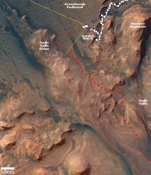
The plan is to retrace the rover’s path back through Gordon Notch and then head uphill though another gap that will take it directly onto the next sedimentary layer, dubbed the sulfate unit. On the overview map above, the red dotted line shows the long-planned route. The yellow lines indicate the area seen in the panorama I posted on April 6th, when Curiosity was at its farthest into the pediment. The blue dot marks Curiosity’s position two days ago. You can see that it has retreated backwards.

This change means the scientists will likely not get a close look at Gediz Vallis Ridge. However, it also means the rover will likely reach Gediz Vallis much sooner that previously planned.

0 comments

Michael Knowles – Celebrating Columbus

An evening pause: On this day when all should be celebrating Christopher Columbus and his willingness “sail beyond the sunset,” to use a phrase from Tennyson, this short video give us an accurate picture of the man, his times, and his achievements. It also puts the lie to the bigoted, hateful, leftist slanders that have been used in recent years to poison his legacy.

Note that I got this video from Rumble. I ask all who wish to suggest evening pauses to consider searching on Rumble and Vimeo, so that we are less dependent on YouTube. The Google company needs to feel some competitive pressure.

14 comments

Curiosity faces the mountains

A cropped section from Perseverance's 1st panorama
A cropped section from Perserverance’s 1st panorama.
Click for full image.

Though the present excitement over the spectacular images and sounds coming down from Perseverance is certainly warranted, what must be understood is that this rover is presently only at the beginning of its journey, and is thus sitting on relatively boring terrain, from a merely visual perspective. The scientists might be excited, but to the general public, all we really are seeing is a flat dusty desert with some scattered rocks on the floor. In the far distance can be seen some hills and mountains (Jezero Crater’s rim), but they are very far away.

Curiosity, which the press and the public has largely forgotten about, is actually just beginning what will likely be the most breath-taking part of its journey. As I noted in my last rover update last week, Curiosity is now at the very base of Mount Sharp, and is about to enter the mountain’s canyons and initial slopes. For its past eight-plus years of roving it has been on the flat floor of Gale Crater, followed by some weaving among the smallest foothills of Mount Sharp. The views have been intriguing and exciting from a research perspective, but hardly breath-taking from a picture-taking point of view.

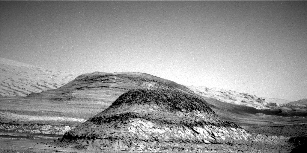
That is now changing. The picture below, taken by Curiosity just this week, gives us a taste of what is to come.
» Read more

11 comments

Unexplored Mars

Strange crater on the edge of Argyre Basin
Click for full image.

The constant stream of images and data that our orbiters and landers are feeding down to us from Mars can sometimes give the impression that the red planet is being thoroughly explored. Today’s cool image illustrates how this impression is false, and instead shows a hint of what remains untouched on the fourth planet from the Sun, a planet with the same land area as on Earth.

The photo to the right, cropped and reduced to post here, was taken by the high resolution camera of Mars Reconnaissance Orbiter (MRO) on May 10, 2020, and shows a strange crater on the north interior edge of Argyre Basin, one of Mars’ largest basins located in the southern hemisphere. Not as deep or as large as Hellas Basin, what I call the basement of Mars, Argyre is still the second largest such basin on Mars, about 1,100 miles in diameter with its lowest elevation 17,000 feet below the surrounding southern cratered highlands. Like Hellas, it is thought to be the remains of major impact.

The point of this post is not to try to explain the geology of this crater. Located at 45 degrees south latitude, it might or might not be showing us glacial evidence. The nature of the terrain is inconclusive. To figure out the geology here would require a lot more data, and a focused interest in studying it.

Instead, this image shows us how little we know of Mars. For example, this photo was not requested by any scientist doing specific research. It was requested instead by the science team for MRO’s high resolution camera because they need to take images at regular intervals to maintain the camera’s temperature, and if no one has requested an image for a specific time period, they make their own choice, picking a spot that might be interesting without knowing sometimes what they might find. Often such “terrain sample” images are somewhat boring. Other times they reveal some surprisingly interesting geology.

The map below gives a sense of how little of the Argyre Basin has been explored by MRO’s high resolution camera.
» Read more

3 comments
1 81 82 83 84 85 89