Glaciers or taffy on Mars?

Glaciers of taffy on Mars?
Click for full image.

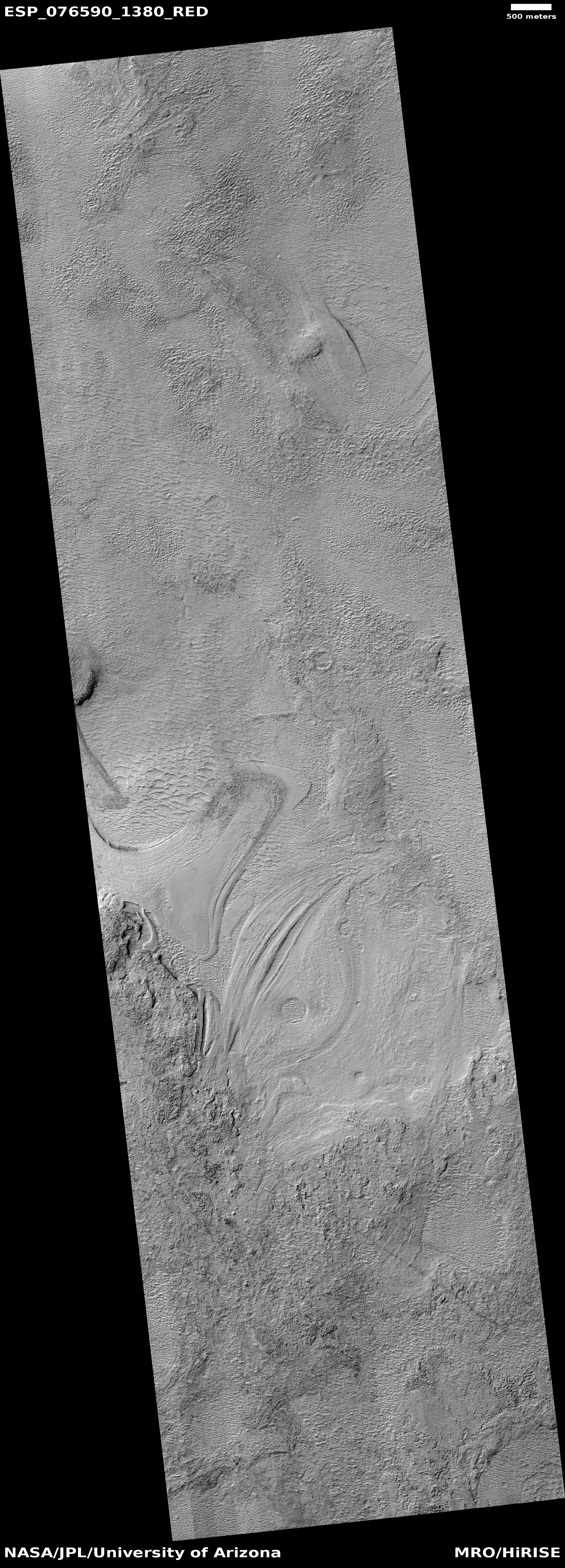
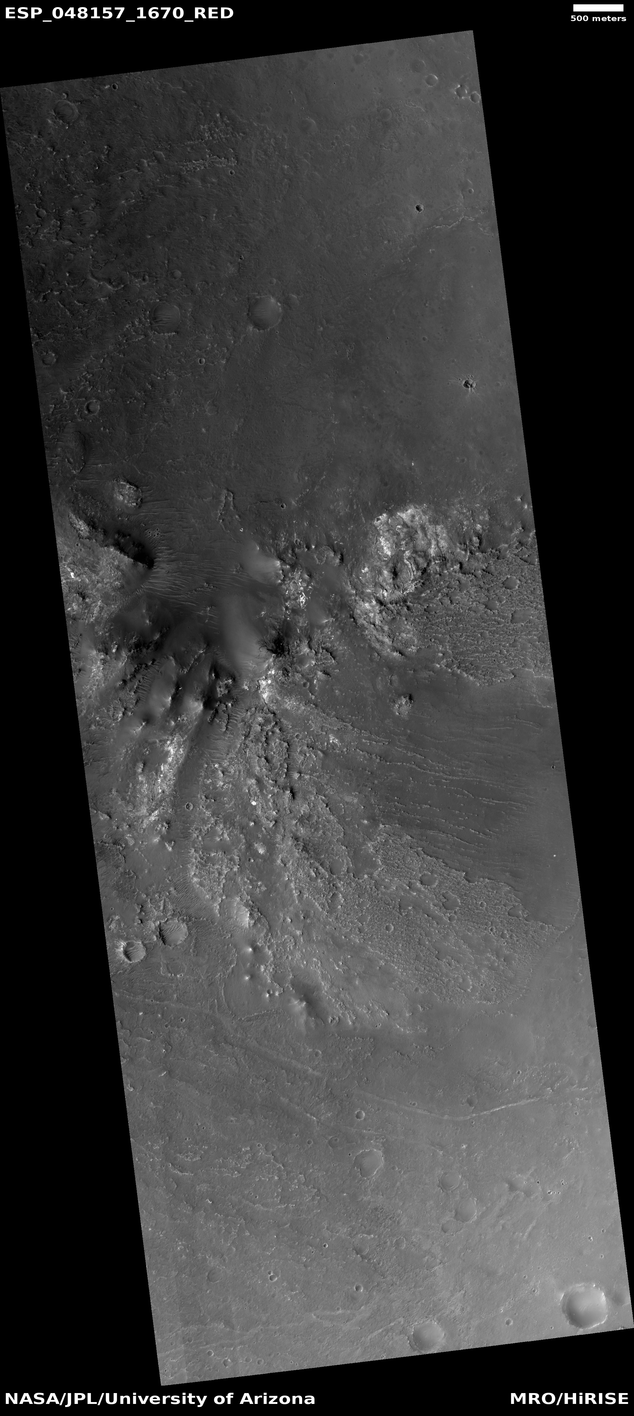
Cool image time! The photo to the right, rotated, cropped, reduced, and sharpened to post here, was taken on November 28, 2022 by the high resolution camera on Mars Reconnaissance Orbiter (MRO). It was released on January 4, 2023 as a captioned image, with this caption by Alfred McEwen of the Lunar & Planetary Laboratory in Arizona:

The floor of the Hellas impact basin, the lowest elevation on Mars, remains poorly explored because haze often blocks it from view. However, we recently got a clear image, revealing the strange banded terrain. These bands may be layers or flow bands or both.

At first glance, these bands reminded me of the many glaciers found on Mars. McEwen however is being properly vague about the nature of these features, for a number of reasons illustrated by the overview map below.
» Read more
1 comment

A dry lakebed on Mars?

Evidence of a past lake in a crater on Mars
Click for original image.

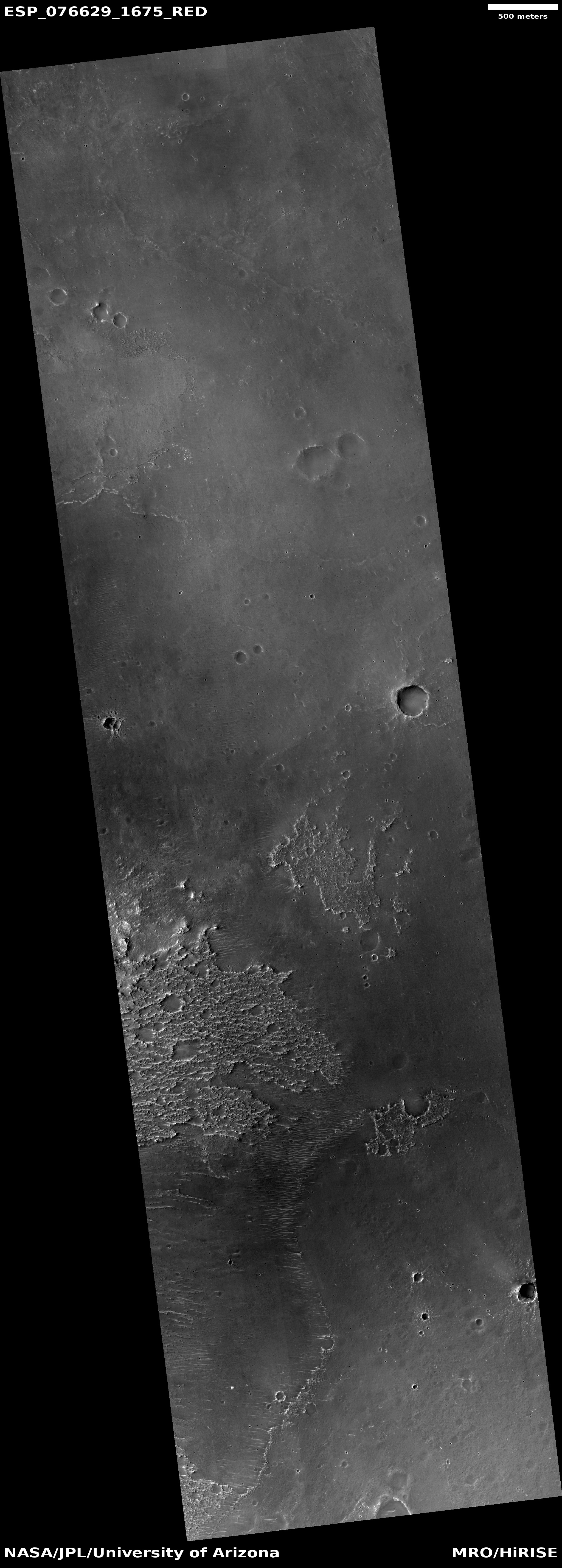
Today’s cool image illustrates in some ways the uncertainty of science. The photo to the right, rotated, cropped, reduced, and sharpened to post here, was taken on December 1, 2022 by the high resolution camera on Mars Reconnaissance Orbiter (MRO). The science team intriguingly labeled it “Small Candidate Lake Deposit Downstream of Alluvial Fan.” I am not sure what they consider that lake deposit in the full image, so I have focused on the area of stucco-like ground, which resembles bedrock that has been corroded by some water process.

This area is just to the east of the central peaks of an unnamed 25-mile-wide crater in the southern cratered highlands. Many of the craters in this region are believed by scientists to have once harbored lakes formed by run-off from the glaciers that once existed on the craters’ inner rim. In this case it appears this stucco area is the head of an alluvial fan, coming down from the crater’s central peaks. You can see its beginning in this MRO high resolution image of the central peaks, taken in November 2016. As defined geologically,

An aluvial fan is an accumulation of sediments that fans outwards from a concentrated source of sediments, such as a narrow canyon emerging from an escarpment. They are characteristic of mountainous terrain in arid to semiarid climates, but are also found in more humid environments subject to intense rainfall and in areas of modern glaciation.

In this case the terrain is now arid, but shows evidence it once was icy wet.
» Read more

0 comments

Martian crater with mound of ice? mud? hardened sand?

Crater with mound
Click for full image.

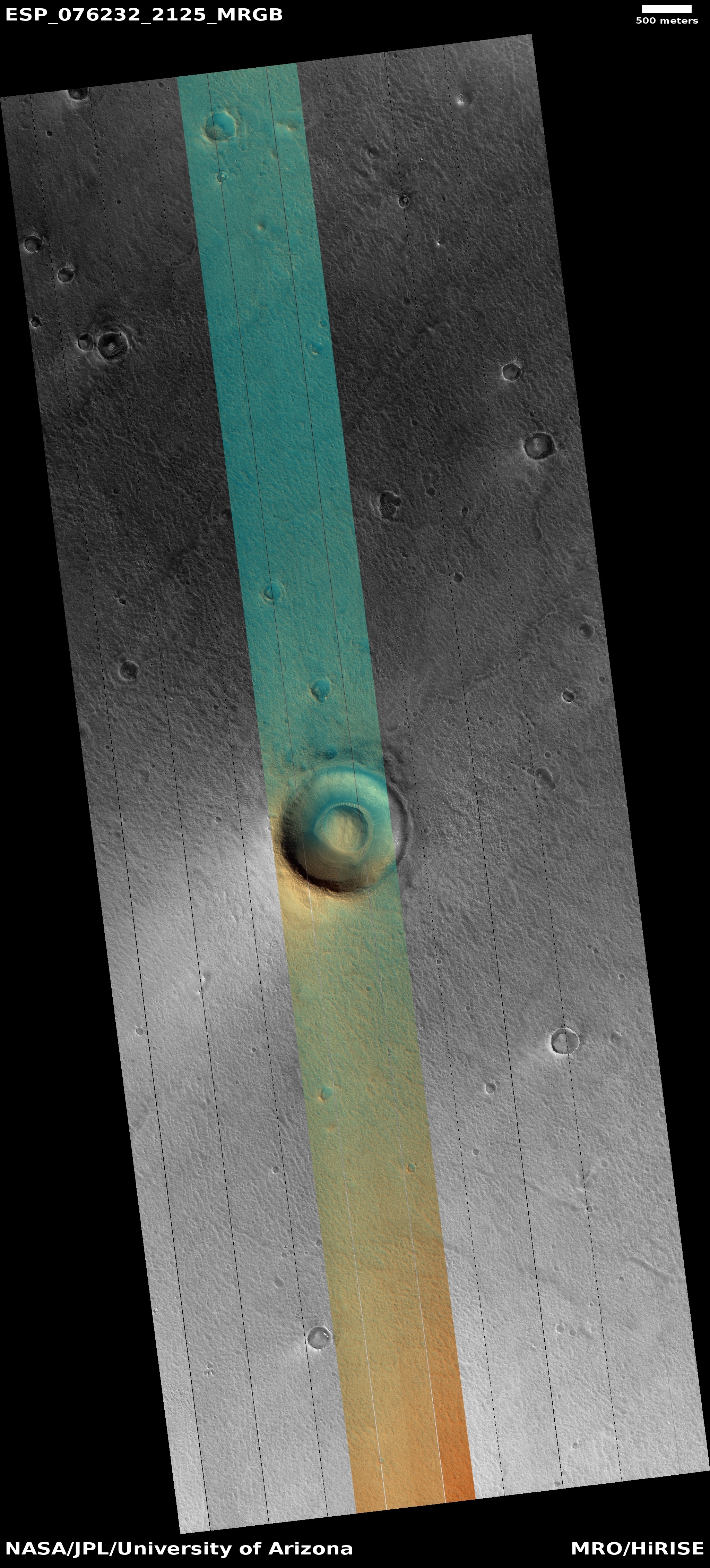
Cool image time! The photo to the right, cropped to post here, was taken on October 31, 2022 by the high resolution camera on Mars Reconnaissance Orbiter (MRO). It shows a small 4,000-foot-wide crater that is practically filled with a smooth, almost perfectly spherical mound, with the rest of the crater interior filled with sand dunes and what appears to be glacial debris.

Is that mound also glacial debris, covered with a layer of dirt and dust to protect it? If so, one wonders how the ice ended up in this shape. There are other craters with similar mounds in this region, all suggesting glacial debris but with the same question. Craters with lots of near surface ice in this region more often have a squishy blobby look.

Is the mound instead possibly mud, expressing the existence of a mud/ice volcano? If so, it shows no central pit or caldera, which is typical of such things.

Is it hardened sand? Martian dust that gets blown into craters generally gets trapped there, building up over time. If so, however, why does it have a smooth almost perfectly rounded shape? The ripple sand dunes surrounding it are more like what you would expect.

The small craters on the mound also tell us that it is hardened and old, no matter what it is made of.
» Read more

1 comment

The youngest flood lava on Mars, flowing past a crater

Crater with lava flow
Click for full image.

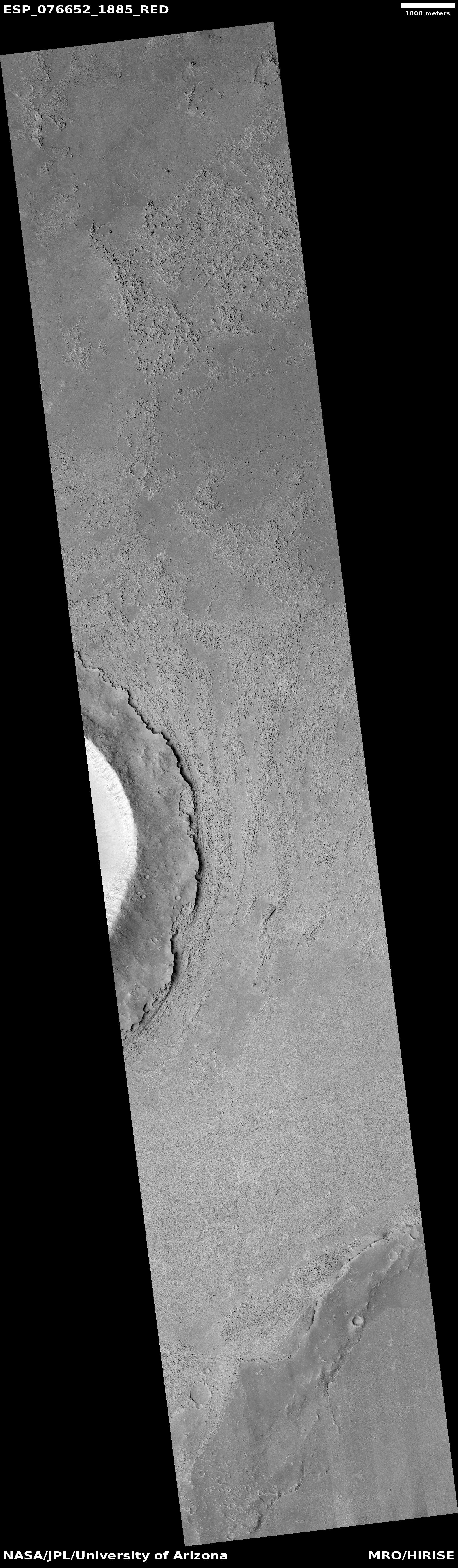
Cool image time! The photo to the right, rotated, cropped, reduced to post here, was taken on December 3, 2022 by the high resolution camera on Mars Reconnaissance Orbiter (MRO).

The title given to this image by the MRO science team is “Upstream Edge of Crater in Athabasca Valles.” The crater itself is a pedestal crater, uplifted from the surrounding terrain because it was more resistant to erosion.

The material to the east of the crater’s rim definitely appears to have flow characteristics, but is it wet mud, glacial ice, or lava?

To figure this out we need as always some context. The latitude, 8 degrees north, immediately eliminates mud or glacial material. This location is in the dry equatorial regions of Mars, where no near surface ice has yet been found. Thus, the flow features are likely hardened lava.

What direction however was the flow? Was it flowing to the north, widening as it moved past the pedestal crater? Or was it to the south, narrowing as it pushed past that crater? To answer this question we need to widen our view.
» Read more

0 comments

Machete Mesa on Mars

Machete Mesa on Mars
Click for full image.

Cool image time! The picture to the right, cropped to post here, was taken on November 30, 2022 by the high resolution camera on Mars Reconnaissance Orbiter (MRO). It shows a variety of ridges in a region of Mars called Arabia Terra, which is also the largest transition zone between the Martian southern cratered highlands and the northern lowland plains.

While this picture illustrates some nice geological facts about Mars (see below), I post it simply because of the dramatic sharpness of the ridge on top of the mesa, which I guess is several hundred feet high, but only a few feet across, at most, at its peak. A hike along this ridgeline would be a truly thrilling experience, one that the future human settlers on Mars will almost certainly find irresistible. Put this location on your planned tourist maps of Mars. It will likely be an oft-visited site.
» Read more

2 comments

Curiosity climbs onto the Marker Band

Panorama as of January 17, 2023
Click for full image.

Overview map
Click for interactive map.

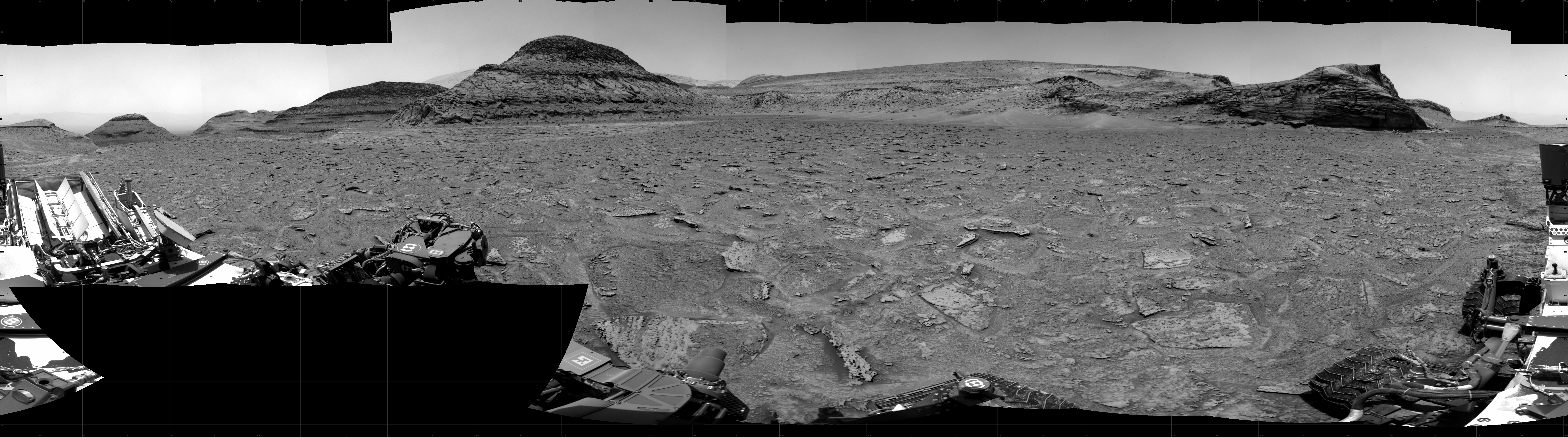
Curiosity’s exploration of the foothills of Mount Sharp continues. The panorama above, cropped, reduced, and annotated to post here, was taken on January 17, 2023 by the rover’s right navigation camera. It looks forward across the flat marker band terrain that the rover has been studying for the past few weeks.

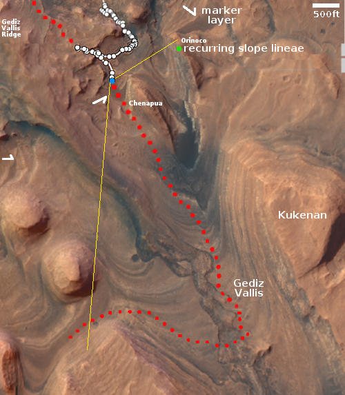
From orbit, this marker band appears very smooth and flat, and is found in many places on the flanks of Mount Sharp, always at about the same elevation. The arrows in the overview map to the right mark several places near Curiosity where the band is evident. The blue dot marks Curiosity’s present location, the red dotted line its planned route, and the yellow lines indicate the approximate area covered by the panorama above. The distance across the marker band to the uphill slope is about 500 feet.

Now that Curiosity is on the marker band, it no longer looks smooth. Instead, it is a flat plain of many uneven paving stones interspersed with dust. While not as rough as the Greenheugh Pediment, which Curiosity had to retreat from because it was too hard on the rover’s wheels, the marker band is hardly the smooth soft terrain implied by the orbital images.

These paving stones have also proven difficult to drill into, with Curiosity’s drill already failing twice previously because the rock was too hard. That hardness should not be a surprise, however, as this layer’s flatness in many places shows its resistance to erosion.

As it crosses this wide section of the marker band the science team will obviously be looking for more candidate drill sites. Sooner or later one should work.

1 comment

The sea of dunes surrounding the Martian north pole

The sea of dunes surrounding the Martian north pole
Click for full image.

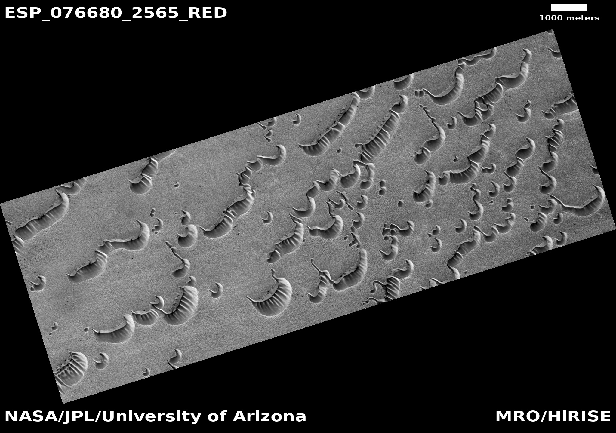
Cool image time! The photo to the right, rotated, cropped, and reduced to post here, was taken on December 5, 2022 by the high resolution camera on Mars Reconnaissance Orbiter (MRO). It shows a collection of wormlike dunes located in the giant sea of dunes that surrounds the Martian north pole ice cap.

North is to the top. The season when this picture was taken was northern winter. The Sun is barely above the horizon, only 8 degrees high, and shining from the southeast. Because it is winter it is also dust season, making the atmosphere hazy and thus making the light soft. No distinct shadows, except that the sides of the dunes facing away from the Sun are darkly shadowed.

The consistent orientation of the dunes suggests that the prevailing winds blow from the northeast to create the steep-sided alcoves. The wind however might not be the only factor to form these dunes.
» Read more

1 comment

A collapse on Mars

A collapse on Mars
Click for full image.

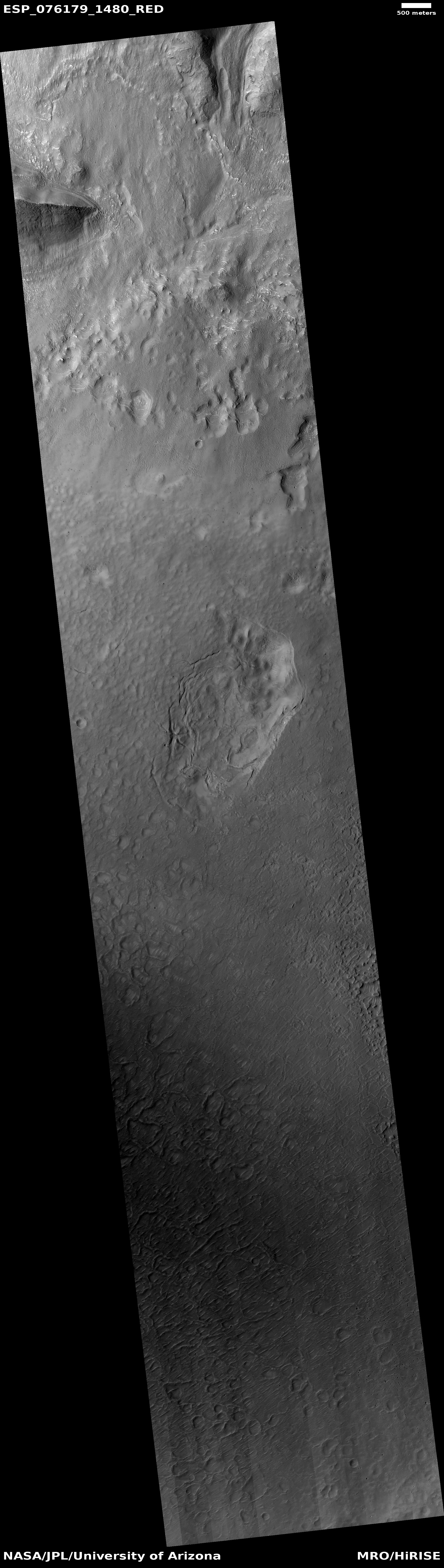
The photo to the right, cropped, reduced, and enhanced to post here, was taken on October 27, 2022 by the high resolution camera on Mars Reconnaissance Orbiter (MRO). The full photo was simply labeled as a “collapse feature”, and because it contained a few other sinks to the north beyond the top edge of this cropped picture, it is unclear if the scientists were referring to this sink in particular.

This sink is the most interesting however, because it really looks like something had sucked material out from below, causing the surface crust to fall downward, intact except for some cracks along the perimeter of the collapse.

The overview map below as always provides some context that might explain what we are seeing.
» Read more

0 comments

The dry and dusty equatorial regions of Mars

The dry cratered highlands of Mars
Click for full image.

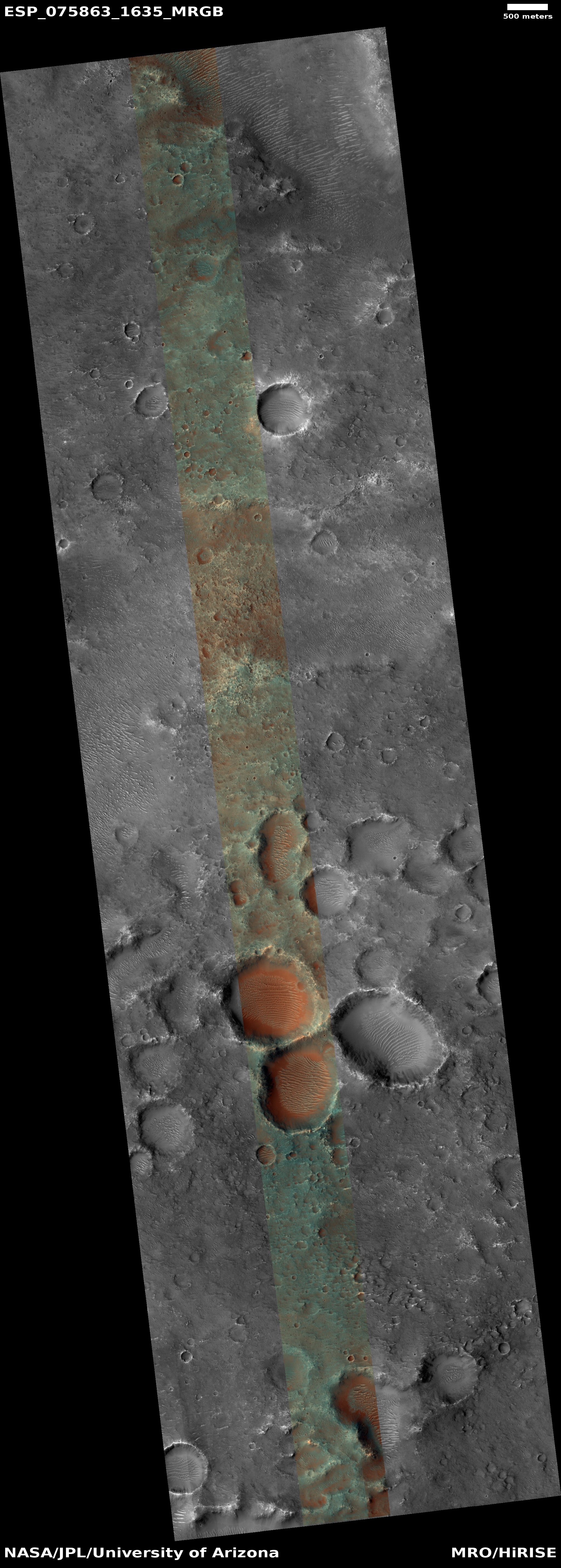
Cool image time! The photo to the right, rotated, cropped, and reduced to post here, was taken on October 2, 2022 by the high resolution camera on Mars Reconnaissance Orbiter (MRO). It shows a cluster of craters filled with ripple dunes.

The color strip tells us something [pdf] about the surface materials here. The reddish-orange in the craters is thought to be dust. The greenish terrain above the craters is likely coarse rock or bedrock, covered with a veneer of dust.

There is no ice here, just dust that over time has become trapped in the craters and cannot escape. And though there is also dust on the surrounding terrain, there is not that much. The craters themselves are likely very ancient, based on their shape and the eroded condition of their rims.

» Read more

1 comment

Drainage out of a Martian crater

Drainage out of a Martian crater
Click for full image.

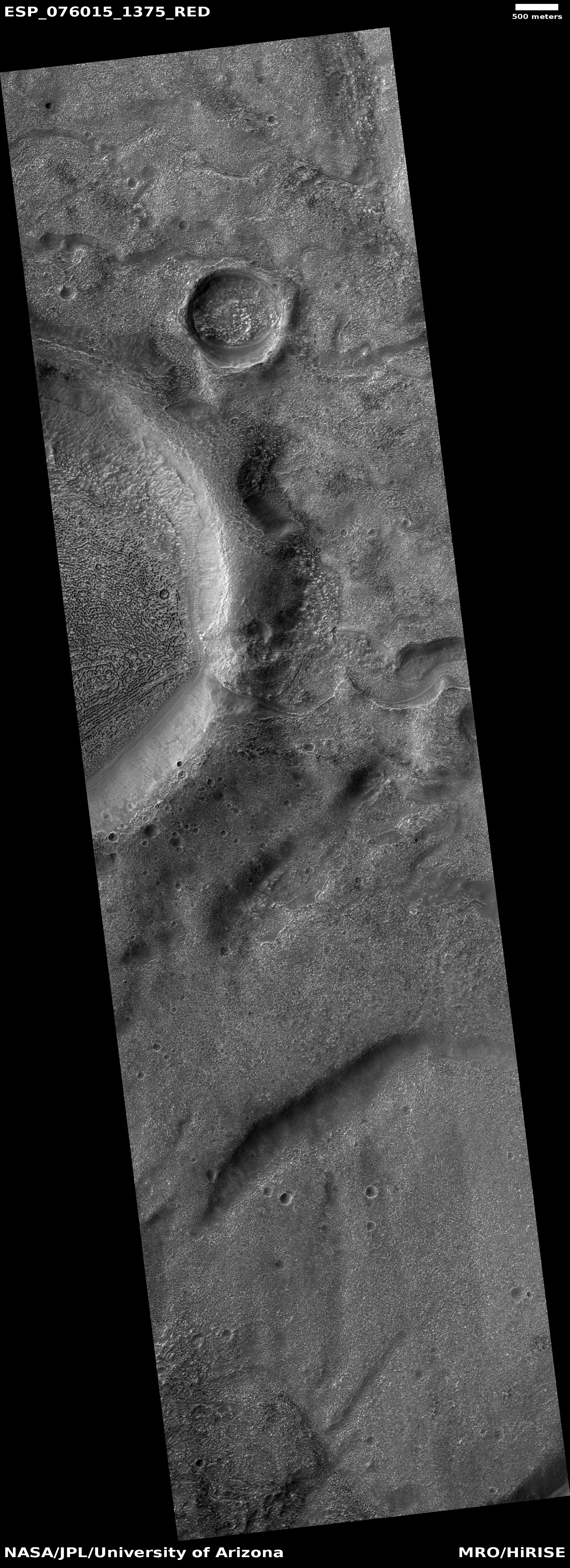
Today’s cool image to the right, rotated, cropped, reduced, and sharpened to post here, not only gives us another example of a Martian geological feature that is unique to Mars and whose origins are not yet understood, it also shows what appears to have once been a lake-filled crater that over time drained out to the east through a gap.

This picture was taken on October 14, 2022 by the high resolution camera on Mars Reconnaissance Orbiter (MRO). The inexplicable geology is called brain terrain, and it fills the floor of the crater on the picture’s left side. The rim shows a gap, from which a meandering channel continues downhill to the east. The lake inside the crater might not have been liquid water, but ice. The channel might not have been formed by flowing water, but by a glacial flow downhill.

What makes this glacial evidence especially interesting is that it is located in a very different part of the Martian mid-latitudes.
» Read more

1 comment

China releases first update on status of Yutu-2 since September

Yutu-2's travel path through December 2022
Click for full image. The red flag marks the landing site.

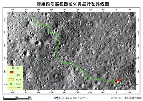
China today released its first update since September on the status of its Yutu-2 rover on the far side of the Moon. The map on the right shows the rover’s travels through December 2022.

As of today the rover has traveled 4,774 feet total, and about 450 feet since September. The goal, as stated in April 2021, was to “move northwest toward the basalt distribution area located about 1.2 km away.” At the time the rover was only averaging about 100 feet travel per lunar day. According to these numbers, it picked up the pace in the past year, though it is unclear whether it has reached that goal.

1 comment

The soft icy Martian northern lowland plains

The soft icy Martian northern lowland plains
Click for full image.

In a cool image post last week, I noted that the near surface “ice sheets in the northern lowland plains are never … smooth, even if well protected.” The picture to the right, cropped, reduced, and sharpened to post here, provides an excellent example. It was taken on November 2, 2022 by the high resolution camera on Mars Reconnaissance Orbiter (MRO).

It is winter, and the sunlight is coming from the southwest, only 27 degrees above the horizon. The mound on the left is soft, while the depression on the upper right appears to have sand dune ripples sitting on top of a flat glacial mound. This depression may be an eroded crater (no upraised rim) or it could be a sink caused by the sublimation of the near surface ice.

Everywhere else the flat plains are stippled with small knobs.

The overview map below provides more context.
» Read more

0 comments
1 80 81 82 83 84 89