
The mountains of Mars
Click for full resolution. For original images go here and here.
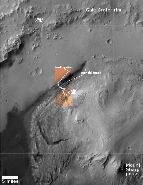
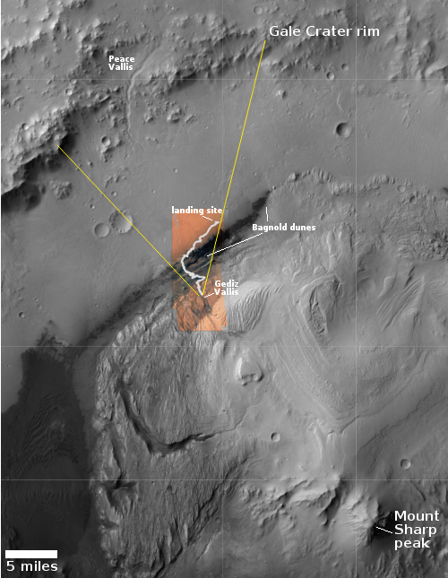
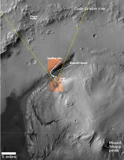
Click for interactive map.
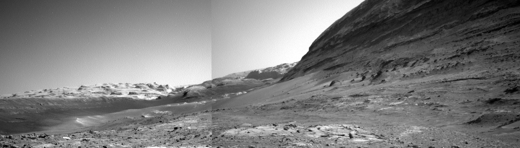
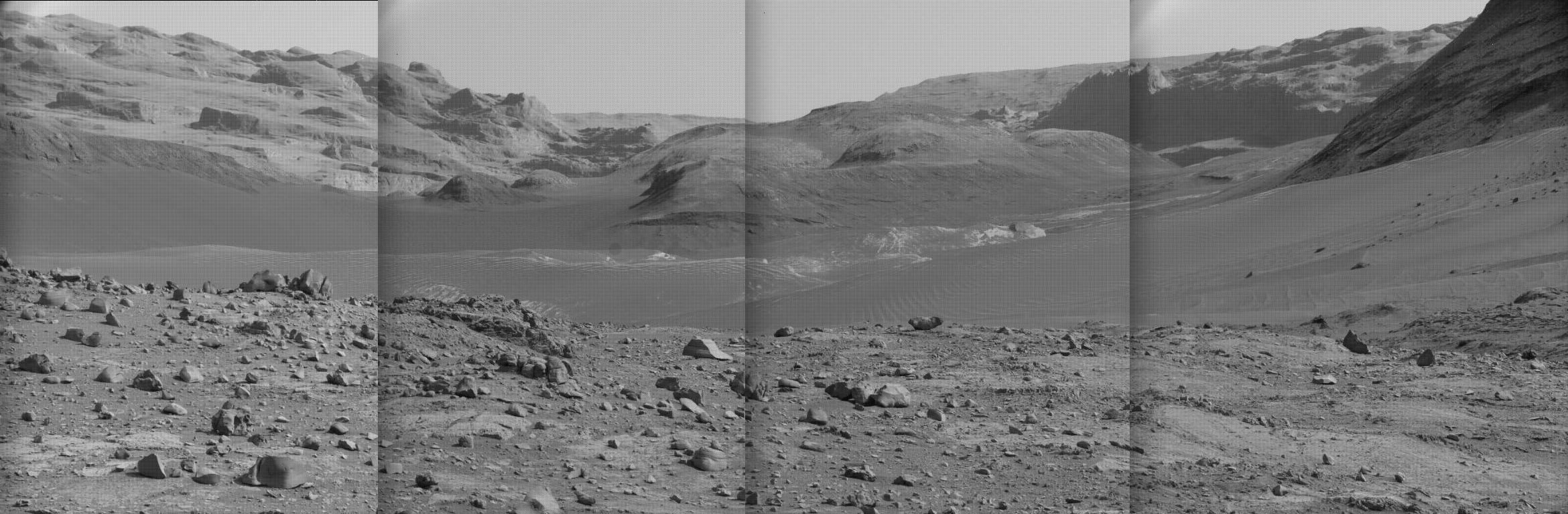
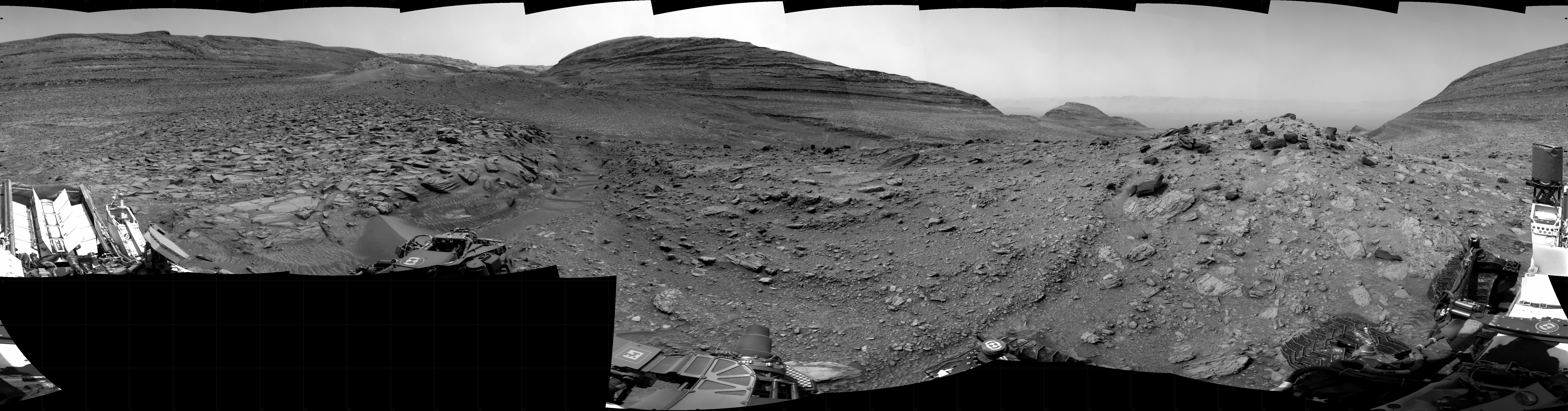
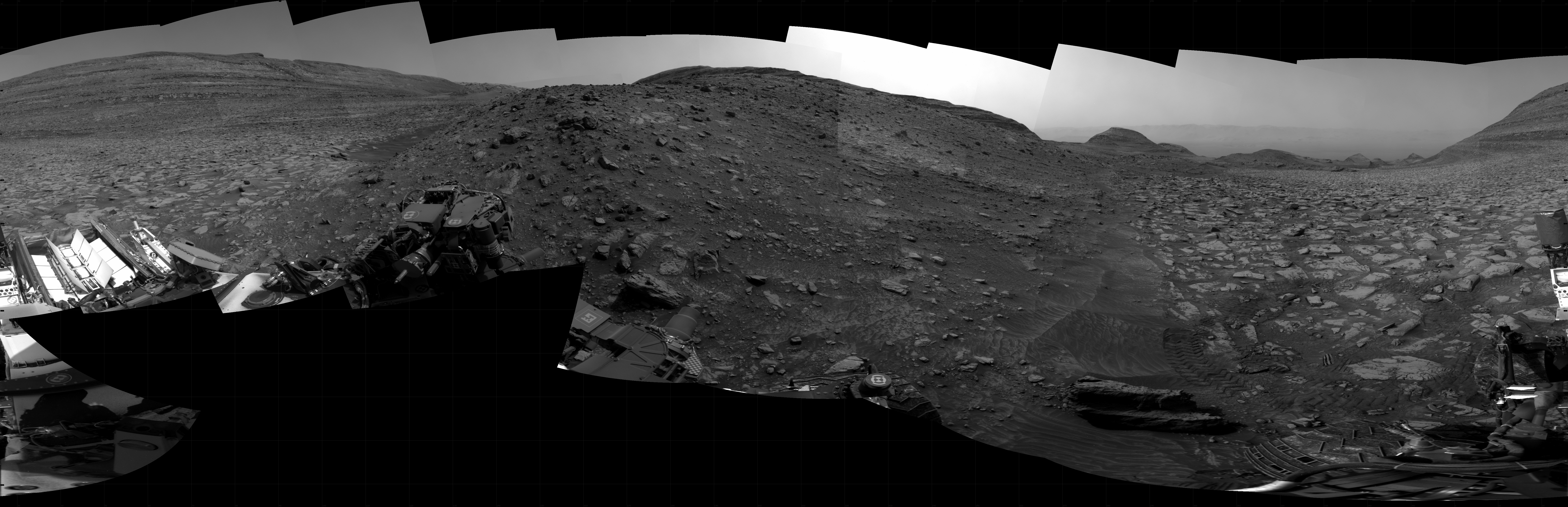
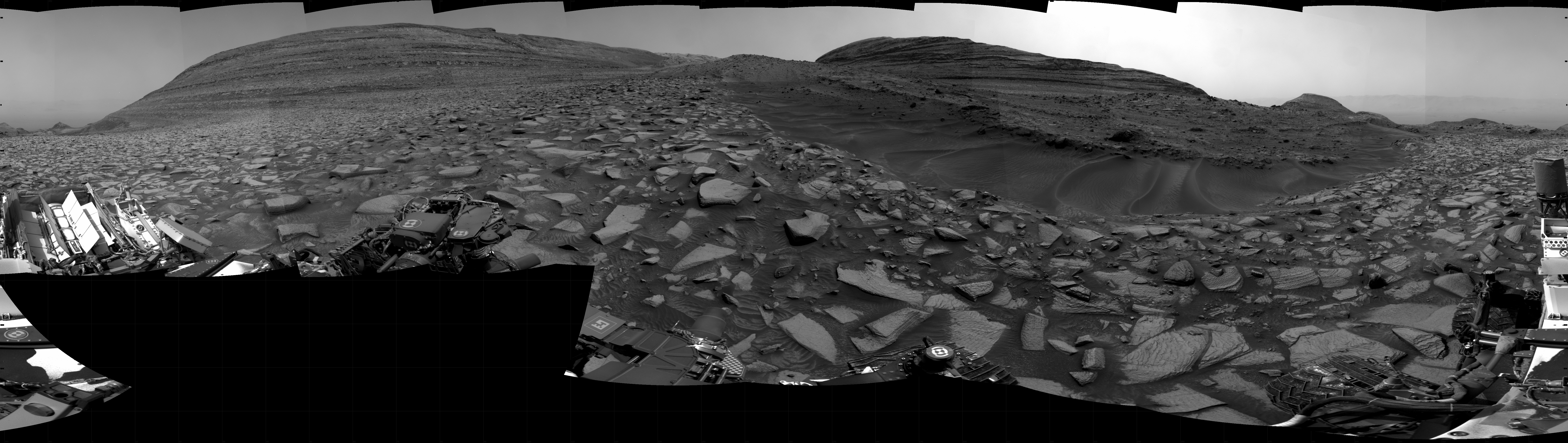
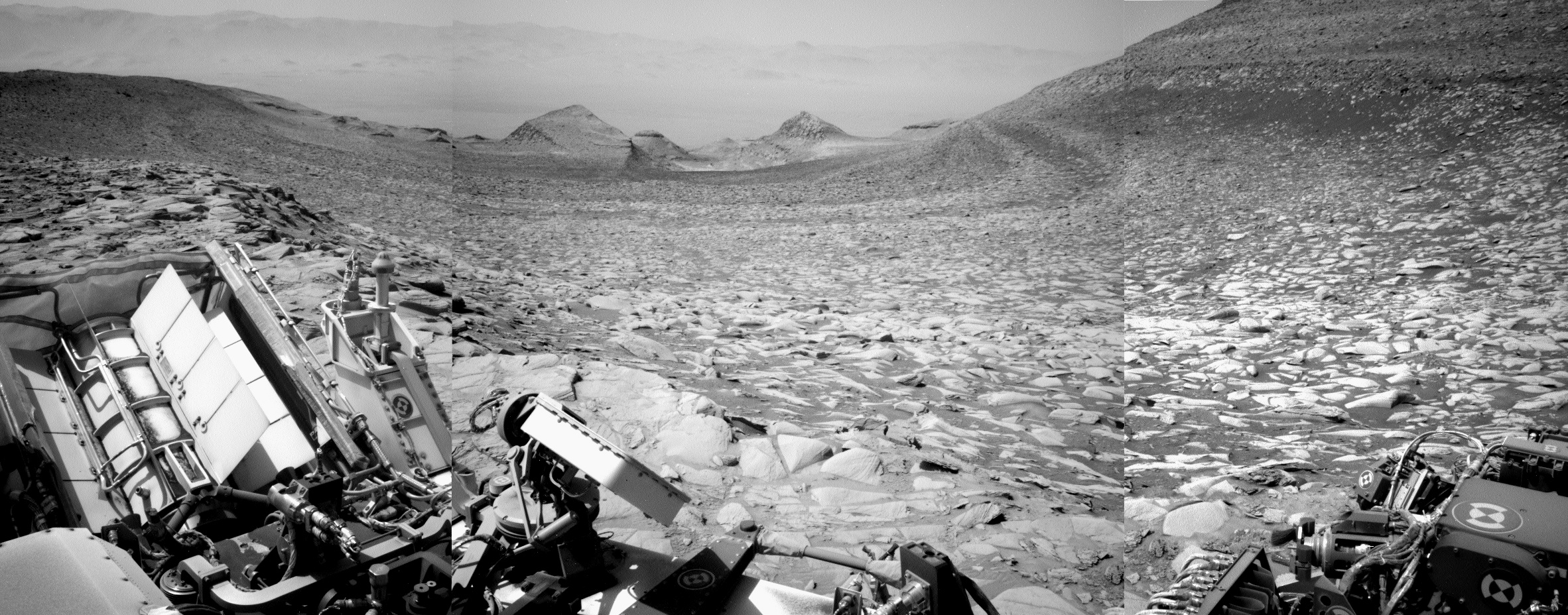
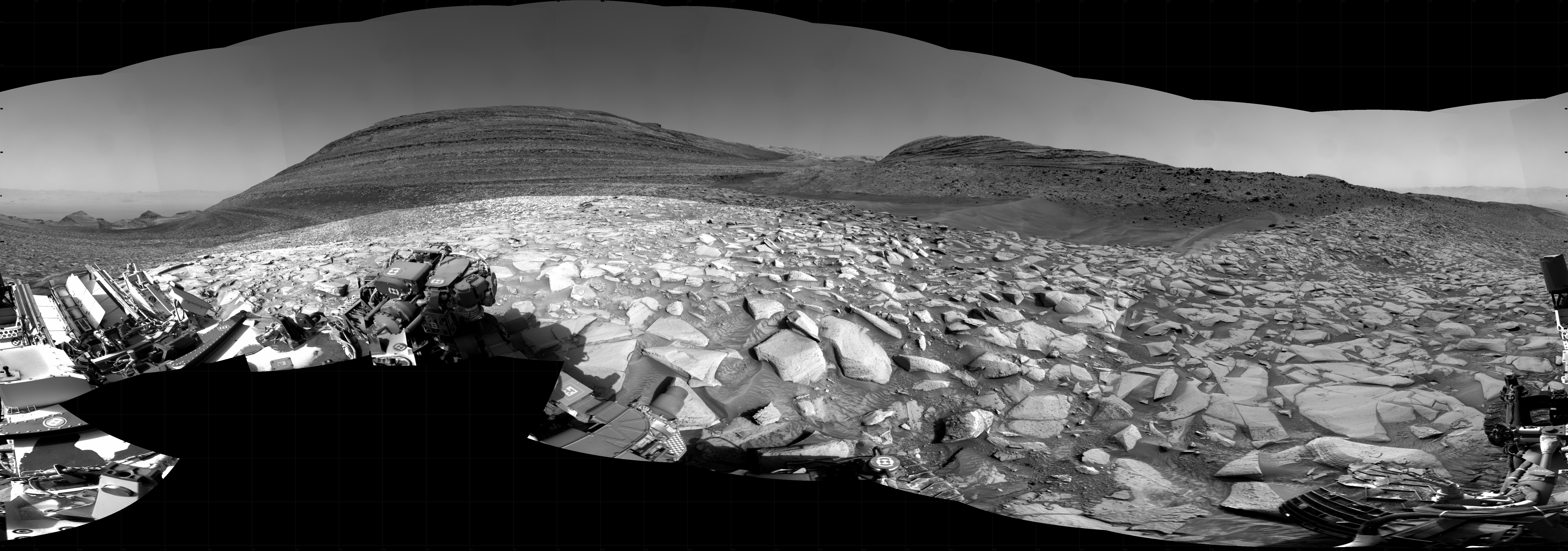
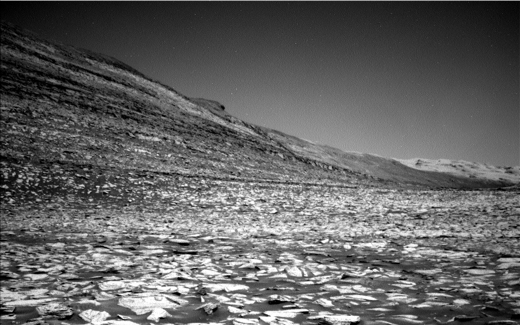
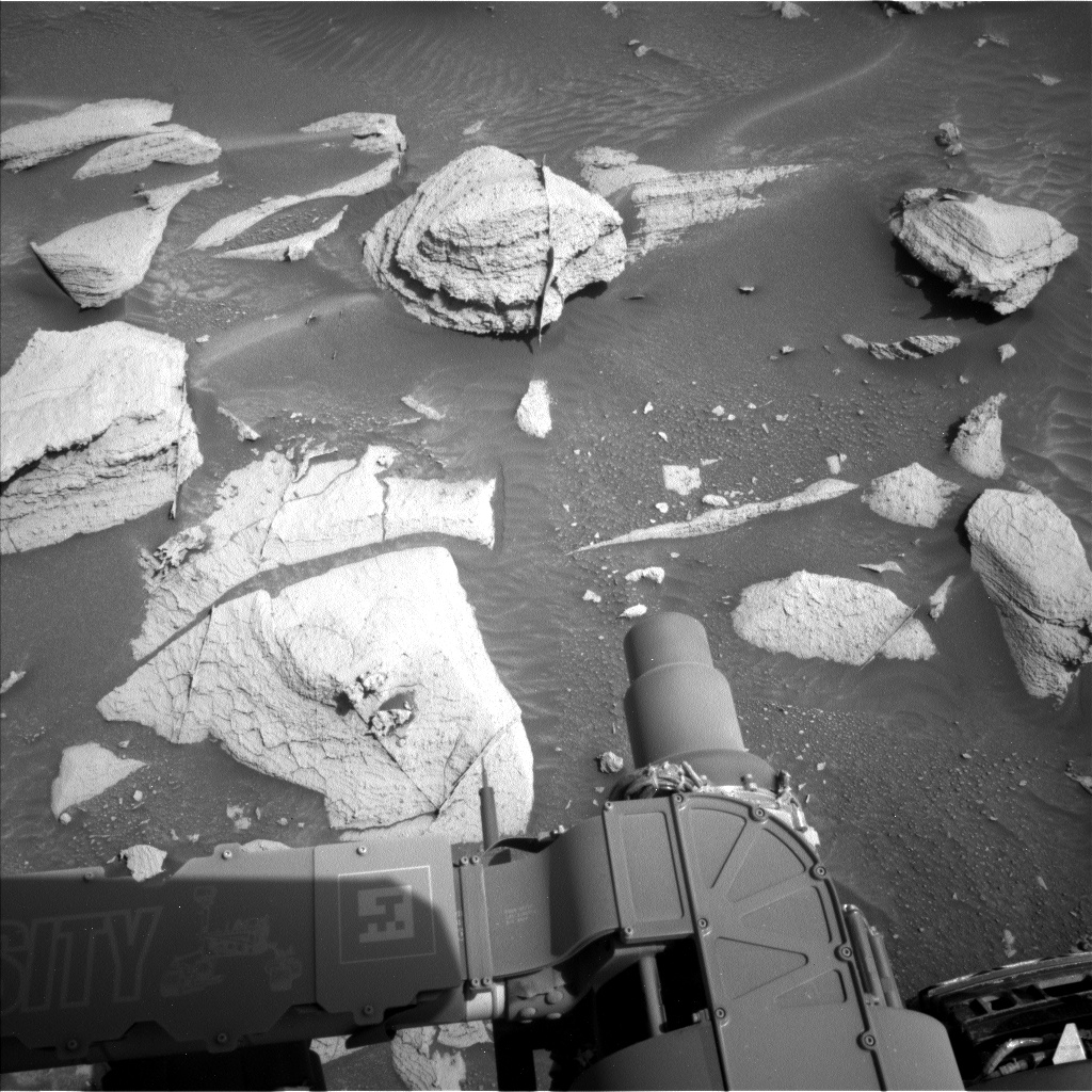
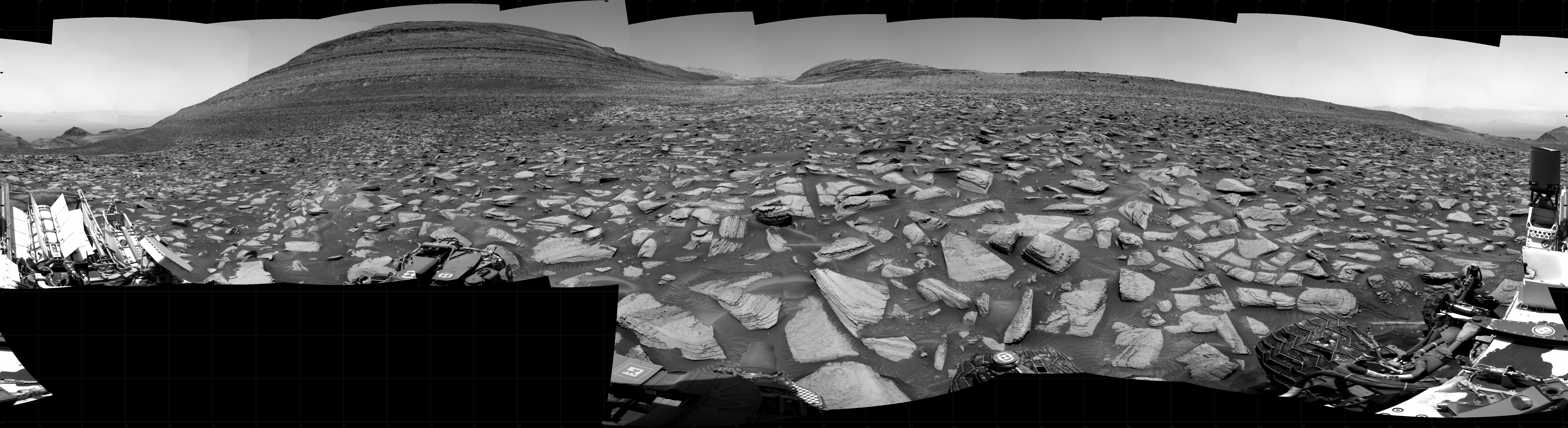
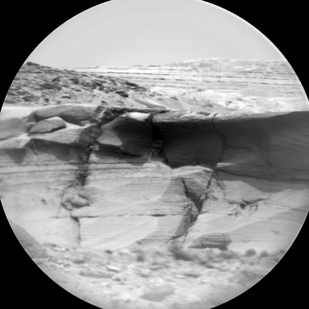
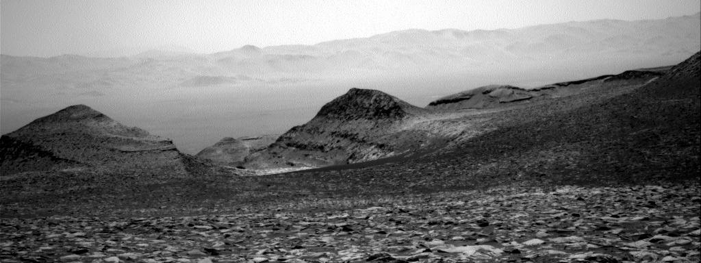
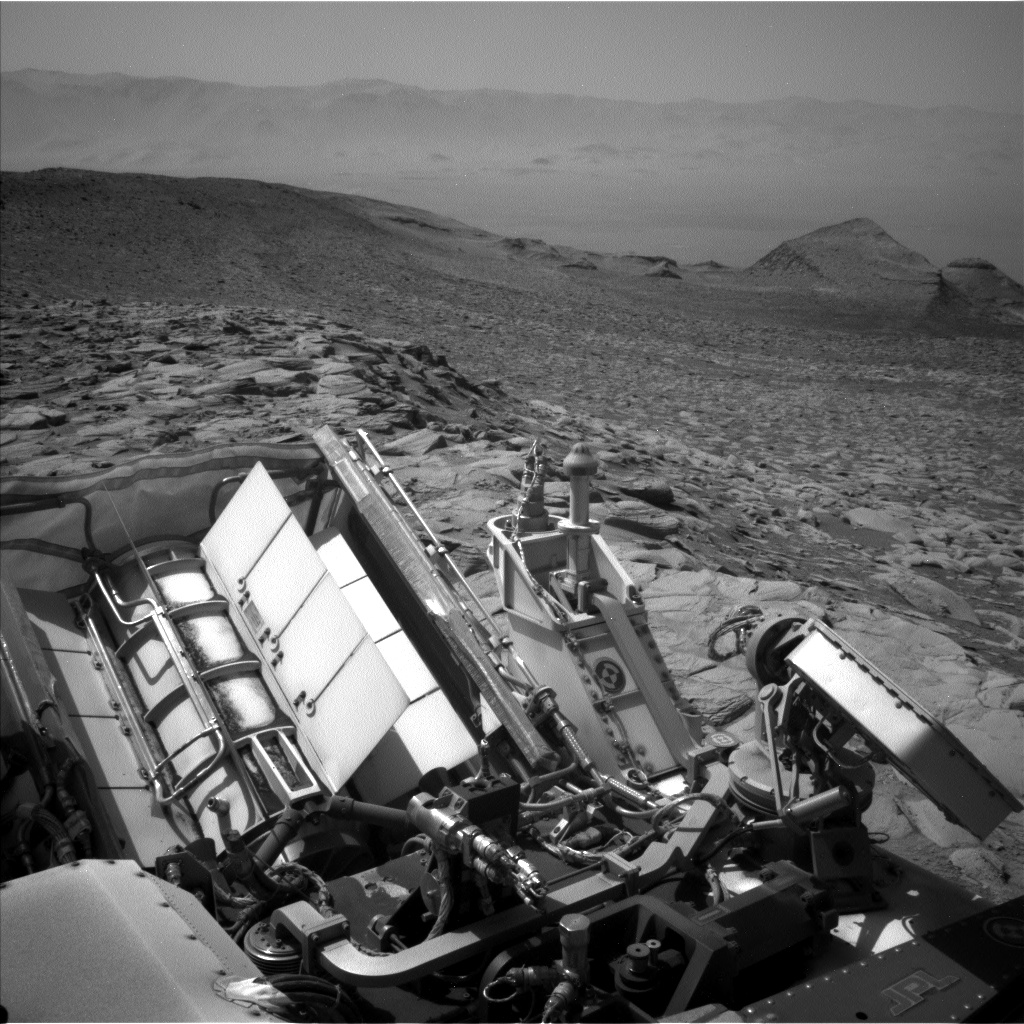
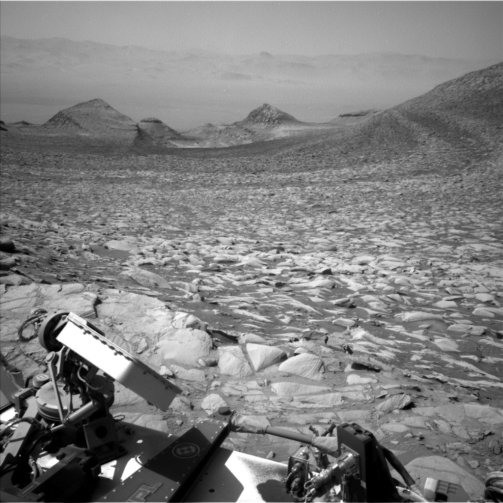
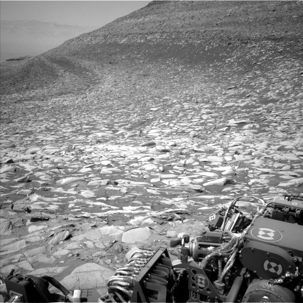
Cool image time! The panorama above, created from two left navigation camera photos taken by the Mars rover Curiosity on July 24, 2024 (here and here), looks south up the flanks of Mount Sharp as well as into the Gediz Vallis channel that the rover has been exploring for the past year or so.
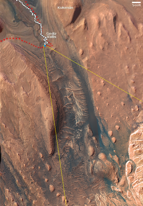
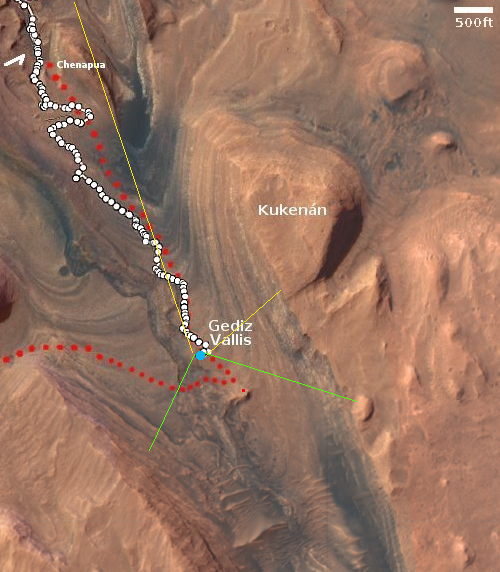
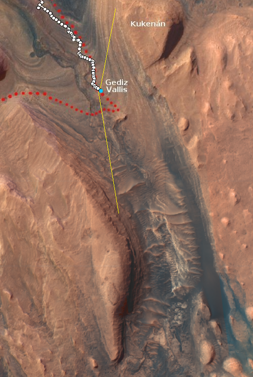
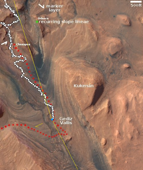
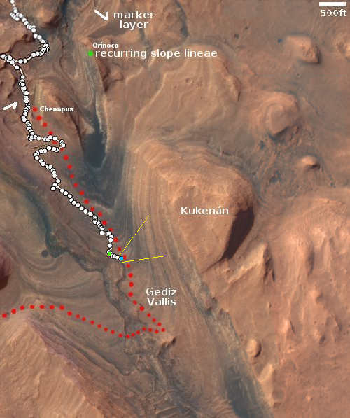
The overview map to the right provides us a wide view of Gale Crater and the rover’s entire journey there since it landed on Mars in 2012. The blue dot marks its present position. The yellow lines indicate the approximate view in the panorama above. The red line indicates the planned route, leaving Gediz Vallis to take a parallel canyon uphill to the west.
Curiosity during its dozen years on Mars has traveled just under 20 miles and climbed about 2,500 feet. The peak of Mount Sharp however is still about 26 miles away and about 16,000 feet higher.
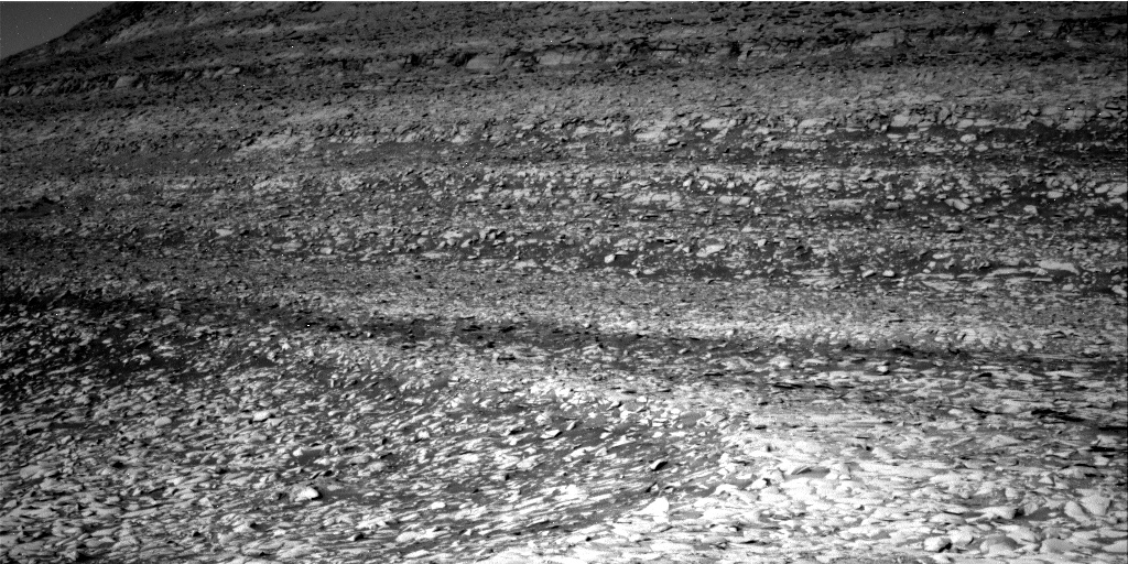
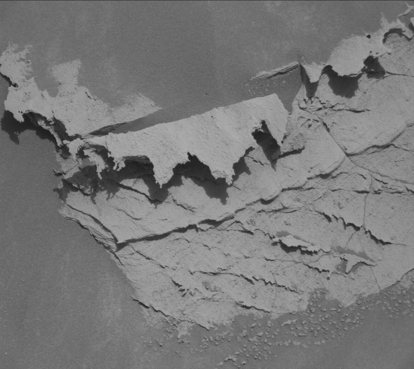
The rover is now at the very base of the sulfate-bearing unit, which is why last month it literally ran over some rocks that were its first detection of pure sulfur crystals on Mars. Once Curiosity reaches that sulfate-bearing unit it is likely going to be an extremely alien landscape, comprised of rock that is suffused everywhere with sulfur. Such landscapes are likely impossible on Earth due to its oxygen-rich atmosphere. The sulfur and oxygen would interact, forming different molecules.

