Scientists catch a big volcano eruption on Io

Scientists reviewing twenty year old data from the Galileo orbiter that studied Jupiter and its moons in the 1990s have identified the most intense volcanic eruption yet found on Io.

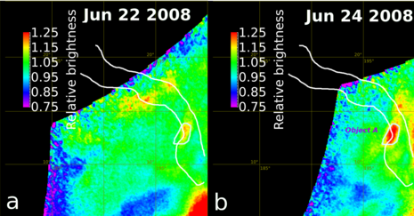
While looking through the NIMS temperature data, Davies and his colleagues spotted a brief but intense moment of high temperatures that cooled oddly quickly. This signal showed up as a spike in heat from a region in the southern hemisphere called Marduk Fluctus. First, the researchers saw a heat signal jump to 4–10 times higher than background, or relatively normal, levels. Then just a minute later, the signal dropped about 20%. Another minute later, the signal dropped another 75%. Twenty-three minutes later, the signal had plummeted to the equivalent of the background levels.

This signature resembled nothing Davies had seen before from Io. The lava flows and lava lakes are familiar: Their heat signals peter out slowly because as the surface of a lava flow cools, it creates a protective barrier of solid rock over a mushy, molten inside. Heat from magma underneath conducts through this newly formed crust and radiates from Io’s surface as it cools, which can take quite a long time.

This new heat signature, on the other hand, represents a process never before seen on Io, Davies said: something intense, powerful, and—most important—fast.

There’s only one likely explanation for what the instruments saw, explained Davies, whose volcanic expertise starts here on Earth. Large, violent eruptions like those seen at Stromboli are capable of spewing huge masses of tiny particles into the air, which cool quickly.

The article makes it sound like we’ve never seen this kind of eruption on Io before, which isn’t really true. Such eruptions have been imaged, but this is the first time that infrared data of their temperature spike was captured, thus confirming its nature.
0 comments

Exploring one of Mars’ giant volcanoes

Master index

For the past two weeks JPL’s image site has been releasing a string of images taken by Mars Odyssey of the smallest of Mars’ four giant volcanoes.

Pavonis Mons is one of the three aligned Tharsis Volcanoes. The four Tharsis volcanoes are Ascreaus Mons, Pavonis Mons, Arsia Mons, and Olympus Mars. All four are shield type volcanoes. Shield volcanoes are formed by lava flows originating near or at the summit, building up layers upon layers of lava. The Hawaiian islands on Earth are shield volcanoes. The three aligned volcanoes are located along a topographic rise in the Tharsis region. Along this trend there are increased tectonic features and additional lava flows. Pavonis Mons is the smallest of the four volcanoes, rising 14km above the mean Mars surface level with a width of 375km. It has a complex summit caldera, with the smallest caldera deeper than the larger caldera. Like most shield volcanoes the surface has a low profile. In the case of Pavonis Mons the average slope is only 4 degrees.

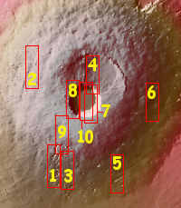
The image on the right is the context image, annotated by me to show where all these images were taken. The images can accessed individually below.

Each of these images has some interesting geological features, such as collapses, lava tubes, faults, and flow features. Meanwhile, the central calderas are remarkable smooth, with only a few craters indicating their relatively young age.

The most fascinating geological fact gleaned from these images is that they reveal a larger geological trend that runs through all of the three aligned giant volcanoes to the east of Olympus Mons.

The linear and sinuous features mark the locations of lava tubes and graben that occur on both sides of the volcano along a regional trend that passes thru Pavonis Mons, Ascreaus Mons (to the north), and Arsia Mons (to the south).

This trend probably also indicates the fundamental geology that caused all three volcanoes to align as they have.

Arsia Mons is of particular interest in that water clouds form periodically above its western slope, where there is also evidence of past glaciation. Scientists strongly suspect that there is a lot of water ice trapped underground here, possibly inside the many lava tubes that meander down its slopes. These facts also suggest that this might be one of the first places humans go to live, when they finally go to live on Mars.

27 comments

A river canyon on Mars

A river on Mars

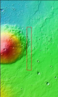
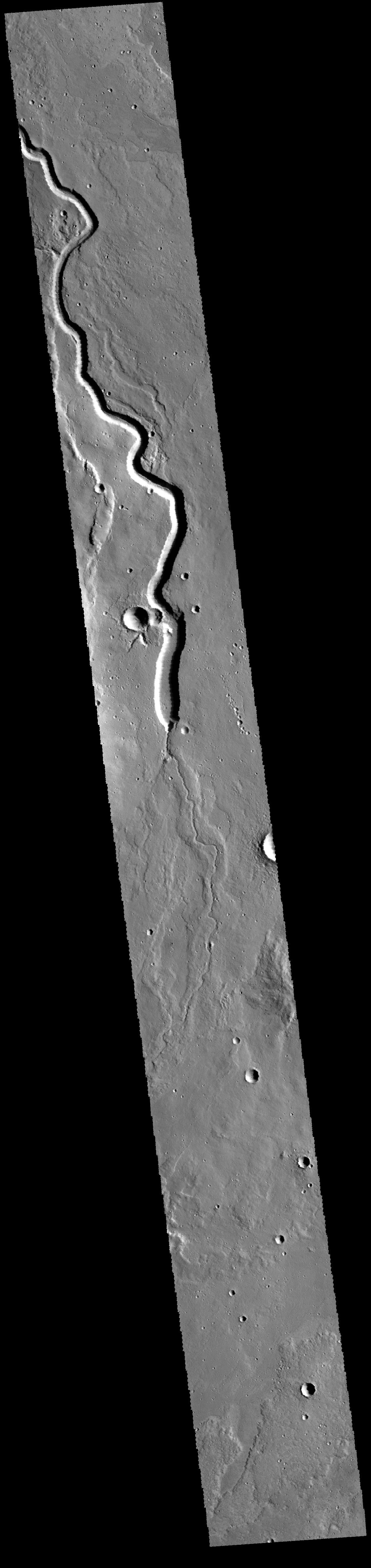
Cool image time! The image on the right, reduced in resolution significantly to show here, was taken by the Themis camera on Mars Odyssey, and shows an unnamed canyon on Mars. Be sure to click on the image to see the full resolution version.

This canyon of course no longer has anything flowing in it. Moreover, it is not clear whether this was formed by water or lava. Unfortunately, the image is part of a series of “Art images” from Mars Odyssey, where they pick an image and suggest it looks like something else. In this case, they are claiming this looks like a “snake, slithering down the image.” Cute, but not very helpful. And unfortunately, they don’t add any further details at all about the image or its location. The context image suggests this canyon is next to a volcano.

After doing further research at the Themis image site, I was able to locate this image on Mars (using latitude 32.0515 and longitude 152.236 given at the link) and look at the images surrounding this one. Further research identified the volcano as Hecates Tholus in the Elyesium Plantia region to the west of Mars’s giant volcanoes.

Looking at all the nearby Mars Odyssey images, it appears that there are a lot of flows like this in this area, and all of them appear to be lava flows, with this one being the largest. A close look at the area just to the south of where the deep canyon opens out shows that the small surface flow draining into the canyon also appears to sit on much larger surface flows (at least two) that left the surface higher than the surrounding terrain.

Elyesium Plantia itself is a plateau, somewhat close to the border between Mars’s southern highlands and the northern plains where some scientists think an ocean might have once existed. Thus, it makes sense that the canyon drains north, as it is following the dip down to those northern low plains.

1 comment

Active volcano on Venus?

The uncertainty of science: A new analysis of past data from a variety of Venus orbiters suggests that at least one volcano is active there.

The review of old data from the Magellan and Venus Express orbiters suggests that some lava flows on the volcano’s slopes are fresh, though how fresh remains unknown. However, computer models and the detection of excess heat by Venus Express on the mountain’s eastern slopes adds weight to the theory that the volcano is spewing out lava.

0 comments

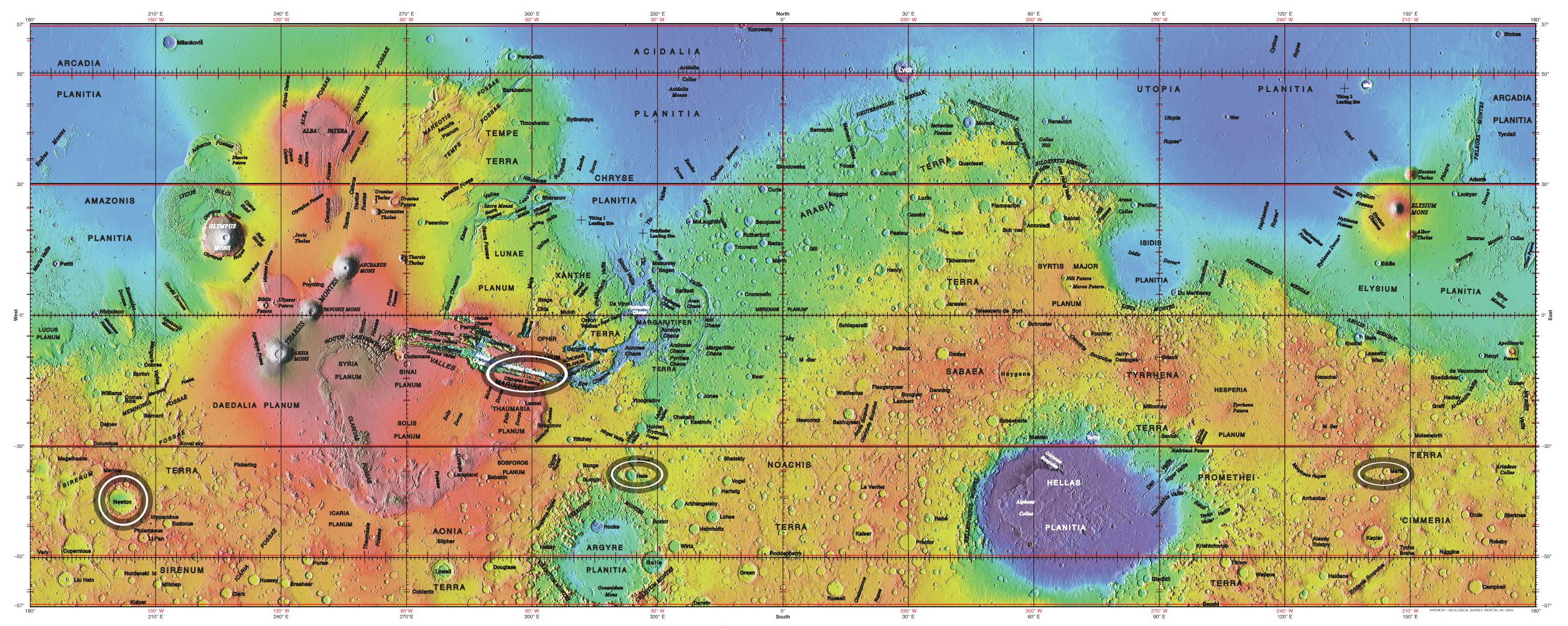
An ancient volcanic mountain chain on Mars

Using data from Mars Odyssey scientists have determined that a mountain chain on Mars was likely created as a chain of volcanoes.

They analyzed the geography and mineralogy of this area they termed Greater Thaumasia, which is about the size of North America. They also studied the chemistry of this area based on Gamma Ray Spectrometer data collected by the Mars Odyssey Orbiter, which was launched in 2001. What they found was the mountain ridge that outlines Greater Thaumasia was most likely created by a chain of volcanoes.

Their research also looked to see if water influenced the mountains’ formation and found no evidence for it. The mountain chain itself is south of the giant Valles Marineris canyons and southeast of the Tharsis region where Mars’ biggest four volcanoes are located.

0 comments

Martian gullies not formed by water flow

The uncertainty of science: Spectroscopy of many of the gullies on Mars strongly suggests that water had nothing to do with their formation, even though these gullies resemble closely similar gullies on Earth that were carved by flowing water..

Color coding in light blue corresponds to surface composition of unaltered mafic material, of volcanic origin. Mafic material from the crater rim is carved and transported downslope along the gully channels. No hydrated minerals are observed within the gullies, in the data from CRISM, indicating limited interaction or no interaction of the mafic material with liquid water. These findings and related observations at about 100 other gully sites on Mars suggest that a mechanism not requiring liquid water may be responsible for carving these gullies on Mars. (Gullies on Mars are a different type of feature than seasonal dark streaks called recurring slope lineae or RSL; water in the form of hydrated salt has been identified at RSL sites.) [emphasis mine]

In other words, these gullies were formed by flowing lava, not water. Considering Mars’s lower gravity, one third that of Earth’s, we should not be surprised if lava is capable of doing things there that it is not generally capable of doing on Earth. In fact, we should remind ourselves constantly that Mars is an alien planet, and that conditions there are different enough to make any predictions based on our knowledge of Earth very unreliable.

More details here.

5 comments

Dormant volcano near Rome reawakens

A volcano near Rome that last erupted 36,000 years ago is now showing signs of re-awakening.

Scientists previously assumed Colli Albani, a 15-kilometer (9-mile) semicircle of hills outside Rome, was an extinct volcano since there was no record of it having erupted in human history. But in recent years, scientists have observed new steam vents, earthquakes and a rise in ground level in the hills and surrounding area. These observations, along with new evidence of past eruptions and satellite data, indicate Colli Albani is starting a new eruptive cycle and could potentially erupt in 1,000 years from now, according to a new study published in Geophysical Research Letters, a journal of the American Geophysical Union.

2 comments

Increased earthquake activity at Mount St. Helens

Though the increase is not large enough to indicate the likelihood of another eruption, scientists have noted that for the past eight weeks the earthquake rates under Mount St. Helens has been increasing.

Over the last 8 weeks, there have been over 130 earthquakes formally located by the Pacific Northwest Seismic Network and many more earthquakes too small to be located. The earthquakes have low magnitudes of 0.5 or less; the largest a magnitude 1.3. Earthquake rates have been steadily increasing since March, reaching nearly 40 located earthquakes per week. These earthquakes are too small to be felt at the surface.

Once again, these quakes do yet not signal another eruption. They are more likely signs of the mountain’s continuing but long and slow adjustment back to silence after the 1980 eruption. Nonetheless, they bear watching, as a volcano will do what a volcano wants to do.

1 comment

Ice and volcanoes on ancient Mars?

New data of past volcanic activity on Mars suggest that the red planet was once covered by at least one extensive ice sheet.

There is a great deal of uncertainty in this conclusion, however. They have found one example with the right geology to suggest past ice sheets under which volcanoes erupted. Translating this into an extensive ice sheet requires many assumptions that might not prove true with further research.

1 comment

Active lava flows found on Venus

volcanoes on Venus

Cool image time! Using archival data from Venus Express, scientists have identified several spots on Venus where it appears there are active lava flows.

Using a near-infrared channel of the spacecraft’s Venus Monitoring Camera (VMC) to map thermal emission from the surface through a transparent spectral window in the planet’s atmosphere, an international team of planetary scientists has spotted localised changes in surface brightness between images taken only a few days apart. “We have now seen several events where a spot on the surface suddenly gets much hotter, and then cools down again,” says Eugene Shalygin from the Max Planck Institute for Solar System Research (MPS) in Germany, and lead author of the paper reporting the results in Geophysical Research Letters this month. “These four ‘hotspots’ are located in what are known from radar imagery to be tectonic rift zones, but this is the first time we have detected that they are hot and changing in temperature from day to day. It is the most tantalising evidence yet for active volcanism.”

The hotspots are found along the Ganiki Chasma rift zone close to the volcanoes Ozza Mons and Maat Mons. Rift zones are results of fracturing of the surface, which is often associated with upwelling of magma below the crust. This process can bring hot material to the surface, where it may be released through fractures as a lava flow.

There have been hints of volcanic activity on Venus since Pioneer Venus Orbiter first circled the planet from 1978 to 1992. This appears to be the first solid evidence of it.

0 comments

Seismic data of Yellowstone has found a bigger second magma chamber

Geologists have mapped the existence of a second deeper and larger magma chamber under Yellowstone National Park.

Scientists had already known about a plume, which brings molten rock up from deep in the mantle to a region about 60 kilometers below the surface. And they had also imaged a shallow magma chamber about 10 kilometers below the surface, containing about 10,000 cubic kilometers of molten material. But now they have found a deeper one, 4.5 times larger, that sits between 20 and 50 kilometers below the surface. “They found the missing link between the mantle plume and the shallow magma chamber,” says Peter Cervelli, a geophysicist in Anchorage, Alaska, who works at the U.S. Geological Survey’s Yellowstone Volcano Observatory.

The discovery does not, on its own, increase the chance of an eruption, which is driven by an emptying of the shallow chamber. The last major eruption was 640,000 years ago, and today the threat of earthquakes is far more likely. But the deeper chamber does mean that the shallow chamber can be replenished again and again. “Knowing that you have this additional reservoir tells you you could have a much bigger volume erupt over a relatively short time scale,” says co-author Victor Tsai, a geophysicist at the California Institute of Technology in Pasadena. The discovery, reported online today in Science, also confirms a long-suspected model for some volcanoes, in which a deep chamber of melted basalt, a dense iron- and magnesium-rich rock, feeds a shallower chamber containing a melted, lighter silicon-rich rock called a rhyolite.

0 comments

New data says volcanoes, not asteroids, killed dinosaurs

The uncertainty of science: A careful updating of the geological timeline has strengthened the link between the dinosaur extinction 66 million years ago and a major volcanic event at that time.

A primeval volcanic range in western India known as the Deccan Traps, which were once three times larger than France, began its main phase of eruptions roughly 250,000 years before the Cretaceous-Paleogene, or K-Pg, extinction event, the researchers report in the journal Science. For the next 750,000 years, the volcanoes unleashed more than 1.1 million cubic kilometers (264,000 cubic miles) of lava. The main phase of eruptions comprised about 80-90 percent of the total volume of the Deccan Traps’ lava flow and followed a substantially weaker first phase that began about 1 million years earlier.

The results support the idea that the Deccan Traps played a role in the K-Pg extinction, and challenge the dominant theory that a meteorite impact near present-day Chicxulub, Mexico, was the sole cause of the extinction. The researchers suggest that the Deccan Traps eruptions and the Chicxulub impact need to be considered together when studying and modeling the K-Pg extinction event.

The general public might not know it, but the only ones in the field of dinosaur research that have said the asteroid was the sole cause of the extinction have been planetary scientists.

5 comments

Mapping the inside of Mt St. Helens

A new array of seismometers, combined with a series of planned explosions, will be used to map the interior of the Mt. St. Helens volcano to a depth of eighty kilometers or fifty miles.

To get the job done, starting next week roughly 65 people will fan out across the mountain to deploy 3,500 small seismometers along roads and back-country trails. They will drill 24 holes some 25 metres deep, drop in industrial explosives used for quarrying, and refill the holes (see ‘Under the dome’). The plan is to detonate the explosives in separate shots over four nights. Each blast will shake the ground as much as a magnitude-2 earthquake.

Results from the active blasts will be combined with the passive seismic part of the experiment, which is already under way: 70 larger seis­mometers around the mountain are measuring how long waves from natural earthquakes take to travel through the ground. Their data can be used to probe as far as 80 kilo­metres down, says Vidale.

3 comments

Scientists think they have detected active volcanoes on Venus.

Scientists think they have detected active volcanoes on Venus.

We should hear more about this story in the next couple of days, after the scientists give their presentation at a science conference today. Note too that this result would only confirm other data, such as the fluctuating levels of sulfur in Venus’s atmosphere, that have suggested active volcanoes hidden under that planet’s thick cloud cover.

0 comments

The geological history of Venus: What’s known, not known, and unknown.

The geological history of Venus: What’s known, not known, and unknown.

This is a very clearly written overview by James Head, one of the world’s preeminent planetary geologists, of what has been learned about the geology of Earth’s sister planet, the planet of a million volcanoes. Key quote:

Many features on Venus (folded mountain belts, rift zones, tesserae) were like Earth, but there were few signs of Earth-like plate tectonics, so that Venus seemed to have a single lithospheric plate that was losing heat conductively and advectively. But the cratering record presented a conundrum. First, the average age of the surface was <20% of the total age of the planet, and second, the average was not a combination of very old and very young surfaces, such as Earth’s continents and ocean basins. Third, the lack of variability in crater density, and of a spectrum of crater degradation, meant that all geological units might be about the same age. This implied that the observed surface of Venus must have been produced in the past hundreds of millions of years, possibly catastrophically, with very little volcanic or tectonic resurfacing since then! Suddenly, Venus was not like Earth, nor like the Moon, Mars, or Mercury.

Some scientists even believe that Venus was essentially resurfaced in a massive volcanic event about a half billion years ago. Others disagree. Meanwhile, the European probe Venus Express has gotten hints that volcanic activity is still going on.

As Head concludes, it has been 20 years since the last spacecraft arrived at Venus to do geological research. It is time to return.

6 comments

Geologists have determined that the magma reservoir under Yellowstone is much bigger than previously thought.

The uncertainty of science: Geologists have determined that the magma reservoir under Yellowstone is much bigger than previously thought.

Jamie Farrell, a postdoctoral researcher at the University of Utah, mapped the underlying magma reservoir by analysing data from more than 4,500 earthquakes. Seismic waves travel more slowly through molten rock than through solid rock, and seismometers can detect those changes.

The images show that the reservoir resembles a 4,000-cubic-kilometre underground sponge, with 6–8% of it filled with molten rock. It underlies most of the Yellowstone caldera and extends a little beyond it to the northeast.

The geologists also noted that the threat from a huge volcanic eruption is less of a concern than that of earthquakes.

0 comments
1 2 3 4